free to be able to rate and comment on reports (as well as access 1:25000 mapping).
Martin, one of my walking partners has four friends who were staying with him and his wife for a week and had planned to walk everyday for the time that they were around the Lake District. As all four of them live in a relatively hill starved part of the country they wanted to cover as much ground as possible during their time in the locality even though it would throw out a challenge to their hill fitness. As it happened the two men coped well enough whilst the ladies plus Martin's wife elected to take a girl's day off to pound the footpaths and halls of the local shopping areas therefore, according to their way of thinking, contributing to a small but essential act of preserving the wear and tear of the footpaths in the fells. I wonder which one of them thought that one up!
Well, Martin escorted them on various walks around the LD and asked if E and I would like to join them on this particular walk as it was one that Martin and I had planned to take a walking group on later this year so it would give us an opportunity to check out the route well in advance of the group walk. E and I hadn't met any of the four prior to meeting at the National Trust car park that is behind the Honister Youth Hostel but it was immediately obvious that we were all going to get on very well as they were a friendly and chatty group and right from the start it seemed as though we had known each other for years.
 Group pose at Honister Slate Mine
The start of the path is quite obvious as it's directly behind us, over a fence stile and then more or less follows the line of the fence straight up the fellside. The walk starts easily enough on a narrow path through the grass before starting the climb proper along a section of pitched stone that aids ascent for quite some way up. The climb is easy enough and despite the cloud cover being more than the sunny areas it was a warm day but at least there was no wind today so things are a lot calmer than have been lately. From only a short way up the path I got a good view of the Youth Hostel and the lay down area of the slate mine.
 Honister Slate Mine and Youth Hostel
 On the opposite side of the road the old and now redundant workings of Yew Crag Quarries can be seen with the two long tracks leading up to the old levels and the buttresses that carried the track for the wheeled tubs full of material.
 Yew Crag Quarries now disused
 These old workings are burrowed deep into the side of Dale Head and makes one wonder just how much has been taken from the insides of this massive fell. Over to the right of the photo the path leading to Dale Head summit can be seen leading away from the road opposite the Youth Hostel.
The views are a bit restricted at this point the only decent views being those to the northeast where just a hazy smudge could be seen through the heat haze and low cloud cover. As height is gained so does the path get a tad rougher as we did a mild scramble over the rock of the lower crags with this same rocky section bringing some walkers in front of us to a time of indecision of where to place their feet for the best, something that caused a backlog, a mini-jam of walkers waiting behind.
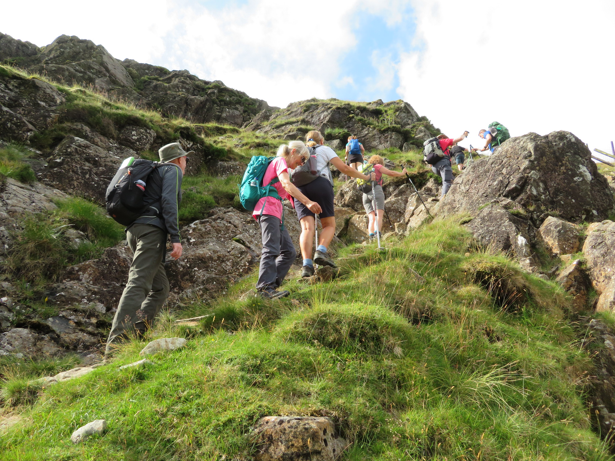 A bit rocky at 450 metres
 This gentle scramble goes on for around 20 metres and runs into a kind of trough that lies between the rock face and the fence the posts of which are all blocking the path as they lean inwards, caused I must presume by people using them to pull themselves along the climb.
 And the same a little higher
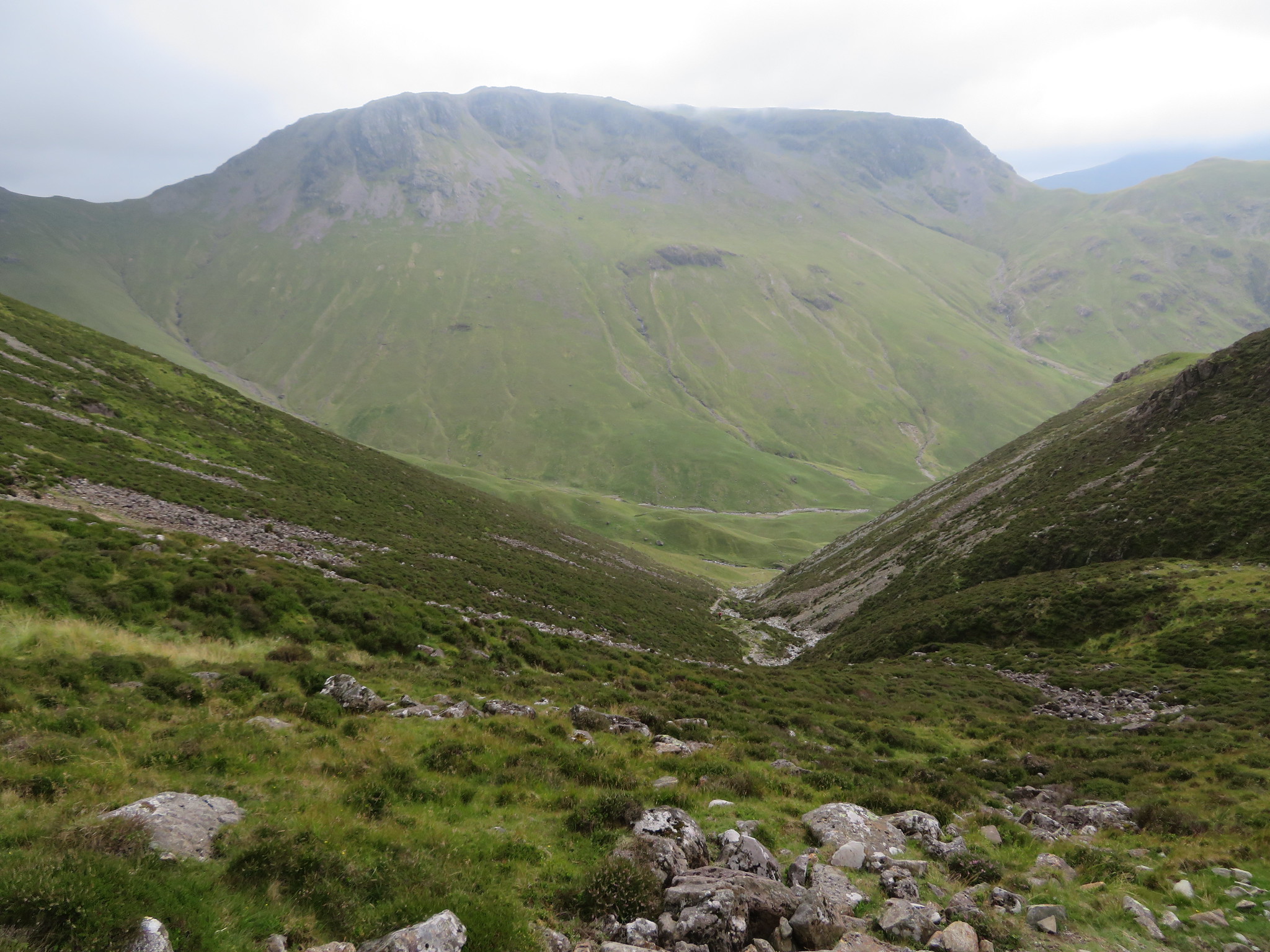
 Leaving the rock behind we arrived on grass at about the 470 metre contour where a quick drink was to be had before the final and easy pull to the summit. At around 560 metres I got a decent view northeast along the valley. We could also see along the ridge of Fleetwith Pike to our left with the summit and Black Star being quite prominent, a place where we would be later on today.
 A view along Little Gatesgarthdale
 We soon reached the lower crags, the ones just below the summit…
 Not far to the summit now
 as we made good time up these easy slopes still with the fence to our right and a few minutes later we were climbing over the fence stile to reach the summit of rock having crossed over to the righthand side of the fence further down the fellside.
The views are nothing short of fantastic from this top and to the north we could see a fine array of fells and mountains including Great Gable, Scafell Pike, Bow Fell etc and my only wish was that it had been a lot clearer, but I was so pleased to be here once again that I would take what was offered. Of course the people from down the south of the country were agape at the extent of the views.
 Base Brown - Green Gable et al
 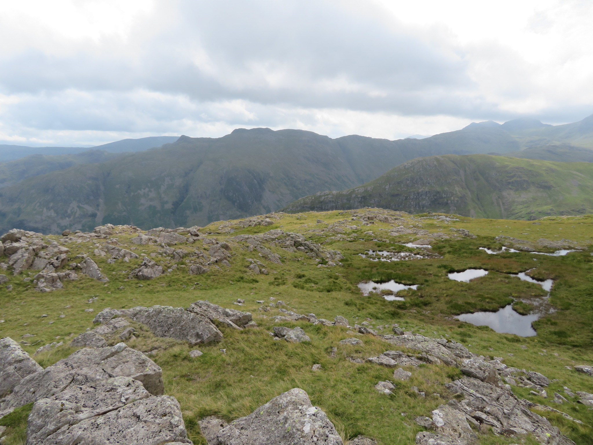 Glaramara view from Grey Knotts
  The view northeast from Grey Knotts
 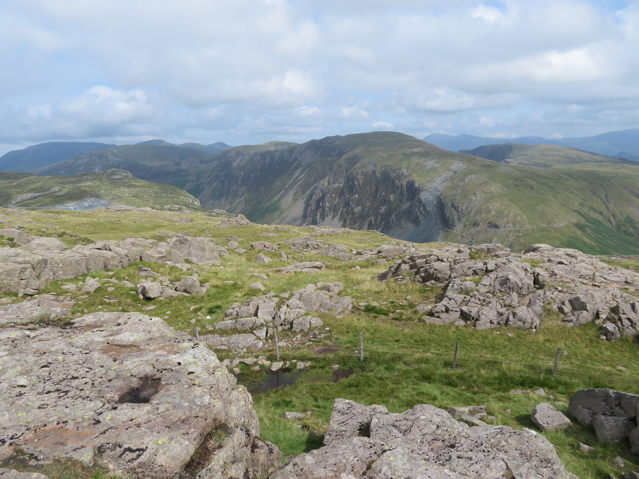 Fells of the Newlands Round
 There were probably around 6 to 8 other walkers on the summit but we dropped our bags and took a drink and a bite to eat before setting off for the short walk over to Brandreth.
 Across the top of Grey Knotts
 After the climb up Grey Knotts the rest of the walk is very easy walking and after our break we set off along the grassy slopes leading to the rock strewn summit of Brandreth with the big boys of the LD under cloud making this walk a good choice for today.
 Brandreth ahead
 It doesn't take long to walk these easy slopes and we were soon at the summit where the visitors wanted a photo shoot.
 Brandreth summit pose
 We didn't linger here and setting off once again we were now going for Haystacks but first turned to the northwest for some strange reason instead of just following the fence from the summit but a change of direction to the southwest back to the fence soon had us on track again but not before a couple of photos were taken.
 Northwest towards Buttermere-Haystacks-High Crag and Ennerdale Water
 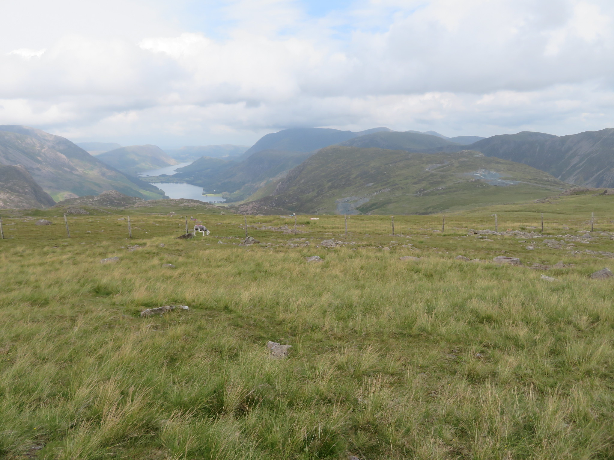 Fleetwith Pike-Grasmoor-Mellbreaks etc
 Just as we got back on track by the northwest running fence I grabbed a shot of the Kirk Fell and Pillar massifs with Pillar and the ridge of the Mosedale Round under cloud.
 Kirk Fell and Pillar
 A little further down the fell and Haystacks was getting larger by the minute.
 Next one is Haystacks
 This was easy walking, downhill on a wide grassy path with glorious views to the fore, a most delightful scene of the fells surrounding Buttermere and Crummock Water and before we knew it we were at the head of Loft Beck that runs down the stony gully that lies between Brin Crag and Seavy Knott and although it doesn't look too steep a climb alongside the beck I can assure you that after a long walk it can be a toilsome exercise working ones way up from Ennerdale. Looking across the head of Ennerdale Kirk Fell was perfectly framed by the fells either side of the beck.
 Kirk Fell
 We crossed over the head of the gill and was soon at the gate that would put us on the path that meanders its way through the humps and bumps of the fell above Black Sail YH down to the left and both Blackbeck and Innominate Tarns to the right. The path is good and clear and the climbing is hardly noticeable as it ascends ever so steadily. Kirk Fell and Pillar continued to dominate the western skyline with the clouds lifting and dropping at a whim.
 Pillar
  Pillar and Ennerdale
 Whilst I was lingering taking photos the group had come to a halt…
 Haystacks ahead
 maybe they had stopped for a drink!
 Good path between Brandreth and Haystacks
 We met up with the regular path just to the northwest of Innominate Tarn where the numbers of walkers greatly increased from the very few that we had seen on the rest of the walk so far. An easy climb up soon had us on the summit of Haystacks and a view of High Crag sat behind the unnamed tarn on Haystack's summit. On one of my past visits to here someone had emptied an urn of ashes out onto the summit, unless Alfred was looking for a view and had gathered himself up and decided that he'd spent enough time at the Innominate Tarn.
 High Crag from Haystacks
  Haystacks summit
 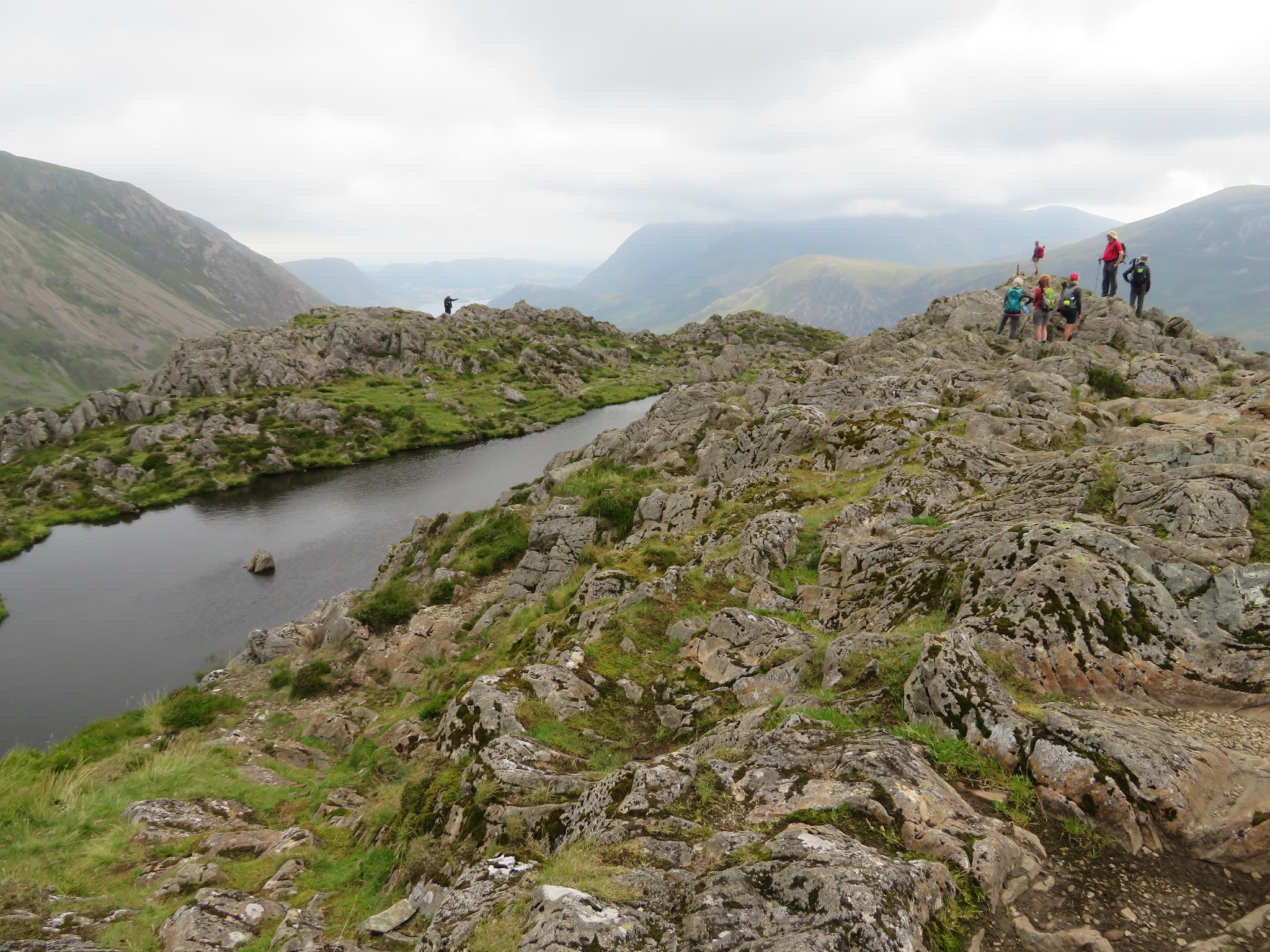 A busy old hill
 It was getting too busy and noisy, why people have to shout and play loud music on the fells is beyond me. If they don't like the peace, quiet and a touch of solitude why do they bother gracing the fells and mountains with their 'not caring' attitude to those of us that walk for the pleasure and enjoyment of this fair land? We left.
We were now going for the last fell of the day, Fleetwith Pike and from Haystacks it looked a long way away, much further than it is really, so off we set for our next rest stop before the climb and that would be the recently renovated Dubs bothy. We passed Alfred's place of rest, Innominate Tarn, a good choice for a scattering of one's ashes as it is a lovely, although busy place for a long and well earned rest.
 Innominate Tarn
 We passed numerous people both coming and going as we now followed the regular path that would take us to the site of the old Drum House and Dismantled Tramway and as we passed by Green Crag took the next photo.
 Warnscale Bottom and Buttermere from Green Crag
 And then this as we approached Dubs Bottom.
 Great Round How with Grey Knotts behind
 Twenty minutes later we were at the bothy.
 Dubs bothy
 Another rest and a bite to eat before taking the final climb along the faint path that leads off in a north westerly direction from behind the bothy, a thin path through the grass and heather that fades away in the odd place but is soon picked up again without too much bother to soon join up with the main path that comes from the Hopper Slate Quarry. A quick look back gave us a view of part of the route that we had taken to get to this point.
 Grey Knotts - Great Gable - Kirk Fell
 And then we were at the summit from where there must be one of the best views in the LD.
 The view northwest from Fleetwith Pike
  High Stile range with Pillar behind
 It was a little bit hazy and things could have been a touch clearer but that haze didn't really detract from the beauty of what lay before us.
Another rest whilst the visitors took their fill of the views, excited about the panorama around them, sites that they never get from where they hale from. Well it was time to leave these remarkable views and we initially walked the path towards Black Star before turning to the south and heading for the Hopper Slate Quarry and the service road that was quite hard on the feet and slippery due to the amount of small stones and quarry waste dust before arriving back at the mine for a welcome cup of tea.
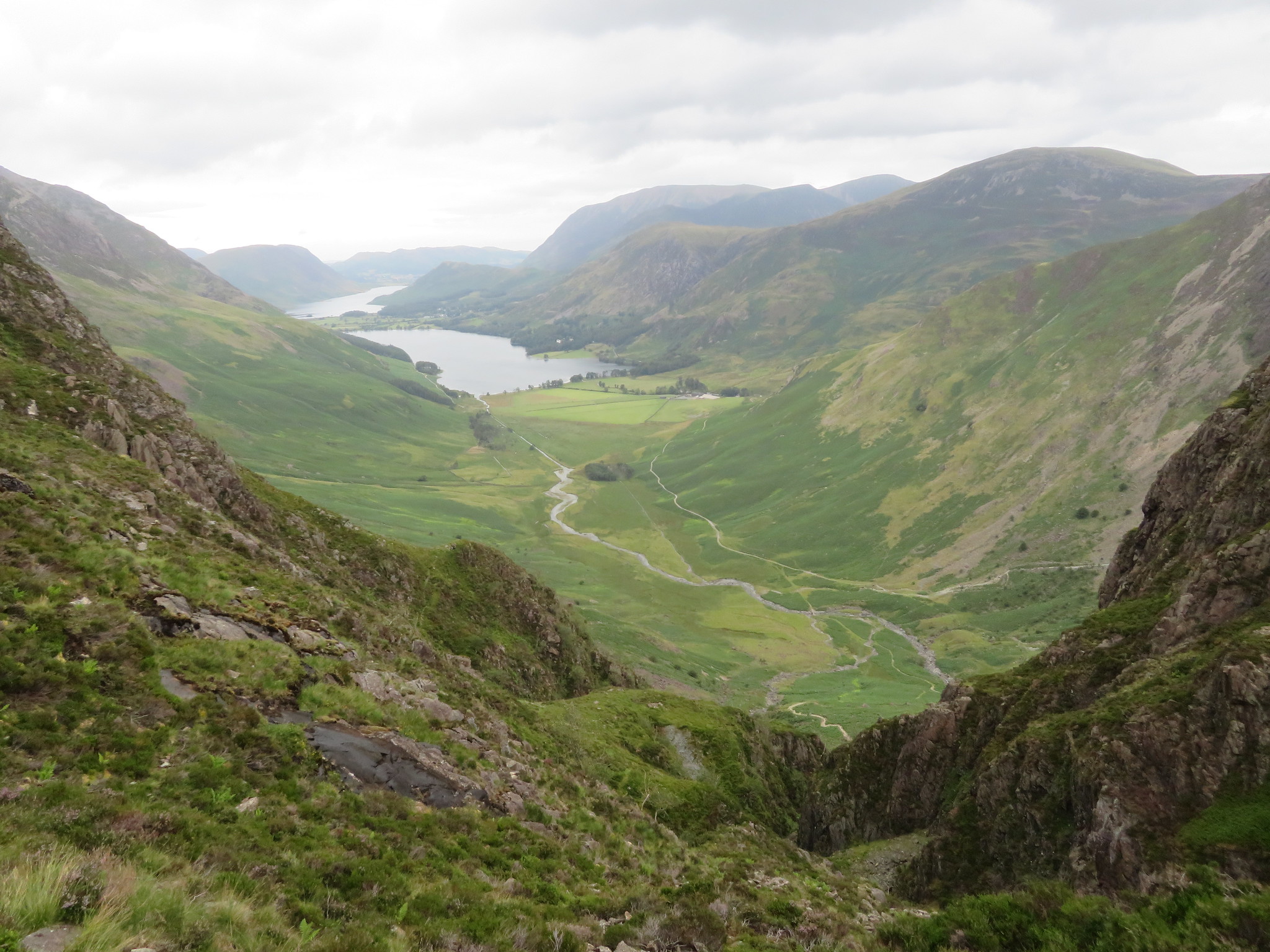
 The view across Honister from Fleetwith Pike
 Well, after the walk we had a gathering where we shared in a meal and a few drinks over the day's inquest. It had been a great day out with what in effect were strangers, like minded people who all got on together and although we may never meet them again they shall remain in our memories as friends and fellow walkers.
