free to be able to rate and comment on reports (as well as access 1:25000 mapping).
As Chris has trimmed his numbers down of Wainwright's to do he was now keen to get rid of the remaining two Southern Fells, Holme Fell and Black Fell, and the furthest away of the Central Fells and that would be Loughrigg Fell that is parked up at the southern end of Grasmere and Rydal Water. To make a decent walk of it I suggested stuffing in Silver How - which he'd done before - and if he felt perky enough making the climb up to Alcock Tarn from the Old Corpse Road before dropping back down to Grasmere. And so it was, another walk sorted for his first Monday back on shore this month.
We elected to park on the lay-by on the north bound side of the A591 just outside of Grasmere - NY33779 08526 - as it was convenient for both the start and end of the walk and as we arrived there at around 9am there was only one more car ahead of us, and it's free.
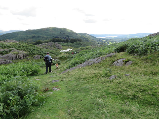
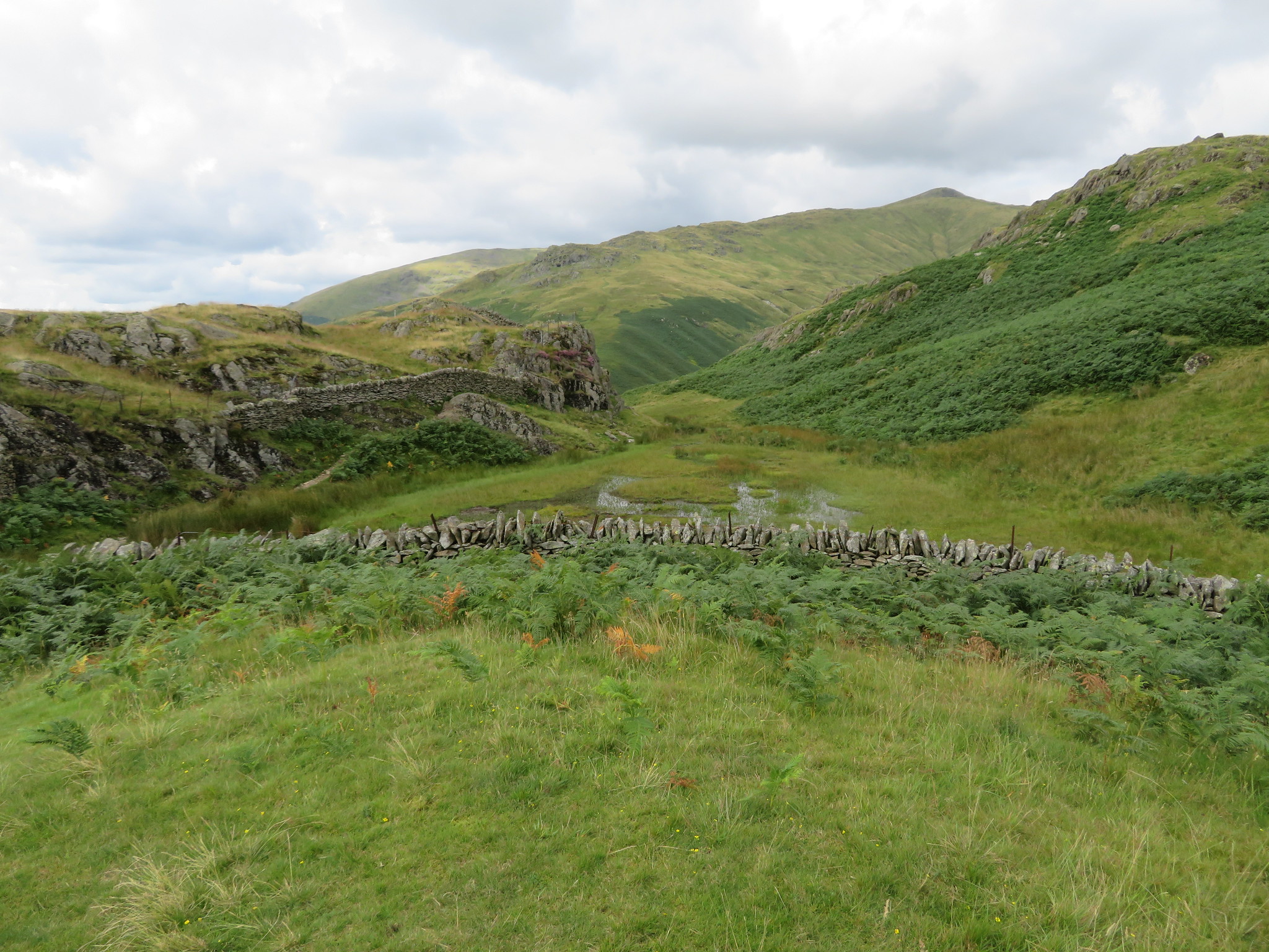
It was drizzling though warm when we arrived, typical of what we have been getting these last few days so it was, unfortunately, on with the waterproofs for the time being although, as it turned out we wore them for quite a while as we had some very friendly bracken to push through that was carrying quite a lot of moisture on their rather tall fronds. O how I detest the stuff.
Walking down the road for a while towards Grasmere we turned down the narrow metalled lane to reach the B5287 from where, after passing the blacksmith's we turned off through a small gate to walk along the good path below the north side of Butharlyp Howe to reach Easedale Road where we then turned left for a short walk before passing through the gate by the side of the Grasmere/Quakers Meeting House into the low pasture where we walked west across the grass before turning up the short grassy bank to pick up the metalled lane that runs up Allan Bank to reach the last couple of dwellings.
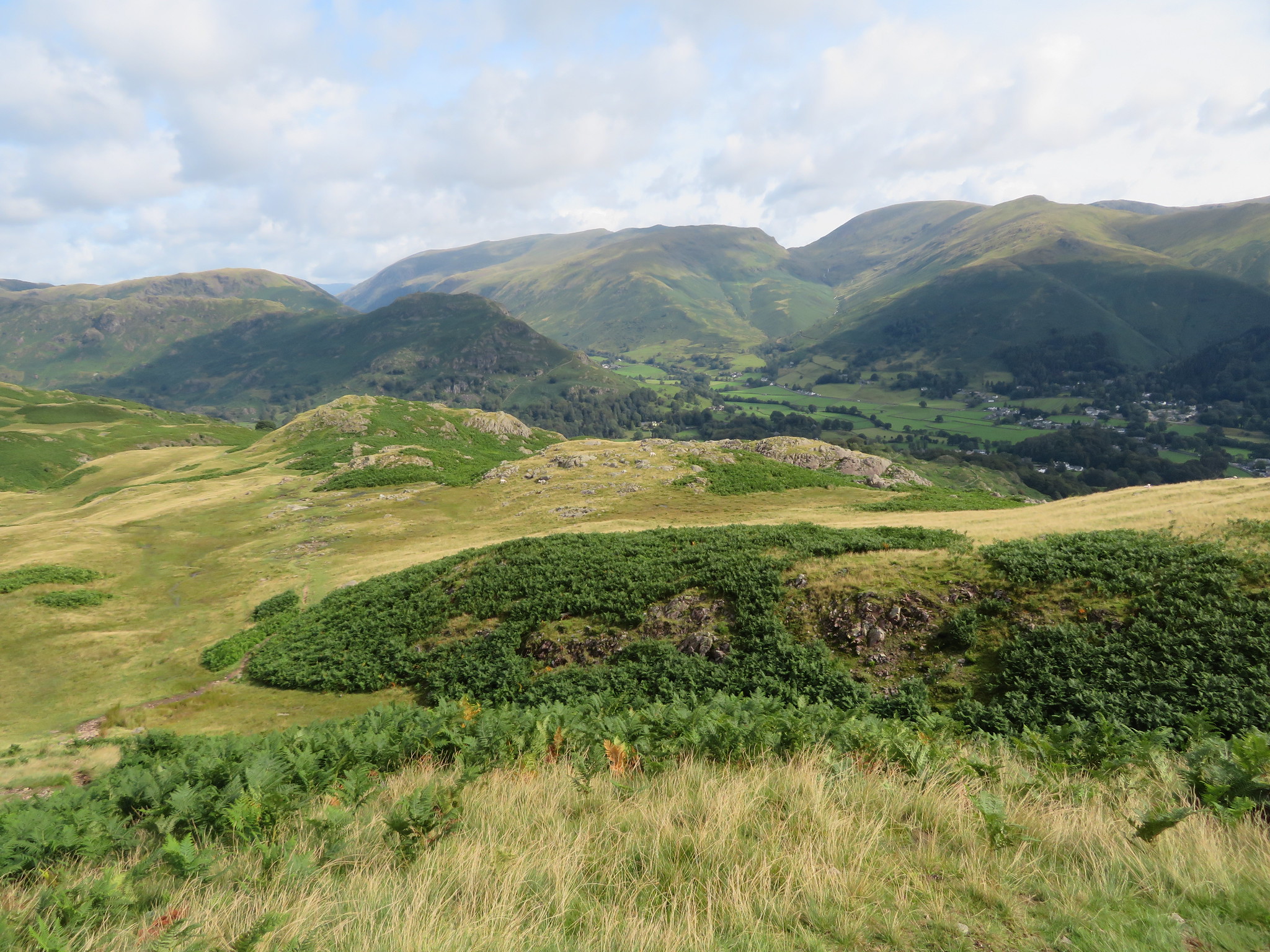
From Allan Bank there is a fair view of Helm Crag and Seat Sandal, a view that would get a lot better as we gained height. Leaving the cottages behind we now turned more to the southwest following the rough and wet track as it climbed steadily upwards until we reached the gate in the intake wall. We were now on a nice grassy path that runs along much steeper ground for short while before easing off as it reaches a spread of juniper trees and from where we got that better promised view of Grasmere.
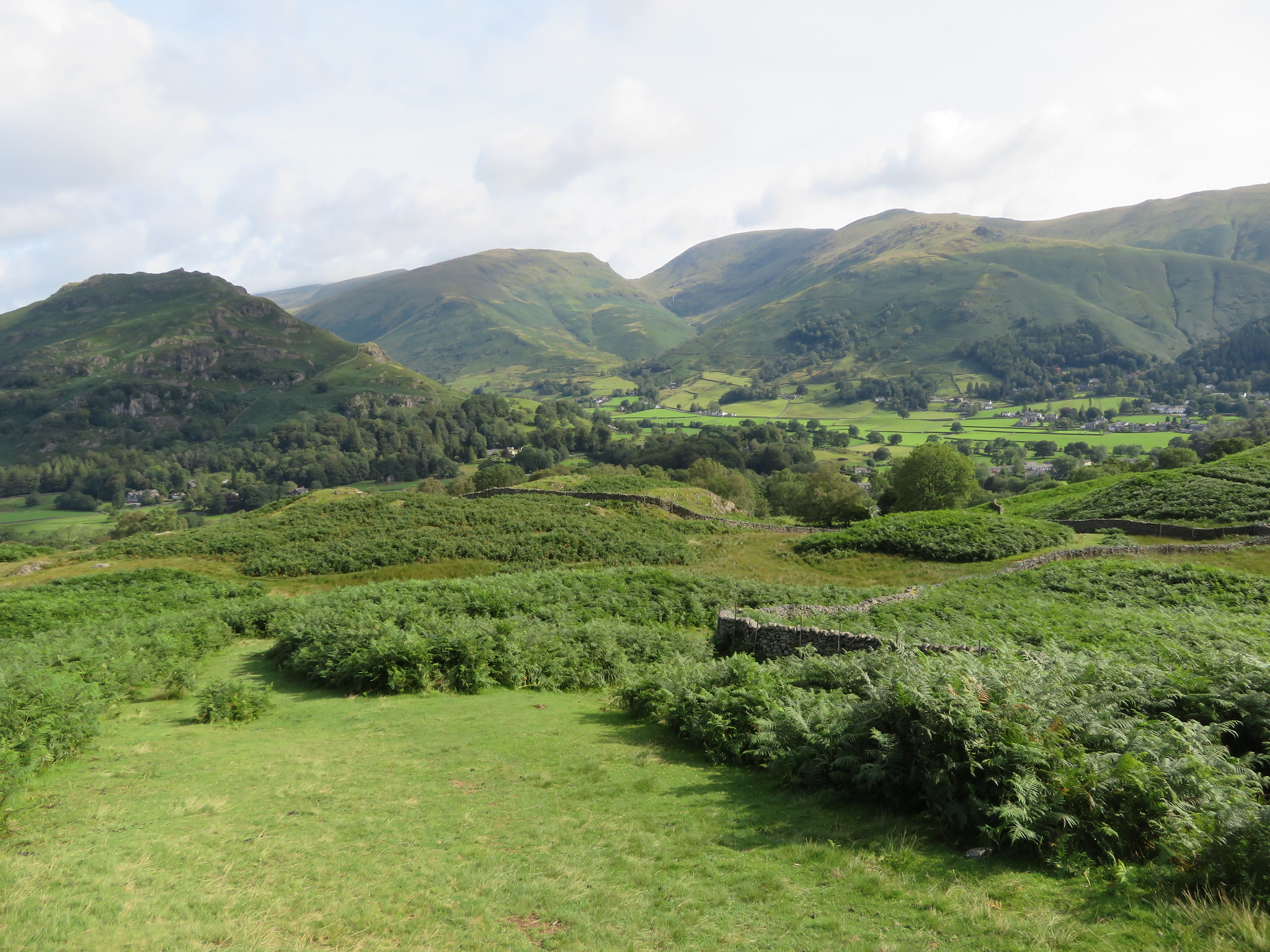 Helm Crag - Seat Sandal - Great Tongue - Fairfield
 The drizzle had stopped by this time but it warm and humid, wet underfoot, and slippery on the grassy slope but we were soon passing through the juniper trees and on our way to Wray Gill where the sun had made an appearance making it look a whole different to the last time that I was here just a couple of weeks ago in clag and pouring rain. What a difference the weather can make, not only in comfort when walking but also the different perspective of the surrounding countryside, if you can see it, as last time I was here the whole valley below was buried in thick grey cloud.
Wray Gill bathed in sunlight looked nothing like the Wray Gill of two or three weeks ago.
 Crossing at Wray Gill
 A few minutes after the rocky crossing Silver How came into view as we approached Brigstone Moss.
 Silver How ahead
 We were now walking south and climbing easy slopes once again to arrive at the summit of Silver How from where the views from this middling sized fell are quite stunning in all directions.
 North from Silver How
  West from Silver How
 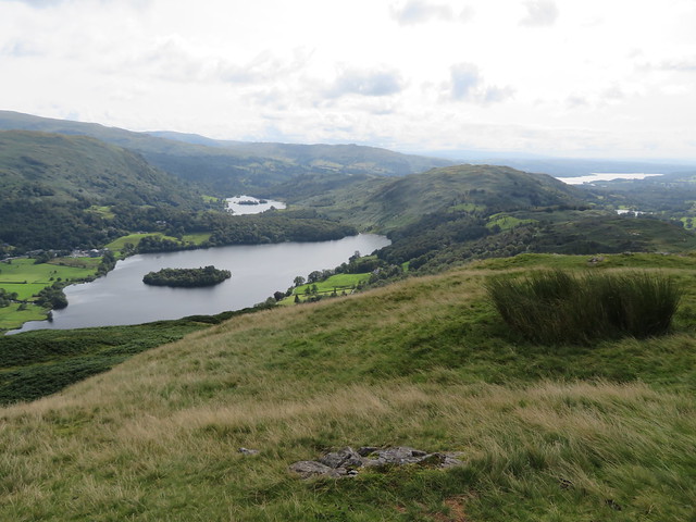 Grasmere - Rydal Water - Windermere
  A view over Grasmere
  Just south of west from Silver How
We drank in the views, there is too much to see, too many fells and mountains to count and name for the time that we have here so we slowly dragged ourselves away, turning our backs towards the north and eastern fells to concentrate on what lay out before us to the south and west.
 South towards Black Fell
 Our next objective looks tantalising close but it's still a fair distance away and we have no more untoward climbing to do apart from the odd rocky knoll as we walk along the ridge.
 Loughrigg Fell
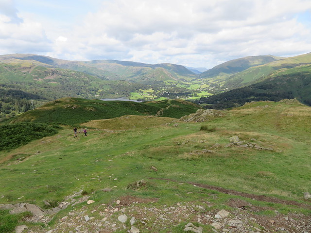
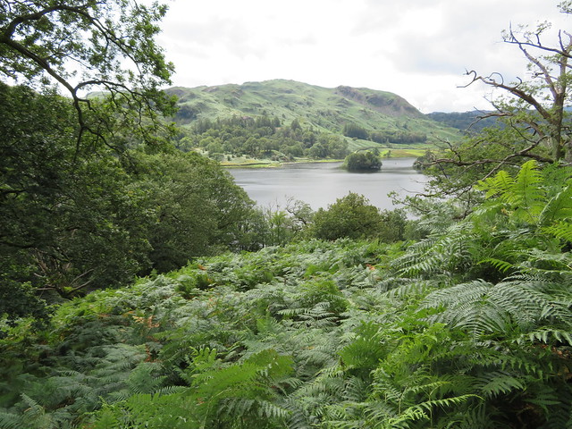
 Just before we reached Spedding Crag and from where we would turn to the southeast along the ridge we had a great view of Grasmere and Rydal Water.
 Grasmere and Rydal Water
 Well the sun had forsaken us for the time being and although we had shed our coats we were still wearing our over trousers as the ground and vegetation was still wet. We were making good progress from Silver How as it is very easy going on good paths and it was a delight to walk amongst such beautiful countryside. Great Langdale had come into view with Lingmoor Fell and the Conistons with the Tilberthwaite and Furness Fells nestled below to the left. Even the tiered levels of the Banks Quarry look attractive sat amongst the green of the trees. This is a delightful ridge walk with a whole expanse of Lakeland spread out wherever you turn.
 Lingmoor Fell and Coniston Fells from Spedding Crag
 We met a few other walkers as we ambled along the undulating ridge, all of them climbing to where we had just left and soon after leaving Spedding Crag we had arrived at Dow Bank from where we had a great view of Grasmere and its surrounding fells. Helm Crag, Gibson Knott, Steel Fell, Seat Sandal, Fairfield and the Helvellyn ridge were all in clear view and the sun by now had broken cover properly making it an even more pleasant day to be out and about. It was also a lot warmer.
 Grasmere from Dow Bank
 And looking west from the same place.
 The Crinkles - Bow Fell - Langdale Pikes from Dow Bank
 Whilst looking to the south…
 Black Fell - Elter Water - Loughrigg Tarn - Windermere
 and further round there is the great mound of Loughrigg and by just turning a little more to the northeast both the west and eastern approaches of the Fairfield Round are clearly in view with the route part of the Old Corpse Road hidden by the trees above Rydal Water.
We were by now catching up with the rocky top of Huntingstile Crag with its small unnamed tarn glistening like a spilt and misshapen blob of silver.
 Huntingstile Crag and Loughrigg Fell
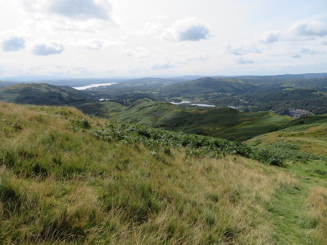
 We left this crag by the narrow and sloping path that runs down its south face to then make our way down to the road at Red Bank just below the Youth Hostel. A short walk along the road soon had us walking through the YH grounds where the numerous paths were a little confusing at first but once sorted we were soon through the grounds and crossing the metalled lane at Deerbolts Wood to then begin the climb on a narrow path through the bracken to the summit of Loughrigg Fell. The path climbs roughly east and is quite steep in places as it passes through the bracken that lies in the open space between Billy Plantation and Intake Wood and at about the 200 metre contour got a photo across the sea of bracken towards the Coniston Fells.
 Coniston Fells and Lingmoor Fell
 The way up was uneventful with the steepness of the path easing off as we got higher and within a half hour we were stood on the summit fighting the crowds for a clear place to take a photo from. As can be seen by the photo the summit was going to get even more crowded in a few more minutes.
 Loughrigg summit
 And the views, well…
 Northern view to Grasmere
  West towards Langdale - Bowfell etc
  Elter Water with the Conistons behind
  Windermere with Wansfell far left
  North towards the Kentmere Pikes with Red Screes to the left
 this is where we had a bite to eat, drink, and a dawdle.
After our break we set off down the southeast path picking our way on any of the many paths that are cobwebbed across this fellside and just before we got down to Rydal Water I got a shot across it towards Nab Scar knowing that before too long we would be walking beneath it along the Old Corpse Road on our way to Alcock Tarn.
 Nab Scar
 As Chris had never been to Rydal Cave before we had a quick pit stop there where he and Sonny had a wander inside to join the throng of tourists.
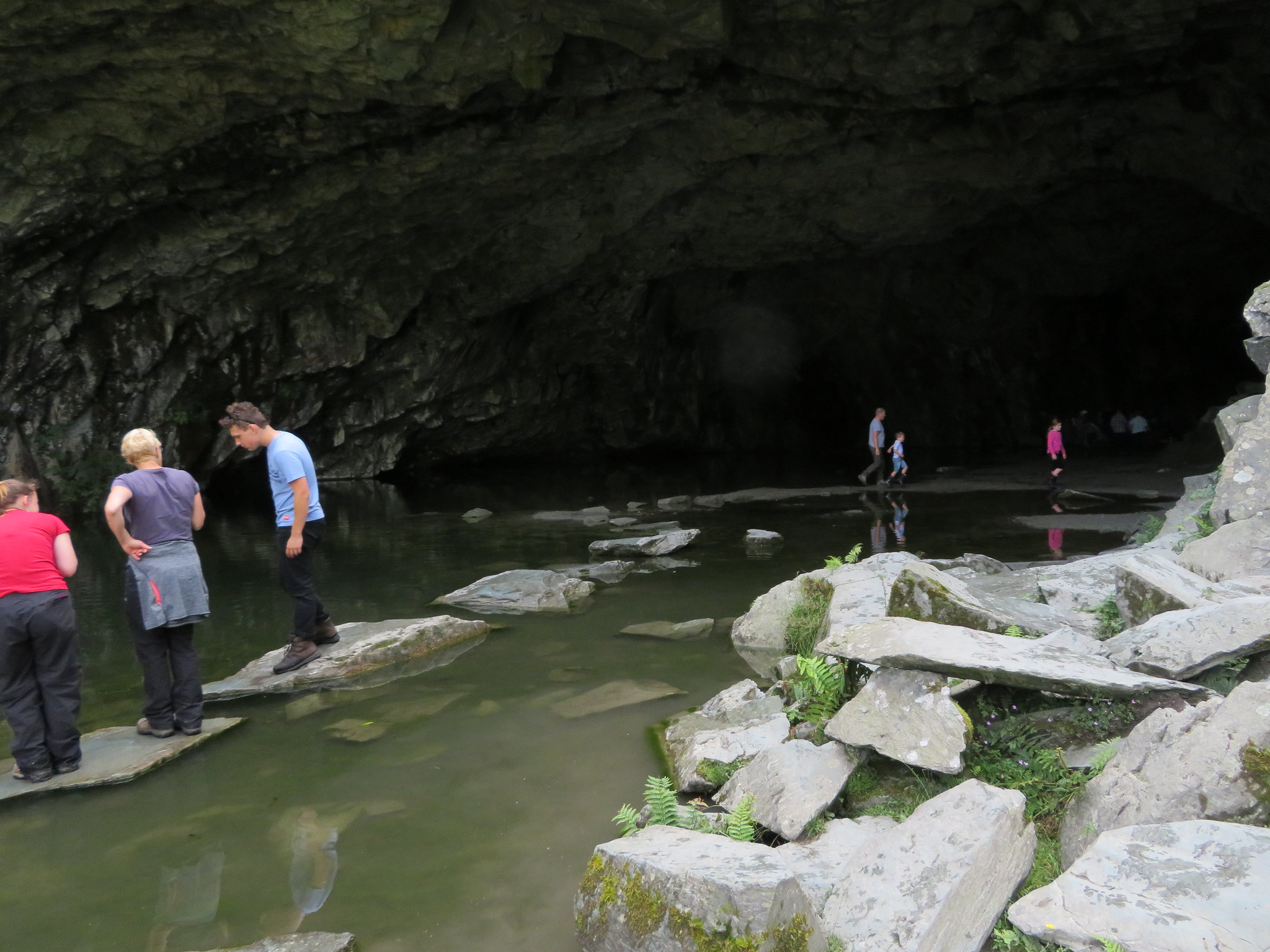 Busy in Rydal Cave
 Leaving the hordes behind we quickly made our way on a delightful path down to Rydal Water then Rydal itself where we made our way up the hill past the church, Rydal Hall and the Tea Room at Rydal Mount once the home of probably Lakelands favourite and best known poet, William Wordsworth who was also the churchwarden at Rydal Church for a short time. Just past Rydal Mount we took the named corpse road that runs all the way to Grasmere passing through glorious woodland for most of the way with the openings in the trees giving us ample views of the hills on the south side of Rydal Water.
 Loughrigg from the Old Corpse Road near Rydal Hall
  Lanty Scar from the Old Corpse Road
 This old road/lane is well made and a pleasure to walk on as it meanders up and down following the profile of the fell.
 The Old Corpse Road
 Keeping a steady pace it wasn't long before we were in Lady Wood above Grasmere where the stoned up path had become an old metalled lane used to service the scattered dwellings set amongst the trees. A short walk along this lane soon had us at the wide and signed turn off for Alcock Tarn with this short lane leading to a house amongst the trees. As the lane turned right we went left to follow a good path through the trees resulting in another pleasant woodland stroll.
 The path in Lady Wood
 The clouds had started to thicken up quite quickly and we hoped that it wasn't the sign of a thunderstorm arriving although it was quite humid and sticky despite the cloud cover. After a while of easy walking the path began to get steeper as we approached the zigzags…
 The path steepens on the zigzags
and at the first corner we arrived at a small reservoir with old pipes leading into and out of it so obviously made to service some industry somewhere down in the valley bottom.
 Man made reservoir
 From here on the path gets steeper and in the heat and humidity it was getting quite tedious but with the consolation that the views were by now opening up again, but oh for a bit of a breeze.
 Silver How centre skyline
 Once past the zigzags the gradient eases off and forward momentum increased once again with the views getting increasingly better and at around the 315 metre line I managed a decent view over towards Grasmere and beyond.
 Grasmere
 Just after that photo was taken there is a bit of rough and narrow path to pass along.
 A bit rough just here
 This next photo was taken from the top of Grey Crag.
 Loughrigg - Grasmere and the Coniston Fells
A few minutes later and we were at the tarn. Alcock Tarn is a lovely spot, quiet and secluded although it is mentioned in dispatches and is more popular than it used to be back in the day but despite it being around 370 metres - 1,200 feet - above Grasmere it does attract mostly those who are prepared to make the climb. It's quite some time since I was last here but it still looks in pristine condition with no untoward erosion evident.
 Alcock Tarn
We lingered awhile over a bite to eat and a drink before setting off on the descent northwards with a view of Stone Arthur and Great Rigg before us on the opposite side of Greenhead Gill before the path swung over to the west on an easily graded path. This path took us down to the gill and footbridge and also at the spot where the Thirlmere Aquaduct passes through on its way to serve the peoples of Manchester.
 Stone Arthur and Great Rigg with Seat Sandal behind
 Taking on water at Greenhead Gill
 All that we had to do now was wander along the narrow metalled lane and then make our way back to the car in the roadside lay-by and sally off to our favourite drinking hole.
