free to be able to rate and comment on reports (as well as access 1:25000 mapping).
We were a bit late getting away from home this morning and could have done with an earlier start as we're off to climb the last two Southern Fells as part of Chris's desire to complete the Wainwright's this year which means quite a long drive down to Tarn How that is just north of Coniston. By the time that we had booted up and Chris had eaten his breakfast it was 9:40am and despite the sun shining and doing its best it did nothing to warm up the cold breeze that has lingered about for a few days now. We were parked up in the NT car park - SD32145 99873 - under the trees of Lane Head Coppice at Glen Mary Bridge that we left by walking roughly south for a few short metres before entering a field and following the path alongside the roadside fence to a second gate that is just past the metalled lane leading to Yew Tree Farm.
 A short walk before passing through the Yew Tree Farms yard
 We walked past the typical old farmhouse with its modern cars and machinery scattered about with a patch of sunlight just grazing the background of the eastern slopes of Holme Fell, its lower slopes covered in trees.
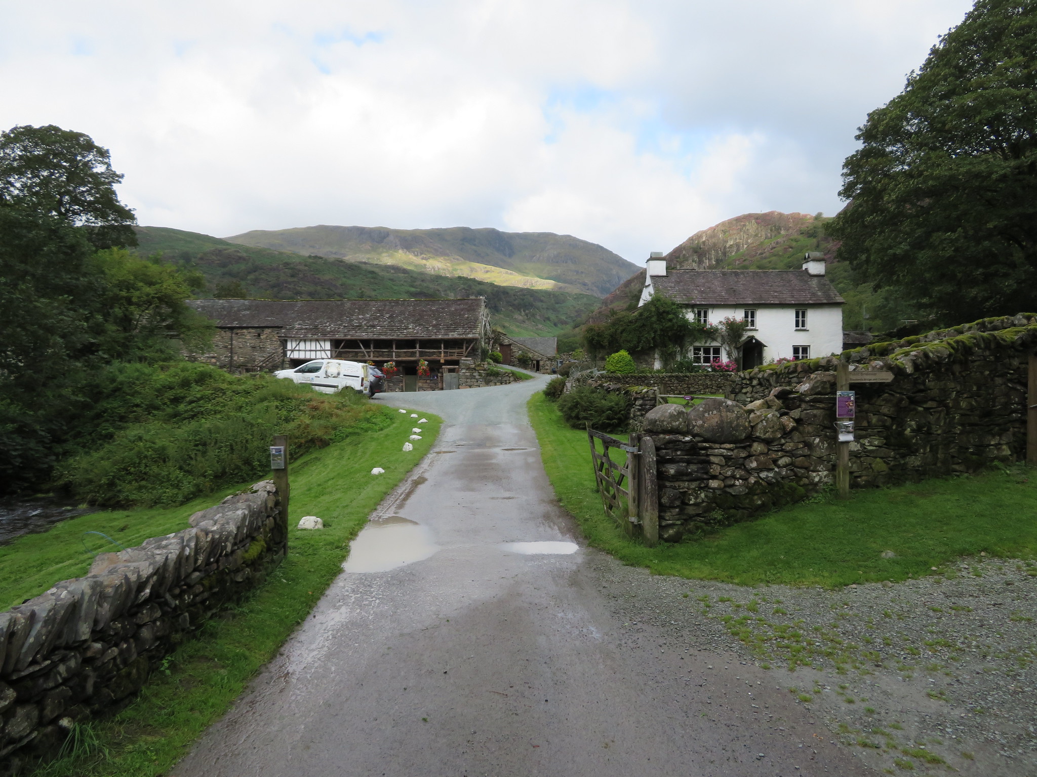 Yew Tree Farm with Holme Fell behind
 We passed through the gate with a fingerpost pointing the way to 'Shepherd's Bridge and Coniston' and within minutes were walking along a grassy path that was saturated from the previous night's rain as we approached the trees of Penny House Wood, trees that spread high up the slopes of Holme Fell and in this light they looked absolutely lovely despite some of the leaves losing their summer time lustre.
 Approaching Penny House Wood
A short stretch of open ground separates Penny House Wood from Harry Guards Wood where the trees are no less beautiful than the previous one we had just passed through.
 The lovely trees of Harry Guards Wood
 Once again the bracken is prevalent, encroaching onto the path but at least it isn't of the giant variety that makes one feel as though you are walking through the thick foliage of a Cambodian jungle. We came across a very large boulder from where the path began to rise through the trees giving us some welcome shade from the now much stronger sun, feeling it much warmer now that we were sheltered from the cold breeze. A short section of the path through the trees was quite steep, stony and wet making it a slippery walk along this stretch of path but after that the path eases of somewhat and within just a few minutes more was up on to the flat area just below Ivy Crag.
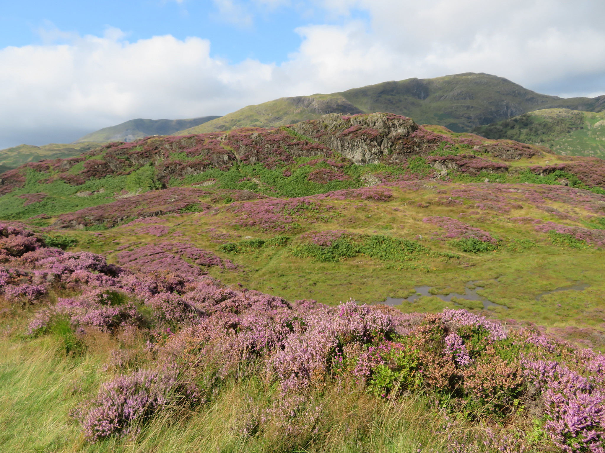
 Unnamed crag with the Langdale Pikes just off centre
 We were only at around the 260 metre contour but the views had already started to unfold around us, initially to the northwest and the Langdales through the gap between the crags, but as we gained height and mounted Ivy Crag and Holme Fell the views into the far distance are outstanding, although due to where we were they would remain more or less the same during this walk. The view to the west was more or less blocked by Wetherlam and Coniston Old Man although the lesser fells of Tilberthwaite and Furness could be seen sitting below their larger companions.
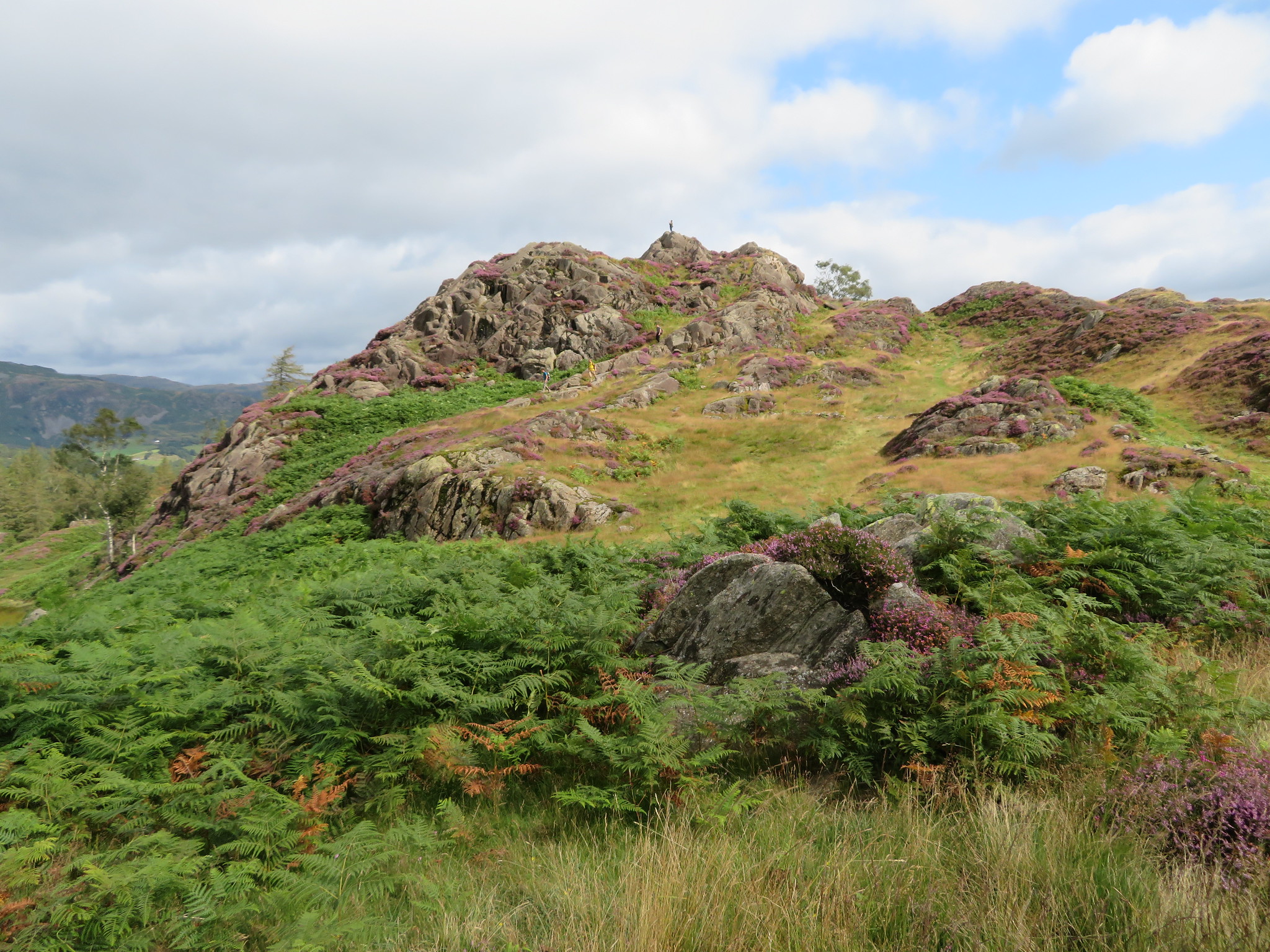
A short walk across the flat ground and we were starting the short climb onto Ivy Crag. The first time that I came here and because it was the first crag with the largest cairn I thought that it was the summit of Holme Fell until a couple that was having a rest put me right and approaching the summit from this side it seems just natural to assume that it is the real summit of Holme Fell, endorsed by the fact that Chris horsed up it with much glee until I pointed out the correct one that he needed before being able to put another tick in his book.
 A view of Ivy Crag
 The short climb onto this none Wainwright summit is well worth the slight effort as the views are second to none. From just below the top of Ivy Crag I took another photo of the unnamed crag with everything looking resplendent clothed in the beautiful purple of the heather that cover this fell so well.
 Unnamed crag with Lingmoor Fell behind in sunlight
 And then from the summit with its larger cairn than Holme Fell we were given this view towards the Langdale Pikes plus bits and pieces of other tops.
 Lingmoor Fell and the Langdales from Ivy Crag
Despite the obvious cloud cover that looked quite ominous at times the sun was making plenty of headway but it was now still cool enough with the breeze to warrant wearing an extra layer now that we were in a more exposed position.
I took advantage of our visit here to grab a few record shots.
 Wetherlam and Coniston behind Holme Fell
  Windermere from Ivy Crag
  Holme Fell
 Holme Fell is separated from Ivy Crag by a narrow corridor full of humps and bumps that are covered in bracken and stunning coloured flowering heather with a path running along it north to south and one that we would pick up later on when we had left Holme Fell. But we are going to climb up a narrow crack in the face to save a bit of time and leg work walking around to the north end by the regular path. The mild scramble along this narrow cleft is adorned with wild flowers making it attractive enough to warrant it being a showpiece in a large garden.
 Mild scramble onto Holme Fell
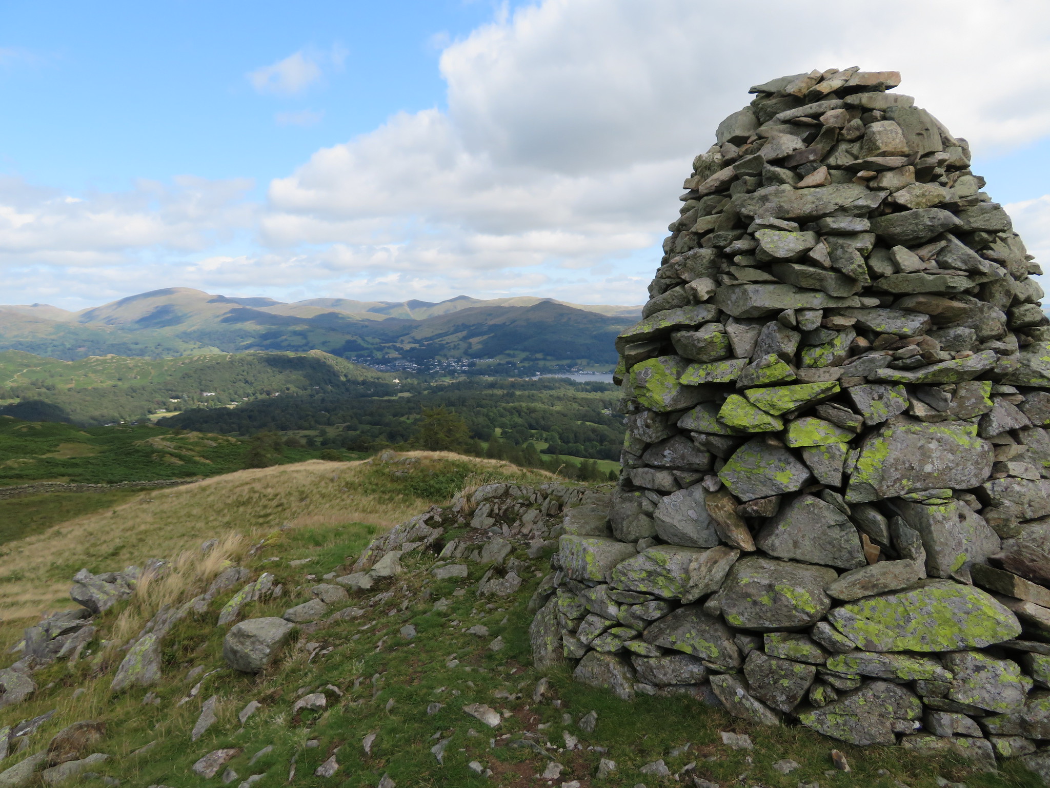
 The path led us onto the wide top that is covered in rough grass and beautifully coloured heather with the small cairn atop the highest of the many rocky outcrops that are on this fell top.
 Holme Fell summit
 The views are fantastic especially on a day like this with fairly clear views far into the distance and we have caught the fells looking their best with their cloaks of heather and scattering of many other types of flowers that remain anonymous to me without further research.
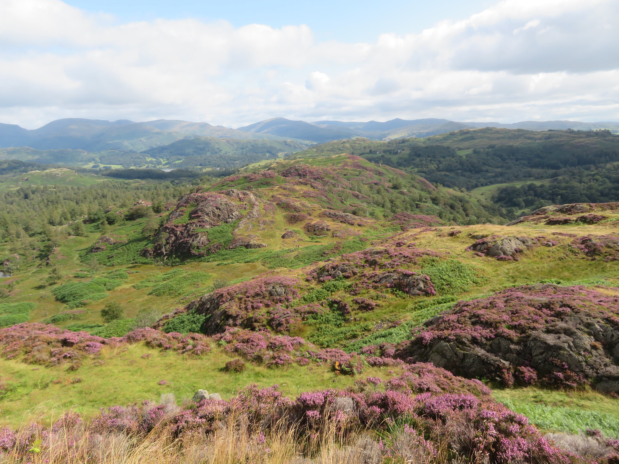
 Black Fell from Holme Fell
  Langdale Pikes and Helvellyn Ridge from Holme Fell
  Windermere from Holme Fell
 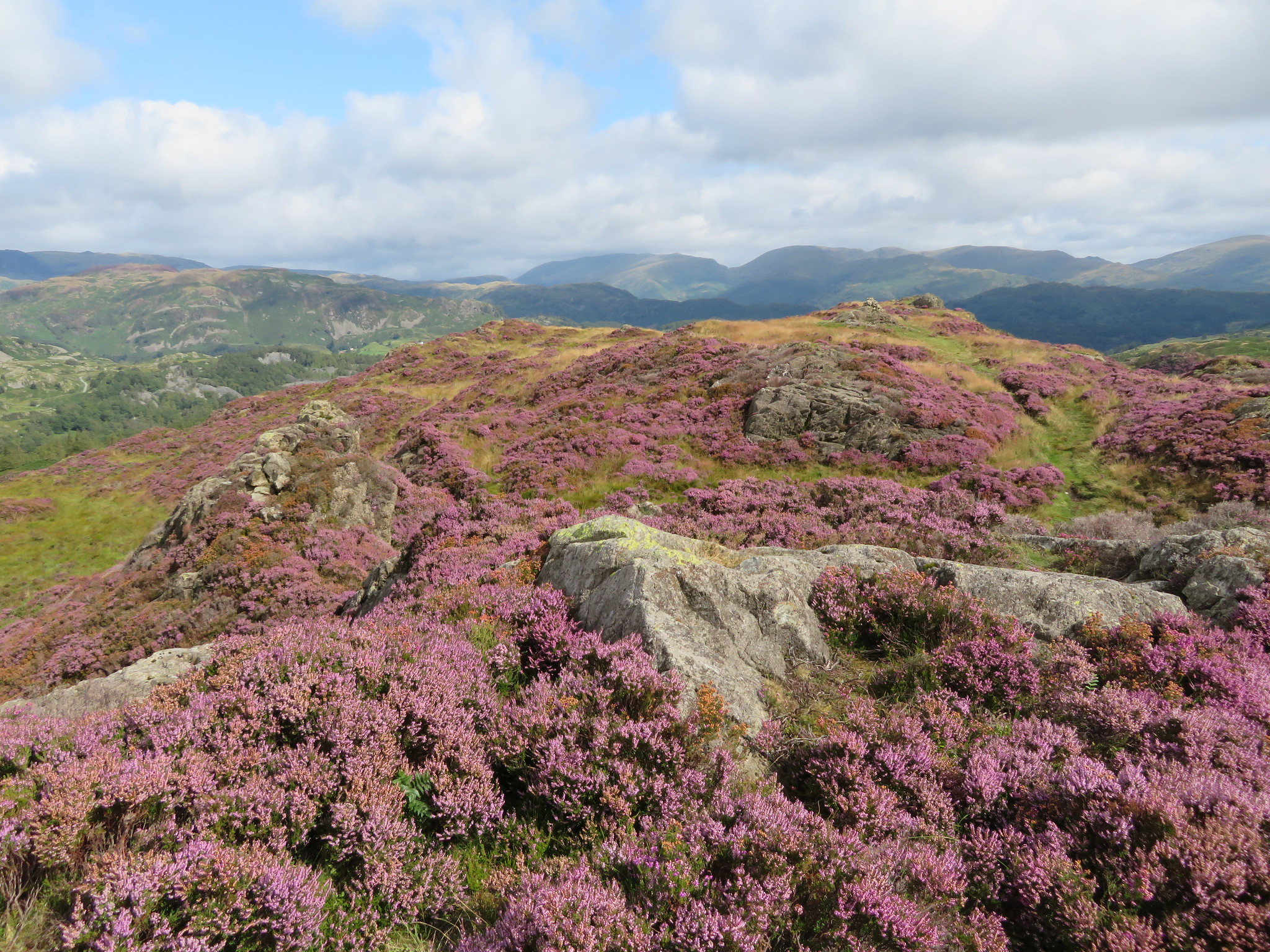 Across the top of Holme Fell towards the Eastern Fells
 Wetherlam and Coniston Old Man are over to the west and southwest respectively with the bulk of Wetherlam hiding most of COM and I hoped to be able to get a better photo of them from further away when are walking along the ridge.
 Northwest along the ridge with Black Fell behind
 We lingered and then left, walking north along a good grassy path that meanders around and up and down the many grassy knolls and crags that cover this whole ridge. We passed a group of four who was walking in the opposite direction to us and were just leaving an unnamed crag in front and to the left of us.
 Unnamed crag on Holme Fell
 This path along the ridge is a joy to walk, especially passing through the areas of heather and we decided to stop for a quick break below the crag that the other walkers had just left. It was peaceful and warm sat amongst the rocks, a place where a soul could pass away a good bit of time on a day like this, but unfortunately we can't as we have somewhere else to go so we packed our things away and set off once again along this delightful ridge. After a few minutes of walking I looked back and grabbed a shot of where we had just been.
 Looking back to Ivy Crag and Holme Fell
  This is a beautiful ridge full of crags - heather and trees
 Continuing on enjoying the walking and the views we saw Windermere through a break in the hillocks.
 Windermere behind High Arnside Tarn
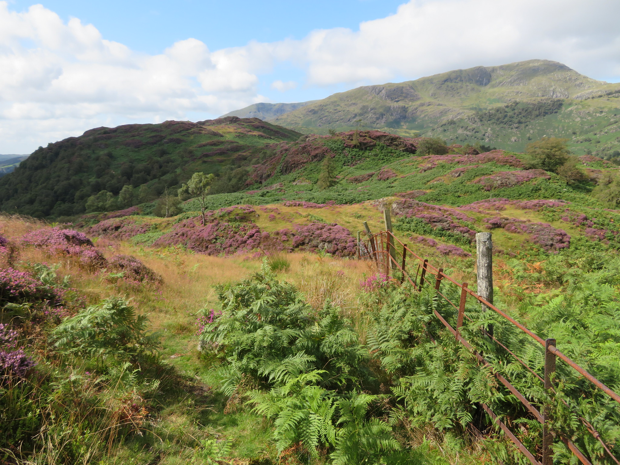
 After our break our wanders had us leave the northern path to now swing over to the northeast working our way steadily along with a quick change of direction to walk southeast for a short stretch before turning back to the northeast at an old decrepit wire fence to reach the 250 metre summit of Man Scar/Crag, a lovely round hill. The wire fence quickly changed to a much sturdier though well worn metal one of the kind the used to inhabit old boundaries from where we also had a view of a dominant Wetherlam.
 Wetherlam with Coniston Old Man behind left
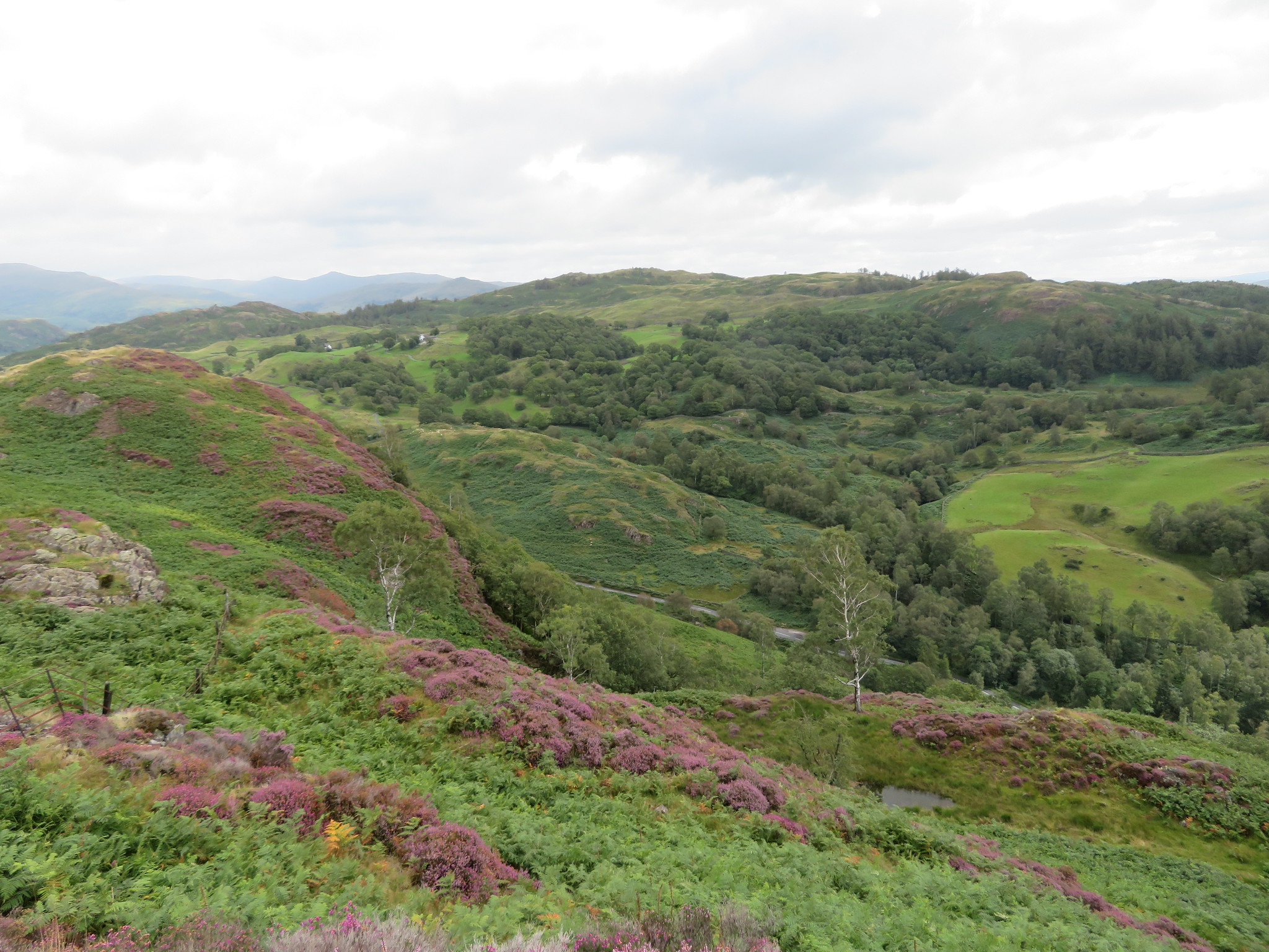 Black Fell from Man Scar top
 We left the summit by negotiating a wooden fence stile that looked as though it was created by Heath Robinson of DIY fame of many years ago and is as rickety as it looks.
 One dodgy stile
 From Man Scar/Crag we made our way over Hog Bank and down to Low Oxen Fell, through the north end of Gale Close Coppice and then down to the A593 at the southern end of Tongue Intake Plantation where we now enjoyed a short walk through the trees.
 Tongue Intake Plantation
 We left the trees behind to now walk up Hollin Bank along an initially wide grassy track that very quickly turned into a very wet and stony one that terminated at the top of Hollin Bank to let us through a gate and onto a section of stone paved bridlepath that we would follow to our turn off point where we would begin the climb onto Black Fell summit.
 The humps and bumps of Black Fell
We made good time along the bridleway and were soon climbing through the bracken once again on the lower slopes more or less following the wall for a short time.
 Bracken bashing on the way up
 Once that we had left the bracken behind it was a walk over grass to the small craggy summit, a summit that AW treats with some sort of disdain even though it was his own choice to figure it in his Southern Fells book. It may be small but it has quite big views so has something in its favour.
 Black Crag summit
 Well it's definitely warmed up as Chris had shed his coat quite a while back but as the breeze still has a chill about it we may see it go back on when we stop for a break at the southeast cairn.
 Windermere from Black Crag
  Windermere and Coniston from Black Crag
  Fells of the south-west and northwest areas
 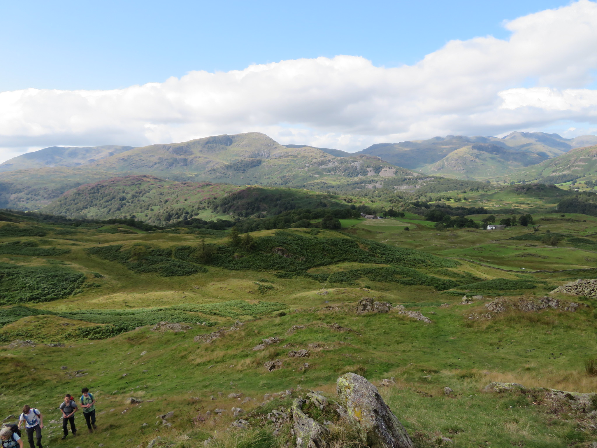 Holme Fell with Wetherlam and Coniston Old Man behind
 It was quite busy around here at the summit with people coming and going non-stop so we moved off to the southeast currick where it looked a lot quieter and the views are very open that way.
 The southeast summit currick
 A short walk across the connecting hollow soon had us sat down and enjoying the views and meal break.
 A view to the Far Eastern Fells
 Below us to the south are the long stretches of water belonging to Windermere and Coniston Water with a glimpse of Tarn Hows amongst the trees. The landscape is varied as we looked across fields, woods and fells both large and small with our exit route clear to see before us that showed an easy amble down to the tarn and beyond. We left this lower summit to walk west down the fellside before turning to the southwest along the easily followed path right the way down to Iron Keld Plantation that we would stay with for a while.
 Walking through Iron Keld Plantation
 A few minutes of walking along the stony track had us looking at Tarn Hows through the trees…
 Tarn Hows
 a track that we followed for quite some time until we arrived at a green lane that took us down to the north end of this lovely tarn. There were quite a few people about, mainly day trippers with lots of dogs and children and an ideal place for both of them to get their feet wet. We didn't linger as it was too busy but enjoyed the walk along the side of the tarn that had a scattering of water lilies that were just starting to bloom, showing off their white flowers.
 Tarn Hows
  Water lilies on Tarn Hows
 The bank side path is an undulating sort of affair with hordes of peoples walking against us presumably from the Tarn Hows car park at the south end. We were by now walking through Tom Heights Plantation, another delightful area, although more enjoyable I would think with less the crowds.
We were now heading for the outlet from the tarn and the walk back to the car park via Tom Gill, yet another great place to walk and enjoy the sights and sounds of the gill as it tumbles down over the rocky bed and numerous small cascades with the highlight being the fairly long waterfall dropping into a dark pool at its foot.
 Walking alongside Tom Gill
  Mini falls on Tom Gill
  The rushing waters of Tom Gill
  Tom Ghyll Waterfalls
 The way down was wet and slippery in places where the rock had worn smooth by the passage of thousands of boots but more probably shoes looking at the amount of strollers out today. We soon reached Lane Head Coppice…
 Lane Head Coppice
 from where we soon made it back to the car park that was now full to the brim with cars.
Well, this has been a great little walk with easy going all the way around through some beautiful and varying countryside and I feel fortunate in being here when the heather was in full bloom showing its rich purple at its best. The paths and tracks are good although wet in a few places where the ground was a touch lower or as with some of the tracks where the recent rain had turned them into mini becks in places but apart from that the whole walk has been wrapped in beauty of the best kind. It has been a round trip of about 100 miles from my house to do this walk and we were now savouring a couple of pints in our favourite watering hole before Chris sets off to complete his day with another 65 miles drive back to the northeast.
