free to be able to rate and comment on reports (as well as access 1:25000 mapping).
Paul's done his own superb report of the Laugavegur Trail, with he and Helen walking it under their own steam:
https://www.walkhighlands.co.uk/Forum/viewtopic.php?f=16&t=75244My trip was a guided version for various reasons, and a couple of friends joined me. The instigation to go had been mine, basically because I wanted to see live volcanic land and walk in it. I was keen on camping, but the original party of friends were more keen on huts, so once all the dust had settled, huts it was. Actually, it was really pleasant, and on at least one of the nights most of the campers ended up on the floors of the huts anyway because of some fierce winds.
Day 1 - the most photogenic day!
Landmannalaugar to HraftinnuskerAn 8am drive to Landmannalaugar, mostly took us across high moorland, and then below Hekla (which last erupted in 2000) with a view over to Eyjafjallajökull (the ashily disruptive one of 2010). From the road it's impressive to see the geothermals and how their energy is harnessed to heat pretty much anywhere in Iceland.
 002 Geothermals from the bus
 by
Emma Kendon, on Flickr
The last hour or so was a crawl along gravel roads. In a bus. This would have been a bit more practical in something a bit more off-road-friendly, but ...er, well, we weren't in a hurry

 013 Slowly on the gravel road
 by
Emma Kendon, on Flickr
At Landmannalaugar some of us had a good long dip in the hot springs there. What a sensation

. Everywhere else we were going to walk, the springs were boiling hot and bubbling, so it's a wonderful treat to make the most of it when there's a safe hot spring. Obviously doing this at the start of a walk does mean that just as you're really wallowing and feeling, yeah, you could quite happily stay all afternoon in that water, you gotta go.
We didn't take any photos, but Paul did in 2017, and here's his (hope you don't mind my 'borrowing' it, Paul!):

So, time to set off, at what was going to be a ridiculously leisurely pace, as we had four days to get from here to Þórsmörk. On the map below, "here" is the bottom left dot, under the shaft of the stick, and Þórsmörk is the furthest red dot, top right.
 016 Zoom on map north to south
 by
Emma Kendon, on Flickr
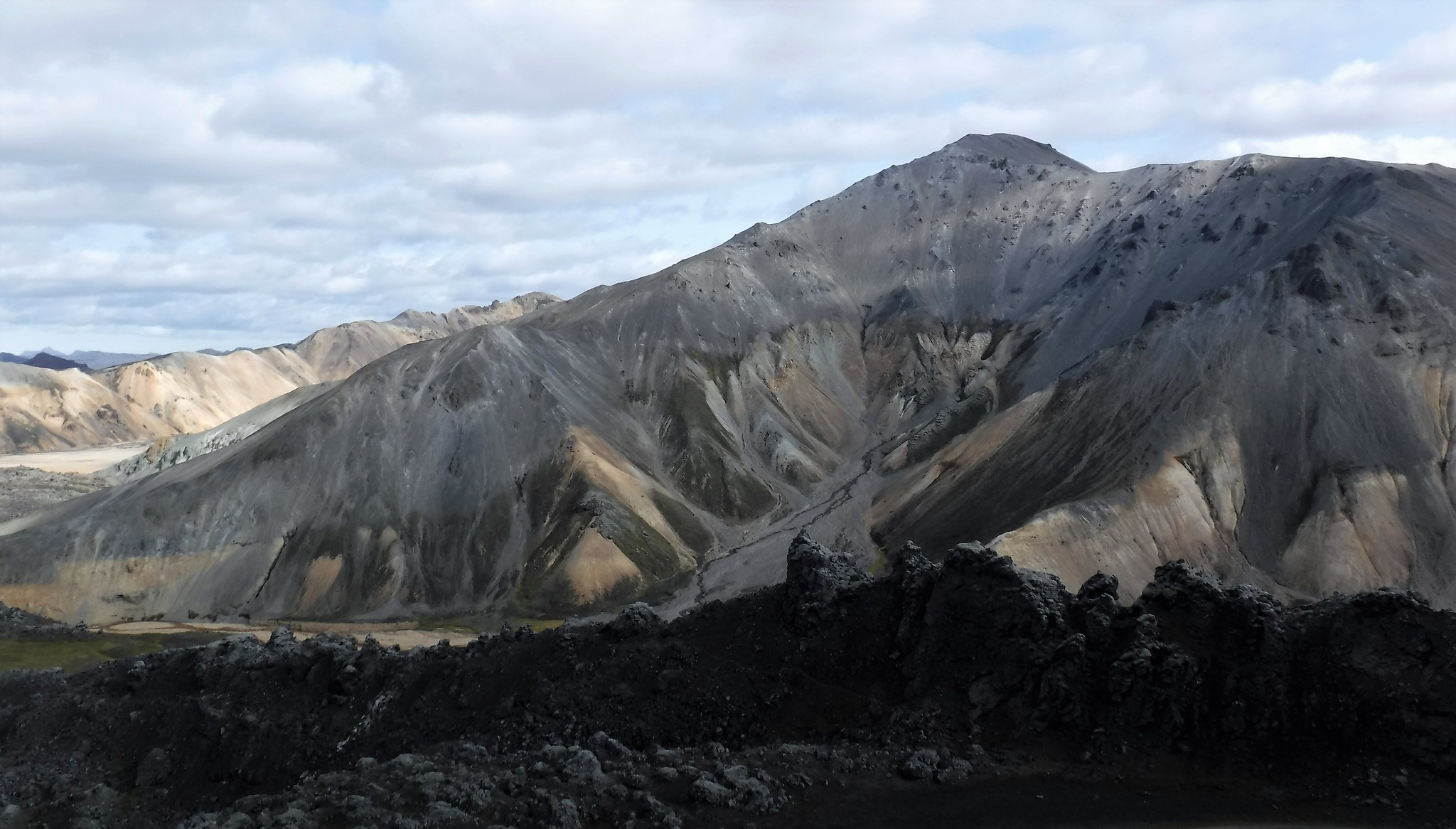
Early on, as you can see on the map, is Brennisteinsalda (which means "sulphur wave"), and it was our stunning companion for the first half hour or so. That sulphur hits you first as a smell of course.
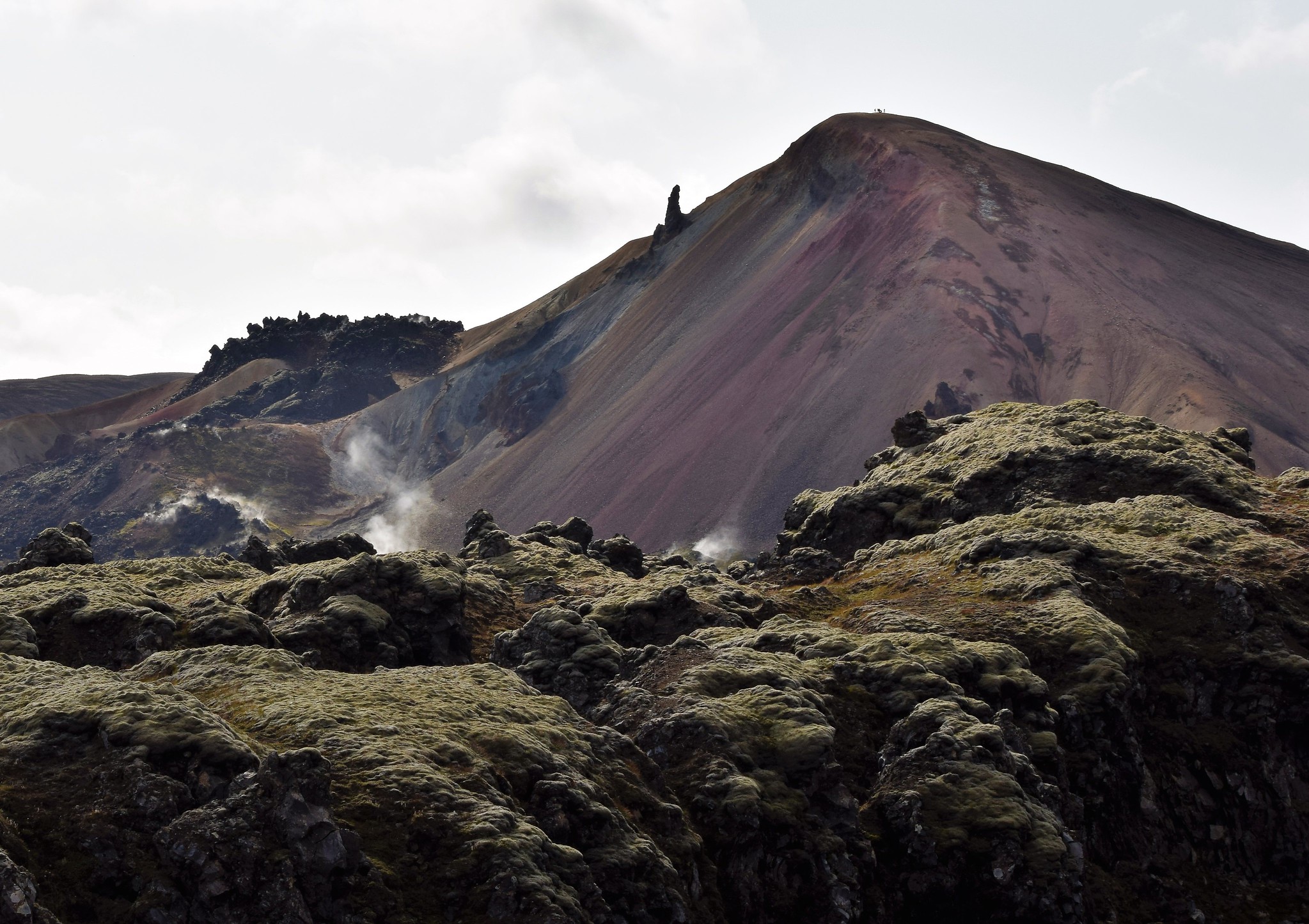 018 Laugahraun lava field - fumaroles - Mt Brennisteinsalda
 by
Emma Kendon, on Flickr
The strong, sulphurous rotten egg smell even kept my mind off the rude bit ^

,... and in fact kept transporting me to the fields of Waterloo... (don't ask, but yes, I'm 3rd from the right at the back...).

 020 Brennisteinsalda means sulphur wave
 by
Emma Kendon, on Flickr
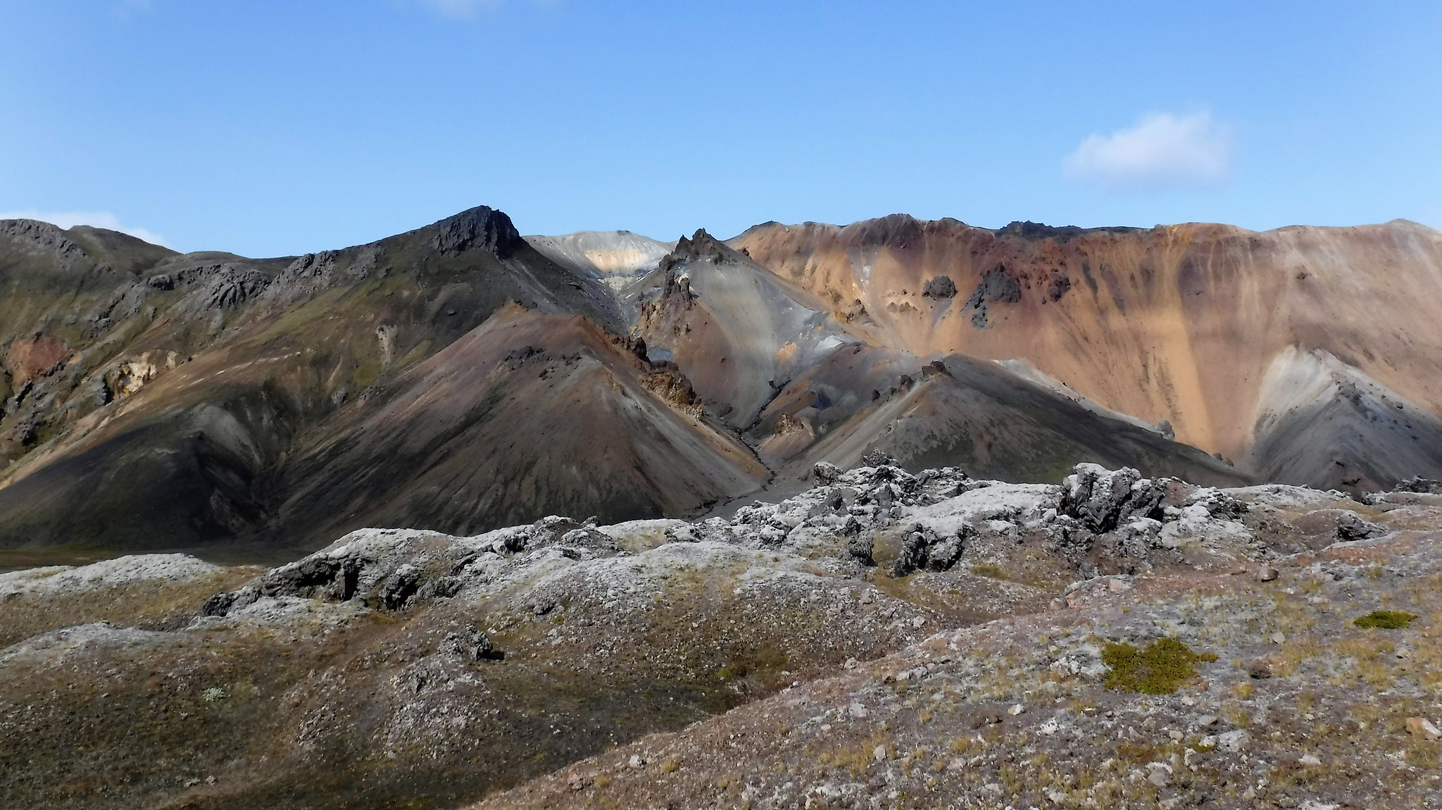
The wildly varying colours of the rhyolite do have to be seen to be believed. And where I associate rhyolite with the stuff climbers really like to get on to in Glencoe after all the lichenous andesite, this younger stone is crumbly, a feast for the eyes but really not for scrambling hands and feet.
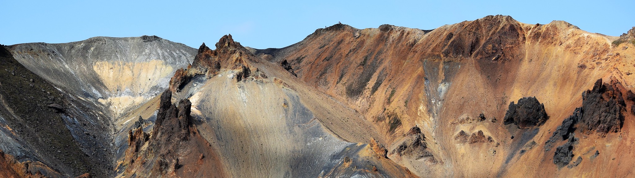 022 Brennisteinsalda skyline
 by
Emma Kendon, on Flickr
 024 Mt Brennisteinsalda from Fuji camera
 by
Emma Kendon, on Flickr
Tear your eyes away from that... and ahead of you it's completely different.
 025 Lunar landscape of Stórihver
 by
Emma Kendon, on Flickr
You can see how red hot the ground is.
 026 Hot springs and thermal vents of Stórihver
 by
Emma Kendon, on Flickr
It was amazing, just what I wanted to do, walk in land that was steaming (and not on fire because of man!), changing all the time, and hot just below the surface. It was like time travel. Our volcanic activity is what, about 400 million years old or so? This was like our Lakes and Highlands when they were just forming, minus the heady Himalayan heights of course. Hard to get your head round - well, hard to get
my head round, it was like a sensory overload.
The trail's very well marked with these wind-proof signposts, incidentally.
 029 Windproof signage on Laugavegur trail
 by
Emma Kendon, on Flickr
Just as well, if you're not in sheep-mode like I was, because as well as there being a few deserts, the rock's magnetic and the weather's very changeable of course. On that front, we were being really lucky. The first part of the trail is probably the most beautiful, and we were in t-shirt weather with far-reaching views. (Just wish I had this kind of luck on Skye

!)
 030 Icelandic highland desert
 by
Emma Kendon, on Flickr
 031 From golden to grey and green
 by
Emma Kendon, on Flickr
The other all-pervading landscape element of the day, and of much of the trail, is the bright green moss. It's delicate, easily damaged, takes hundreds of years to repair, and sometimes doesn't repair at all, as guides, drivers, rangers et al are at great pains to make sure everyone knows. So no going off-piste on the trail. It demands its own kind of deep respect.
 032 Moss covered rhyolite landscape
 by
Emma Kendon, on Flickr
 034 Highland flora
 by
Emma Kendon, on Flickr
 035 Meandering stream
 by
Emma Kendon, on Flickr
You rise good and quickly from Landamannalaugar, so the view back north is pretty rewarding. And, well, those colours... I don't know... just other worldly. I don't generally fly to holiday abroad. I've only ever booked a plane once for a holiday, so this was pretty much a one-off, and one of those questions of balance between Iceland's recovery through tourism versus its glacier's melting. The plaque had just gone up on Okjokull the day before, reading:
"Ok is the first Icelandic glacier to lose its status as glacier.
In the next 200 years all our main glaciers are expected to follow the same path. This monument is to acknowledge that we know what is happening and what needs to be done.
Only you know if we did it."So the huge treat of being in this landscape wasn't lost on me.
 037 Looking back north
 by
Emma Kendon, on Flickr
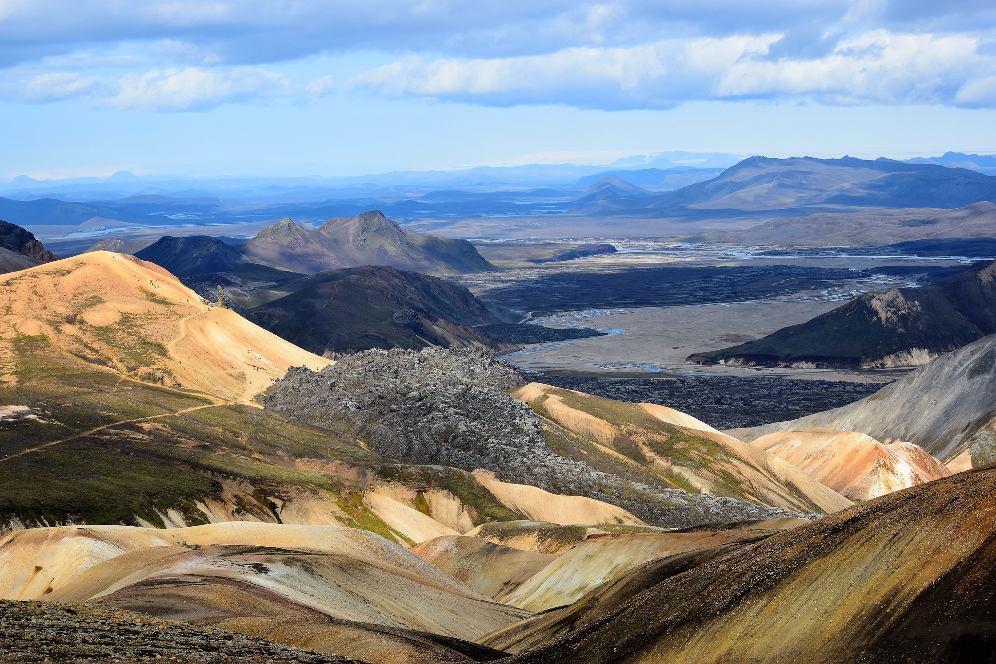 039 View north to Hofsjökull on horizon
 by
Emma Kendon, on Flickr
 038 Steaming sulphurous spring
 by
Emma Kendon, on Flickr
1000m up we started to cross some snow, black with ash.
 043 Ashy snow detail
 by
Emma Kendon, on Flickr
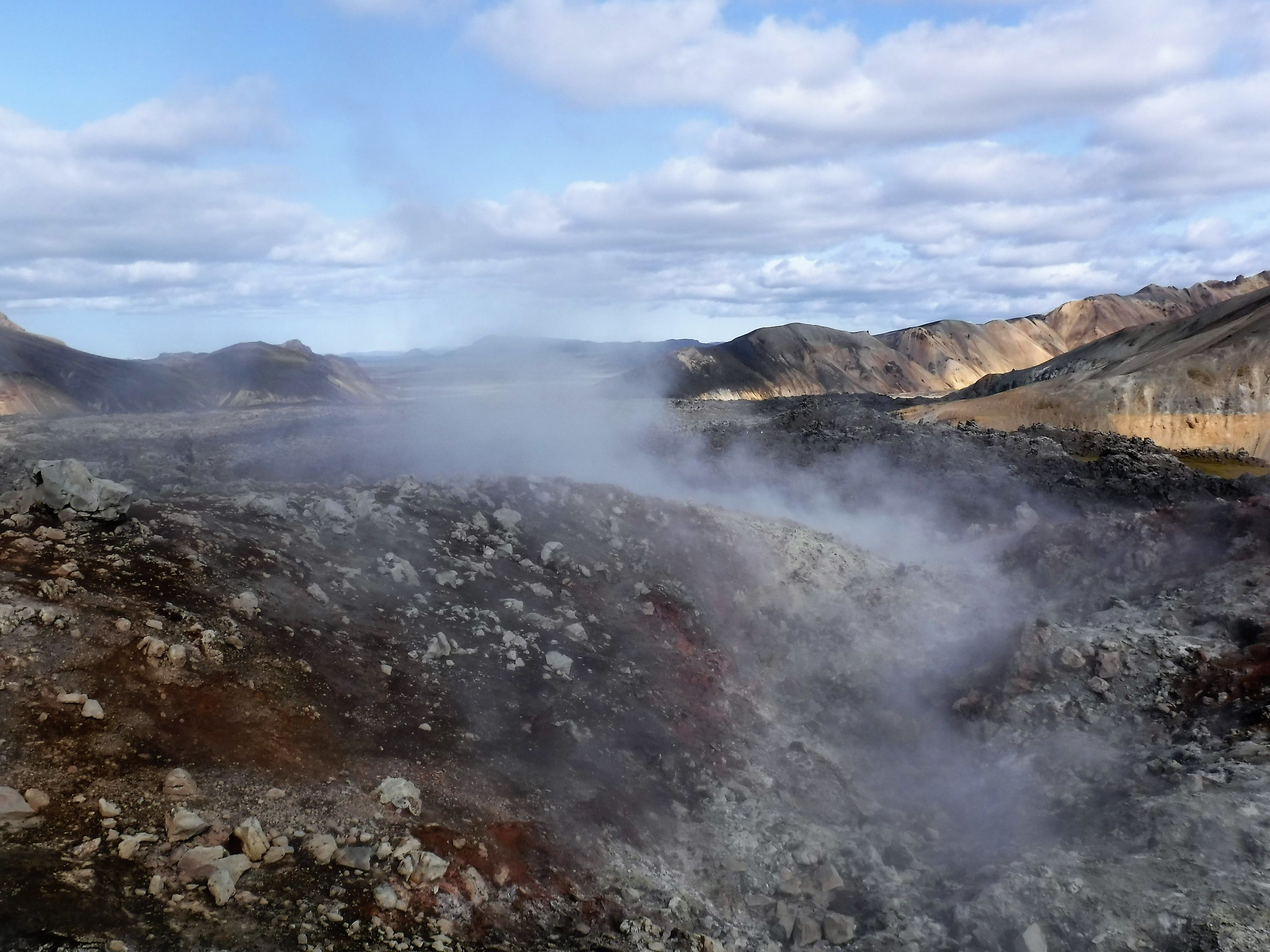
Then half an hour later, we were back in bubbling hot springs, geothermals, everything boiling and steaming again. Flippin' marvellous!
 044 Bubbling hot spring
 by
Emma Kendon, on Flickr
 045 More bubbling springs
 by
Emma Kendon, on Flickr
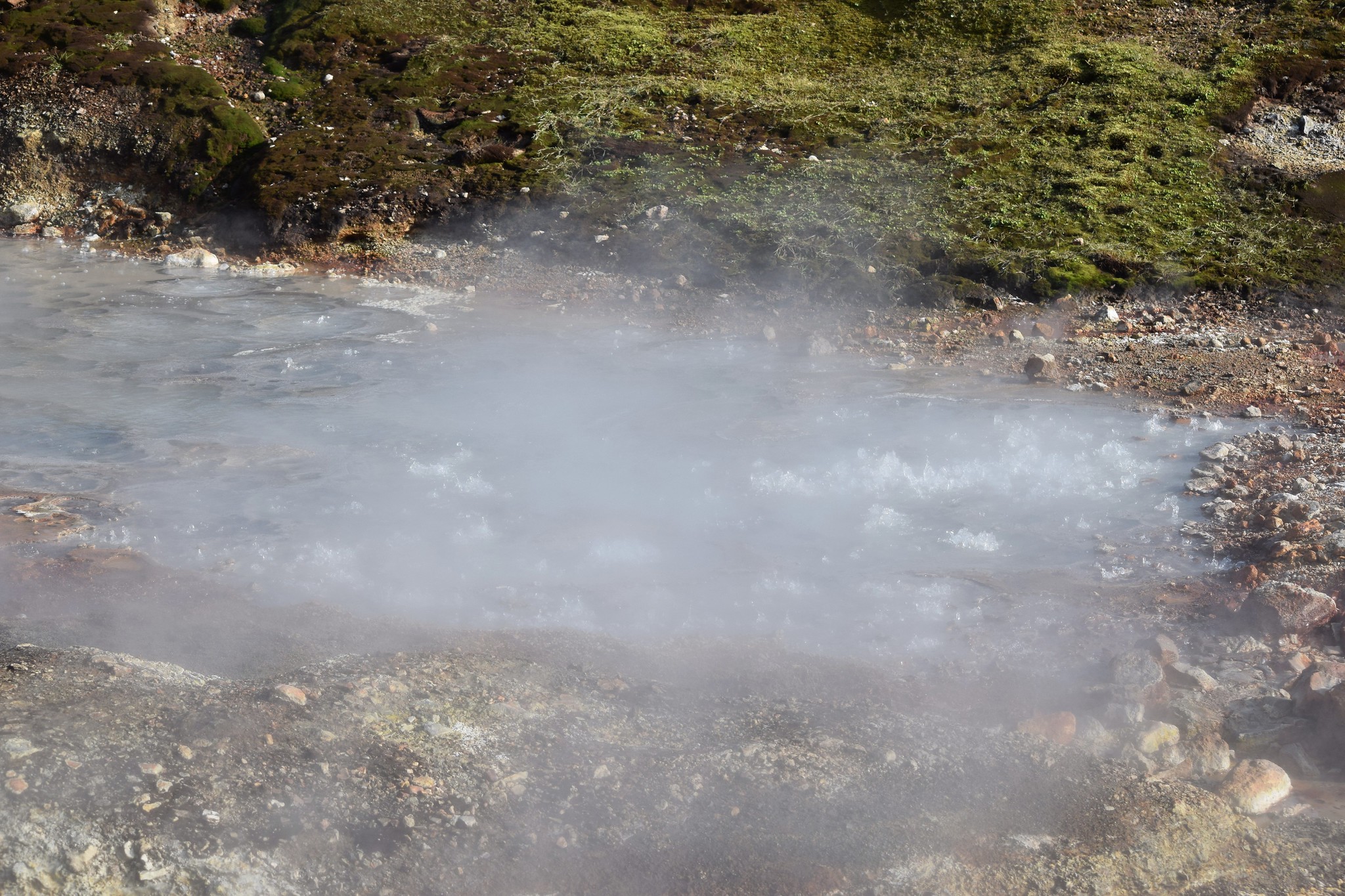 046 Boiling
 by
Emma Kendon, on Flickr
I think you can poach eggs in this stuff. But you might need a metal vessel on a long stick.
 047 Under pasture heating
 by
Emma Kendon, on Flickr
Rising up again above the springs, you're suddenly in the land of obsidian.
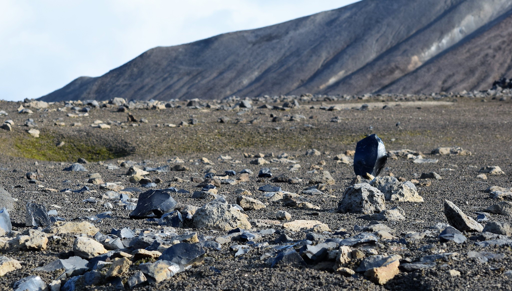 049 Obsidian - volcanic glass
 by
Emma Kendon, on Flickr
The area is Hrafntinnusker which basically translates as obsidian hill I think.
 050 Obsidian and hills
 by
Emma Kendon, on Flickr
It's beautiful. Finer and with a lower water content than the pitchstone of An Sgurr on Eigg, but broadly similar. Anyway, one more snow crossing and we were at Hrafntinnusker hut pretty much.
 057 Hrafntinnusker camp and hut
 by
Emma Kendon, on Flickr
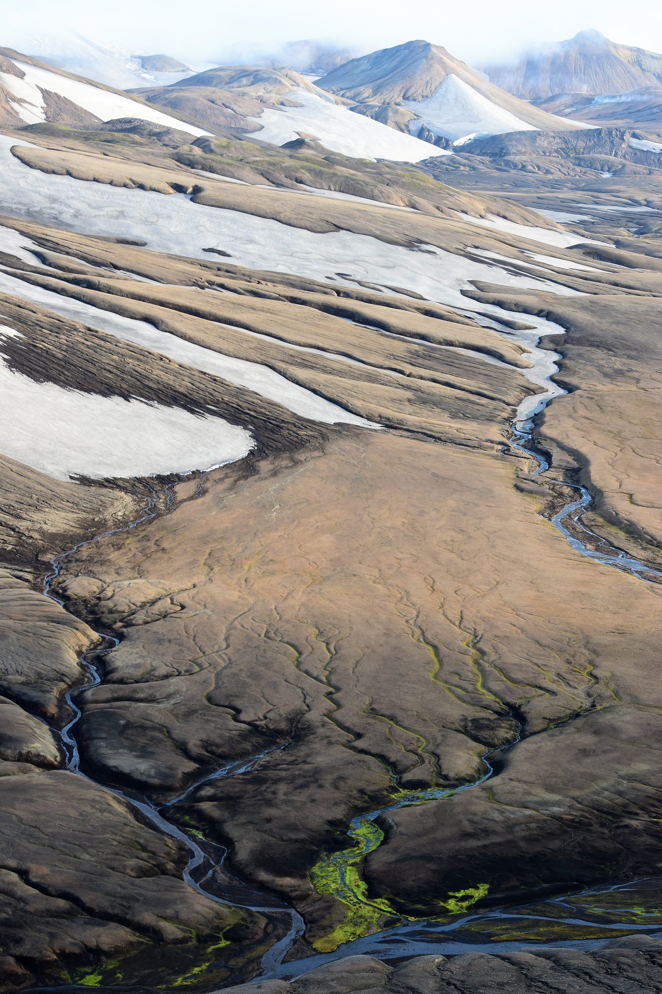
Nearby is a cracking viewpoint called Mount Söðull, so it was too inviting not to take a wander up there and soak in the views before cooking up our dinner.
 060 View east from Mount Söðull
 by
Emma Kendon, on Flickr
 062 Snow and rock from Mount Söðull
 by
Emma Kendon, on Flickr
 063 Luminous moss from Mount Söðull
 by
Emma Kendon, on Flickr
and so , on to the next three days, all contained here (
https://www.walkhighlands.co.uk/Forum/viewtopic.php?f=16&t=92760).
