free to be able to rate and comment on reports (as well as access 1:25000 mapping).
For the last day of our holiday in the Narvik area, we chose the small but spectacular Stortinden (847m), one of a set of remarkable looking mountains overlooking Efjorden to the south-west of Narvik, that culminate in the extraordinary and iconic Stetinden, Norway's national mountain. Despite its name (big mountain), Stortinden is a short day out: it looks a ridiculous prospect, especially when approaching from the east along the main E6 road. However, it turns out to have a single weakness in its rocky defenses that means the climb is quite straightforward, with nothing more than a couple of very easy scrambling moves.
The way up starts from the E6 where it crosses a col between Efjorden and Tysfjorden. Tysfjorden has to be crossed by ferry: the country is almost split into two here. The head of the fjord is only about 5km from the border with Sweden, and there is no actual road linking to the south within Norway. A well marked path initially makes its way up some huge granite slabs, before bearing right to a tiny lake at about 500m. From here, the way ahead is still not obvious, but the path continues, bearing right again across increasing steep ground with blank slabs above and below. Abruptly, it meets a diagonal grassy rake, cutting back left across the face. Where this starts to level off, another rake cuts back right, with a couple of scrambly bits, to emerge on the summit ridge at a tiny cairn. The final section along the ridge is also remarkably easy and lacking in any serious exposure, following natural grooves along the crest to a platform just below the summit cairn. This is perched on a point of rock where there is room for only one person at a time.
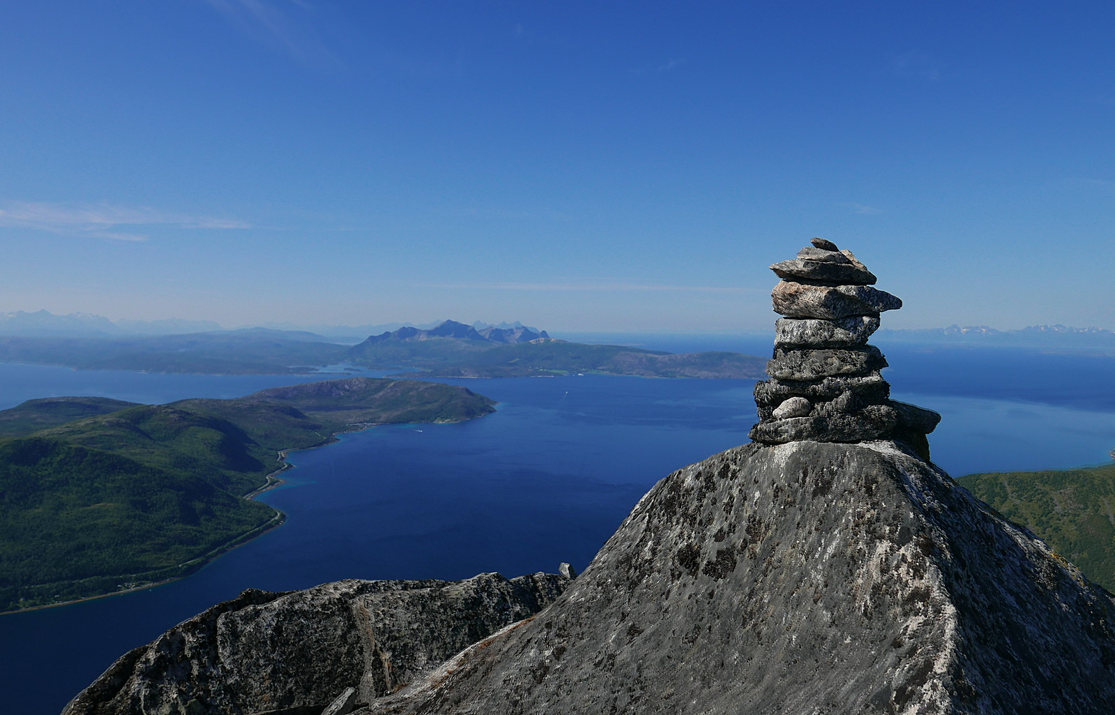
We were blessed with the best possible weather - blue skies and clear air. The views are just stunning, with Stetinden and its neighbours to the south and the Lofoten islands out to the north-west.
On the way down, we took a detour across pathless terrain above the lake to the lower top of Kjerna. This overhangs spectacularly on the other side, but you can safely lie on a slab and put your head over the edge! From here a path leads back down to the lake, which for us was an idyllic lunch spot, before we headed back down to the car. Afterwards, we took a drive through the tunnels to the foot of Stetinden, and scoped out some of the other fantastic looking hills in this area.
Online map
Stortinden and Breidskardtinden across Efjorden

Huglhornet

Kobbenestinden and Mellomtinden
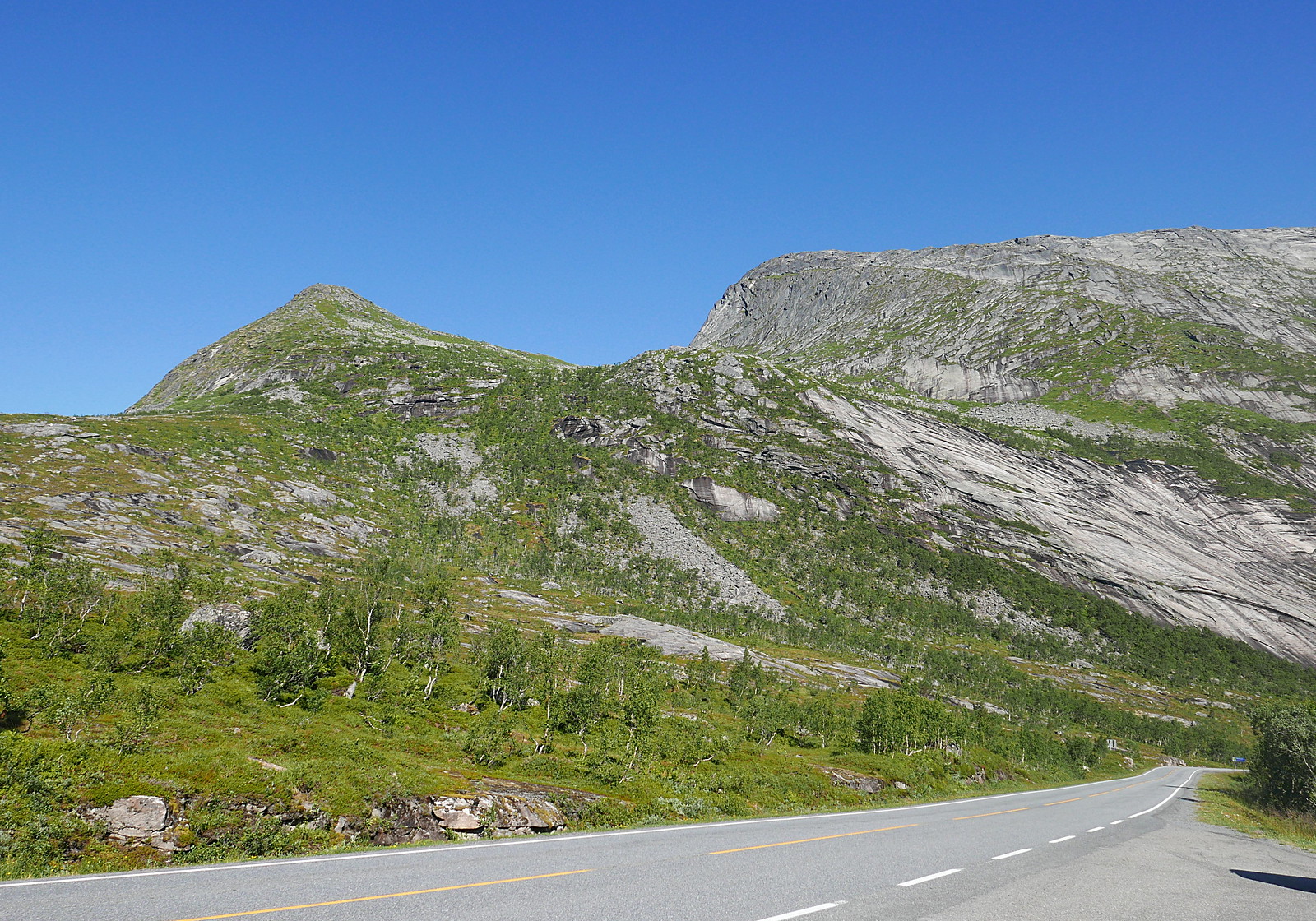
Stortinden from the start at the high point on the E6

The initial slabs

Huglhornet
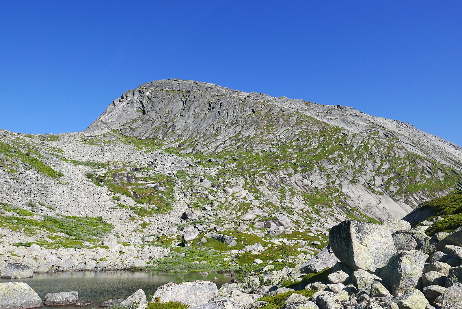
Stortinden from the lake: the route follows the least rocky ground rightwards to reach the rake which is just visible parallel to the skyline.

Huglhornet

Stetinden comes into view!

A wider view

Through the weakness in the crags

On the diagonal rake
Reaching the ridge
Looking north

Stetinden again
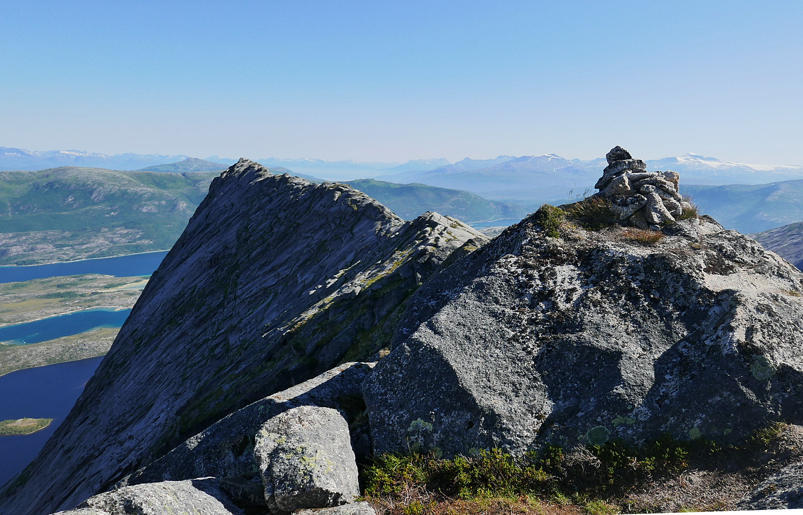
Summit cairn

West across the mouth of Tysfjorden

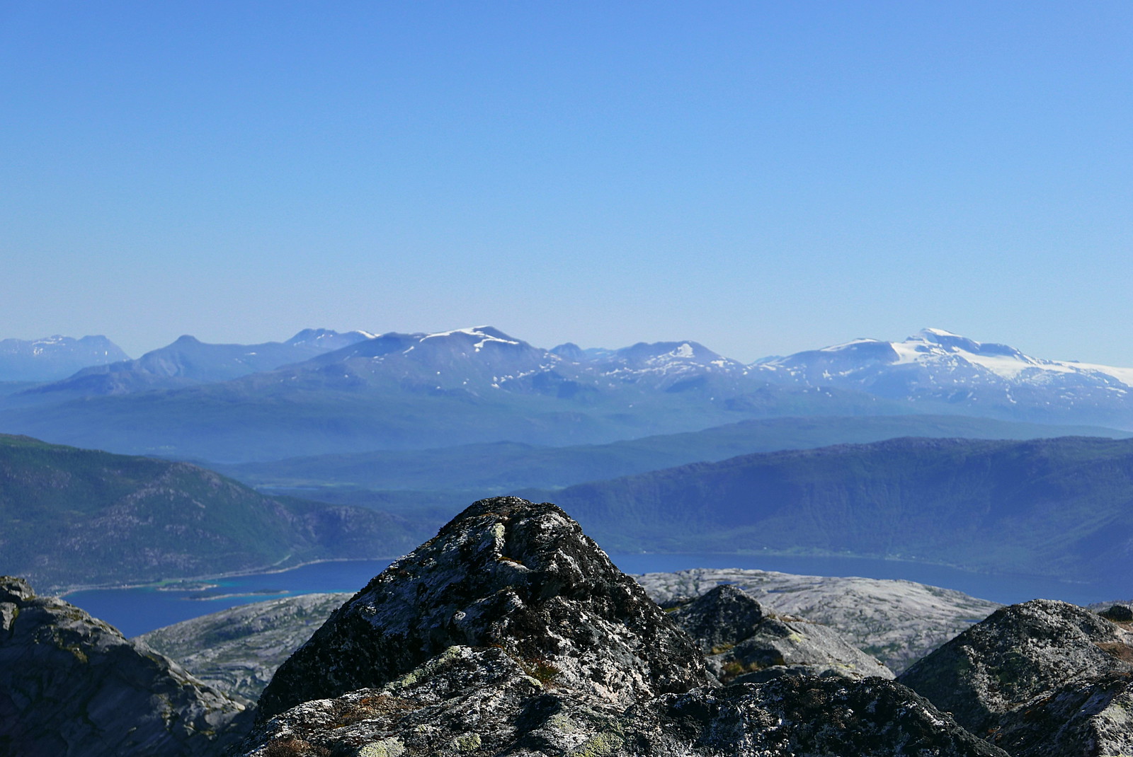
North to Breidskardtinden, with Møysalen on Hinnøya in the distance
East to
Rånkeipen, Simlefjellet and Frostisen

Panorama of Huglhornet and Stetinden

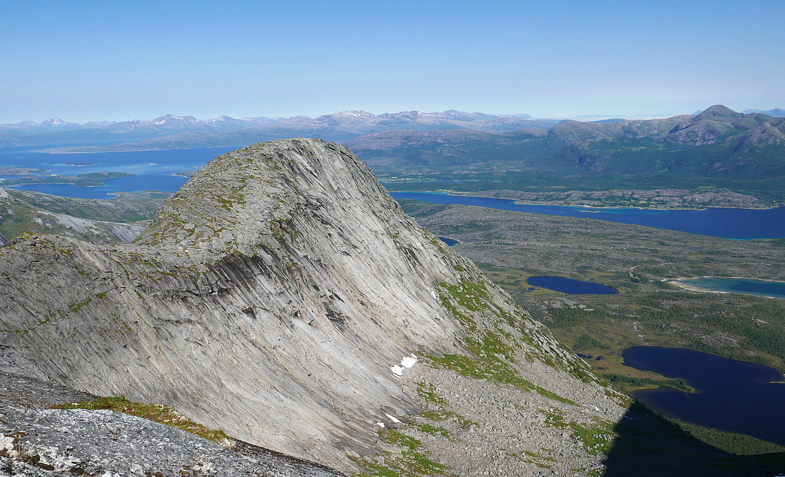
Looking down on Kjerna, Lofoten in the distance

Down to the lake and the E6

Breidskardtinden from Kjerna

Looking back up to the summit

The overhangs on Kjerna

East ridge of Huglhornet

Stetinden

Breidskardtinden

A last look back at Stortinden
