free to be able to rate and comment on reports (as well as access 1:25000 mapping).
 20200122_093717
 by
Mal Davies, on Flickr
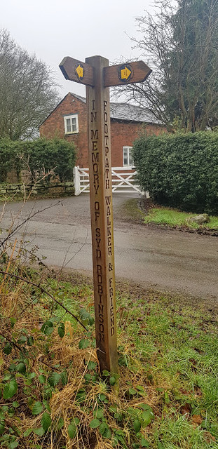
Hello humans and pooches. Joe the Cocker here reporting on a muddy, muddy hike with my human dad. We are waiting for the weather to pick up so that we can overnight camp in Snowdonia. Unfortunately, the recent weather and the forecast for the next week or so is yukky. My dad wanted to do a linear walk for a change but, the logistics of parking the car, doing a hike and then returning to the car would mean using public transport or a taxi service. A relatively local trail that we have walked parts of is the Baker Way. This hike is designed around train transport and starts at Delamere railway station and ends at Chester railway station. I have never travelled by train before and my dad was a bit nervous about how I would react. It’s only a sixteen minute train journey so it would be a good try out. The weather was ‘dreich’ as they say north of Hadrian’s Wall. It was foggy, very damp and chilly. Off we went on the twenty minute drive to Delamere.
 20200122_094417
 by
Mal Davies, on Flickr
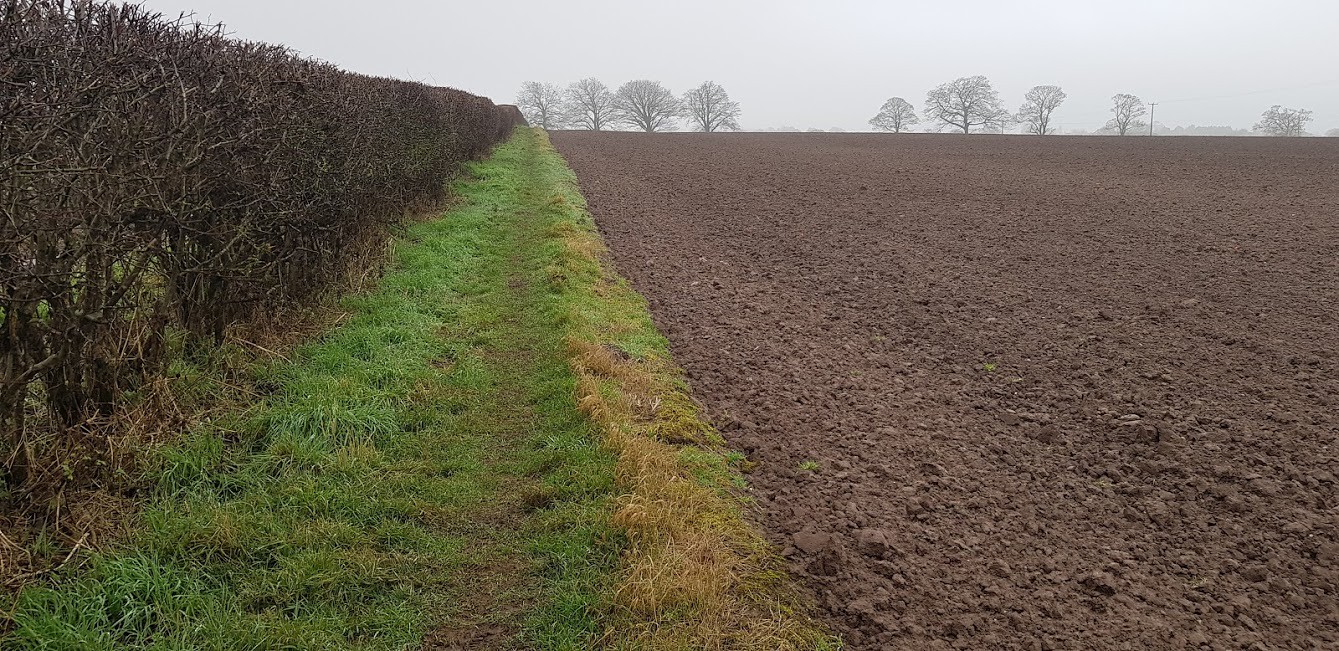
With the car parked for free in the station car park and the ticket for the train bought on-line all we had to do was to walk to Chester following the Baker Way waymarks. Sounds simple but, it wasn’t as easy as we expected. We expected some mud but what we encountered was too much in places even for a mud-loving cocker spaniel like me. The route took us past the Station café and the forest visitor centre until we turned left off the wide track onto a narrower footpath through the conifers. On reaching the Sandstone Trail the route turns right along a wide track with a good surface. I had attempted to chase lots of squirrels while we were in the forest. I think that they were teasing me by crossing the trail a few yards in front of me and just as I was about to catch them they would sprint up the nearest tree. They must know that I am not built for tree climbing. I don’t think that this is very sporting of them. The trail passes over railway bridges three times until it descends to Ashton Road where we turned left past Fox Howl Outdoor Centre. Then we had to walk along a fairly busy winding road and under the railway this time until we came to Brine’s Brow car park.
 20200122_095429
 by
Mal Davies, on Flickr
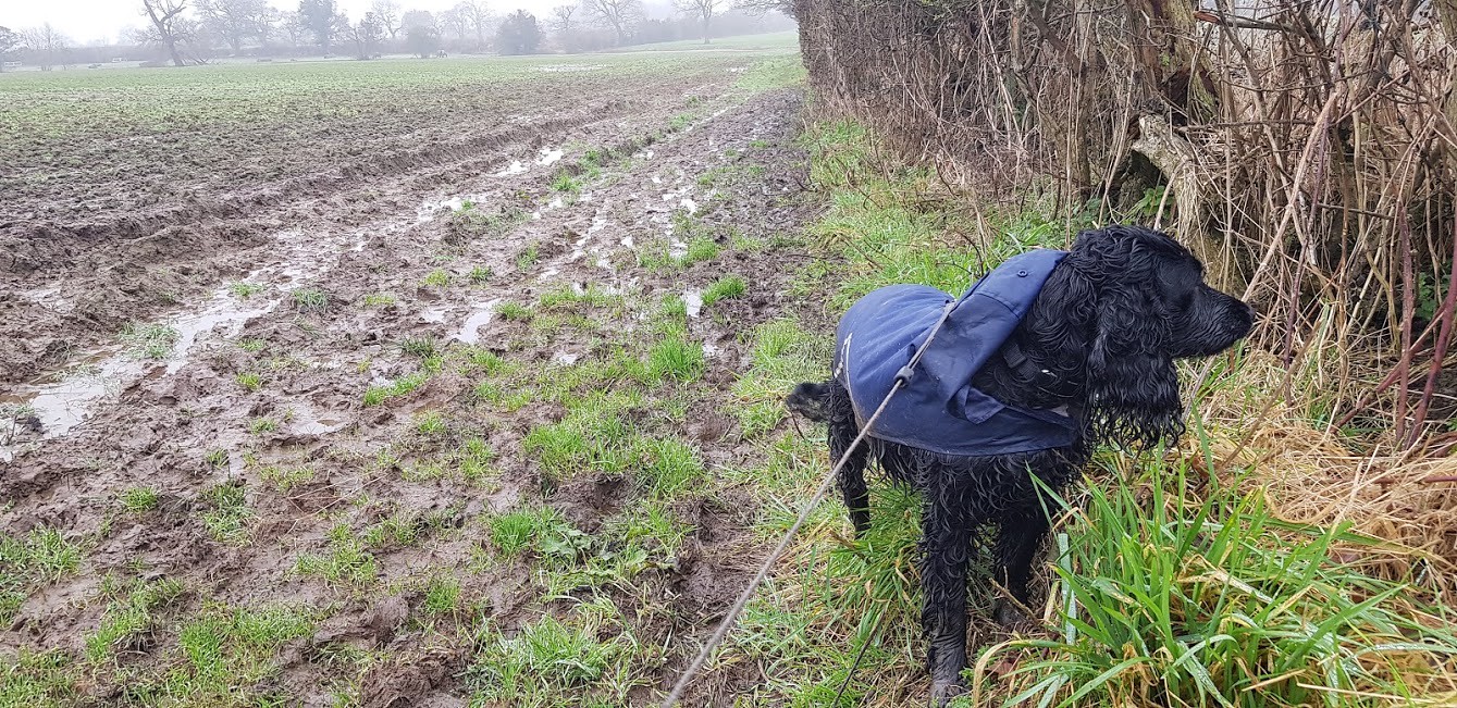
We followed the well waymarked paths and crossed the B5393 on the outskirts of Ashton Hayes. This short section was a wee bit overgrown with tree branches and brambles but once it was squeezed through we met a narrow path between a fence and a hedgerow. Thousands of midges and gnats pestered my dad as we passed through this section much to his annoyance. I had to be lifted over a few stiles, much to my dad’s disapproval due to me being very muddy underneath. I can’t help that. I was wearing my waterproof coat but it was caked in mud. After crossing a minor road at Ashton Brook we headed along the lane towards Peel Hall, a large horse riding stable. The trail passed through the farm buildings and is not well signposted. However, the route is easy to find with the use of an OS map. Once the farm tracks were left behind us conditions under foot deteriorated rapidly. Waymarking was also quite poor as we had to skirt and cross fields. The mud was belly deep for me in places and there was no way around it. We had no option but to wade through it. After taking a wrong turn and following the wrong side of a hedge we turned back before crossing Salter’s Brook by a small wooden footbridge. It was a relief to exit the fields as we crossed Barrow Lane and walked down Sandy Lane towards the A54. After crossing this busy road we were on dry land as we entered Tarvin village.
 20200122_103928
 by
Mal Davies, on Flickr
 20200122_104417
 by
Mal Davies, on Flickr
 20200122_110910
 by
Mal Davies, on Flickr
 20200122_115216
 by
Mal Davies, on Flickr
 20200122_115759
 by
Mal Davies, on Flickr
My dad wanted to take a break in Tarvin to have a coffee outside of a small café but as we were both covered in mud he thought that we would walk on through the village. The George and Dragon and the Red Lion both looked tempting for a lunch stop but, we would probably have been turned away. We turned left onto Hockenhall Lane which we would follow for some time. The trail passed through houses along a pavement until it crossed the community woodland and then crossed the very fast and busy A51. We crossed this road after waiting a while for a suitable gap in the traffic and continued along the lane. At the end of the lane we followed the path along the side of a stream. Mud, mud, mud. Even I was trying to avoid it in places. My dad said that we were ready for a lunch stop and when he found somewhere convenient to sit down we would grab our food.
 20200122_122121
 by
Mal Davies, on Flickr
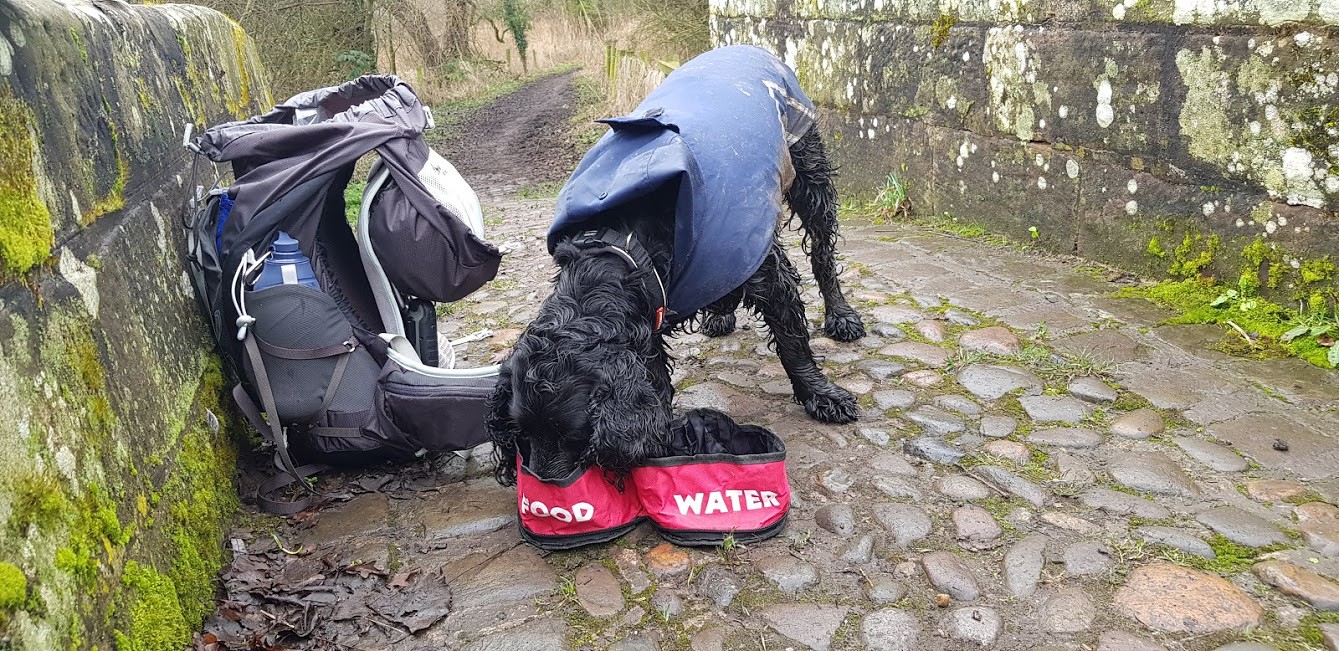
After a short distance we entered Hockenhall Platts Nature Reserve as the trail approached the River Gowy. The nature reserve is a mix of wetlands, reedbeds and ponds and is a haven for birds, otters and dragonflies. The river divides into three narrow streams at this point and is crossed via three humped sandstone packhorse bridges. This was a perfect spot for the big feller to park his backside while we ate our food. We were both hungry at this point and it didn’t take long for us to devour our snacks. The weather was still dreary and the fog had only cleared slightly so we decided to plod on. We reached a tarmacked lane and continued along it until it became Plough Lane. The Baker Way shortly leaves this lane to cross fields on the left. We chose to ignore the route across the fields’ as it looked like another mud bath, in favour of a longer but dryer road walk. We wouldn’t normally do this but conditions today were wet wet wet. This was obviously a cue to a song but he didn’t start singing what you would expect. Instead, I was tortured by a rendition of ‘The River’ by Bruce Springsteen. Not surprisingly, it was his version of the lyrics interspersed with the correct words. Painful!
 20200122_124658
 by
Mal Davies, on Flickr
 20200122_125211
 by
Mal Davies, on Flickr
 20200122_125650
 by
Mal Davies, on Flickr
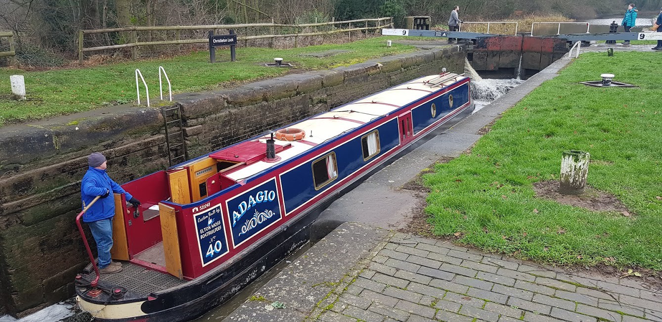
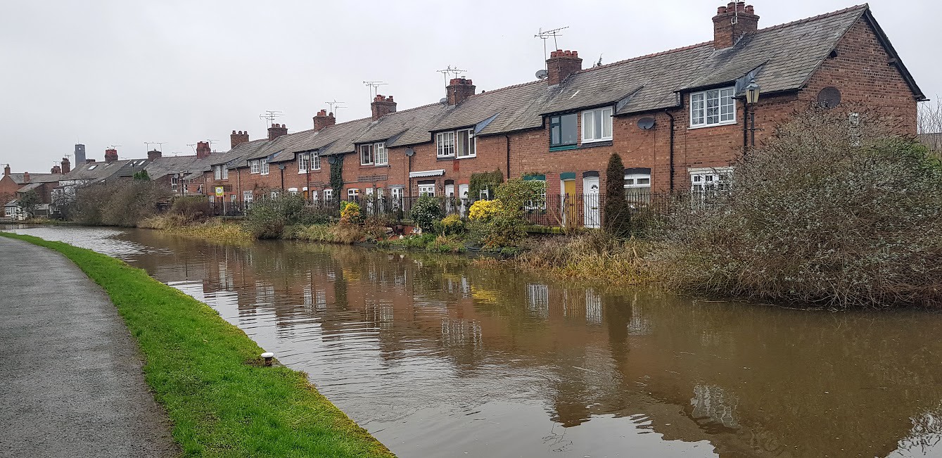
We continued along Plough Lane where we came across a restored sandstone cross that told the tale of the Squire of Stapleford, a devout Puritan, who destroyed crosses of local churches and villages in the seventeenth century. Then, passing the Plough Inn on our right as we walked into Christleton village. After turning left along Rowton Bridge Road and over the canal bridge we turned right back onto the Baker Way. The route took us along the towpath of the Shropshire Union Canal. The towpath is initially a quiet pleasant stroll towards Chester but, becoming busier as the city centre is approached. A series of locks were passed as we approached the historic city. I was pulled away from one that was filling as a narrowboat was passing through it. I was too close to the edge according to my dad. I think that he is a bit overprotective at times. After all I am two years old now. The Shot Tower on the right, which was used to produce lead shot for the Napoleonic Wars, dominates the skyline and is now being redeveloped to provide luxury flats. The Steam Mill was passed on the left which now contains a number of bars and eateries before we reached a metal staircase that took us to City Road where we turned right and approached the railway station.
 20200122_140656
 by
Mal Davies, on Flickr
There was twenty minutes spare until our train returning to Delamere Station was due to depart. This was all a new experience for me. I had never travelled on a train before. We climbed a few staircases before we dropped down to platform five for the Manchester bound train. Luckily, it was already at the platform and we jumped on and found an empty seat for my dad. Apparently, I am not allowed to sit on the seat so, I sat on the floor between my dad’s feet. Soon we were off and after being a bit nervous because of the engine noise I settled down to relax on the floor. We must have looked a disgrace as we were both very muddy. Fortunately, the train wasn’t busy and we were soon back at Delamere Station. All that we had to do was to cross the bridge and we were back at the car.
 20200122_142826
 by
Mal Davies, on Flickr
It was a good day’s hike but the underfoot conditions were awful at times. It wasn’t the most scenic of trails but we had a good time in the Cheshire countryside. When my dad checked his GPS he discovered that we had walked over fifteen miles and not the thirteen as the waymarked route states. This was probably due to avoiding some muddy sections and the slight detour when we were on the wrong side of a hedgerow. It was a good adventure. Till next time!
 20200122_205039
 by
Mal Davies, on Flickr
