free to be able to rate and comment on reports (as well as access 1:25000 mapping).
The back end of 2019 and the beginning of 2020 showed little respite from the strong winds and rain that had been with us for quite some time and this weather was causing havoc with our planned high level walking routes for the group. So, to keep the group out walking we were looking for relatively low level walks to help keep us out of the worst of the strong winds in the higher reaches of the fells and mountains. This is sometimes a difficult exercise as varied and lower level walks are quite hard to sort out during the winter months as time is short on daylight so the walks would need to be a lot nearer to home to gain as much daylight walking hours as possible. A lot of the lower walks had either been done or were/are too short to give a decent day out even on a short winter’s day so we had to look a little further afield and for this one it was to the South Lakes portion of the map that we looked at with the central point of this triangular walk being Fletcher’s Wood. We didn’t enter this wood but we did pass through Sawrey’s Wood that sits to the north of Fletcher’s Wood.
Apart from a roughly planned route to sort of estimate distance and height gain, including time to do it in, we thought that we would go where we found the route would take us the easiest and lowest way possible that also had plenty of options for a quick return to the car if required to do so. We would see much of interest, waterfalls, ancient quarries and mines as we followed the Cumbria Way to Elterwater, Sawrey’s Wood and along the south side of Lingmoor Fell to Little Langdale with its tarn and the famous Slater Bridge that allows passage over the still young River Brathay. The ‘Cathedral’ and Colwith Force are to be seen on the return leg of the walk, also much rain and wind.
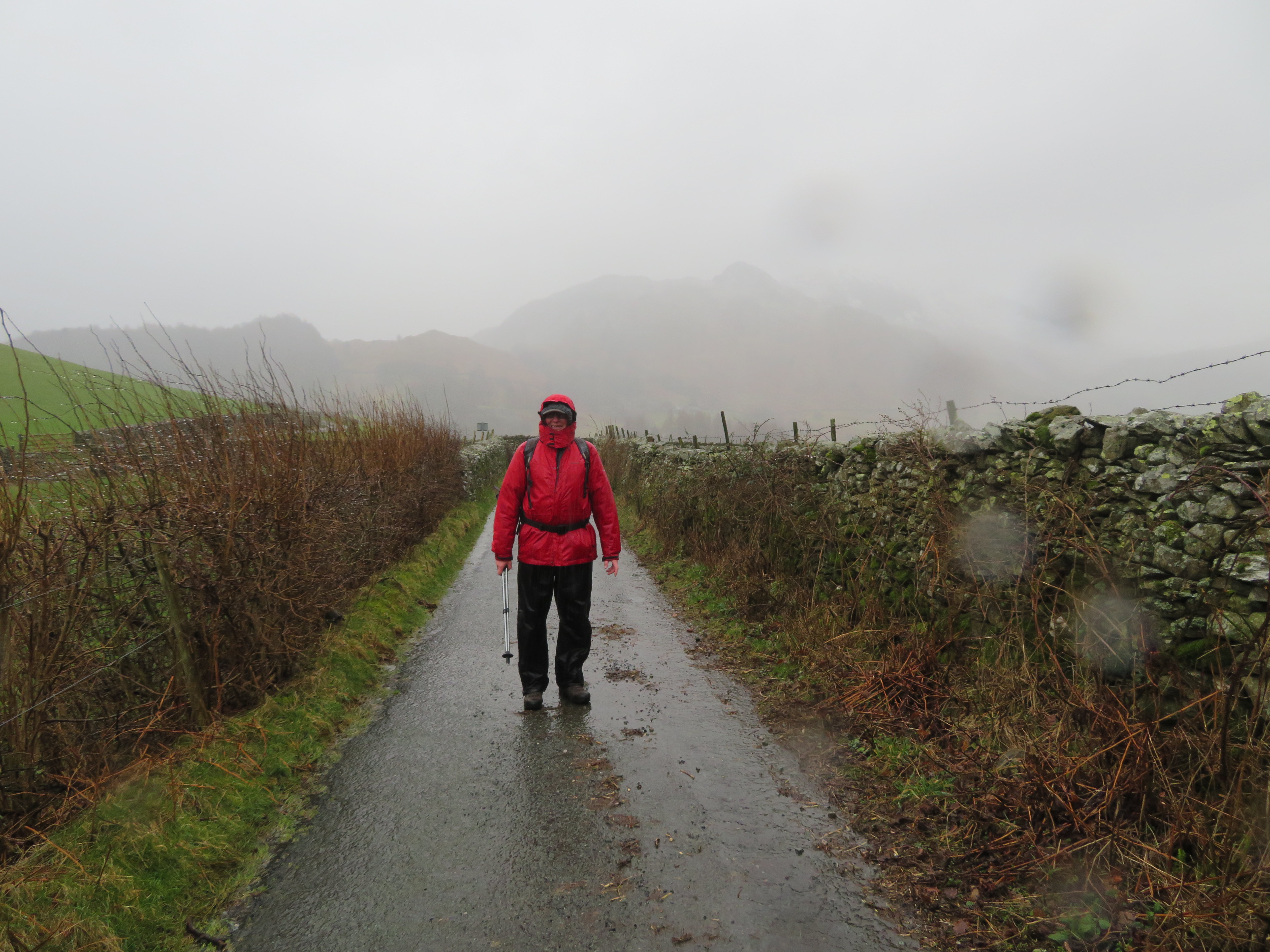
On the day of the recce, sod’s law, the clouds were low and it was damp and windy, ideal weather conditions to check out this walk and what it’s about, although later on in the walk the damp turned to full on rain.
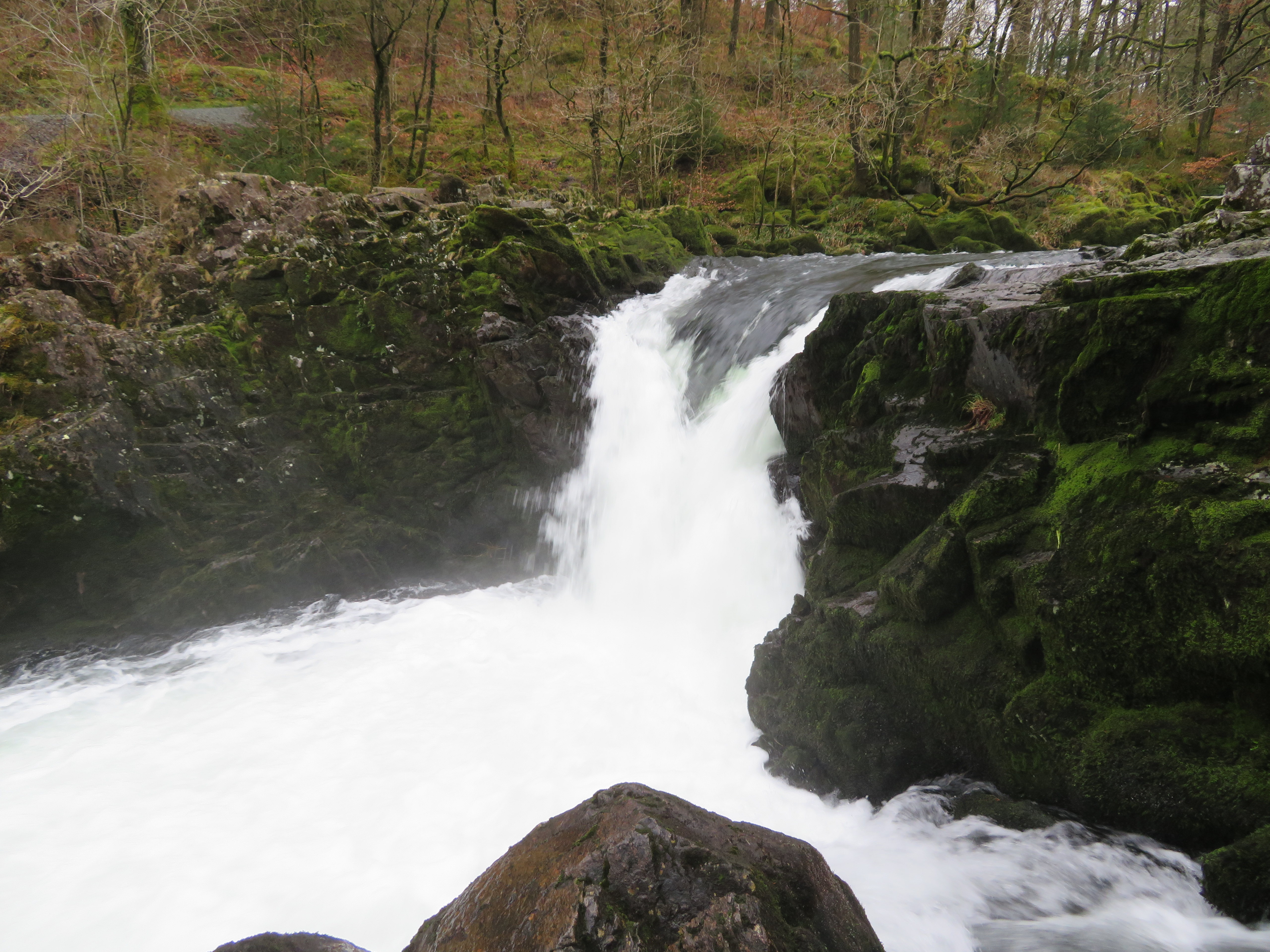
Due to the time of year there was plenty of room to park outside of the Skelwith Bridge Hotel and as we were getting booted up a young couple passed by and wished us both a Happy Valentine’s Day. Wow! I know that we standing close together but didn’t realise that we looked ‘close’. Nonetheless, we returned the greeting and set off for a short distance along the road to then cross the rough patch of ground that is just beyond the pub car park and gardens and was soon alongside the River Brathay from where we could hear the roar of the water from the recently rain filled river as it poured over the rocks of Skelwith Force Waterfall.
 Skelwith Force through the trees
 As we looked upstream we could see the gentle arch of the Trevor Woodburn Memorial Bridge. This bridge that was handmade from both metal and wood was named after a local man who suggested the original idea in 1998 and links to a new footpath through ancient woodland on the Coniston side of the River Brathay creating an alternative route away from the road. Known as a ‘miles without stiles’ it is suitable for wheelchairs and prams. We made use of the bridge on our return journey but for now passed it by as we walked on to Elterwater.
 Looking upstream along the River Brathay
 To see the Force at its best we had to leave the path and cross over a couple of metal footbridges to see it as it rushed white and foamy through the narrow jaws of the rocky sides of the river. The photos underestimate the force and power of the water as it squeezed through the narrow confines of the rocks whilst the thunder of the water made speaking to each other from a short distance a tad difficult.
 Skelwith Force
 Everywhere was wet so care had to be taken when walking across the rocks to access the lower bridge as one bad slip could mean a white water ride along the Brathay.
 Skelwith Force access bridges
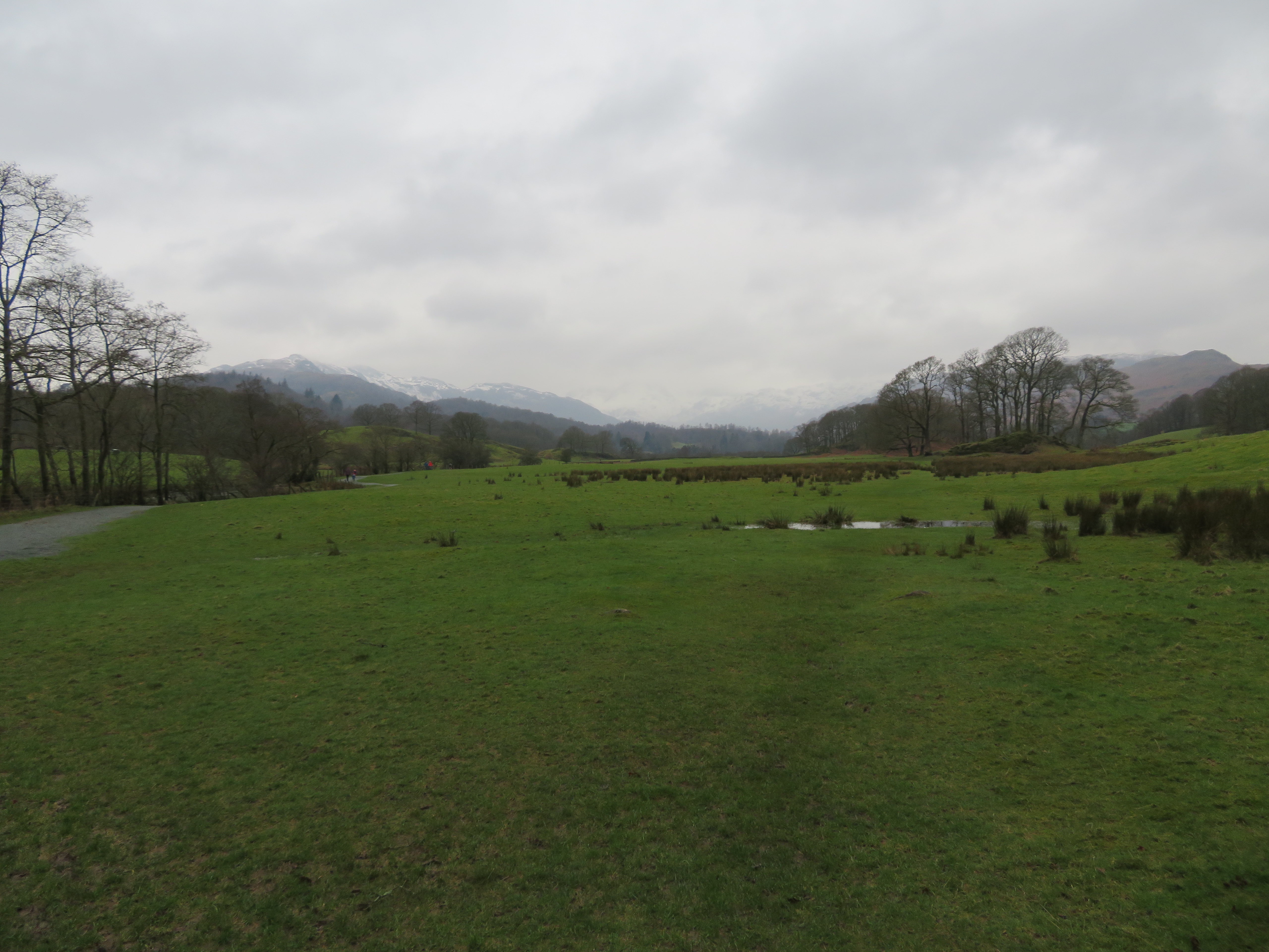
 After a mooch around in the damp atmosphere of Skelwith Force we continued on for the remainder of the short walk through the trees along the very well surfaced path to more open ground with wet pastures and the Loughrigg’s on our right with the pastures on the other side of the river running away to higher ground below Fletcher’s Wood. Everything looked wet and gloomy with the low grey clouds hanging close over the snow capped Lingmoor Fell and the Langdale Pikes with a very faint showing of Bow Fell disguised by the low clouds holding centre position.
 A vague view of Lingmoor Fell and the Langdale Pikes
 The River Brathay was calm and peaceful today but there was evidence of the floods that had recently ravaged the Lake District once again with parts of the stoned up path being washed away and the debris of branches and swathes of dead grass lying around. But just now all was quiet and calm with the breeze sending gentle ripples across Elter Water.
 Elter Water and beyond into Langdale
 We soon entered the trees again as we passed by Rob Rash where more evidence of the floods was to be seen amongst the bare and stark looking trees that would enhance the night scene in a horror movie. The woodland looks old with plenty of dead tree stumps, trunks and branches in various states of decay and covered in bright green moss.
 Well made paths abound on this walk
 So far so good, cold and damp but good to be out with the good paths allowing for a decent walking speed and to be kept up. There were a few people about on the paths and we met quite a few as we got nearer to Elterwater Village.
 Storm damage along Great Langdale Beck
 With the good condition of the path we were soon arriving at Elterwater that is an attractive village even on a day such as this but it was so quiet, different from a summer’s day with throngs of people either walking about or sitting outside the pub with foaming glasses of ale. We arrived at the bridge where the beck and cottages with the old mill race – I think it is – looked worthy of a shot.
 Great Langdale Beck at Elterwater village
 A look along the main street showed the welcoming lights of the village shop looking very festive amongst the gloom of the day.
 Elterwater Village
 We left this peaceful village behind and took the track going roughly north still following the course of the beck and now entering the area of the old mines and quarries that were in abundance around here many years ago with just the odd one now in operation. Some, like the one shown are blocked off with locked gates...
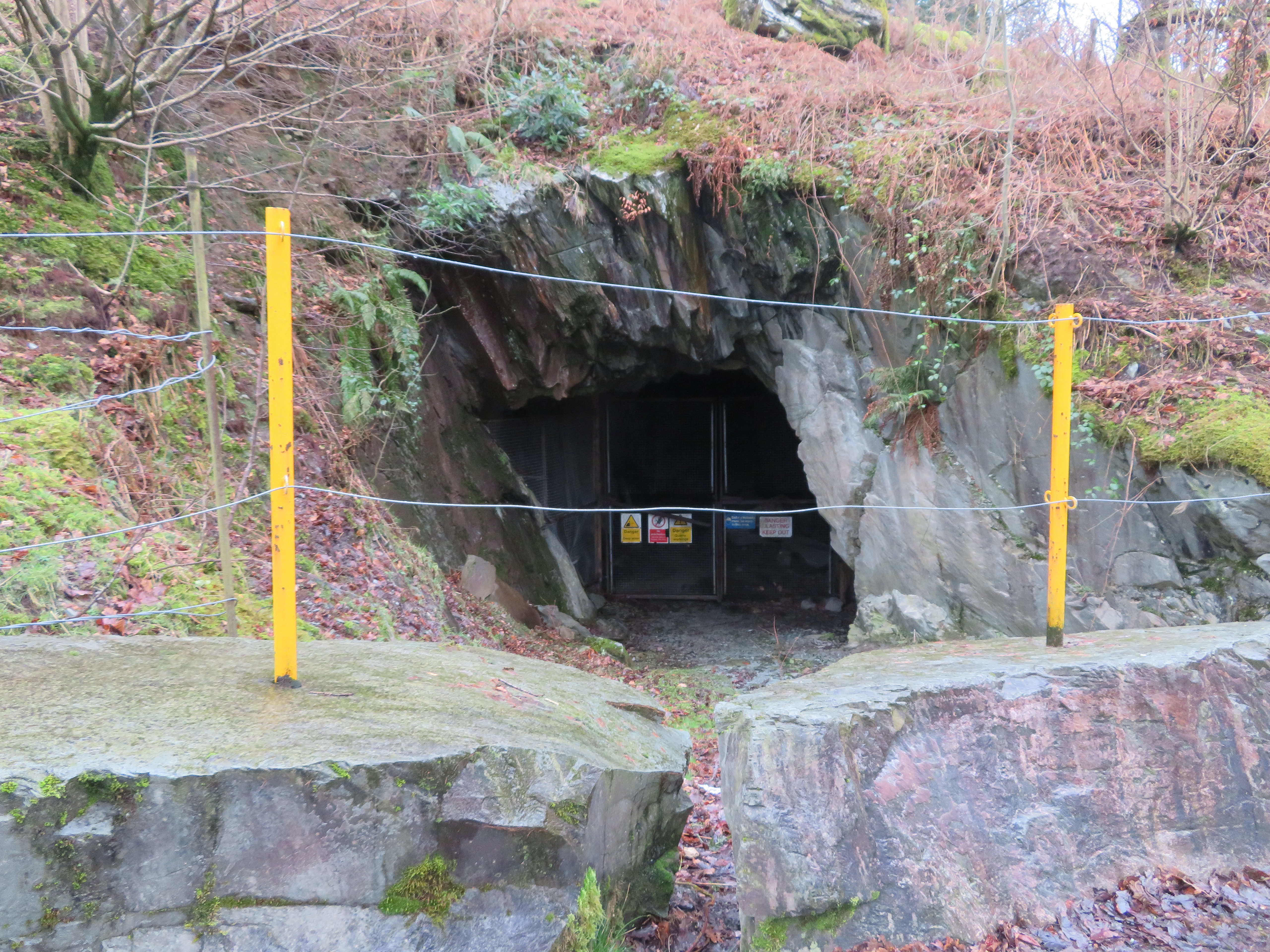 So dangerous its blocked off
 others are still open but it’s not worth the risk of entering them. Soon after passing the mine entrance we were amongst the debris of years of quarrying slate, it’s everywhere, millions of tons of it stacked up with nature trying to reclaim it by covering it with carpets of moss and bracken.
 Some spoil heaps below Yew Crags
 We walked on through the spoil heaps and couldn’t stop marvelling at the amount of graft that was used to create these giant mounds of waste material and if this much was discarded then how much was actually quarried and used?
The spoil heaps towered above us as we passed them by to soon arrive at our first positive turning point just south of Toc Hostel and Wainwright’s Inn where we sat on the stone and slate seat for a short break and a drink whilst watching a dipper diving into the water from a rock in the middle of the beck. The beck is placid just now but by the looks of those tree roots it has another side to its seemingly gentle demeanour.
 Martin relaxes at the Elterwater Slate Quarries
 It was a bit surreal in a way, what with the beauty of the woodland and the beck with its wildlife to our front and then the massive dark and crumbling spoil heaps to our back it was like being in two different worlds, one being of beauty and the other stark and grim, a reminder of harder days gone by. As I sat there by the beck I began to wonder just how many miners and quarrymen had rested here during their breaks or on their way back home, stopping to take a drink from the cool clear waters to rid the dust from their parched throats from a day of blasting and carting the slate around.
 Great Langdale Beck from the Elterwater Slate Quarries
We left this peaceful spot to now wander south through a large area of quarry waste and spoil heaps and despite the grey and the damp atmosphere there is a roughness about the place that is both beautiful and enchanting, with the many moss covered walls, trees, and spoil heaps looking their best under the cloak of verdant green.
 The path continues on through the old quarries
  Quarry feature and spoil heaps
  The Langdales behind the spoil
 The path started to gradually climb now as walked on towards the still working Elterwater Slate Quarry passing a lovely slate built house sitting below Yew Crags.
 A fine house and Lingmoor Fell
 This climb from the site of the old quarry workings was just about all we would do on this walk as it took us up through Sawrey’s Wood after leaving the well made track that we had been on. It had started to rain a good few minutes ago so we decided to take advantage of the shelter from the few bare trees and have a bite to eat whilst sitting on an old moss covered log before making our way out of it by way of the now rough path.
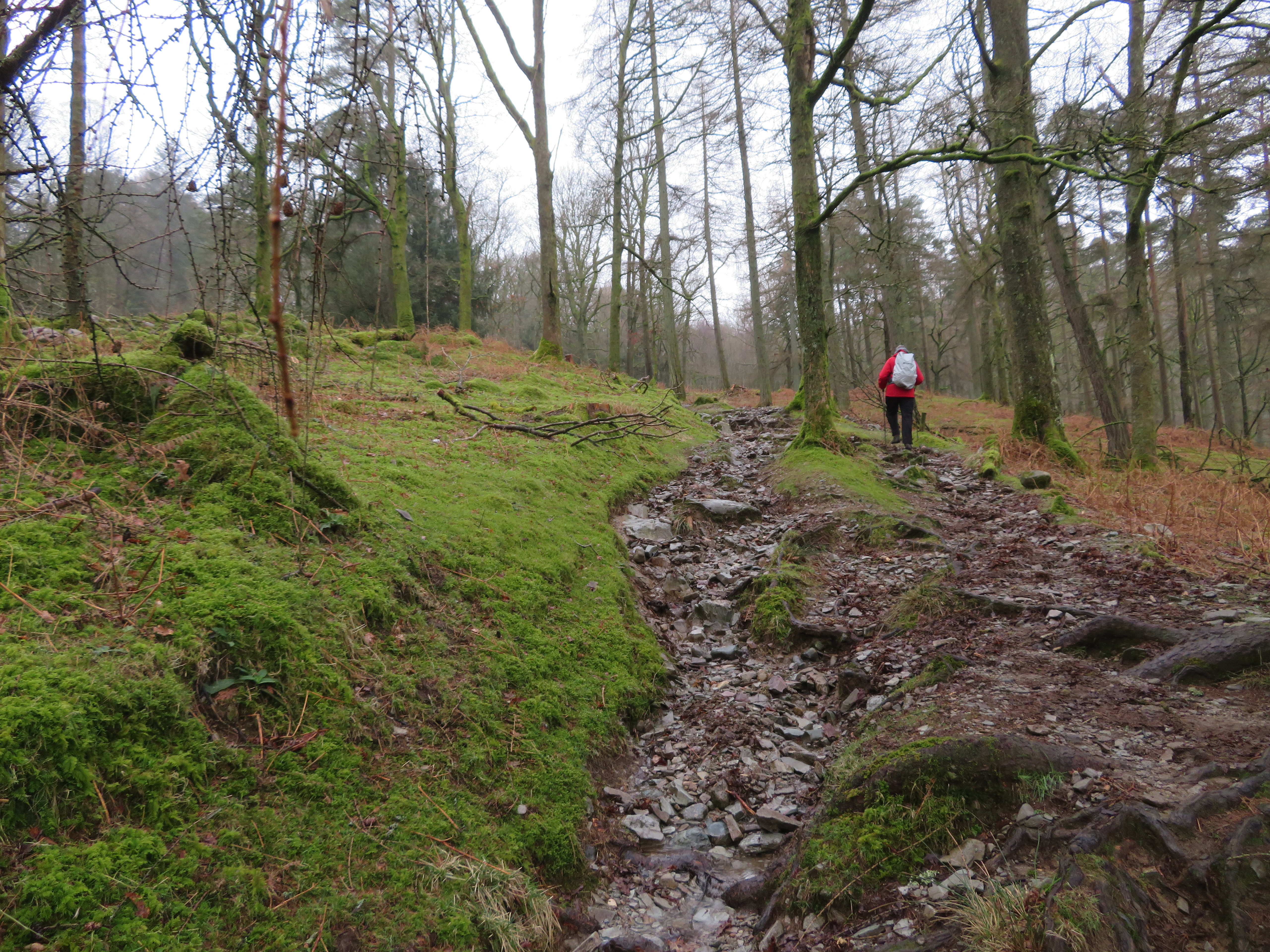 The path climbs through Sawrey's Wood
We were now walking below the east end of Lingmoor Fell and we would soon be arriving at the narrow metalled lane at Dale End that would see us heading for Little Langdale and walking below the south side of Lingmoor Fell. As we left the trees behind we felt the full force of the weather with the now substantial wind driving the rain full onto us for this part of the higher part of this walk.
 He does it to help others enjoy it - Tilberthwaite and Coniston Fells behind
 It’s a shame that the weather was as it was as the views would have been most enjoyable and although I have seen and walked them at their best I would have preferred it to be one of those days today. It’s a damn nuisance trying to keep the rain off the camera lens and I couldn’t keep anything dry to wipe it down with. We battered on along the lane and descended to the T junction where we crossed over and took the path down to Slater Bridge, another of those old iconic slate bridge features that are scattered throughout the LD. It is one of Lakeland’s ancient pedestrian and packhorse bridges linking Little Langdale with many of the slate quarries in the Tilberthwaite area and was built sometime in the 16th century.
 Little Langdale Tarn with pointed Pike of Blisco behind
  Martin on Slater Bridge in Little Langdale
 It’s a lovely little bridge and a work of art with its two spans of different design and quality. It’s testament to the builders that their construction is still standing having withstood floods, civil wars, and some of the severest weather conditions over the past 500 years.
As we are going to pass the Cathedral Cavern we decided to call in and have a short break in the vastness of its interior and get some short respite from the rain. So after a short climb across the field we passed through the gate to enter the lane just below Black Hole Slate Quarry where we then turned to the east for the short walk along the lane to arrive at the locked gate preventing any vehicular access up to the Cavern.
 Little Langdale Quarries Information Board
 A short climb along the track found us at the entrance to the Cathedral Cavern.
 The entrance to The Cathedral
 A lovely little short dark tunnel carved out of the solid slate gave us entrance into the enormous cavern but due to the nature of the day it was very dark with the only light coming in was from the ‘back entrance’ that leads into another large but open quarry with the alternative access by way of a flight of fairly steep stone steps.
 Back door to The Cathedral
  A look out of the back door
 Now this is where I have had to cheat a little with the photos of the inside of the cavern. Due to my flash not working for some reason on my camera it was too dark to take any decent photos so on our return visit with the group the following on a much better day I managed to take a few shots of the inside. The colours of the stone is just amazing them being various shades of grey, pink, brown and buff and the size of the cavern can be gauged by the size of the people stood by the supporting column.
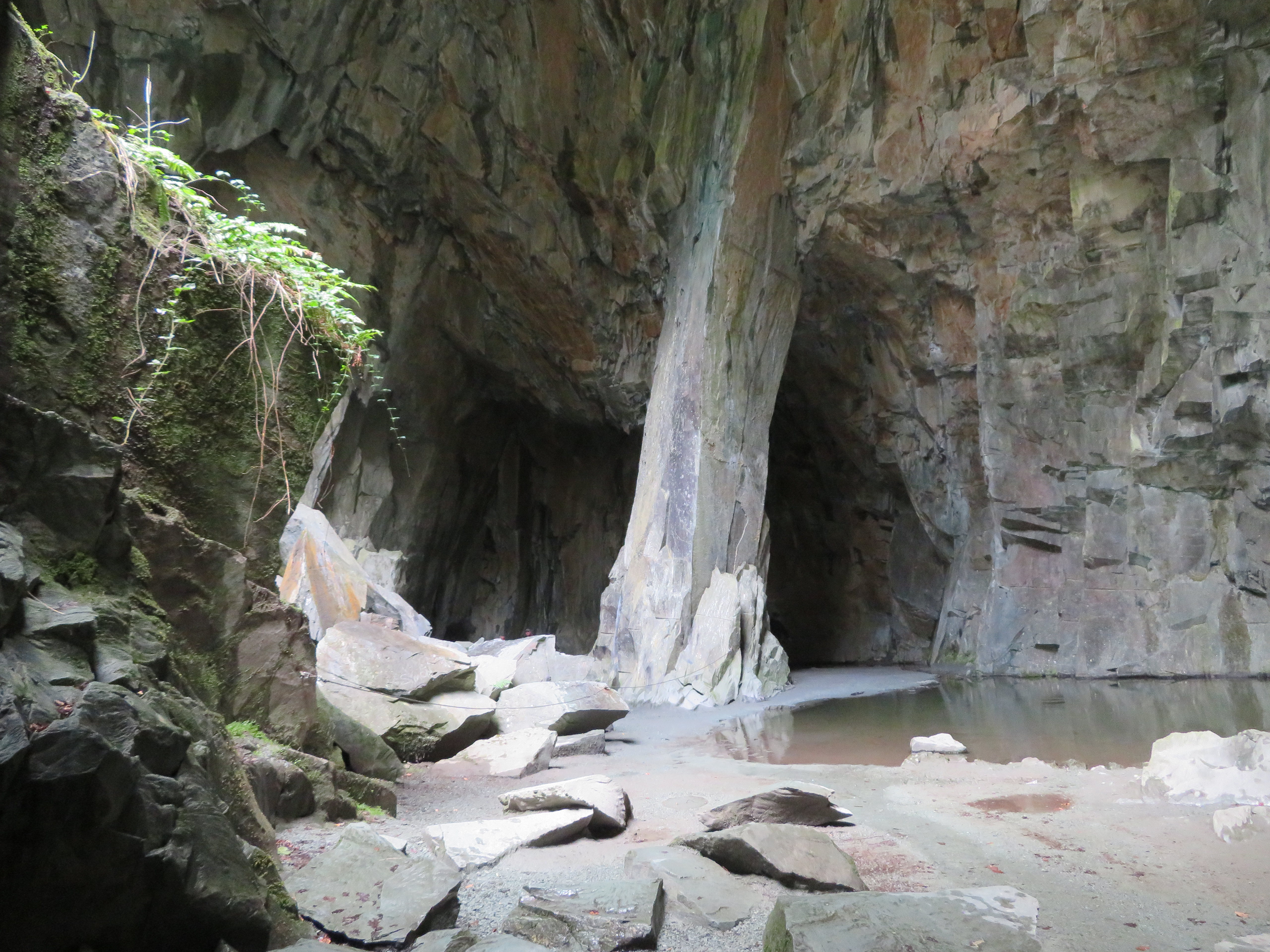 Inside the Cathedral Cavern
  Supporting pillar in the Cathedral Cavern
  Martin-Elizabeth-Iaian in the Cathedral
 Just inside the entrance on the right there are a couple of vertical slabs of slate that would take the place of the pulpit of a church when the Cathedral Cavern is used for weddings but it was too dark for me to grab a shot of them. There were some climbing aids bolted into the walls at various points some with bits of rope hanging from them.
Now there are just the two of us again as we exited the cavern back into the rain and clag whilst we did a bit of exploring higher up the quarry where there are some old stone buildings and many more worked out quarries and tracks. It was a miserable day indeed but still good to be out and about and the next image might portray just how miserable it was.
 A wet and cloudy view over Little Langdale Tarn
  Old quarry workings above The Cathedral
 And a murky shot of the steps into the open quarry behind The Cathedral.
 Steps into one of the deep quarries
 As can be seen by the GPS, the track spiked quite a bit whilst inside the cavern through loss of signal and no doubt made worse by the very low clouds and surrounding high fells.
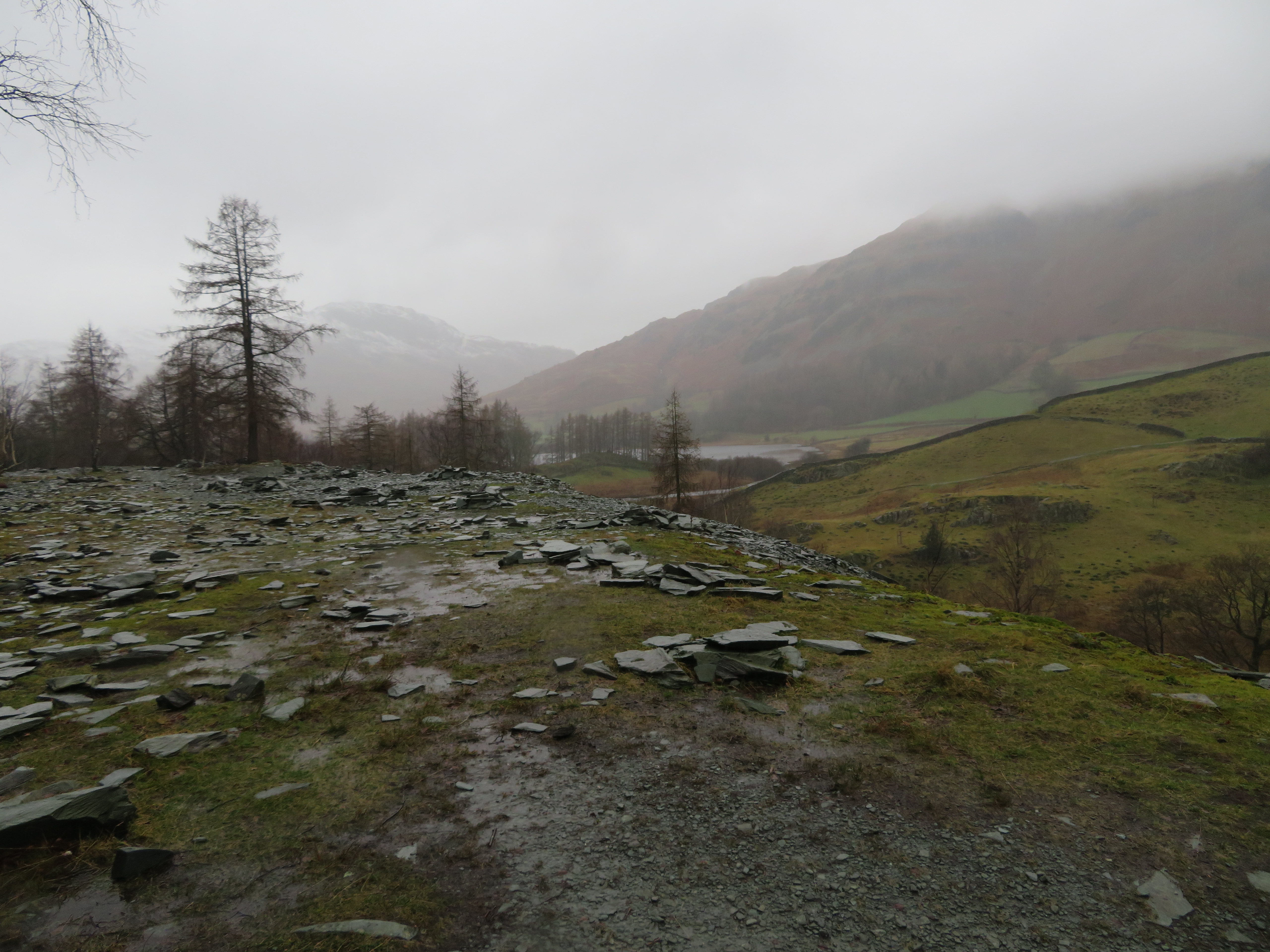
Despite the interesting history of the place we had to make a move as time was getting on so we followed the lane roughly east towards Stang End and at least we had some kind of relief from the wind at this lower level. No matter where you are on this walk Lingmoor Fell is nearly always in sight and we got a rain splattered and hazy view of the whole ridge from Stang End.
 Lingmoor Fell from Stang End
 Just before we left the lane to pass into High Park Coppice I got the next shot.
 Looking towards Pike of Blisco and Crinkle Crags
 We left the lane at High Park to take the woodland path through High Park Coppice turning first to the southeast and then a turn to the northeast as we made our way to the waterfall of Colwith Force, one with a long drop on the River Brathay. Damp but easy and pleasant walking soon had us at the waterfall that again was in good form due to the recent and today’s rain.
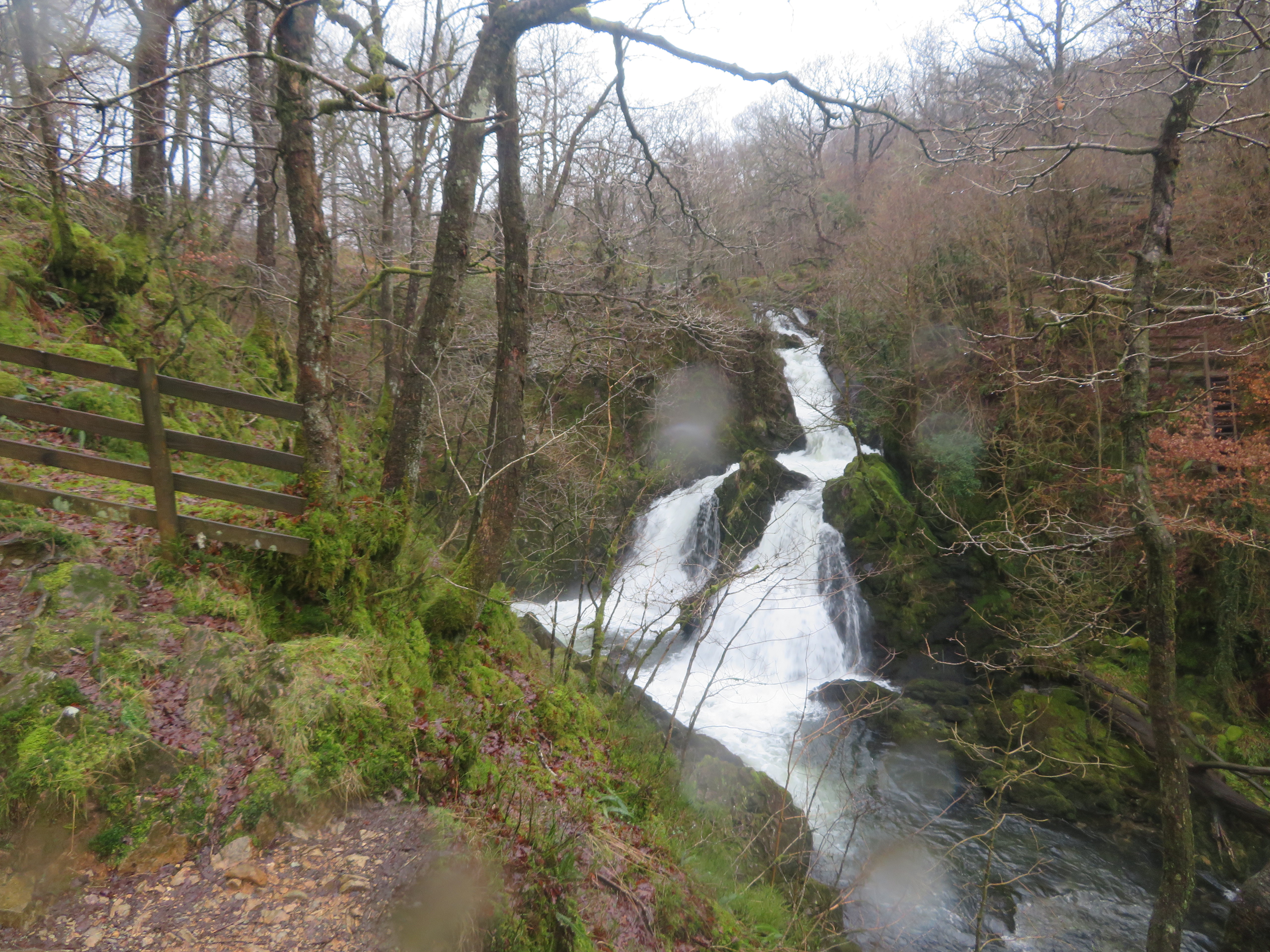 Colwith Force
 Below the waterfalls there is a stone building perched right on the river bank, a couple of long ladders leading down to it and I couldn’t decide if it was some sort of hydro-power unit or not.
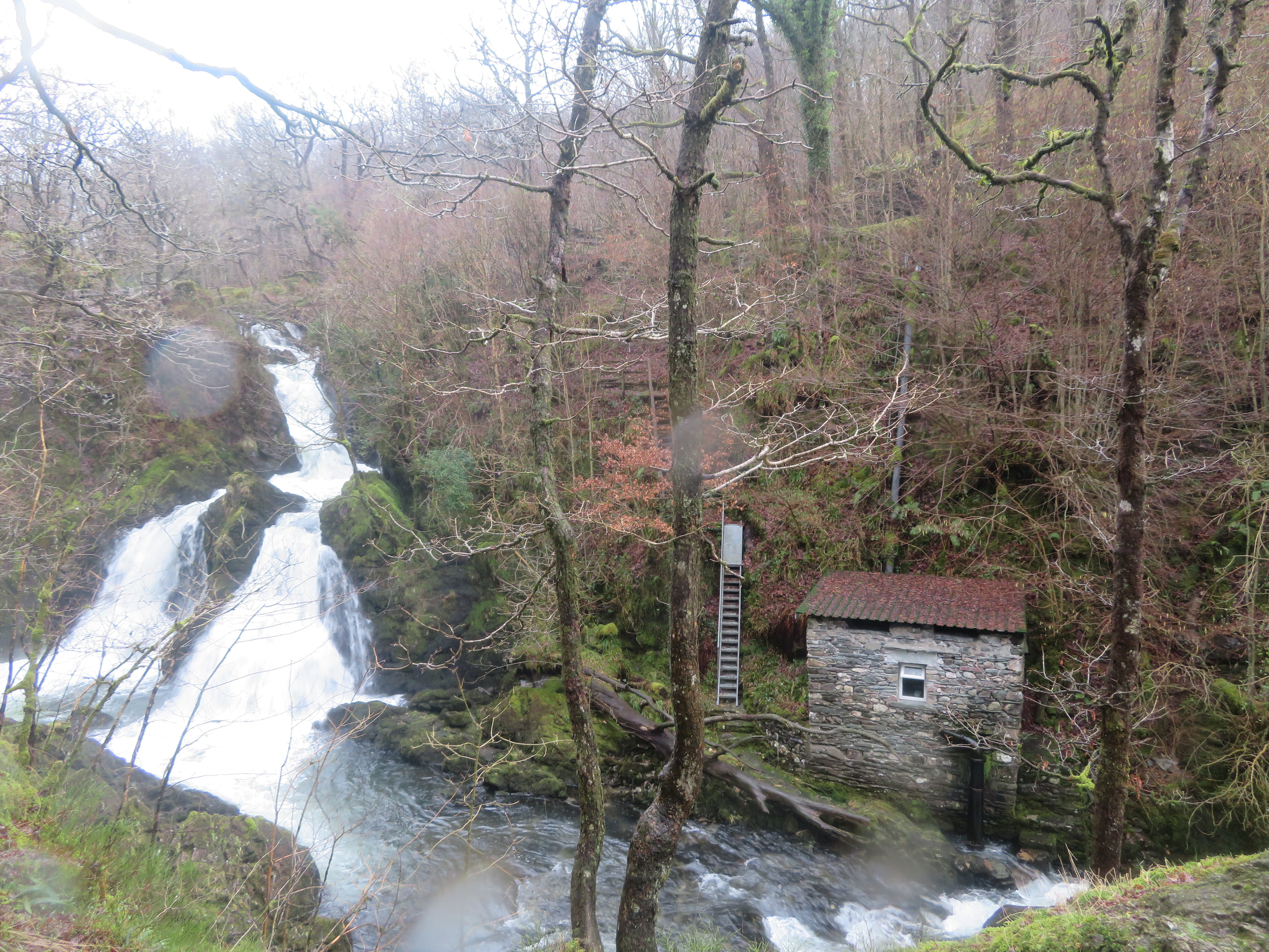 Colwith Force and hydro building - maybe
Despite the miserable countenance of the day we enjoyed the walk through the trees, all was silent apart from the roar of the water that slowly receded into the distance as we walked the leaf laden path. Just before we reached the metalled lane near Colwith Bridge we passed through the yard of a house and spotted an unusual plaque set into one of the walls. The alphabet was portrayed in several different fonts but there was no one around to enquire of the reason or history of it.
 Six different fonts carved in stone
 It wasn’t too far to Skelwith by now but just to see off the remains of our drinks we stopped for a quick drink and a minute’s contemplation on the days walk and despite the poor weather conditions deemed it a decent walk.
Soon enough the roar of Skelwith Force was within our hearing and sight...
 River Brathay at Skelwith Force
 with just a short walk to the aforementioned Trevor Woodburn Bridge, and it is indeed a work of art with every piece individually cut and shaped to form the elegant contours of it.
 The Trevor Woodburn Bridge over the River Rawthay
 A plaque on the Skelwith side of the river a nice reminder of who instigated the project.
 Memorial stone for the bridge
 Well we have done the task of fact and route finding for the group on a less than poor weather day but despite that we have enjoyed the walk and seen plenty to talk about and take our minds away from the wind and rain. The bonus for us is that the group enjoyed this walk when we took them round this roughly triangular route as the area wasn't familiar to them.
