free to be able to rate and comment on reports (as well as access 1:25000 mapping).
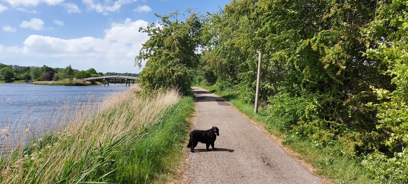
Hello people and pooches. Joe the Cocker here again reporting on a VERY windy local hike. We quite often drive to the Acton Bridge area in Cheshire because the walking is pleasant along the River Weaver and Weaver Navigation. While we have been in lockdown due to the Covid-19 pandemic we have only walked from our door but, now that some of the restrictions have been lifted, we can drive a short distance to some of our favourite areas. We had already been for a short walk in the morning but, the sunny weather was beckoning us to get back outside. The wind, however, was forecast to gust at speeds of 50 mph so we decided that a low-level walk would be preferable to taking a battering in the hills.
 20200522_170920
 by
Mal Davies, on Flickr
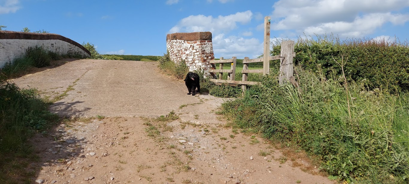
 20200522_142435
 by
Mal Davies, on Flickr
It is only a 15 minute drive to the minor road at the side of the Leigh Arms in Bartington on the A49. There were a few cars parked in the pub car park and on the roadside but, not as many as usual on a sunny day. Probably due to the pub being closed and the strength of the wind deterring people from venturing outdoors. We parked in the lane and set off, across the pub carpark, before turning right along the Weaver Navigation under the Acton swing bridge. The bridge was built in 1933 to replace a weak road bridge that was positioned a few yards away.
 20200522_144256
 by
Mal Davies, on Flickr
We walked along the Dutton Bridleway in the direction of Dutton Locks. The sun and wind were hitting us head on as we hiked along the side of the Weaver. Dog Parsley, long grasses and reeds line the banks of the river whilst, on our right, a hedgerow separated us from the dredging lagoons. I was walking ahead of my human and he kept singing ‘Wiggle, wiggle’. He was taking the mickey out of the way I walk, I suppose. He isn’t funny. He just thinks that he is. Once we passed the raised sides of the dredging lagoons the view opened up across farm fields and up to the Trent and Mersey canal along with Garden Wood and Lodge Wood. We saw our first view of the narrow road bridge ahead, just before the locks.
 20200522_144915
 by
Mal Davies, on Flickr
I spotted a swan sitting on her eggs on a nest in the reeds by the bank as we passed. We stopped to have a quick look but, we didn’t disturb her. Further along the river we came to the wreck of the MV Chica, tilted precariously to the side and overgrown by weeds and young trees. The Chica was built in Norway in 1894 and called the Flora. She was used to transport fish. She was commandeered by the Germans in WWII and renamed Bjorg Haukus. She was later returned to her owners and renamed Till Tove in 1965 and used in the Mediterranean as a smuggling ship, allegedly. She then came to this area as a pleasure boat and was renamed Chica. She capsized in 1993 and remained in this place since being too expensive to remove.
 20200522_144457
 by
Mal Davies, on Flickr
 20200522_144553
 by
Mal Davies, on Flickr
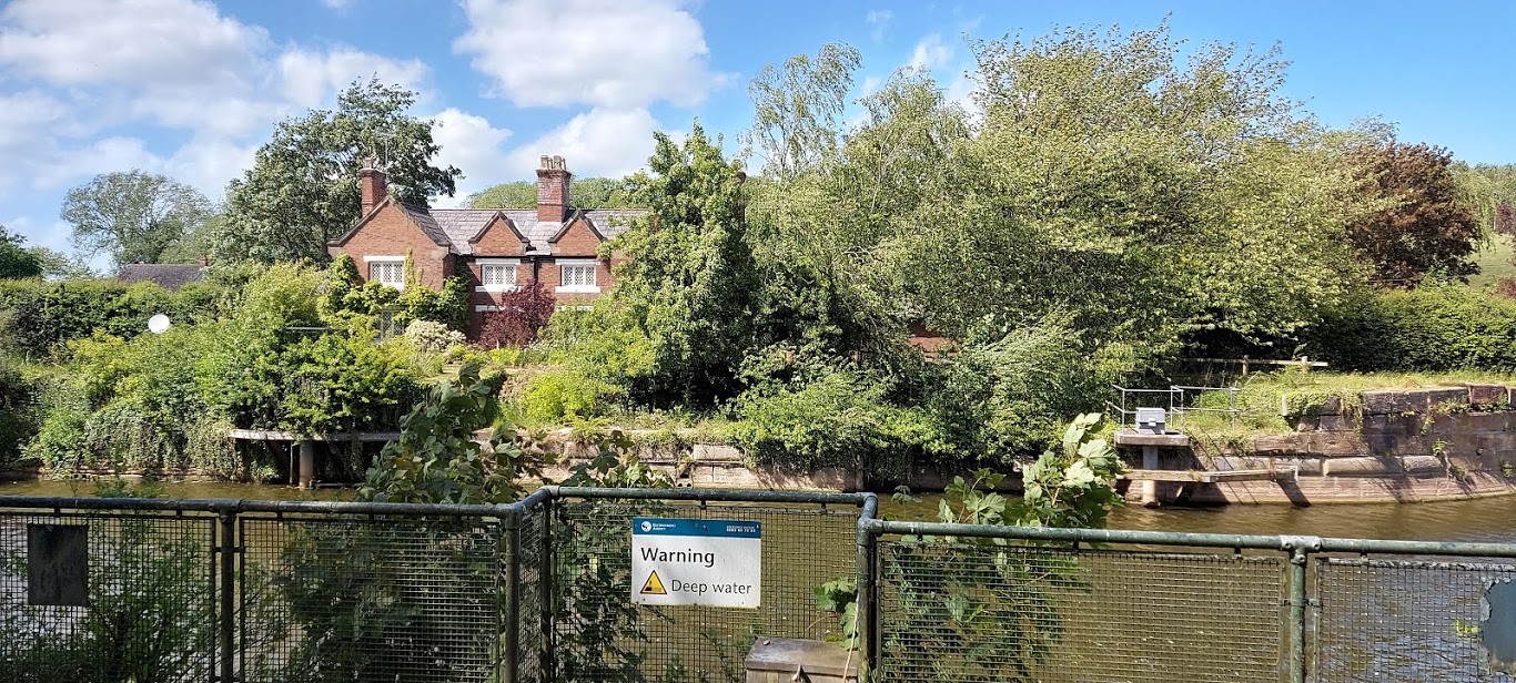
The last time that we walked in this area was the day after severe flooding. A number of boats had been swept downstream from their moorings by the swing bridge. My dad took a few photographs at the time and has included one here. Further along the river is an old sandstone sluice bridge that it gated and inaccessible to the public. Cormorants use this structure to stand on to dry in the breeze but, not on this day. It was too windy even for them.
 20191028_110641
 by
Mal Davies, on Flickr
 20190222_114737
 by
Mal Davies, on Flickr
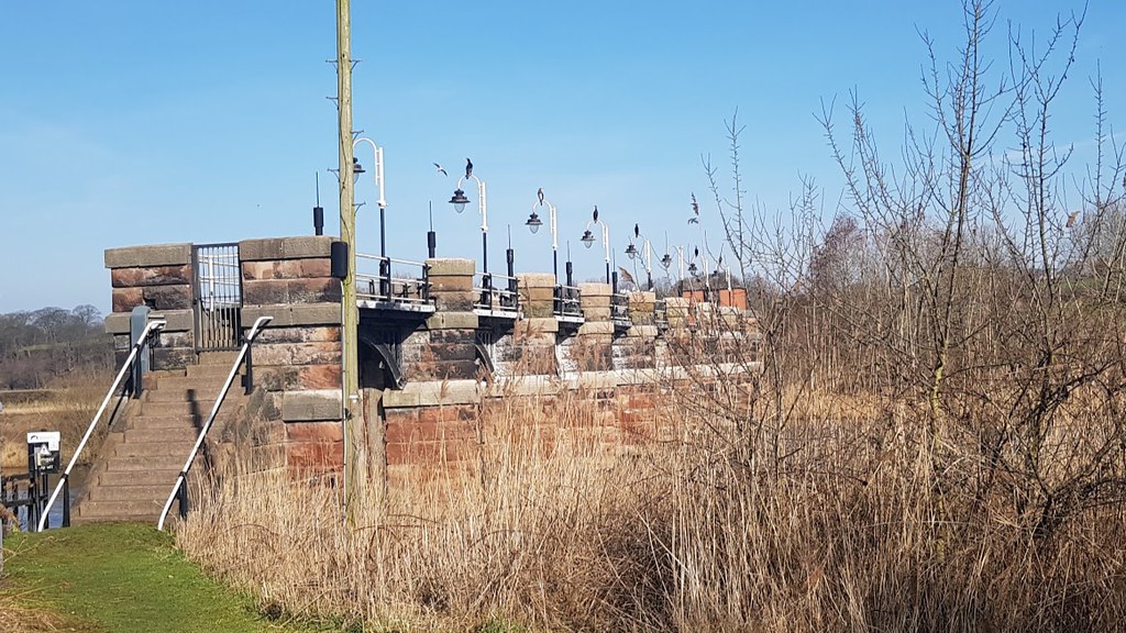
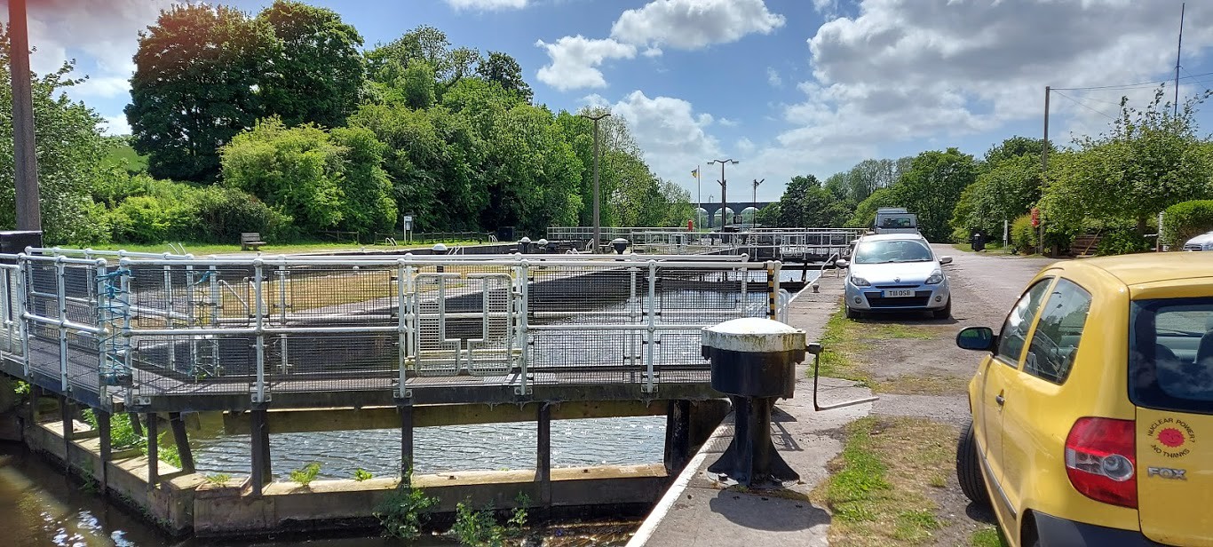
The bridge spans the River Weaver at the point where the Navigation branches off to the left toward the locks. Cormorants can usually be seen, at this point, diving for fish or drying their wings in the sun and breeze. We only saw the one today with its wings spread drying in the wind. We passed a small row of houses at the lock side before we crossed one of the lock gates. My dad put me on the lead at this point because he is a nervous Nancy and worries about me falling into the deep water. I do have previous of falling into canals, I suppose! The locks are Listed Buildings and were built in 1874 to take sea going ships. The largest being over 1000 tonnes. The semaphore signalling system to the locks is still in place.
 20200522_145211
 by
Mal Davies, on Flickr
 20200522_145403
 by
Mal Davies, on Flickr
We headed towards Frodsham along the Weaver Way with the river on our right. The river rejoins the navigation as it passes under Dutton Horse Bridge. The wind had brought down branches from the trees along the footpath through Manor Brow. It was a stick fest for me. I was spoilt for choice. They were everywhere. I loved it. As we walked on, we passed under the magnificent arched railway bridge, Dutton Viaduct. It was built in 1836 and is another Listed Building. It has 20 huge arches and is 500 yards long. A masterpiece of heavy engineering. Repairs are planned to the foot of the bridge, next to the footpath, after a split of the sandstone caused a huge piece of rock fall and shatter on the ground. We passed under it as the wind whistled and howled. It was quite eerie.
 20200522_145712
 by
Mal Davies, on Flickr
 20200522_150125
 by
Mal Davies, on Flickr
 20200522_150424
 by
Mal Davies, on Flickr
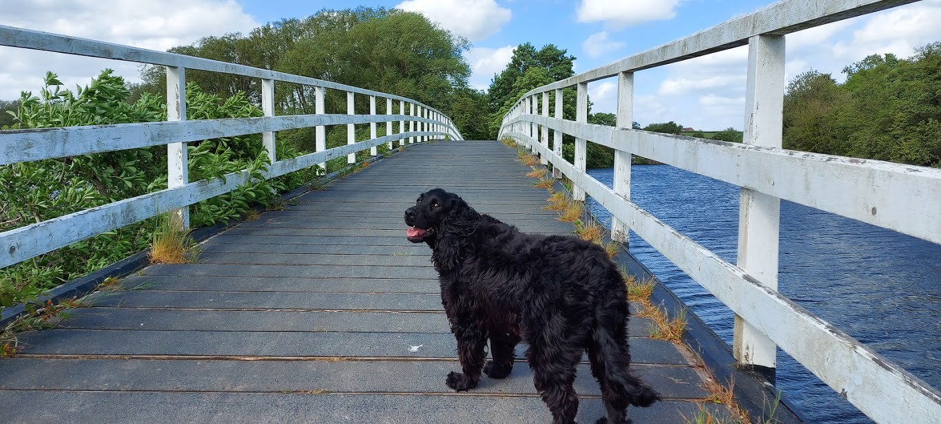
We then entered a wide-open area where sheep usually graze and horses are allowed to run. Today, the area was deserted except for a few ducks on the river. The dust from the footpath blinded us as we headed straight into the wind. We were happy to return to trees again at Pickerings Lock. The lock was the highest point on the Weaver that was tidal until the locks were built at Dutton. It has since been removed. We crossed a small footbridge over Cliff Brook and saw recently snapped tree limbs in the wetland below. We followed the Weaver Way as it passed through the middle of a small caravan site. We left the site and entered a field of maize. The path skirted the field and the cracks in the soil showed how dry conditions had been lately.
 20200522_150841
 by
Mal Davies, on Flickr
 20200522_151257
 by
Mal Davies, on Flickr
 20200522_151431
 by
Mal Davies, on Flickr
A hundred yards along the footpath, before we left the field to enter woodland, we could smell the pungent aroma of wild garlic. We were hit by the intensifying smell as we entered the damp and shaded woods. This is when conditions became challenging. The wind was blowing at its strongest. The trees were swaying and creaking. The path was strewn with snapped branches and twigs. As we struggled through the debris, we witnessed a huge tree branch breaking away from the trunk, only 50 yards in front of us. We stopped for a few seconds before my dad said that we should get out of that place as quickly as possible. We clambered over and under the branches and swiftly left the trees behind us. We were out in the open as we heard a tree creak and then fall in the woods 100 yards to our left. We still had a few stretches of the footpath to walk before we were completely out of the trees so, it was head down and go for it.
 20200522_151738
 by
Mal Davies, on Flickr
 20200522_152444
 by
Mal Davies, on Flickr
 20200522_152647
 by
Mal Davies, on Flickr
 20200522_152740
 by
Mal Davies, on Flickr
 20200522_153242
 by
Mal Davies, on Flickr
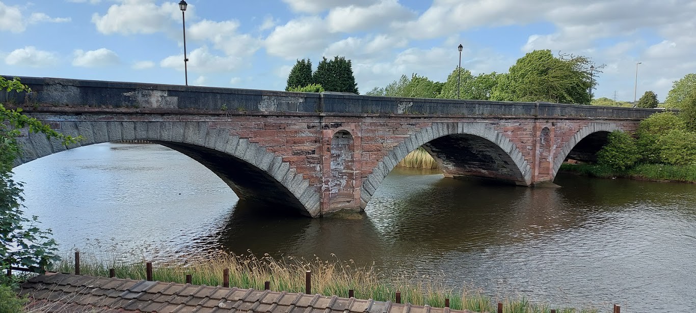
We had planned to turn left at some stage on the footpath to circle back to Bartington but, due to the high winds, we chose to avoid walking through more trees and to carry on to Frodsham along the side of the Weaver. The path became a tree-free zone as we passed close to Catton Hall, the outdoor activity centre. We soon reached the A56 road bridge on the outskirts of Frodsham just past the water-skiing centre. The red sandstone and limestone bridge was built in 1850 at Sutton Causeway and is designated a Grade II Listed building.
 20200522_173317
 by
Mal Davies, on Flickr
 20200522_172643
 by
Mal Davies, on Flickr
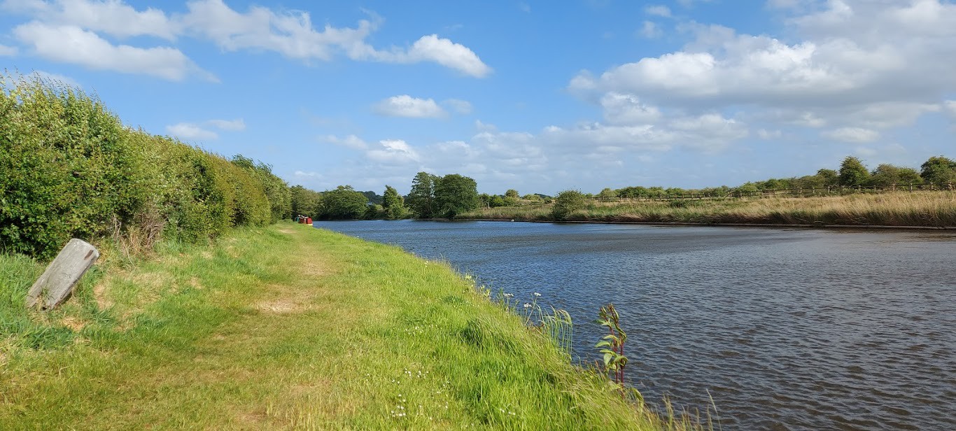
We walked along the pavement on Sutton Causeway until we crossed the Sutton Swing bridge. Built in 1926 to replace a much weaker version with a wooden planked surface and recently painted, it looked bright and new in the afternoon sunshine. We turned right to walk along the towpath of the Weaver Navigation, heading back towards Bartington. The footpath runs along the side of the water for much of the way on a raised embankment. It is walked less frequently than the path on the opposite side of the river and can become really muddy and overgrown in places. There was very little mud but, plenty of gorse to trip over, which my dad did more than once. Now who is wiggle wiggling? Ha!
 20200522_172707
 by
Mal Davies, on Flickr
We passed close to Pickerings Bridge Cottage before we were back in open land, thankfully away from the trees. The sun and the wind were on our backs and the walking was very easy. It wasn’t long before we passed under Dutton Viaduct and crossed Dutton Horse Bridge, another Listed building. We retraced our footsteps past the cottages and over the road bridge. Shortly, we turned off the tarmac road across fields to the Trent and Mersey canal. We were protected from the worst of the wind by a large hedgerow on our right as we walked along the towpath. I tried to catch a couple of dragonflies without success, as usual. I was also keeping a close eye on the moorhens that were teasing me by waiting until the last second before jumping into the water.
 20200522_162630
 by
Mal Davies, on Flickr
 20200522_155921
 by
Mal Davies, on Flickr
 20200522_163010
 by
Mal Davies, on Flickr
A few residential canal boats were moored on the canal in various states of repair. We came to the Black Prince Narrowboat Hire moorings at Bartington Wharf. It was, sadly full of unused narrowboats due to the coronavirus restrictions. We walked down the hill into Bartington and passed Davenports Tea Rooms that were also deserted. A sign of these unfortunate times.
 20200522_163829
 by
Mal Davies, on Flickr
 20200522_164147
 by
Mal Davies, on Flickr
 20200522_164221
 by
Mal Davies, on Flickr
 20200522_164333
 by
Mal Davies, on Flickr
 20200522_164419
 by
Mal Davies, on Flickr
 20200522_165605
 by
Mal Davies, on Flickr
A few minutes later we were back at the car after hiking 12 miles instead of the 8 that we had planned to do. We didn’t mind walking the extra miles as it had been a lovely sunny day if not a wee bit breezy! It was time for a huge slurp of water for me and a few treats. Oh yes, followed by a few z’s on my bed on the back seat while I was chauffeured home. Till next time!
