free to be able to rate and comment on reports (as well as access 1:25000 mapping).
It had been just a week since me and two friends did the three dales walk from Mardale Head on a cold and windy day with much water underfoot, well, just one week later Martin and I thought that we would visit Swindale again but from a different location and take a walk around the bottom of the dale. This walk hasn’t got the drama and excitement of the high fells as we were in a valley, but it does have the thrill and pleasure of being outdoors in a beautiful dale that was let down on this occasion only by the amount of underfoot water due to the rain that had fallen the previous day and night. In spring, summer, and autumn it is obviously in better nick than when it’s wearing its winter coat although on a good sunny winter’s day it can hold its own with the best of them.
In March of 2016 a project partnership by the RSPB, EA, UU, and NE took on the task of putting the meander back into Swindale Beck to help prevent flooding in the dale. The beck had had a long section straightened out at least 160 years ago and this was now causing flooding of the SSSI hay meadows that were in danger of being destroyed by the seemingly ever increasing floods that have hit the area of late. The river works were completed between March 2016 and September 2016 and a further project saw 40,000 trees planted. More detailed information can be found at:-
https://restorerivers.eu/wiki/index.php?title=Case_study%3ASwindale_Beck_Restorationand
https://naturalengland.blog.gov.uk/2016/10/13/putting-the-bends-back-into-swindale-beck/There was also a plan to create a new path that would allow a walk around the bottom of the dale, a walk that begins and ends at Truss Gap. This is a lovely walk, easy on the legs and eye and one that takes you up to the head of the dale and the waterfalls of Mosedale Beck. This new trail is advertised as around 5 kilometres – 3 miles – in length but whether that is from the Mere Sike car park at Swindale Foot or the access gate from the metalled lane I’m not sure as we started our walk from outside of Swindale.
It was Friday 17th January on a cold, damp, and cloudy day when we arrived at the medium sized car park on the edge of Rosgill Moor occupied by a yellow waste skip that belongs I presume to United Utilities this being their neck of the woods. The car park that is for public use is situated at NY52840 15683 and has a good hard standing to it but if wanting to start the walk a tad closer then the Mere Sike car park in Swindale at NY52149 14243 could be used.
We had been here 3 days earlier to do this walk but the wind was so strong that we could barely open the car doors so retreated to Booth’s at Penrith for coffee. Today was calm but, as mentioned, cold and damp with plenty of water underfoot left behind from the previous nights rain as can be seen on this first photo taken from just beyond the car.
 Start of the walk onto Rosgill Moor from the car park
  Swindale Head appearing from Rosgill Moor
Our intended walk was to be southwest across Rosgill Moor to pass below the Birkett of Scalebarrow Knott...
 Scalebarrow Knott
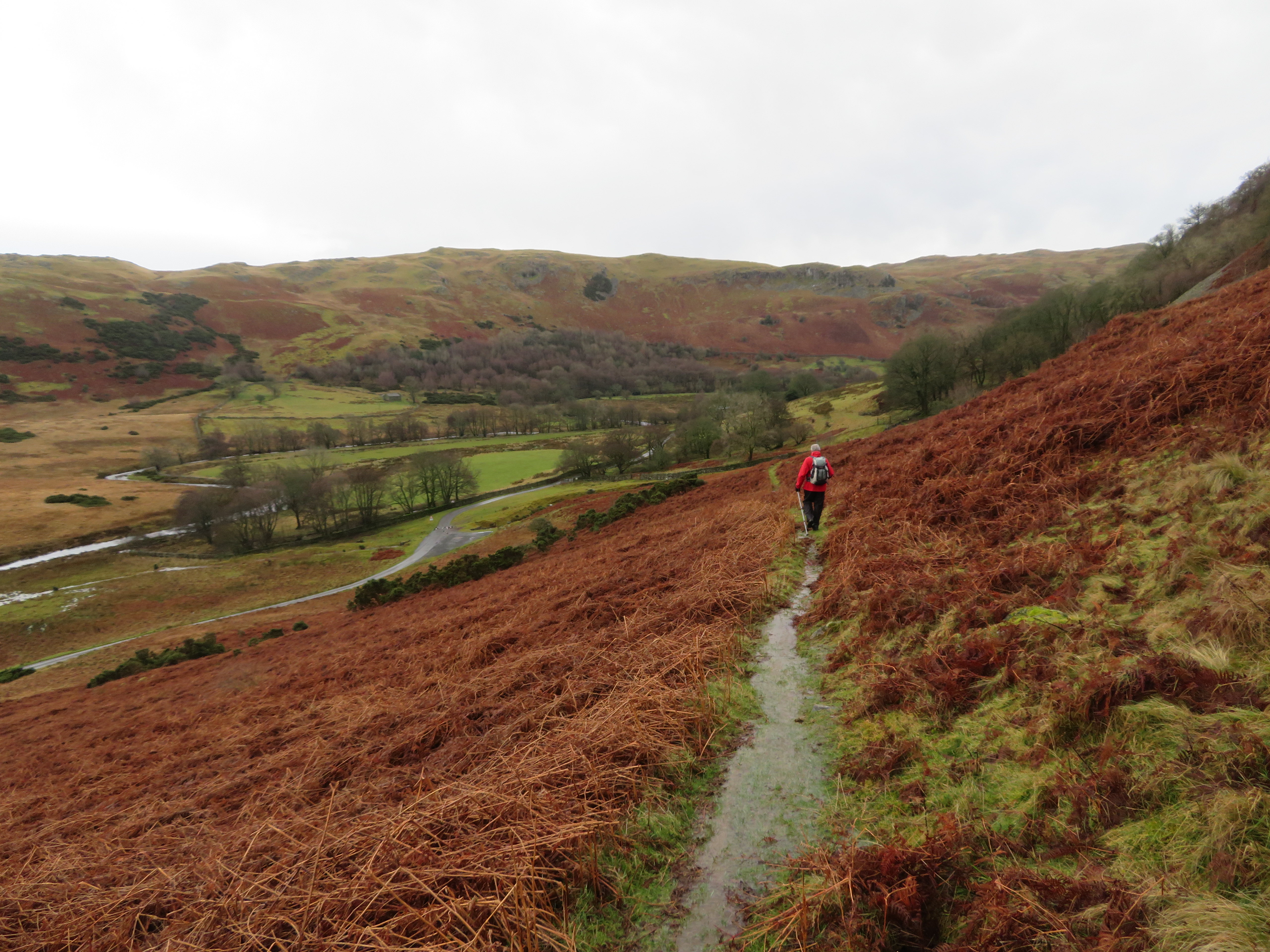
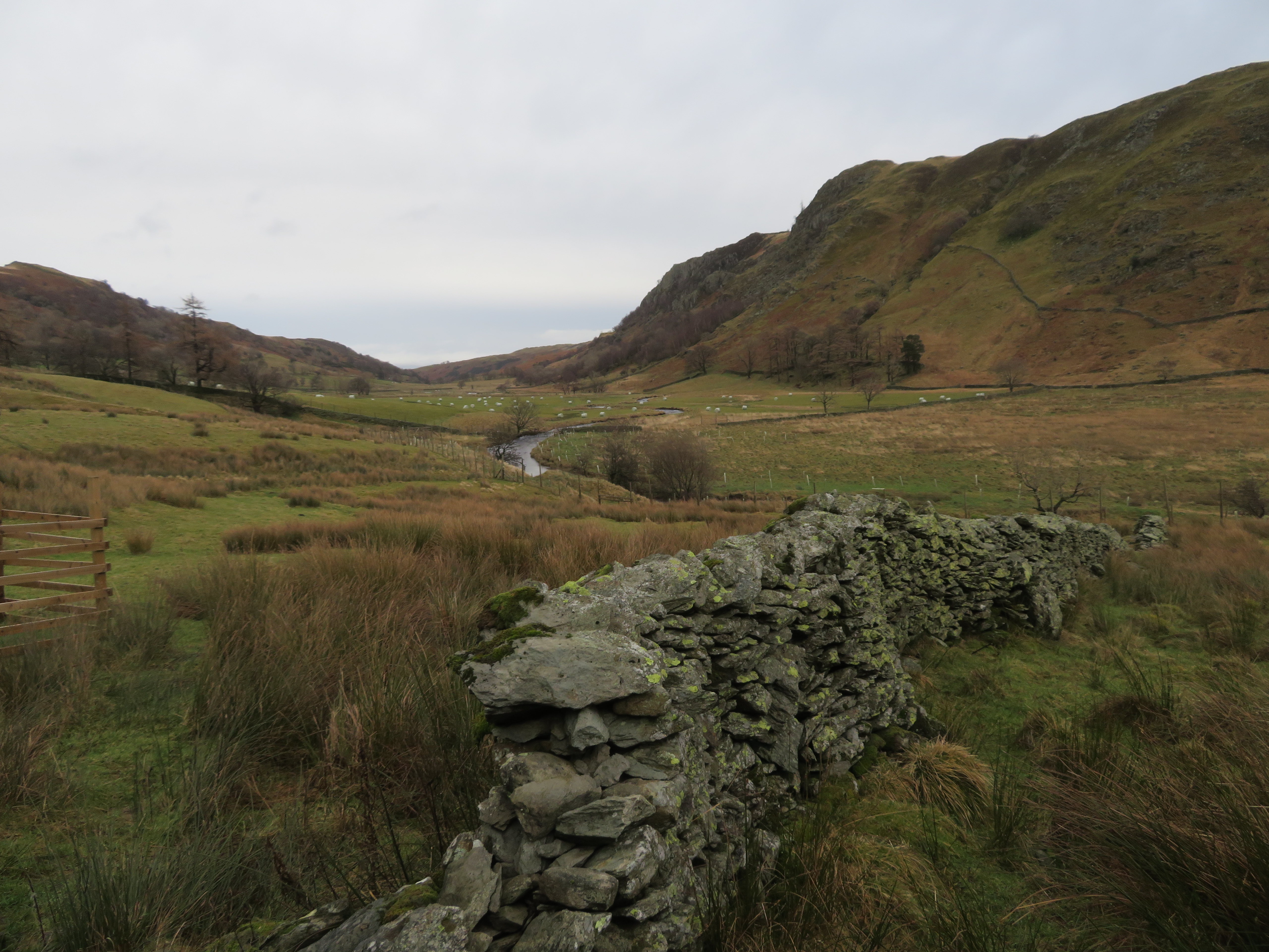
 on a good if wet track to then turn to the south where the path is a bit thin on the ground for a short distance to pick up a decent path that would take us all the way down to Mere Sike car park. Despite the poor weather day visibility wasn’t too bad with the previous rain bringing out the winter colours of the landscape showing various shades of brown and green as we looked down over Swindale Foot where the Filter House sits close to the curvaceous Swindale Beck.
 Swindale Beck and the Filter House
 The path down to Mere Sike is mostly fit for purpose but due to the very wet ground was a touch greasy today...
 Martin on his way down to Mere Sike
 especially at the point where we crossed over an unnamed watercourse...
 The path to Mere Sike is a bit rough in places
 although, as mentioned above, mostly good going and well graded and arrives directly at Mere Sike car park.
 A well graded path down to Mere Sike car park
 The car park sits alongside the metalled lane that passes the dwelling of Truss Gap and leads all the way to the newly renovated farm of Swindale Head.
 The way into the dale
 The lane was not much drier than the paths as there are many small watercourses running down the fell sides helping to swell the waters of Swindale Beck.
 All waterways running fast and clear
 It was very quiet in the dale with the only sound being of the beck rushing over the rocks and our boots as we splashed our way along the lane with not a sign of life anywhere be it human or animal nor any sound or sight of a bird. It was almost as though all life on earth had been wiped out so quiet was the dale. Apart from a couple of stops for photos we made good progress along the lane with just a short diversion off piste through the fields on our left to gain a better view of the Swindale Beck and along the dale.
The dale has contrasting sides to it where the north side of the beck is mostly steep grassy fellside with a scattering of trees broken only by a few small craggy outcrops whilst the south has the best of the features with its longer and higher crags above steep rocky ground leading up from the dale bottom.
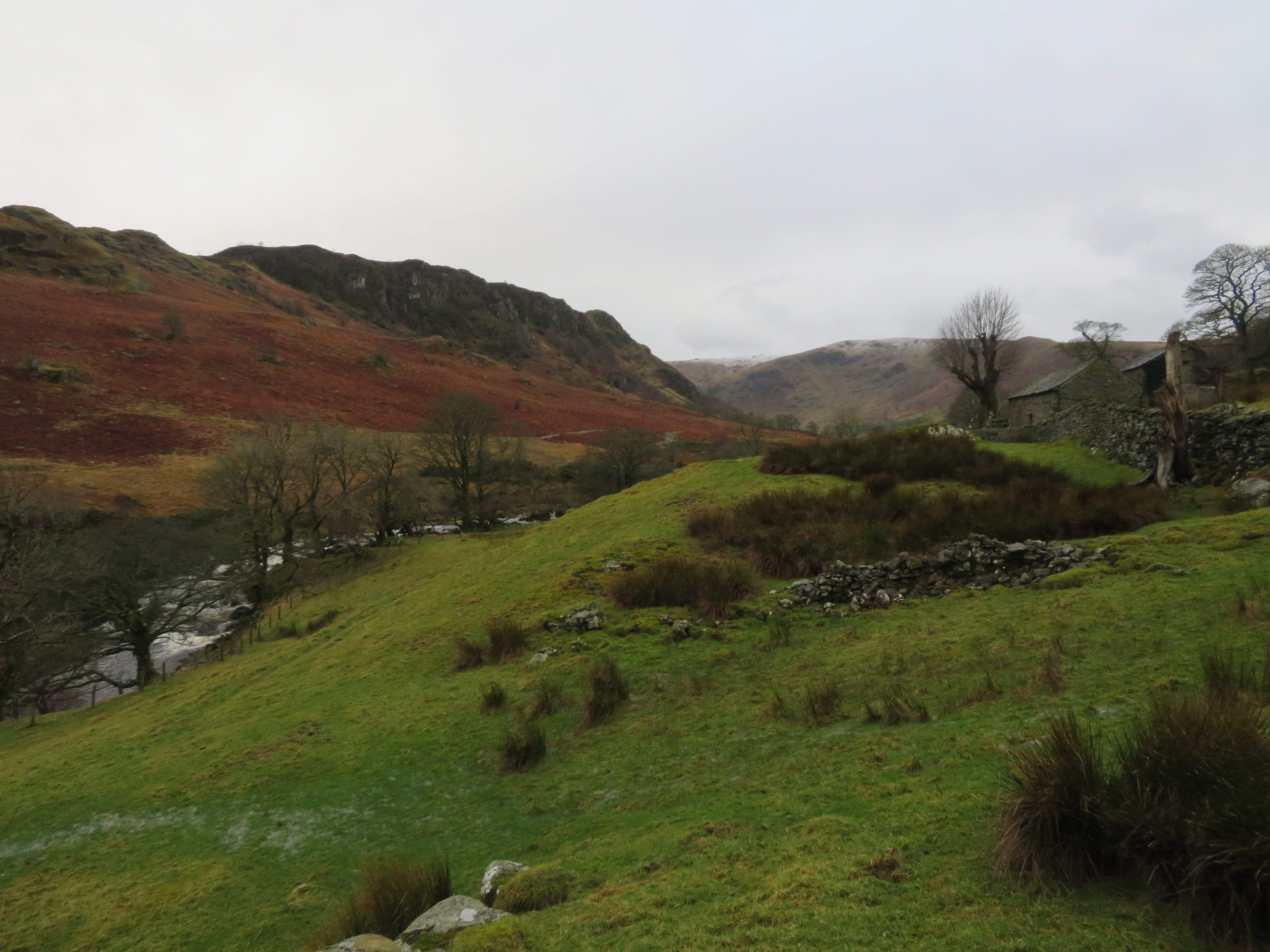 Gouther Crag and Outlaw Crag from Mullender
 We walked between the beck and the lane for a while but as we approached the fairly new weir...
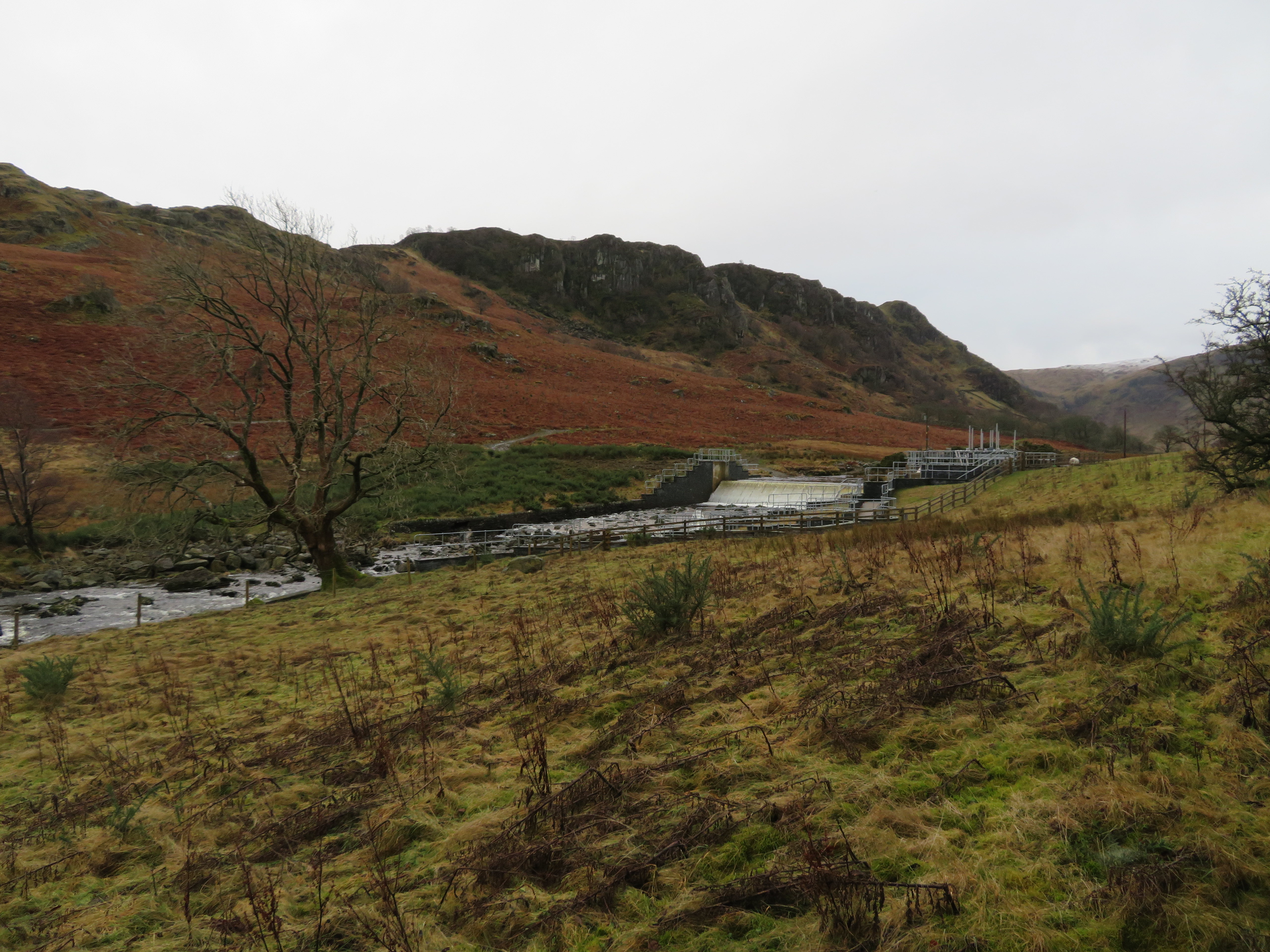 The weir or dam straddles Swindale Beck near Truss Gap
 we had to get back on to the blacktop as we neared the dwelling at Truss Gap where the ford that was used for the Old Corpse Road between Mardale and Shap is situated.
 Footbridge and house of Truss Gap
After the recent 24 hours of rain the beck was fairly busy with the old stepping stones not really fit for purpose.
 Stepping stones at Truss Gap
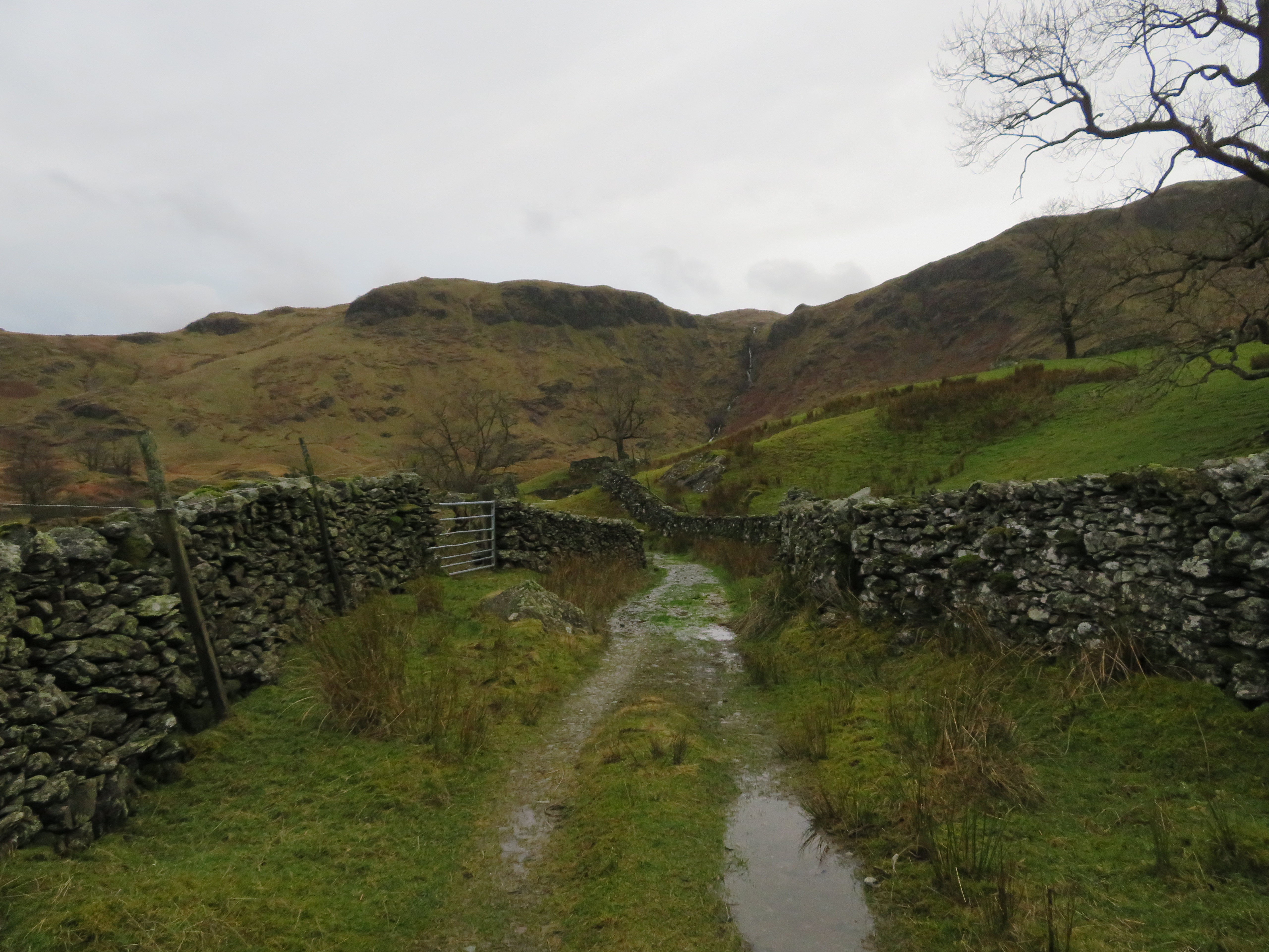
 Just a few more metres past Truss Gap and we were at the gate that would allow us access onto the new Swindale Valley Trail and from that point on is where the going got a lot wetter.
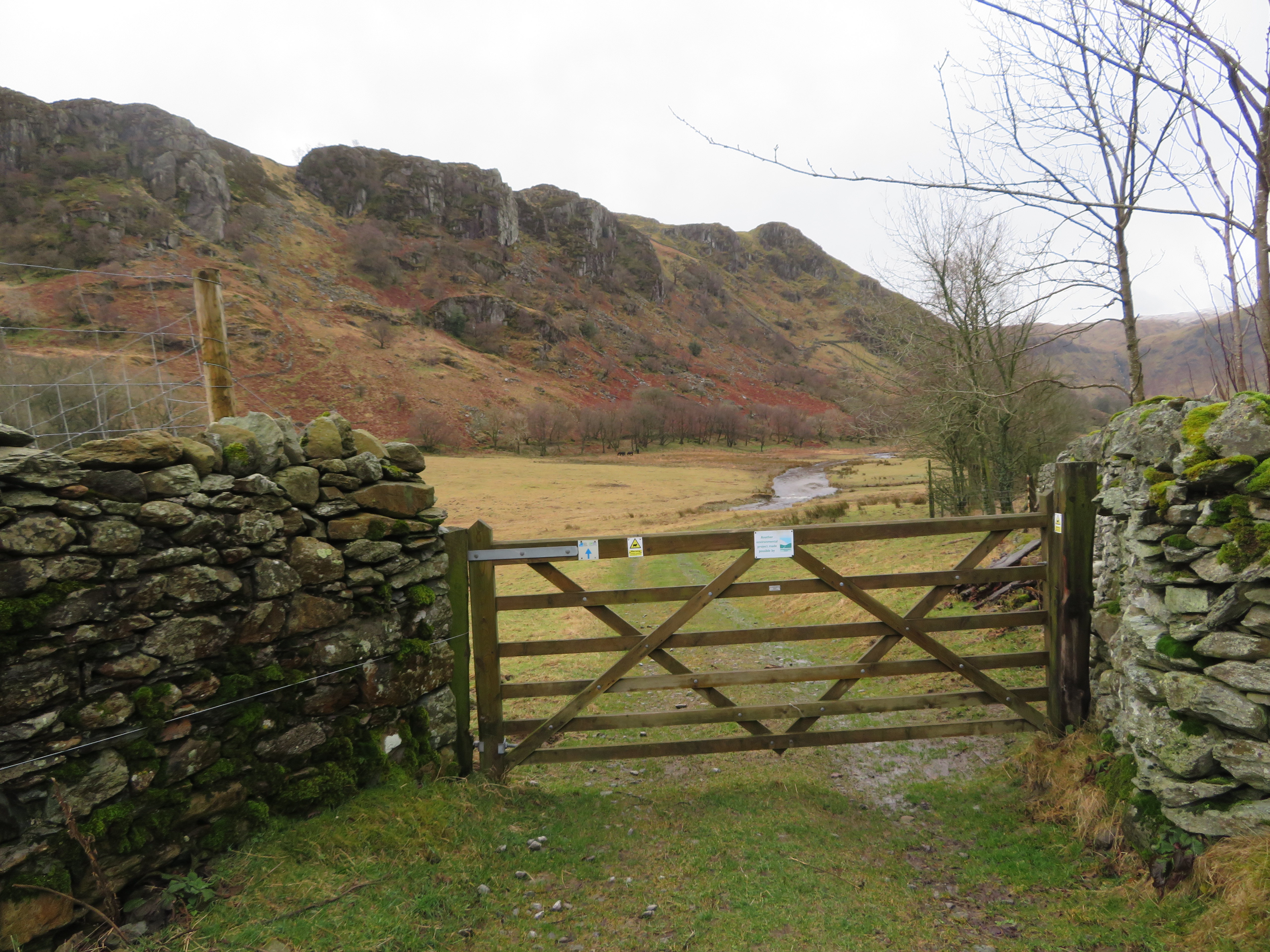 We left Swindale Lane just after passing Truss Gap
 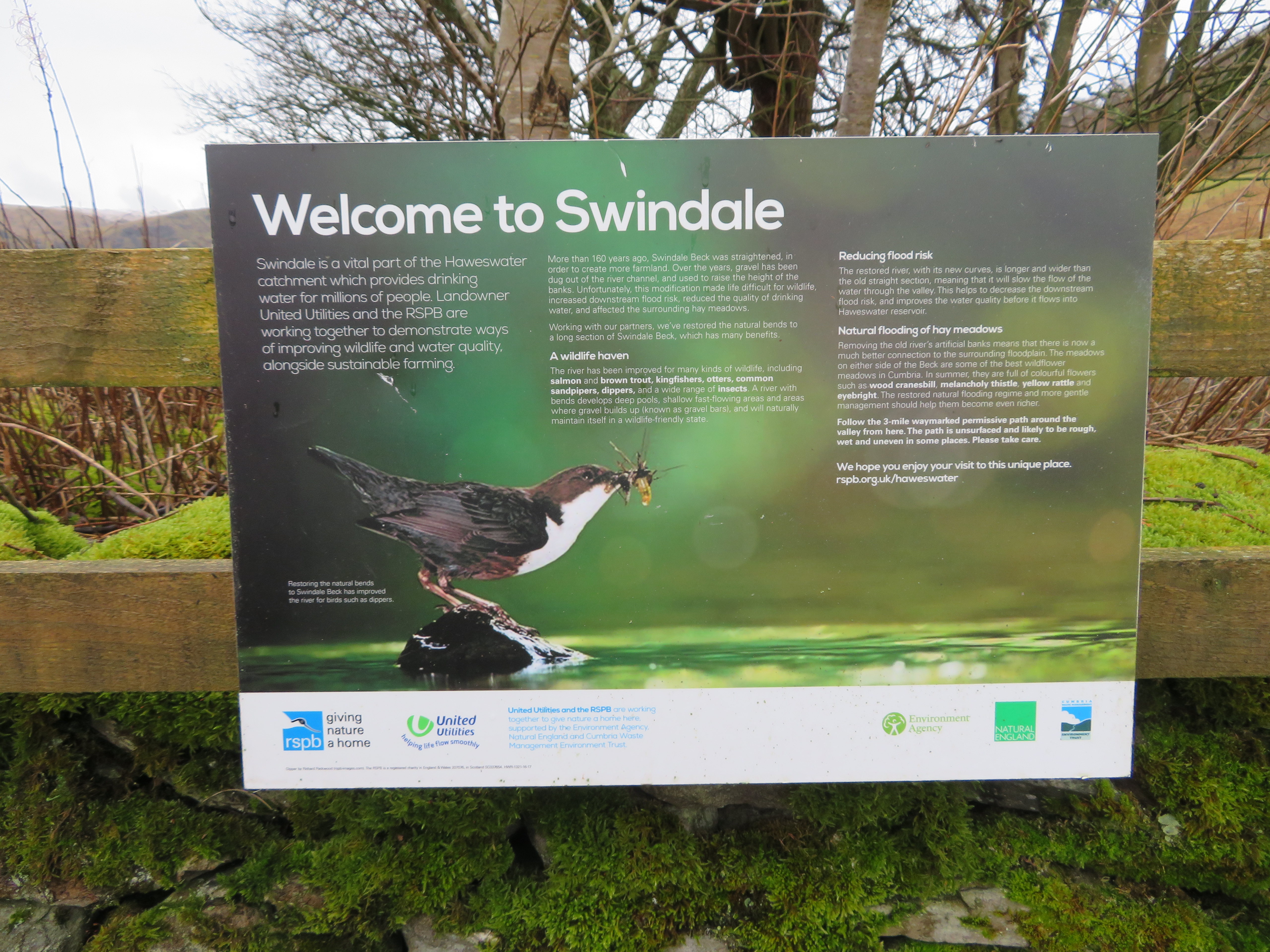 Swindale Information Board
Under normal conditions this track would be great, well it was today apart from some areas of flooding as it is a well made up and established one that has seen much service from local farm traffic.
 The track towards the farm at Swindale Head
On the far side of Swindale Beck Gouther Crag and Outlaw Crag looked most impressive...
 Gouther Crag and Outlaw Crag
 whilst on our side of the beck the much smaller and flat topped Hannah and Black Crags are mostly hidden by the trees.
 Hannah Crag and Black Crag
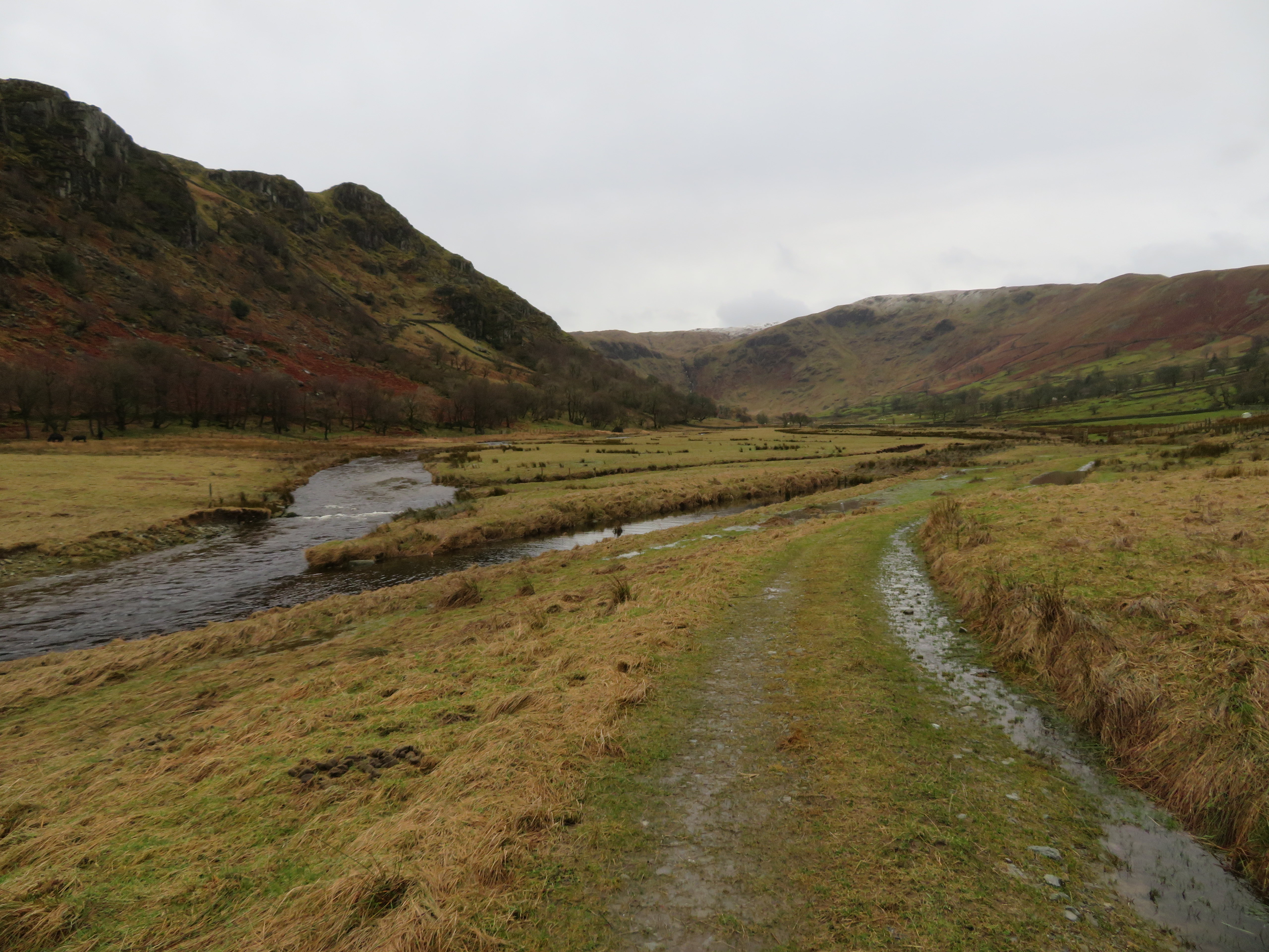
 We sloshed our way along the track that more or less follows an old water filled ditch/dyke to eventually turn to the northwest towards Swindale Lane and the farm of Swindale Head with the circle of crags below the east face of Selside Pike hanging over the large bowl of Dodd Bottom.
 A tad wet underfoot in places
 Swindale Beck is now Mosedale Beck at this point as we made our way up the field alongside an unnamed beck – the one that was flooding the footpath at the gate in the above image – to eventually bring us out at the farm at the foot of the Old Corpse Road from where we turned down the stony track to the head of the dale.
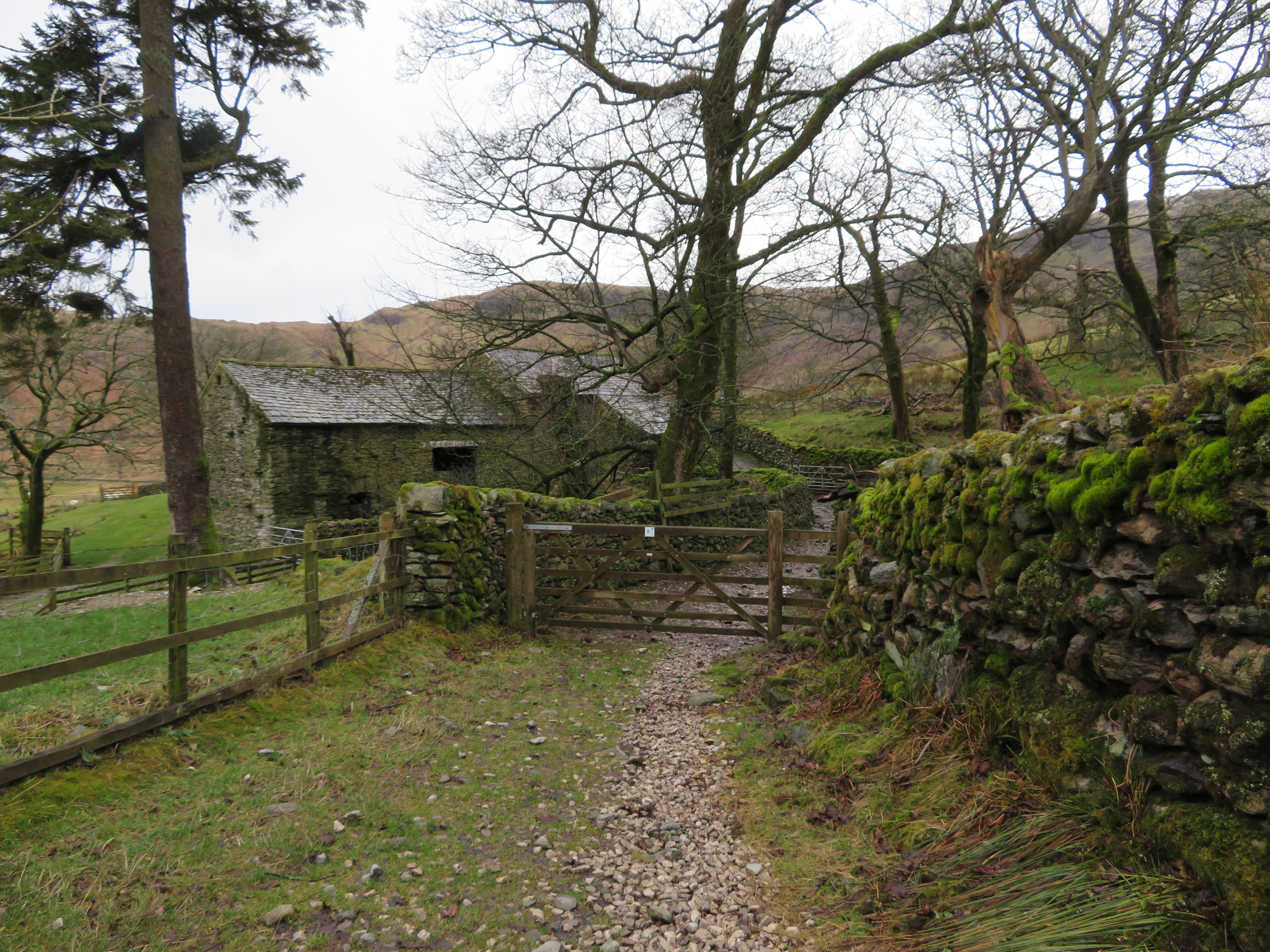 Swindale Head farm buildings
 The morning hadn’t improved any weather wise but it in no way detracted from the attraction of the dale or the beauty of the ruggedness of this end of Swindale as opposed to the gentler nature of the pastureland further back along the dale. There was still a damp atmosphere that played well with our surroundings as it brought out the brightness of the moss covered walls and seemed to deepen the tones of the usually flat brown and grey colours of the rough grass. Some of the higher crags were glistening with water despite the dull conditions as it seeped out of the cracks of the fractured rock.
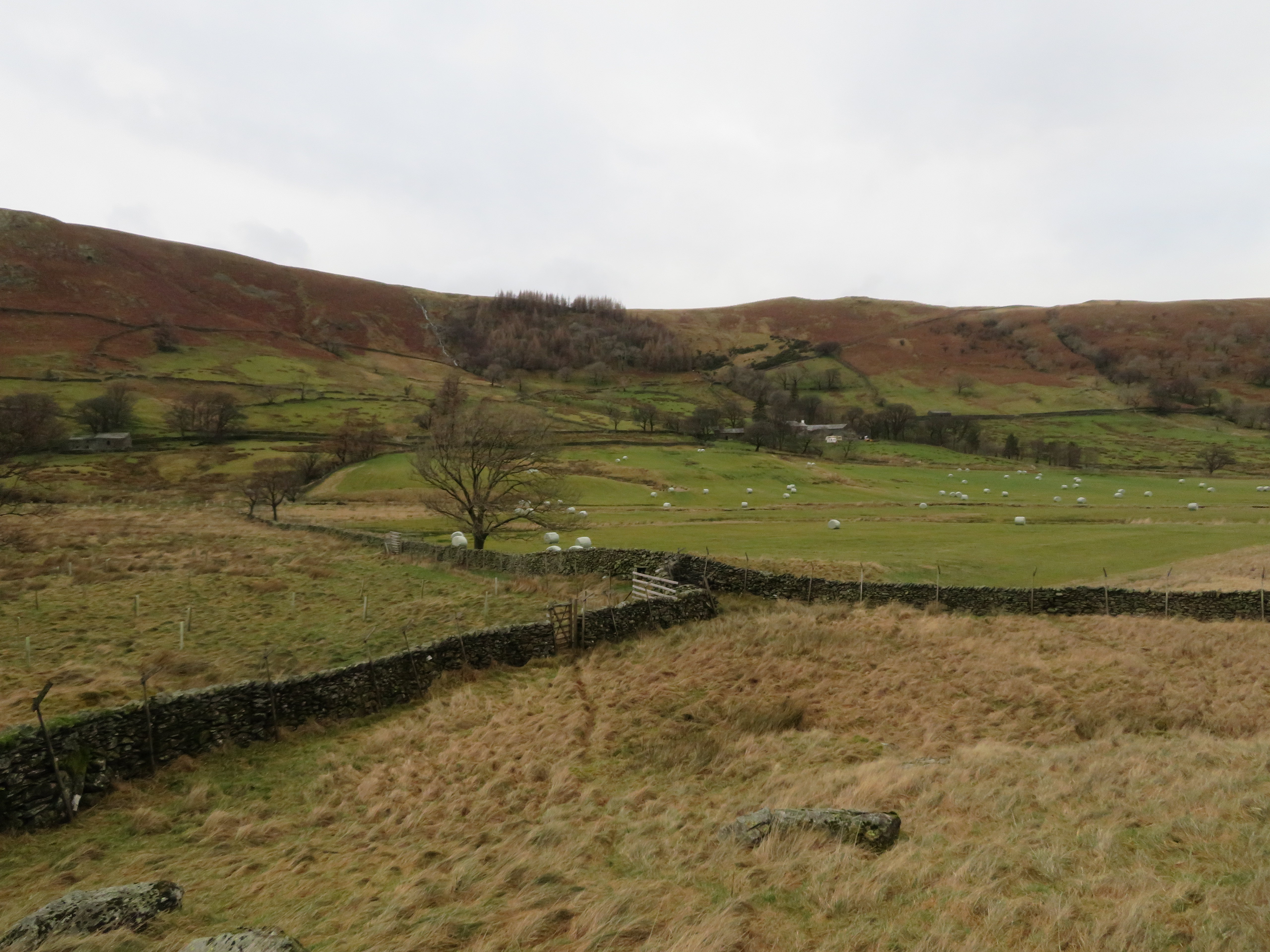
 And yet more water underfoot
 As we looked down the dale we could see the change in the nature of the ground as it went from rough grass and rushes to green pastureland where countless bales of silage lay scattered around them.
 Northeast along Swindale
 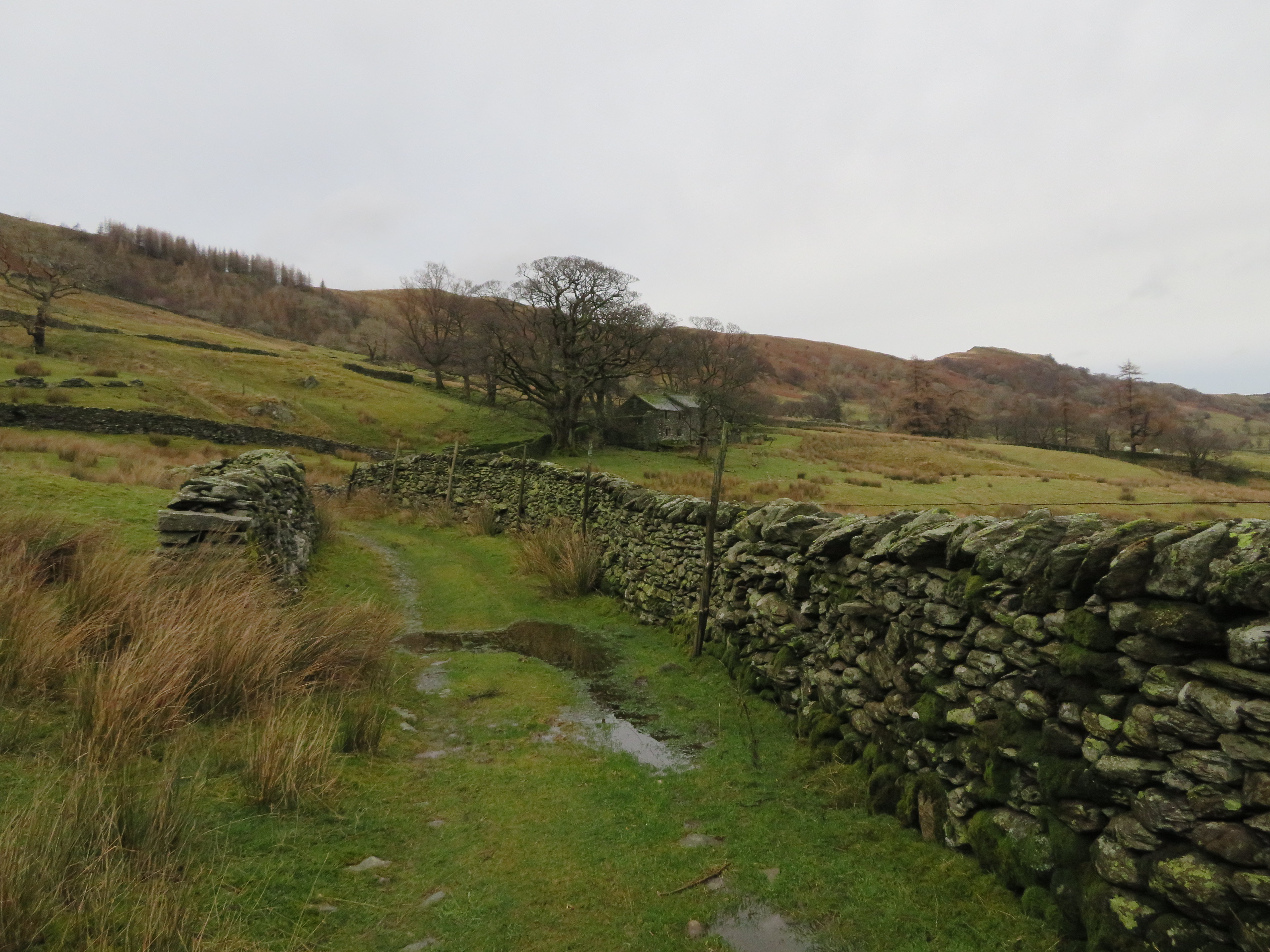 Nameless farm further along the lane
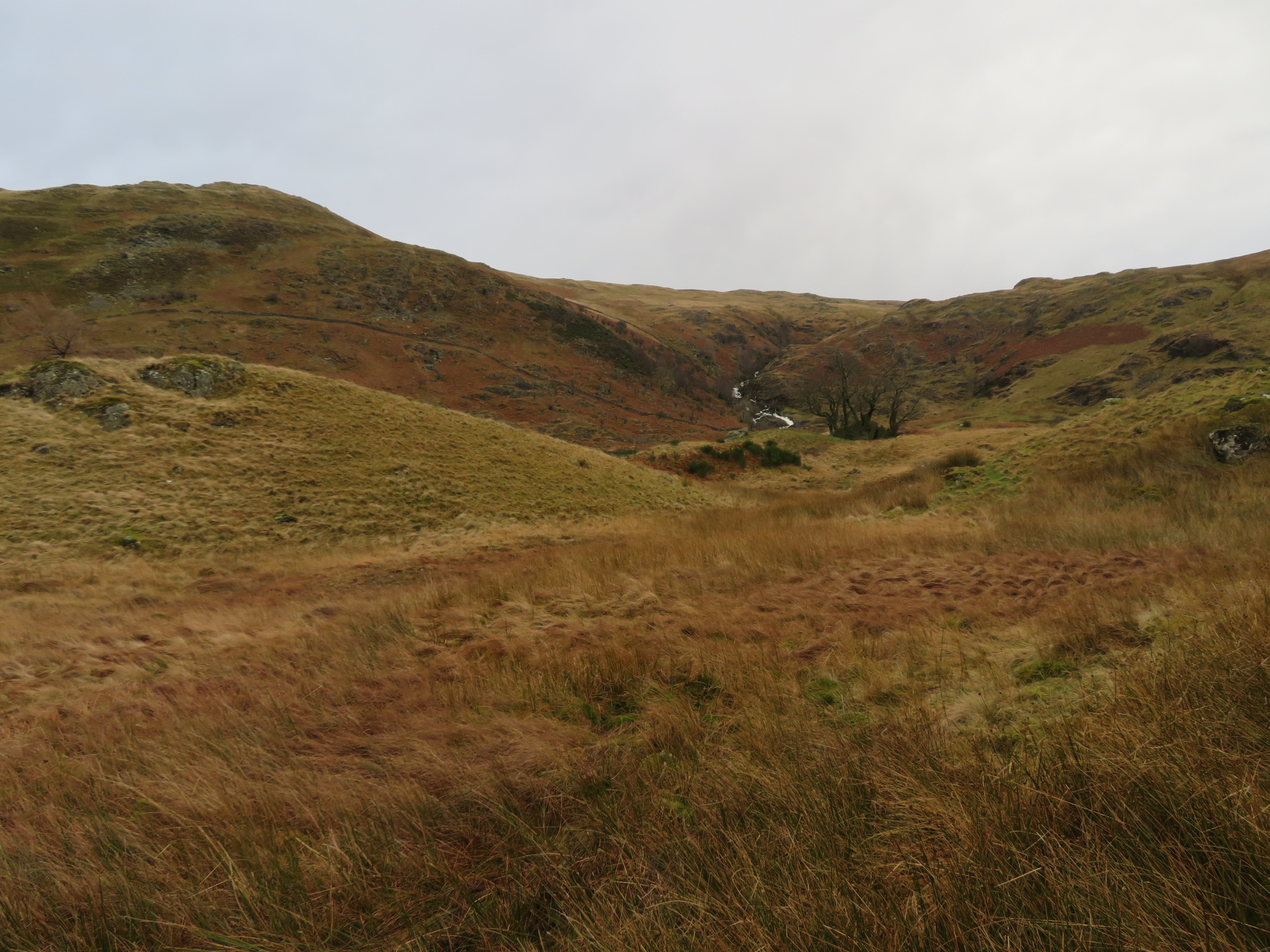
 We were slowly descending into the head of the dale with Nabs Crag and Hobgrumble Gill directly ahead of us.
 Nabs Crag to the left of Hobgrumble Gill
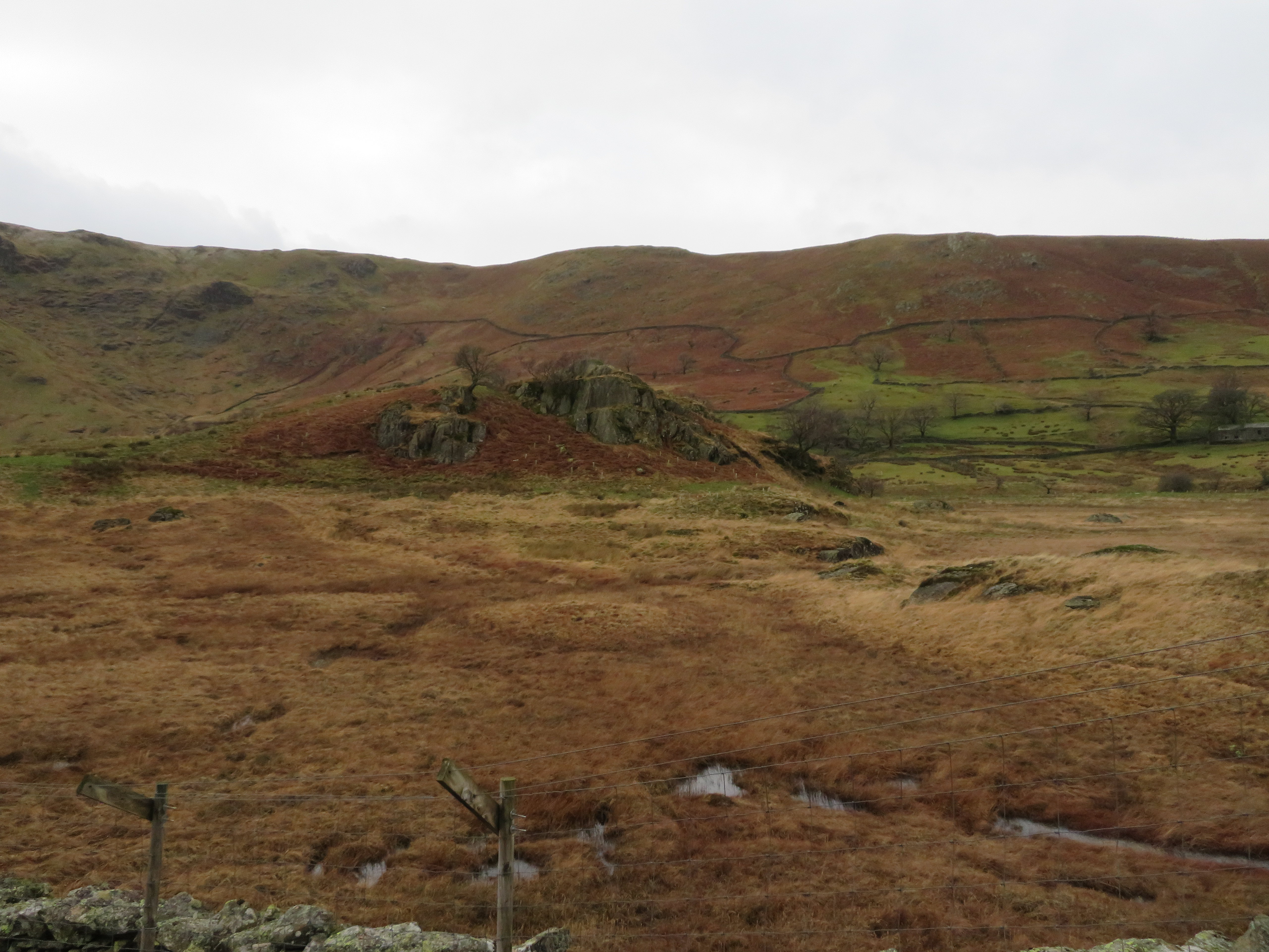
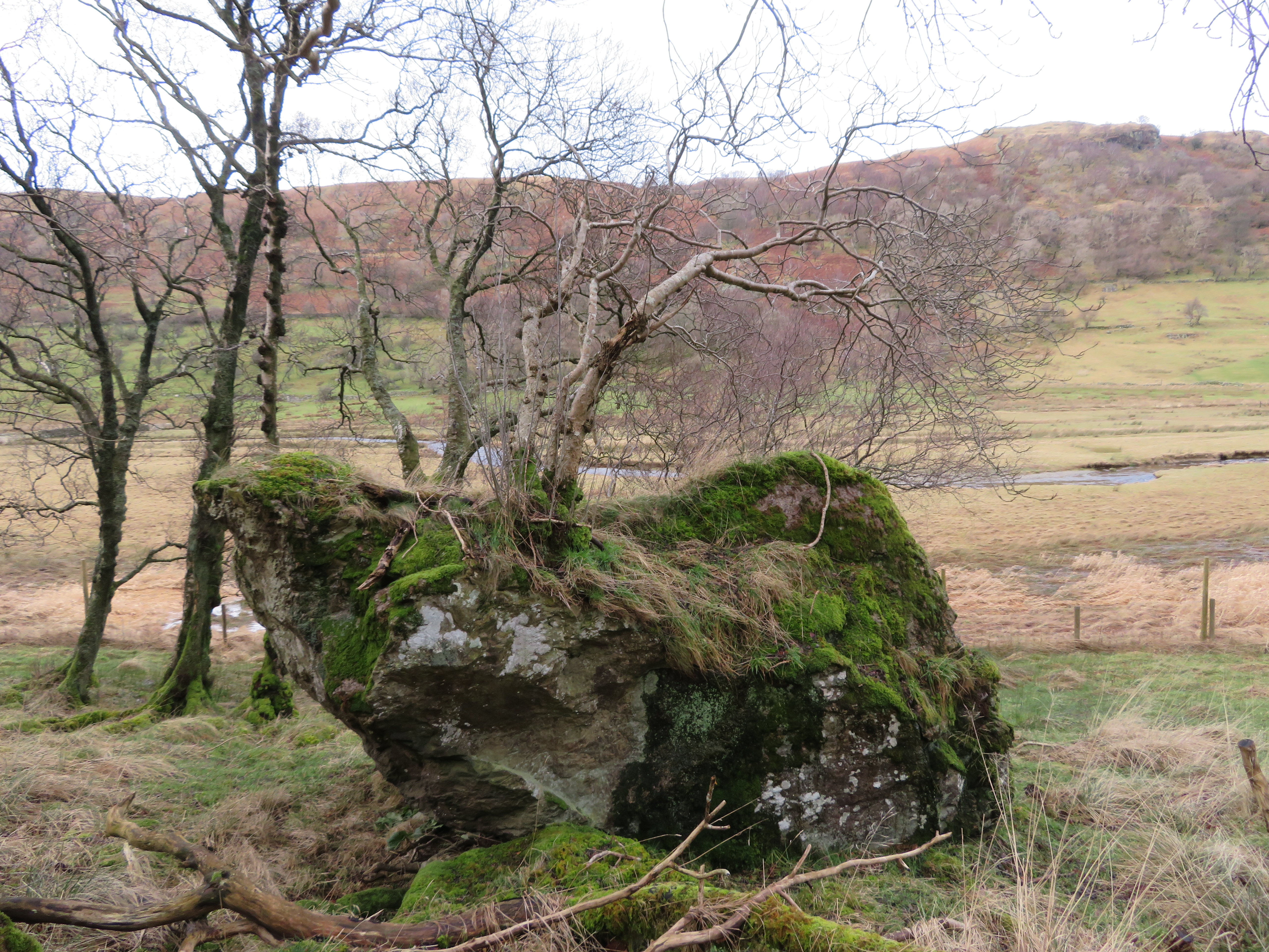
 Over to our left there was the curiously named Simon Stone, in fact it’s a number of large vertical rocks that form a circle with a number of twisted trees growing around its perimeter.
 Mosedale Beck appears behind Simon Stone
Now we were back amongst the drumlins that we walked through a couple of weeks earlier and nothing much had changed in that short time. In fact I don’t think much has changed in this quiet and isolated dale from one 100 years to the next one.
 Hobgrumble Gill feeds the wet area of Dodd Bottom
  Simon Stone - Mosedale Beck and Ewe Close in the background
  Drumlins-Mosedale Beck at the head of Swindale
 We turned away from the path that leads up into Mosedale and continued on around and down to the footbridge that sits across Mosedale Beck at the foot of the waterfalls.
 The drumlins at Swindale Head
  Foot of the falls on Mosedale Beck
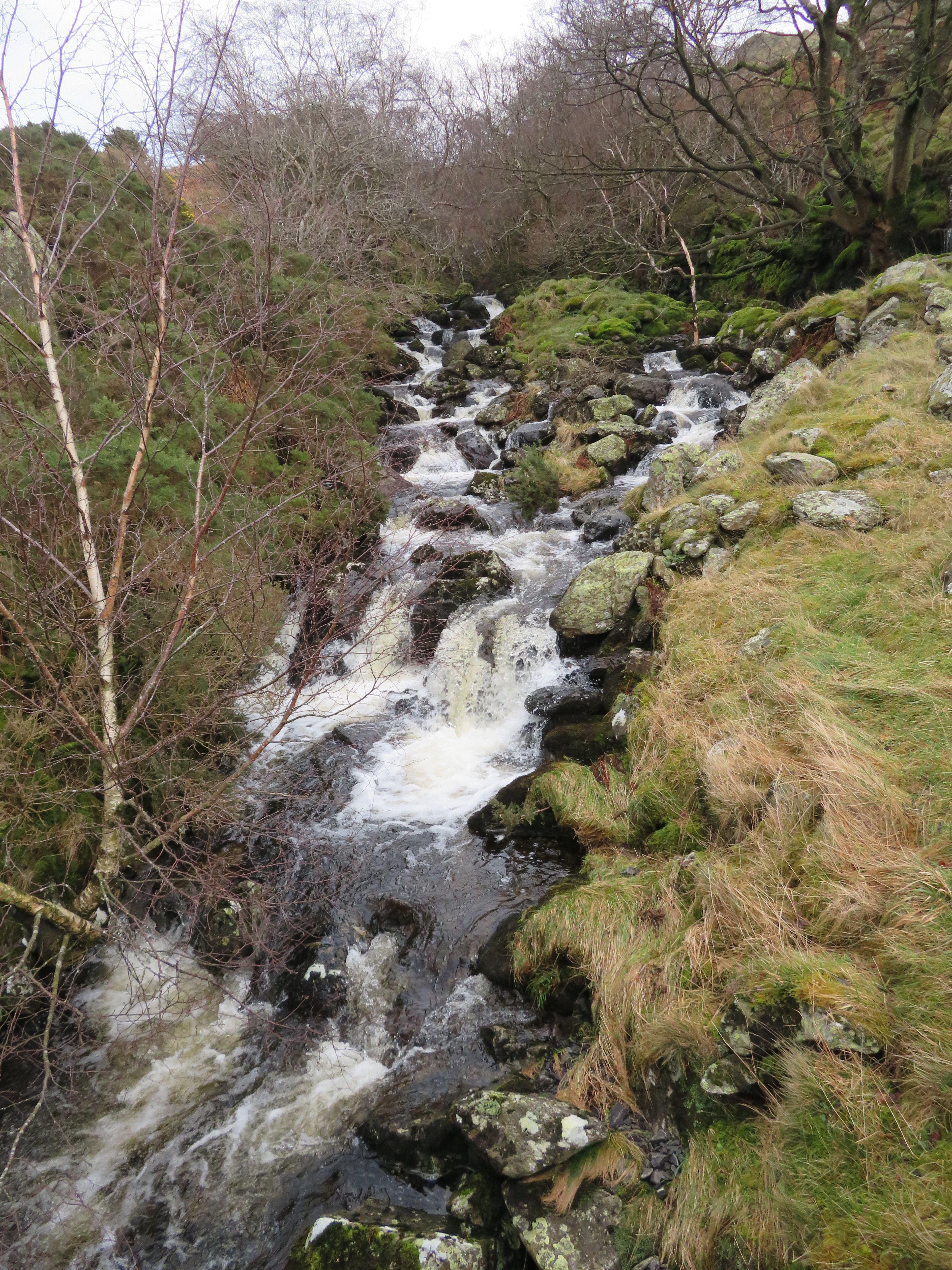
The waterfall was in good flow due to the last 24 hours of rain and looked mighty impressive as they fall roughly 120 metres from Mosedale to Swindale.
 Mosedale Beck
 We decided to take a closer look at the falls so we climbed up a thin path to a rocky grass covered ledge where we decided to have a bite to eat amongst the roar of the water as it dropped over the shiny black and grey rocks.
 Mosedale Beck Falls
  Stunted hawthorns on the slopes of Ewe Close
 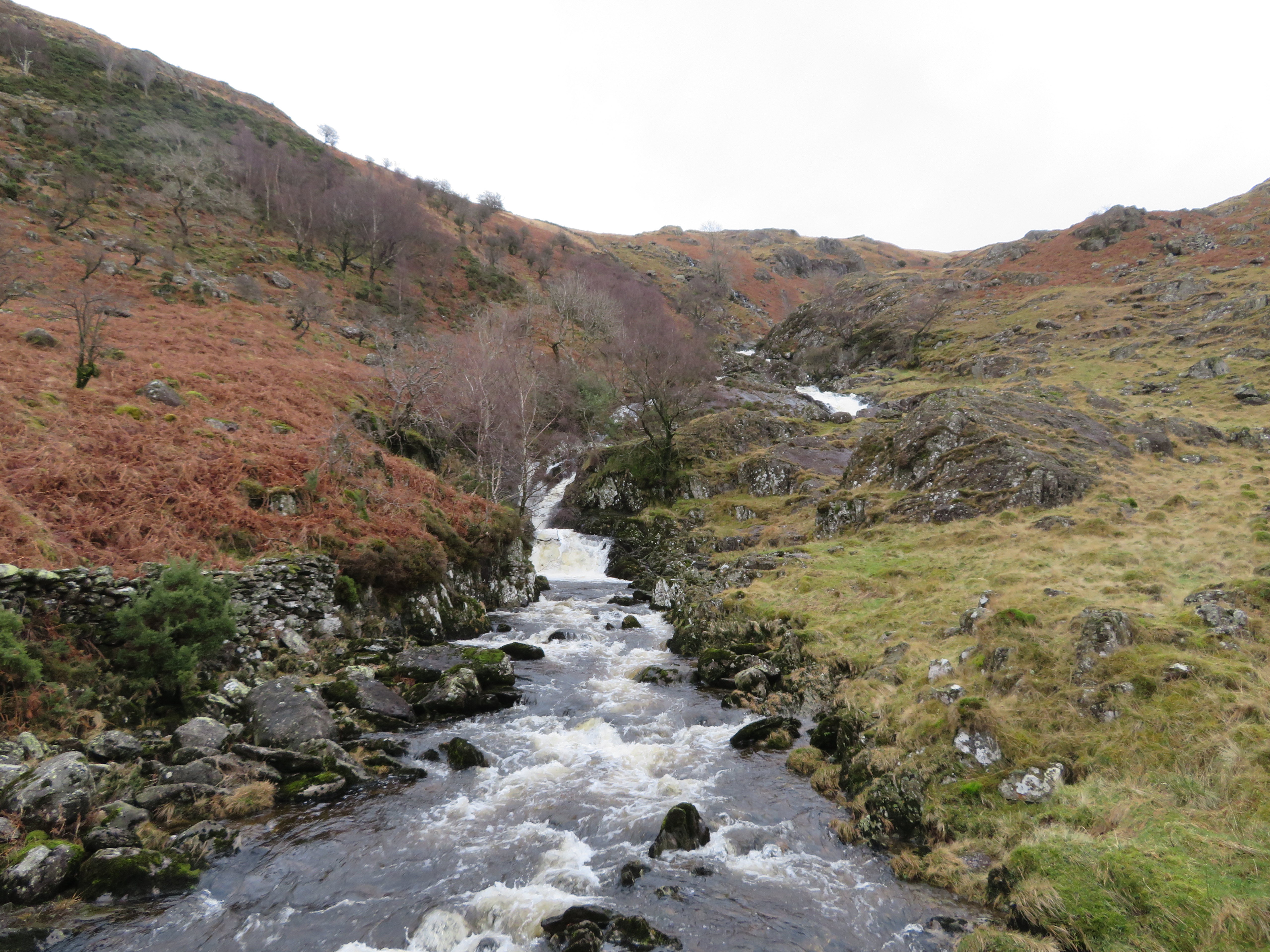 A view up Mosedale Beck
 We sat, looked and listened for a while and all was good with the world and I got to wondering if there was still a path leading up into Mosedale, one that used to more or less follow the beck and gully to the top and come out somewhere on the edge of Nabs Moor so I took a little walk to have a look. Looking closely I could see the makings of an old path that was now getting overgrown but in the past was quite a good one giving easy access onto the northern end of Mosedale and more to the east of where the path is now. I followed it for some way before deciding that it would still be a viable way out of Swindale before turning back to join my walking partner.
We retired back down the hill to the footbridge to cross it and pick up a path that is as yet not used very much due to its newness on this Swindale Valley Walk passing the large outcrop of rock that looks so out of place where it is.
 The Knott
  The faint path follows the wall along the dale
 The path although faint in places is not too bad along this rugged side of the dale as it wends its way through fallen rocks and trees with good open views across the dales pastures.
 Swindale Head farm across the valley
 A view into Swindale Head
 What trees there are scattered about the fellside are small sorry looking affairs just now without their cloaks of green and despite their small stature must be a fair old age with the stony ground and weather conditions making for a short growing season. A lot of the trees play host to a covering of lichen no doubt due to the lack of sunshine reaching this north facing side of the dale. The first of these trees were below Dog Crag and Outlaw Crag where the now wet again path wended its way below the low hanging branches.
 The path below Dog Crag
 Plenty of moss and twisted trees adorn the scene as we made our way below Gouther Crag.
 Bonsai
 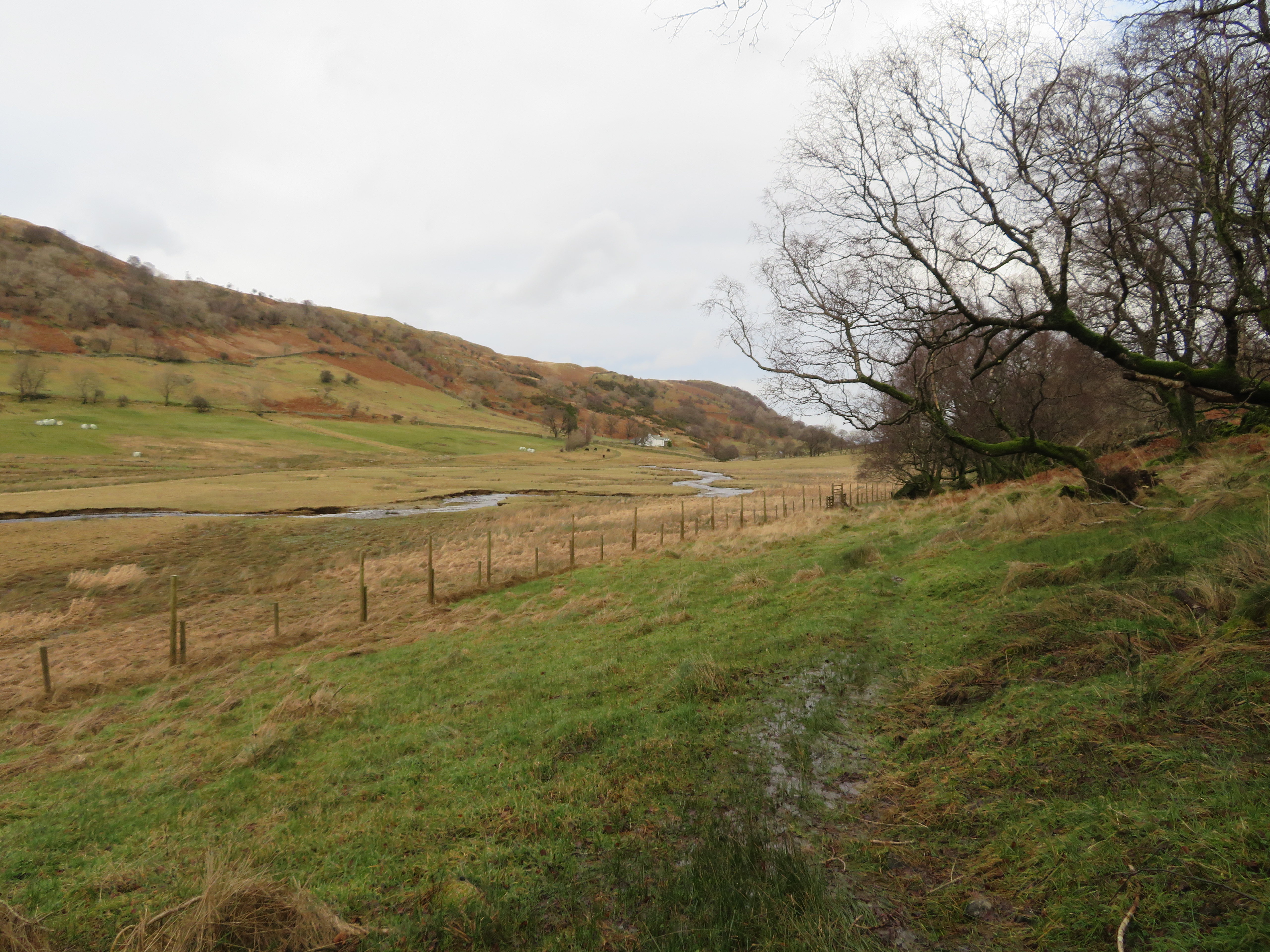 Truss Gap in the distance
  Hanging slab of rock on Gouther Crag
 In not too much time we arrived at the footbridge over Gouthercrag Gill.
 Gouthercrag Gill
 The crags are made up of stacks and tiers of shattered rocks that look as though they could collapse at any moment.
 Gouther Crag and Outlaw Crag from Gouthercrag Gill
 Soon after crossing the gill we were opposite the farm at Truss Gap and the flooded ford from where we would start the steady climb out of the dale along Low Katelade and below Trussgap Brow a line of intermittent crags that includes High Katelade, Langhowe Pike and Thiefstead.
 Truss Gap
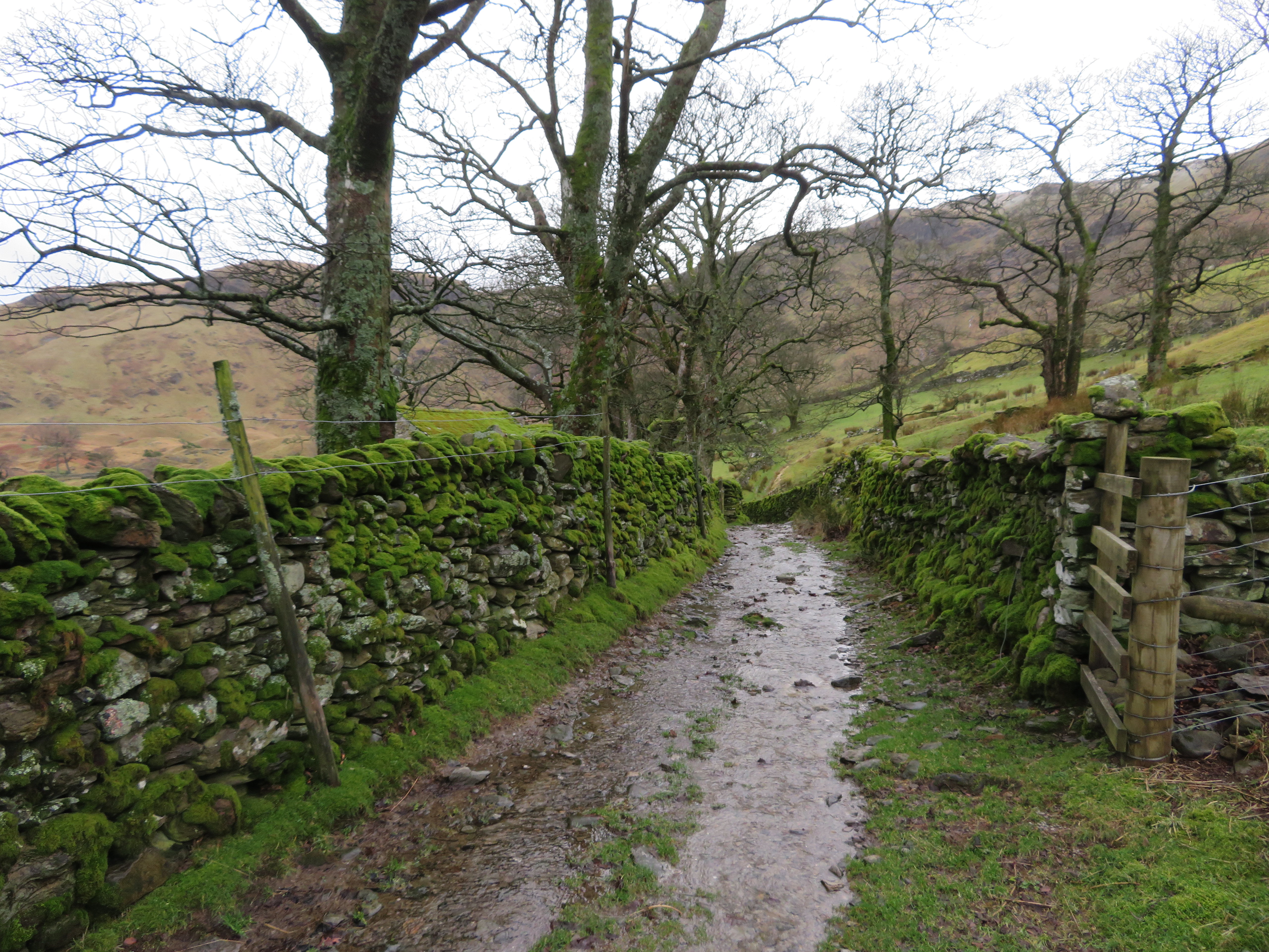
 This path is well graded as it makes its way up to Tailbert Head although today it is running with last night’s rain. As we ascended the path the views in both directions opened up before us giving us good views along the dale again with green pastures on the far side and dead bracken and rough fellside on this.
 North along Swindale
  The path leads up to Thiefstead
  Looking down to Truss Gap
 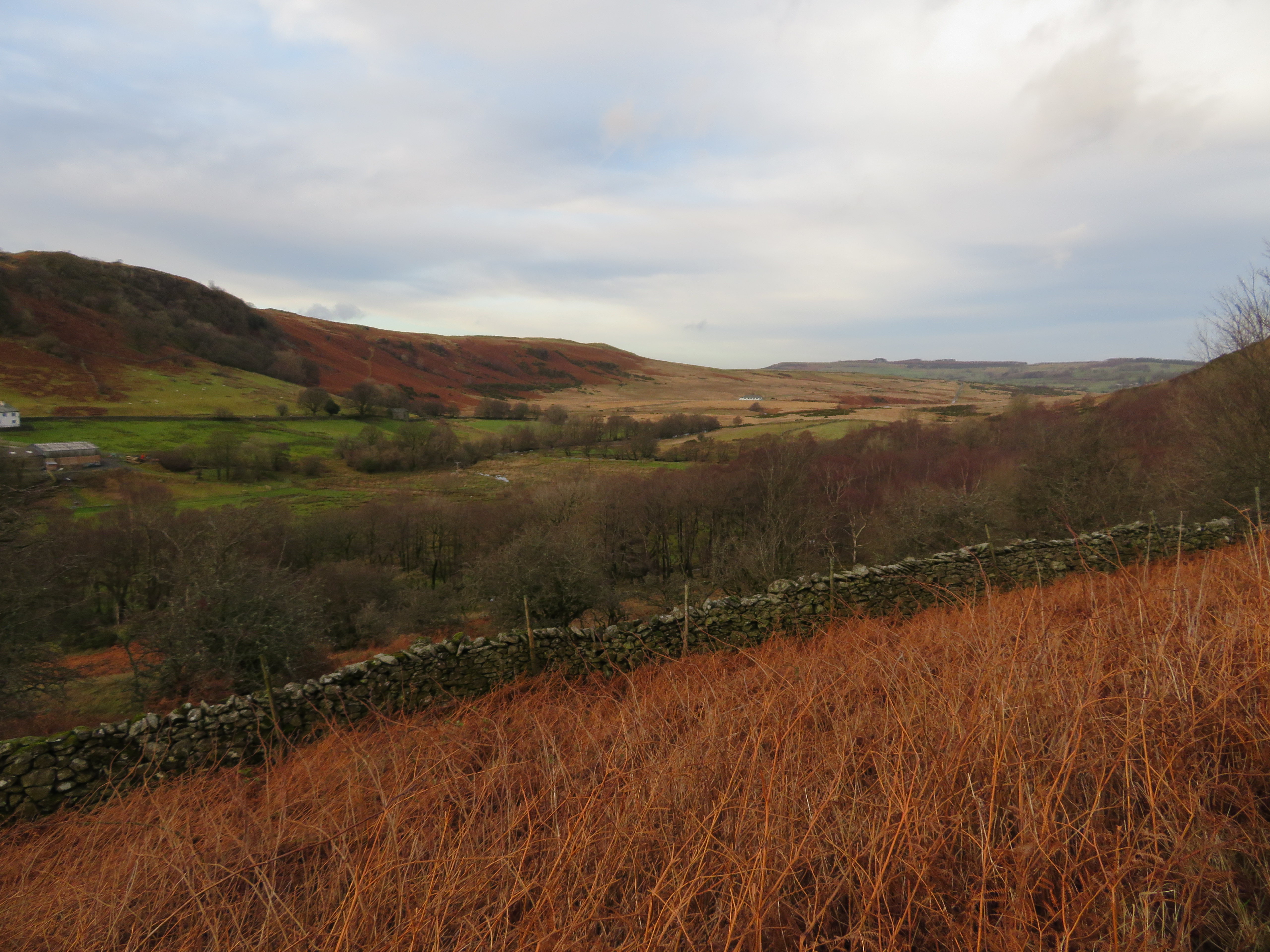 A view towards Rosgill Moor and the Filter House
 Most of the path runs through open ground apart from one short section that is surrounded by juniper and gorse as we approached the high deer fence and gate across the path.
 A look back into Swindale
 It wasn’t too long before we reached the top of the climb at Tailbert Head...
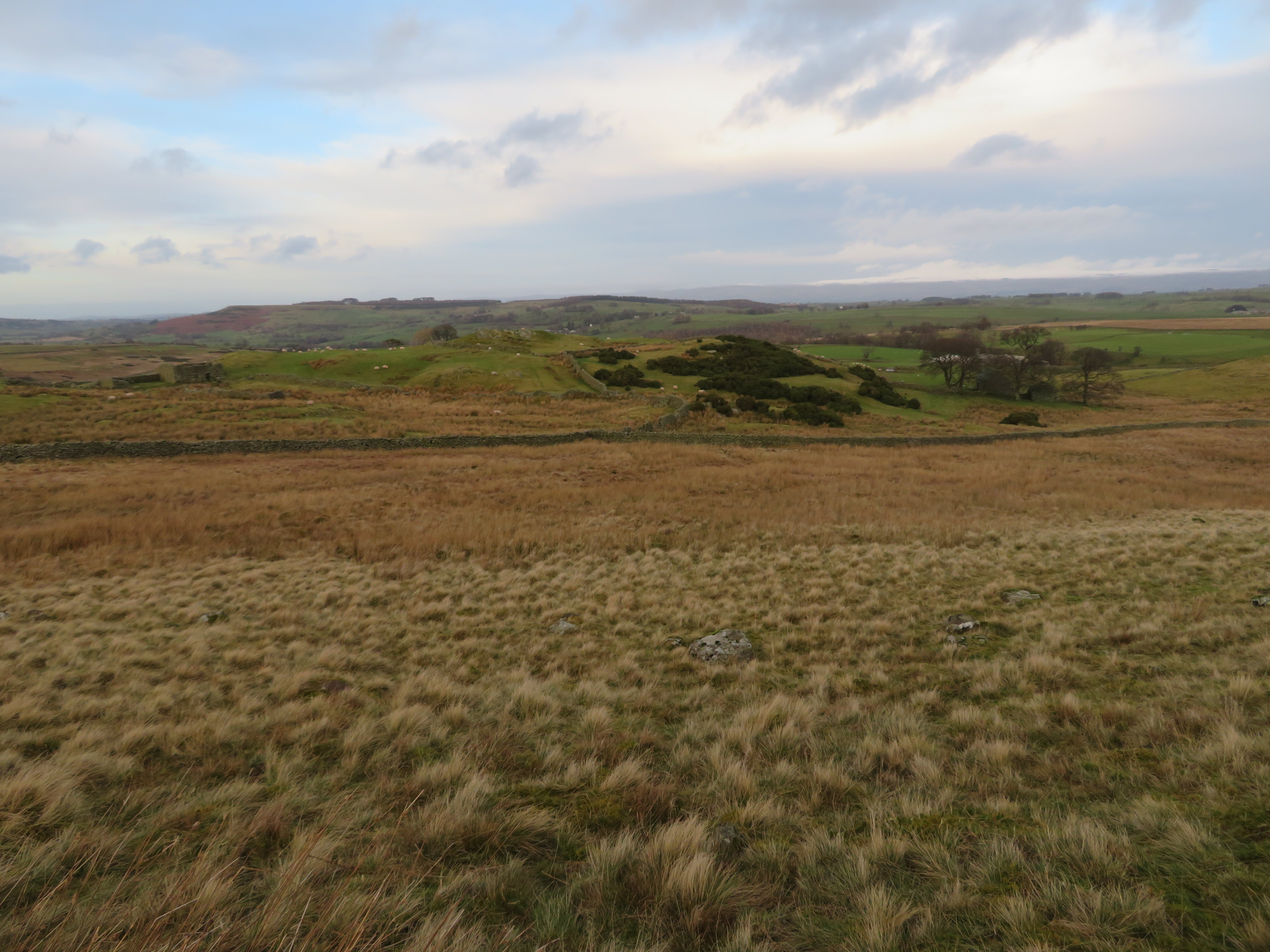 Tailbert Head
 From Thiefstead the path now starts its descent towards the United Utilities service road but we turned off at Tailbert Gill to follow the wall along to the farm of Tailbert from where we followed the fence and path that runs high above the same gill as we made our way to the service road by this route instead of following the road therefore cutting off a large amount of road walking. Once on the service road we simply followed it back to the car park on Rosgill Moor passing a small group of fell ponies.
 Grazing fell ponies
 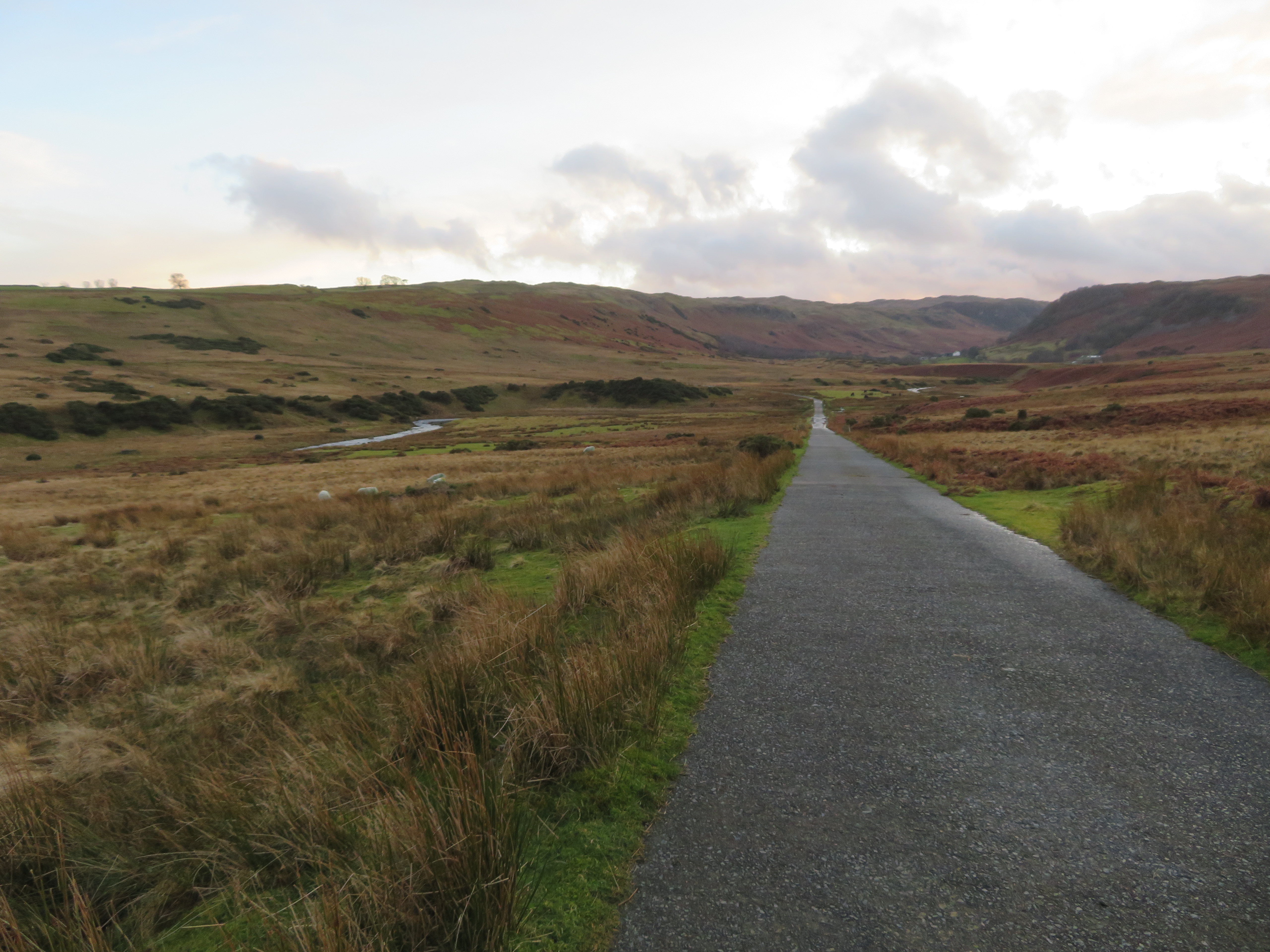 That way for Swindale
 It all depends on what kind of walking one prefers, this sort or the ones that take you onto the high fells and mountains, myself, I don’t mind where I walk as long as it’s an interesting one, I’ve done and still do both, finding much pleasure in either. Whether it’s mountains, fells, valleys or the moors there is a beauty in all of these very diverse environments but if at all I had a preference it would be one that gave me the peace, quiet and solitude of some of the less frequented areas with either myself or in the company of some like minded companion. There are places where one can get away from the ever increasing noise and clamour of the fells, away from people who care not a whit for the noise and upheaval that they cause as they roam around in places that they aren’t qualified to be in. Only last week I was making my way down from Kidsty How by the Randale Beck route and there were three youths with nothing but the T shirts and shorts they were stood up in clambering among the crags and shouting at the tops of their voices that in itself could give the wrong impression of someone in trouble and need of assistance.
Nevertheless, this walk has been good enough for a winter’s day and one that we enjoyed very much despite its gentle nature.
