free to be able to rate and comment on reports (as well as access 1:25000 mapping).
A damp and cloudy day saw us passing through Mungrisedale and driving on to Mosedale – yes another one - where we turned left along the narrow metalled lane that runs below the south side of Carrock Fell passing green pastures aplenty along this attractive dale. Another lovely feature of this dale is the River Caldew that runs its course under the steep slopes of Bowscale Fell that overlooks Carrock Fell by a mere 39 metres, but both lovely fells in their own right.
A few minutes of driving from the hamlet of Mosedale saw us at one of the three or four parking places at the confluence of Grainsgill Beck and the River Caldew near the old Carrock Mine with us taking a spot at NY32663 32645 just a few metres east along the Cumbria Way from the junction with the metalled lane. There are in fact three areas of parking just here with a forth and larger one just before the end of the lane at approximately NY33050 32613.
We were parked at the foot of Coomb Heights on which there is a decent path along the east ridge that will take a walker - should he want to go this way – to the summit of Knott and on to Great Calva. The OS Map does not show any paths but they are there good and clear as depicted in The Northern Fells book by A Wainwright but it may be a good idea to use this path when the bracken is down. Today we are taking the easy route along the Cumbria Way, as the title suggests
Once parked, booted up and donned in our wet gear we set off on what we expected to be a wet walk, not only from anything that fell from the sky today but also underfoot due to the latest bouts of overnight rain and despite the day looking as miserable as sin it was quite warm with a little brightness here and there in the low cloud cover. There was an abundance of bracken and foxgloves about...
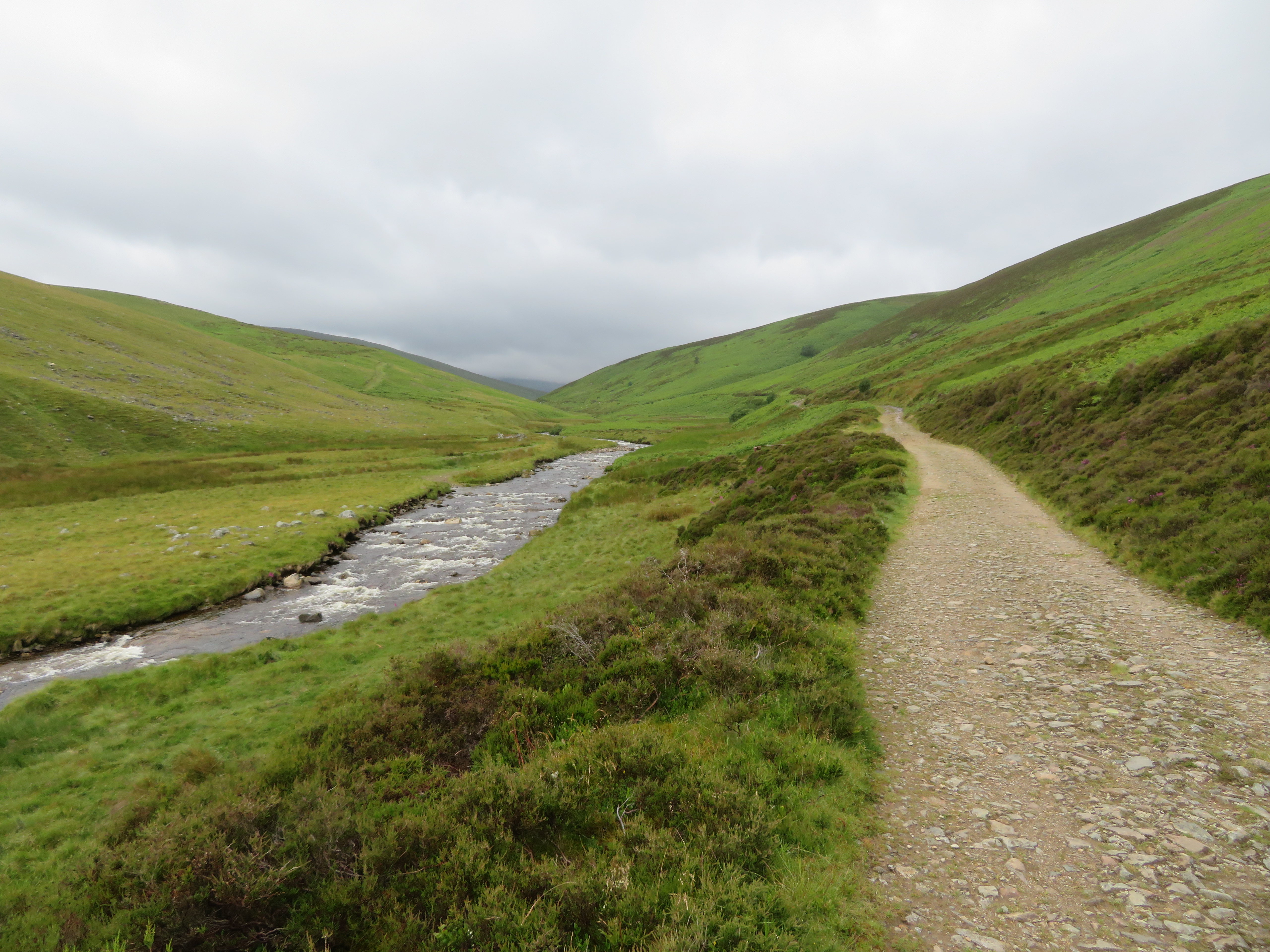
 East along the River Caldew
 as we looked along Mosedale following the winding course of the River Caldew as it made its way down from its head 700 metres up the east side of Skiddaw running down a great fold in the fell between Blake Hill/Hare Shaw and Sale How.
Looking the other way, southwest, all we could see from the car park were the lower slopes of Bowscale Fell and Mungrisedale Common to the left with Cocklakes and Pike on our right.
 Cumbria Way and the River Caldew
 We were now on our way along the easy and gently rising track/path that runs all the way to Skiddaw House and beyond. Somewhere in the region of Blackhazel Beck and Pike the track deteriorates into soft, wet and overgrown ground and whilst it is there to see it is not fit for purpose so we did as everyone else has done, we took to the higher path that avoids the low ground near the river.
All we had to do was look at the unfolding scenery as we walked to the circular sheepfold at Wiley Gill.
 Bowscale Fell to the left and Mungrisedale Common centre
  Carrock Fell centre skyline
 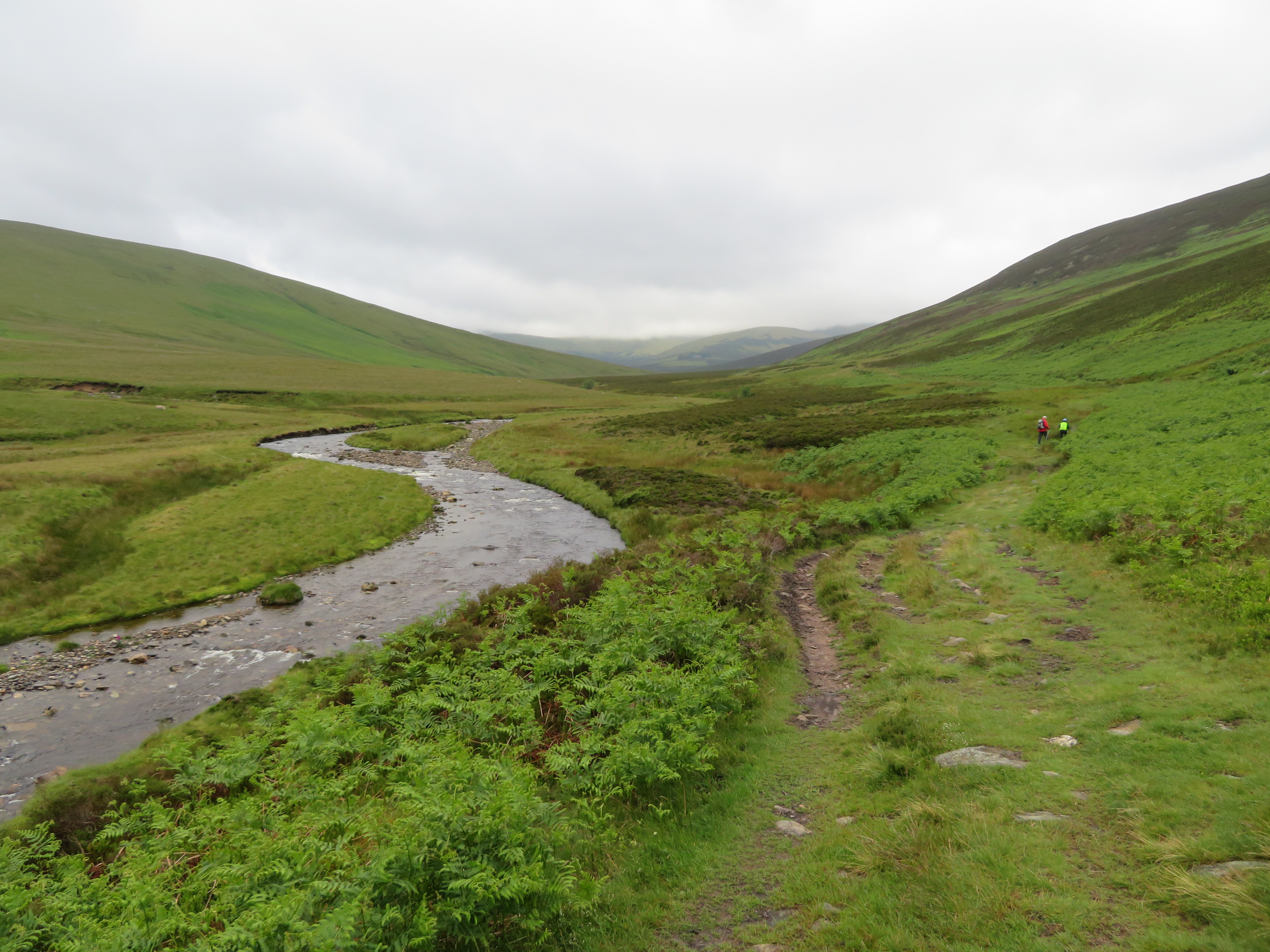 A view towards Skiddaw House with Sale How behind
  Blackhazel Beck
 The clouds seemed much lower over to the south than they did behind us with them covering a fair amount of the higher slopes of Skiddaw, Lonscale Fell and Blencathra athough Great Calva at some 690 metres was virtually clear as we approached it.
 Lonscale Fell under cloud
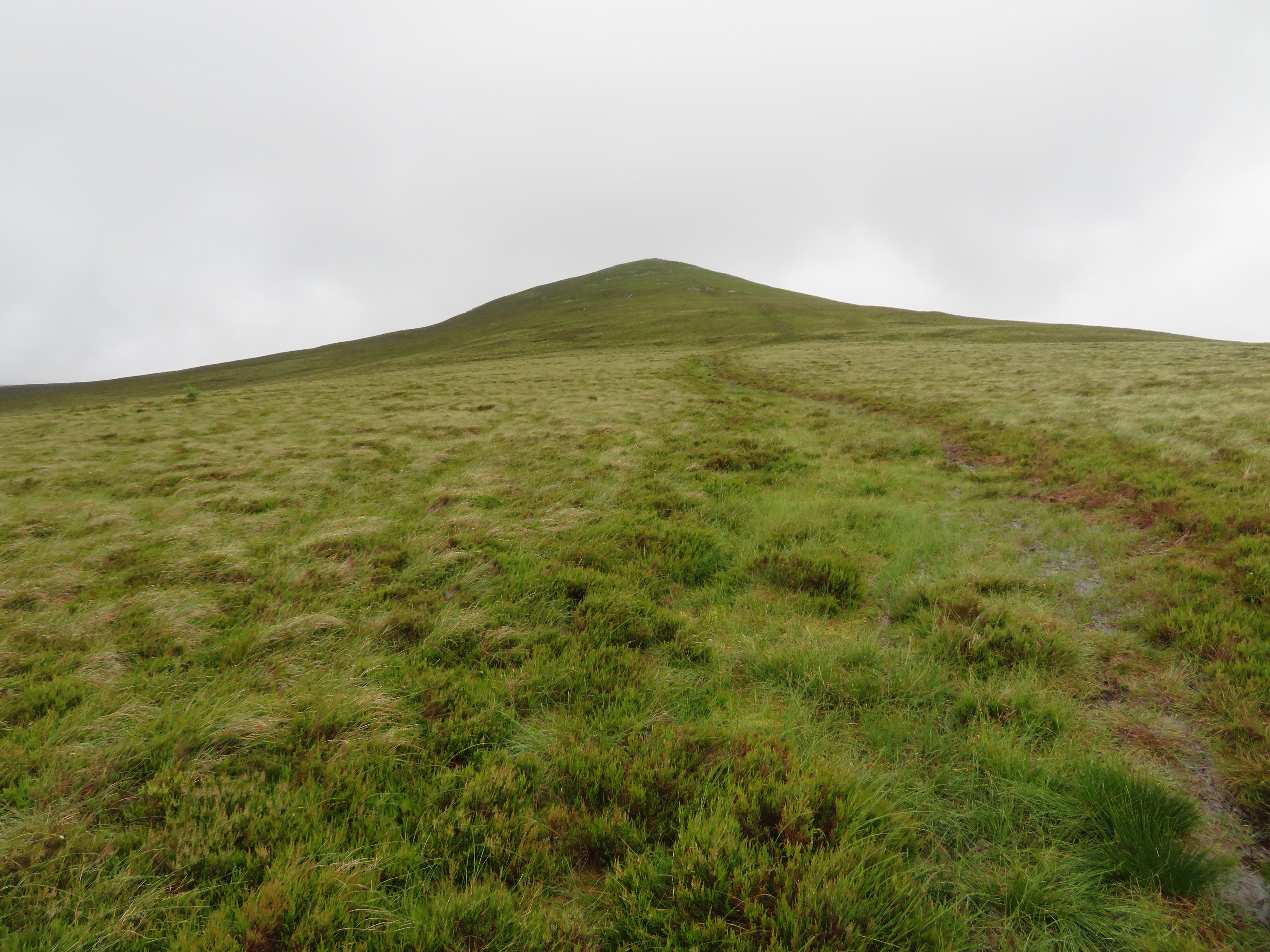
  Approaching Wiley Gill below Great Calva
 As expected the track and the path was wet in places but not too bad and we made good time in walking to the sheepfold where we stopped for a short break before embarking on the fairly steep climb to the summit up the east face. We had a spatter or two of rain on our way to here but so far it’s held off quite well, but as the intimation was there we soon set off once again to walk a short distance along Wiley Gill before starting the first bit of climb up a steep but short bank that has quite a big step as the path turns, a step too far for E as Martin had to unceremoniously drag her up to more friendly ground.
 Martin dragging E up a big step
 After the short and steep bank the going was fairly easy with the path running through a large acreage of ankle grabbing heather at an easy gradient with the slopes also dotted with small pine trees that posed the question of whether they were planted as an experiment on growth potential on these fells or whether the seeds were distributed by the wind or birds.
 Now for the hard work
 However, we were at the fence and gate within just a few minutes from where the fellside is considerably steeper especially in its higher reaches.
 Follow the fence to the summit
 Stopping for photo opportunities we now saw the cloud lowering behind us as a light rain began to fall once again but despite the conditions there was a certain beauty about what we was looking at, calm and peaceful.
 A view back to Bowscale Fell
 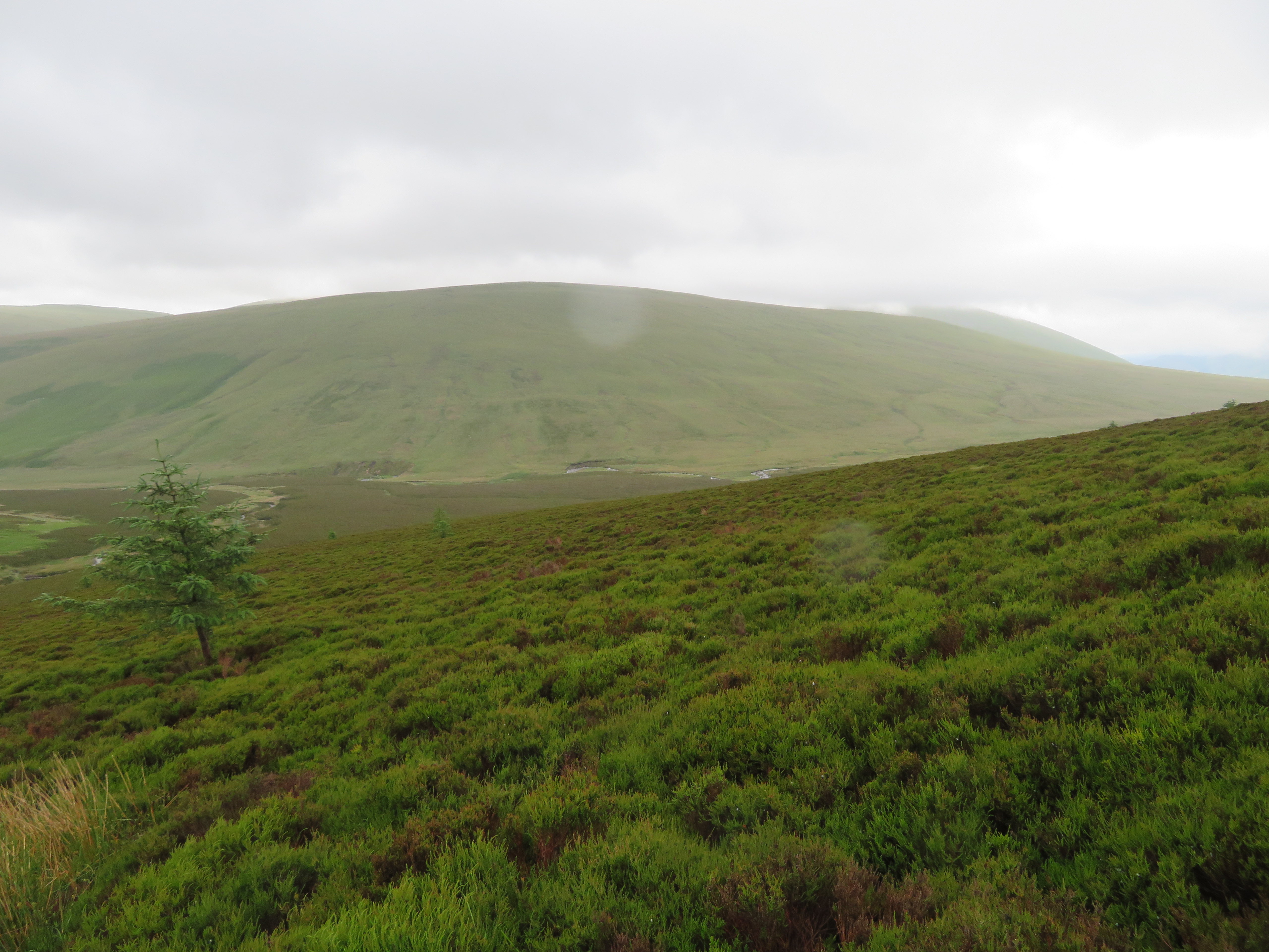 Mungrisedale Common
 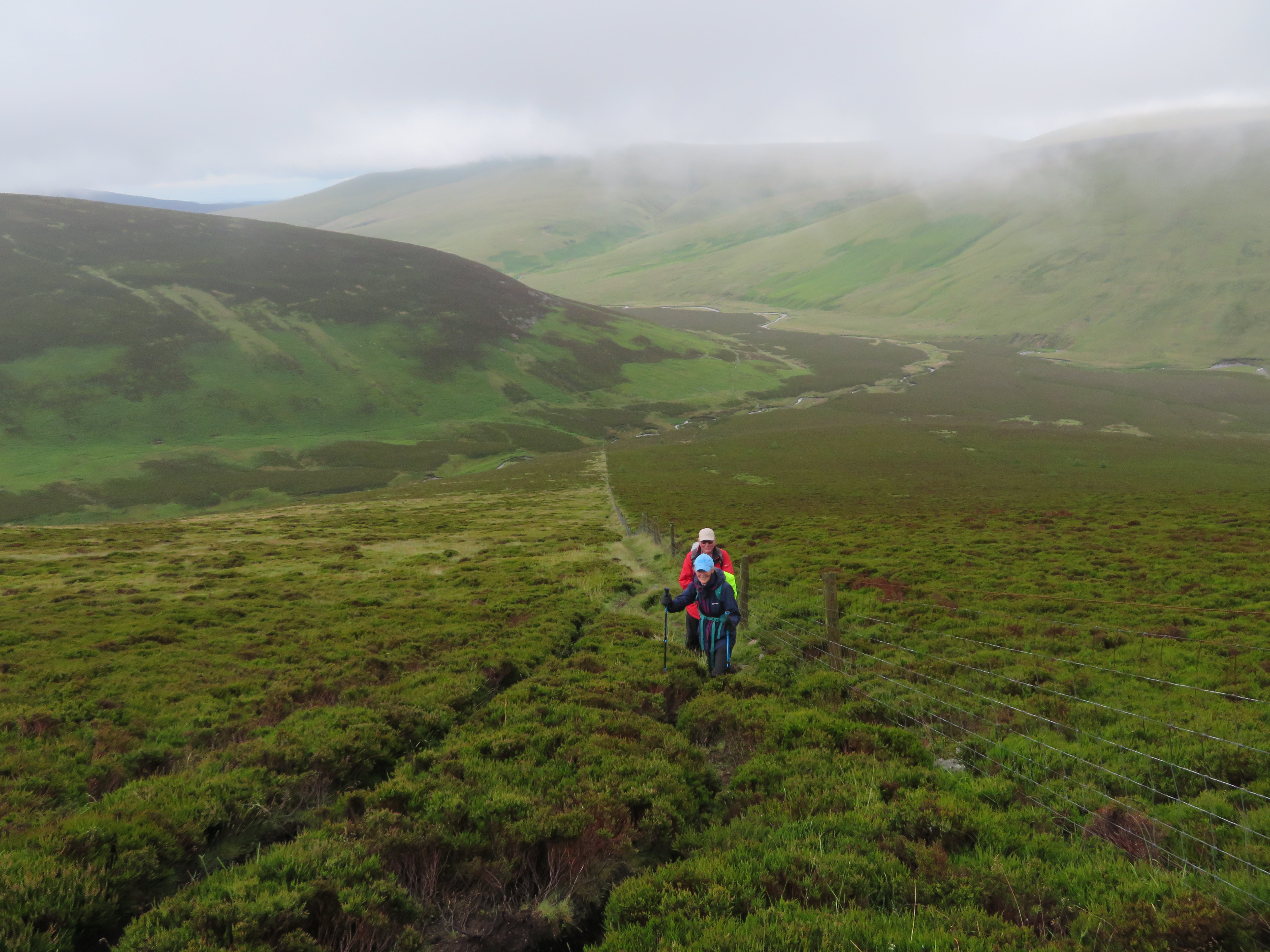 The view east from 540 metres
 From this point the going is much more strenuous with the path also now showing more rocks and stones underfoot.
 Just keep on going girl
 At 645 metres we weren’t far from the summit as I took a look to the south into a cloud hazy distance.
 A view south between Blease Fell and Lonscale Fell
 A few more minutes saw us in cloud and arriving at the stone and rock scattered summit.
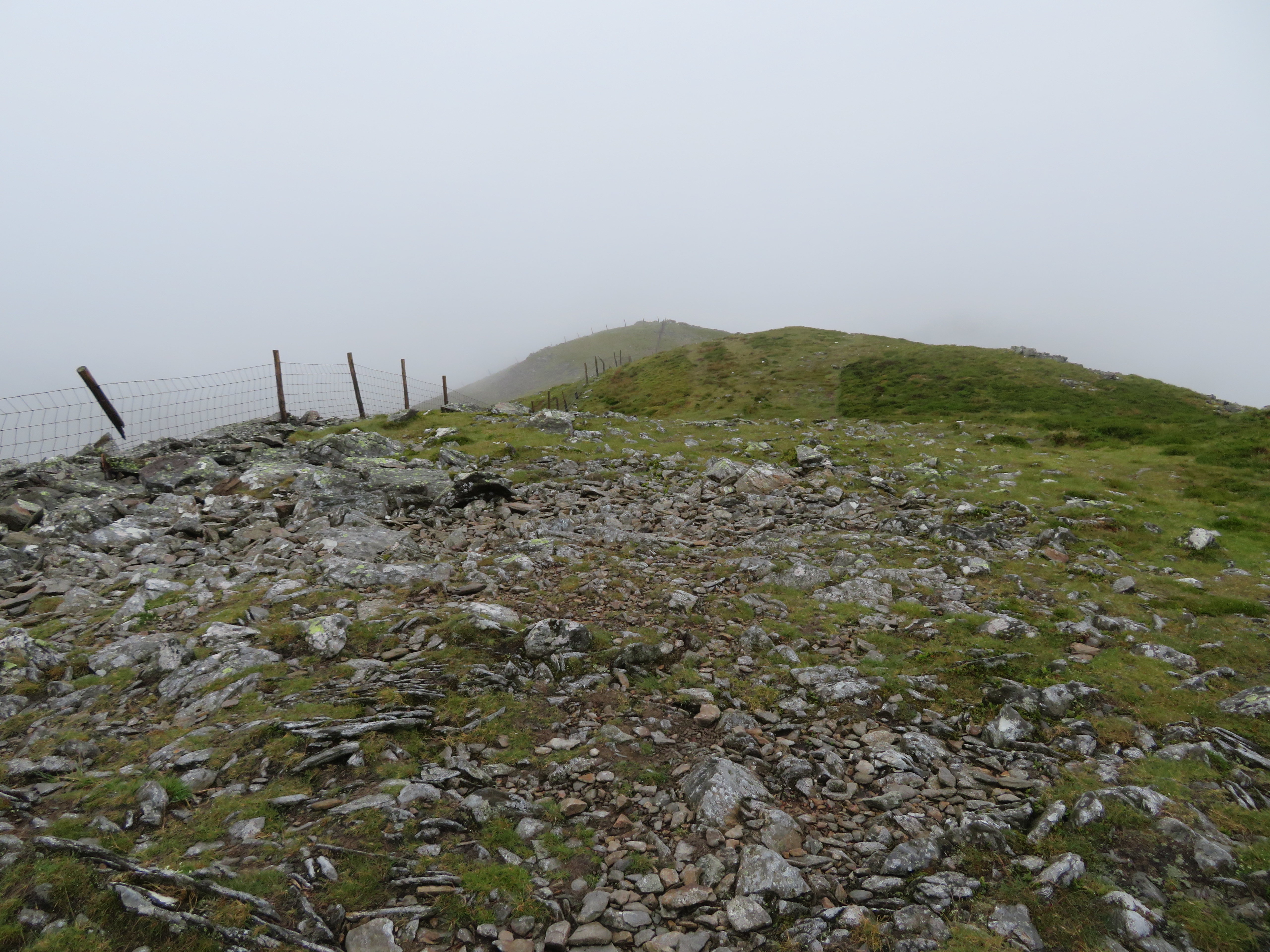
 Topping out on Great Calva
  The south summit of Great Calva
 As we stood in the cloud we could see the edges of it swirling around just below us and with the clear views below it could have been a cloud inversion in reverse. There was a cool breeze on the summit so we didn’t linger as we took a walk over to the north summit...
 A view towards the north summit
 where the views were zero. On our return we passed a couple and their dog that had climbed up the fellside behind us and was now going to make their way to Bakestall.
 A moving cloud base
 The plan now was to take the right hand path down towards Dead Beck and have a bite to eat by the side of the beck but on viewing it from above it looked very wet and mushy and in worse condition than when Chris and I climbed it sometime last year when even after a hot dry spell it was very spongy.
 Route down the south face with Dead Beck coming in from the right
 Across the opposite side of the Cumbria Way we could see the birth place of the River Caldew...
 A young River Caldew between Hare Crag and Sale How
 with the heights of Blencathra left to ones imagination or memory.
 Mungrisedale Common and Blencathra
The path down is good on the higher slopes...
 Looking back up the south ridge
 but before too long it got very narrow, wet and boggy in places, slipping around on the greasy peat didn’t help in making a quick trip down the fell.
 Hare Crag below Blake Hill
 It seemed to take an age to reach the Cumbria Way – about a half hour – from where we would now make our way to Skiddaw House and a refuel.
 On the Cumbria Way to Skiddaw House
 Another easy walk would now take us all the way back to the cars but I had to take a couple of photos as we walked along the track to Skiddaw House...
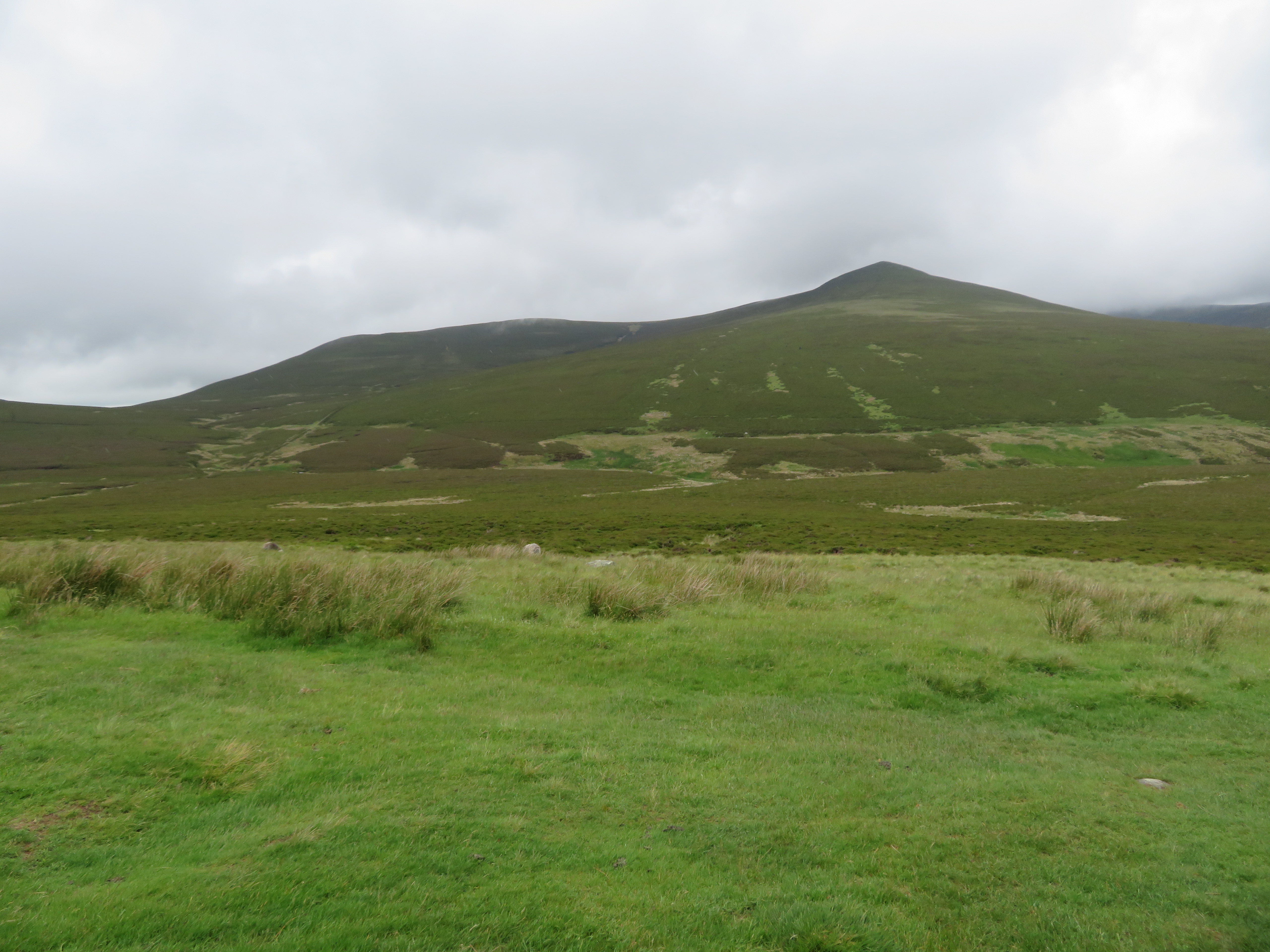 Great Calva with Little Calva to the left
 and from Skiddaw House
 Great Calva - Coomb Height and Carrock Fell
 Like Black Sail Hostel in Ennerdale this one time shepherd’s winter retreat is also in an isolated position way back in the Northern Fells where peace and quiet can be guaranteed.
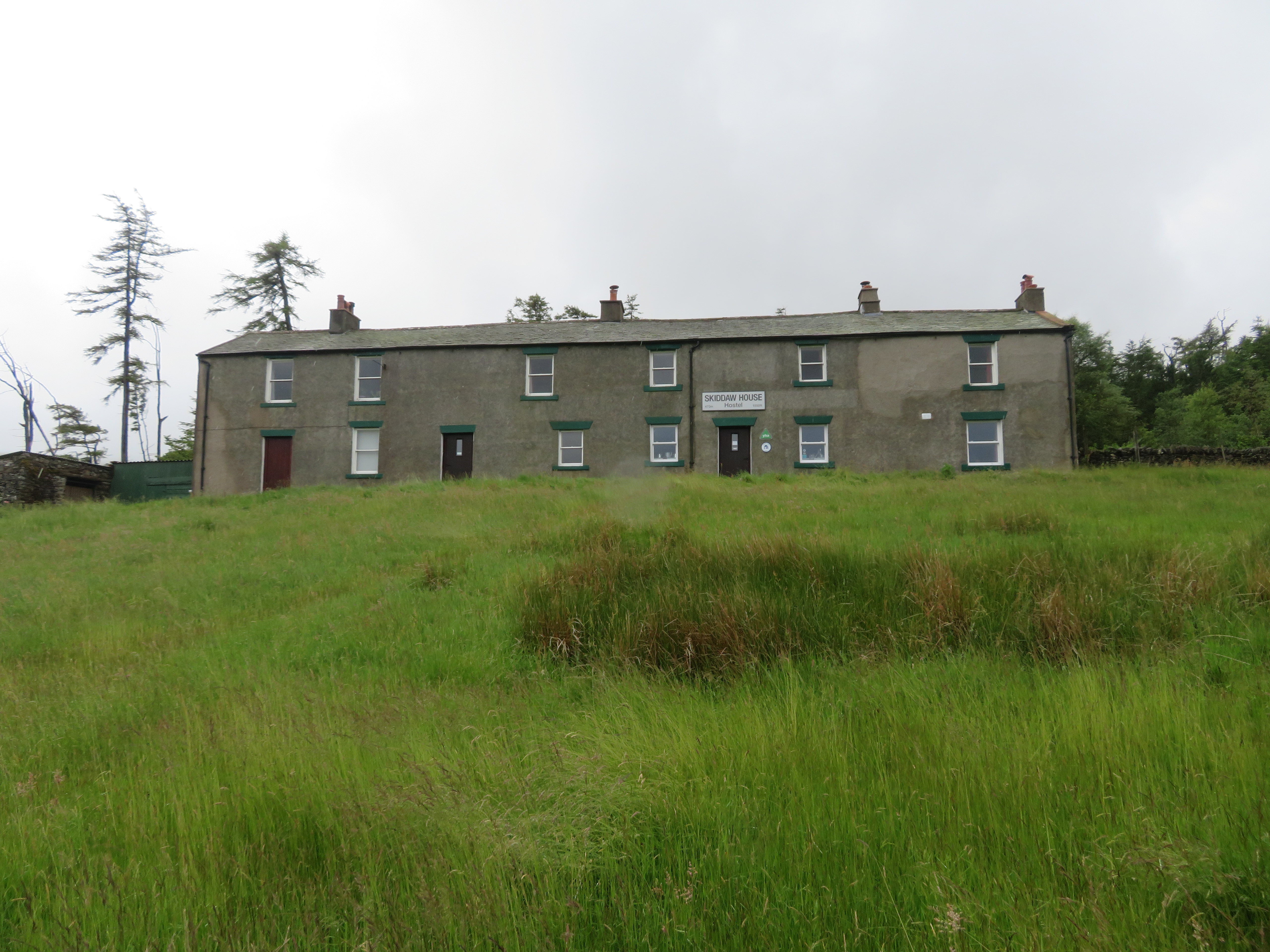 Skiddaw House
 We lingered awhile and as the old wooden seat is now no longer there we chose a fairly sheltered spot sat on the ground up against the wall taking in the damp and winter like landscape before setting off once again to now walk back northeast to cross the River Caldew and pass another of those circular sheepfolds that are so popular around here.
 Another view to the northeast
 As was the walk in, the walk back was easy along this good track and path with the clag now dropping low over Carrock Fell in line with every other fell today and it gave a hazy backdrop to this third round sheepfold of the day, but this one is different, it has a building attached to it. What could it have been used for we wondered? A shelter for shepherd’s during a sudden storm, a place to store winter feed, or both, another enigma of the fells lost to the march of history and long forgotten workers of the fells.
 Sheepfold with shepherd's shelter below Pike
 Even Bowscale Fell has succumbed to the cloak of damp that is now steadily getting closer to the lower ground...
 The western slopes of Bowscale Fell
 and there was nothing left to do now but keep on walking as photos were taken on the outward journey, so apart from taking in the damp views and listening to the sound of the river it was a pleasant stroll back to the cars. We hadn’t seen many other walkers so maybe the weather and low cloud was keeping them away from the fells today although when we arrived back there were another six cars parked up in the various parking places.
It was only last year that I had last been on Great Calva with Chris but many a year since I had done it by this route so it was good to re-visit a long ago walked route to refresh the memory and see the surrounding fells from a different perspective, but I know one thing that hasn’t changed, the slopes get no easier as time goes by.
