free to be able to rate and comment on reports (as well as access 1:25000 mapping).
In an attempt to get my Lakeland fix while staying clear of the honey pots my faithful mut Hughie and I headed for the fells north of the Whinlatter Pass. It had been a wonderfully clear morning while travelling over the Pennines but the Lakes seemed to have more high cloud and not quite the clarity in the air. No matter, we parked at the Spout Force car park at the foot of the Whinlatter pass for the start point of today's expedition.
The observant among you will notice a lack of photos from the first half of the walk, believe me I took quite a few but for what ever reason they are not on my memory card

or anywhere else for that matter, normal service is resumed from the summit of Seat How........
The first problem you face is how to access the open fellside. There are probably several points you can force your way through the forestry plantations but I decided to attempt to keep it simple and go they way I went the last time I did this round,
seven years ago.

Yes, I know in the world of forestry things can be totally transformed in that time but I was going to at least try plan A first off.
We followed the track past Darling How and up towards where the the Aikin plantation is indicated on the map. Seven years back the trees were far less mature so I initially strode straight past the intended route which goes up by a broken down wall. Once I realised my mistake I returned to where a small cairn and a rusty water tank were situated. My heart sank a little as things looked very unpromising but once on the path it turned out to be way better than it had been previously when felled trees and young saplings made life difficult. I imagine this route will remain nice and clear until more trees are felled, after that it will no doubt become a trial.
I got a little confused at the top due to changes in tree cover and fences but this time, unlike seven years ago, I found the trod up the fell straight away which Hughie was delighted about given his little legs aren't keen on bashing through heather.

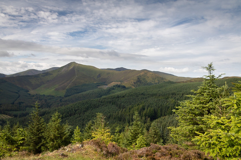
Feeling pleased with myself we tromped our way up to the first top of the day enjoying views of the Galloway hills, before stopping at Brown How with it's superb view up Hobcarton which is surely the reason AW picked what he knew was the lower top. The wind was quite strong so I was thankful of the well built shelter as we enjoyed our morning repast before moving on towards Whinlatter Top.
We followed the trod over the fell's high point without really pausing and pushed onto what has to be the most unattractive sounding top of them all, Tarbarrel Moss. The last time we'd nipped over the fence onto what we didn't realise was a MTB and therefore missed the dubious delights of this magnificent eminence

Turns out Tarbarrel Moss doesn't even have the decency to live down to it's name as it really wasn't that wet. With any sense of it being a top robbed by the trees that surround around 300 degrees of the view it's as underwhelming a summit as you could imagine. Fortunately it's easy to leave through a gate that takes you down to a forestry road and onto better things.
A short wander along the forestry road brought me to the start of the path to Seat How. Following the disappointing nature of the last "top" I felt some reservations about losing height to visit another Birkett but as the woodland was far more natural around these parts the well surfaced route was very pleasant and made well worth it by Seat How turning out to be a very fine vantage point.
 Grisedale Pike from Seat How
I retraced my steps until a boggy trod on the right took me up to the 'so so' top of Ullister Hill, not a place to linger if I'm honest, and across more boggy ground towards the characterful little fell which was next up. Barf, despite it's lack of inches and strange name is comfortably the best view point in this group of fells and I sat for a while resting against my pack taking it all in, in fact if Hughie had curled up beside me I'd have probably nodded off so it's probably for the best he didn't.

 Lord's Seat from Ullister Hill
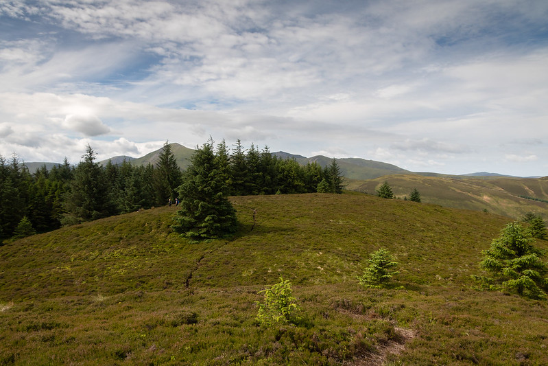 Obscured view to Grisedale Pike
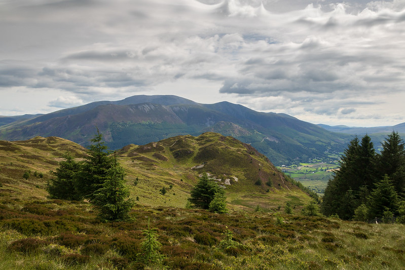 On the way to Barf
 Bassenthwaite
 Barf Summit
 Barforama - Click on pic for big version
 Bow Fell, Esk Pike and Causey Pike from Barf
 Dewent Water
 Hughie
I pulled myself away eventually and set about the largely dreary trudge up to Lord's Seat, the high point of the round. I was getting quite hungry by now but given the lack of shelter and group of mountain bikers inhabiting the summit I pushed onto Broom Fell. The character and feel of this route takes a subtle change at this point as things start to feel more empty with views opening up towards the Irish Sea and beyond. The number of other walkers falls away as well but It was far from deserted as I made my way across the grassy plateau in the increasing wind. I was fairly famished by the time I reached Broom Fell and manged to get out of the wind behind the fine cairn as the shelter was occupied.
 Looking back to Barf
 Lord's Seat Summit
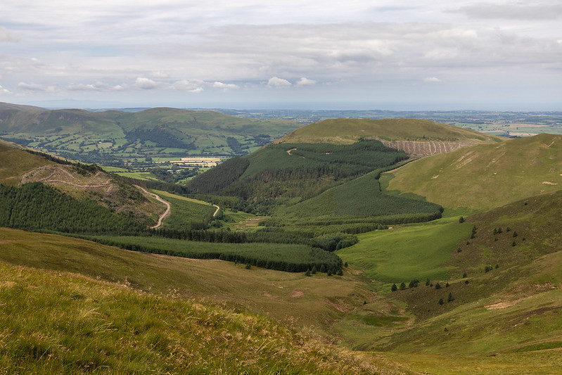 Looking down to Darling How
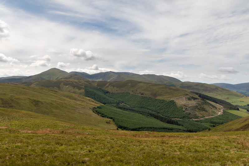 Whinlatter with Grisedale Pike Beyond
 Skiddaw from Broom Fell
 Broom Fell Summit
Lunch done with, it was onto the final 3 tops of the day as we made out way past the unpleasantly denuded Widow Hause plantation before a short pull up to Graystones. Birkett and Wainwright disagree with the summit here so I wandered about the top to make sure I'd found the high point, the Birkett summit, before for making my way to the far superior Wainwright summit perched on a rocky outcrop. We didn't linger on either however and made our way to the final high point in the shape of Kirk Fell on Lorton. I rested my weary limbs and sat with my boots off, cooling my feet next to the few white stones that arbitrarily mark the summit.
 Graystones and the Widow Hause Plantation
 Is this the High Point of Graystones?
 Or Perhaps here?
 View up Hobcarton from Graystones
 Wainwright Top of Graystones
 Vale of Lorton from Graystones
 Kirk Fell on Lorton
A bit of map study and I decided I may as well head back across Sware Gill as I really didn't know just easy or not it would be to cross lower down. I at least managed to contour around Graystones so I didn't gain any height but still had a little toe crushing fun on the steep descent down to Scawgill Bridge. I could have returned to the car along the road but chose to use the built footpath up to the car park. This turned out to be hideously overgrown with 6 foot tall bracken in places making a good brushing down and a tic inspection necessary upon reaching the car.
 Sware Gill
 Steep way down Graystones
 Vale of Lorton
 Still Steep!
 Skaw Gill
Still a very enjoyable, and surprisingly given the forestry land encountered, trouble free walk that takes round two up to 161 and my Birkett tally up to 370. Onward and upwards.

