free to be able to rate and comment on reports (as well as access 1:25000 mapping).
My 12 year old son, Tobey, planned this backpacking route over 4 days.
Scafell Pike from Eskdale, via Pen, is not for the faint hearted. You need to like uphill – and lots of it! We tackled the highest mountain in England, with lots of climbing, walking on scree and going off-piste.

This is the quietest and most rugged ascent of Scafell Pike. Once we had passed Tongue Pot, we did not see a soul.
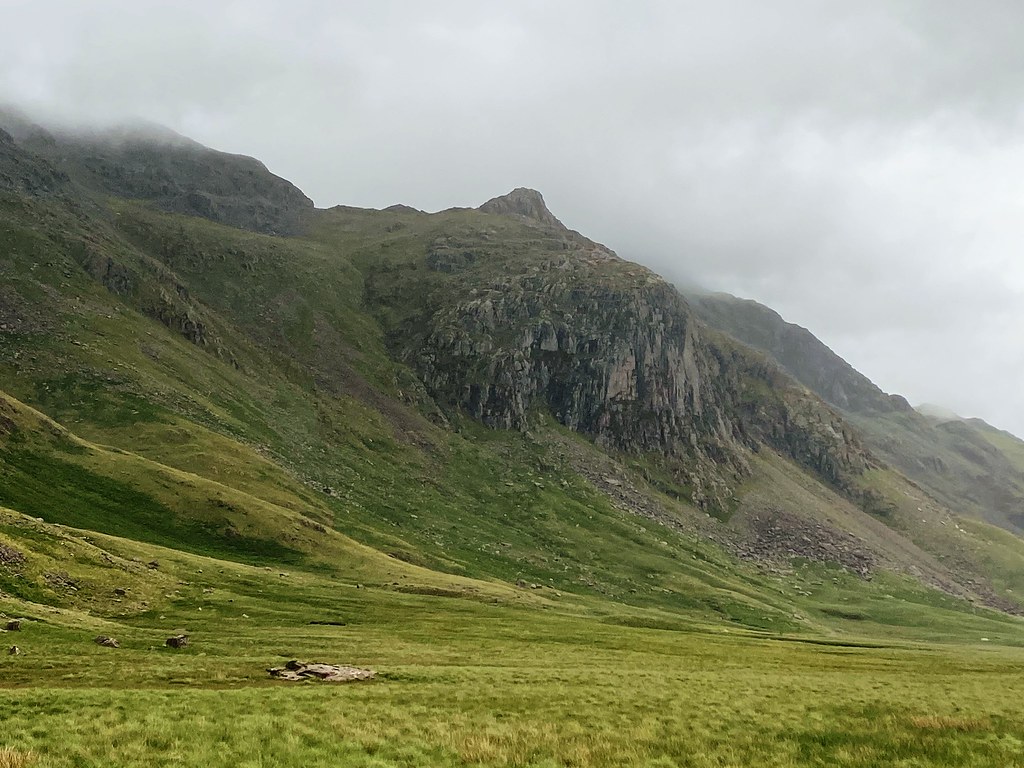
Upper Eskdale is an awesome valley. There are no roads and few footpaths. The route to the mountains of Eskdale means a long walk over the very boggy ground of Great Moss. Well worth the effort though, as hiding here is some of the best scenery in the Lake District.

Our original planned route included five Wainwright’s over four or five days. But Tobey’s aim for this trip was to camp on Pen and see the sunrise from the summit of Scafell Pike. Alas, the weather forecast showed only one morning with the promise of clear skies, so we changed our route.
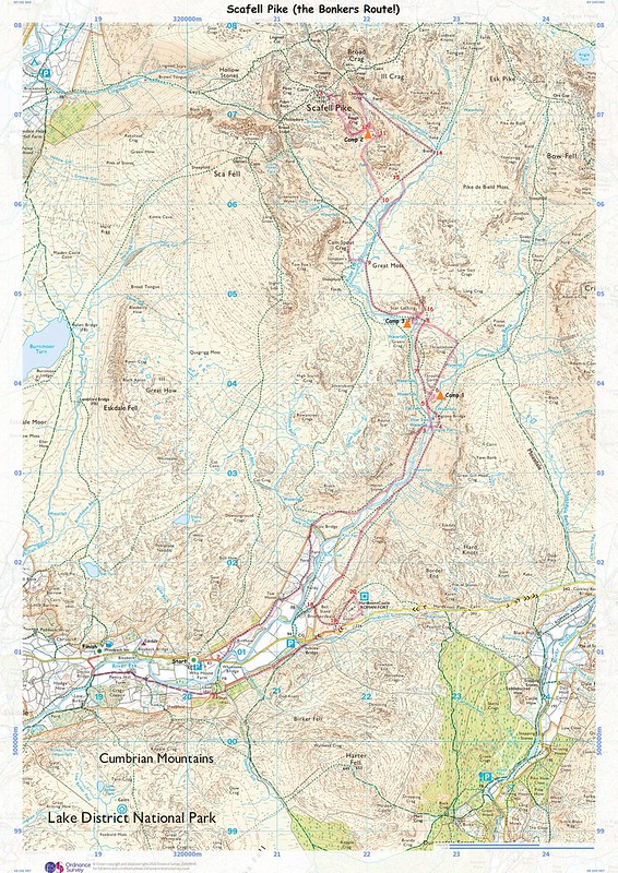
We wanted a quiet route to reach England’s highest peak and chose one of the remotest through Great Moss. Upper Eskdale is wild and a relatively unspoiled valley. It has everything we wanted; a beautiful river with waterfalls and pools for a swim, pathless navigation, remoteness and solitude. We would have settled for less water in the bogs though!
Our route started from the small car park opposite Wha House Farm and followed the River Esk to Great Moss in Upper Eskdale. You can walk on either side of the river. We chose the western side. If I do this walk again, after days of rain, I will choose the other side! It is wilder on the western side, but it was just one big overflowing bog. To reach this path, we turned left off the road at Whahouse Bridge.
We followed the track (which had more water flowing than the river) to Scale Bridge, along a dry stone wall descending to the River Esk.
Whilst route planning on OS Maps, this section had lots of exclamation marks indicating boulders and marsh. Take note next time!! Very wet and boggy all the way along. Wet feet could not be avoided. Despite this, the sun was shining and our spirits high.
As we approached Tongue Pot, the path veers left and climbs steeply, mostly obscured by thick bracken. We wanted to camp somewhere nearby but the only option on this side of the river was bog. We could see Lingcove Bridge below us and some drier looking grassy areas.
The last of the swimmers had left the pools at Tongue Pot so we descended to the river, took our boots off, and waded across. We had a refreshing wild swim in the crystal-clear pool below the roaring waterfall.

Then we headed to Lingcove Bridge. Disappointed to see evidence of fire scars in the sheepfold and several discarded camping chairs.
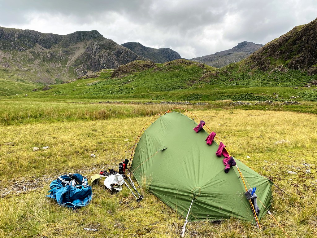
We found a camp spot higher up, with a lovely view down the valley and a secluded waterfall and beautiful pool just behind us.


Spag Bol for tea tonight. Then the rain came, so we retreated to our tent where I lost several games of UNO and Transformers Top Trumps. I slept really well with the soothing sound of the waterfall and woke early from the sound of birds singing (looked like blue tits in the oak tree).


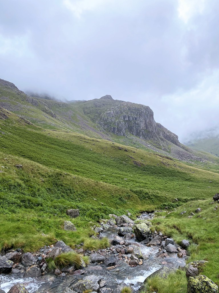
We packed up camp and the rain started. Rain, mist and poor visibility were forecast all day. Tobey was keen to practice his navigating skills with map and compass. We continued to follow the river towards Scar Lathing. The views become progressively more spectacular with waterfalls and high mountains all around. Disappointingly, the cloud stayed low and we did not get the anticipated views of the Scafells.


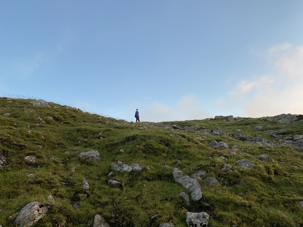
The trails are very wet and our feet are already soaked so we simply take the shortest routes to where we want to go, whether this was straight through a bog or not. Tobey is very fit and, despite carry a big pack, is leaping up the steep climbs. I, however, am not! I tell him I am bird watching so am taking my time. I am rewarded with seeing ravens on the crags and a male stone chat in the bracken and what I think were meadow pipits.
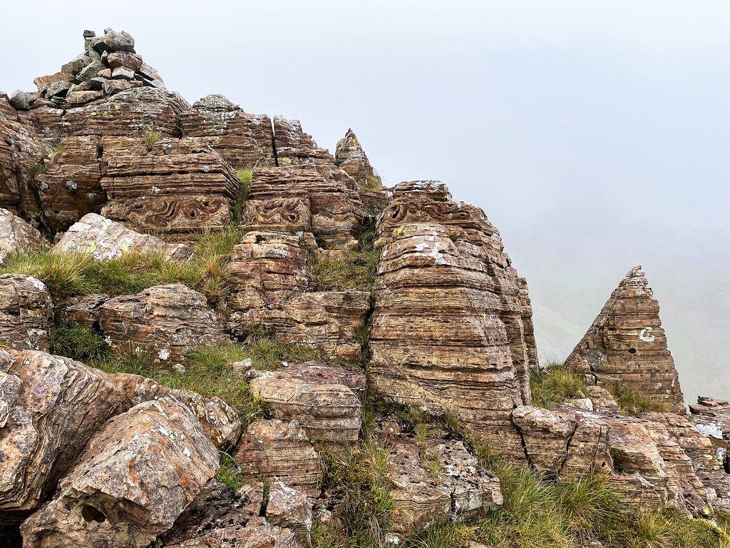
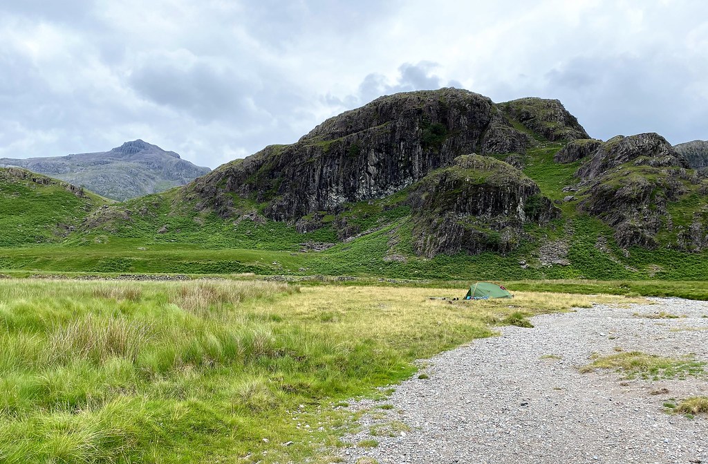
The valley opens out and is wide and boggy with the rocky river through the middle. Great Moss is like a huge amphitheater with high mountains all around. We took shelter under one of Sampson’s Stones to have dinner and I felt extremely small sitting there. It is an awesome place even in the mist. Sampson’s Stones are a collection of huge boulders, the result of a rock fall from Cam Spout Crag. They are some of the finest volcanic rock clusters in the UK and a popular bouldering spot.


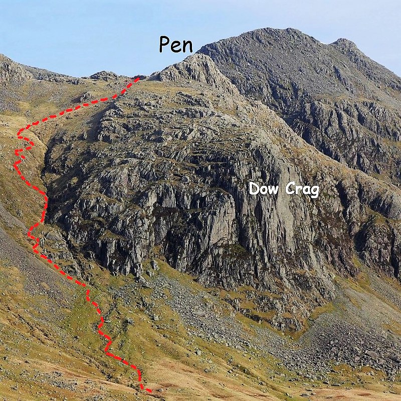
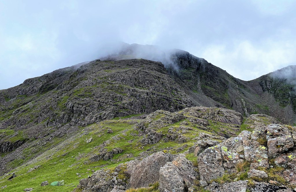
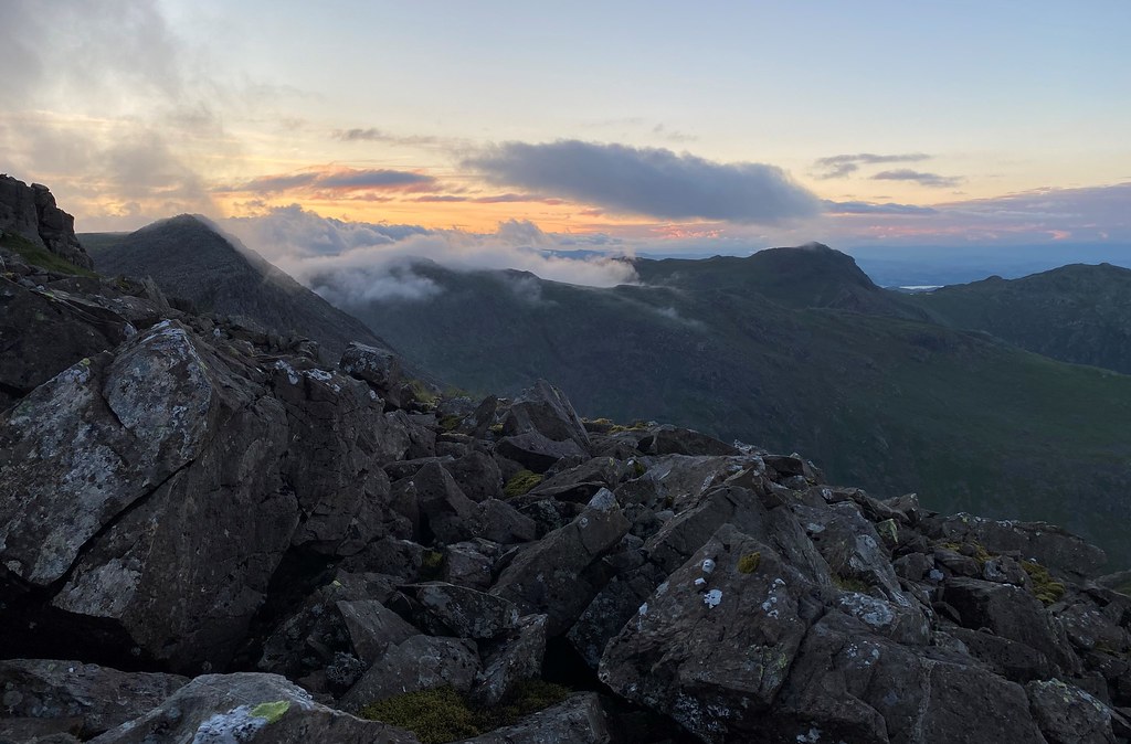
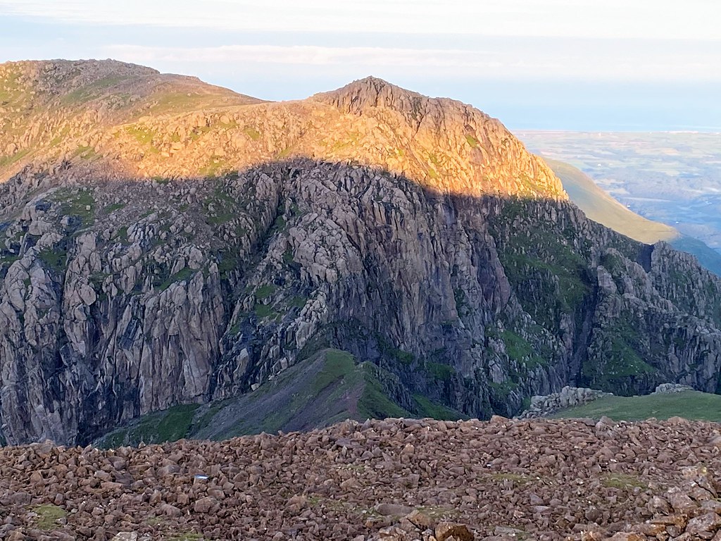
Briefly, the clouds thin out and the Scafell Massif makes a sudden, dramatic appearance. At last, we can see the summit of Pen emerge on top of the impressive Dow Crag. Our planned route following scree up a gully to the left of the buttress becomes noticeable. At this point, Tobey just looked at me and said “Mum, you are joking right? We’ll never get up there with these packs, it’s vertical and there isn’t even a path!” Then he said, “At least we haven’t got canoes this time.”
Pen, perched on top of Dow Crag.
Cam Spout.

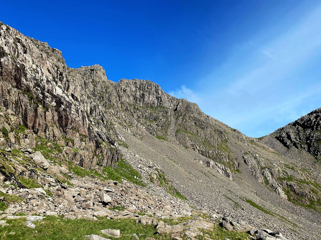
We reach Cam Spout Crag, refill our water bottles then we cross How Beck. There is a small cairn to mark the point where we leave the main path and start following the gully as it climbs alongside Pen. The ascent is tough and very steep, and it was so warm our energy levels were drained very quickly. Jelly Babies, Mars Bars, Tobey’s enthusiasm and teamwork got us up there.

Our route up Pen.
Visibility was very poor; it was raining heavily and careful navigation was needed. Scrambling up the rocks was more enjoyable than the steep grassy areas at the start of the climb. The route steepens further and then all of a sudden, we reached a broad, rocky gully and some grassy areas. The forecast was to stop raining at 6pm so we decided to set up camp first and wait for the clouds to clear before the final ascent to Pen summit.


Whilst looking for a good place to camp, the blanket of cloud occasionally gave us bursts of blue sky and brief glimpses of Scafell, Broad Crag and Ill Crag. But still Scafell Pike remained hidden. Then the cloud would roll over the summits like a wave, descending at speed into the valley. We were both in awe of our surroundings. This is an incredibly special place indeed.


I will never forget Tobey’s face as the clouds cleared and he saw the view down to Great Moss for the first time. He thought it was incredible. He was also shocked when he turned around 10 seconds later and could not see a thing! Without realizing it, Tobey has learnt a valuable lesson today. He has experienced for himself poor visibility in the mountains and he said that if we did not know how to read a map and use a compass, we would be lost. He seems to have inherited my love of paper maps and geography! He has been using the compass and taking bearings all day and worked out which way we needed to go to reach Scafell Pike. Also, he has not complained once about the weight of his pack or his wet feet!

Looking towards Rough Crag and Scafell Pike.
As we retreated to the tent to wait for the weather to clear, Tobey mentioned the drop in temperature up there and put on his extra warm layers and changed into dry socks without being asked – amazing!
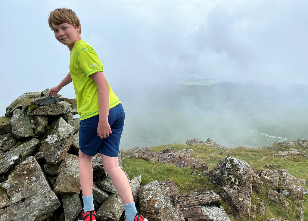
We had our tea and it did stop raining and the clouds cleared. Tobey was keen to explore and scramble to the summit of Pen. We chose a direct route from our sheltered camp spot to the top. Pen’s summit has a small cairn on top and is like a fortress of rock that is just plonked on a patch of grass. We enjoyed the easy scramble to reach the top of Pen. Looking east out over the Moss gives the impression of being very high up. Looking the other way is rather humbling with the summit fortresses of Scafell Pike, Broad Crag and Ill Crag towering overhead. Pen really is just a small protrusion on the east side of Scafell Pike but it is a wonderful viewpoint and there wasn’t another soul to be seen amongst this very grand and wild rock scenery. The River Esk looks a long way down from here.
Pen Summit.


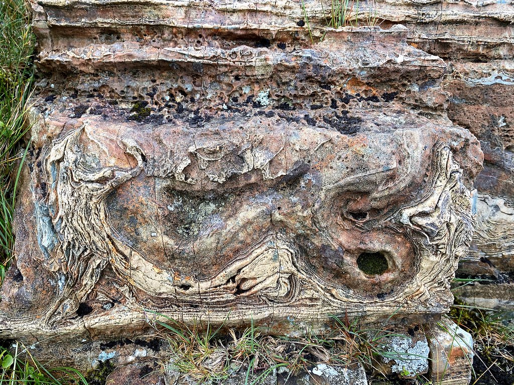
The rock formation is formed from the direct fall out from volcanic eruption and from the sediment deposited by rivers and mudflows.
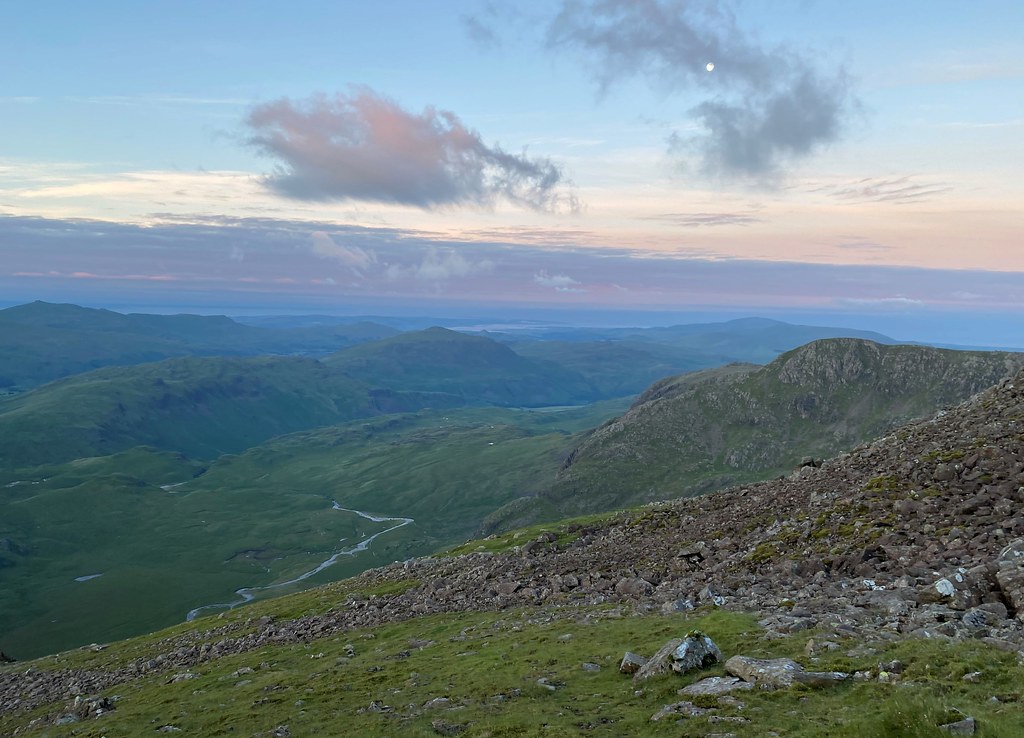
From Pen we looked across to work out our route up Rough Crag in the morning. We scrambled up to a cairn that marked 768m on the OS Map. We found a small tarn and looked for an alternative route out for tomorrow. We will be able to descend via Little Narrowcove which was a relief.

Early to bed tonight as we are getting up at 3am ready for our ascent of Scafell Pike.
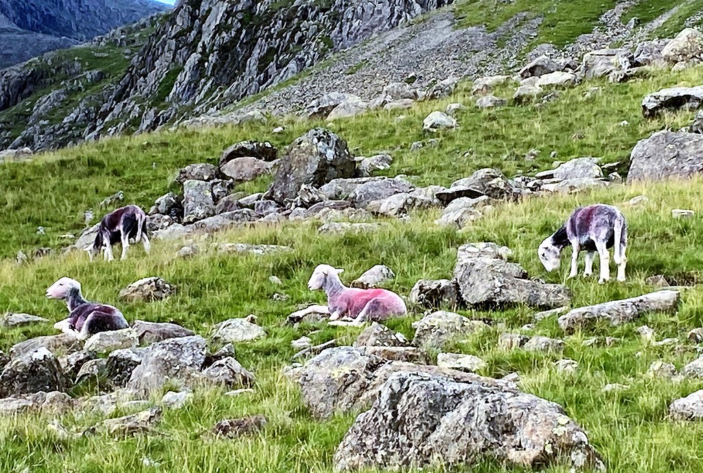
3.30am and brews drunk, we set off completely off-piste, in a north westerly direction following Tobey’s bearing until we reached a scree slope at the base of Rough Crag. After the scree we clamber over a series of rock terraces and patches of grass, heading towards Chamber’s Crag. From here we follow some Herdwick sheep up a feint path that appears from nowhere to the final section towards the summit.

Looking towards Ill Crag.

On Rough Crag.

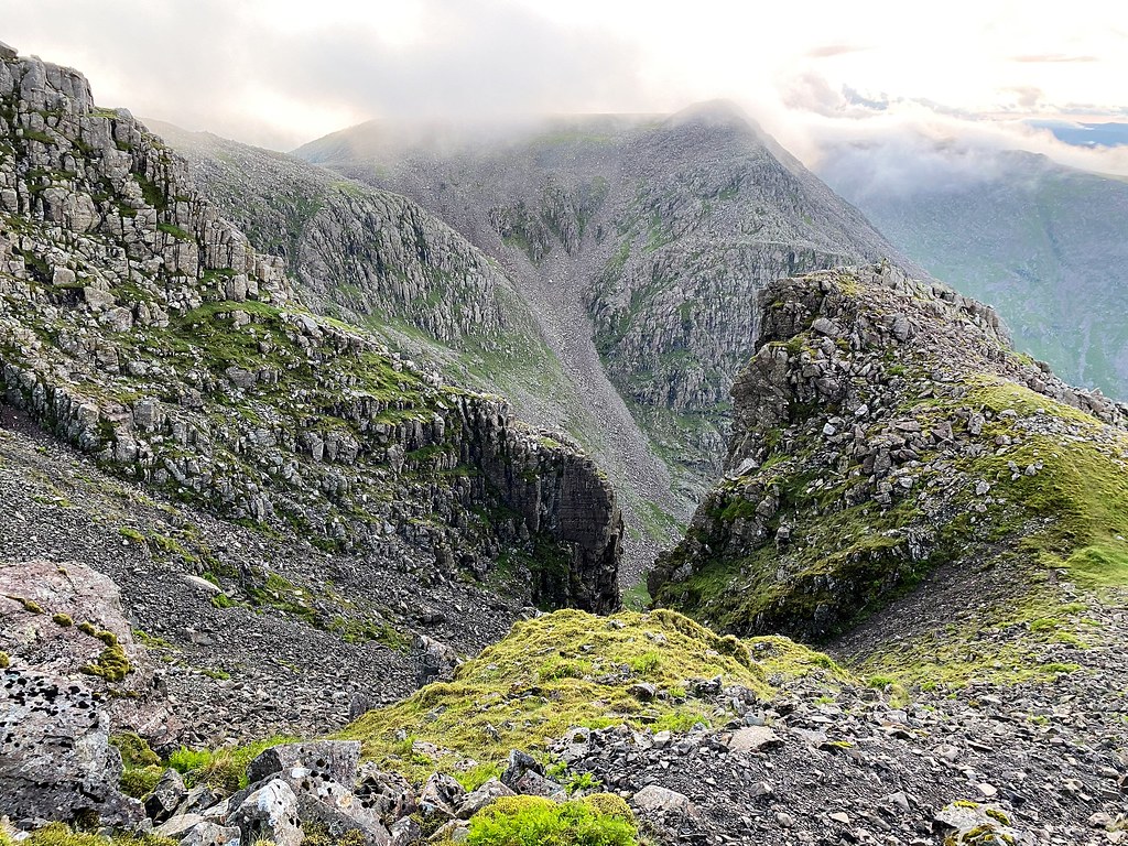
In my opinion this is Scafell Pike’s best side. The superb views of Eskdale and the views down Little Narrowcove to Ill Crag are spectacular.
Looking up to Scafell Pike.

Looking down to Great Moss.
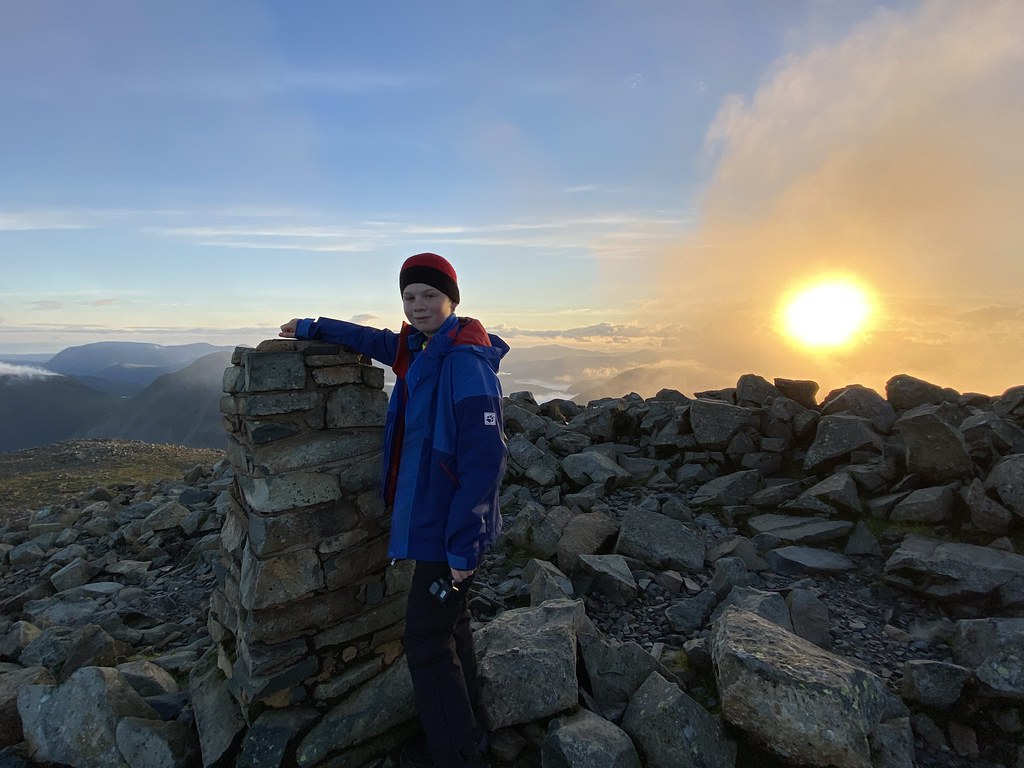
Tobey goes on ahead towards the summit cairn of Scafell Pike to see if he is the only person up there. He is in luck, 4.30am and all alone on the top of England. I soon joined him. It was very windy up here and the temperature was reading as 3ºC. We watched the sun rise and could see clouds below us in the valleys. I cannot describe the feeling and elation that we both felt, being privileged to see the sunrise so beautifully and to have the summit of England’s highest mountain all to ourselves. We celebrated by eating Mars Bars and Jelly Babies for breakfast whilst sheltering from the wind behind the summit cairn and just soaking up our surroundings.

Chambers Crag.
Nearly there!
Tobey on his way to the summit cairn.

I never thought I would think the top of Scafell Pike as beautiful, but on this occasion, it is magnificent. Tobey said that all the effort to get here was so worth it.


Sunrise on Scafell Pike Wednesday 8 July 2020, 4.47am.


Tobey’s aim to see the sunrise from the summit of the highest mountain in England – completed!
Looking towards Scafell.
Wast Water.

Taking shelter from the wind.

Time to head back down the way we had come to pack up camp.

Looking down Rough Crag towards the summit of Pen.

Our actual route to the top.

Bags packed, we pick our line of descent carefully down loose, broken slopes down into the wonderful hanging valley of Little Narrowcove (another geography lesson). We are aiming for the bottom of the river valley and the River Esk. It is quite steep as we walk parallel to the stream enjoying the glorious sunshine with just a few Herdwicks for company.
Looking up to the top Little Narrowcove.
Looking down Little Narrowcove.

Looking back from Great Moss.

Scafell on the right and Cam Spout.

We followed the river until we reached a lovely spot near Scar Lathing that Tobey had chosen as a place he would like to camp on the way up. It was only lunch time but we were tired, so we paddled across to a shingle beach next to the river and later, set up camp here.
Crossing the River Esk.


A few fell runners and hikers passed by, the first people we had seen since the first day.
We spent a relaxed day in the sun, swimming in the river, making brews and just enjoying the amazing view. The rain that had been forecast for lunch time did not appear until 7pm. By then, we had already had tea and were settling down to play cards in the tent.


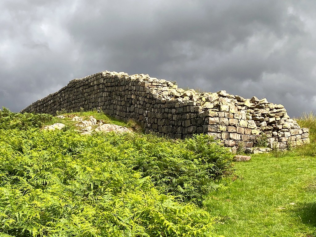
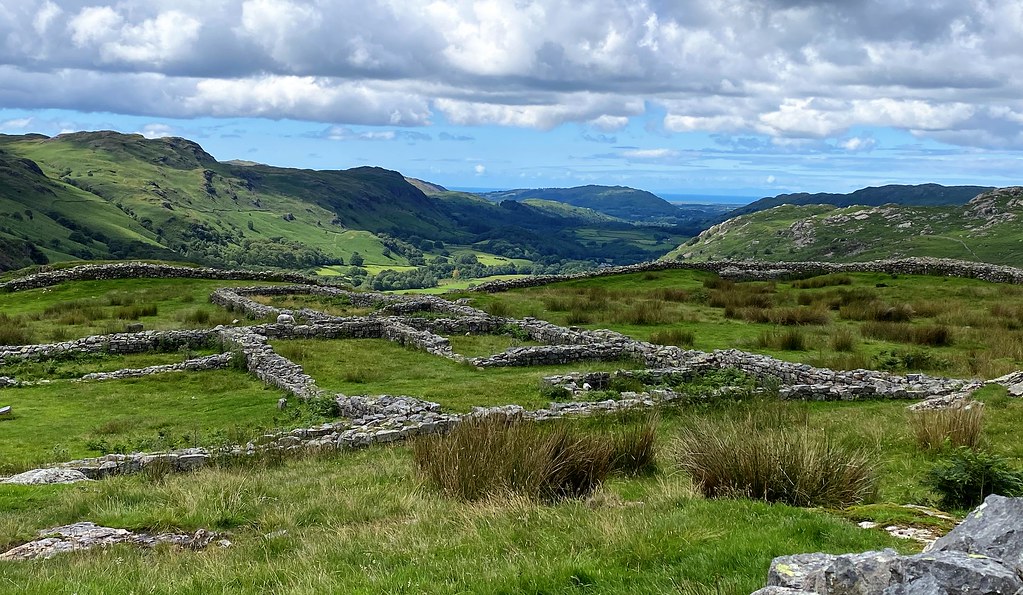
During the night rain and wind battered the tent but by morning it had stopped. We headed off back down the valley on the eastern side of the river to Brotherikeld. Tobey had spotted Hardknott Castle Roman Fort whilst planning this route, so we detoured to explore. Today, we had a history lesson as Tobey told me all about the Romans.


I cannot believe that I have passed this fort so many times whilst driving by but have never visited. Awesome views and well worth exploring. A dramatic landscape with the dark clouds overhead. Thanks to Tobey for including in the route!

We had a very enjoyable walk back towards the village of Boot, crossing Jubilee Bridge and walking through fields and woodland until we reached the Woolpack Inn, the end of our backpacking.
I have to say that this is one of the best walks I have ever done in the Lake District. Pen is a magnificent summit and an awesome place to camp. The ascent of Scafell Pike to watch the sunrise with my son was perfect thanks to the weather and having the summit to ourselves.
Pen was a new summit for me. I am still not sure how it missed being a Wainwright. This was my 9th ascent of Scafell Pike and the first time I have seen the views from the top and no crowds. I have never particularly enjoyed this mountain or its summit, until now. From Great Moss and Pen, Scafell Pike is truly majestic and every inch a mountain. At sunrise, with not a soul in sight, the summit is beautiful.
Although we did not cover a lot of miles, we took our time wild camping and enjoying just being in this beautiful location. This trip has reminded me why I love back packing and being in the mountains. Although Tobey was not in school, he has learnt a great deal whilst being out here.
For Tobey, it was not about bagging summits, it was about his desire to camp on top of a mountain, get up in the dark and watch the sunrise from the top of England. And he wanted the summit to himself! Seeing his delight and appreciation of our awe-inspiring surroundings was reward enough for me.

A superb route. I doubt Tobey will ever forget his first ascent of Scafell Pike. I certainly won’t.
Cheers,
Lynne & Tobey
