free to be able to rate and comment on reports (as well as access 1:25000 mapping).
This is the continuation of the report from a long walk across Europe in 2003-4.
The first part of the report can be read on this link. The previous post can be read
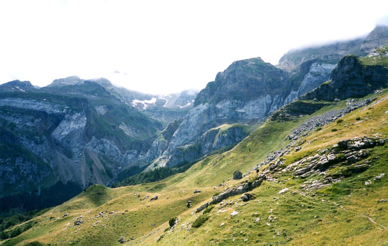
here.Day 47We set off from Zuriza, heading up the valley to the east. Great towering rock peaks filling the view on our right, reminding me of the Towers of Paine in Patagonia. Woods and pastures give way to stunted trees and gorse, before we emerge again on grassy hillsides for the final stage of the climb to the pass, at 1941 metres our highest point so far.
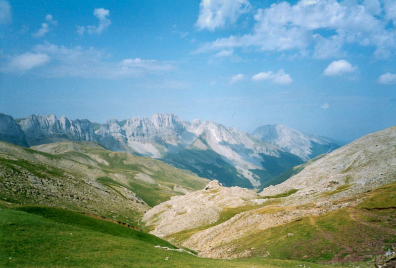
From here, the great rock towers no longer dominate, as even higher, gaunt peaks rise in all directions. Most of the descent down to the Echo valley is well graded on a grassy path leading through a carpet of vivid purple Pyrenean Irises, covering the ground as completely as bluebells in any British wood, whilst to the north slender pinnacles of rock soar above the French side of the border – the Aiguilles d’Ansabere.
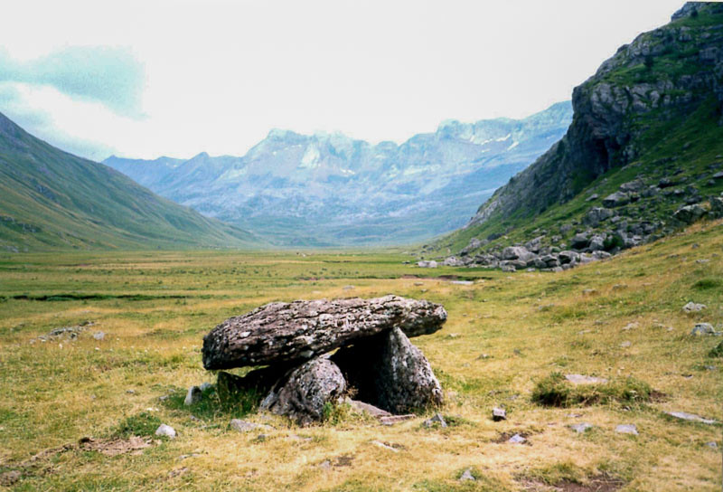
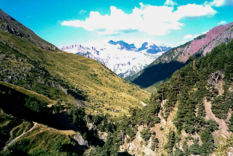
Once down in the Echo valley there is nothing except the head of a tiny road, and circling red kites, so we again begin to climb, heading up the side valley opposite. After passing through a band of rocks we emerge on a flat, green plain at sixteen hundred metres, ringed by mountains except for our rocky entrance where the stream suddenly plunges out down a series of cascades. This is Aguas Tuertas, or ‘Sweet waters’. It’s a wonderful place to camp, and we set up the tent beside an ancient dolmen, but the herd of cattle which is the only other sign of man means it doesn’t live up to its name and I have to wander back half an hour down the valley to find fresh water. We’ve drank an incredible twelve litres today, and need more to cook and for the morning. It’s now half past eight and we’re finally snug inside the tent for the night. Today’s electrical storm has just arrived – I’m glad it’s four hours late!
 Day 48
After packing up our gear we enjoy the leisurely walk up Aguas Tuertas, the easy ground underfoot meaning we can concentrate on watching the Griffon Vultures gliding in endless circles overhead. Then we start on the climb to the next high pass, leading to the Ibon (or mountain lake) d’Estanes – or so we planned. ‘Climb steeply up a rocky-sided bowl with a grassy bottom,’ claims our guidebook – but we choose the wrong bowl out of seemingly hundreds. We end up wondering up and down rocky slopes for three hours before I finally scramble up some airy rocks to reach a lake – but it’s the wrong one. However it means we again know where we are and can descend and reclimb to rejoin the correct route – all extremely frustrating as today was supposed to be easy. There is compensation though; whilst far from the trail we see
Izards, short-horned deer like creatures which are a relative of the chamois. They leap up and down seemingly vertical rocks with incredible agility, mocking our hours of painful attempted progress.
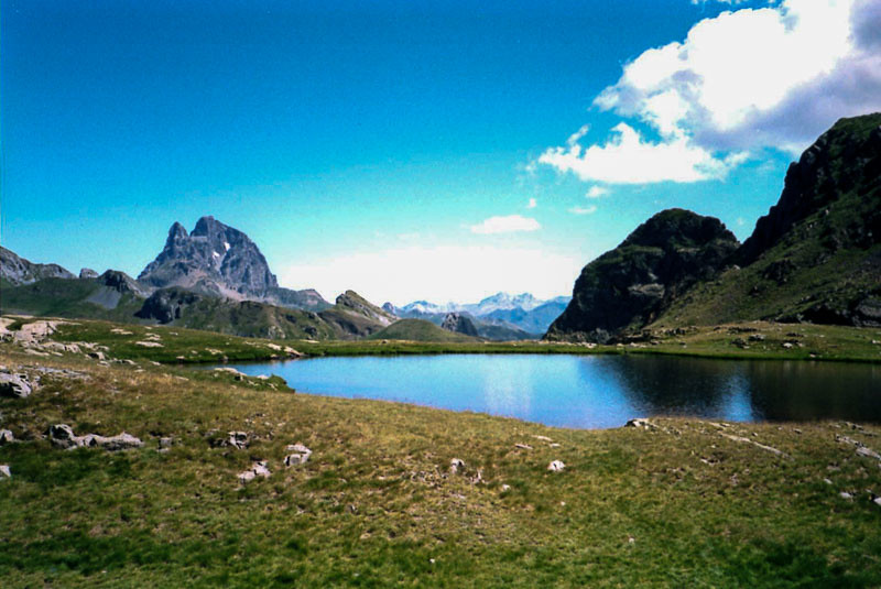
At last we arrive at the right pass and look down on the right lake, a surprisingly large and beautiful sheet of deep blue in sensational surroundings.
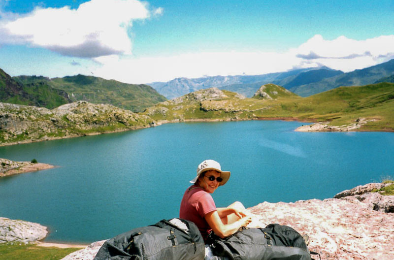
The route traverses round the awkward slopes above for an hour before dropping down to a well-walked trail which has brought many hikers up to the lake from France – the first we’ve seen since before Isaba. We follow the trail down into France before breaking away to traverse round the head of the Aspe valley.
Glancing ahead, we’re alarmed to see a section of ‘path’ further round the valley, which cuts across a near vertical slope of scree and rocky mud. Reaching it we steady ourselves and gather together what nerves we have before beginning to walk nervously across it. The first section isn’t as bad as it looked, but half-way across the original path has been taken away by a recent landslide leaving only a two inch deep groove in the mud and stone bank. The only way to continue is to face uphill and edge across sideways, using only the toes of our boots to prevent a slide into the crumbling abyss below. Helen was in front and turned to jelly at this point, saving me from the embarrassment of having to call her back if she had crossed it and I found I couldn’t. So we turned back.
It seemed a momentous decision as this meant retracing our steps and then descending deep into the Aspe Valley and France, abandoning Spain and our planned route. But on eventually reaching the road far, far below we gird our loins and decide to try to walk over into Spain via the Somport pass, adding another two hours to an already epic day. We eventually cross the pass and arrive into Candanchu, an ugly ski resort with fantastic views, just as darkness falls. Wandering round the abandoned buildings we find an open hostel with beds, and then a richly deserved ‘plato combinado’ – basically a feast on a plate. After such difficulties we’re delighted to have made it here. We’ve clearly become much fitter than I’d thought!
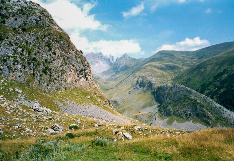
Day 49After finding yesterday’s route across the washed-out scree simply too hair-raising, we study our guidebook with care this morning for word on any hazards ahead. Yesterday’s horrors merited the comment ‘cross a steep scree slope (care is needed)’ whereas today’s route includes the alarming description ‘somehow find a path up the dauntingly steep rock face at the end of the valley’. This sounds even worse – but how much meaning can we put onto care-free words of description by an author who probably finds it all very easy?
So we ascend up a long, tiring valley with some sense of trepidation, only to find that the ‘steep rock face’ actually has an excellent path with little exposure. It seems yesterday's scree problems had been probably been caused by recent landslides temporarily taking out the path.
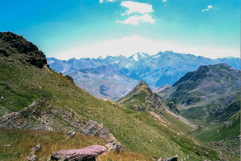
At the top we reach a couple of gorgeously deep blue lakes with stunning views across into France; here we settle down for a special lunch. We’ve reached two thousand two hundred metres, our highest pass so far, and today is our fourth wedding anniversary. We’ve bought wild boar pate and French toast up from Candanchu as a celebratory feast. I’ve never felt happier.
Three Spanish men approach us from below, asking for directions to the Pico d’Anayet. I point out the shark-tooth like peak of rock to the southwest and they set off towards it, leaving me thinking that if you want to climb such a hair-raising peak maybe you should at least have the navigational nous to work out which one it is. Clearly we’re just cowards!
The descent ahead is long, but with further carpets of Irises and views ahead of the great, snow-clad Balatious massif, it couldn’t be more idyllic, all the way down into the small town of Sallent de Gallego.
We are going to stay here for our first rest day for a couple of weeks, but can only find a hotel with a vacancy for one night. Never mind; it’s our first en-suite room since Cape Finisterre and it even has a bidet, perfect for cooling a decent bottle of cava before heading out for a relaxing meal. It’s been a fantastic anniversary. We’ve been getting on better than at home, which is amazing considering our poor language skills mean that talking to each other is the only real conversation we get to have. Never have the simple things such as food, a bath and a bed given so much pleasure.
Day 50Sallent has the most incredibly beautiful setting of forest, river and mountains and also many fine old buildings, but it’s becoming an increasingly important tourist centre and there are many cranes and construction sites; it feels like its charms could be gone in a few more years. We have the indignity of having to leave the hotel and move onto the packed-out campsite – it seems there’s going to be a big music festival starting here tomorrow which is why we couldn’t get a room. It’s slightly worrying that crowds of youths are walking up to the site, laden down with huge crates of lager. Still, we need the relaxation time.
The post office doesn’t sell any packing materials so we have to raid a dustbin for old sheets of cardboard, making a box to post camera films and San Fermin outfits back home. By the time we’re back on the campsite, there’s barely room to move for all the canvas and guylines. We crawl into our tent and try to sleep, surrounded by thousands of happy, hippy teenagers sitting around drinking red wine and coke mixed together (a favourite of Spanish youngsters) and playing guitars. All night long. It’s like turning up, by chance, at Glastonbury and hoping for a quiet night.
Next stage