free to be able to rate and comment on reports (as well as access 1:25000 mapping).
The Tour of the Matterhorn is a circuit around and among the largest cluster of 4000m peaks in the Alps. It is mainly in Switzerland but also ventures into Italy. It involves two glacier crossings which are easy in good weather but would be challenging in bad. For this reason it is necessary to be flexible in planning and not leave yourself on the wrong side of a glaciated pass with a plane to catch. Accommodation is in mountain huts or hotels and is possibly the only thing in Switzerland which is good value. DBB was 81CHF in places that might have to be supplied by helicopter. Cicerone publish an English guidebook and the walk has its own website. This is a brief account of a trip I did with my wife and son in the summer.
Day1Because the walk is a circuit you can start where you like. We began in St Niklaus down valley from Zermatt. A local cableway lifts you up the very steep valley sides to the picturesque village of Jungu and takes you back 100 years. There are stunning views of the Dom and right up the Mattertal to the Breithorn. We then had a very scenic 950 m climb to the Augstbordpass and then a similar drop to the remote Turtmanntal with its solitary hotel.
img]
 IMG_4708
 by
Trevor Price, on Flickr[/img]
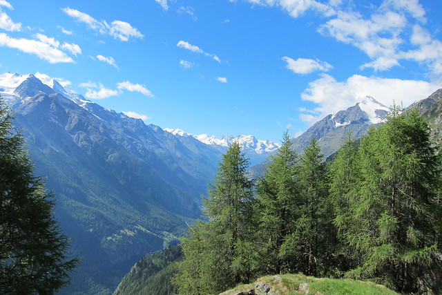
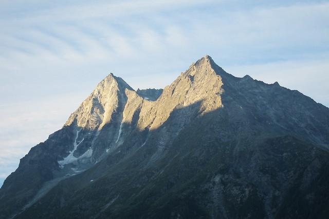
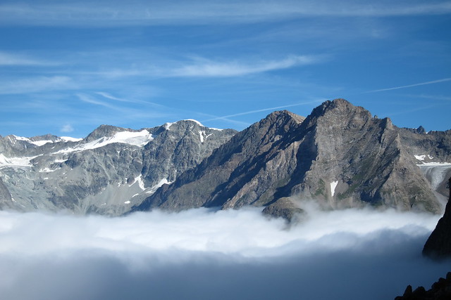
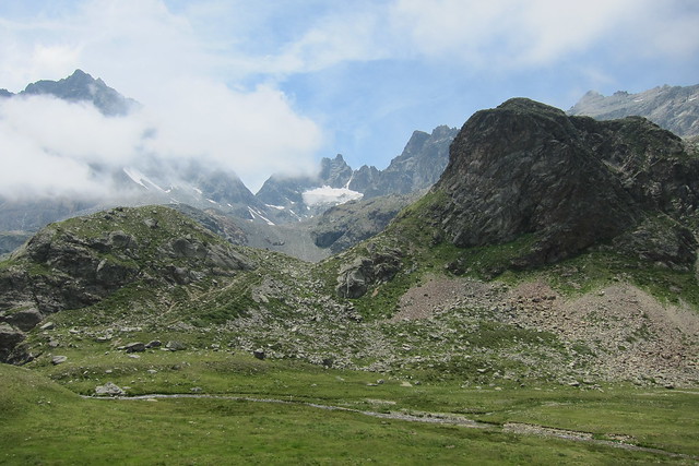
Looking up the Mattertal to Monte Rosa and the Breithornimg]
 IMG_4711
 by
Trevor Price, on Flickr[/img]
The route up to the AugstbordpassDay 2Today we needed to reach Zinal. There are two passes to choose from and we chose the Forcletta. This is reached by steep slopes to the alp of Chalteberg with its wonderful views of glaciated peaks and then up beautiful flower covered slopes to the pass. This gave us a grandstand view of the Val d'Anniviers which is arguably the loveliest Swiss valley. A long descending traverse eventually took us to the small town of Zinal where we stayed in a very characterful mazot behind the Auberge Alpina.
img]
 IMG_4721
 by
Trevor Price, on Flickr[/img]
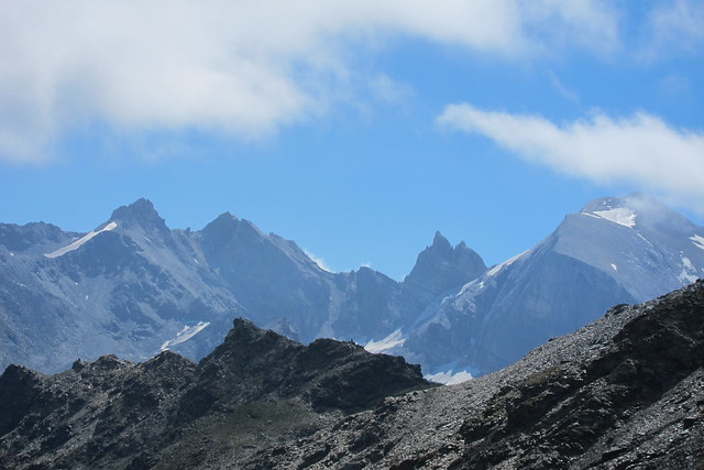
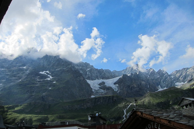
Bishorn ( think)img]
 IMG_4723
 by
Trevor Price, on Flickr[/img]
Stellihorn to Brunegghorn (I think)img]
 IMG_4740
 by
Trevor Price, on Flickr[/img]
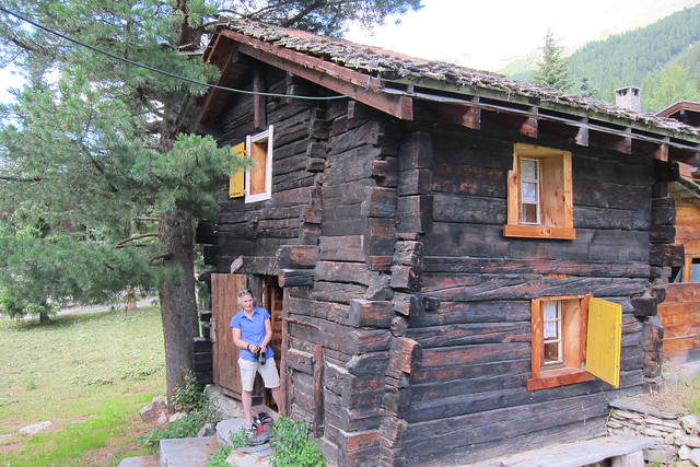
The MazotDay 3A stay in Zinal entitles you to a free ticket for the cablecar and the postbus. As the next day was a bit brutal and the tops were in cloud in the morning we succumbed to the temptation but even with assistance it was a longish way and a big descent into the Val d'Herens where we stayed at La Sage. Even though this was in a very smart hotel it had walker's rooms in the attic and was exceptionally good value. This was also the standout day for wild flowers.
img]
 IMG_4745
 by
Trevor Price, on Flickr[/img]
Moiry Glacier with Grand Cornier behindimg]
 IMG_4766
 by
Trevor Price, on Flickr[/img]
The way up to the Forcletta passDay 4Almost a rest day although it didn't feel like it. There was a descent into Les Hauderes with its views of the Dent Blanche and then a climb up a gorge to Arolla at 2000m with two tough days ahead. We took a diversion to the popular but amazing Lac Bleu and then a spectacular path with a lot of up and down to Arolla.
img]
 IMG_4789
 by
Trevor Price, on Flickr[/img]
Early morning light on the Dents de Veisiviimg]
 IMG_4800
 by
Trevor Price, on Flickr[/img]
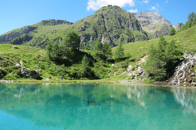
Lac Bleuimg]
 IMG_4801
 by
Trevor Price, on Flickr[/img]
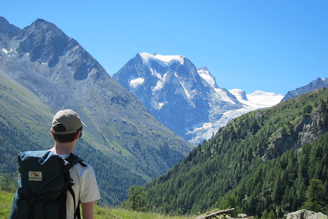
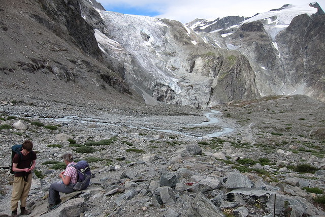
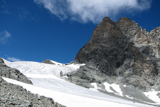
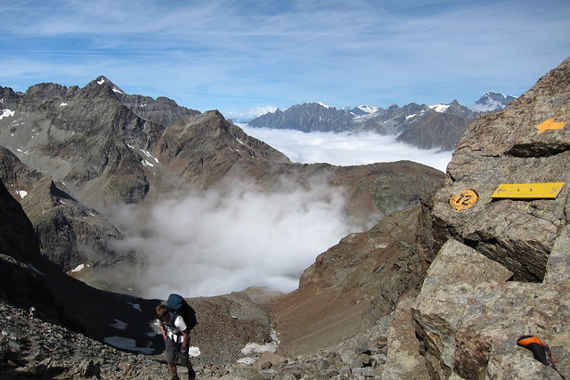
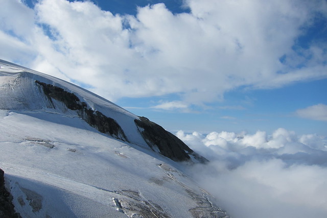
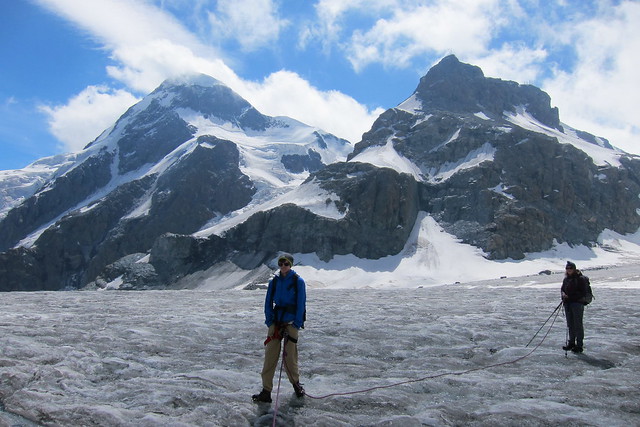
Mt CollonDay5I had last visited Arolla 38 years ago and while the village hadn't changed much I was staggered at how much the glaciers had retreated. There was still however a lot of very spectacular ice particularly on Mt Collon. Our route essentially followed the line of a glacier around this and the scale felt Himalayan. Most walking was on moraine but there were two places where the glacier needs to be crossed. It was a dry glacier with no significant crevasses so we didn't need a rope. Despite a delay caused by crampon malfunction we got to the top and the Italian border by early afternoon. The Italian side was a lot greener and we had a long and stunningly beautiful descent to the Rifugio Prarayer. This was a great place with more food than we could eat and very friendly - even after I broke their screwdriver fixing the aforesaid crampon.
img]
 IMG_4823
 by
Trevor Price, on Flickr[/img]
Icefall on Mt Collonimg]
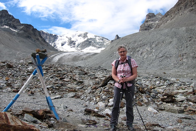 IMG_4827
 by
Trevor Price, on Flickr[/img]
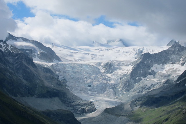
Haut glacier d'Arolla. Our route climbs the moraine and then follows the glacier up right.img]
 IMG_4834
 by
Trevor Price, on Flickr[/img]
The route up to Col Collonimg]
 IMG_4836
 by
Trevor Price, on Flickr[/img]
L'Evequeimg]
 IMG_4838
 by
Trevor Price, on Flickr[/img]
Crossing into Italy at Col Collonimg]
 IMG_4851
 by
Trevor Price, on Flickr[/img]
Looking back up the Comba d'Orenimg]
 IMG_4860
 by
Trevor Price, on Flickr[/img]
Socks in quarantine at Rifugio PrarayerDay 6The next day was another 9-10 hour walk over a very steep col. The plan was to curtail this by staying in a high hut but as the forecast for the following day was iffy we decided to go all the way to Cervinia. We set off in mist but eventually got out of it at about 2700m with attendant brocken spectres and encounters with ibex and chamois.
It was vey steep and very wild but probably the finest day of the trip. There was hardly anyone else on the hill. The descent was astounding in its variety and beauty.
img]
 IMG_4871
 by
Trevor Price, on Flickr[/img]
Climbing up to the col de Valcorniereimg]
 IMG_4873
 by
Trevor Price, on Flickr[/img]
img]
Looking back from the col
 IMG_4874
 by
Trevor Price, on Flickr[/img]
The other side of the colimg]
 IMG_4877
 by
Trevor Price, on Flickr[/img]
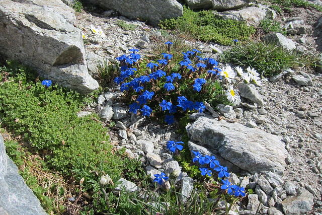
growing on the col at 3072mimg]
 IMG_4892
 by
Trevor Price, on Flickr[/img]
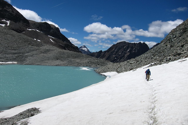
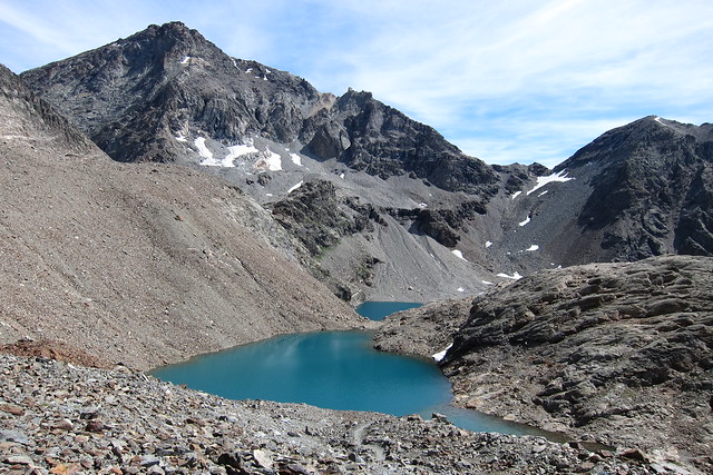
Lacs du Mont Dragonimg]
 IMG_4893
 by
Trevor Price, on Flickr[/img]
Looking south into sunny Italyimg]
 IMG_4909
 by
Trevor Price, on Flickr[/img]
retrospectiveimg]
 IMG_4919
 by
Trevor Price, on Flickr[/img]
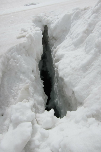
Room with a view in CerviniaDay 7The next stage involves crossing the Plateau Rosa at about 3500m and going back into Switzerland. Even the guidebook suggests taking the cable cars to pass quickly over the environmental vandalism of the ski industry. It may look stunning in winter but could make you weep when the snow has gone. As the mountains were cloud bound we did not have a difficult decision. Happily the cloud started breaking above 3300m and we got views from the top at intervals. Having drunk our fill we said goodbye to Ian, a Kiwi/S African who we had been walking with for the last 2 days, and set off down the glacier into the mirk. I had been expecting this to be easy as it is a ski run but it was closed because some crevasses had opened across it. The problem was it was snow covered and you couldn't see them all. Just as well we brought a rope. We soon got out of cloud and onto dry glacier which was a lot easier. From here we could have gone all the way to Zermatt but I wanted to go off route on a more interesting but longer descent and also to sleep at the beautifully situated Gandegghutte. It was a lovely hut but next to a building site for a new cablecar.It didn't mention that on its website. Despite that, it was full -mainly with people going up the Breithorn- so I was thankful I had booked. This is incredibly easy as all hut bookings can be done online in English. Oh and after 7 Days we finally saw the Matterhorn!
img]
 IMG_4927
 by
Trevor Price, on Flickr[/img]
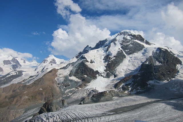
Glacier de Valtournenche from Testa Grigiaimg]
 IMG_4933
 by
Trevor Price, on Flickr[/img]
crevasse across the ski runimg]
 IMG_4941
 by
Trevor Price, on Flickr[/img]
crossing the Theodul glacier - Breithorn and Klein Matterhorn behindimg]
 IMG_4966
 by
Trevor Price, on Flickr[/img]
Breithorn and Klein Matterhornimg]
 IMG_4981
 by
Trevor Price, on Flickr[/img]
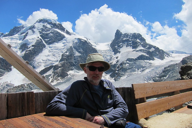
Me at the Gandegghutteimg]
 IMG_4983
 by
Trevor Price, on Flickr[/img]
Breithorn and Monte Rosaimg]
 IMG_4989
 by
Trevor Price, on Flickr[/img]
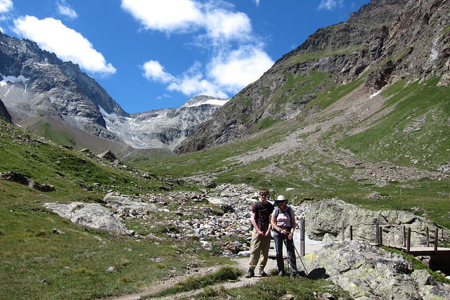
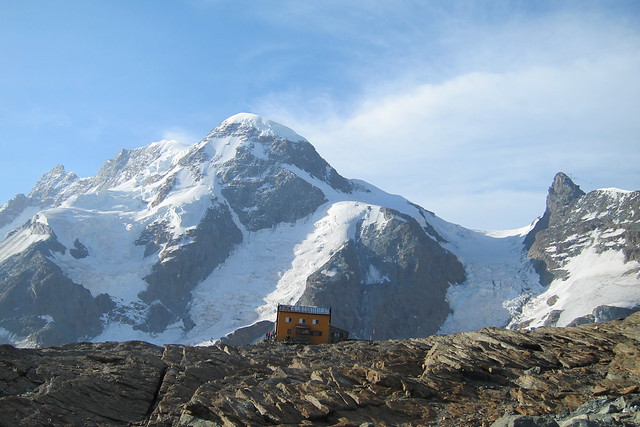
GandegghutteDay 8The official route heads straight down to Zermatt which seems daft when a traverse takes you round to the north side of the Matterhorn well away from most skiing infrastructure. Anyway we went this way and didn't regret it. Zermatt needs to be seen but it is very expensive and very touristy so we passed quickly through.
img]
 IMG_4990
 by
Trevor Price, on Flickr[/img]
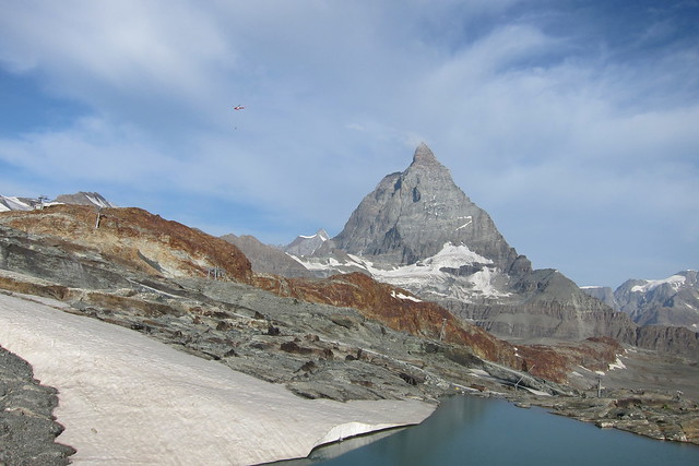
Matterhornimg]
 IMG_4991
 by
Trevor Price, on Flickr[/img]
Obergabelhorn, Zinal Rothorn and Weisshornimg]
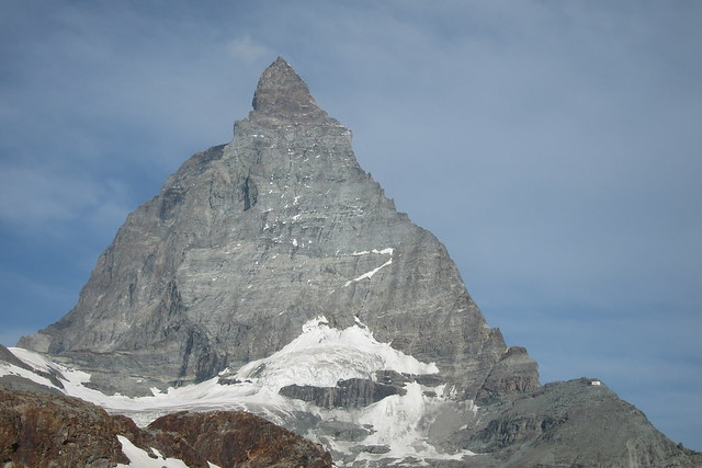 IMG_4992
 by
Trevor Price, on Flickr[/img]
Matterhorn. Note the large Hornli hut on the right. The Hornli ridge is the right skyline and is the easy way up. It is not difficult but dangerous because of loose rock. Two-thirds of the way up the Hornli ridge at the notch is the Solvay bivouac where many years ago I spent an uncomfortable night after a storm plastered the mountain in snow.img]
 IMG_5007
 by
Trevor Price, on Flickr[/img]
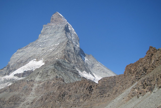
Matterhorn north faceimg]
 IMG_5016
 by
Trevor Price, on Flickr[/img]
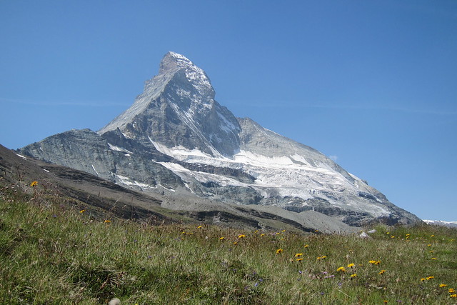
And againimg]
 IMG_5024
 by
Trevor Price, on Flickr[/img]
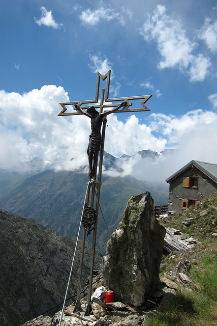
Iconic Swiss sceneDay9Back in the Zermatt valley there are 3 ways to finish the trek. The easy way is just to walk down the valley (or even easier take the train). The original trek followed the Europaweg but a vital bridge had been closed for years (a replacement opened the week after we finished- longest suspension bridge in the world at about 450m!).Because of this the website now directs you along the Weisshornweg from Randa to the Topalihutte and then back to Jungu. This looked really good and was the plan but the forecast for the last day was not good; as the plan involved crossing a pass at 3100m and then descending to Jungu and then getting the cablecar and then a 4 1/2 hour train journey to catch a plane we were a bit concerned we could do it in time. We could have in good weather with an Alpine start but possibly not in bad. We therefore decided to do a day walk instead which had the appeal of light packs. We therefore had a walk up to the incredibly situated but quiet Kinhutte where we had the undivided attention of the warden and his wife and also walked part of the Europaweg. A fine way to end the holiday.
img]
 IMG_5043
 by
Trevor Price, on Flickr[/img]
Tunnel on the Europaweg. With Swiss efficiency this remote tunnel has an electric light switch powered by solar panelsimg]
 IMG_5054
 by
Trevor Price, on Flickr[/img
Kinhutte looking to the Weisshornimg]
 IMG_5060
 by
Trevor Price, on Flickr[/img]
Descending. The Kinhutte is just below the skyline at the top left and well above what looks like it on the photo.It is another 10 -12 hours above it to do the Taschorn