free to be able to rate and comment on reports (as well as access 1:25000 mapping).
See previous reports 1-4 of Scotland's Watershed for the story so far
Classified Hills climbed
Munros Ben Lomond
Grahams Cruinn a Bheinn
Marilyns Beinn Uird, Beinn Uamha
I forgot to take my note book for notes and whilst I jotted down a bit when I came home, I realise that a few weeks on and some of my days merge in the memory. Hopefully this is a reasonably accurate account of my last trip on the Watershed. As usual photographs are by mobile phone
Day 1 Saturday 26th AugustThroughout this section the songs that went round and round in my head were mainly from Dylan’s “Modern Times”
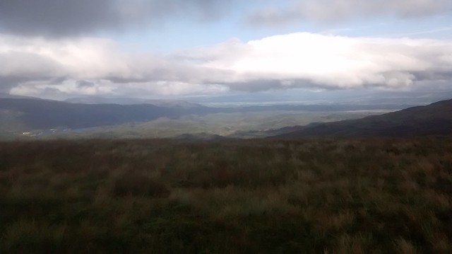
The earliest bus I could catch from Stirling to Arnprior saw me leaving the viewpoint layby on the B822 (Crow Road) at 12.40. The 2 mile walk up from Arnprior had been a pleasant warm up in the afternoon sun. The hills were turning purple with heather in full bloom, the brambles were ripening, marking the passage of time since I had last been out on the Watershed. There had been heavy rain in the week before but despite a distinctly negative forecast for some reason I remained optimistic that I had made to right decision to have a few more days out on the ‘Shed. The next 8 miles sorely tested that optimism.
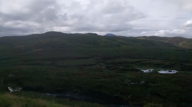
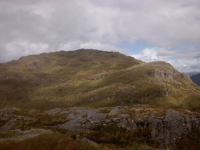
 Hill of Balgair
 by
Seal54, on Flickr
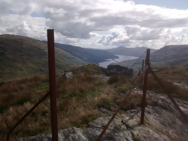
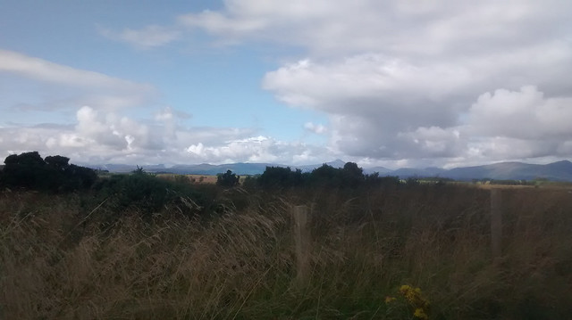 Start at layby on B822
 by
Seal54, on Flickr
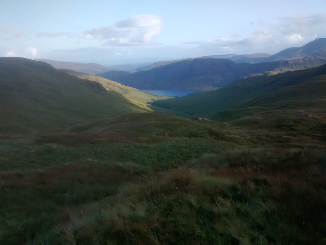
The stretch from the B822 to A811 is low-lying and boggy looking. In fact, the actual watershed isn’t always clear and I made a few errors both when drawing it onto my 1:50,0000 map and also on the actual walk (when I argued with my armchair-line). I also came across more cows than I had seen since Biggar. I crossed to Badenkep Farm where the woman of the farm assured me that the cows I could see wouldn’t be bothered by me or be bothersome to me BUT she warned that way was very soft. She repeated this not once, not twice but three times. I think she underestimated how “soft” it was and as I sloshed and splattered my wet way through the soft rush and tussocks to the A875, I reflected that this was not my favourite sort of walking, in fact it was leaving me thoroughly sweaty and bad tempered. I stumbled and fell in hidden dips and pools and to add insult to injury, a misplaced boot when crossing a fence and dyke together saw me rip my hand open in 4 separate places. I realised, as I used up most of the plasters in my 1st aid kit, that I couldn’t remember when I had last had a tetanus boost. The song that played in my head “Rollin’ and Tumblin’” from Dylan’s Modern Times. First, following a firebreak through a mature plantation (Dave Hewitt in 1986 found these trees to be “merely shrub-height”) then crossing a felled section of forestry my grumpiness was alleviated slightly by the sight of Ben Lomond rising cone-like ahead. Its magnetism pulling me onwards.
 Ben Lomond is calling
 by
Seal54, on Flickr
I must have looked a sorry sight as I squelched across the field behind Cairnhall. On the map there was a road marked down to the main road and I decided that this was preferable to yet another boggy field. I didn’t really notice the buildings of this “farm” as I approached but a large black Range Rover of the type favoured by the Royals drove up the farm road and disappeared behind the building when I was about ¾ the way across the field. 2 seconds later it reappeared, reversing at high speed and then driving around the house towards me, stopping just the other side of the gate. I hauled out my map and saw that I could turn to the right and go round through another field to join the access road further down. The driver of the Range Rover (and presumably the owner of the “farm”) called to me across the gate “Can I help you?” which I translated to mean “WTF are you doing here?” By now I could see that this was no ordinary farmhouse but a ‘des res’ extraordinaire (recently on the market for no less than £1,700,000, something I found out much later) and that it was not appropriate for me to walk through. I assured Mr Range Rover that I would head off round by the other field. This was enough for him and he left me to it. The thick mud at the bottom of the field as it entered the neighbouring field should have alerted me to the fact that there were cows about but my confidence had been boosted by the docile herd of beef cattle I had already negotiated through. Cue “Maggie’s Farm” from my back catalogue of Dylan songs.
We all got on fine to begin with most of the Friesians ignoring my presence but one wasn’t going to leave it at that and wanted a closer look. Once she started towards me it wasn’t long before the rest also decided that they needed to come and see this odd human. I had spotted a strainer post on the fence at the edge of the field, trying not to break into a run, I headed for it. The cows followed and started to speed up. I banged my walking poles and shouted but this just made them more excited. It was touch and go but I got to the strainer in time to fling my rucksack over and follow it post (no pun intended) haste, with not a moment to spare. I could now tell myself that they were just curious… once I had the fence between me and them
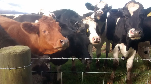 Cows
Cows by
Seal54, on Flickr
I half expected Mr RR to reappear and to tell me to get off his drive, for it was a drive, immaculately tarmacked with its own lights and evenly spaced avenue of young trees. He didn’t, but I found that the gates were firmly shut against me where the drive met the road. I clambered over a side wall fully aware that I was probably on CCTV.
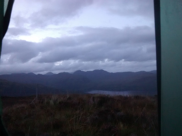
My troubles with cows were not over and I had to detour off the ‘Shed a couple of times between A875 and the A81. I sustained another injury when crossing ladder stile which turned out to be rotten. The remnants of the huge bruise were visible on my thigh for more than 3 weeks. Finally, I was heading up the hill to the Bat a’ Charchel. Time was getting on. Again rush was the dominant vegetation but the sheep had made paths through it making passage relatively easy. Every now and then there were open, tent-sized patches of grazed grass. Ahead, I could hear a cow bellowing in pain or distress. I think she had recently been separated from her calf and I did not want to meet her in that state. The noise did not move any closer and I decided that she was probably the other side of a fence. After 10 ½ miles of walking (8 ½ of challenging Watershed terrain) I decided that the grazed patches were flat and dry enough to make a good camp site and soon had the tent up, tea cooked and eaten. A site with a view, a good meal and a fine sunset does much to restore the spirits. The day hadn’t been all bad, apart from the cows I had seen a golden-ringed dragonfly, always an impressive sight. It had been warm and sunny with all the wetness being under foot. The lights of Glasgow were coming on beyond Earl’s Seat as I watched the sun go down over the Gargunnock hills. I felt a frisson of excitement as I realised that the next day would see me firmly out of the Central Belt and into the Highlands…just in time to meet the high winds and rain forecast for the early hours of Monday morning. Song for bedtime, Dylan’s “Beyond the Horizon”
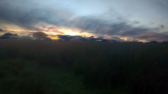 Sunset
 by
Seal54, on Flickr
Watershed total for the day 13.7 km (8.5 miles)
Total for the day 17 km (10.5 m)
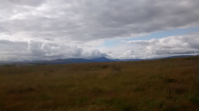
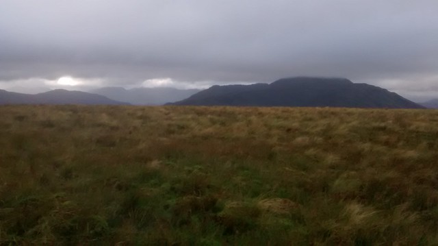
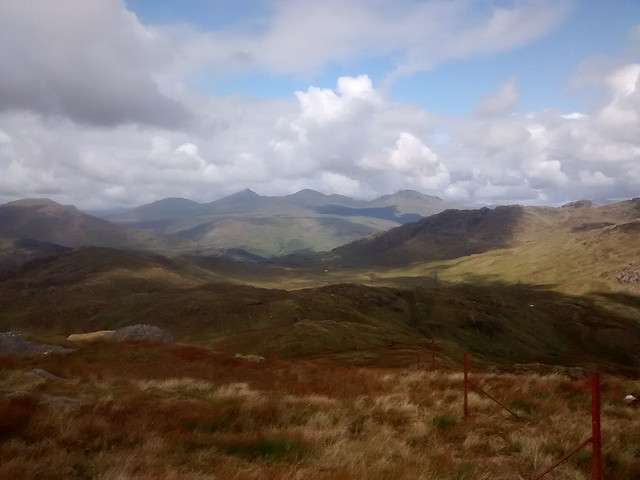
Day 2, Sunday 27th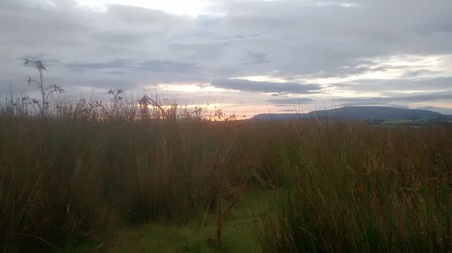 Sunrise at campsite, looking to Stronend and the Fintry Hills
 by
Seal54, on Flickr
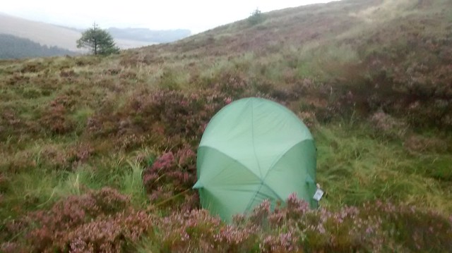
The poor cow started her tragic belly-aching as the sun rose so there was no more sleep to be had. I was able to get the MWIS weather report and the good news was that the 65 mph winds forecast for Monday had lessened to a mere 60 mph. These were to be accompanied by heavy rain. Today it was just to be showery. I donned waterproofs as the vegetation was very wet; my boots and socks were still soaking from the previous day. I had a spare pair of dry socks but hoped to save these for the bus home. The wet theme continued as I packed up a dew-sodden tent but on a more positive note I noticed a distinct lack of midges despite only a ghost of a breeze. At the last minute I remembered to take a photo of my campsite, something I frequently forget.
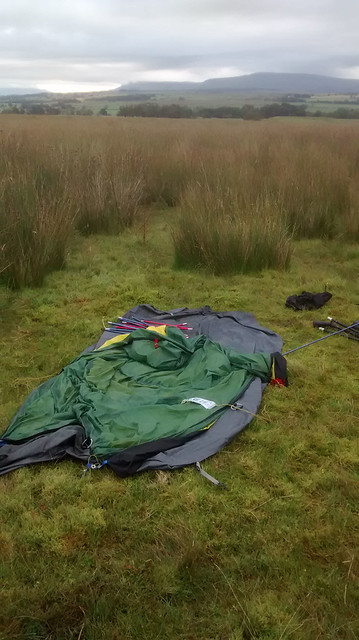 Campsite
 by
Seal54, on Flickr
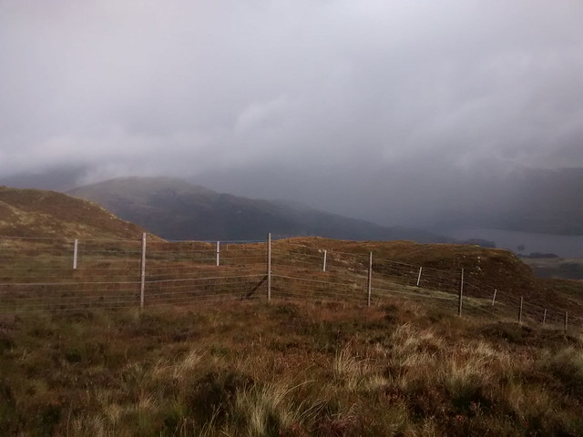
The cows needed to be avoided, spread out as they were across the watershed. However, they showed no interest in me and after a bit of zig-zagging and more, boggy ground I arrived at the fence below the slope of Bat a’Charchel. Rucksack went over ok, I followed but as I turned to retrieve my walking poles I managed to tear my waterproof trousers on a lower strand of barbed wire wrapped around the strainer post. At this point I discovered that I had left my repair kit at home. The rip was below my jacket line and quite large. Monday’s forecast was now becoming troublesome in my mind. I had already decided that I would find somewhere sheltered and just sit out the bad weather, it was meant to clear by the afternoon and for the winds to ease. For now, I was going to celebrate leaving the cows behind, hopefully I wouldn’t see many more of them for the next few hundred miles. Barbed wire fences should also diminish in number but of course there would be deer fences to negotiate although hopefully fewer in number and without the vicious wire.
Views of Loch Lomond and the ever increasing hills to the North distracted me from worrying about my trousers. The walk was becoming better and better. After crossing the summit of the Bat and its crop of masts there is a short descent to the road which had a surprising amount of “traffic” with a couple of walkers going east and a group of cyclists whizzing past. I thought to fill my water at the reservoir but the presence of a large dead trout put me off this idea. There was no shortage of water just off the watershed so I wasn’t unduly worried about waiting. I then disturbed a male hen harrier which flew off over Gualann so my raptor tally was mounting on the Watershed.
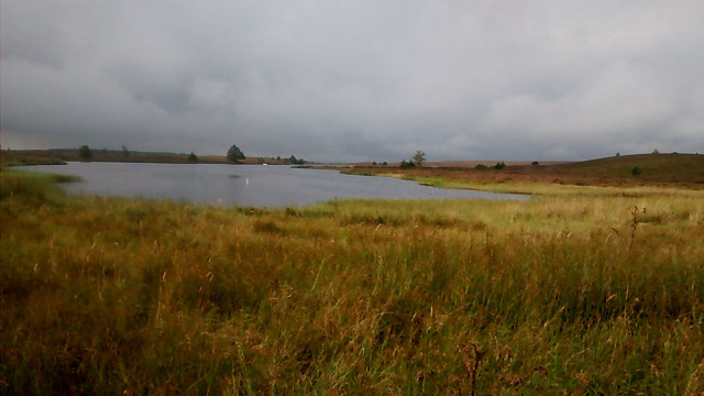 Muir Park reservoir
 by
Seal54, on Flickr
Peter Wright (“Ribbon of Wildness”) talks of the going getting easier and to some extent this was now true but it was still tussocky and the rush continued unabated I tried to stick to the heather clumps but noted that whilst there was plenty of
Calluna vulgaris (ling heather) and
Erica tetralix (cross leafed) there was very little
E. cinerea.
Calluna and
cinerea (bell heather) favour drier spots,
tetralix the damper areas.
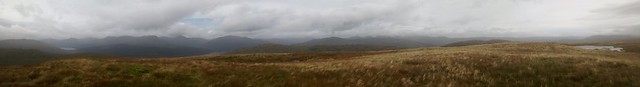
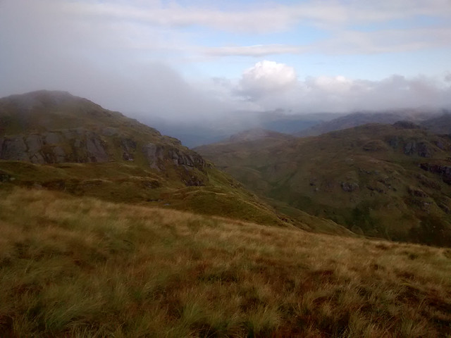
The biggest problem for me was a series of narrow ditches crossing my route. They were overgrown and naturally I fell down a few of them before I realised that they were marked by ling growing on the drier edges of them creating distinct lines across my line of travel. Now and again I came across a glimmer of a path that seemed more human than animal in that it was following a line up the hills. I came to call this the High West Highland Way or HWHW and although it wasn’t always present, when it appeared over the next few days, I recognised and welcomed it for the easier walking it afforded. I also broke with Dylan and started singing “Loch Lomond” given it was now visible on my left-handside. I also welcomed the steeper, better drained slopes of Gualann and I spent some time on the top of Gualann id’ing mountains and taking photos. The view to the east along the Highland Boundary Fault (HBF) took in the Lake of Monteith, and to the west, the wide southern foot of Loch Lomond with its islands marking the HBF that way, beyond which the Firth of Clyde could be seen glinting in the distance. My progress was further “impeded” by the frequent need to stop and eat the blaeberries which were abundant.
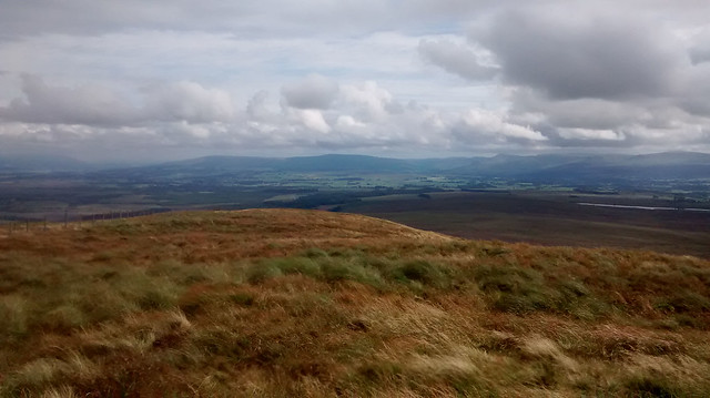 Watershed already done (from Gualann
 by
Seal54, on Flickr
 Watershed ahead from Gualann
 by
Seal54, on Flickr
 Looking at HBF east
 by
Seal54, on Flickr
 Looking at HBF to the West
 by
Seal54, on Flickr
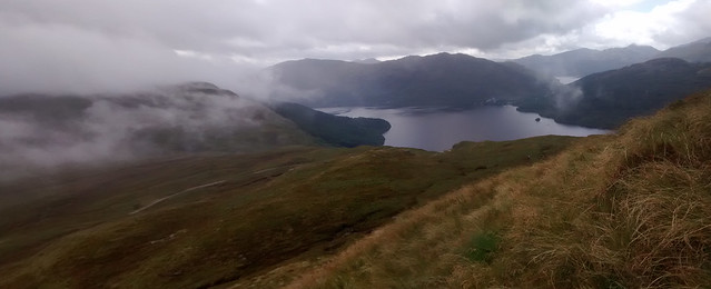
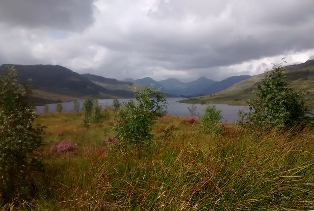
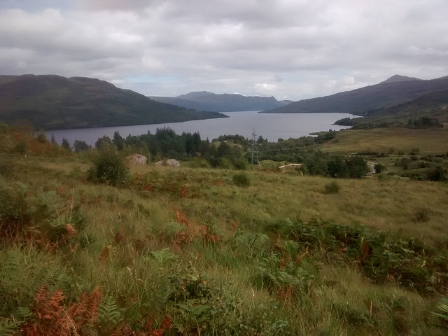
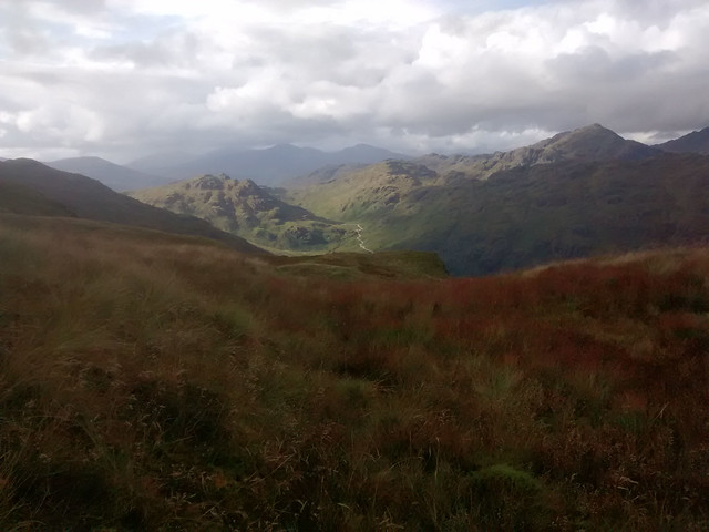
Back on Carleatheran in the Gargunnock Hills I felt very much in contact with the Forth and its way to the North Sea, now having wended my way westwards I felt more in touch with the Atlantic side of the Watershed as most of the mass of water I could see was heading that way. Loch Lomond would always be in view at my left hand side for the next few days
 Loch Lomond over to the Clyde estuary
 by
Seal54, on Flickr
 Bheinn Bhreacwith Ben Lomond behind
 by
Seal54, on Flickr
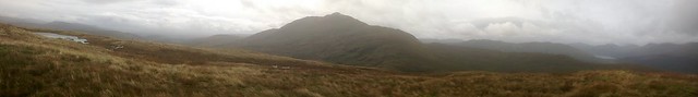
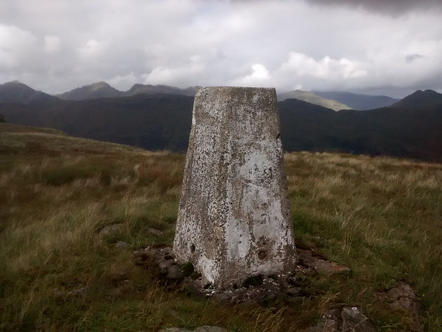
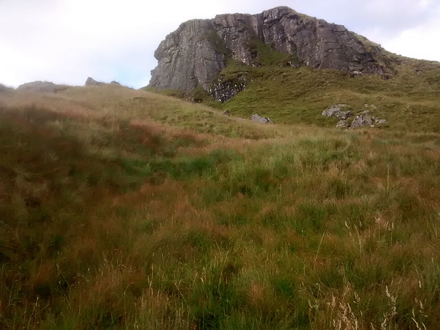
Onwards and the rain came in as I reached the knobbly mass of Bheinn Breac with a number of different summits, the Trig point being on the slightly lower one a ¼ mile from the highest point of 586m.
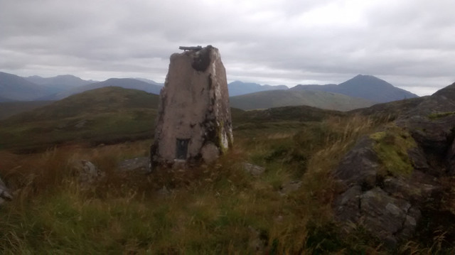 Trig Point Beinn Bhreac (with Ben Lomond behind to the right)
 by
Seal54, on Flickr
 Damaged top of Bheinn Bhreac trig point with the hole plugged
 by
Seal54, on Flickr
 Summit Beinn Bhreac
 by
Seal54, on Flickr
 Bheinn Bhreac view to Loch Lomond
 by
Seal54, on Flickr
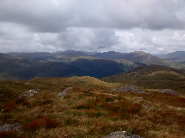
Peat hags had replaced ditches and rush as the hazard of choice but I came to realise that as the Watershed passed through these at the highest point this was usually the driest place and firmest to cross. I took the opportunity of checking the forecast again. Heavy rains and high winds were still forecast to come in during the early hours but the wind speeds were now down to 55mph. Again the situation was forecast to improve by Monday afternoon. Looking across to the whaleback of a hill that is Beinn Uird I could see that it was riven with peat hags across my route, and looked like it had little in the way of flat shelter on the eastern slopes. I felt I had made slow progress but reasoned that I would be better looking for a campsite on this side of the hill. Singing “Thunder on the Mountain” I descended towards the bealach.
As it happens I would have had plenty of time to cross and camp on the lower slopes of Ben Lomond but the attraction of camp in the hand was preferable to a camp in the full blast of the wind as had happened way back in the Borders (viewtopic.php?f=25&t=70980). I found a reasonable spot just before the deer fence, albeit a bit tight and the entrance to the tent was hard up against a raised area but it was out of the wind. There was water close by and I had a good book to read; “Instructions for a Heatwave”. If my tent failed and I had to bail out it was only a couple of miles down to the road beside Loch Lomond. It was good to get out of my wet boots and have an early tea. Re-reading Dave Hewitt’s account of his descent from Beinn Bhreac (“Walking the Watershed” TACit press 1994) as I write this up, I feel I got off lightly as I descended in clear visibility with Ben Lomond looking good. The coll is not that distinct and the vague ridge down from Beinn Bhreac twists and turns over the inevitable lumps and bumps with one burn pushing the Watershed right over to the Loch Lomond side. I suspect it was this burn that misled Dave in the mist
 Hunkered down
 by
Seal54, on Flickr
Daily total 14 km (8 .7 miles)
Trip total 27.7 km (17.2 miles)
Day 3 Monday 28th AugustHaving expected to be woken by the rain and wind, I did not set my alarm and slept on until 08.00. Sticking my head out, the deer fence was barely visible in low cloud but beyond a spit of rain the forecast heavy rain had not materialised. The rain started in earnest as I was eating breakfast. I realised that whilst I had been worried about the wind I hadn’t considered the hillside turning into a river. (“The Levee gonna Break” was the obvious song here). However, I remained dry in the tent and benefited from being able to fill my water without having to take a step outside. The wind rattled the fly sheet but mainly left me alone as I read on through the hot summer of 1976 and ate my whole supply of Snicker bars. Other chocolate bars are available
.
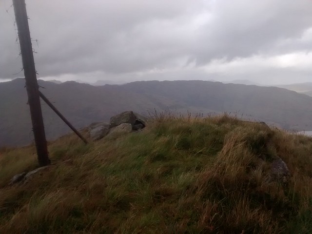
Frustratingly the wind and rain did not ease until well after 3. I was under way by 4 (again packing a wet tent) and thought it would good to have a high camp on Ben Lomond whose summit clear ed of the cloud that had dogged it as a crossed Beinn Uird. I checked the weather forecast as I crossed a very blustery Beinn Uird (597m and a Marilyn), a much less of a bulk than it had appeared the previous day, and the words “severe buffeting on high ground” made my mind up, particularly as I struggled to stand still as I waited for a signal. It never takes much to persuade me to stop.
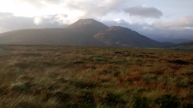
 Ben Lomond from Beinn Uird
 by
Seal54, on Flickr
 Looking beyond Ben Lomond to the continuing Watershed
 by
Seal54, on Flickr
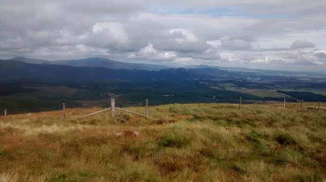
 Looking to Aberfoyle from Beinn Uird
 by
Seal54, on Flickr
 Towards the Arrochar Alps
 by
Seal54, on Flickr
 The sun shines on the Ben
 by
Seal54, on Flickr
I would stop short again and camp on the lower slopes of The Ben. My snail-like progress was gradually becoming impossibly slower. Still I found a delightful spot to camp having covered a scant 3 miles.
The breeze put paid to any midges and the evening did turn out to be very pleasant and I had views through to Bridge of Allan and the Ochils one way and if I turned my head I could see the high rise flats of Glasgow the other. Again I enjoyed watching as the lights started to come on. There is something both comforting and satisfying to see this evidence of “civilisation”. No-one down there imagining that high up in the hills their lights could be seen from a small tent.
 Campsite on lower slopes of the Ben . Loch Lomond behind
 by
Seal54, on Flickr
Daily total 4.4km (2.7 miles)
Trip total 32.1 Km (19.9 miles)
Day 4 Tuesday 29th AugustI last climbed Ben Lomond in August 1998. It was the first hill I had climbed on my own. I lived in Doune at the time and left home before dawn so I could set off from the car park at first light. I was on the summit, on my own at 08.30 in glorious sunshine. I didn’t meet anyone until I was halfway down. I always meant to return and climb by the Ptarmigan ridge but today was the first time I had been back. The forecast was for blustery wind but Loch Lomond NP was meant to be fine. The forecasters failed to pass this on to the Ben who kept a firm head of cloud on until mid-afternoon by which time I was well over and trying to find the watershed route through the broad complex ridge above Glen Goaithe.
 Ben Lomond TP
 by
Seal54, on Flickr
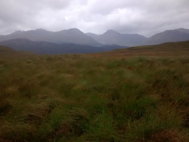
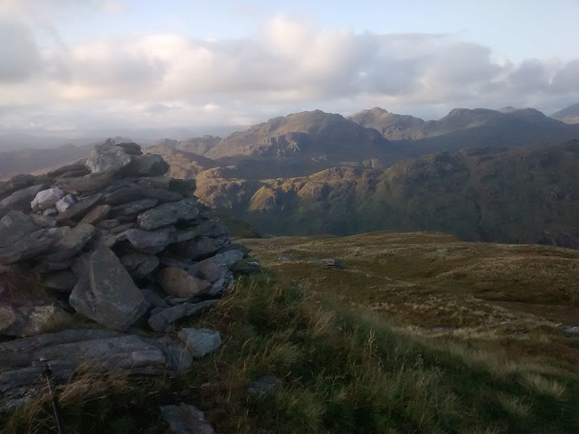
I did expect to at least see someone on Ben Lomond but once again I had the hill to myself, this time probably due to the poor weather rather than the hour with sensible people staying well away and enjoying a prolonged breakfast in the warm and dry. The route down follows the upward way of the Ptarmigan route. It was a little slippery and the wind appeared determined to shove me off. At times I resorted to “bumming” it and again resolved that I would return on a good day and come up this route as it looks a fine way up a fine mountain. I was also enjoying the pleasure of having rock underfoot rather than spongy grass and rush. I was soon down below the cloud and parted company with the main path to head steeply down to the col before the ascent up Cruinn a’Bheinn, a Graham that sits alone like a large sloppy pudding that needs clambered over before tackling the rough ridge of hills between Cruachan (516m) and Ben Uamha (596m). There were excellent views through to Tarbert and beyond to The Cobbler and the Arrochar Alps. Shafts of sunlight occasionally broke through the clouds that were starting to lift.
 Cruinn a Bheinn from Ben Lomond descent
 by
Seal54, on Flickr
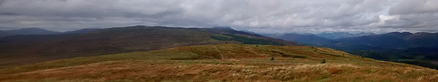
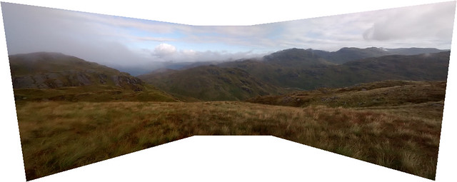
 Panorama Cruinn a Bheinn
 by
Seal54, on Flickr
 Panorama from Cruinn a Bheinn looking to Ben Lomond
 by
Seal54, on Flickr
 Cobbler, Beinn Narnain Ime and Vorlich
 by
Seal54, on Flickr
 Panorama between Cruinn a Bheinn and Cruachan
 by
Seal54, on Flickr
 View across Loch Lomond to Tarbert and Loch Long from shoulder of Cruachan
 by
Seal54, on Flickr
An indication of how much rain there had been could be seen at Loch Cruachan, just below the summit of the hill of the same name. Maps show that it drains to the Atlantic and I went round its NE end only to discover that it was high enough to be draining to the North Sea as well. As such I came back round its Southern end. So far I had made, for me, fair progress and started to get a little confident that I would make up some time. Once again my temptation to count the Watershed miles ahead of doing them soon had me unstuck.
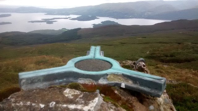
 Summit; Cruachan
 by
Seal54, on Flickr
I temporarily turned my back on Loch Lomond and Loch Arklet replaced it on my left, ahead I could see Loch Katrine.
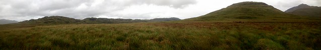
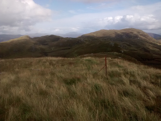
The “ridge” between Cruachan (536m) to the west and Ben Uamha (a Marilyn, 596m) to the east was a jumble of minor protuberances that had to be climbed and this took forever despite each one being no more than 50 metres above the surrounding ground. The ridge is just over 4.6kms (nearly 3 miles) in length and involves a total of 370m ascent and 270 m of descent. The first half doesn’t drop below 500m then there is a stuttering descent to the Bealach na-Imriche at 450m. There were 2 fences; a fairly new deer fence and an old broken down stock /boundary fence trending west-east. Neither totally followed the Watershed, the deer fence often crossing it then back again. As such I followed the ‘Shed as best as I could manage, I certainly wasn’t going to cross and re-cross the deer fence every few hundred metres. Left over materials from the new deer fence had been liberally strewn around, some rolls of rylock and staples were being gradually overtaken by vegetation. Sadly, whoever had installed the new fence clearly wasn’t coming back for them.
 Ridge to Beinn Uamha
 by
Seal54, on Flickr
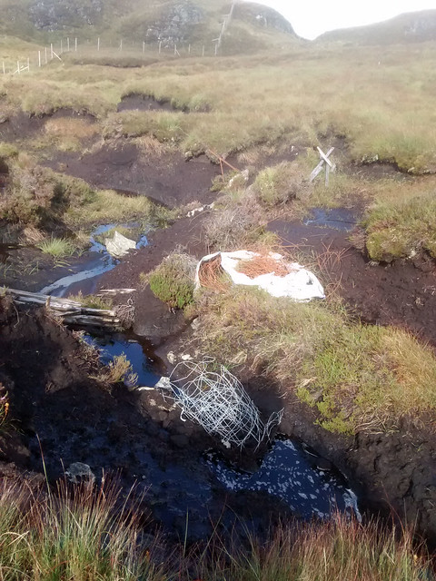 Fence mess
 by
Seal54, on Flickr
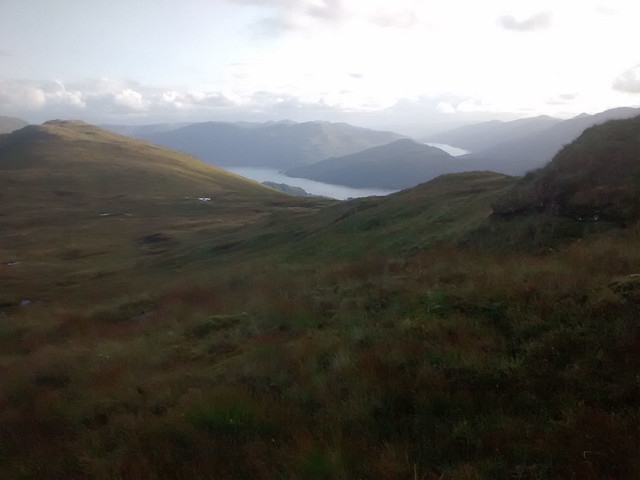
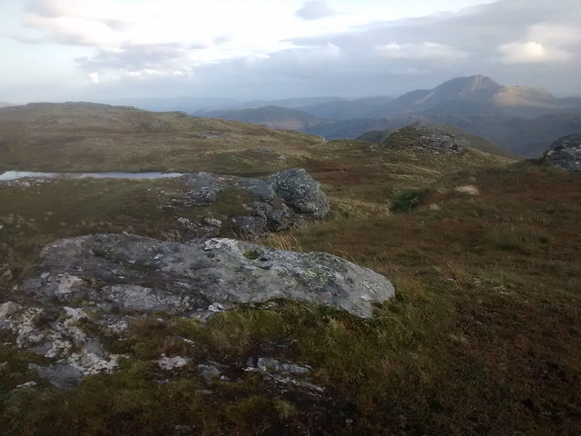
The day was clearing and once I had a view back to the Ben’s summit I could see that finally it was cloud free. Following the bealach there was a steep pull up by a waterfall on a muddy animal track before the gradient lessened Finally, in late afternoon sunshine I stood on the summit of Ben Uamha and was rewarded with more stunning views east across Loch Katrine and north across Loch Arklet as well as towards the west (Arrochar Alps) and North to the next group of Munros on the Watershed (Beinn Chabhair to Cruach Ardrain). The clumps of season- aging deer grass looked like a trendy hair style with green roots and russet-brown tresses tipped with sparkling jewels of water drops.
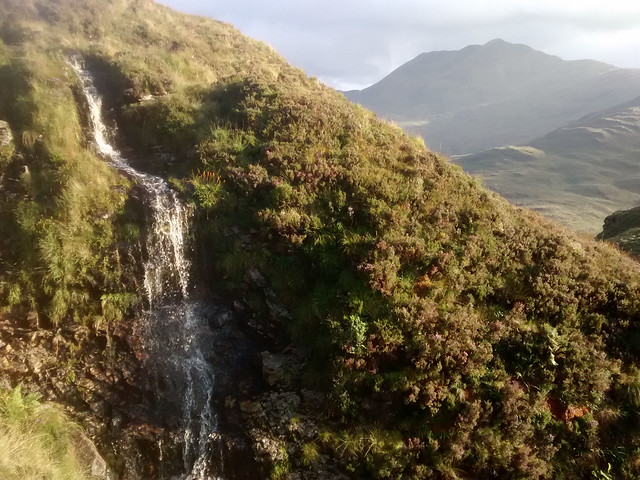 Waterfall with Ben Lomond behind
 by
Seal54, on Flickr
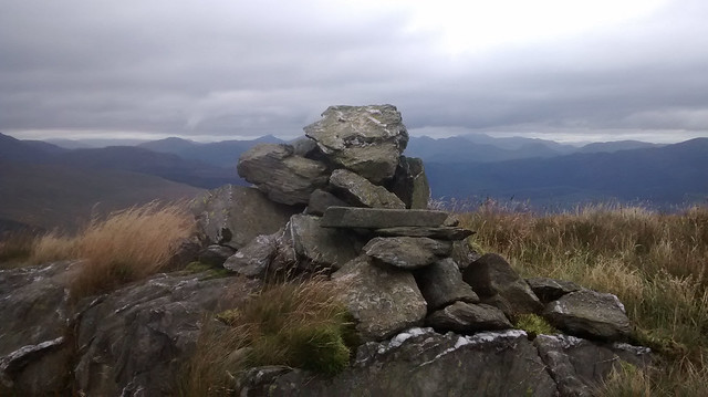
 Summit Beinn Uamha
 by
Seal54, on Flickr
 Watershed skyline
 by
Seal54, on Flickr
 The Cobbler and Loch Long
 by
Seal54, on Flickr
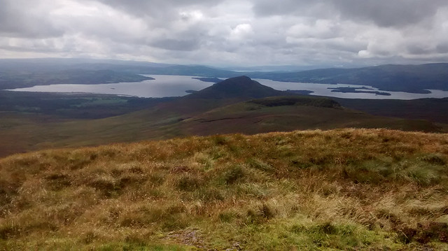
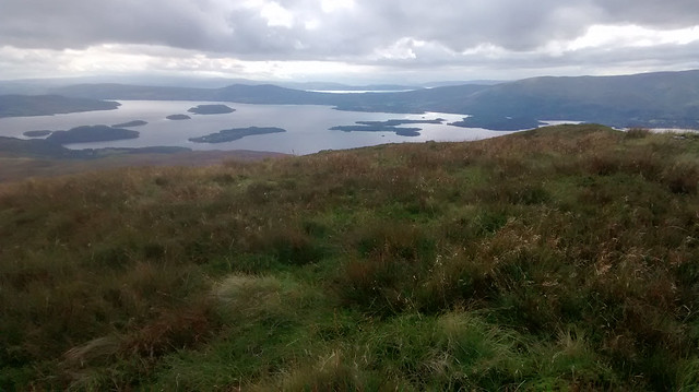
 Ben Lomond from Beinn Uamha
 by
Seal54, on Flickr
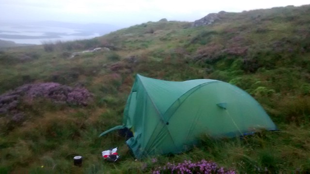
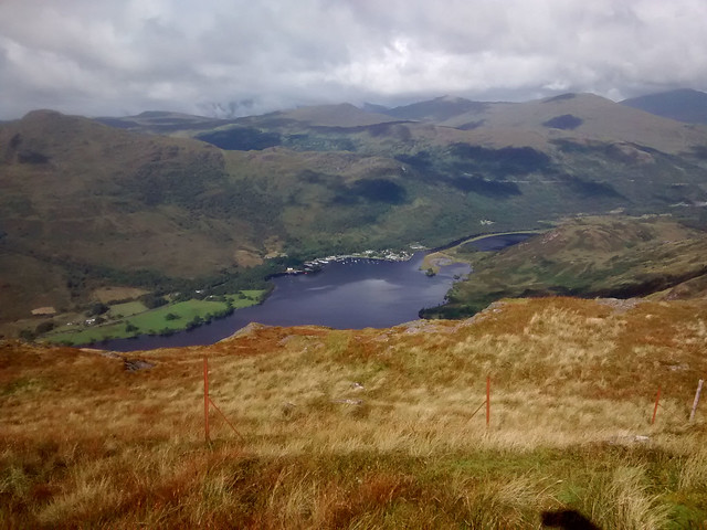
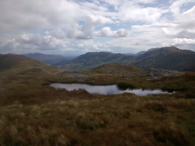
I didn’t want to camp around Stronachlachar (actually it is subject to the LLTNP camping restrictions) so I decided to stop about half way down the ridge, before I reached the power lines that marched across the lower slopes of Beinn Uamha, past Stonachlacher, along the banks of Loch Katrine and up Glen Gyle. The wind had dropped and out had come the midges. Tonight I wanted a flat, dry site, with enough breeze to see off the midges and a good view. I also added the presence of blaeberries to my wish list. What I got was everything but the blaeberries and a fickle breeze that dropped without warning. My feet had again been subject to wet boots and socks, they never had much of a chance of drying out since the first day’s soaking. I also managed to find and step in the wettest of puddles each day. As such my feet were beginning to protest. No blisters but very white, wrinkled soles that smarted at every step.
 Tent with a view (Loch Katrine)
 by
Seal54, on Flickr
Tent with a view (Loch Katrine) by
Seal54, on Flickr
Forecast for the next day was rain, increasingly heavy and the same on Thursday. Friday, which is when I intended to head for home, was going to be beautiful. I had hoped to be further on the Watershed but I wasn’t unduly bothered. My main aim was to enjoy myself and whilst some sections are more to be tholed than enjoyed as long as I came out happy at the end of the day that was enough. Along this section of the Watershed between Balfron and Crianlarich, there are plenty of escape routes. I was conscious though, that if I didn’t reach the northern end of Loch Lomond the waterbuses from the west shore to the east shore don’t run over the winter and this may limit my return before next spring.
Daily total 14.5 Km (9 miles)
Trip total 46.6 Km (28.9 miles)
Day 5, Wednesday 30th AugustI woke to low cloud, a poor forecast and no wind. Due to the midge population doing their best to suck the life-blood from me and as my coffee stocks were running low, I decided to forgo breakfast in my camp and head for the Pier Café at Stronachlachar. I could have an extended break there and decide whether to continue or head out to Inversnaid and the boat across Loch Lomond. I did not fancy continuing and route finding in limited visibility amongst the jumble of small hills between Beinn Breac and Beinn Chabhair, besides the views deserved to be seen.
 Morning cloud cover
 by
Seal54, on Flickr
It took longer than expected to do the 2 miles to the cafe, partly due to my lack of sustenance but also as I tried in vain to capture a photo of the numerous scotch argus butterflies that came out as the sun started to show its face. The weather improved all the time and the views were stunning as the cloud started to lift. When I arrived the café, staff were most welcoming despite my filthy state and smelly boots. I sat outside so as not to disturb the day trippers and enjoyed lots of strong black coffee, a goat’s cheese tart followed by a pudding of millionaire shortbread for a late brunch. I stocked up on Snicker bars and checked that as long as I was away from the immediate lochside I wouldn’t be contravening the new camping restrictions with my wild camps. I should have taken my boots off to give them a few of hours in the warm sunshine but felt it would be pushing the café’s hospitality too far. I was taken with the new, potentially life-saving use for the old phone-box
 Loch Arklet
 by
Seal54, on Flickr
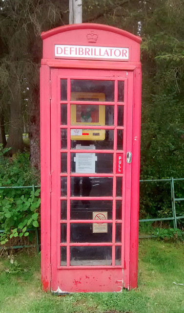 Cool phone box
 by
Seal54, on Flickr
When I could put it off no longer and as the day was far better than forecast with plenty of blue sky and sunshine, I headed back to the Watershed. Initially the slopes of Maol Mor are steep and covered with bracken. I thought the going through this would be difficult and tried to head for where there were breaks. I noticed a brown streak through the bracken and this turned out to be some sort of path or animal trail and although I was slow the going wasn’t bad. I found the bracken’s normally tough stems weakened as it was beginning to die back. Up to now I had seen plenty of ling and cross-leaved heath but virtually no bell heather (
Erica cinerea) . Finally I saw a clump. I also finally captured a photo of the scotch argus. Unfortunately, I think this pair's final act was too much and they both appeared near to death.
 Erica cinerea
 by
Seal54, on Flickr
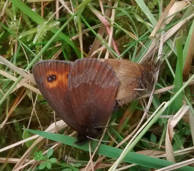 Scotch Argus
 by
Seal54, on Flickr
Down below to the right, a built, glaringly white track goes up Glen Gyle. A helicopter had been flying in and out and vehicles were also heading up it as further up (and very close to where the watershed turns east up Parlan Hill) work was being carried out on the pylons of the power line. The workmen were probably too busy to notice but I wondered if they took bets on how long it would take me to get up Maol Mor. Of course I had to stop frequently to look back, down Loch Katrine snaking away down to the cracker of a wee hill, Ben A’an on the eastern side with Ben Ledi behind. Ben Venue guarded the western side. As I approached the summit of Maol Mor a flock of house martins swooped around, feeding on any midges and I wondered if they were an early group heading south. Another sign of the passing year.
 Loch Katrine to Ben A'an
 by
Seal54, on Flickr
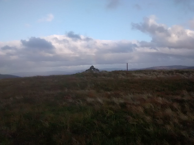
 Maol Mor Trig Point
 by
Seal54, on Flickr
 TP Maol Mor looking to Beinn Chabhair An Caisteal and Beinn a Chroin
 by
Seal54, on Flickr
Beinn Chabhair, An Caisteal and Beinn a'Chroin rolled away to the east looking like steep-sided waves ready to break over Balquidder.
 Track up Glen Gyle between Beinn Ducteach and Parlan Hill
 by
Seal54, on Flickr
From the summit the onwards route wasn’t entirely clear, another lumpy ridge with all manner of ways in which the water could run off. When I eventually made it to the slopes of Beinn a'Choin having chosen not to go over a prominence named Stob a Choin Dhubh that had a rock face on the western side (and my route), I looked back and saw that the line of the watershed was straightforward enough and there would have been a route along the NE side of Stob a Choin Dubh.
 Stob a Choin Duibh
 by
Seal54, on Flickr
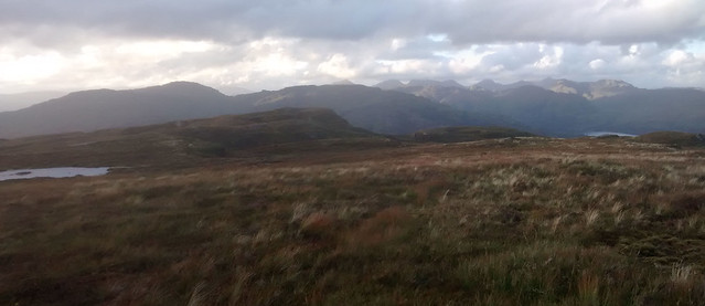
The summit of Beinn a' Choin brought more stunning views and plenty of mountains to pick out, I could see the Watershed, trending north before turning east over another bundle of minor hills ahead of Parlan Hill then steeply up Beinn Chabhair, An Caisteal, Beinn a Chroin and Cruach Ardrain. They seemed intimidatingly large but Inothing I hadn’t done before. Ben Lui, Oss and Dubcraig were almost directly ahead. There was much to look forward to.
 Loch Lomond and Loch Long from shoulder of Beinn a Choin
 by
Seal54, on Flickr
 Loch Arklet from Beinn a Choin
 by
Seal54, on Flickr
 Summit; Beinn a Choin
 by
Seal54, on Flickr
 Ben Lomond from Beinn a Choin
 by
Seal54, on Flickr
Whilst the day was still relatively young and with not many miles or hours of walking under my belt, my feet, after 5 consecutive days of wet boots and socks, really started to make their presence felt. No blisters but it felt like I was walking on needles. After reaching the summit of Beinn a Choin I decided that I needed to give them a long break out of wet boots and socks. I startled a group of deer as I started down towards the col and at this point I suddenly realised that I had taken no account of the stalking season. The previous day I had mainly been on NTS land so that was ok but I could well disturb the deer from now. I pondered turning back to Inversnaid the next day, there was still the option of a boat across Loch Lomond. I decided to risk going on, I was keeping to the ridges and higher ground and, I reasoned, there would be very little stalking going on in Glen Gyle due to the power-line works.
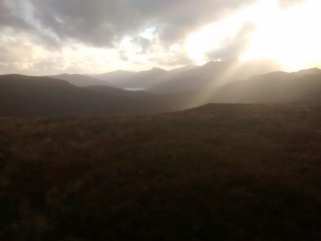
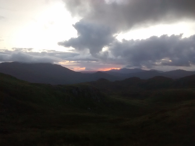 Sunset over Ben Lui group.
 by
Seal54, on Flickr
I found a lovely spot to camp and there was enough breeze to keep the midges off. In fact, the wind had increased again and with the pain in my feet I didn’t make a particularly good job of pitching the tent This resulted in the fly sheet flapping noisily and I ended up not sleeping well
Daily total 9.26 km (5.75 miles) plus detour to Stronachlachar of 2km (1.2 m)
Trip total 55.86km (34.65m)
Day 6 Thursday 31st August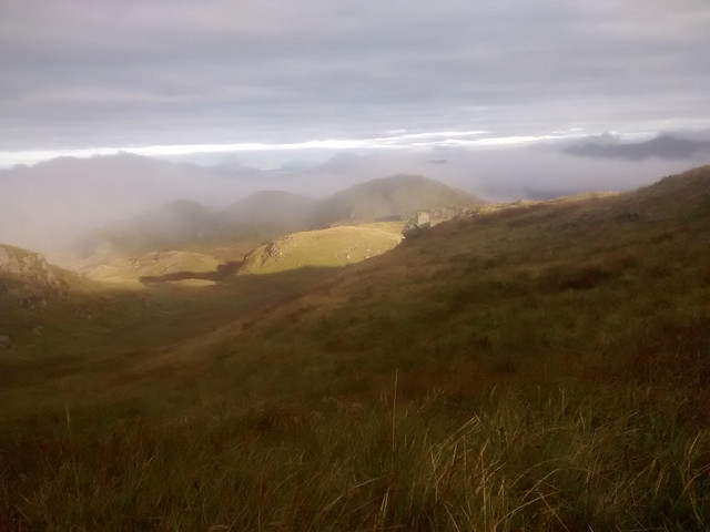 Traces of inversion
 by
Seal54, on Flickr
I woke to a bit of a temperature inversion with the cloud lifting and shifting before burning off leaving a lovely sunny day. Definitely not the forecast. A few things had played on my mind through the night. Should I go on? Against continuing after today were my feet which had begun to worry me. My boots had never dried since day one and I had used the same wet socks each day. I had not packed enough socks and had been hanging on to the other, dry pair as long as possible. Now I had to use them. My feet were white and wrinkled and although refreshed overnight I knew that after a few miles and they would be a problem again. The other issue for the next night would be that I would be probably somewhere around 800m. The temperature over the last couple of nights had been noticeably colder, today I had woken to a bit of a temperature inversion. High pressure would mean clear skies and a drop in night temperatures. I had only packed my summer camping gear and whilst I could put on all my spare clothes I would probably have an uncomfortable night. Then there was the stalking problem although until over Parlan Hill and past the pylon work it would probably be ok. I also needed to get back to Edinburgh buy a birthday present for my granddaughter and it would be better travelling on home (by bus) on the Saturday rather than Sunday.
For continuing was I had enough provisions (apart from coffee) to do another overnight camp and possibly get as far as Crianlarich. The weather was improving and it should be a fine weekend, perfect for walking. I was also really enjoying being out (apart from the feet), leaving would mean an interruption in the flow of the walk. However, the foot issue was the overriding factor and as such it made sense to leave the Watershed before Beinn Chabhair. This would mean I could make use of the Glasgow-Fort William bus and access the next part of the Watershed on 1-2 day trips over the autumn and winter, particularly after the stag stalking season was over.
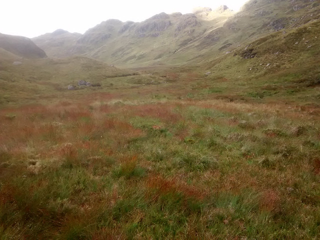
 More lumps and bumps
 by
Seal54, on Flickr
I packed up the tent, possibly for the last time and set off down to the complex of hills all around about the 600m mark. I had been worried about route finding on this section in poor weather but the weather turned fine and being a local government boundary an old fence line marks the way. Unfortunately, as with many old fences there were remnants of old wire cunningly disguised a strands of the deer grass. The latter was just turning the same shade of reddish brown as the rusty wire. I managed to miss most of the trip hazard of wire by keeping a couple of metres away from the fence. Having virtually made up my mind to leave the watershed and go home I also deserted Dylan and hummed and sang Joni Mitchell’s “Carrie”, substituting “bog mud” for “beach tar”. As the mist cleared the weather improved and this was the best day of the walk. The views were clear and the mountains so tempting, I didn’t finally make up my mind until after Parlan Hill. Before then the going was good over Maol nan Fhithich, Stob nan Eighrach and Beinn Ducteach. There were constant flights of helicopters bringing supplies and personnel up to the powerline. Engineers worked high up on the arm of the pylon closest to Parlan Hill. Cars and coaches could be seen on the far side of Loch Lomond and the waterbus crossing from Ardlui and this all gave a sense of returning to the World of People.
 Route ahead
 by
Seal54, on Flickr
 Ardlui
 by
Seal54, on Flickr
 Loch Katrine from Beinn Ducteach
 by
Seal54, on Flickr
The views in fine weather, were excellent, with Dubhchraig, Oss and Lui getting closer and more distinct. Ben Cruachan's recumbent old woman could just be made out to the west.
 Ben Lui , Oss and Dubhchraig (L-R)
 by
Seal54, on Flickr
 Ben Cruachan in distance
 by
Seal54, on Flickr
From the summit of Parlan Hill I could see people on the summit of Beinn Chabahir, my first hill walkers for many miles of Watershed. I didn’t really check my map and thought that the fence continued to follow my route so blindly followed it far too far before I realised that the watershed route and the boundary fence parted company on the summit of Parlan. I could almost see down to Balquidder before it dawned on me that I needed to turn back. When I finally reached the bealach, my feet were starting to smart again. So although Beinn Chabhair looked enticing I turned off the Watershed. I always have a sense of rebellion when I leave the ‘Shed. It feels strange to be following a stream. For some perverse reason I decided to pace myself against the couple who were descending Chabhair into the glen. I was pleased that I managed to keep up with them on the other side of Lochan Beinn Chabhair, however my feet and body could not sustain this and they soon pulled ahead after we met up at the end of the Lochan and had exchanged pleasantries.
 Looking back to Beinn a Choin , Maol Mor, Ben Lomond behind from Parlan Hill
 by
Seal54, on Flickr
 Bheinn Chabhair from Parlan Hill
 by
Seal54, on Flickr
 The Watershed between Parlan Hill and Beinn Chabhair looking to the North Sea side
 by
Seal54, on Flickr
 Heading off the Watershed to the Atlantic
 by
Seal54, on Flickr
I have only ascended Beinn Chabhair once and that was in 1997 with 3 of the people who walked the Watershed through Cumbernauld with me and I remembered the path beside the waterfall down to Beinglas as being a delightful walk. No doubt in the intervening years many thousand feet have passed this way and the path now is eroded and rubble strewn. My feet were stinging badly again and I decided to stop the night at Beinglas campsite, catching the early bus the next morning. I bought a new pair of 1000mile socks in the shop and hobbled around amongst the WHW walkers. They all looked fresh and I reflected that they had probably walked further than me over a shorter period of time, however I think I had the better deal despite my feet.
Daily total on Watershed; 6.44 km (4.0 m)
Total for the day 11.5 km (7.16 m)
Total Trip on Watershed 62.3 km (38.65m)
Total from Arnprior 66.8 km (41.5m)
Total Watershed miles from Peel Fell; 377 km (245 mile)
