free to be able to rate and comment on reports (as well as access 1:25000 mapping).
Following on from completing the Southern Upland Way, Cath said she wanted a coastal walk that she could walk with me rather than just supporting and she decided on the 50 mile jaunt along the coast of Moray from Forres to Cullen which we walked over 4 days at the end of August
First though we had to get to Forres from our west Yorkshire home in Huddersfield;
This involved a 4 train journey via York, Edinburgh, Inverness along the Highland Main line and finally to Forres,
At York we saw 3 generations of East coast racehorses with a Class 91 (IC225); Class 55 Deltic and the A3 Pacific Flying scotsman.
A change of trains in Edinburgh and across the Forth rail bridge and along the Fife coast then through Perth and over the Highland Main line to Aviemore and Inverness and onto the forth train along the coast to Forres.
Indulge me in some pics of our Journey North......
 The Leaving of Huddersfield ( doesnt quite have the same ring to it as Liverpoool
 our Virgin steed North at York
 Passing in the Museum railway Yard first Deltic 55009 Alcydion( named after a racehorse that won the Ascot Gold Cup in 1949)
 and the 94 year old A3 pacific Flying Scotsman originally built in 1923, simmering away
 Time to grab a coffee in Waverley before boarding the Inverness train
 To Inverness and our 4th train along the coast to Forress, Cath telling me to hurry up and get aboard and stop taking photos of trains!!
 To arrive at Forres. This station has now closed and has been replaced with a newly built one on the otherside of a new bypass
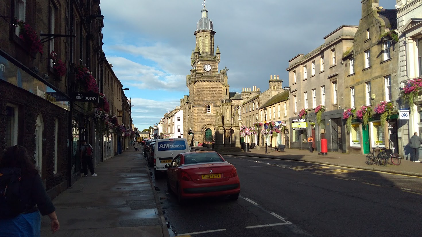
 A short walk through the town to our B and B for the night
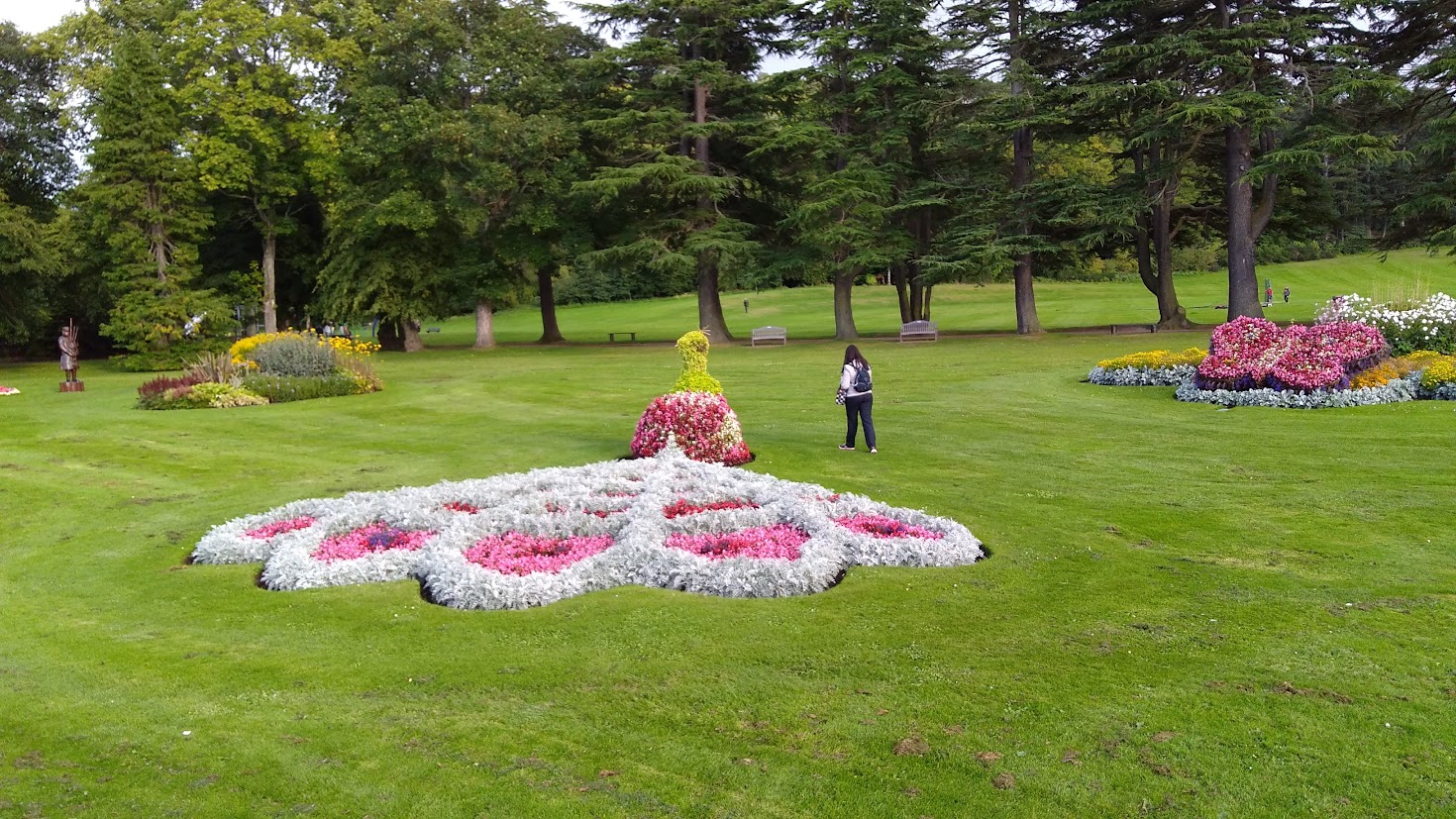
Forres Is a lovely town and the park has superb floral displays

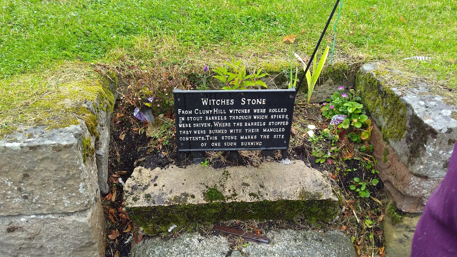 Past the Witches stone ( /whispers/ They knew how to treat their women in North east scotland
  )Day One - Forres to Burghead
An excellent night in a B and B and after a Scottish breakfast we set off on the 13 miles to Burghead
First was the amazing stone Sueno' stone, a 6.5m high Pictish stone. encased in glass.

 Sueno's Stone
 Cath and Bargee at the stone ready to head eastwards along the coast
After viewing the stone it was across the Forres Bypass and along minor road to Kinloss then along the River Findhorn estuary around the edge of the old RAF Kinloss base to Findhorn, 5 1/2 miles of tarmac walking.
 Across the bypass
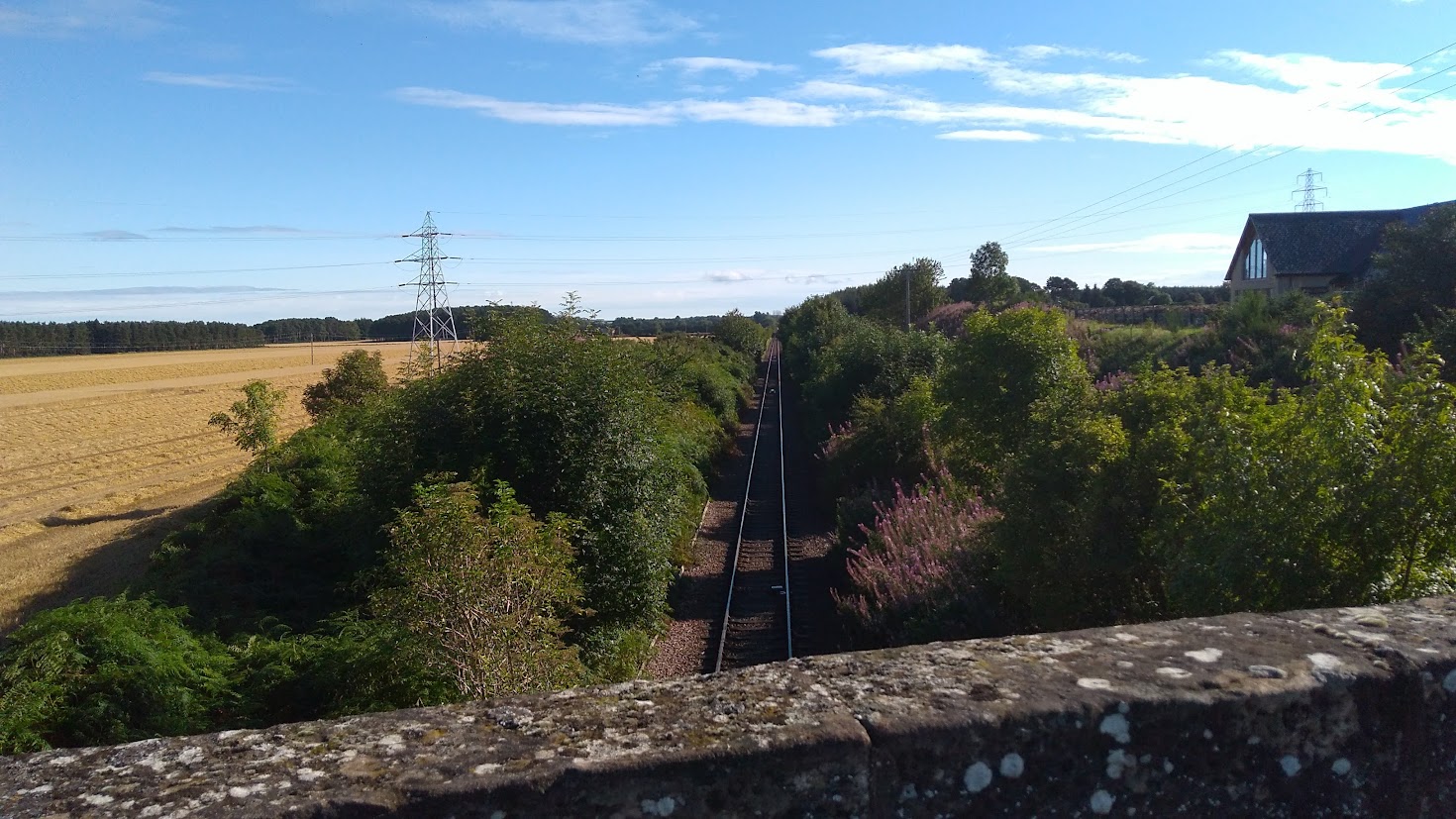 and across the Inverness to Aberdeen railway
 Through fields of corn following minor roads
 To meet the edge of the marshes around the findhorn estuary
 then more straight roads towards....
 Marshes and Estuary and Findhorn in the distance
 ... to Kinloss, Now I knew Kinloss as the base for the Rescue helicpoters, Thankfully never had to call on them but used to love watching the huge Sea kings flying over the fells, Now retired of course
 we turned left at Kinloss and passed the Abbey inn too early for lunch
 Passed the Church
 and Parked on the tarmac was a Nimrod
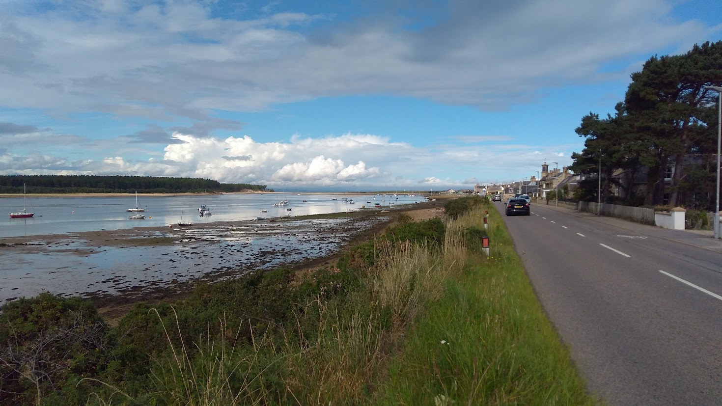 arriving into Findhorn
 Looking back over the estuary to Forres
 Cath using the Binoculars to scout the way ahead
 We stopped in the Findhorn Yacht club cafe for an excellent lunch, Linguinie aux Fruits de mer for me Yum Yum Yum
Whilst we were eating a squall came through and it rained heavily good thing we stopped for lunch, from there it was across to the beach and our first view of the walk of the North Sea.


Then through a strange landscape of shingle and sand
 Thats our destination for the day Burghead at the end of the bay around 7 miles away
 Looking back along the coast and I think the gap in the hills is the Cromaty Firth
 Shingle and sand desert
 Cath waiting for me to catch up after detouring to find a geocache
 The trail rejoins the beach at the boundary fence of the Air base the sea was so Blue
 Not too long until the fence needs moving back from the eroding beach
 Into the trees and the long sweep of the bay leading to burghead
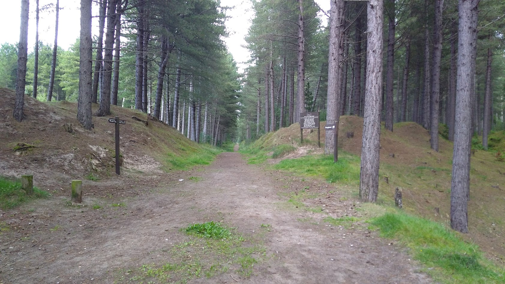 The next few miles is a pleasant walk through the forest though we had a few rain showers
 To emerge from the trees at Burghead
 The end of a long first day for us, seemed longer than 13 miles but I was getting used to carrying all our clothes etc on my back with Cath carrying the day sack, but we managed to avoid the worst of the rain and really enjoyed the coast walk.
