free to be able to rate and comment on reports (as well as access 1:25000 mapping).
The good news is that I think I have finally sorted out my Flickr account so no more composite photos, the bad news is that my photographs are taken with my mobile so not brilliant quality.
Munros Sgurr nan Coireachan
Garbh Cioch Mor
Sgurr na Ciche
CorbettsBen Tee
Meall na h-Eilde
Geal Charn
Sgurr Mhurlagain
Fraoch Bheinn
Sgurr Cos na Breachd Laoidh
GrahamsSgurr Coinnich
Meall Blair
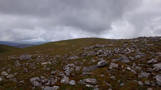
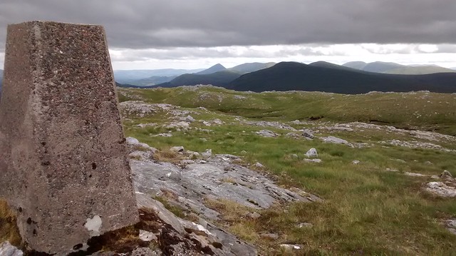
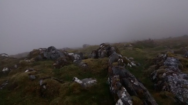
17/07/2018Up at 4.30 and setting off from home even before my early bird neighbours were up to catch the first bus of the day and of my trip. 3 buses and 11 ½ hours later, I’m ready for the walk, stepping onto the Watershed at 4 pm, The highlight of the trip thus far was discovering I had put on the wrong trousers and wondered who else had noticed that I had split them down the back seam. A big red neck and a change into my “going home” trousers, plus cursing my stupidity and I was ready for off with the offending pair stowed probably for the next 5-6 days. I wasn’t ready to don my shorts, there was bracken ahead and on the flatter ground, thick scratchy heather, both no doubt crawling with ticks just ready to jump aboard.
 Watershed at Great Glen
 by
Seal54, on Flickr
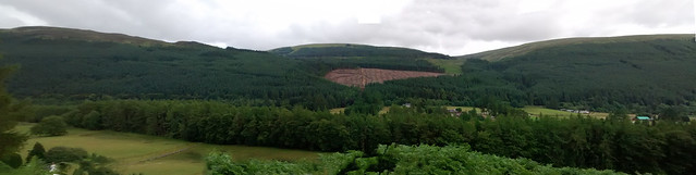
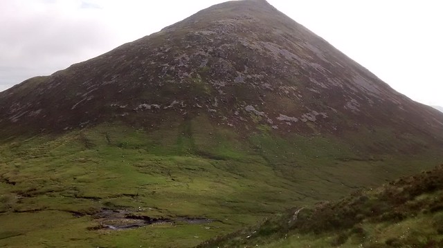
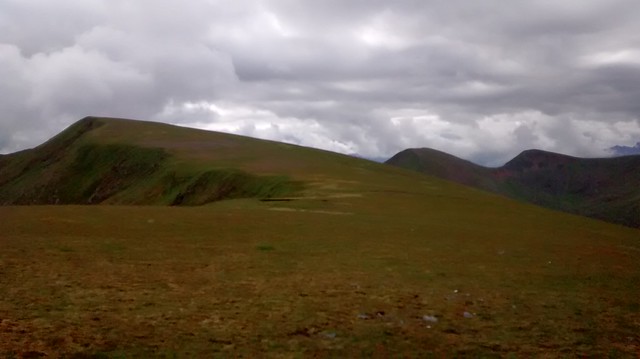
The day was warm, muggy and overcast and I expected to be joined by a halo of flies as I sweated up the lower slopes of Ben Tee but they, like the midges, seem to have been hammered by the long dry spell. Conditions were pretty near to ideal, problem was, I wasn’t and the intervening weeks had drifted by without much walking on my part. I paid the price and used every opportunity to stop and admire the views or the plant life.
 Ben Tee ahead
 by
Seal54, on Flickr
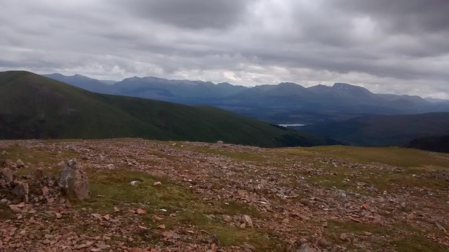
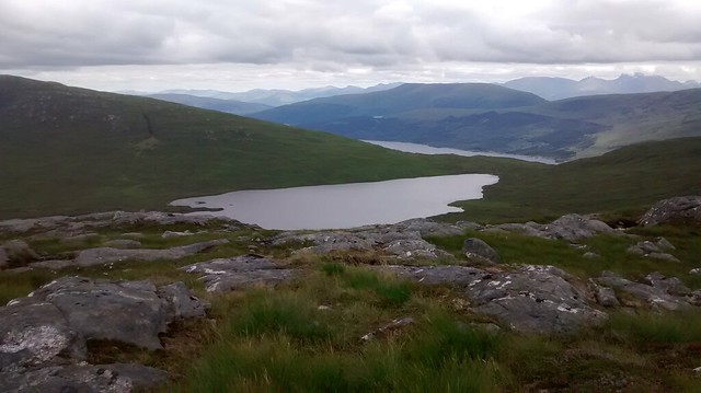
 Loch Garry and Beyond
 by
Seal54, on Flickr
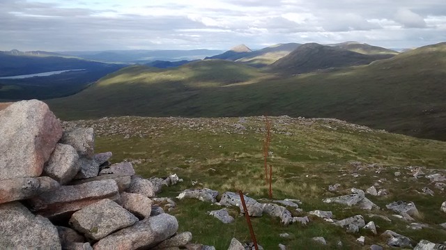
Some of the earlier flowers were over but there were new kids on the block with tiny eyebright now making an appearance along with the bright yellow spears of bog asphodel and the tall bobbing heads of purple scabious. Orchids, white, pink and purple muscled in on the act and all the heathers were in bloom. I am ashamed to say that it took near on 4 hours to reach the summit of Ben Tee. This climb of over 860 m is, I think, the longest continuous climb of the Watershed, the Great Glen being a mere 35 m above sea level, lower even than the Forth & Clyde canal at near Kelvinhead, the previous lowest point. The climb is rewarded with views in most directions although the eastern shoulder of Sron a’Choire Gairbhe out to Sean Mheall blocked the views south.
 Summit of Ben Tee,
 by
Seal54, on Flickr
 Looking west
 by
Seal54, on Flickr
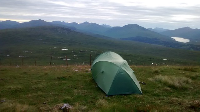
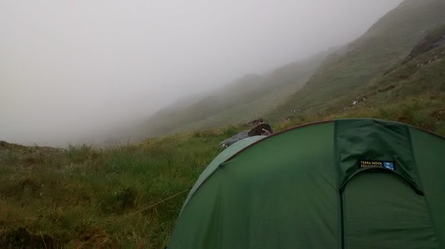
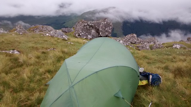
Having hauled myself up the 800 plus metres I immediately had to descend 350m down to Bealach Easain and where I intended to camp for the night, my early start catching up with me. The slopes were covered in small, ankle wrenching rocks hiding amongst the heather making for trouble if a foot was wrongly placed so this helped to slow my descent.I had previously looked out at Ben Tee from Sron a' Choire Ghairbh and thought it would be good to add it onto the 2 Munros. The steep descent and re ascent maybe put people off but I could see no obvious path indicating that others also thought so. The camp site was fine if lacking in the fine views of a higher spot. The ground was no longer the dry crunch of my previous outing but neither was it sodden. A pleasant, comfy billet for the night.
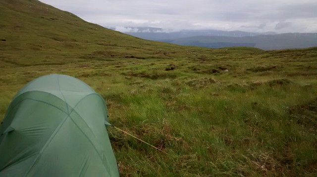 Camp site Bealach Easain
 by
Seal54, on Flickr
Watershed Stats for the day; 4 miles 6.6 km height gain 824m, height loss 346m
18/07/18]
No alarm was set or required and I woke at 7.00 and was away at 8.30. The day was overcast but warm so the shorts came out and I was able to reserve my good trousers for the journey home. Another steep climb to start, this time of about 350 m to the end of the Meall Choire Ghlas ridge. I was struck by how quiet the hills were. There was no sight of sound of any birds and a total absence of the sound of running water. I hunted for, and found, a quiet trickle to fill my bottle with.
 Nae water
 by
Seal54, on Flickr
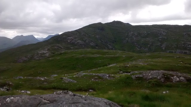
 Ben Tee
 by
Seal54, on Flickr
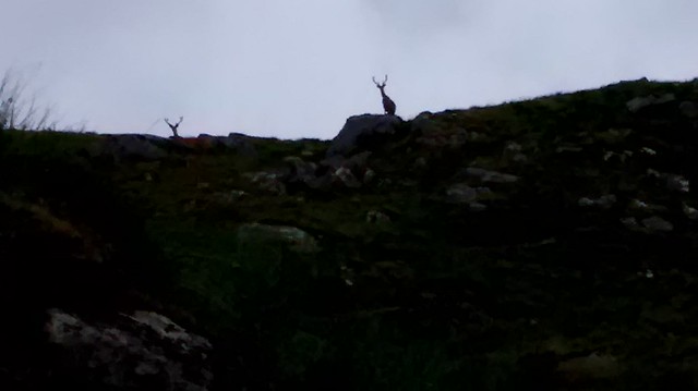
Once up on the ridge proper I was rewarded with an easy 1 ½ kilometres of wind-pruned vegetation and views to the west. The full stop of Sgurr na Ciche at the end beckoning me on as Ben Lomond had back in the Central Belt. Between me and the full stop, a veritable switch back of climb and descent, with the only respite, boggy looking low ground at the bealachs. Ahead a group of deer grazed unconcernedly as I approach from downwind. The clatter of my poles jump-started them and they were off. After this rarely an hour went by without sight of deer, often very close, this very much being deer stalking country.
 Ben Tee
 by
Seal54, on Flickr
 IMG_20180718_101008355
 by
Seal54, on Flickr
 Deer ahead
 by
Seal54, on Flickr
 Stob a Chiore Ghairbh
 by
Seal54, on Flickr
The summit of Sron a Choire Gaibhre lies a short distance off the Watershed. I knew I would regret not going to the summit on what would be my 3rd ascent of this hill but my slow rate of progress convinced me that I needed to stay focussed on the Watershed. Would I regret this? Probably. 500 m of descent later, I met my first deer fence of this trip. Past this hurdle the Watershed passes close by a burn coming out of Bealach an Essain. This burn was chortling and gurgling its way down the mountain, where the water came from on this driest of summers I do not know but it was the most significant and noisiest water I had seen for a while and handy for a refill.
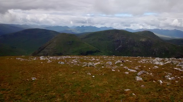 Meall na h-Eilde
 by
Seal54, on Flickr
The ascent (another 300m) goes up over a rocky nose which before making the ridge of Meall na h-Eilde, a Corbett (838m), and turning south to the summit. This is a second ascent for me, previously having climbed this and Geal Charn on a cold, February day with snow on the ground. The relentless up and down could be dispiriting but the views make the heart sing (Wild Thing). I love pouring over maps but there is nothing to compare to the real thing and putting Scotland together like pieces of a jigsaw puzzle. Climbing hills for their classification be it Munro, Corbett or Graham can lead to an isolationist way of thinking. Here I could see the hills of the South Clunie ridge and Sgurr na Ciche with the northern Loch Quoich hills. Gairich on the south shores in between showing how close these hills are if you don’t travel to them by road. To the south Bheinn Bhetheir, Ben Nevis, Carn Mor Dearg, the Aonachs, the Grey Corries and all the way to Creag Megaidh window which remains visible. Nearer, across Loch Arkaig, Meall Phubuill and Gulvain beyond. Ben Nevis was clear of cloud. I ponder on the classification of hills as I quickly make my way down the next short descent and re-ascent (only just over a 100m) meaning that Meall Coire nan Saobhaidh at 826m doesn’t make it into the Corbett list but the next hill does at 804 m with a drop of 180m and re-ascent of just over the requisite 152m. Meall Coire nan Saobhaidh is probably hump, tump or even a lump but hopefully not a trump. A novel classification could be to call them all….hills but where would be the fun in that. Iron fence posts appeared with the summit of Meall na h-Eilde , following the Watershed (mainly) and I start following them (mainly)
 Meall na h-Eilde summit
 by
Seal54, on Flickr
 Stob Coire Easain to Ben Nevis
 by
Seal54, on Flickr
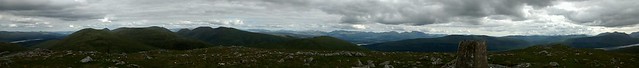
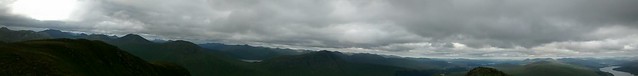
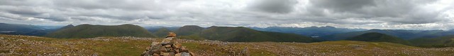 Summit panorama Eatern side
 by
Seal54, on Flickr
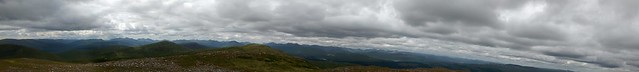 Summit panorama western side
 by
Seal54, on Flickr
 Summit Meall Coire nan Saobhaidh
 by
Seal54, on Flickr
 Ciste Dubh etc
 by
Seal54, on Flickr
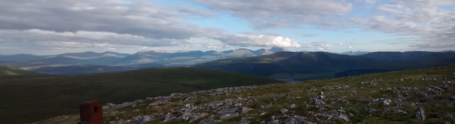
Geal Charn (804) is also decorated with a trigpoint. I try and pick out the intermediary hills between here and Sgurr na Ciche but the light is such they tend to blend together. It feels a bit of a slog over Carn Dubh and once again I am faced with another steep climb to the shoulder of the next hill, Sgurr Choinnich, (749m), a Graham. There has been a pleasant breeze all day. No sign of midges or cleggs but in the shelter of the shoulder the breeze leaves me and for the first time this year the midges hone in for the attack. I race for the top of the shoulder and am rewarded with enough wind to disperse the wee blighters. I stop for breath and see a golden eagle. I lost it and then it reappeared and I was able to watch it and indeed photo it for about 5 minutes before it decided that I was far too large for its dinner.
 Summit Geal Charn looking west
 by
Seal54, on Flickr
 Summit Geal Charn
 by
Seal54, on Flickr
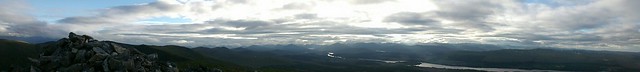
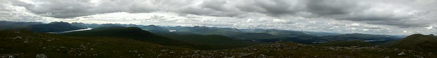
 Panorama from summit of Geal Charn
 by
Seal54, on Flickr
 Panorama looking North
 by
Seal54, on Flickr
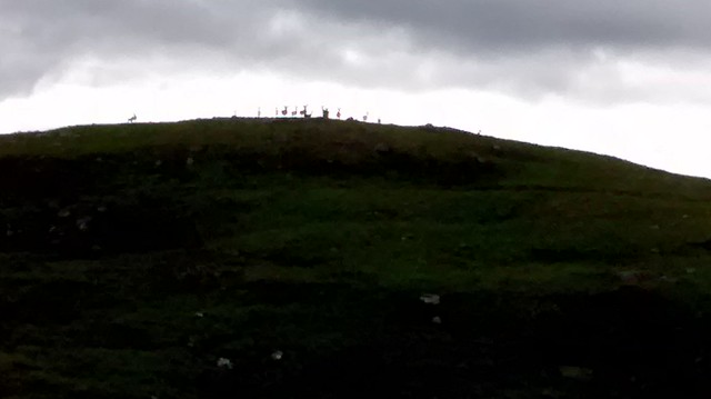 Deer on the Horizon
 by
Seal54, on Flickr
 Glen Finnan hills
 by
Seal54, on Flickr
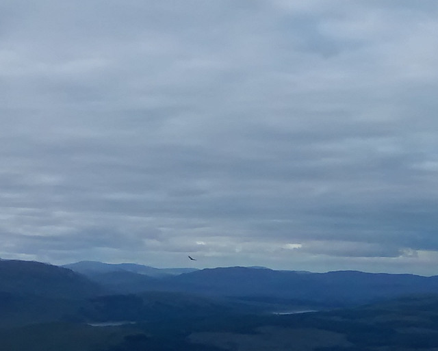 The Eagle
 by
Seal54, on Flickr
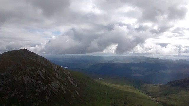
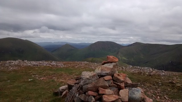
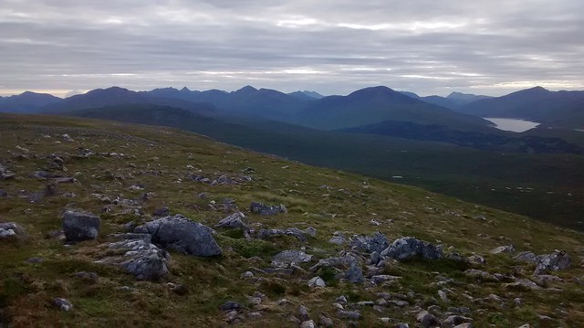
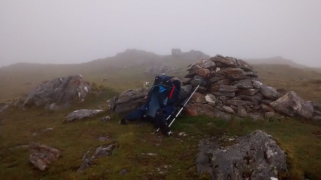
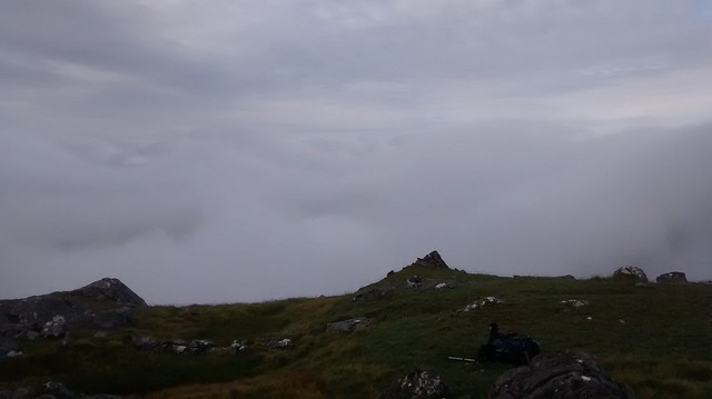
Over the summit of Sgurr Coinnich and I started looking for a suitable spot to camp. It was still early and I would have liked to get a few more miles in but Meall Blair was still over 3 miles distance and I wanted a high camp. In the event I found what I think was my best camp ever. The ground was flat, dry and grassy. The sun shone and high clouds cast patterns on the hills to the south. west and north of me. There were seat sized rocks near at hand where I could sit and enjoy my tea, picking out all the hills around me. The ground ahead was liberally scattered with lochans and looked very wet but that was for tomorrow.
 Summit Sgurr Choinnich
 by
Seal54, on Flickr
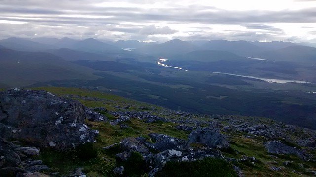
 Ben Nevis and the Grey Corries from Sgurr Coinnich Summit
 by
Seal54, on Flickr
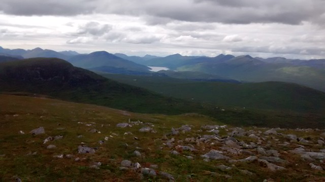
 Sgurr na Ciche ahead, Loch Quoich to the right
 by
Seal54, on Flickr
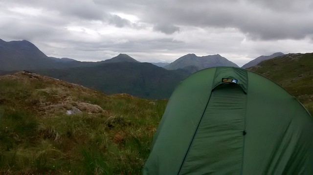
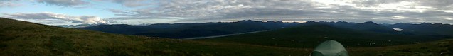 Campsite
 by
Seal54, on Flickr
 Camping views
 by
Seal54, on Flickr
Day’s stats; 8.4m, 13.4 km. 1417m gain 1337m loss
Running total; 12.4m, 20 km. 2241m gain ,1683m loss
19/07/18During the night, I am woken by a creaky door sound as a ptarmigan comes across the tent and I peek out at the reddening sky which I think is the sun coming up rather than going down. It is wonderfully peaceful.
 Early morning
 by
Seal54, on Flickr
Later, at 7, I wake again. There has been a heavy dew and wisps of cloud drift through the glen below me as I breakfast and break camp.
 morning cloud
 by
Seal54, on Flickr
Down almost 300m to the bealach which is a confusing area of lumps, bumps and lochans and a random pole. I followed the route I had marked on the 1:50 000 but remained with the fence too long and overshot the crossing to Meall Lochan an Dubh Lochan. After the golden eagle last evening, breaking the duck as it were for birds, the bealach was hoaching with them; plovers, pippets and grouse all giving me what for. The day was clouding up but I still saw plenty of lizards and frogs of all sizes. Below and to the south of Sgurr Choinich is the Alt Mhuic nature reserve where I have been lucky to see the rare, chequered skipper butterfly. I had hoped to have seen more butterflies and Odonata on this trip but the only one I saw was a common darter, between Sgurr Choinnich and Meall Blair and, after I had left the Watershed to walk into Knoydart, scotch argus butterflies, flying in the mist.
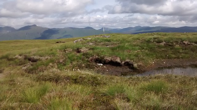 Random Pole
 by
Seal54, on Flickr
 Meall Lochan nan Dubh Lochan
 by
Seal54, on Flickr
 Lochan na Beinne Baine
 by
Seal54, on Flickr
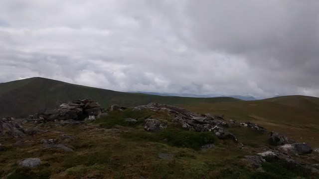
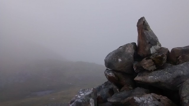
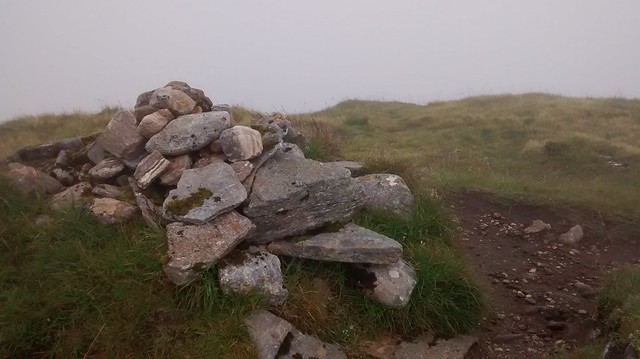
Up and over Meall Lochan an Dubh lochan with twice maybe thrice as many lochans as its name then onto the TP of Meall Blair.
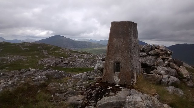 Trig Point Meall Blair
 by
Seal54, on Flickr
 Trig point and view back to Ben Tee
 by
Seal54, on Flickr
Again there is little respite from the endless up and down and I am soon on the steep 350m descent to the north end of Lochan Dubh which adjoins Loch Blair. It is a good spot for lunch so I stop and fuel up for the climb ahead. There is an abundance of both types of sundew down by the loch.
 Lochan Dubh
 by
Seal54, on Flickr
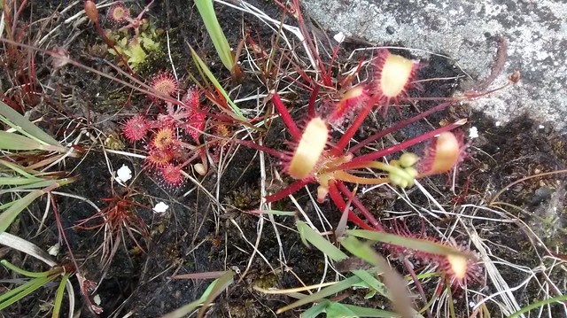 Two varieties of Sundew
 by
Seal54, on Flickr
My next objective, Sgurr Mhurlagain (880m Corbett) looked a long way off with some up and down on the way. The shoulder did not disappoint with some good crags and opportunities of mild scrambling and views down to Glen Kingie with Gairich keeping pace across the way but at times it felt that the summit was never getting nearer. Looking back down Loch Arkaig the Creag Meagaidh window was still in sight. Finally, at the summit in just under 4 hours, I have awe inspiring views across Glen Dessary, down Loch Arkaig across to Sgurr Mor , Sgurr nan Fhuaran and Gairich. Memories of a high camp on The Sgurr Mor- Sgurr nan Fhuaran ridge one beautiful mid-summer night come flooding back.
 Sgurr Mhurlagain from Mam an Doire Duinn
 by
Seal54, on Flickr
 Loch Blair with Loch Arkaig behind
 by
Seal54, on Flickr
 Summit Sgurr Mhurlagain
 by
Seal54, on Flickr
 Panorama from summit of Sgurr Mhurlagain
 by
Seal54, on Flickr
 Loch Arkaig
 by
Seal54, on Flickr
The ridge had sapped my energy and thoughts of completing the day with 2 Corbetts faded. Fraoch Bheinn looked large and craggy and a hill too far today. The weather was deteriorating and to reach the other side of Fraoch Bheinn to a possible campsite still required almost 400 m of descent and reascent. The wind was picking up and after crossing Feith a Bhrolaich which was as boggy as I remember it from 2 trips to Sgurr Mor, I found a flat campsite at about 550 m. On the ascent, I found my first blaeberry of the year. It quickly disappeared!
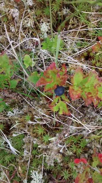 Blaeberry!
 by
Seal54, on Flickr
I had been watched by deer as I approached the area and the long grass suggested that there would probably ticks about and sure enough I soon saw one crawling towards me as I ate my tea. Each night I checked for these wee beasties and managed to pick up only one on the whole trip which I found pretty amazing.
 More deer
 by
Seal54, on Flickr
I had no views from inside the tent as I pitched with my back to the wind but outside I could see to Gulvain, Streap and Sgurr Thuilm.
 Campsite Fraoch Bheinn
 by
Seal54, on Flickr
A check of the MWIS site brought disappointing information for Friday
“Winds 15-15 mph, drizzly rain in the morning, lessening in the afternoon. Chance of cloud free Munros 10%”
Saturday’s forecast was similar but with 40% chance of cloud free Munros but worse towards the west. Ah well, at least there would be water.
Before I fell asleep I thought that I would walk to Kinbreak bothy, leave my stuff and do a circuit of Fraoch Bheinn and Sgurr Cos na Breachd Laoidh and back to the bothy. Then, if the weather didn’t improve, I would walk out to Glenfinnan. This seemed like a good idea.
Day’s stats; 9.3m,15km 983m gain 911 loss
Running total; 21.7m, 35km 3224 gain 2774 loss
20/07/18Almost as soon as I woke I thought what a bad idea my plan was. Instead, as the weather was going to improve, I would wait until after lunch and in, hopefully in better weather, I would continue over Fraoch Bheinn and start up Sgurr Cos na Breachd-laoidh, leaving the rest of the route out to Sgurr na Ciche manageable on Saturday. The drizzly rain sounded anything but and sticking my nose out of the tent confirmed that this 2nd plan was preferable as I couldn’t see the valley floor.
I tidied up my stuff, sorting the rubbish into a spare bag and stowing it away. I then re-packed everything except my sleeping bag and stove. This took all of 10 minutes so I settled down to read a story about witches, vampires and daemons, checking on the state of the cloud every 30 minutes or so, willing it to lift. Around midday there appeared to be a little improvement and I cooked and ate a good lunch.
 Cloud at midday
 by
Seal54, on Flickr
I decided that I would take my chance and headed off up the steep slopes at around 2 pm. Whilst the cloud lifted and fell, with the sun threatening to break through I was in cloud to the summit and needed a bearing to take me off.
 Summit Fraoch Bheinn
 by
Seal54, on Flickr
Descending, I came out below the cloud at about 650m, it was beginning to clear.
 Clearing off Sgurr Cos na Breachd-laoidh
 by
Seal54, on Flickr
Across the way Sgurr Cos na Breachd-laoidh looked as difficult as its name. The wet rocks glistened in the sun which had now come out. I decided to take a route slightly to the left of the main Watershed route. This looked steep and slippery enough but in fact presented no problems and I felt that I should have stuck to the Watershed. With the amount of rock to vegetation ratio increasing with height I decided to camp before the first summit and leave the Corbett and 3 Munros for tomorrow. Another lovely evening camp looking over to the Glen Finnan Munros. I watch the clouds building over the tops, covering them with fluffy white duvets. My hill remained clear but across Loch Arkaig, the tops were obscured.
 Clearing clouds on ascent of Sgurr Cos na Breachd-laoidh
 by
Seal54, on Flickr
 clouds across Glen Dessary
 by
Seal54, on Flickr
 Campsite on Sgurr Cos na Breachd-Laoidh
 by
Seal54, on Flickr
I was optimistic for the next day. There was a lot of up and down but with the ridge beyond An Eag never dropping below 700m, there should be good views. I was missing pizza night at The Table in Knoydart but other than that I am happy to have made the decision to stay on the Watershed.
Day’s stats; 2m, 3km 641m gain 515m loss
Running tota;l 23.7m 38km 3865 gain 3289 loss
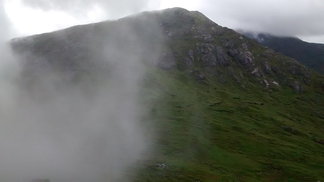
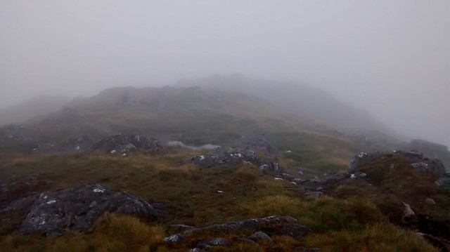
21/07/18I woke to cloud but with the sun threatening to break through, I wasn’t unduly disappointed. I doubted I would have the temperature inversion that Dave Hewiit enjoyed but as I climbed to the first 815m point and the first of the 9 summits I would cross today, occasionally blue sky appeared above me as I remained in cloud, “beam me up Scotty”. The hill just lacked the few extra metres needed to get above the cloud. I didn't know at the time that this was to be the best weather of the day.
 First summit on Sgurr Cos na Breachd-laoidh
 by
Seal54, on Flickr
 Cloud threatening to lift
 by
Seal54, on Flickr
 A few metres more
 by
Seal54, on Flickr
 Just not high enough
 by
Seal54, on Flickr
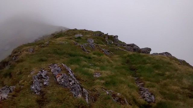
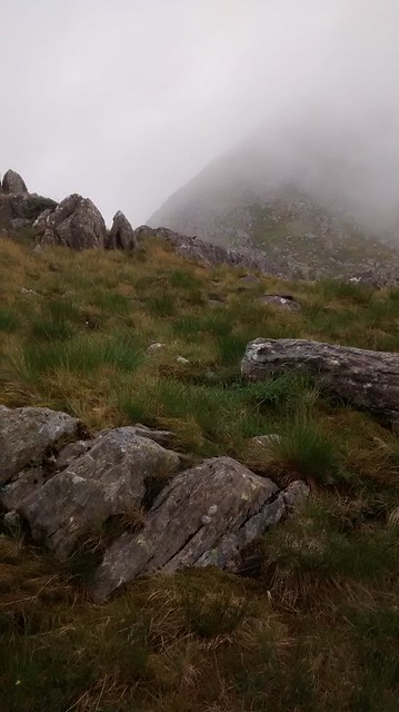
A line of old iron fence posts came in from the north and these would stay with me along the ridge until a dry stane dyke took over at the start of the Garbh Chioch ridge. Like Fraoch Bheinn and Sgurr Mhurgalain I have climbed this hill before completing it in the same direction as today. Then, I had been concerned that the finger of rock, A’Chioch, would present a bit of a challenge but it is easily passed and gives choices of a little scramble or an easy passage. Today both the vegetation and rocks were slippery with the moisture dripping from the clouds so I took the easy route along the fence line.
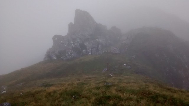 A' Chioch
 by
Seal54, on Flickr
 Momentary clearing again
 by
Seal54, on Flickr
 Cloud clearing around A'Chioch
 by
Seal54, on Flickr
 Summit Sgurr Cos Breachd-loaidh
 by
Seal54, on Flickr
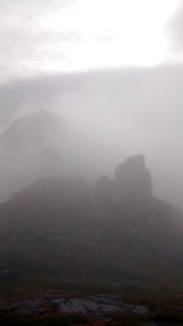
The mist swirled and thinned but each time I reached for my phone to take an atmospheric photo, it closed in again. At the summit of the Corbett (3rd peak), I made sure that the fence was heading in the right direction before following it down slope. I hadn’t gained confidence that it would be with me all the way and so when it veered off route near the col I kept to the right and ended up a few metres down from the col. The col was particularly dark and gloomy and the climb up An Eag as slippery as the descent, I occasionally used the fence posts to haul myself up. In the mist I failed to notice that the fence had veered off again and at the summit I was momentarily confused by the onward direction which appeared (in the mist) to go over a sheer drop. Visibility was down to a few metres. At one point I headed off on a strong path until I realised that it was the path to Sgurr Mor, totally the wrong direction. I contoured back round to just below the summit and started off gingerly down my compass bearing. Oh me of little faith, here were the fence posts again and a very minor steepness soon levelled off to an easy gradient, the mist having obscured the levelling out.
 An Eag summit ( Ithink)
 by
Seal54, on Flickr
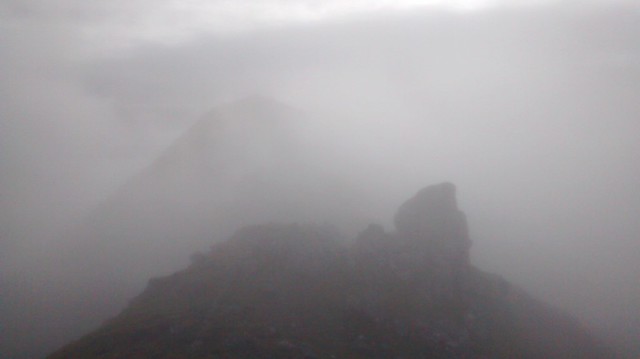
After the big ups and downs of the previous days, today’s ups and downs seemed mild in comparison. In the mist though, there was no sense of progress and only the twists and turns of the ridge gave me any clues as to where I was. The summit of Sgurr nan Coireachan appeared out of the mist and there was another brief lightness in the cloud. "Come on!" I shout but the cloud swirls in and around me again.
 Threatening to clear again
 by
Seal54, on Flickr
 Summit Sgurr nan Coireachan
 by
Seal54, on Flickr
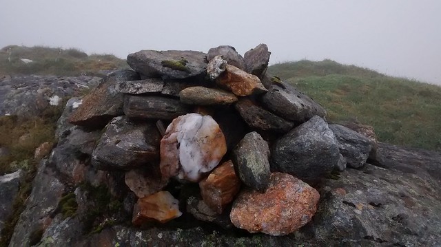
 Sgurr nan Coireachan cairn
 by
Seal54, on Flickr
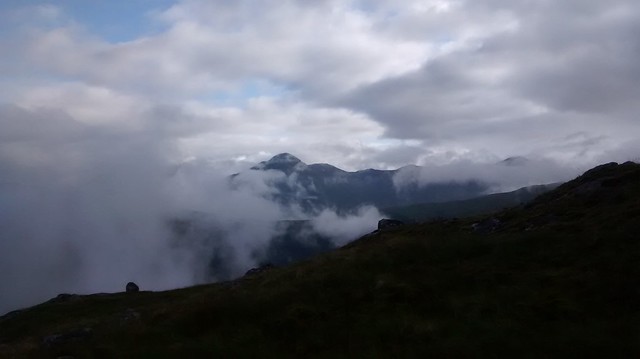
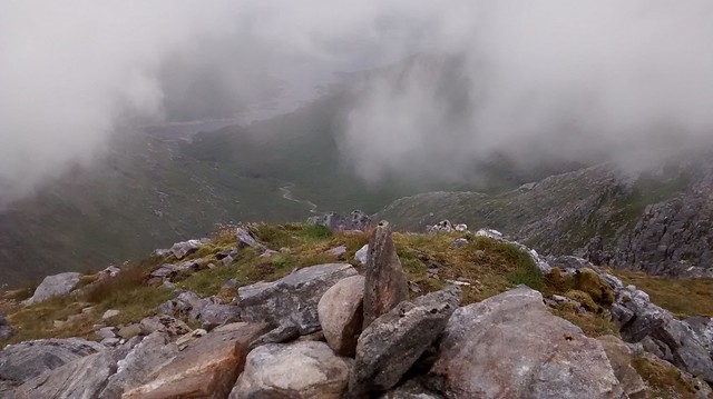
Fortunately, I have had good views on all these hills but it makes it no less disappointing that there are only tantalising glimpses today of a shoulder here, a glen there and a very low Loch Quoich beneath it all. The hills were acting like Victorian ladies and keeping the skirts of mists modestly wrapped around them.
There had been a faint path along the fence line from An Eag but now a significantly eroded path made its appearance, a testimony to the popularity of Munros. The wet, scree strewn path slowed my progress to the col but once there the rocks were not as wet as expected and it made a change to cross the col on solid rock as opposed to dodging sinking peat hags.
 Clearing on descent of Sgurr nan Coireachan
 by
Seal54, on Flickr
 Slabby col
 by
Seal54, on Flickr
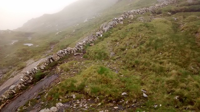
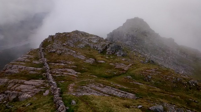
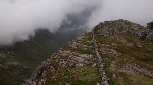
I think it is the first such col on the Watershed. At the col the fence gave over to a well-constructed and rather fine wall, although at times it couldn’t make up its mind whether it was a fence or a wall or both. One wonders at the necessity of such a wall along this ridge. Who was it keeping out (or in)? It seems that there have always been those who need to mark their boundary with a wall whether or not it is needed or welcome. Today it is a handy guide if I ever lost the path. There was no shortage of materials for the wall and at times the ridge on either side resembled a drystone dyke rejection pile, with chunky rocks lying this way and that. Other times it seemed that there was nothing stopping the wall crashing down the north side of the ridge but it has lasted so far, evidently well built.
 The wall takes over
 by
Seal54, on Flickr
My Munro diary of my previous ascent of the Munros states “Never-ending lumpy ridge. Would have been more enjoyable if not pressed for time. Recognisable by dry stane dyke,” I wasn’t so pressed for time today but I was beginning to have concerns for the descent off Sgurr na Ciche if the cloud stayed low. Dave Hewitt says in "Walking the Watershed" “This side of the hill is even rougher than the southern flank: endless crags and slabs needing dodged. Nothing difficult, just continuously awkward The drystone dyke descends with me, usually showing the quickest route through ground less navigable in broad daylight than are many hills in thick mist.” I knew that the wall would help to begin with but it disappears off to towards Ben Aden all too soon. Then there was what Peter Wright says. “Careful route finding is again called for here, picking a way north-eastwards by way Meall Chiore Duibh” From "The Ribbon of Wildness"
But I am getting ahead of myself. I have still the Garbh Chioch ridge to complete and an increasing number of happy walkers going my way and the contra flow of those doing it from Sourlies. All faster than me but all pleased to chat and everyone, despite the poor weather, in an up-beat frame of mind. In fact, this prompted me to wonder if I had ever encountered an unhappy walker on the hill. There have been those who have passed with a mere grunt or even (back at Beinn Mhanach) no greeting at all but these were perhaps just wary of engagement. I can’t recall ever meeting anyone who wasn’t glad to be out in the hills regardless of the conditions, ever optimistic the weather, at some unspecified future moment, would improve.
 On way up Garbh Chioch ridge
 by
Seal54, on Flickr
I lost count of the ups and downs and twists and turns and after a scramble up some rocks was surprised to find Garbh Chioch Mhor ahead as the clouds cleared momentarily and I could see down to Loch Quoich and back to Garbh Chioch Beag.
 Wall and Garbh Chioch Beag
 by
Seal54, on Flickr
 A glimpse of Loch Quoich
 by
Seal54, on Flickr
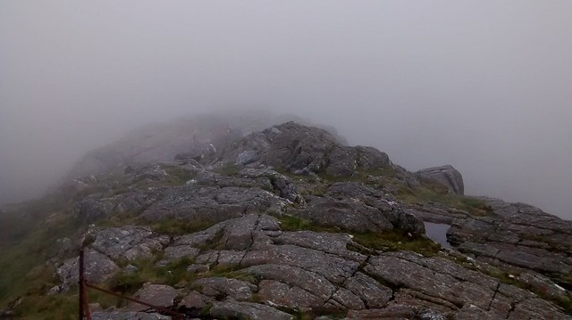
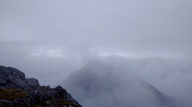
An easy scramble and I am on the summit of Garbh Chioch Mhor. The mist starts to clear and I can see
across to Sgurr na CIche. I had quick keek down to Meall a Choire Duibh. The map’s squiggles were no exaggeration and I hoped the brief clearance would herald a complete clearance. I had made up my mind that unless the visibility improved I would come back down to the col after climbing Sgurr na Ciche and head down to the stalkers path that goes to Loch Quoich from there. I still had memories of the descent from Ben Lui etched on my brain and it only had 3 bands of squiggles, this was one long complex squiggle.
 Loch Quoich from Summit of Garbh Cioch Mor
 by
Seal54, on Flickr
 Sgurr na Ciche
 by
Seal54, on Flickr
 Sgurr na Ciche appearing
 by
Seal54, on Flickr
Meantime I enjoyed the summit of Garbh Cioch Mor. This had been my 200th Munro back in April 2002. Today, I didn’t have long before the cloud closed in again and the rain started. It didn’t take much persuading for me to leave my bag at the col and sprint up to the summit of Sgurr na Ciche.
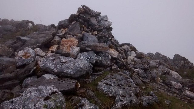 Summit cairn Sgurr na Ciche
 by
Seal54, on Flickr
The weather had turned windy as well as wet and with no views there was nothing to keep me there. I have often looked at this peak from the Long Beach campsite in Knoydart and I had been looking forward to looking down into Knoydart and seeing the western seaboard. It was not to be. I even forgot to look for the toppled trig point. I was at the full stop of the ridge but could have been anywhere. I didn’t have time to feel disappointed. The weather was now wet and showing no signs of improvement. I had completed a further 28.7 miles 46.2 km of the Watershed at this point with 5017m of climb and 4056 m of descent.
 Mist on the descent route
 by
Seal54, on Flickr
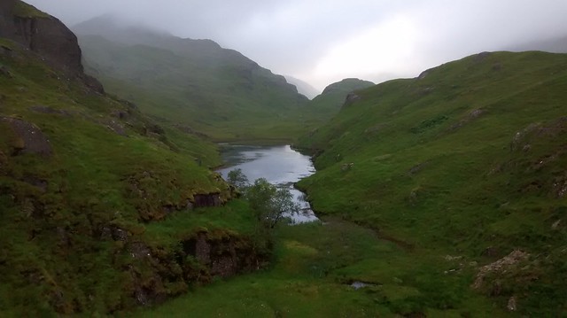
Back at the col and I made my way north and down to the stalkers path just under 2 km distance and from there to the first dam on Loch Quoich. The Loch was impressively low, the lowest I have ever seen. I then headed to a camp spot above the beautiful and lonely Lochan nam Breac. The rain was now coming down heavily. The cloud was low and it did not bode well for the morrow.
 Watershed from damn
 by
Seal54, on Flickr
 A very low Loch Quoich
 by
Seal54, on Flickr
 Looking west from dam
 by
Seal54, on Flickr
Day’s stats; 8.8m. 14 km 1218 m gain 1670m loss
Running total; 32.5m. 52km 5083m gain 4959m loss
Total for the Watershed so far 657 km 425m (roughly)
My plan had been to get as far as Sgurr a Choire Beithe, the most westerly point of the whole Watershed, on this trip. From there I intended to walk to Inverie and catch up with its good folk. It would mean a long walk out and back to the Watershed. Having missed the Watershed route down from Sgurr na Ciche I was in no hurry to continue to Sgurr a Choire Beithe particularly if the weather and visibility was poor. I wanted to see Loch Hourn and Barrisdale Bay from the summit, surely that was a must. So when the next day dawned wet and miserable with cloud down to my ankles I decided just to head out to Inverie over Mams Unndalain and Barrisdale. It was a very atmospheric walk with the rain having replenished all the burns so ribbons of white foamy water thundered and sang down the flanks of the hills. The mist, hovered around and below the 350 m level and Lochan nam Breac and its surrounds look surreal. I look forward to returning and although it will mean a bit of back tracking I think it will be worth it.
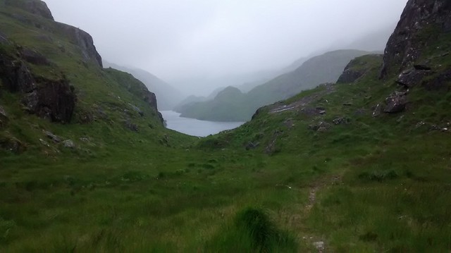 Lochan nam Breac
 by
Seal54, on Flickr
