free to be able to rate and comment on reports (as well as access 1:25000 mapping).
The Cape Wrath Trail formed the second half of a longer journey that comprised of walking just over 400 miles from Banchory in Aberdeenshire (from my girlfriend Sarah’s family home) to Cape Wrath, via Fort William. For the first leg from Banchory to Fort William, I was accompanied by Sarah and for the final leg from Ullapool to Cape Wrath, I was accompanied by my brother Josh. For the middle leg from Fort William to Ullapool, I went solo. For the purpose of this report I will solely focus on the Cape Wrath Trail.
Summary of Itinerary (Sat 6th July to Sun 21st July)Day 1: Fort William to Corryhully / Corryhully Bothy (24 miles)
Day 2: Corryhully Bothy to Carnach River / Camp (15 miles)
Day 3: Carnach River to Kinloch Hourn / Camp (19 miles)
Day 4: Kinloch Hourn to Ratagan / Hostel* (13 miles)
Day 5: Rest Day (0 miles)
Day 6: Ratagan to Killilan / Camp (17 miles)
Day 7: Killilan to Benondraig / Benondraig Bothy (17 miles)
Day 8: Benondraig to Kinlochewe / Hostel* (21 miles)
Day 9: Kinlochewe to Strath na Sealga / Camp (17 miles)
Day 10: Strath na Sealga to Ullapool / Campsite** (20 miles)
Day 11: Ullapool to Knockdamph / Knockdamph Bothy (11 miles)
Day 12: Knockdamph to Glen Oykel / Camp (18 miles)
Day 13: Glen Oykel to Inchnadamph / Hostel* (9 miles)
Day 14: Inchnadamph to Glendhu / Glendhu Bothy (12 miles)
Day 15: Glendhu to Badcall / Camp (21 miles)
Day 16: Badcall to Kervaig via Cape Wrath / Kervaig Bothy (21 miles)
*Resupply parcels were sent here.
**Resupplied from a shop here.
Prior ExperienceOne of the things I found most difficult to ascertain when I was deciding whether to walk the Cape Wrath Trail was whether I had the experience necessary to take on a challenge of this kind. It is often hard to gauge from the guide book what a sufficient level of experience is, or to get a sense of other people’s previous experience, so I thought it might be helpful to share what I’d done prior to walking the Cape Wrath Trail (some of it gained in the days and weeks leading up to the CWT itself):
- Self-supported three-day hike along the Pembrokeshire Coast Path with a friend.
- Self-supported three-day hike in the Pyrenees along clear paths.
- Four self-supported three-day hikes in the Peruvian Andes along clear paths.
- Self-supported ten-day hike from Banchory to Fort William, along the Deeside Way, Lairig Ghru and East Highland Way, with my girlfriend Sarah.
- Two days training in ‘Hill & Mountain Skills’, covering navigation, mountain weather, route planning and water hazards, amongst other things.
With this experience in mind, especially given that the vast majority of it was on clear paths, and with bridges over any rivers, I would say that the Cape Wrath Trail was right on the edge of my capabilities, especially for the first section during which I was hiking alone. I was extremely lucky with the weather for most of the trip, which could be the difference between a serene time in the mountains or a hair-raising experience. That being said, with the GPS navigation on the ViewRanger app on my phone, along with the skills picked up on the training course, navigation was relatively straight-forward and much of the time it was fairly obvious where one had to go – predominantly through a glen, over a pass and back down the other side. The real hazards were river crossings and this is where the weather is the key determinant factor as to the level of difficulty of each stage, with a couple of hours of rain making the difference between a simple boulder hop over a river or having to re-route altogether due to a river being impassable.
Day 0: Deciding between the Glenfinnan and the Great Glen variantsOn the day before I was due to set off from Fort William, I was still umming and ahhing over whether to go via Glenfinnan or the Great Glen Way. At the time, the Carnoch Bridge over the River Carnach was yet to be replaced, which (if the weather wasn’t in my favour) left a potentially impassable river on the third day of the Knoydart route. That, combined with a general nervousness about the scale of what I’d taken on, forced me to consider the apparently easier but less inspiring Great Glen variant. In the end, the weather forecast was looking okay for the first three days, so I stuck to the Glenfinnan route, but felt the need to make good time in order to get over the River Carnach and through Knoydart before the forecasted heavy rain began in four days’ time.
Day 1: Fort William to Corryhully (24 miles)I got a taxi down to the ferry port nice and early, and despite some anxiety-inducing midge chat with the taxi driver, I was ready and excited to get going. I was the only passenger on the ferry, which can’t have taken more than ten minutes to chug its way to Ardgour on the other side of Loch Linnhe.
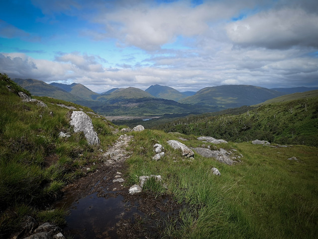
Following a decent stint walking along the quiet road that skirts the loch, I took a right turn up a 4x4 track towards Cona Glen. From here things picked up, and I really enjoyed the first taste of climbing - up to about 400m over Meall na Damh. The five days’ worth of food meant that my rucksack was heavier than it had been on the prelude to this trip, but I was feeling strong and the forecasted rainclouds hung in my mind, propelling me forwards to make the most of the sunny weather. The descent on the other side made for a nice introduction to the rough, boggy ground that I’d heard so much about, and with which I would become so well-acquainted in the following weeks.
Arriving at the Glenfinnan Visitor Centre was an abrupt ending to a nascent feeling of solitude. Who knew that so many people were so passionate about viaducts! It turns out that the Glenfinnan Viaduct appeared in the Harry Potter films, which explains why the number of visitors has reportedly grown from 40,000 visitors a year, a decade ago, to over 350,000 in 2018.
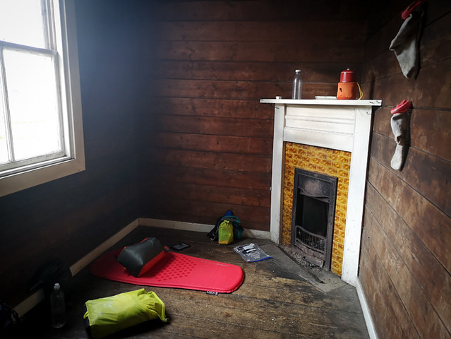
Anyway, the visitor centre did a nice cup of tea and from there I pushed on for the final hour of so up to the bothy at Corryhully. There I met three walkers; two that were walking the first leg of the CWT from Fort William to Morvich, and one who seemed to be regretting his decision to walk the entirety of the CWT and was exploring options for shortening his trip. He had two weeks’ worth of food with him and the pack weight was obviously getting him down. He also had leather boots and seemed to be having problems with the boggy ground.
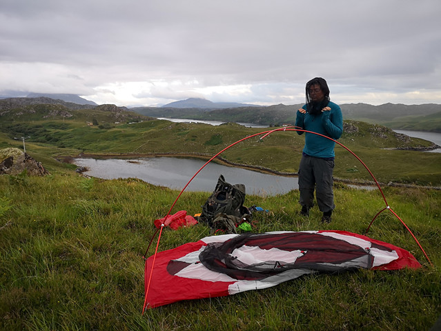
Following a little while sat by the fire, I decided to camp outside by the river. I was keen to get my one-person tent up for the first time of the trip and the wind was up so no real threat of midges.
 IMG_20190706_151750
 by
Fred Branson, on Flickr
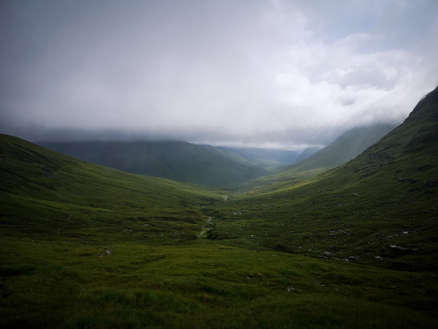
Day 2: Corryhully Bothy to Carnach River (15 miles)I awoke nice and early to another glorious day, and on hearing nothing from within the bothy, I set off towards the ‘rough bounds of Knoydart’. I was eager to get stuck in and it was reassuring to know that people would be coming up behind me, should I find myself well and truly out of my depth. Quite early on, I saw two walkers on the other side of the river, although it was hard to communicate anything beyond a friendly nod due to the noise of the water and the concentration it took for us to navigate our respective ways over the boggy ground. They turned out to be the only people I would see all day.
Heading up over the passes between Streap and Sgúrr Thuilm and over Màm na Cloich Airde gave me a good sense of how the terrain underfoot was going to be, and the sometimes-blurry line between path and non-path. Often when the map says that there’s a path, it’s quite indiscernible on the ground, amongst all the bog, or the boggy path has become eroded to the extent that it becomes the least viable option to walk along. At other times, when the map says that there is no path, there are in fact desire lines left by previous visitors (human or otherwise) to give you something to follow. As one of the walkers in the bothy said the previous night, the problem is not that there isn’t a path, it’s more likely to be that there are too many paths! I definitely fell victim to that briefly on my way up Màm na Cloich Airde.
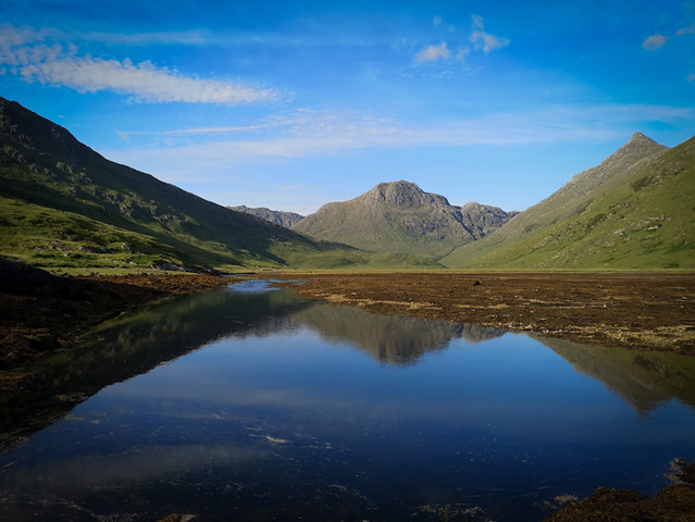
As I headed up towards the Lochain a’ Mhàim, the landscape became more and more enchanted and the feeling of isolation was intoxicating. I was so happy I’d decided to come this way! Coming down the other side made for stunning views of Loch Nevis and slowly brought into view the distant Sourlies Bothy, perched at the edge of the loch in the most unsuspecting of places. As I made it down to the bothy, I realised that the tide was out in the sea loch and that presented me with two opportunities to gain a little bit of time. Firstly, as the guidebook suggests, in order to head on from Sourlies, it is easier to go along the beach at low-tide than to go over the headland and through potentially waist-deep bogs towards the River Carnach. Secondly, according to some advice I’d received from a local man prior to setting off, given the lack of a bridge over the River Carnach, crossing the river where it meets the loch at low-tide is a good alternative. So, I didn’t stop long in Sourlies and I crossed the river fairly easily in the end, taking the opportunity for a quick bath in the shallows of the loch in the process, before setting up camp under the watchful eye of Sgurr na Ciche, just past the site of the Carnoch bridge, for which construction was obviously underway.
 IMG_20190707_190930
 by
Fred Branson, on Flickr
Day 3: Carnach River to Kinloch Hourn (19 miles)I woke up with a few more clouds in the sky than the previous evening. These were forecasted to build over the course of the day and to start raining at about 7pm. My aim was to get to Kinloch Hourn before then. I got going at 7am and absolutely loved heading over Mam Unndalain on my way to Barisdale Bothy, which was a natural half-way point on the way to Kinloch Hourn. There were some steep, pathless climbs, and these were rewarded with brilliant vistas of bulbous mountains draped in lush greens, with trees growing from the most unlikely of places. I reached Barisdale at 2pm and encountered a fair amount of construction work going on, which slightly tainted my experience of Barisdale Bay. Nonetheless, I stopped to make myself a coffee and take half an hour’s rest before tackling the second half of the day to Kinloch Hourn.
Despite the guidebook’s clear attempts to manage my expectations, I still underestimated this section, which seemed to go on forever, with some small but awkward climbs and descents. By this stage, I wasn’t feeling quite as steady on my feet and my dodgy ankle (I’d sprained it twice in the last six months) was causing me to be extra-careful with each tired step. At around 5pm, I bumped into a young walker who had set off from Ratagan at 6am that morning and was hoping to finish up in Barisdale – he was as exhausted as I was by this point and we barely managed to mutter much more than some expletives about our current states and an ETA for each other based on the respective halves we’d just covered. A littler after he had predicted, I reached Kinloch Hourn at 6.30pm as it was beginning to rain. Just as I saw a great looking camping spot by the river, I saw a sign saying that I needed to walk on a further 500m to talk to the estate before setting up camp. They were probably the hardest 500m I had to walk in the whole 400-mile trip. I summoned the will to head that way, paid the woman £1 and then set up my tent as quickly as possible before the rain really came in.
That evening I poured over the map, read and re-read the guide book. The weather seemed to be adding up with the forecast, which predicted an extended period of heavy rainfall for the next two days (my Garmin InReach Mini was really useful for getting up to date weather forecasts in these situations). The rain was set to get worse from about 9am and continue right through the following two days. The following section would include the highest pass of the whole trail, as well as two potentially impossible river crossings. With the midges amassing outside the tent, I went to sleep as early as possible, still weighing up the different options.
 IMG_20190708_145150
 by
Fred Branson, on Flickr
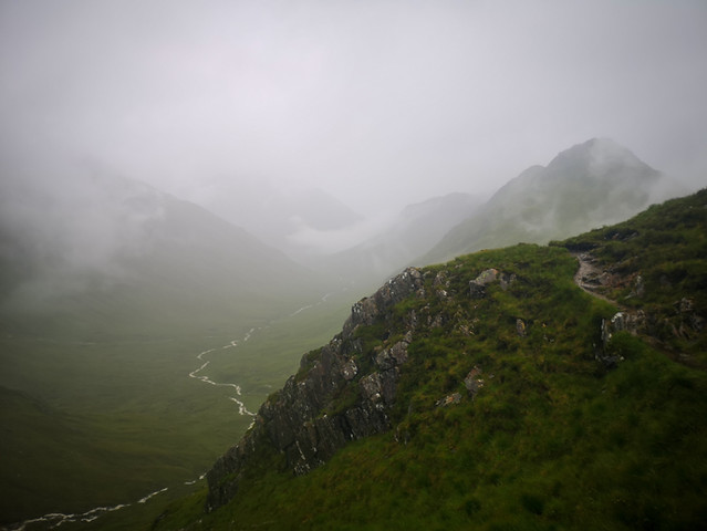
Day 4: Kinloch Hourn to Ratagan (13 miles)This turned out to be the most challenging day of the whole trip. I woke up at 4.15am, and realised that there had been a pause in the rain that had been pattering on my tent most of the night. By this stage I was wide awake, so I decided to seize the moment, setting off half an hour later in a bid to get over the two river crossings before the rain really set in and made them impassable. I remember thinking that I’d be up and over the pass and down to Ratagan for lunch. How wrong I was!
By the time I reached the first river crossing, the rain was already in full flow but the river had yet to fully swell and I was able to cross without any major difficulty. At this stage, I felt a little silly for having worried about the poor weather so much – I was actually quite enjoying the mysterious feel on the mountain. It was awe-inspiring to watch the mountain come alive with water streaming down every possible channel in increasingly furious flurries of white. But visibility became increasingly poor, the rain got heavier and before long my waterproofs had given up. I was now completely soaked through.
After a few minor navigational wrong turns (made in haste), I made my way through the pathless and rough glen, reaching the top of the pass and using an awkward-underfoot but extremely well-placed line of rocks as a hand rail to take me to Meallan Odhar. From there, I dropped down into the glen. By now, I knew that the river crossing on the main route would be impassable, and so looked to cross one of its tributaries further up. But even this was raging with white water and required a leap between two rocks that was far too risky. I climbed higher and higher but there was nowhere.
My movements were becoming more frenetic and it took some conscious effort to remain calm. Amidst the wild weather, I’d forgotten to stop for any rest or refuelling. I forced myself to stop and eat something whilst I weighed up my options, looking at the map and the guidebook. As far as I could gather, I could either sit and wait it out or climb back up to the pass and down another side to a road that would take me to Ratagan (a route suggested in the guidebook in the case of emergencies). Given the rain wasn’t letting up and the forecast suggested it was only going to get worse, I decided on the latter.
As soon as I began descending on the other side of the mountain and dropped beneath the cloud, the mood changed. The intense noise of the multiple burns in spate had dissipated and the view of the road and the tiny cars, hundreds of metres below, was a soothing sight. On reaching the road, I walked to Shiel Bridge and then onto Ratagan, taking about two hours. My adrenaline was still high when I arrived at the Youth Hostel and phoned Sarah to recount the story. I was exhausted and my nerves had been a little frayed, but I had learnt many lessons and had come away unscathed, so I was actually feeling quite upbeat. Happy to be alive, perhaps!
 IMG_20190709_103417
 by
Fred Branson, on Flickr
Day 5: Rest Day (0 miles)Ratagan Youth Hostel makes for a lovely spot to take a rest day. The manager was very welcoming and the place was full of families, couples and solo travellers, each living out their own adventure and each with their own anecdotes from the previous day to recount. I slept in until 8am, took full advantage of the breakfast and then went back to lie in bed, whilst reading the guide book and checking the forecast for the days ahead. The next section of the trail has numerous variants and so required some careful planning, which occupied most of my afternoon.
The weather forecast for the following day was getting progressively worse during the day and by the afternoon there were four weather warnings from the Met Office: continuous heavy rain, thunder, poor visibility and just for good measure, high levels of UV! My confidence was still a little debilitated by the previous day’s adventure and the prospect of the reportedly hair-raising descent alongside Falls of Glomach waterfall was something I was keen to avoid in the forecasted weather. At this point the guidebook offers no alternatives to the falls and whilst there were a couple of potential options on the maps, these both included river crossings that would be potentially difficult in the weather. I began reading other people’s walk reports and saw that some had taken a slightly longer alternative route along the road to Dornie before walking up to re-join the route at Killilan just below the Falls of Glomach. I settled on this as my plan and got my stuff ready for the following day.
Day 6: Ratagan to Killilan (17 miles)Knowing that the weather was only going to be getter better, I gave myself a leisurely start today and set off about 11am, hoping to reach the Kintail Lodge pub for a spot of lunch before pushing onto Killilan. Whilst I was tucking into a delicious vegetarian chili con carne, the heavens truly opened (as did the doors of the pub as people raced to escape the rain). As I finally set off along the road that skirts the loch, the weather steadily improved until the point at which the sun was shining amidst clear blue skies - I checked the weather forecast and all the weather warnings had gone! I didn’t have the energy to open the planning can of worms and so carried on towards Killilan, diverting from the main road when possible and taking the opportunities to climb higher for some lovely views of Skye and of Eilean Donan castle. The 17 miles on tarmac and concrete were only made palatable by the fact that I was able to listen to England beat Australia in the cricket world cup semi-final!
I finished the day camping in a field at Killilan. As an Englishman, I’ve always felt a little sheepish about camping on people’s land but the farmer at Killilan actively encouraged me to camp in a spot not more than 100m from his house and instructed me not to worry about ‘the canniest bull on earth’ (the one that was ‘so big and black that you can’t miss him’!).
Day 7: Killilan to Benondraig (17 miles)I got up nice and early and set out through the Highland cows in the neighbouring field. The bull was indeed as ‘canny’ as the farmer had said and there were no problems.
After about 2 miles I reached the end of the road which became a 4x4 track for a short while before becoming a clear but boggy path that headed up towards Maol Bhudhie; a brilliantly maintained bothy in an expansive and remote glen. I was sad not to be able to spend a night but resigned myself to having some early lunch there. As I did, I was joined by Veggie and Karma, two serial thru-hikers from the US who were travelling seriously light and were hiking in sandals. It was interesting hearing from them about the different trails in the US – apparently the Pacific Crest Trail would be the best place to start – all 2,600 miles of it!
From Maol Bhudhie, I set off slightly ahead of Veggie and Karma, onwards to Bendronaig Lodge, anti-clockwise around Beinn Dronaig to meet a 4x4 track which takes you all the way to the estate bothy at Bendronaig. As you pass along the shore of Loch Calavie you begin to see a 4x4 track that is linked to hydro work going on in the area. It carves right through the area called Attadale Forest on the map and whilst it isn’t too much of an eye-sore, it does tarnish the sense of remoteness and unspoilt nature and made me realise how much I’d grown accustomed to pristine and virgin glens on the trail until now.
Bendronaig was an extremely well-equipped bothy with the Attadale Estate making you feel very well-looked after. There are several rooms, a small kitchen, a huge stack of logs, and even a flushing toilet! After a short while sat outside reading, I was joined by two munro-baggers from Oban who had just ten munros to go before they had successfully climbed all 282 of them. They were setting of at 5am the following morning to bag two more, so it was an early night for everybody!
 IMG_20190712_193225
 by
Fred Branson, on Flickr
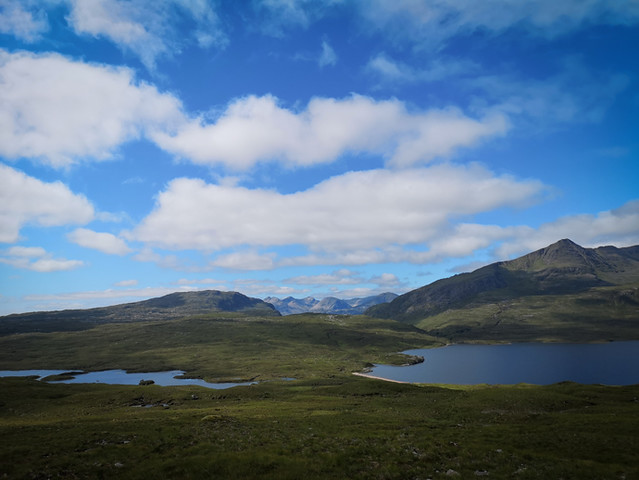
Day 8: Benondraig to Kinlochewe (21 miles)By the time I set off at 6.30am, the munro-baggers had already departed. I followed the 4x4 track for a short while to a small loch before taking a right turn along a faint but relatively decent path up and over Bealach Bearneas. A low sheet of cloud hung just over my head, bringing a mystical feel to the lush green glen.
From the pass, it was a clear and easy path down, over the wire bridge across the river and onto the 4x4 track that takes you to Craig. At the 4x4 track, I picked up some signal and got in touch with Sarah at home who was busy working on her dissertation for her masters. We carried on chatting as I hit the road, at which point, I had to hang up as the cars and caravans were coming around the bends at a decent pace and I needed to have my wits about me. At this stage, the guide book offers a slightly less direct route which is said to be more scenic but does require an extra couple of miles on the road first. Given how busy the road was, I decided to get off it at the first possible opportunity taking a clear path over the Coulin Pass.
As I began to gain a little more height, the spectacular Torridon Hills came into view, wearing their shimmering crowns of Cambrian quartzite. Now I understood why the guidebook took a slight diversion to get a little closer these dramatic peaks – hindsight is a brilliant thing! My advice would be to take the main route and not be tempted by the Coulin Pass shortcut. Anyhow, I carried on my way along clear paths and 4x4 tracks and took the often-recommended road stretch into Kinlochewe, which wasn’t too busy and reportedly saved a slightly thankless section along the river into Kinlochewe.
As I entered the village, I was already harbouring urges to put down my rucksack and settle down for a quiet life in Kinlochewe. It is brilliantly located close to the Torridon Hills and gives the sense of a tightly-knit community, with a voluntary firestation and its very own community toilet, which was set up when the village took matters into their own hands in response to council’s threat to close the public toilets.
The Kinlochewe Bunkhouse was the perfect spot for a night. A small dorm with four triple-tier bunk beds was nicely maintained alongside a communal kitchen, some showers and a drying room. Additionally, the adjoining pub next door was obviously very popular with locals and tourists alike, and with good reason!
 IMG_20190713_095019
 by
Fred Branson, on Flickr
Day 9: Kinlochewe to Strath na Sealga (17 miles)I loved this day. I felt like I had the mountains to myself and all the time in the world to sit and appreciate them. The combination of the route and the weather made for a relatively leisurely day that was nonetheless rewarded with some of the finest views of the trip, especially looking back to the Torridon Hills. I was so sad to see them go as I passed over Bealach na Croise, but if there is one thing that the Cape Wrath Trail teaches you, it is to deal with transience, and to move on from scenes that your instincts want to capture and freeze in your mind. Heading over the pass was the main challenge of the day and another point at which the book and map differ. On this occasion, on balance, I would go with the guide book as it keeps you well away from the bog and peat hags. It is, however, easy to be pulled into the map’s route which offers good terrain and a clear path at first.
On the other side, there were fairly clear paths down to Strath na Sealga, where there are some fantastic and very tempting camping spots. Nonetheless, I carried on to Shenavall bothy, in two minds as to whether to spend a night at the bothy or to camp. As I approached the bothy, the circle of tents surrounding it suggested there was no room at the inn, so I duly set up my tent not too far from the river, just under the impressive Beinn Dearg Mor.
 IMG_20190714_104539
 by
Fred Branson, on Flickr
Day 10: Strath na Sealga to Ullapool (20 miles)As I stuck my head out of the tent, there were two men making their way down to cross the river and on their way to Beinn Dearg Mor. There was also what appeared to be a fell runner setting off in the same direction. I climbed up and skirted the lower flanks of An Teallach and was rewarded with some excellent views back to where they were headed – they had quite a day in store!
According to the guidebook, today was going to be an easy stage, but when combined with the road walk into Ullapool, it became quite a slog. The start of the day was fantastic but any fond memories of the morning seem to have been obliterated by the road walk in the afternoon. I came to hate myself for feeling it necessary to do the road walk, as opposed to hitching a ride or getting a taxi, which is offered as the most sensible idea by the guide-book and an understandable bit of external support. But my walk was about more than just the guidebook, and I wanted to maintain a purist idea of a walk from Banchory to Cape Wrath. So I just put in my earplugs to soften the noise of the busy road, and marched as quickly as I could towards the alluring seaside town that I could see on the horizon. My biggest mistake was not filling up my water before setting off on the two-and-a-half-hour road walking section, as there were no places to fill up and no shops along the route. It was a hot day, and by the time, I reached Ullapool I was severely dehydrated.
The campsite made for a very welcome spot to sort my stuff out, have a shower, and even to clean my clothes. I enjoyed soaking up the campsite atmosphere and marvelled at the different set-ups people had brought, along with a car full of food and half their kitchen. I decided then that my next camping trip would be just to a campsite with as many luxury items as could fit in my car! Amongst the imposing tents and family cars, it was fairly easy to spot the minimalism of a hiker and I soon got chatting to Maarten, from Bristol, who had just arrived in Ullapool by bus with the intention of hiking the rest of the CWT up to Cape Wrath.
I then walked about 200m into the town centre for a brilliant fish and chips and a pint of ale at the Ceilidh – a nearby bar, which had been recommended to me by the munro baggers I’d met at the Bendronaig Bothy.
 IMG_20190715_183840
 by
Fred Branson, on Flickr
Day 11: Ullapool to Knockdamph (11 miles)Today was the day that I would meet up with my brother Josh who’d travelled up from London overnight in order to join me for the rest of the trail to Cape Wrath. We’d originally planned for a rest day, but on looking at the weather forecast (it was set to rain continuously for the next week!), we thought it might not be a bad idea to get a head start and walk the 11 miles to Knockdamph Bothy.
Josh arrived at 3pm and we set off around 4.30pm, heading along a 4x4 track all the way to the bothy. It was fairly monotonous but certainly not unpleasant, and made for a nice introduction for Josh to get used to his pack. The most exciting thing in said pack was a pair of binoculars, which meant that we would actually be able to identify the wildlife we saw, as opposed to merely appreciating them at a distance. We soon spotted two golden eagles and a badger! We reached the bothy around 9pm, to find Veggie and Karma settled into one of the two adjacent rooms. We swapped stories from the last few days before retiring to our separate rooms. As he hunkered down on the floor, I think Josh began to feel a long way from London!
Day 12: Knockdamph to Glen Oykel (18 miles)Today made for the least enjoyable walking of the trip. The rain had already begun to fall by the time we left the bothy and it persisted right through to late afternoon. Thankfully we had two pit-stops along the way that would provide us with some respite. The first was the School House bothy which is a charming old school house with a fascinating history. The MBA have even managed to acquire old school desks and a blackboard to bolster the classroom theme. The second break came in the form of the Oykel Bridge Hotel, which did a nice, hot (and slightly overpriced) cup of coffee. It was here that we caught up with Maarten, who’d spent the previous evening at the School House.
We ended up setting off together, following the River Oykel in constant (but not too heavy) rain. I was pretty glad to have company for this bit, but was a little worried that Josh was beginning to regret his decision to come and join me for the last stage of the trail. So far, his time had coincided with the least inspiring sections and some of the worst weather!
We pushed on and made it as far as Glen Oykel, where we’d planned to set up camp. We found a great spot by the river, but soon realised that the wind wasn’t strong enough to keep the midges at bay. This meant for a swift dinner followed by some enforced solitary confinement, each of us in our one-person tents.
Day 13: Glen Oykel to Inchnadamph (9 miles)We’d agreed to wake up nice and early this morning in an attempt to beat the rain. Although the forecasted poor weather never really arrived and the potentially difficult river crossings that had served as key ingredients for others’ nightmarish walk reports turned out to be no more than simple boulder hops.
On the way up Glen Oykel to Bealach Trallgil, there is another difference of opinion between the guidebook and the map. With clear sight of the pass and no threat of the river being in spate, we decided to take the more direct but pathless route offered by the map. In hindsight, looking back at a clear path which skirted the glen slightly higher up, we all decided that the book had got it right again, as it avoided the rougher ground.
Coming down from the pass was quite straightforward and was accompanied by fantastic vistas and ever-improving visibility. Before long we were at our final destination for the day – Inchnadamph Lodge, where we were due to pick up our final resupply package. Despite taking our time to savour the views from the pass, and even to take a small detour to visit the Traligill Caves, it was still only lunchtime.
For Josh and Maarten in particular, it felt a little soon to be taking such a short day, but the Inchnadamph Lodge offered everything you could hope for from a hostel, including a cast of interesting characters each in the middle of their own dream trips; cyclists, fishing folk, families, and other walkers. Here we met Impala, a seasoned thru-hiker from Manchester, who had done some of the big trails in the US, as well as the Te Araroa trail in New Zealand. He was doing the Scottish National Trail, which incorporates the CWT for its final 230 miles and was pretty disparaging about the first section of the Scottish National Trail, until it reached the CWT. He was travelling seriously light, and as we were soon to learn, seriously fast. We toyed with the idea of heading to the bar at the neighbouring Inchnadamph Hotel, but were advised against it by another guest who’d been turned away the previous evening – something about it only be open to hotel residents? Instead, we sorted our bags, showered and got ready for tomorrow – reportedly the toughest stage of the whole trail.
 IMG_20190718_094954
 by
Fred Branson, on Flickr
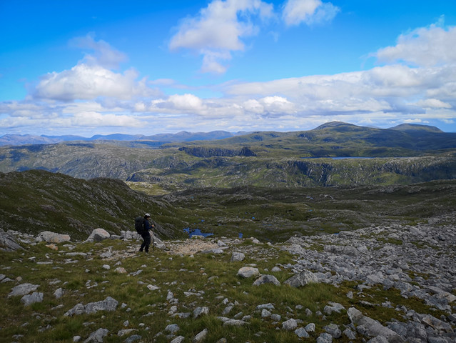
Day 14: Inchnadamph to Glendhu (12 miles)This was perhaps the most beautiful day of the whole trip. We were blessed with beautiful weather, which raised the already impressive landscape to gasp-inducing levels of splendour. That being said, I can see how this could have been a very challenging stage in different conditions. We set off slightly later than usual in order to make the most of the included breakfast, finally leaving around 9.30am and despite only covering 12 miles, we ended up walking (with a few short breaks and a minor wrong turn) for over 10 hours, finally arriving at Glendhu at 7.30pm. The initial ascent itself took no time at all and when we reached the top we were gobsmacked by the vistas. We sat for half an hour at the top, nodding in agreement with the guidebook’s assertion that this was some of the best mountain country in the world. The landscape was intricate, complex and almost at odds with itself. Far from the brutal simplicity of the Torridon Hills.
The descent on the other side is over challenging terrain and the section following the river down to Glencoul Bothy makes for especially slow going, not least due to the continuous distractions of the two mighty waterfalls tumbling dramatically into the glen. We reached Glencoul at 4.30pm and to our amazement we saw Impala’s entry in the logbook at 12.31pm. He only left half an hour before us, which meant he ‘crunched those miles’ (as he would say!) in just three and a half hours. We knew then that we would probably never see him again!
Following a much-needed cup of coffee, we pushed on to Glendhu bothy where we’d be stopping for the night. This section wasn’t as bad as the guide book had us fearing, but it was slow-going and took us a further 2.5 hours before we reached the bothy. Before we did, we had one of the most special swims of the trip, in the Gleann Dubh river, that flows into Loch Glendhu. Bathing in water with the rapids kneading our backs, and with the toughest day behind us, for the first time I contemplated the idea that we might actually make it to the lighthouse.
 IMG_20190719_115340
 by
Fred Branson, on Flickr
Day 15: Glendhu to Badcall / Camp (21 miles)We woke up nice and early, having slept in one of the downstairs rooms at Glendhu Bothy. It had a been a full house the previous evening, with two large groups who had walked in from the nearby road.
With the constant threat of bad weather, it’s tempting to push on whilst the weather is good. Our plan was just to do just that today, hoping to reach Rhiconich, which is said to be a long day, even for the fittest walkers. It was here we learnt the power of a culinary incentive – we’d be told by a fisherman staying in the bothy that there was a mean fish and chips just past Rhiconich and that set the perfect motivational prize to get us moving!
It was fast-going up the 4x4 track and on a clear path before we reached the summit of Ben Dreavie. From here, things slowed quite considerably, as the cloud came right down and navigation became quite challenging. As we ventured down the other side, we took a bearing and made slow progress down to join the road that would take us to Stack Lodge. The fish and chips were under threat!
We were expecting a difficult trudge to Rhiconich, but the boggy path actually made for nice forgiving terrain and we made good time, helped by the fact that the potentially hazardous river crossing was a mere boulder hop. We arrived in Rhiconich for a quick Irn-Bru at the hotel there, before pushing onto the restaurant serving takeaway fish and chips at Inshegra. It certainly didn’t disappoint. We sat outside in the sun and it felt like another victorious moment. Tomorrow we would attempt to make Cape Wrath! But first we had to find a spot to pitch up and it didn’t take long to find a beautiful spot just before Badcall.
 IMG_20190720_200826
 by
Fred Branson, on Flickr
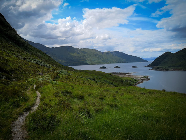
Day 16: Badcall to Kervaig via Cape Wrath (21 miles)The previous night had probably been my worst sleep of the whole trip. In a bid to deter the midges, we had purposefully pitched up in the most exposed position, on top of a small knoll looking out to sea. I woke up at 2am to a rattling tent being hit by mighty gusts. A look at the MetOffice site confirmed that gale force winds were coming in from the west and were due to remain throughout the rest of the night. I lay awake for some time contemplating whether it would be wise to head out to put up the extra guy lines, before laziness prevailed and I went back into a deep sleep.
Despite the interrupted sleep, we broke camp at good time and set off for Sandwood Bay. We opted for the road/track option as opposed to the pathless section taken by the main route. Iain (from the guide book) said that the road route was arguably more scenic, and we were keen to make some ground with the idea of pushing onto Cape Wrath before the poor weather hit the following day.
As we passed Kinlochbervie, we began to gain glimpses of a speck of a lighthouse far on the horizon, obscured from view at regular interviews. This pulled us inexorably forwards and we reached Sandwood Bay at about 10am, passing a fair few campers who'd obviously spent the night there. Perhaps its status as one of the most beautiful and remote beaches has caught up with it? We stopped for a short while to admire the impressive stretch of beach, the striking sea stack, and the numerous gannets hurling themselves into the water at terrific speeds. The water looked extremely inviting and I couldn’t resist a brief dip in the Atlantic Ocean, which was noticeably colder than the rivers and lochs that we’d been swimming in.
Moving on from Sandwood Bay, towards Cape Wrath, was slow going. Just getting off the beach must have taken about 20mins and then for some time, as we looked back, Sandwood’s giant stack just wasn’t getting any smaller. We had decided on a route that would hug the cliffs, staying close to the sea and affording us awesome views, but making for a hillier and more winding route. Interrupted views of the ever-enlarging lighthouse continued to pull us forwards. We were so close!
We finally reached the Cape at 4.30pm. Any hope of savouring the moment and basking in glory was soon dispelled by Josh’s urgent need for a toilet. I think we were both pretty relieved and excited to reach the lighthouse, but maybe for different reasons! The Ozone café was brilliant. They were so friendly and accommodating and served up what we both agreed to be the best prawn sandwich we’d ever eaten. We hung out for a little while before starting out on the final 6.5km to Kervaig Bothy, where we would spend the evening.
Cape Wrath makes for a beautiful and historic ending to such an epic journey. Whilst the lighthouse cuts a striking image against the Atlantic Ocean, and the information on display offers a fascinating insight into the site’s history, it is also suitably understated so as to remind you that it is, after all, all about the journey and not the destination.
 IMG_20190721_192609
 by
Fred Branson, on Flickr
WildlifeBadger, Golden Eagles, Osprey, Common Sandpipers, Oystercatchers, Greenfinches, Roe Deer, Red Deer, House Sparrows, House Martens, Black-throated Diver, Golden Plover, Rock Pipits, Hooded Crow, Wood Pigeon, Stonechats, Gannets, Lapwings, Guillemots, Razorbills, Puffins, Common Gulls, Greater-backed Black Gull, Herring Gull, Seals, Red Fox, Rabbit, Swallows, Peregrine Falcon, Shags, Kittiwakes, Curlew, Black-headed Gulls, Frogs, Toads.
KitWorked out to be around 9kg base weight.
SleepingMSR Hubba NX Tent - 1,300g
Performed well. Wasn't seriously tested but very liveable, light and easy to use.
OEX Compact 3/4 Sleeping Mat - 498g
Performed well. Didn't lose air and always had a comfy night's sleep in tent or on bothy floor or sleeping platform.
Vango UltraLite 100 Sleeping Bag - 953
Performed well. For summer trips could have done with something lighter.
Tent Pole Splint - 8g
Didn't need it. Leave this out and plan for success.
Emergency Sleep Bag - 113g
Didn't need it. Leave this out and plan for success - especially as I have tent, other warm clothes etc. This is still good for day hikes when you don't have all that.
Load CarryingOsprey Kestrel 58 Rucksack - 1,622g
Now when I look at the pack I realise it was too big and there are so many weight gaining extras that it needn't have. It was comfy and did the job great apart from annoying not to be able to reach water whilst walking.
Black Diamond Distance Z Trekking Poles - On person
These are great. Really nice to hold. Lots of positions. Very lightweight but I would worry about their durability on more difficult terrain. I managed to break one - completely my fault as it was still attached to my bag that I threw over a gate and it got caught.
Osprey DryPacks - 194g
I love these. They make packing so simple and keeps me organised.
CookingMSR Pocket Rocket Stove - 73g
This was great. Happy I chose gas which allows for those quick and efficient coffee breaks. Gas lasted us a lot longer than I thought it would and sometimes to save gas we did a cold rehydration of expedition foods which worked within a few hours.
Toaks 1,100m cooking pot - 120g
Brilliant. No qualms at all. Worked well for one and we managed to make it work for two with a bit of taking it in turns.
Plastic Mug - 50g
One a one person trip you could do without this and just have your coffee out of the pot.
Coffee Filter - 19g
Coffee's were a real treat and a perk to help me push through with any big afternoon chunks of walking in particular. Created a nice reason to stop and take some weight of your feet and chill before pushing on.
Sawyer Filter - 38g
Most of the time this wasn't necessary but did come in handy on a few days when we just didn't pass that much good looking water. Worth it's weight I would say.
Flint lighter - 27g
Good.
Light My Fire Spork - 10g
This spork broke immediately as did Sarah's and also Maarten's. Bought a new one (metal Sea to Summit) which has served me much better. Also 10g
Knife - 45g
Not sure this is necessary. Think it would be if I wasn't doing resupply parcels and was buying food on the go. Keep it but only just.
Water Bottles x 2 - 60g
Could get away with just one on the CWT due to the amount of water.
Washing Up Sponge - 3g
Came in handy.
ClothingBuff - On person
Really handy. Used it loads and was good as eye cover and head cover (against synthetic pillow (clothes bag)) whilst sleeping.
Camp Socks - 40g
Three pairs of socks plus waterproofs was a bit of a luxury. Could get away with 2.
Altra Olympus 3.0 Trail Running ShoesNA
The sole wore out within two weeks (almost from new) and the upper had holes in them by the end of two weeks. Picked up a pair of altra lone peaks in Fort William and they had the same problem over the following two weeks. Need to find new footwear that is more durable. Love Altra but the durability is just too much of an issue.
Compression shorts x 2 - 79g (+ on person)
Combined with the running leggings could probably get away with just one pair of these although they were good for swims.
Lightweight Baselayer - 118g
So happy I took this. Great in the hot weather. Long sleeve (good for midge and sun) but super light and breathable.
Rab LS Tee Merino+ Baselayer - 160g
Could just take one of these. Performed well and very versatile in a range of conditions.
Montane MicroFleece - 163g
Brilliant. Lightweight. Super quick drying and incredibly warm.
Lightweight down jacket - 404g
Quite heavy for it's warmth but for summer camping trips this is great and was a nice extra layer at those chillier times.
Zippable shorts/trousers - On Person
These are perfect.
Running Leggings - 200g
These were great and could either work as shorts if I rolled them up or as leggings.
Marmot Knife Edge Waterproof Shell jacket - 334g
This worked well. Gave up on the super wet days but don't think much would have survived those. Keep for UK trips.
SprayWay Santiago Waterproof Overtrousers - 401g
These kept me dry and were really comfy. Gave up on the super wet days but don't think much would have survived those. Keep for UK trips.
SealSkinz Waterproof Socks - 86g
Worked well but think they stopped losing waterproofness and weren't strictly necesarry but were nice to have. Wouldn't take on another trip that wasn't as boggy.
Merino Socks x 2 - 40g (+ one pair on person)
Ended up getting innov8 all terrain trail running socks in Fort William - much better than the Merino stuff I tried. Will stick to trail running socks in the future.
Ankle Brace - On person
These were great. Would recommend for anyone with ankle issues.
Duckbill Cap - On person
Brilliant cap. Can't fault it. Versatile and light.
Sunglasses - On person
Good and would keep but didn't end up wearing that much on more technical terrain so could see footing - especially when bogs were around.
Waterproof Gloves - 106g
These felt a bit unnecessary but maybe just cos we had good weather most of the time. Even on my stinker of a day I didn't end up using as I didn't like the lack of connection between hand and pole.
Hygiene/HealthMidge Repellent - 98g
Smidge worked well. Would keep for midge areas.
Pack towel - 48g
Great towel. Perfect size and just about dries you after shower. Not stricly necessary and could cut back on if was feeling super lightweight but nice for a longer trip.
Green Midge Ultra-Fine Mesh - 17g
Essential for midge areas.
Sunscreen - 33g
Didn't use too much but gotta have it.
Tooth Brush and Paste - 48g
Yep.
First Aid Kit - 118g
Didn't use
Sewing needle - 3g
Didn't use
Dental Floss - 12g
Didn't use
Trowel - 52g
In most places it was hard to use this due to roots or hard dry soil. Bothy spades worked much better.
Sanitizer - 53g
Used this but not the kind of quantities I was expecting.
Duct tape - 27g
Tried this on my shoes but turned out not to be duct tape. Get the real stuff next time!
Cable ties - 6g
Didn't use
Massage ball - 136g
Could do without this but a very good luxury item - def helped release tension in hips and legs.
Spare guy rope - 19g
Don't bother.
Mini Vaseline - 34g
Didn't use
Rock Tape - 22g
Used once and felt like it helped.
ElectronicsHUAWEI P20 Phone - 204g
Great battery life. Big screen. Great camera. Good for guide book and bird books.
Waterproof phone bag - 46g
Worked really well. Annoying not to be able to use camera when it's in there.
Petzl E+ Lite Head Torch - 30g
Hardly used my headtorch due to the daylight hours in Scotland but probs good for other trips.
Spare batteries - 3g
Didn't use.
Head phones - 13g
Didn't use much but did the trick.
External power source - 257g
Could save weight here but was nice to know I had the safety of plenty of power especially given reliance on phone for GPS.
Phone Charging Cable - 30g
USB Wall Charger - 76g
Would have been good to have two port charger. Should get this for future.
Cryptic Crosswords - 35g
Loved having these.
Kindle - 193g
Could do without and just read on my phone which has big screen anyway.
Notebook and 2 pens - 74g
Cut this and just write on the phone
Wristwatch - On person
Worked perfectly.
In Reach Mini - 115g
Worked really well and was nice to be able to check in with Sarah and have reassurance of SOS as well as being able to check weather when there was no phone signal.
NavigationSilva Compass Expedition 4-360 - 38g
Great compass. Worked well with the harvey maps as had the 1:40k scale on there.
Harvey Maps - 124g
Brilliant maps. All you need.
