free to be able to rate and comment on reports (as well as access 1:25000 mapping).
After my dad's funeral on Wednesday I wanted a few days in the hills to have space and time to adjust. I wanted to go somewhere with "proper hills" and had thought of heading up to Ullapool, but the weather forecast was fairly miserable and I reckoned that spending 5 or 6 hours driving each way wasn't really on. Some where closer to home then...another trip to Argyll.
This would be the first 3 day weekender Allison and I had had for goodness knows how long. My phone was switched off for the weekend - something I haven't been able to do in the last couple of months. I picked Allison up after her work on Thursday and we set off for deepest Knapdale - first on the list was Cruach Lusach in Kilmichael of Inverlussa. We stopped off at the nature reserve where the road splits to Tayvalich for a bite to eat - listening to a ranger talking to a group of folk, presumably going out on a beaver hunting walk. Handing around a beaver or otter pelt - now what's the Covid transmission risk from that

Onwards we drove and parked at the start of the road that heads up to the cemetery - although we could possibly have driven further up the track past the holiday homes and parked by the hydro building...a bit risky perhaps.
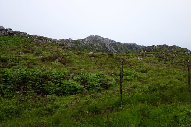
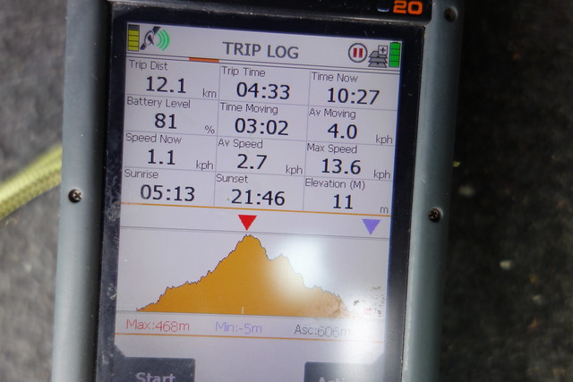
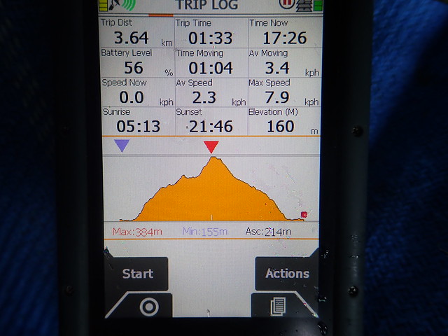
Laden with overnight gear we set off into a rather muggy evening, cloud down on the hilltops. After walking a short distance through the trees we came to the dam, which has just a trickle of water coming from it. No bother crossing over the rocks below it. Then onto track for a bit. I was using Ian Park's route and when we came to the line he'd taken through the trees I was alarmed, seeing no obvious way through. We hummed and hawed for a bit and chose to follow a stream before his route - which ended up taking us parallel to the direction we wanted to go. Some course correction and plunging through trees was required to bring us out at the first set of crags. Sadly we were now moving into mist - no fine sunset tonight, and a bit of bother at times picking the best route up the hill too. We reached a level area, mindful of the need to camp somewhere. I found a possible spot and marked it on the GPS, but hoped we'd get somewhere higher up. Another band of crags, not marked on the map but requiring some agility on wet rock with a big pack on. Then we made it up to the final ridge and the summit. It was pretty windy there and the flattish spots were all a bit too exposed for my liking to pitch the tent...so we ended up coming down and returning to the spot we'd found earlier - all a bit of a faff really. By this time it was almost 10.30, light was fading and sleep was very welcome.
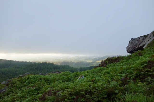
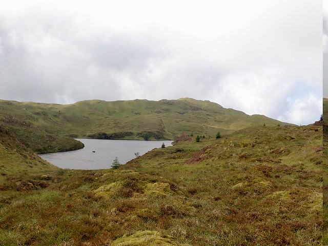
View down Loch Sween before the hill
 0B94790D-5466-480F-BEC6-E38DE1D93662_1_201_a
 by
Al, on Flickr
Crossing below the dam
 FE5EA712-F0D4-4F3F-8515-3F5D2737B427_1_201_a
 by
Al, on Flickr
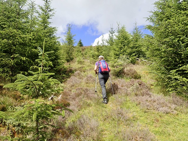
Our "route" through the trees
 41C790D0-09E9-43FF-A43D-F1503C1A976B_1_201_a
 by
Al, on Flickr
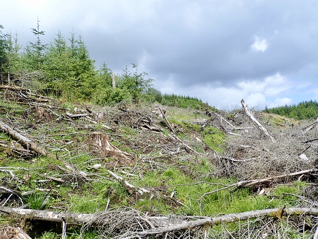
After the trees - more obstacles
 F8F23B52-FA60-4C85-A141-D62AC852FAB4_1_201_a
 by
Al, on Flickr
 365E9237-1AB5-417F-BEB6-977E7732799E_1_201_a
 by
Al, on Flickr
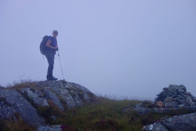
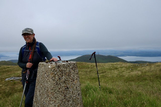
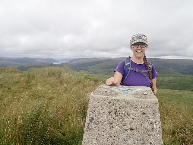
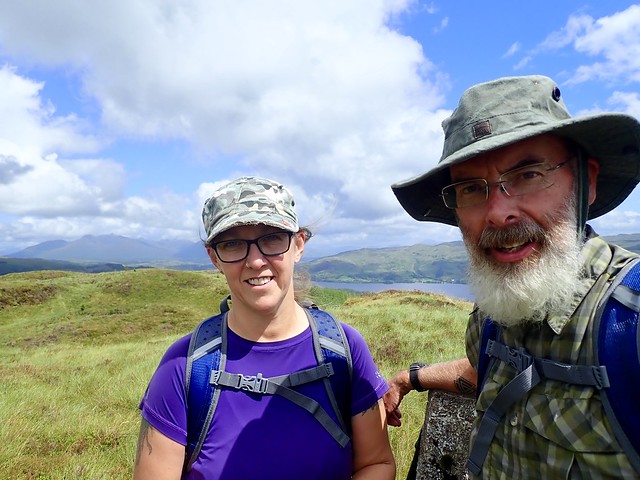
Summit Cruach Lusach
 1DB61882-D0A1-40D0-8A1B-9100CC3A50E4_1_201_a
 by
Al, on Flickr
A dry night, quiet and peaceful. We packed up our kit after breakfasting on sandwich thins and Biscoff and headed back the way we'd come...more or less. Managed to find ourselves on the wrong side of a substantial stream which would have needed a wade and had to blunder through more bits of forestry to get to the track again. Nothing wakes you up like a forest blunder

Once we'd made the track, the adventure wasn't over - the dam, which we'd crossed so carelessly on the way up had now been opened and a torrent of water was issuing forth - crossing still possible but a tad more difficult.. Then a final twist - on the narrow path, bounded by bramble filled gully on one side and river on the other was a herd of cows, calves and the daddy bull, standing in the middle of the track. It wasn't possible to go round them, so we had to try and get by them. The bull seemed a docile fellow, fortunately.
Morning
 DF74658A-D49C-442E-BAA4-BD9EE7F29883_1_201_a
 by
Al, on Flickr
Dam on the way back
 967ABD6A-70BD-4120-87C8-066DA632E935_1_201_a
 by
Al, on Flickr
You're on our road...
 7C15BE34-6B66-4B32-9250-D02417D8472D_1_201_a
 by
Al, on Flickr
 25CCCE0E-96A3-4F8B-9812-910398933724
 by
Al, on Flickr
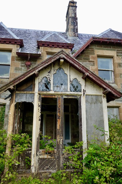
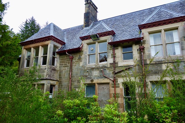
Back at the car we dumped the big packs and drove back, stopping a couple of miles up the road at Achnamara. This was where my dad had been evacuated to from Glasgow in 1940, somewhere he'd had vivid - and not very positive memories of. Walking through the village we couldn't see the old school and asked a couple of locals where it was. They told us it was derelict now, having been bought by someone who'd let it go to ruin. It had been owned by Glasgow Corporation, back in the day and - after the war - groups of school kids had come to stay for a month. The man we were talking to, who'd grown up in the village, remembered that the local kids would be invited to the leaving party at the end of each month's block. The village, in fact, was build to support the school in the early 1950s and its demise led to the closure of the one shop and unemployment. We walked up the road marked "The Stables" and found the remains of the building secreted behind vegetation.
 B5422AD6-F605-4A93-BAF9-77ECFC9D4E1B_1_201_a
 by
Al, on Flickr
 D7B03E76-D457-4FB0-AA0B-B666B0A56DBD_1_201_a
 by
Al, on Flickr
 AC45BDE1-298F-4128-92C1-F89849534DF0_1_201_a
 by
Al, on Flickr
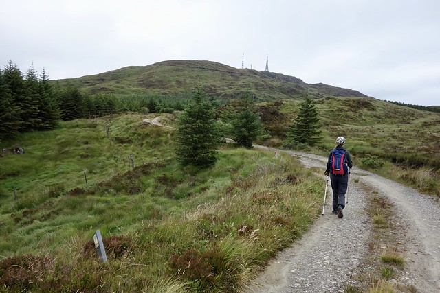
After a nosey around we drove back through Lochgilphead and past Ardrishaig, for our next hill - Stob Odhar. This was quite a long walk, mostly using track going to communications masts, but with a bit of a drop in altitude from the masts to the hill. We could have parked right at the start of the track, but used a lay-by just north of it. Wild flowers lined the track - purple cones of buddleja, yellow flower crowns and red berries of St Johns' Wort, purple heather. After a it the noise from the road faded away. We got almost to the masts on Meall Mor then noticed a signpost "Hill Walk" pointing over to Stop Odhar. Not much sign of a path, mind, just a general direction marker

To be fair there was something of an ATV track across the boggy/tussocky ground. Sadly, I jiggered my ankle again - the ankle I injured a fortnight ago and which had been healing nicely. A few curses later I was gingerly continuing on my way, paying great attention to what I might be stepping on. It's a bit of a haul up the hillside, but some nice enough views. We returned by the same route, me a little slower given the state of my ankle. Near the bottom I noted various bits of tape around the bridge and surrounding trees - a bit like police crime scene tape, only this said "Archaeology" - I suggested to Allison this was what they used when investigating really old crime scenes
On the track
 DAE9DE7F-E5A6-49D3-839F-A41514D4510D_1_201_a
 by
Al, on Flickr
Masts on Meall Mor
 3D2C9B53-BBD9-46B2-A1D9-91A763006493_1_201_a
 by
Al, on Flickr
Stob Odhar and Hill Walk sign
 D92546D8-30C1-490D-8B79-894D36FD0116_1_201_a
 by
Al, on Flickr
 4911A25C-D70A-4535-8E76-55E68DB8F0DD_1_201_a
 by
Al, on Flickr
 311B7226-8DE1-426E-A29A-9C6BF9D8EA9B_1_201_a
 by
Al, on Flickr
 70B6ECC6-2E04-4817-A8F9-639010D6212F
 by
Al, on Flickr
The plan had been to drive to Tarbert and do Cnoc a'Bhaile-shios by the longer northern approach, utilising the Kintyre Way, rather than the shorter but grim southern approach from Redesdale. I hoped there would be somewhere suitable to camp along the route and intended to do the 10k walk in tonight, walking out in the morning. However, with a painful ankle, was this wise - what if I woke up with a balloon sized ankle and had to walk out on it? Crossing fingers, I assembled the stuff we needed and set off through the backstreets of Tarbert and up to the ruin of Tarbert Castle, originally constructed by The Bruce. Once on the Kintyre Way the going was reasonable - scenic grassy path then quite dull forestry track. We met a foursome of ladies coming the other way, who'd been walking for "four and a half hours" and were dead keen to get to their hotel for a comfortable night. Something we were unlikely to be having...
Tarbert
 5F1D1169-D299-4C1D-84E3-01E5A1703904_1_201_a
 by
Al, on Flickr
Tarbert Castle
 FEB0B296-01DC-46E4-A194-78B8926C1EC8_1_201_a
 by
Al, on Flickr
 4730C808-3638-4A27-ADBA-D1D08B56E0B3_1_201_a
 by
Al, on Flickr
Cnoc a'Bhaile-shios and sheep
 0F6ACB7E-AC97-42B1-B0ED-E8E1502F7CA8_1_201_a
 by
Al, on Flickr
We left the track not long after a forestry sign, the rain having started by now. Going was tough - tussocks and long grass, lots of places to twist an ankle again...We decided to try and find a place to pitch and managed to get something vaguely level and vaguely dry - again very little choice of spot. Although I'd hoped to press on and get the hill done tonight, the rain was now heavy and we retreated to have tea - it was about 7pm. A wet night followed, and I had to get out into the rain to adjust the guys as the wind direction changed and water was coming through the outer - not great when you have very soft spongy ground to peg into. When morning came around we found water had gotten into a pack of Oatie biscuits, rendering a section of the packet into a porridgy mess. I scooped a glob of this out onto the grass, where it was pounced upon by a large black beetle that, earlier, had been trundling about in the tent vestibule. Boy was it enjoying its biscuit breakfast.
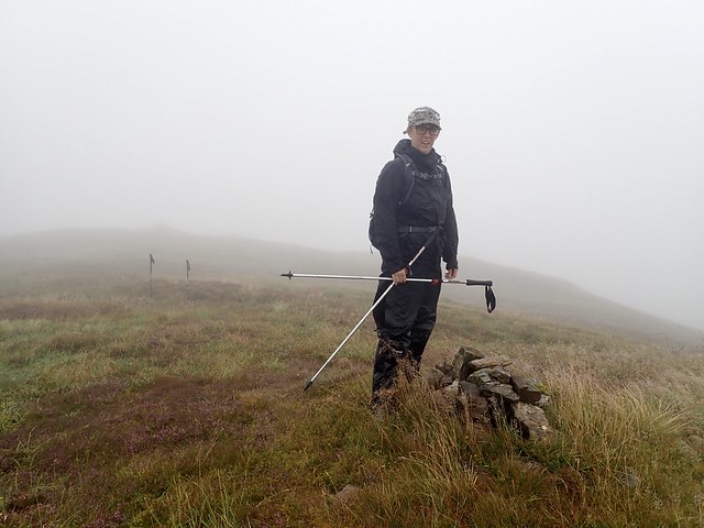
Outside the mist was down to limit visibility to fifty metres...I had to mark the tent position on the GPS in case we wouldn't find it again. Then set off for the invisible summit - a kilometre or so across bog/peat hags/tussocks...just great fun
After what seemed ike a very long time we made it to the top, and were assisted on the return leg as the mist began to clear. We packed up and set off back down the Kintyre Way, meeting a few folk on the way and arriving into a busy Tarbert at lunchtime. We had our sandwiches and crisps sitting on the quay, watched by Herring Gulls.
Misty morning
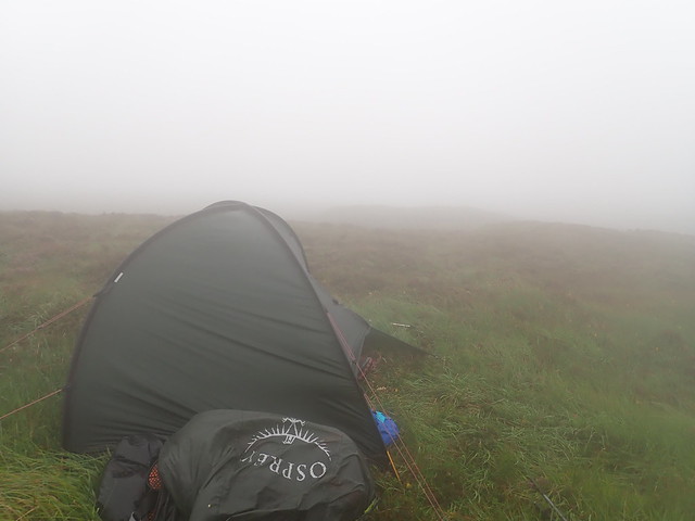 B4F1736F-3DCA-40D2-B307-A333E4F78925
 by
Al, on Flickr
Our hill is...somewhere
 18303366-5BB4-422E-9EDC-9E3D4E7FA904_1_201_a
 by
Al, on Flickr
Found it
 CB1DB977-7F53-409E-A80F-1EDFFC34DB41_1_201_a
 by
Al, on Flickr
 267B7FFA-FF5F-4336-ACAA-4D3D0C292186_1_201_a
 by
Al, on Flickr
Weather clearing up on the return to Tarbert
 381526FB-7302-4DD7-B702-F70A28CC7459_1_201_a
 by
Al, on Flickr
 D06E5D20-03DE-4332-BCA1-0AD77C324E6C_1_201_a
 by
Al, on Flickr
 C2CF96CD-D0B9-4AC3-8985-42FDCC6CFC9D_1_201_a
 by
Al, on Flickr
 CC8D6713-E95F-430A-85B1-762E837B3DE9
 by
Al, on Flickr
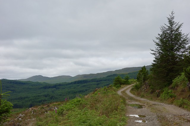
We had now walked around 50km and picked up only three Subs...not a great bang per buck! Wanting to do the longer walk yesterday had also meant a bit of a logistical aberration - we were now having to drive up past Lochgilphead again to reach the next set of hills. Beinn Bhan was first- located just east of Kilmartin. There was only one trip report for this, by Malky, who freely admitted his wasn't the best route to use. I had hunted around on Hill-bagging before planning this weekend and found a much more friendly way up, utilising track for the most part, from the farm at Stroneskar. There's a gate on the public road just past the farm's bins - you can drive through this and park at the beginning of the track, although I was a bit fearty and just parked the car by the farm.
Our first obstacle was a much larger herd of cows, with babies and a substantially less passive bull amidst them. Allison was not enjoying the bovine experience at all...We detoured off onto the grass to pass them, and there were a few bellows let out behind us - Mr Bull kept his eye on us til we'd left the field behind. The track provided easy going, with sheep instead of more cattle. Beinn Bhan appeared ahead of us, surrounded by knobbled lumps. The path petered out and we had to walk the last kilometre over grass, fairly good going. A short steep pull onto the summit where the views were curtailed again by cloud. Return by the same route, the cows having fortuitously moved away from the path as we walked though their field.
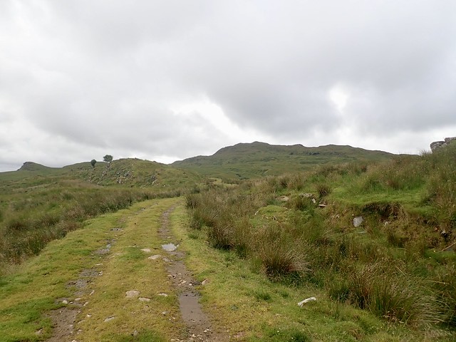
Start of track
 3FAC8CBD-D7A6-4B5B-9EF8-C185A48B89CA_1_201_a
 by
Al, on Flickr
Beinn Bhan
 EBE0E42B-23AE-4DE7-B90C-6D06AB7FD7AA_1_201_a
 by
Al, on Flickr
 7F54111F-0EB3-4ED0-9DA2-E129840EB0F0_1_201_a
 by
Al, on Flickr
 6D361083-E9DF-4AE2-B009-A57E353F17E3_1_201_a
 by
Al, on Flickr
 6CB9390B-E9D4-4C2B-9088-F2C67A52EB10
 by
Al, on Flickr
I had hopes to do Cruach na Seilcheig (Heap of the snail) then Carn Duchara before finding a place to camp along Loch Avich. However the weather wasn't looking promising and Allison was reaching saturation point with Marilyns
So we headed along past Kilmelford, taking the narrow and steeply climbing little road east from the middle of that village. Cruach na Seilcheig sits to the south of the road to the west of Loch an Losgainn Mor. There were several folk fishing when we drove up. There's plenty of option for parking around the west of the loch - we left the car in a large space with a stile and walked back along to the dam.
There's a wee track that runs to the west of the dam and for a short way up the hillside - I do mean short...From then on it was walking over grass and heather, not too bad underfoot. Going became wetter once we'd passed the loch and the final pull up to the twin cairned summit seemed to take a while. Rain was on and off, views weren't possible and Allison was begging me to let her die on the hillside rather than climb another hill like this... At least going down was quite easy. By the dam, the fishing family we'd passed on the way up were preparing to leave, saying the midges were starting up - although I suspected the smoke from the guy's reefer would have kept them at bay quite effectively...
View from our parking place
 5F0F825A-53AF-4FF5-BBC9-0E15D0C01EDE_1_201_a
 by
Al, on Flickr
 2EDB1B05-D02C-409E-9512-4A404BF5B057_1_201_a
 by
Al, on Flickr
Allison modelling our new 25l Lidl rucksack (£16.99 in your local Lidl) - just the thing for Marilyns...
 2DF0745F-EA1B-4009-9166-B71E9C238728_1_201_a
 by
Al, on Flickr
The joy of Subs
 78314209-E94D-4679-BA77-526C06D10A76_1_201_a
 by
Al, on Flickr
Is she looking triumphant?
 4E9C796B-390B-4C3C-983D-B5522F9983E2_1_201_a
 by
Al, on Flickr
Strange tree with very short branches
 5D4481DF-6742-4D8F-8A70-F6CC83382280
 by
Al, on Flickr
 F3DF0864-2CF6-4513-894D-EB0FF960C890
 by
Al, on Flickr
We decided to just camp where we were, taking the tent up onto a small raised area beside the car to maximise the chances of breeze keeping the beasts at bay. We'd only just got pitched when the rain started coming down in earnest and it rained in heavy showers throughout the night. No traffic on the road, no noise apart from the occasional lamb baaing. In the morning we tried to wait for a dry spell before getting the tent down. I spied a shepherd (well at least a man with a sheepdog) on the hillside across from us. He stood watching us, in the pouring rain. As we took the tent down he continued to watch us, and was still standing there, silhouetted against the skyline as we drove off, like some kind of sentinel from a science fiction film. Mildly disconcerting.
Our next stop was a couple miles further along the road - Carn Duchara, one of the Subs with no trip reports on here. I had come up with what I hoped would be a manageable route, although there was a section going through forest on the map.
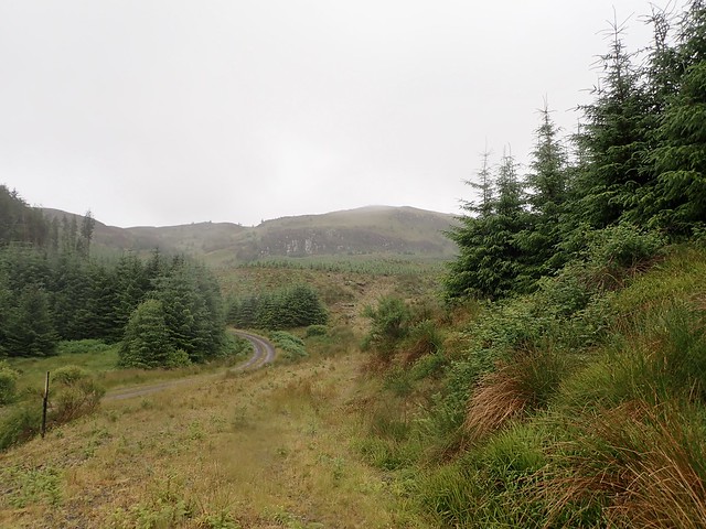
We parked by the start of two forest tracks, one on either side of the road. A good track into the forest but dense trees where we wanted to go. Still raining, cloud down over the hilltops. We approached the spot where I'd planned to leave the main track - and found, lo and behold, a reasonable if somewhat overgrown track heading the way we wanted to go. Some new plantings in the area, but still a very serviceable way up. Some steep grass to reach a flatter section above the crags of Creag nan Cuilean then a pleasant if pathless wander towards Loch a'Ghille. The rain had stopped, the mist was clearing and we could see Carn Duchara up ahead.
Good track to start
 8B6EDBA7-8B6E-4F82-8393-6D0CDB98F04E_1_201_a
 by
Al, on Flickr
There is a way...
 2A7BA5FF-166C-48D3-84D4-EC77DAEAB30B_1_201_a
 by
Al, on Flickr
 7DFAD41D-6C67-40C0-9779-8176E7BB44C4_1_201_a
 by
Al, on Flickr
Now modelling the groovy yellow rain cover with said rucksack
 D298199D-3FC1-40C6-84E9-3AB992F05F53_1_201_a
 by
Al, on Flickr
Carn Duchara
 75476ABD-C079-425C-A032-B4229714F8A0_1_201_a
 by
Al, on Flickr
We headed round the south of the loch, then crossed an easy deer fence, making for the slopes up to our summit. There was a feeling of remoteness and peace - one of the best hills I've been out on in recent times. The summit trig was ringed by stones - we could just about see across to Scarba. We went round the other side of the loch on the way back, pausing to have an early lunch on the hillside surrounded by peace and quiet.
Heading round Loch a'Ghille
 B78466CD-67D7-41F4-9F67-A2620E255F39_1_201_a
 by
Al, on Flickr
 4581D7DD-30C4-4A79-9DC2-3ACBB50C1A09_1_201_a
 by
Al, on Flickr
 9605CC19-2190-40E1-AE07-F525532C1369_1_201_a
 by
Al, on Flickr
Weathered wood
 DE6E7D71-612A-4643-B845-AAE191BF8FAD_1_201_a
 by
Al, on Flickr
Carn Duchara
 10B83EC8-4639-4061-915D-696051663364_1_201_a
 by
Al, on Flickr
 A6A6474F-A3A4-41AD-9B27-169F6AE48A5A
 by
Al, on Flickr
Our final hill took us beyond the east end of Loch Avich to Tom an t-Saighdeir, another reportless Sub. The map suggested there was a footpath going through the trees that would allow a circular walk to be made of the hill. We parked at a wide mouthed bit of track, although again it would have been possible to park where we started up the hill from. A few more metres isn't going to hurt however, even my ankle was behaving itself today. We walked past the first section of "Footpath" on the map. No sign of there ever having been a footpath there...just trees - not too densely planted, mind - and undergrowth. I could hear Allison groan. We continued along the road to where the second "footpath" was marked - not much sign here either. However we had come this far...so we headed into the trees, following a deerpath that seemed to co-incide with the path I had marked on the map, although there was no evidence of human presence. We're reading Conrad's "Heart of Darkness" in the tent at present, and there was something of journeying into the primeval about this - tree branches hung with fronds of lichen, mosses underfoot, almost a steamy sense of expectation...
Can you spot a "footpath"?
 CA738A03-2525-4667-A828-5D42AF113AD3_1_201_a
 by
Al, on Flickr
Well we continued up til we met a proper forestry track, but since it was going horizontally it was of little use to us. We headed around the edge of some felled trees and did pick out an extraction path to follow to the treeless summit. Another trig column, a bit better view this time - Ben Cruachan, Ben Starav group. We pondered how to go down - should we take the invisible "path" on the map or retrace our steps? In the end we did a bit of both, the invisible path becoming truly invisible over some felled ground.
 B3D29FE8-F545-413C-95D6-B796B954465D_1_201_a
 by
Al, on Flickr
 C99239ED-7648-42DE-B8A8-A5ADBF9D2F14_1_201_a
 by
Al, on Flickr
Not as bad as it looked
 8B5BCD87-7DFB-4299-8B38-2A901E2CEF04_1_201_a
 by
Al, on Flickr
 0DD2FB95-D991-429E-B8F9-CD5414D83596_1_201_a
 by
Al, on Flickr
 C2D956A7-0EA6-4A98-A2A0-343ACC72C329_1_201_a
 by
Al, on Flickr
Ben Starav hills
 B1A49400-F0DA-49C0-AC52-09CFD6456494_1_201_a
 by
Al, on Flickr
Maybe there's a way down in there...somewhere?
 7114FE94-DB02-487A-890D-01DD98C21267_1_201_a
 by
Al, on Flickr
 489DA823-C638-4EC9-887D-D7614C83E9F4_1_201_a
 by
Al, on Flickr
 74E41AED-EAFC-45DF-8178-A0FAD163FC0B_1_201_a
 by
Al, on Flickr
 F554FDF1-E35F-4127-9B27-F8CD5A7AAE41_1_201_a
 by
Al, on Flickr
 867B3BD8-2F26-4F7F-8DAA-C700690AD869
 by
Al, on Flickr
Drove back to Kilmartin using the substantially better quality road along the north shore of Loch Awe and from there back down to home. I had really felt the benefit of getting away into the hills for a "normal" length of time again and I have to admit that this part of Argyll is really rather beautiful - even if the weather didn't show it at its best, no ravishing sunsets over the western seas and the like. But there is quiet to be found in the hills here, and quiet at the moment is what I'm after.
