Page 1 of 1
Carpark and route closed!

Posted:
Wed Sep 23, 2020 4:09 pmby amadablam
Access to the carpark is blocked off and a sign saying route closed due to landslips. There was a diversion sign but it takes you nowhere. Best avoided at the moment.
Re: Carpark and route closed!
Posted:
Fri Sep 25, 2020 3:42 pmby Gleneagle5
Thanks. Was planning on doing it.
Re: Carpark and route closed!
Posted:
Tue Mar 23, 2021 9:12 pmby TRG318
On 28th Feb 2021 the car park was still closed and paths closed because of "landslips". We parked at the dam and went up the route from Garrison Farm: no sign of any landslips. We noticed that some others had moved the cones aside and parked in the car park regardless.
Re: Carpark and route closed!
Posted:
Sun May 16, 2021 3:20 pmby Gareth Harper
Walked this yesterday. Checked RSPB web site and it stated the car park was closed. So planned to park at the view point just along the road. Arrived to find RSPB Garrison car park open.
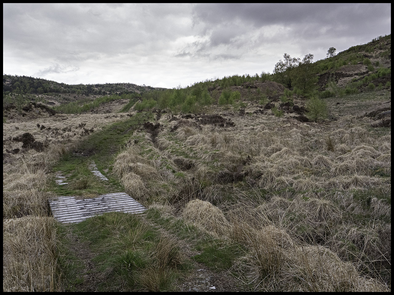
Followed the walkhighlands route. It states “Immediately after another gate the track reaches the old drystone dyke of a sheepfold. Don't enter this but instead follow the now rougher earth and grass track to the left. After another 500m or so this fainter track forks; bear right, following ATV tracks as they aim NE up the slopes - this is rough and boggy going.”
I think things have changed since that was written – much tree planting and no sign of the ATV track referred to. I ploughed on regardless – not much fun at all. Easier going after the deer fence. Got to summit of Beinn a' Choin but the cloud was down. Popped over to Stob an Fhainne and looking back at Beinn a' Choin I could see the cloud had lifted, so I popped back over to take in the views. Therefore, I then headed back down the way I came up, but from the deer fence I followed an ATV track, this comes out just short of the old drystone dyke of the sheepfold.
So would suggest looking out for that track if heading up that way. It leaves the main grassy path just after the sheepfold and after crossing a burn – see photo. You can make out the ATV track heading up (top rhs of photo). Though doesn’t seem much used – so maybe it too will vanish soon.
Re: Carpark and route closed!
Posted:
Sun May 16, 2021 3:24 pmby Gareth Harper
Photo;
Re: Carpark and route closed!
Posted:
Mon Sep 20, 2021 11:48 amby iain_atkinson_1986
Did this hill Saturday. No issues with the car park, other than the track up being a bit rough but I would definitely reiterate Gareth's comments about the route on Walk Highlands. There's been a lot of planting going on (mostly rowan by the looks of it) and the route will probably stop being viable in the next couple of years once it fills in a bit.
Asides the young trees it's essentially waist-high grass until shortly before the deer fence. Apparently my Montane Terras aren't water resistant anymore as the wet grass soaked through them, under my gaiters and into my boots. The route back is similar but not as bad. It would probably be a decent enough route if the slopes were banked out in snow.
I had a quick look at the southern slopes as I was driving off and a straight up and down from the dam doesn't look much better. If I ever do a second round of the Corbetts I think I'd maybe look into a route from Stronachlachar or park somewhere and try the loop around Corrie Arklet.
