free to be able to rate and comment on reports (as well as access 1:25000 mapping).
Wed 23 Sep
Tour De Sub2Ks (Strathnairn edition)
Tom Bailgeann + Creag nan Clag (3hrs / 7.5km / 415m)
Stac na Cathaig (1¾ hrs / 4.8 km / 220m)
(planned but not executed) Stac Gorm (1hr / 3.7km / 57m)I’d originally thought that the weather for today wasn’t meant to be very good, so I’d not really come up with a plan early, as I usually do. But I realized just before going to bed that the at-the-time forecast was actually quite good, so decided I needed to make a plan so as to not fritter away the day (esp since I’d just had a rest day). So I decided to do a tour of East Loch Ness wee hills. I found a malky_c route for the first two, and since that was the longest and the furthest away, I started there.
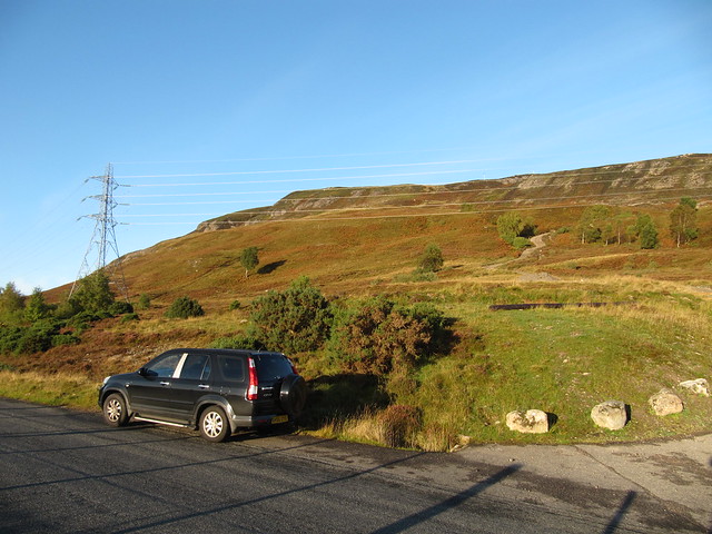
squozed in next to the track up to the mast

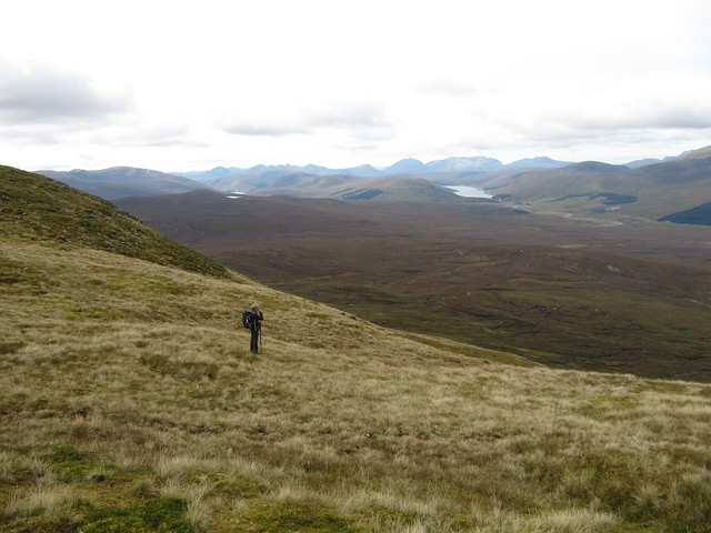
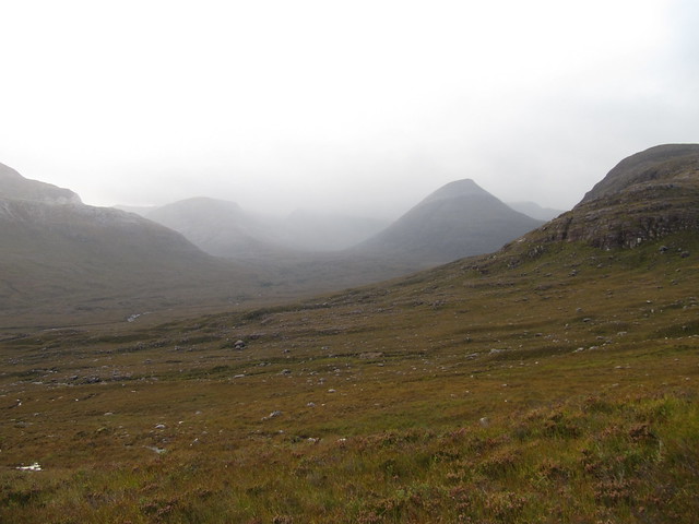
view across to my second target
It was less than a half hour till I was at the top of Tom Bailgeann, which is cluttered with two masts (one big, one much smaller) along with its trig point.
from the top of Tom Bailgeann; a few small inversions about (Loch Ness just appearing at the bottom)
I didn’t stick around for long before I headed back down toward the B862 for a short jaunt along it. The descent included a little bit of heather bashing and bracken hackin’, as I tried to avoid a small gorge that had been mentioned in one of the walk reports I’d read. I ended up having to cross it anyway.


looking back up what I'd descended
I enjoyed the trudge up the ridge toward Creag nan Clag, and sat to have a snack and enjoy the view over Loch Ruthven and down Strathnairn.

looking doon the glen as I ascended Creag nan Clag (I think the big hills in the distance might be the Loch Lochy Munros)

approaching the summit cairn

Loch Ruthven
The descent was more of the same: deep heather, long grass, and a bit of bracken. I was back down at the outflow of Loch Ceo Glais before long.
I had a nasty encounter with the fence between the field and the road. There was a sign near the loch requesting that walkers use the road rather than going through the field (esp Mar—May; lambing), but there was no stile or gate. Without providing an access point, it seemed a rather disingenuous ask, and there was nowt to do but go over the fence. It wasn’t high, but it had inset barbed wire, necessitating a wide step. My foot slipped off the lowest wire, and I caught my inner thigh somehow along the top wire; I’m still not quite sure how it happened. Let’s just say there’s now a *massive* bruise (two days on, it’s still swollen and painful).
It was back in the car and onto my next target, Stac na Cathaig. The start point isn’t all that far from the car park for the Loch Ruthven RSPB site, so I was just going to walk the extra distance. But there was a large forest access site, with enough extra space to park without blocking the gate, so I used the opportunity. Not much of note about this, other than the tufty grass and wet holes that made the route somewhat challenging once I was onto the open hillside (to then, it had been forest track, then through a wide fire break through the trees).

a pretty loch (private fishing only, from a boat) on the way up Stac na Cathaig

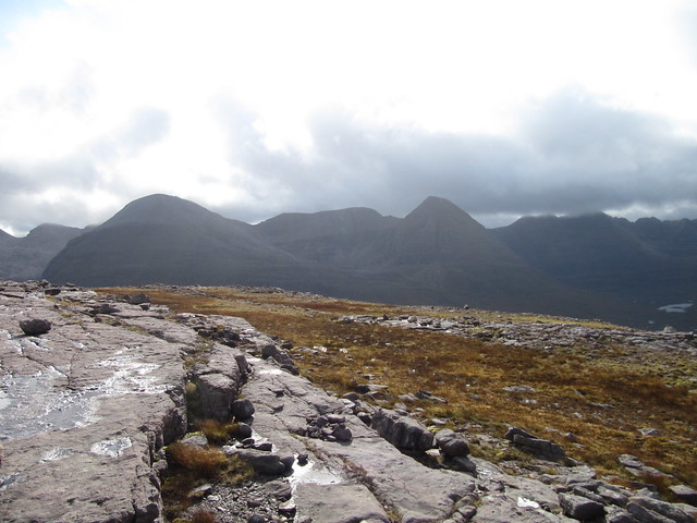
looking across to the summit; the ground disnae look so bad! (it's deceptive)

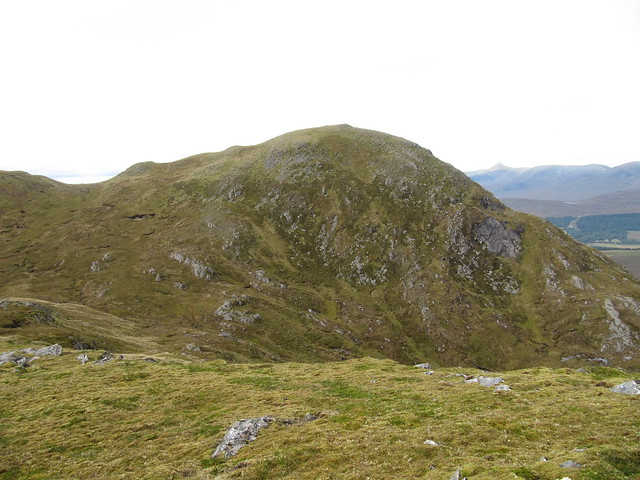
looking back over hill #1, its mast making it easily identifiable
There was a nice view from the top, and I sat and had my sandwich there. I think I could see all of the lochs that presumably comprise the Seven Lochs walk, which I’d read about in preparing for my tour today, but hadn’t heard of beforehand. The descent was simply the ascent, in reverse. Back to the car in less than two hours.
A short drive down the hill took me to the RSPB car park, and the start point for my final objective. The easiest and quickest route would have been to just head straight up the hill from where I’d parked; that would probably have taken less than an hour. But no, I’d downloaded another malky route, which led along the loch, and up onto a ridge, approaching the summit from its back side (ooh eer missus). I thought that malky’s WR had said there was a good path the whole way, and I think he’d also done it in an hour. I KNEW that wasnae gonna happen, but I thought I could maybe do it in two…
Well. The first part along the loch was lovely, although I did manage to lose the path once or twice. There was also (as per malky) a lot of ducking and diving around trees, and a few slimy slippy bits.

pleasant enough loch-side walking
But just about the time I was getting to the point where I’d leave the lochside and head up toward the ridge, I found myself in neck-deep bracken, with no end in sight. I managed maybe 100m through it before giving up, and turning around to go back the way I’d come.

the evil and impenetrable bracken
I’d decide whether to tackle the hill from the other side once I’d returned to the car.
I was tired. I’d had enough, and although I was a bit disappointed in only capturing three hills (after pondering on and off whether all day whether a qualified “tour de sub2k” meant at least four hills—hey, my rules, subject to change at my whim

), I also thought that this wee circuit, once the bracken has died back, would make a good short-day outing for the future.
It had been a good day, and once again, it made me ridiculously happy that I was less than an hour away from a hot shower and hot food.
Thurs 24 Sep
Corbetts: Meallan nan Uan, Sgurr a’Mhuilinn
8 hrs / 13.5km / 1131mEvie and I met at the Strathanmore walkers’ car park (just past the forest plantation) a bit before 9am, and were shortly on our way up the hill. Our progress was slow; we were nearly three hours reaching the top of the first Corbett, Meallan nan Uan. And it wasn’t just because we were chatting and catching up (after not walking together since last Nov)—it was a very long slog over rough ground—deep heather, slippy grass, the odd hole.

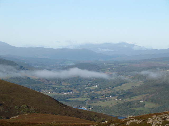
low lying mist shrouding lovely Strathconon
On the ascent, we noticed some spots of colour across the way, on the lower slope of the second Corbett. We thought it must be tents, and didn’t think much more about it at the time.
I think this must be as we approached the first summit, looking back down over Creag Ruadh
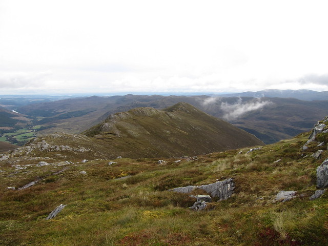
As per the WH desc, the ground was slightly easier once we’d passed Creag Ruadh, but it wasn’t exactly the miles and miles of easy ridge walking that I’d envisioned. We’d not been at the summit for five minutes before a man on his lonesome came up behind us. He didn’t seem inclined to chat, so Evie and I moved off the summit to allow him to have it to himself. We parked ourselves just below it to have a snack. It was a grand view. Fannaichs featured prominently, as well as the Fisherfields, AT, and Ben Wyvis. The Torridons were out there, too.

Hello, Torridons! And Achnasheen
Fannaichs (pointy Sgurr Mor the giveaway)
We set off again, and soon found ourselves once again crossing rough ground.

lochan in the coire between the two Corbetts
We’d always planned to visit at least one of the northern tops, but as we traversed toward the bealach we needed to climb up to, we pondered that the view from there would probably be as good from there as from the top. We heard heavy machinery from the bealach, and it seemed to be coming from just below us. This was odd, as there didn’t seem to be anything but acres and acres of peat bog between us and Achnasheen (which now looked much closer than it had from MnU; we had a very good view of Fionn Bheinn as well). As we wandered across the wide bealach, trying to see below us, Evie pointed out that it was only another 60m (of ascent) to the top. We might as well do it, then, having come this far.
Evie trying to peek over the edge of the bealach to see if we could figure out where the noise was coming from

Achnasheen looked much closer from here; nothing but acres and acres of peatland between us and there
We were glad that we did; this top had a lot of rocky character, and we spent a fair few minutes wandering around it. We still couldn’t see any heavy-equipment activity, and finally decided that the noise was probably carrying across the peatland from the forestry work taking place on the other side of the A832.

Evie wandering around the summit of the highest (by 4m) of the northern tops; our next target in front of her
A few more:


team photo
It was more long slog, plus several false summits, up to the second Corbett, Sgurr a’Mhuilinn.
on the way up to Sgurr a'Mhuilinn
We sat again, had more food, and enjoyed the view some more. With a bit of a shock, we realized that the spots of colour we’d seen earlier were actually diggers. We watched them for a while, and pondered on what the hell they were doing, more or less in the middle of nowhere. There weren’t any signs of industrial devastation; in fact, as we watched them, we became even more curious, as they didn’t seem to be doing anything, other than picking up bits of peat, and maybe moving them to a different place, but then either pounding them back into the ground in their new location, or else moving them back to where they’d originally been, leaving no trace (at least from where we sat) that they’d done anything at all.
We continued watching and wondering during our descent. Digger training and/or practice? It seemed odd that they’d need to do this out in the middle of nowhere. Then Evie said “ground testing,” and I couldn’t get that idea out of my head. Maybe they ARE testing whether the ground is suitable for…wind turbines? It is a vast empty area, and it would be a shame to disrupt it with more of those monstrosities; however, I fear that the enormous Corriemoillie windfarm across the way may unfortunately have set a precedent.
The descent was long and arduous; the same rough ground we’d worked our way over in the morning hadn’t magically gotten any easier. We arrived back at the cars at 5pm; we’d been a full 8 hours on the hills (the WH time is 5–7 hrs

). It didn’t matter, we weren’t in a hurry and still had plenty daylight to make our ways home, but we laughed about having “aged up” from generally performing somewhere in the middle of the WH time, to exceeding it by a not-insignificant amount. Was it a one-off, or is it a trend? Time will tell.
I’d noticed in the morning that the car was sounding a bit rough. After waving Evie off, I turned over the ignition, and it was now sounding really loud (like the vroom vroom noise that boy racers pay extra for), and I was concerned. It was better once I was off the single-track, and at speed, but I knew something was up that needed to be checked.
Fri 25–Sat 26 SepOn Friday, I was fairly wrecked, and didn’t do much of anything, by design. I did take the car to a local garage, and asked them to have a look, so I’d know whether it was safe to drive. The cheery young lad simply said “exhaust,” but assured me that it was OK to drive. They couldn’t book me in until at least 09 Oct, so I told them I’d need to have a think about it, as I wasn’t sure I’d be staying up here for that long.
Evie and I had made another plan for Sunday, so on Saturday, I was all prepared to head up to Loch Maree, to tackle a wee Graham up there. I was literally on my way out the door—rucksack packed and ready—when I decided at the last minute, knowing that I’d have a (relatively) long-ish drive the next day, not to push my luck with the car in its current state. So it ended up being another day of doing not much of note.
Sun 27 Sep
Corbetts: Beinn Tharsuinn, Sgurr na Feartaig
8¾ hrs / 21km / 1244m Another cracking day. We met at the unmarked forestry car park in Craig before 8am. We did a bit of car shuffling, trying to make the best of a bad situation caused by the first cars in having made a right hash of it, and having parked completely inconsiderately. It was a nice Sunday, and it was going to be hoachin’. I pulled my car in front of Evie’s, knowing that we’d be returning together, and we hustled out, leaving the rest of them to fight it out. It didn’t help matters that the back half of the area was a mudpit.

nice morning light on Fuar Tholl and Sgurr Ruadh
After our efforts a few days previous, it was pure joy to walk first along the track to the river crossing, and then on the very good path up to the Bealach Bhearnais. I’ve been up this route (to the Munros) twice before, both times on fabulous days in very different conditions, and today was shaping up to be a corker as well. All of the surrounding hills were resplendent in their autumn colours, and we stopped several times to try and spot the testosterone-fuelled stag who kept roaring out his lust. Or anger. Or whatever.

"I've always wanted to try that," she says (I used the stepping stones)
The Cuillins came into view when we reached the bealach. The grassy rake in front of us, leading up to Beinn Tharsuinn, looked steep, but not particularly prolonged. I thought that the summit would be not far past the top of that rake. Haha. It was still a fair distance; in fact, it was still some distance even before Bidean a’Choire Sheasgaich began making an appearance from behind it.
the Cuillins from the Bealach Bhearnais

oh, wow
We spent a long time on the summit. Evie has actually climbed Cheesecake from this side, and she was pointing out to me the most difficult bits. I’m well impressed with the fact that she managed such a long and difficult route by herself (although the word “mad” also came up once or twice).

Evie eyeing up her route up Cheesecake

this one shows more of what her route was (looks very far, and very difficult to me!)
Once again, we had fabulous views. The Torridon hills, end to end, under blue cloudless skies. Over to Skye, and Rum and Eigg in the far distance. Sgurr a’Chaorachain and Sgurr Coinnich, our immediate neighbours, looking quite fine in the watery sunshine. Loch Monar, which you don’t get to see very often.

end to end Torridons!

the outlying top of Sgurr Choinnich (or maybe it's a'Chaorachain), and Loch Monar

zoom to some of the Torridons

I couldn't stop taking pictures, even though I knew none of them would do justice...
We’d left open the option of not doing the second Corbett. We’d see how we felt once we’d returned to the bealach. Honestly, it had already been such a good day, I’d have not minded at all if we’d decided to not do it. We’d spotted the line of the old stalkers’ path referred to in the WH desc, and neither one of us much liked the look of it. We’d had a look at the map, and better liked the option of heading straight up the steep but mostly grassy slope to the east of the recommended route. It was steep, but we made quick progress.
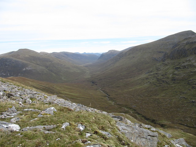
the wide sweeping glen down toward Maole Lunddaidh

steep going up
It didn’t seem long until we were making way to the summit cairn, where we sat, once again, and marvelled at the glorious day we were having, both of us very glad that we’d decided to carry on.


one more back toward Beinn Tharsuinn (sort of), and Cheesecake
After leaving the summit and traipsing up and down past several lochans, we quickly found the cairn marking the top of the descending stalkers’ path. It was quite wet and slippy near the top, but better further down, and also quite easy to follow, which made the descent rather more enjoyable than our long slog down had been on our previous outing.

arty through the rocks
From above, we spotted the small dam, and the rickety bridge just upstream—from there, the bridge looked ok. It wasn’t until we reached it that we saw that the planks were set quite far apart. Getting onto the first one was especially difficult, necessitating either a cautious sidling with both feet along one of the supporting cables, or a wide-legged shuffle with one foot on either supporting cable (Evie used the first method; I the second). Once onto the first plank, it became somewhat easier, although the structure was subject to some swinging motion (I had a death grip on the handrails). The final manoeuvre was to squeeze through the branches of the tree on the opposite side. Let’s end on an adventure!

(Evie's photo)
We returned to the track about a km before the deer fence; it was simply a matter of retracing the steps we’d taken in the morning. We were back at the car at 4:45pm, once again far exceeding the WH time of 7-8 hrs. However, we’re still not convinced that it’s a trend…we’d spent a very long time just enjoying a spectacular day from on high.
Mon 28 Sep
“try to get the damned car sorted” dayIt’s not good news. The entire exhaust system—all three sections—needs replaced, and it’s going to be
tres cher. What’s worse is that it can’t be taken care of for at least a week. I’d been thinking about heading home toward the end of the week, but unless I get a better offer (from my mechanics doon south), I’ll need to stay here, and limit my driving** as much as possible.
** Although I’ve been assured that it’s safe to drive (i.e., parts won’t start dropping off), I’ve also been told “it’s only going to get louder.”
I’m not sure I can stand it getting much louder. It’s pretty hard now to try and sneak away in the early mornings without waking the entire household.
Tues 29 Sep
Graham: Beinn a’Chearcaill (Loch Maree)
5¼ hrs / 12.7km / 732m After looking at the forecast for the rest of the week, Evie realised that today was the best of the lot, and managed to rearrange her work week so she could come out and play again today. I’d suggested this hill the other day, and she was up for it.
We set off walking at 8:45am. There’s a good stalkers’ path that takes you up along the River Grudie for the first 2½ kms or so; then you turn off and follow another mostly good, but wetter and muddier path all the way up to the bealach. From here, it gets a good deal rougher; not only pathless, but also wet and rocky, with a few small lochans, deep heather, and short steep sections thrown into the mix.

hey, Beinn Eighe

looking back down on (and across to) Slioch
there were some showers about, but they didn't come to much...

...and made for some fabulous moody light
We started out aiming toward the highest point we could see, but soon realised that that was too far east, so corrected our general direction until we were mostly in line with the WH route. Rather than contouring around a rocky shelf, we charged directly up its middle, through a cleft that was more waterway than pathway. The odd footprint gave us comfort that we weren’t the first intrepid walkers who’d chosen this route.

more of Loch Maree, and that Corbett the name of which escapes me...
Once we reached the top of that soggy gully, it was still another ½km or so of mostly gentle ascent to the wide flat summit. The views were spectacular; I’ll let the photos do much of the talking for this entry.

the giants' marble playground

Evie approaching the summit cairn
looking across into Coire McF**ker

Evie dwarfed by Beinn an Eoin

Beinn Dearg

some of Beinn Eighe, some of Liathach
We hunkered down just below the summit to have a bite to eat, then retraced our steps (more or less) back to the bealach, then down the stalkers’ paths back to the car, which we reached just after 2pm. (Not only, I might add, well within the WH time range, but even at the lower end of it!

)
magnificent Slioch, on the descent
the rock with the heather hat
We stopped off in Achnasheen at the Midge Bite café for yummy coffee and cake. How utterly civilized; it’s the first time I’ve been in any public eatery since you started having to leave your details for virus tracking and tracing.
After playing phone tag for the past two days with my Station Garage guys, it ends up that they can work on my car on Thurs. So I’ll be shooting down the A9 tomorrow, after another fabulous 10 days in lovely Inverness.
