free to be able to rate and comment on reports (as well as access 1:25000 mapping).
This trip was originally planned for April/May, before the midges and high ferns appear, but events conspired against me. Roll on several months during which I’d managed to use up some annual leave but still had quite a lot remaining so I booked two weeks off in the middle of September. At the start of the first week, a good forecast from Wednesday onwards had me sending off emails to VisitKnoydart, Knoydart Foundation (Estate) and Kilchoan Estate with details of my plans to check they wouldn’t cause any issues, particularly with stalking and the virus. I booked my return ferry ticket with Western Isles Cruises on the Tuesday, got my rucksack packed and was all set to go.
Wednesday 16.9.2020
No issues when I booked the ferry which suggested it wasn’t going to be that busy and, as it turned out, there were only four of us on the Wednesday morning 0730 ferry at Mallaig. One couple with whom I was to meet up on the first hill and a single guy with his bike. Had a socially distanced chat with him before we boarded – he was scouting out possible areas and routes for use in an outdoor adventure and photography business he runs with a friend based in southern England.

We had a good view of the hills on Skye as we headed towards Loch Nevis. Conditions were still overcast and grey around us but a lot brighter over Skye. As there were so few of us, Western Isles Cruises had used a smaller craft which only took ½ hour to get to Inverie. After disembarking, I headed towards the Old Forge then turned left up a track just before reaching it.
First up was Sgùrr Coire Choinnichean. Initially I walked past a number of houses – no streets or numbers in Knoydart, the houses each have signs and are named after the owners, eg John’s house, Jane’s house etc. The track continued to rise quite steeply in zig zags through the forest where there had been quite a lot of tree felling. I then got to a style over a deer fence after which I was on more open ground.

From here on the path was vague at times and I did lose it occasionally. I saw the couple from the ferry up ahead and caught up with them. Turned out that this was their second visit, the first being for Ladhar Bheinn a few years back. They were staying in Arisaig, saw the excellent weather forecast and decided to take the ferry over for the day to walk up Sgùrr Coire Choinnichean. It still looked brighter over on Skye but “excellent weather forecast” ?…....minutes later we were donning waterproofs as the rain started. Mixed with the strong wind it started to get distinctly chilly.
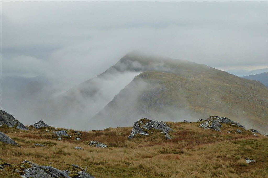
Anyway, onwards and upwards. A couple of short sections where hands were needed before getting up to the ridge which does look rather striking. Despite the wind trying its best to blow me over, I did enjoy this bit of the walk up to the summit.

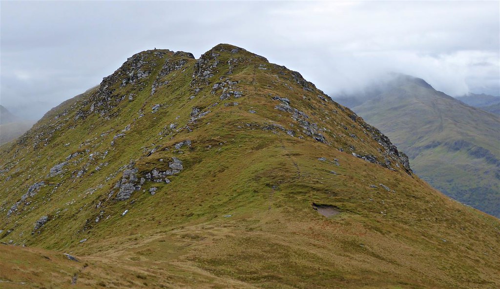
I got to the top before the couple so took a few photos before dropping down a little beyond the summit to try to get some shelter.
I waited until the couple arrived as they had been talking about walking the loop back to Inverie. However, when they arrived they explained that they were just going to retrace their steps given the poor weather. I wished them well and set off NE along the ridge.
Easy walking for this bit despite the wind. For some unknown reason, I’d begun thinking about Bonnie Tyler’s song “It’s a heartache” earlier on and was now singing bits of it to myself as I walked. Just couldn’t get it out of my head – no idea why.
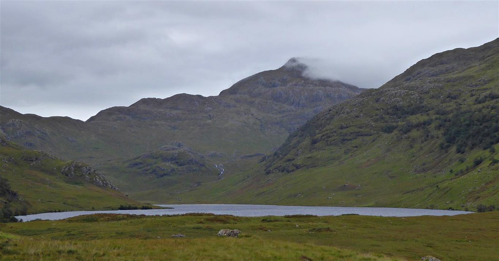
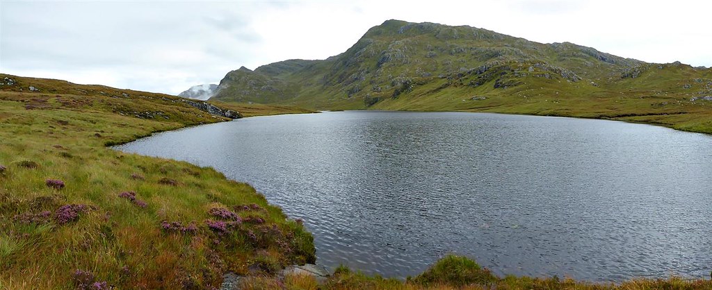
Kept walking until I could see down to Loch an Dubh-Lochain.

When I dropped down to a flattish point I started heading fairly steeply downhill basically aiming for a little before the southern end of the loch. On the way down I saw a Coastguard helicopter flying down from Glen Barrisdale then over towards Beinn Bhuidhe. The last 200m or so before joining up with the path proved to be very hard going. A mix of boggy sections, ferns and some extremely choppy ground with lots of grass tufts and holes slowed me up considerably. Maybe the song wasn’t too far away from the truth after all…..
After the choppy ground, I was quite relieved to join the path which heads down towards Inverie. I passed a couple of estate employees then a little before the junction with the Gleann Meadail path I came across a small herd of Highland Cattle covering much of my way forward with some young among them.

Nothing for it but to keep going and hope for the best. Worst bit was walking through a narrow gap between two with rather large horns on either side of the track each pointing in the way – in the end, nothing to worry about as they effectively just ignored me.
Brocket memorial

Shortly after this and before reaching the hill on which sits the Brocket memorial, I turned off left on to the Gleann Meadail path and then crossed the Allt Gleann Meadail by the bridge. Walked on a short way then stopped to sit on a rock to have some lunch.
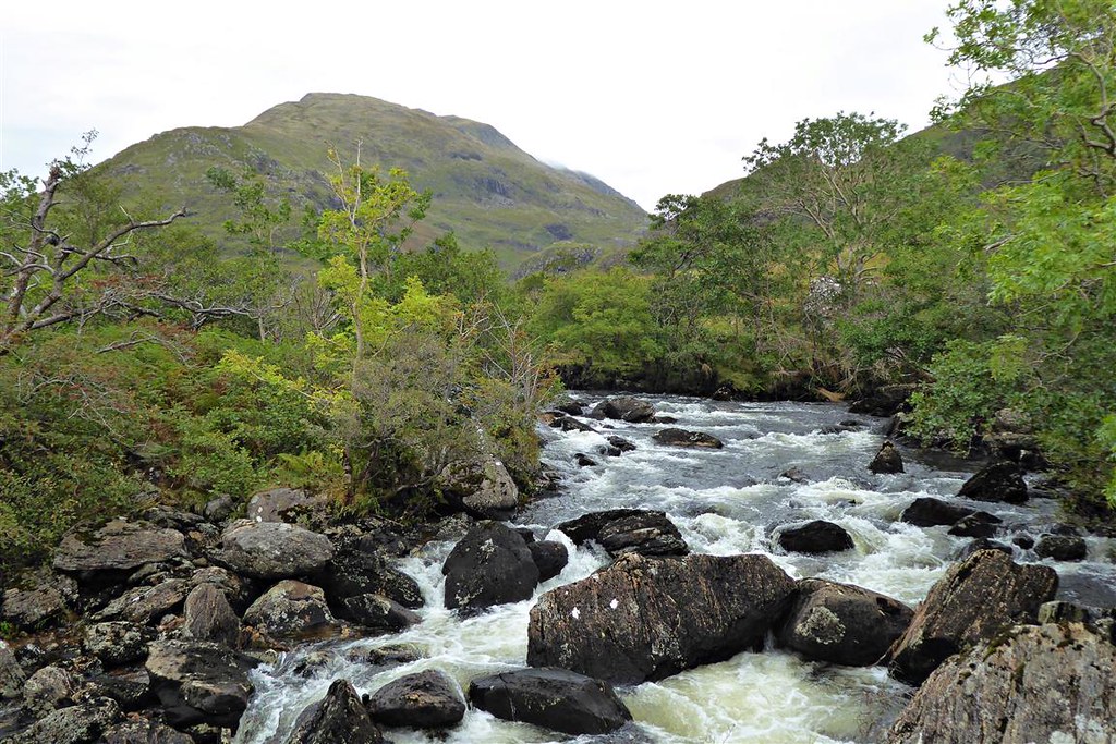
I followed the path through some woods and past Druim Bothy which is owned by Kilchoan Estate – had a wee look in the windows but there was no-one around. From here on, I just followed the path up the glen. There was another water crossing and no bridge but I managed to find a suitable point to cross aided by some well positioned rocks.
Looking back down the glen

The path left the Allt for a while before coming back down very close to it higher up the glen. I needed to cross around about there but there was quite a strong flow of water. Wandered along the side of the Allt until I found what looked like a decent crossing point – after much stretching and with a lot of help from the poles, I managed to get across with dry feet.

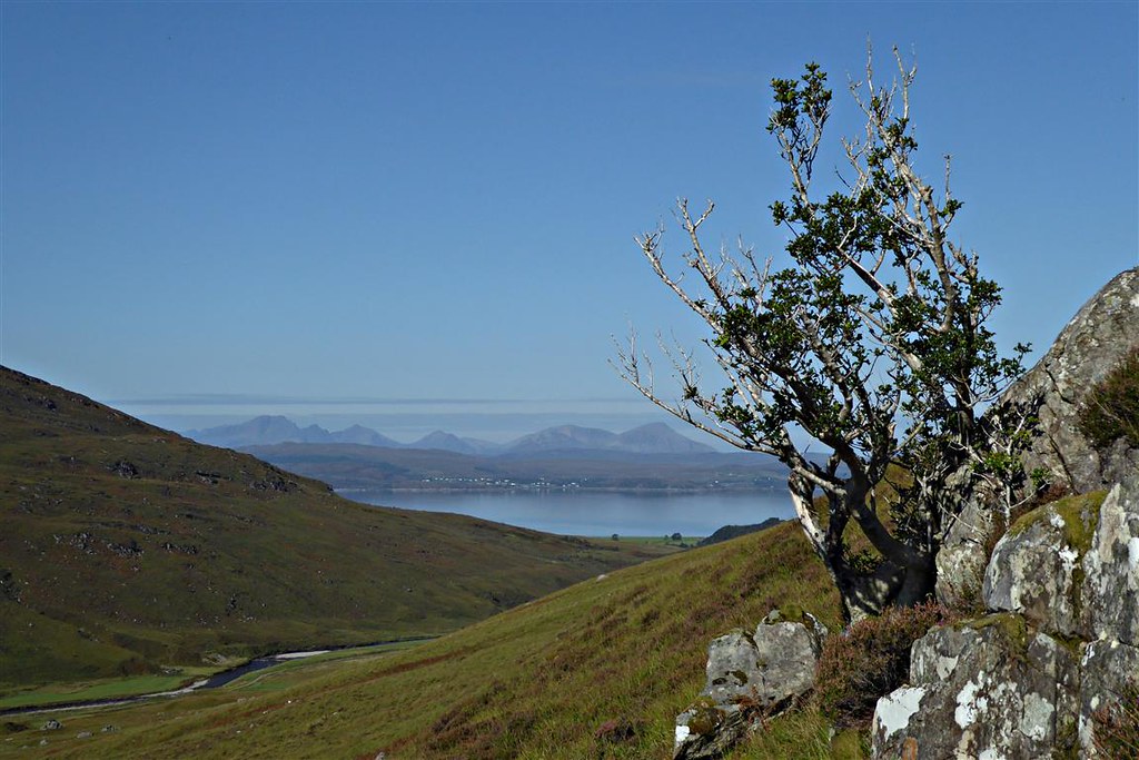
No path now but I could see my objective, the pass of Màm Uchd, higher up the hillside. Initially a little boggy and an easy incline it soon became fairly steep – photo is looking back down to the path.

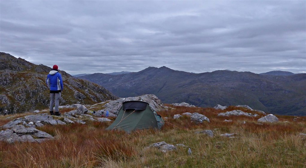
Knowing that I needed water for the night, I found a burn and walked up the side of it. The good news was that its source was just below Màm Uchd – instead of filling up with water at that point, I decided to go on and find a camping spot then go back for water. I went on further up the hill then a little west of the pass to get to a higher pint with less boggy ground. After a bit of wandering around I found a decent spot with a view towards Meall Buidhe, set up the tent then headed back down to get some water.
A little disappointingly it had stayed grey and overcast all day – the good news was that the rain hadn’t lasted long earlier and it was dry. Fingers crossed for tomorrow…. Salmon and Broccoli Pasta for main course followed by custard washed down with hot chocolate and I was ready for an early night.
Thursday 17.9.2020
I never seem to sleep well in a tent and tend to waken frequently – this night was no different. Had a look outside predawn but could see nothing but low cloud with clag in the distance. Dozed off for a bit before getting up, making breakfast (oats/sugar/dried milk/sultanas mix with boiling water), got packed up and set off uphill. It was still looking rather misty in the distance but I was ever hopeful.
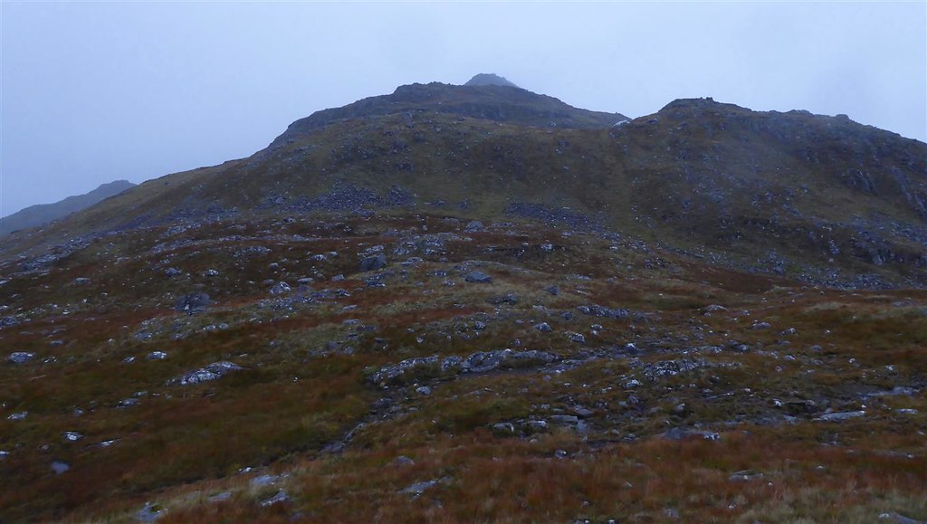
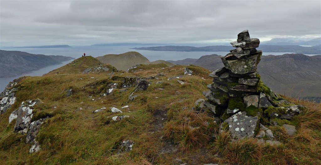
I had camped at about 600m so had less than 300m to go to the summit of Beinn Bhuidhe. Although I couldn’t really see much in the ever thickening clag, route funding wasn’t difficult – just a case of heading upwards.

I got to the summit where its Vanessa trig point has seen better days – the top is split and broken away. Thick clag at the summit but I stopped to switch on my phone and managed to get a signal so messaged home.

I didn’t stop for too long as I knew the ridge would take some time to walk and there was more descent/reascent to come. Continued on in the clag finding a path here and there.

Then at around 10am the mist started to lift and I could see a bit more. Hallelujah, Knoydart was starting to reveal itself.

Spotted a well camouflaged ptarmigan and watched as it darted about until I finally got a picture when it stopped on top of a tuft of moss.

Continuing along the ridge, Inverie Bay came into view and then, well below me, Loch Lagain Loisgte and its much bigger neighbour, Loch Bhraomisaig. They did still look rather far away so I plodded on. Followed down beside a burn aiming for a point between the two lochs. The ground was rather boggy for about the last 1/2km before I reached the lochs.


Skirted round the western end of the larger loch then headed more or less northwards and down towards Inverie House using a stream as a guide.
Again the last 200m or so of descent proved quite hard with more choppy ground to be covered. A helicopter had been coming and going constantly for a while – it was flying in over me with a cable dangling below, descending to somewhere near Inverie House to pick up what looked like timber and then flying back southwards – this was repeated many times.

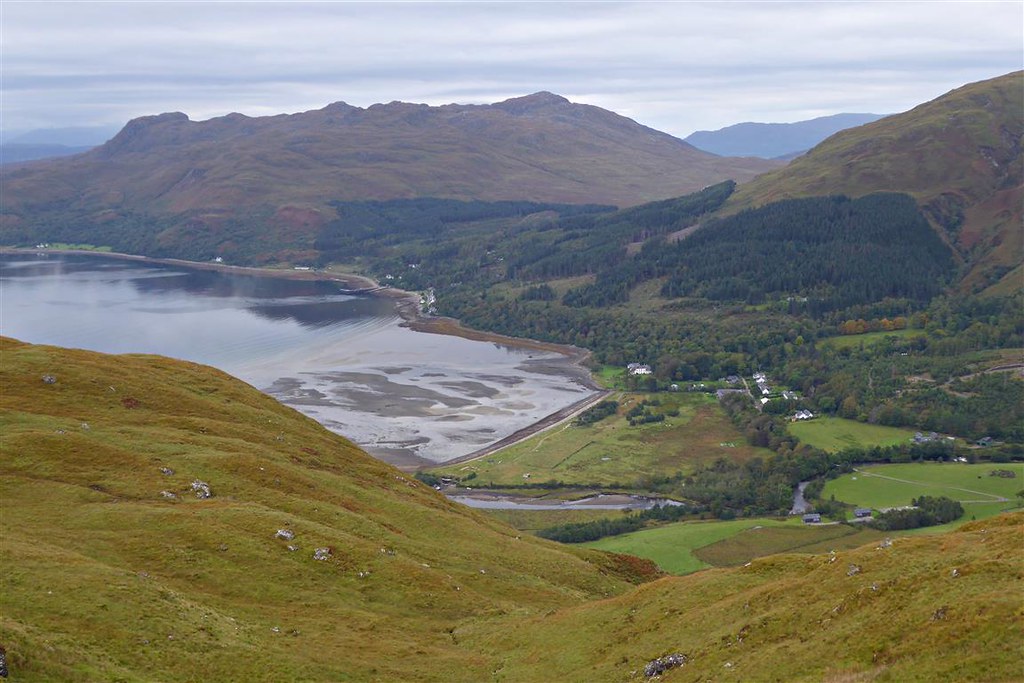
I joined the road at Kilchoan and walked past a group of rather docile deer then walked on towards Inverie.

The weather was rapidly brightening up and, by the time I stopped at a picnic bench for lunch, the sun had appeared. I sat and watched a heron looking for food in the sea – idyllic in the sunshine. Blue skies, sun, rapidly rising temperature and a calm sea – I could have stayed there all afternoon but had to tear myself away.

Walked through the village and stopped to read the inscription on the memorial to the Seven Men of Knoydart. I then continued on to where I had previously branched off the day before but this time I took the main road north towards Màm Uidhe. A little ascent as I walked up through the trees past some more houses then through a gate and I was in open ground.

Continued along the road until I reached a branch off in the next group of trees. Took the branch off to the right and headed towards Gleann na Guiserein. I was now on a landrover track heading down towards the river and Ladhar Bheinn.

Once out of the trees, the track runs along the south bank of the river and passes the confluence with the Abhainn Bheag until, about 1/3km later, it reaches the bridge over the Allt-Coire Torr an Asgaill.

I crossed the bridge then took a sharp right and started following to the right of the Abhainn Bheag. There was a path albeit faint at times with some waterfalls marked on the map – stopped to take a few photos.

I then continued up the path following it when it crossed to the other side of the burn. My plan was to follow the burn up to just before the lochains at the head of Màm Li then pick up water for the night to save having to carry it too far.

Spotted a golden eagle soaring above Beinn na Caillich but it just didn’t want to come any closer to me to get a decent photo.

Higher up at around 350m the path disappeared and I continued on through the grass and heather towards the lochains. I stopped to pick up water at around 450m then headed a little further up to the NW to find a suitable spot for the night.
Looking back

Now at the head of the pass the wind had got up so I set up the tent pointing into it just in case it strengthened any further.

The wind caused some problems with cooking dinner (Chilli this time followed by custard) but nothing insurmountable. The weather though couldn’t really have been any better and I sat down on a rock to eat. Needless to say just at that point the wind dropped completely. The good news - a very small number of midges appeared but they didn’t seem to be biting. The bad news – groups of deer keds started attacking me so I had to move about a bit while eating to try to get away from them.
Lovely evening spent sitting looking out over Loch Hourn

And wandering around taking more photos of Ladhar Bheinn, the rough bounds hills to the east and over to Skye before retiring for the night.


The usual frequently wakening sleep cycles then ensued made a little worse by the fact that I’d managed to pick some ground on a slope – very warm though for the time of year.
Friday 18.9.2020
Got up around dawn to get some photos


You can just see the green fly and orange inner of my tent in the bottom right corner of this photo with Beinn na Caillich in the background

Loch Hourn

Then cooked my usual breakfast, packed up and set off SW up Beinn na Caillich. I managed to find a path for part of the way which did help. However, with no wind at all, the deer keds were extremely annoying. They seem to get everywhere – hair, eyes, ears – and they’re so difficult to brush off. Still, at least they don’t seem to bite humans. I think the keds made me move faster than usual and it didn’t seem to take long before I was at the summit cairn.

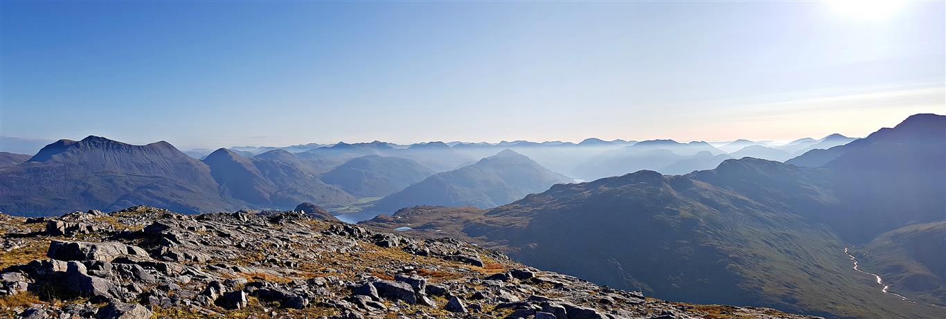
It was a cracker of a day and very hot despite still being before 10am. Just sat and took in the views – at long last I had good weather on a summit in Knoydart.
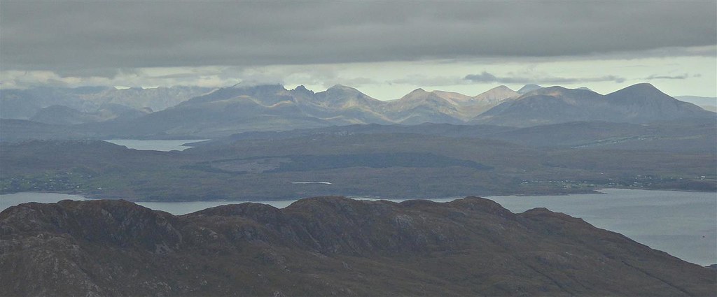
Beinn Sgritheall and the two neighbouring corbetts on the left
Layers

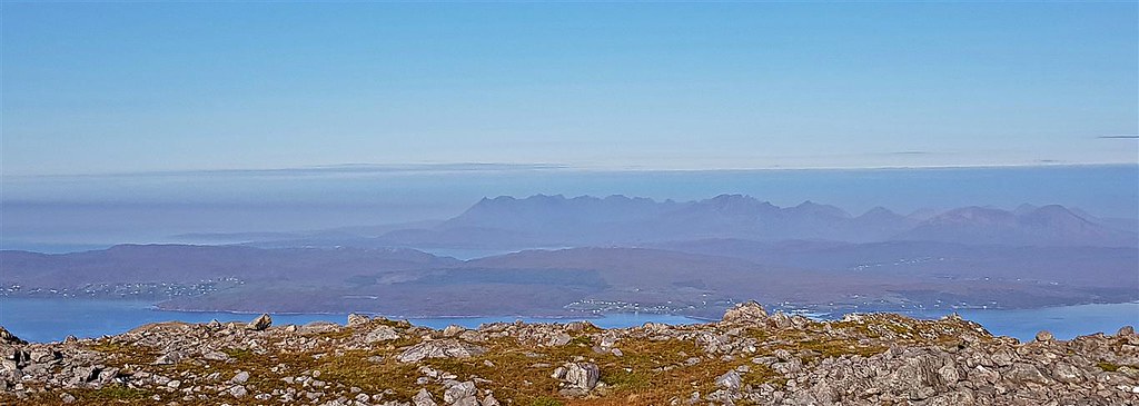
Skye
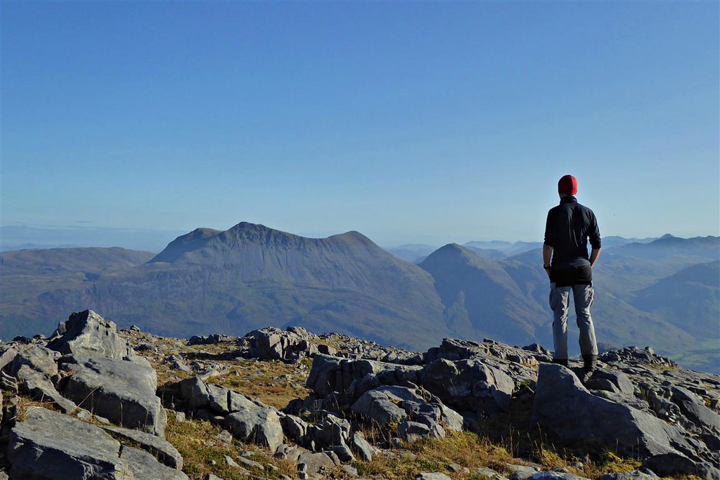
Selfie
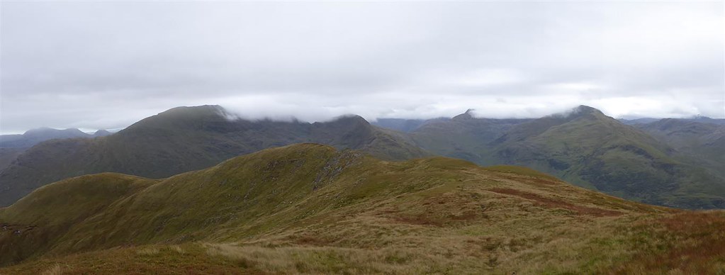
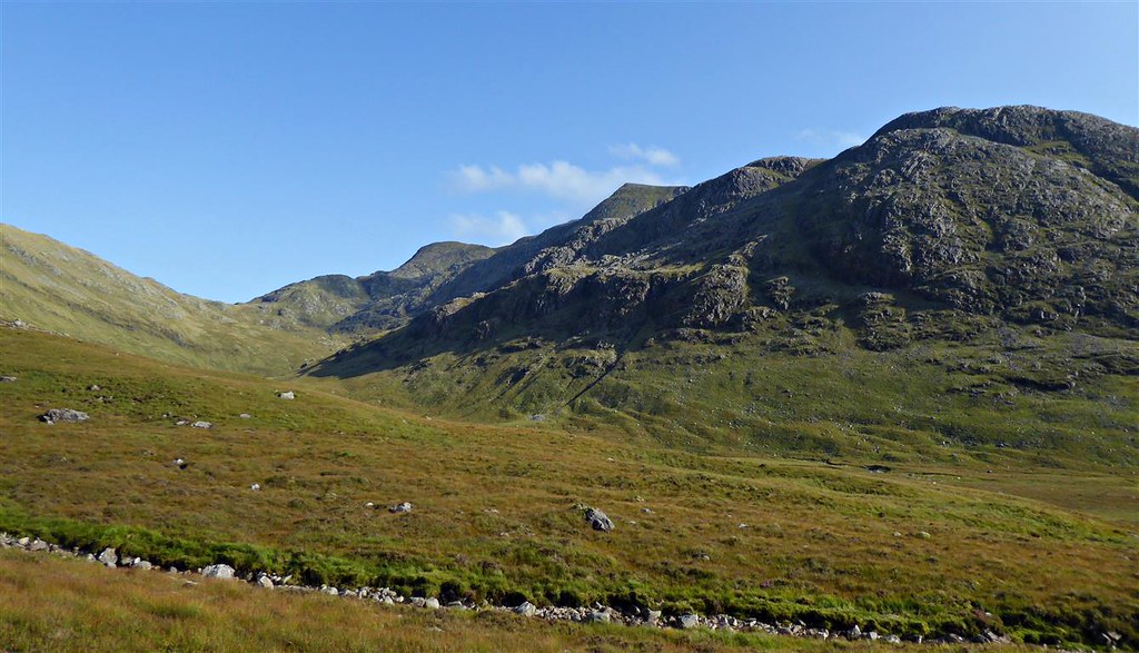
I must have spent the best part of an hour at the summit but eventually had to tear myself away. Rather than retrace my steps I opted to continue SE towards Meall Coire an t-Searraich. I knew this would involve descent and more reascent but it seemed a far more interesting way to go.
Mostly broad grassy slopes with some rocky areas made for easy walking.

I skirted round to the north of Meall Coire an t-Searraich overlooking Dubh-choire then could see the way ahead back down to the road – about 550m to drop over about 2km. The going was quite rough and steep in places until I got back to the road.

Skye

Solitary tree
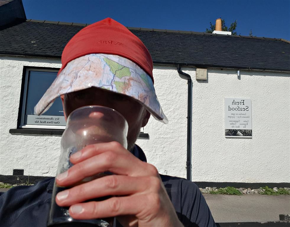
Back on the road I was starting to feel the heat with 5 – 6km of walking to get back to Inverie. The sun was blazing down and, walking southwards, I was walking straight towards it. I was pretty sure my face was getting sunburnt (it peeled for the week after I returned) but, of course, I hadn’t brought a cap or sun screen. Instead I folded up a map print out and stuffed it under the front of my beanie to form a makeshift skip – must have looked extremely odd but it worked rather well in keeping the sun off my face – there’s a photo further below when I got back to Inverie.
Quite a few butterflies out enjoying the sunny weather

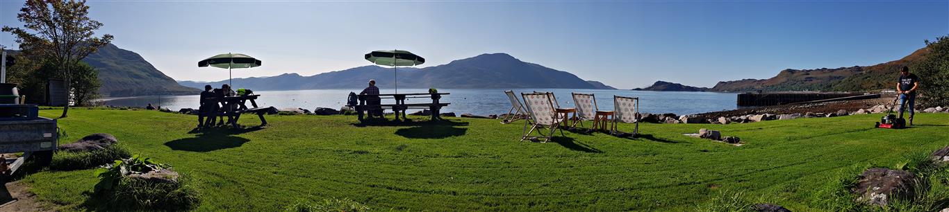
Initially there’s some ascent on the road before it starts to drop gradually back down into Inverie. Back in the village I made a beeline for the Old Forge to get a snack and a pint (of diet coke as I was driving home). Had a couple of hours before the ferry arrived so just relaxed outside in the sun then wandered down to the beach before walking along to the pier to get the ferry.
The next photo is of the makeshift skip mentioned further up – only thing I had to keep the sun off my face
Waiting on the pierside, I had a chat with a couple – she was a musician and he was a film producer in the midst of finalising plans and arranging finance for a short film to be centred on Knoydart. He still had a way to go with it so it wasn’t certain but seemed hopeful.

The ferry was much busier for the Friday afternoon return leg than the outward bound trip – looking back to Inverie Bay.

I had attempted to get photos of the Rubha Raonuill statue of the Madonna in the past but had never been successful as they were always over exposed. This time I tried massively underexposing and managed to get a little more detail than previous attempts.

Heading out of the bay, one of the ferry crew shouted out that he could see dolphins. The engines were cut and we slowed down. Queue passengers rushing from port to starboard and back to see them – didn’t get a photo when they were alongside but I did manage to get a reasonable picture when they were out beyond the bow.

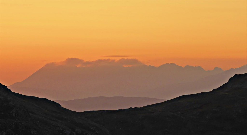
Got back to Mallaig then headed to a chip shop after which I sat and ate on the wall of the car park overlooking the sea. Then set off for the drive back to Glasgow. It was a lovely evening with a rather splendid sunset – stopped just before the bridge at Ballachulish for a quick photo before continuing with the drive home.

