free to be able to rate and comment on reports (as well as access 1:25000 mapping).
I’ve had some interesting walks on Ben Reoch at Loch Lomond. None more so than in 2011 when I was caught up in the infamous “Hurricane Bawbag” of 2011 which saw me battling plus 60mph winds and a blizzard, before being stranded and having to thumb a lift home. I’ve only did this hill on my own before so I was happy to step in as a last minute replacement leader for Glasgow HF Outdoor Club when someone had to call off. The walk was planned to start at the Inn on Loch Lomond, and as I’ve always approached from Tarbet I wasn’t familiar with the approach from this side, and with no time to carry out a recce I had to rely on google and the OS maps site to do a virtual approach. With 11 people booked to attend in total this would be the largest group I had taken out for a number of years, as I had virtually gave up leading walks back in 2014 when my knee troubles put a halt to my hillwalking.
With a poor weather forecast, an unfamiliar approach, a large group of people who I had never walked with and a pair of boots which I was still breaking in, it was with some trepidation that I drove towards Loch Lomond, the radio dominated by the death of Sean Connery, the roads treacherous with floodwater. After an interesting diversion through Helensburgh I found myself in the car park of the hotel, greeting the members of the club who would be joining me, and with everyone present we set off.
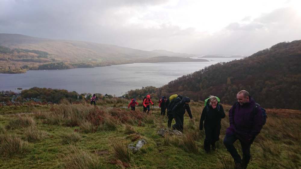
A well known quotation in military circles is that “no plan survives first contact with the enemy”. In my case, my plan didn’t get out of the car park, at least not by the way I had imagined. There’s a path shown on google maps which joins the car park to the Glen Douglas road, however it was barred by a locked gate. Not an inspiring start, but we were soon sweating our way up Glen Douglas, indulging in the time honoured rituals of “faffing”; either removing an extra layer due to the initial steepness of the hill, or putting on a waterproof layer as the increasing rain threatened to live up to the forecast. It’s a steep climb up the road, but we were soon taking an access track which leads to a mobile phone mast. My map recce had shown us following the line of the woodland up from the mast, but a faint path revealed itself, and we undertook a rather steep and sweaty ascent, occasionally pausing to look behind us at the loch and the islands behind us, and the early morning sun hitting the hills on the other side of the glen.
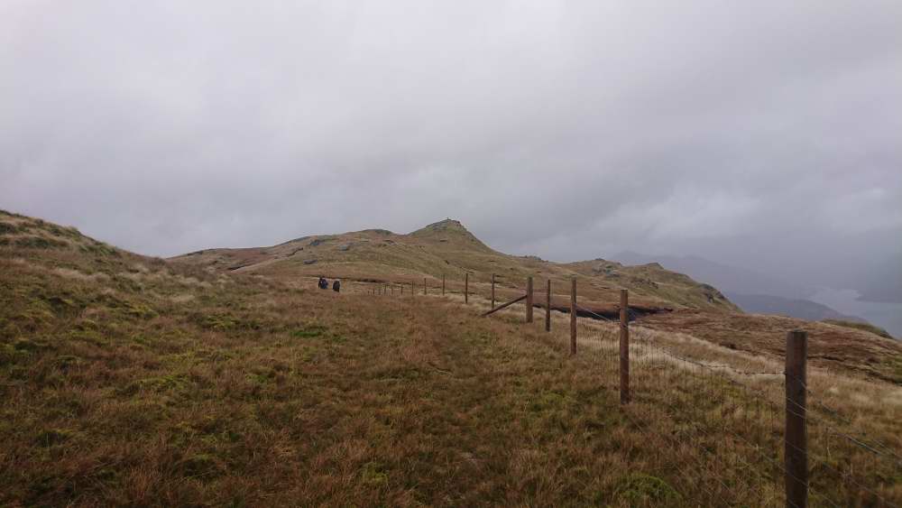 The fenceline acts as a handrail
The difference in map detail between scales is often crucial, and the 1:25,000 map showed that the fenceline we were following would lead us almost to the summit of our first target, the 681m Beinn Bhreac. Being able to take my eye of the map was handy, as the ground here is pretty boggy. Having cleared this section we ascended through running water towards a rocky summit, buffeted by high winds and stung by rain, and we threw ourselves down for our first stop of the day below the trig point, sheltered from at least some of the wind. Across the loch I could see a few tiny stick figures descending from the summit of Ben Lomond, the usual crowds nowhere to be seen.
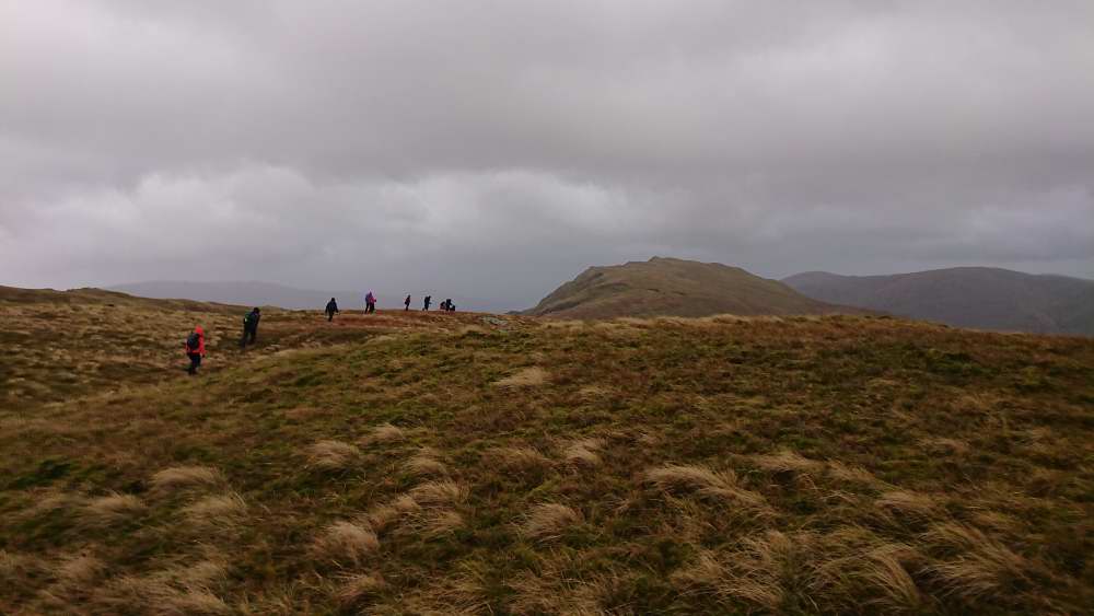
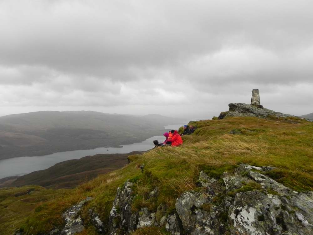 Beinn Bhreac summit
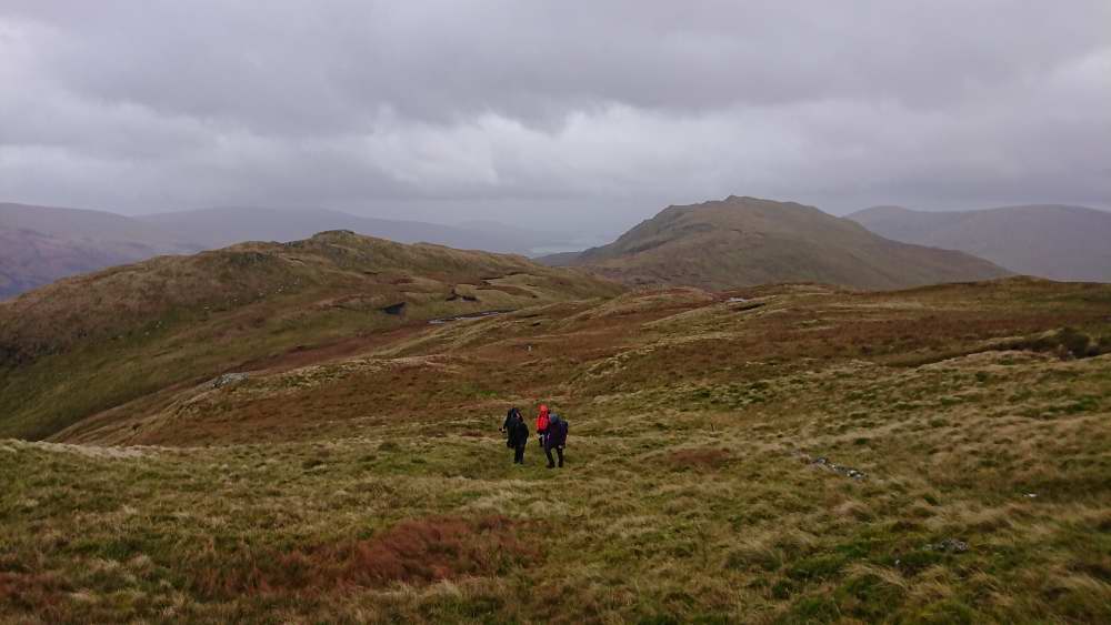 Onward to Ben Reoch
The path onwards to Ben Reoch was not well defined but the route was straightforward, shadowing the fence-line until we reached a small lochan, strangely dry considering the previous nights heavy rains, before forging a line upwards to the wind scoured summit. The winds were now hitting over 50mph and gusting higher, and we were blown and buffeted as we stood taking in the view across to the Arrochar Alps.
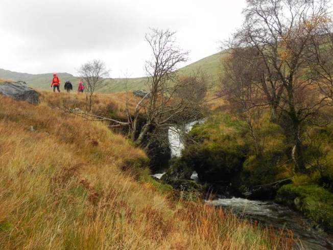
 Time to descend to An t-Sreang
We weren’t hanging around here for tea though, and we headed back on a line parallel with our inward route which gave us the opportunity to look down on the next section of route, a descent into An t-Sreang glen, and along the burn to Tullich Farm. This was a steady descent along the line of a tributary burn, our efforts eased by the bracken now having died back, and we were soon picking our way back and forth across the burn, before finally settling on the right hand side.
 The first in a series of waterfalls
Bare hillside soon gave way to a thin strip of birch trees, their autumn leaves already stripped and gone, and these shadowed a series of ever more impressive waterfalls which we followed down towards the roadside.
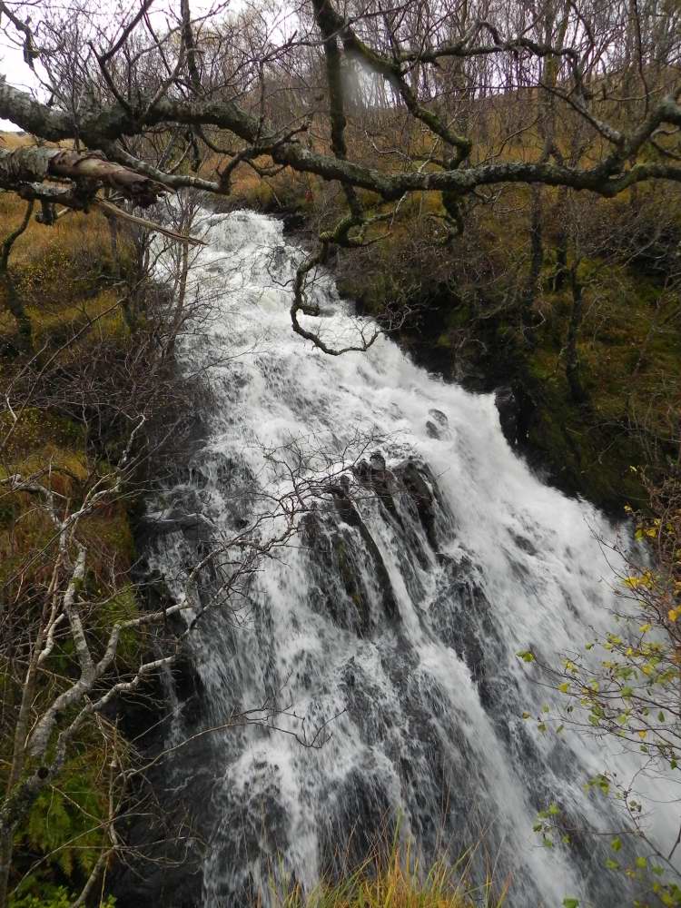 The power of these falls is phenomenal
By now the promised rain had finally arrived and it drove us speedily back along the last three miles to the cars, where we quickly said our goodbyes and tried to carry out the other time honoured hillwalking tradition of trying to get changed out of sodden gear in a public car park; in pre-covid times we would have met up in the bar for a post walk beer but today that’s out of the question. It’ll be nice to get back to that when it’s safe to do so, for now we’ll simply have to make do with enjoying the hills and the socially distant company. That’s not so bad, is it?
