free to be able to rate and comment on reports (as well as access 1:25000 mapping).
I was quite optimistic when I set off. Allison had injured her shoulder last weekend, but it turned out to be strained acromio-clavicular / stern-clavicular joints rather than anything more serious, so of course she was up for heading to the hills again. I decided we'd head off on Friday morning rather than Thursday night - with a lot of rain forecast it made little sense to be driving of in the dark on Thursday evening for an uncertain camp spot, even if it would have allowed us an extra hill. Maybe. So it was Friday morning that we headed away. Being over in Mallaig way last weekend had whetted my appetite for more west coast locations. There are many Marilyns residing in that lovely quadrilateral shaped land of Ardnamurchan/sunart/Moidart/Morvern and it felt right to be starting on their acquaintance.
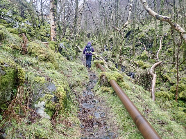
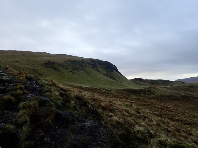
This week we caught the Corran Ferry and headed towards Acharacle, which is the limit of my previous journeying into the west. Beinn Bhreac was first, realistically the only hill we'd get done today, by the time we arrived. It's always pleasant to drive along past Strontian and along the shores of Loch Sunart. We passed the empty Resipole Camp site, which in other times might have been our point of residence. On to Salen and Acharacle, then onto a little road making for Castle Tioram ("the dry castle"). We found a parking area at the end of the public road and set off back through the few clustered houses of Dorlinn, several of which appear to be holiday homes run by Glen Shiel estates, then onto marked track into Bealach Sgairt Dea uisge, which passes a reservoir and some pipe works. Ancient oak woods surrounded us, the rain a constant companion as we headed towards Lochan na Fola, then turned north along the shore of the lochan to begin the ascent to Beinn Bhreac. It's only a small ascent, maybe 70m from the path and there's a rough ATV track going all the way to the summit to make it easier. Through the rain and mist we could make out Eilean Shona, one for another day (when we can work the tides out). We descended following a mix of ATV and deer tracks back towards the path. We passed the abandoned settlement of Braigh, which would have been a pretty location to live in, then dropped down to the Silver Walk which hugs the coastline of Loch Moidart.
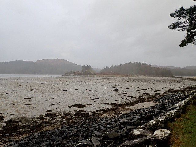
Castle Tioram
 F32D1AF4-E118-4E68-B7C9-F85A86553465_1_201_a
 by
Al, on Flickr
 D3934F66-E5BD-460F-8C02-929DA5E5F735_1_201_a
 by
Al, on Flickr
 B863944C-C55A-4683-84F1-9FB2F0688901_1_201_a
 by
Al, on Flickr
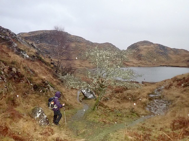
Lochan na Fola
 3D916FB0-1D54-42D9-A7E8-0A0CD469A4C9_1_201_a
 by
Al, on Flickr
 21AA7BB8-65A7-49C8-8CD4-B2A06CDC7294_1_201_a
 by
Al, on Flickr
Beinn Bhreac
 BA1A8423-BF5F-43F5-8006-92ABB3C32428_1_201_a
 by
Al, on Flickr
 62EFD461-FD9B-4CFF-A6AA-2F2F18EAA4A6_1_201_a
 by
Al, on Flickr
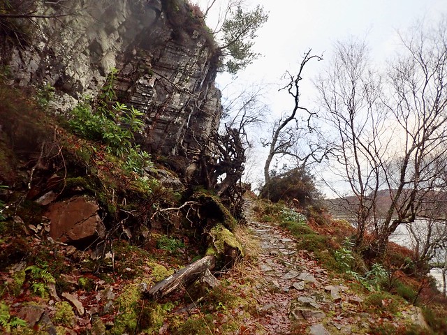
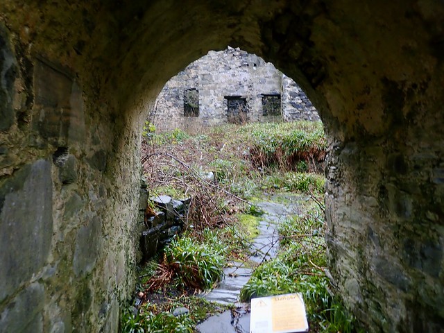
Called the Silver Walk because a Spanish galleon got lost when bringing funds for Bonnie Prince Charlie and sank with a million silver reales on board which every so often get washed up on the shore? It's a nice idea, but I just made that up. I don't know why it is the Silver Walk, but it is very pretty, even on a rainy afternoon in December. The path undulates a fair bit. Fallen tree limbs sprawl across it, verdant, almost iridescent mosses grow in the wet rock. After a time we came round the coast to the view of Castle Tioram, which, of course, we had to visit. The tide was out and we walked across the sandy causeway.
 88643FF0-AEFC-4630-BD23-464D566BFF23_1_201_a
 by
Al, on Flickr
 D18A8762-13D1-4945-8FDF-EA3D42C9A43B_1_201_a
 by
Al, on Flickr
 79C56F09-1DA7-48CE-89DD-B1829ED0ABB4_1_201_a
 by
Al, on Flickr
 9D6A78CF-F1E9-4E62-8316-EB9935A369F8_1_201_a
 by
Al, on Flickr
The castle isn't open to the public, masonry having fallen creating a danger. I read that there's a standoff between the owners and Historic Scotland, which likely means that it will fall into ruin, which is sad, as it's an impressive building. We went up to the gate, then walked around the outside of it. I half thought about camping on the west side, underneath the ramparts, but I'm glad I didn't as when we woke in the morning the castle was well and truly cut off by the sea. We headed back to the car, got our camping gear and selected a spot on the mainland, just across from the castle. This proved a very pleasant place to overnight, not a sound to disturb us all night.
 C20C361C-08A0-492F-8D76-39140489266F_1_201_a
 by
Al, on Flickr
 F2A69164-C678-4B43-BFB4-9E0D52530460_1_201_a
 by
Al, on Flickr
 C36B8B5F-32F3-4BC2-A8FF-070DCAA1E581_1_201_a
 by
Al, on Flickr
 83DAC417-F903-4D8D-987E-7E4F4221CA5A
 by
Al, on Flickr
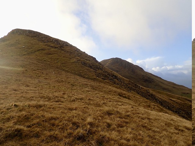
Some rain through the night, but an almost sunny morning greeted us as we breakfasted then got our get together. We drove back through Salen, heading for Laga, where the twosome of Ben Laga and Meall nan Each awaited. The map suggests there's a parking space in Laga, it has a blue P, but I couldn't find this anywhere, only the gates to farms or houses, so ended up parking a little way out of the village on the grass by a passing place. There's a track going up into recently planted native woodlands that we used to access these hills - the path is of good quality, especially in the first section. Meall nan Each is a rather sprawling shapeless hill approaching from the south - we stayed on the track until it met a cross-wise track then followed a stream uphill. Easy going, there's an ATV track going to the summit if you wish. A trig column awaits one's endeavours.
Ben Laga from the road
 A7537865-F3BE-4B8F-9229-DCCA0ED9907C_1_201_a
 by
Al, on Flickr
 39CD7142-C23F-4A97-A2B5-1480D6A6A21F_1_201_a
 by
Al, on Flickr
Meall nan Each
 1771BB2A-D178-448E-90D7-D6EFEC5235BF_1_201_a
 by
Al, on Flickr
Ben Laga
 81549FEE-719A-4133-AE6A-7C6077BF80DE_1_201_a
 by
Al, on Flickr
 4B035374-1E71-4AF2-BC75-F78D90F9F62C_1_201_a
 by
Al, on Flickr
Summit Meall nan Each
 742A32C3-19A5-463B-9EF5-351E94492279_1_201_a
 by
Al, on Flickr
Back down the same way then across to the south of Loch Laga to begin as ascent of the north west flank of Ben Laga. The wind was strong here - we hunkered down behind a massive erratic boulder to have our lunch then continued towards the summit. The terrain becomes increasingly rocky, which - coupled with the heavy rain that had started to fall and the monstrous blasts of wind, proved quite an obstacle to progress. We got there eventually and began picking our way down. I'd chosen a route coming off south west into Coire na Moine - however this involves band after band of crags and is quite tricky in places, particularly in descent (particularly also if you have a gammy shoulder). It took a lot longer to descend here than I'd anticipated, it is definitely more exciting than the map suggests! Eventually we were back on more moderate ground and headed for the gate in the deer fence to rejoin the path we'd come up on. I'd suggest reversing the route and ascending through Coire na Moine if you were to it do this way. A good mountain though, proper rugged.
 57B62764-A349-4D9E-9FBB-C51AC43B8D7B_1_201_a
 by
Al, on Flickr
 7C119B78-A6FC-40FE-AD83-C7989AE49864_1_201_a
 by
Al, on Flickr
Summit Laga
 36D5A774-8619-40A4-BD04-68C49EC7B13A_1_201_a
 by
Al, on Flickr
Carna
 D2B56247-9E6A-4088-971E-ABAFB6266777_1_201_a
 by
Al, on Flickr
 056FF78B-477C-493B-ADE1-79463551233B
 by
Al, on Flickr
Walking back to the car we spotted the Isle of Carna, which has the Marilyn of Cruachan Charna on it - I saw that there's a boat hire place in Laga that does visits to Carn on a Saturday morning at 9.30 for £10pp. Or you can get your own boat, but that's a bit expensive. One for the future. We headed west - my original plan had been to drive to Beinn na Selig and climb that today, then camps somewhere nearby, but we were getting short on time and the weather was increasingly foul, so just getting there became the priority. We passed the Ardnamurchan Distillery (which seems not to be bottling anything much yet). However, we didn't spot many places to camp at all, as we drove round behind Ben Hiant and on to the populous settlement of Kilchoan. Drove down to the jetty, but "no overnight parking" signs prevailed. I wasn't sure what to do - did think of driving up to the lighthouse and seeing if there was space to camp there, but we drove past the starting point for our hill, at the turn off for the new cemetery, and found some flat grass by the roadside there, which would do at a push - not as pretty as last night's spot but as the dark was rapidly falling, like the rain, we just got pitched and set about making an early dinner.
 19F4B911-136B-441D-942F-CE350A426327_1_201_a
 by
Al, on Flickr
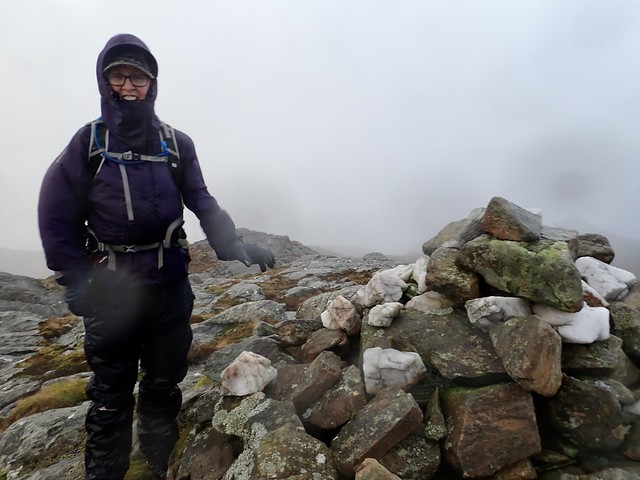
Tinned chick pea curry - Allison not impressed. It filled a hole I suppose, but not of my usual calibre, I grant you. A long night, with bursts of very heavy rain for much of it. At times it sounded as though we were being deluged by a fire hose. We were delighted when we did get up to find the rain was stopping and we enjoyed a few good hours with only the odd brief shower. Beinn na Selig is a rough conglomeration of rocky prominences. We started off up a sheep track that led us to a council yard with a fence round it. This would have been another place to park. We tried to find a way round to the south, but this was prevented by a rust coloured swamp. We went around to the north and found a track of sorts, probably animal, taking us into the heart of the mountain. After all the rain last night that streams were overflowing, but we were able to get across those we encountered without any difficulty. The summit I had marked on my GPS was situated on a big rocky outcrop, but good grippy volcanic rock. Having got there we saw a larger cairn on a rise a hundred or so metres away, which definitely looked higher. The map was inconclusive, so we walked across - but my GPS gave both cairns equal height. Ah well, in any case it was an easier descent from the second cairn, particularly as we could see the council yard we were aiming for.
Beinn na Selig
 B2AD8FD0-D9A0-4358-BE03-514E8CF7A8C1_1_201_a
 by
Al, on Flickr
Eigg/Rum
 A753B8C3-A626-40AB-B03B-BB170987190A_1_201_a
 by
Al, on Flickr
 364CD274-93D8-49BC-BBE7-7E48A3E0F0C4_1_201_a
 by
Al, on Flickr
 4E1D12FF-6FBC-4EE5-B24F-9CA6EC1FB6F9_1_201_a
 by
Al, on Flickr
Ben Hiant
 4500FCF9-0C1B-4A5E-92AD-9261862C34A6_1_201_a
 by
Al, on Flickr
 CE230805-BBC0-44B2-A99D-6F5B66B69B69_1_201_a
 by
Al, on Flickr
 40CB6637-FC8A-409E-8FD5-1159CDC84A65_1_201_a
 by
Al, on Flickr
 92715152-ADEC-4065-B396-584FE2185EEF_1_201_a
 by
Al, on Flickr
 CFD4157D-172E-4B26-83D7-4C203ED7938A
 by
Al, on Flickr
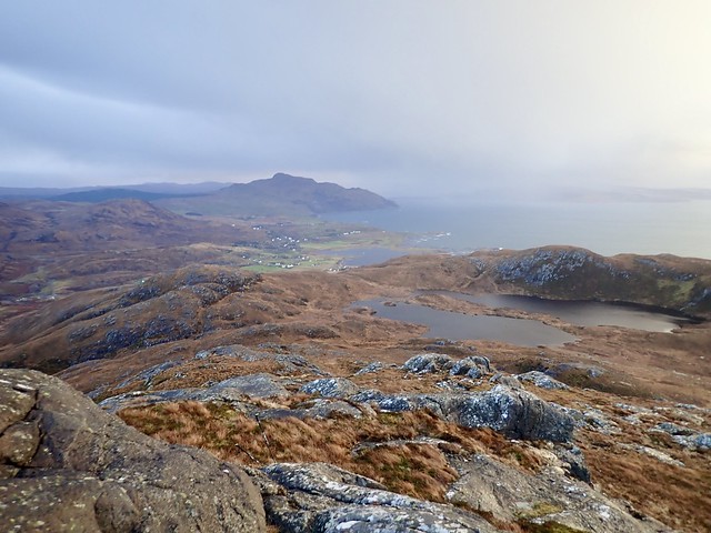
Back at the car I suggested we doing Ben Hiant - especially as we were driving right past it on the way home. The sun was in evidence and it was a better day than we'd ever imagined, so we stopped off at the parking place beside this impressive big lump of mountain and set off. We used the Walk Highlands route, which I'm sure is the one that almost everyone will take. There's a clear path from the parking area right to the summit, which is wet and slippy in places but does the job. The wind was still blustery when we were exposed to it, but for much of the time we were walking in the hill's shadow.
There's a long broad ridge to amble along before one reaches the steeper, rocky summit. A narrow path winds around the south of the summit before coming up upon the trig column from the back, so to speak. Despite the bands of rain out to sea, the views were good, south to Tobermory (surprisingly close over Loch Sunart) whilst the north looked out to Muick, Eigg and Rum. We returned the same way, meeting a couple of lads with their dog heading up. Not a bad drive down the road, new snow on a lot of the Munros from Glencoe down to the Glen Falloch ones. Was thinking about what hills we might pick off next weekend - of course, when we got home we learned about the new 3 week lockdown, so that puts an end to that. Here's hoping that 2021 has more days for the hills than this sad and sorry year has done.
 FCD8F582-D22D-412F-8C6E-2CBACDAFA54C_1_201_a
 by
Al, on Flickr
 30C95224-A986-4434-B8F2-B4367C301CAF_1_201_a
 by
Al, on Flickr
 3E4E4AEB-3D30-4754-A00C-D1C241AAC2AE_1_201_a
 by
Al, on Flickr
 7ADBA587-B229-4433-A808-E680788E760D_1_201_a
 by
Al, on Flickr
 861C7AC0-925B-4B85-B9BD-07A5F7EEC651_1_201_a
 by
Al, on Flickr
 34707A7D-5734-4320-B777-1FFA33E16C1C_1_201_a
 by
Al, on Flickr
 28B1BA1C-956C-4152-8672-662EAFE0B7AC_1_201_a
 by
Al, on Flickr
 F70EBD68-1F76-49B9-BC1D-6DEB08E55C44_1_201_a
 by
Al, on Flickr
 A3C52E61-5E32-4257-AA53-C88748D7E02A_1_201_a
 by
Al, on Flickr
 5D0A2EA7-6AAD-441A-BE9E-BA35C3FF3B6F
 by
Al, on Flickr
