free to be able to rate and comment on reports (as well as access 1:25000 mapping).
Read on Macduff!
I set off as early as I could and got to the car park for 6am. I was at the top of Beinn Odhar Bheag at 8.22am which I noted not to celebrate my speed (or lack of it) but to try to keep to a promised return home by 7pm. So far so good but it had been an almost still morning, the only thing helping me otherwise being the cool start (about freezing at the car park) and the copious amounts of shade afforded by the gully and outcrop strewn stretch of broad ridge between the notch and the summit, the notch being the notch on the ridgeline that the WH route alludes to.
I suppose I was a bit over-dressed for a warming day but I usually can't be bothered putting extra clothing on and off so I just put up with any discomfort if I can. Anyway, despite the coolness I was overheated most of the way up but not too bad because of that shade.
Tremendous view from the top of Beinn Odhar Mhor over Loch Shiel and beyond as well as of the route south. A bit hazy to the west, but you can't have everything. Actually hazy to the east too but a sort of middle layer haziness that permitted the far off tops to be visible and the loch to shimmer below.
I began my stroll south over a pleasant grassy slope, staying on the east for the views of the loch. It soon became apparent though that I would have to descend a bit. I did a double take when I looked at the descent from above thinking it looked a little bit exposed. I guess I would have thought nothing of it eight years ago but I am a lot more cautious these days. Anyway, with a bit of careful foot placement there was nothing to worry about.
I had a got a little bit tired from the ascent to Beinn Odhar Mhor but I had a break and something to eat and that gave me a bit more impetus.
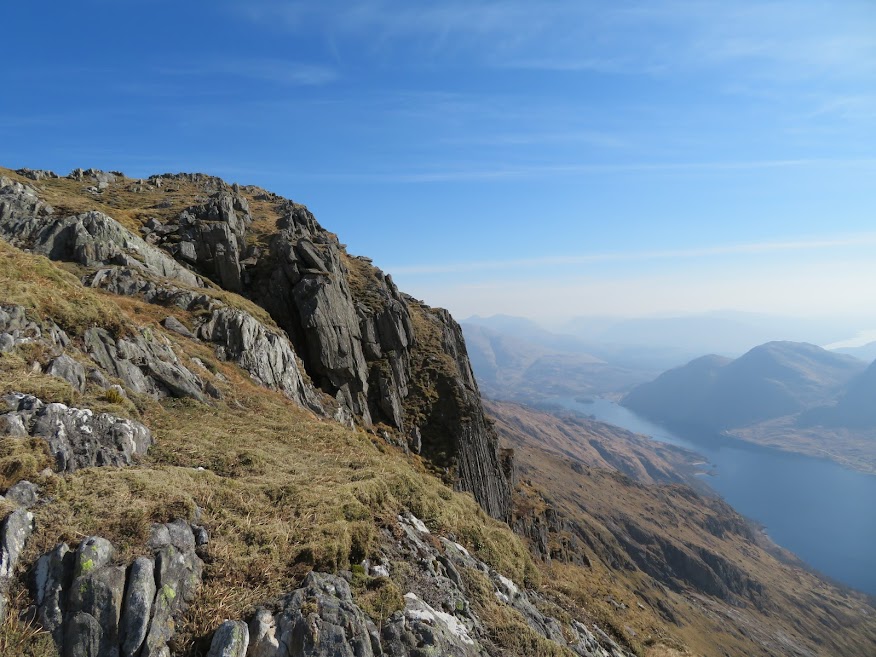
I wasn't sure how to engage with the crags ahead. I wanted to stay east for the views but the traces of path tended to stay west and I didn't want to waste too much energy on climbing over all of the rocky knolls so I tended to stay on the western side where it meant I avoided extra ascent and then switched back to the east where possible for the views. Since it was my intention to reverse the outward route to Beinn Odhar Bheag I suppose it didn't really matter but I didn't want to get too tired in the sun and stillness and I knew that could happen if I over did it. Difficult to gauge though, so the only thing for me to do was just to try to cut out anything that I didn't think would add to the walk. No easy task as the ground between the two Odhars is quite complex and features many fine views.
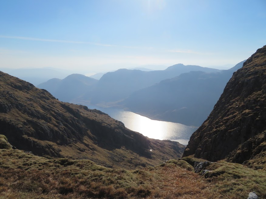
There are numerous views down spectacular gullies along the way so it is worth taking the time to stick to the eastern side of the ridge where possible. It took me an hour to get to the foot of the last wee ascent up to Beinn Odhar Bheag. Including doddering about time it took me a further half an hour to get to the top for 9.53am which was slightly ahead of my 10am schedule. A good deal of the doddering about time would have been taken up with investigating the extra spectacular gully just below the summit.
To use up the seven minutes in hand productively I descended south a bit to see if I could get any decent views of the summit and the loch from there and there is, indeed, a not bad view to be had. I think a proper continuation south to Beinn a' Chaorainn would also be good but not for me today.
I was feeling quite good for the return leg but I also decided to cut out the detours. Easier said than done though; those gullies and crags just keep drawing you back. Also, a cooling breeze had got up which, for me, transformed the day from make the most of it despite the sun and stillness to more like ideal walking conditions. It was also less hazy now so the call back to the eastern side of the ridge was also that of the shifted patch of sun sparkled loch that would yield some different photos to those of the outward leg.
So I probably took an hour between the two tops again. I didn't check the time though as I was now just going at a comfortable pace for me and making sure I kept at drinking the three litres of water I'd brought with me. I knew by now anyway that I would I get home for 7pm.
The descent from Beinn Odhar Mhor was initially straightforward but after a while it became disconcerting. This was, I think, for two reasons. Firstly, I was looking out for a lochan as an indicator of direction but there was more than one visible on the wide ridge. Secondly, a ridge that is visible to the east but not marked on the OS map made me think I might have gone too far west. In fact, with the ridge being about half a kilometre wide 150m below the summit there are initially three ridge like eminences that might compete for attention. If in doubt go in the middle I suppose which is what I did until it became clear that I shouldn't go any further west. Since Sgurr na Paite was visible to the northwest and the notch sits at about the 400m I decided instead just to keep an eye on the former and, sure enough that enabled me to identify the correct lochan for direction which in turn gave me a view to the notch. Then it was just a matter of letting the legs take over but boy were they reluctant!

An interesting sign that tells you that you are here. Could also indicate mood; neither up nor down.

The coast is clear and yet hazy.

The grand entrance.

One or two deer running about.

The notch to aim for is top right.

Sun making an appearance but I find shade for a fair bit of the Beinn Odhar Mhor ascent.

.
Zoom east.

The last steps up to the notch in the ridge.
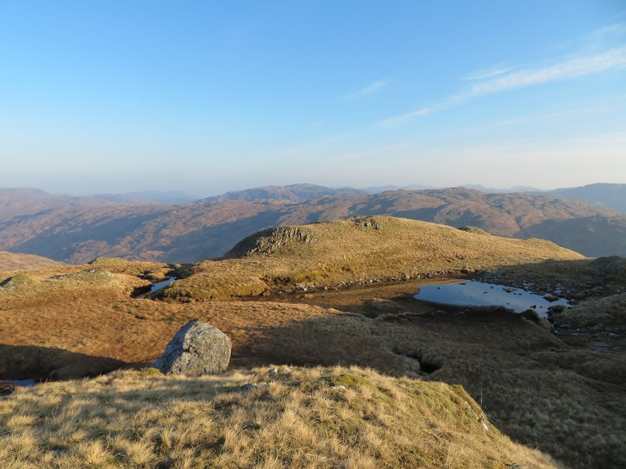
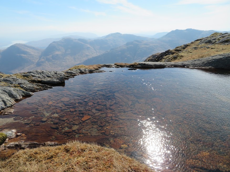
The lochan marked on the OS map, not to be confused with one or two others higher up.
Hazy to the west.

Beinn Odhar Bheag.

View east from Beinn Odhar Mhor summit area.

To the north.

East again.

A careful descent.

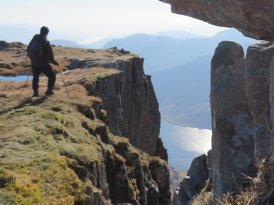
I zigzag around the outcrops between the two Odhars and there are a couple of high level lochans encountered along the way.

I tend to be drawn by the vague path to the western side of the ridge to avoid extra ascent.

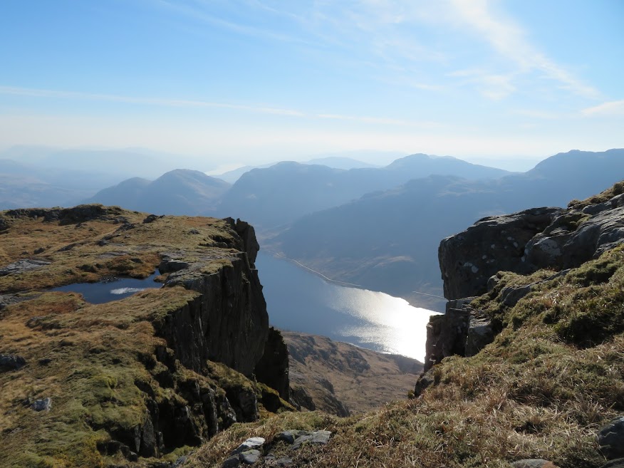
But whenever it's easy to incorporate a detour to the eastern side I do so to enjoy the view of the shimmering Loch Shiel and the many impressive gullies and crags along the way.
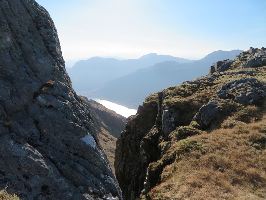
Example gully.

Sgurr an Tuirc.


View north from Sgurr an Tuirc.

And south to Beinn Odhar Bheag summit.

Slabs that form part of the final slopes to the summit.

Grassy gullies is the name of the game now. Nothing too steep though.


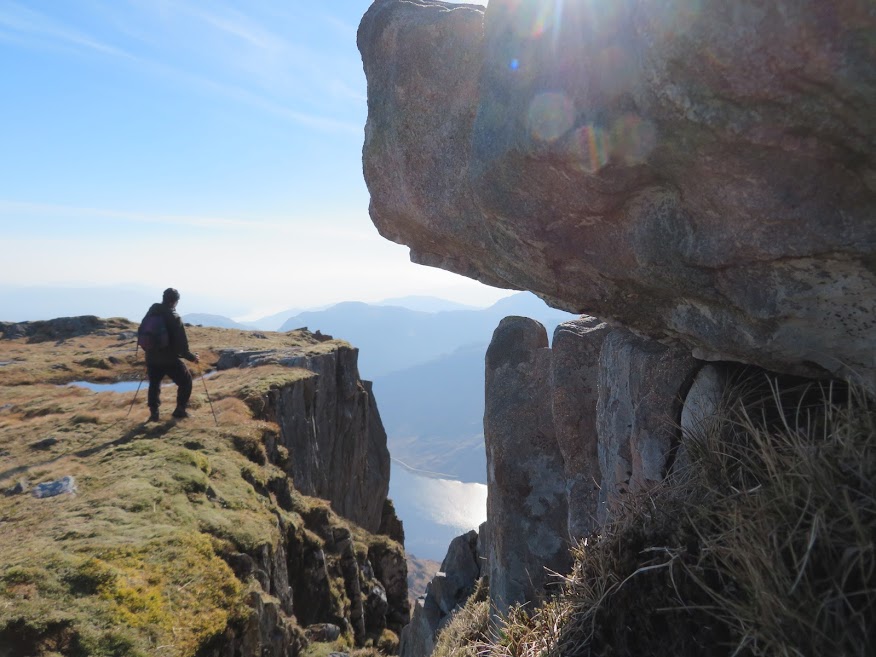
The impressive and abrupt edge just beneath the top.


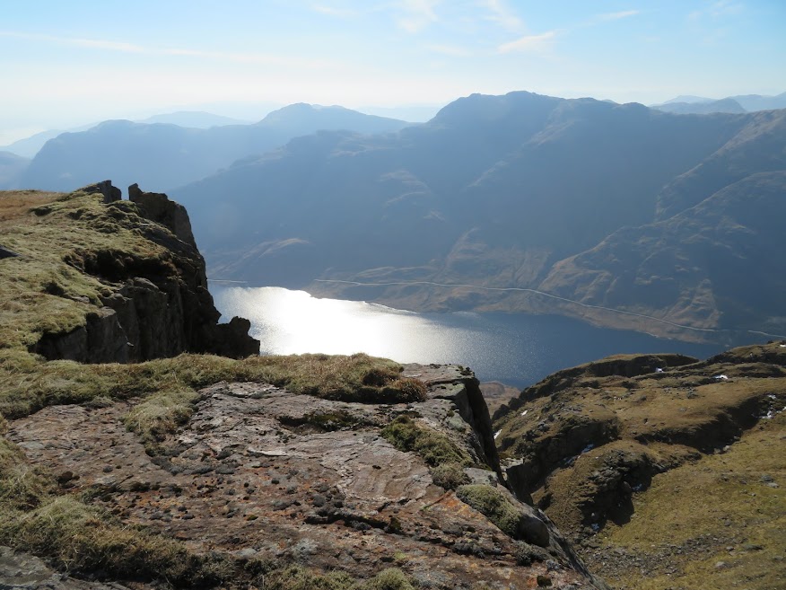
View south from summit.

Ben More Mull on the horizon.

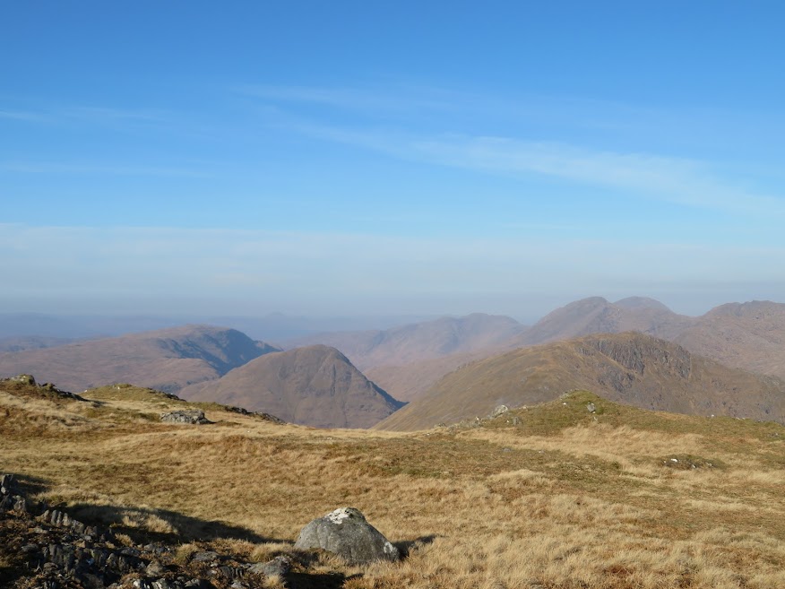
The ridge and hills beyond to the south look good.
View north of summit and Loch Shiel.

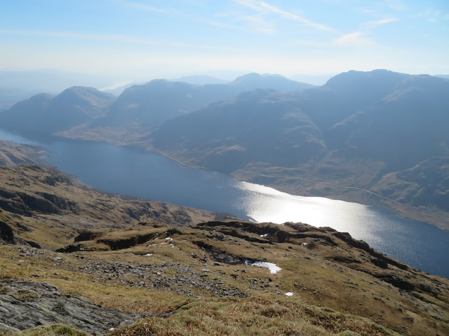
Good views across the loch too.


I reversed my outward route and now there was a wee breeze to help me along and some pleasant fair-weather cloud forming.

A bit less hazy to the west now.


Hazy further north.

The broken trig point on Beinn Odhar Mhor.

Rum now visible after a morning hiding in the haze.

Cotton wool.


