free to be able to rate and comment on reports (as well as access 1:25000 mapping).
Another long weekend was looming (I had gone back to work for a couple of days rather than take the entire Easter fortnight off). While sub-zero temperatures and snow showers seemed to be the theme after our mini heatwave in Torridon (temperatures all the way into double figures

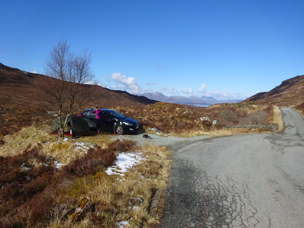
), the wind looked to be dropping again, and plenty of sunshine was forecast between the showers. After initially planning to go down to Glenelg and Arnisdale, we swapped at the last minute for the other side of the water. Jackie was uncertain of her abilities and there was a much wider selection of small hills on Skye. We packed for a couple of nights of camping, fully expecting to give up after one.
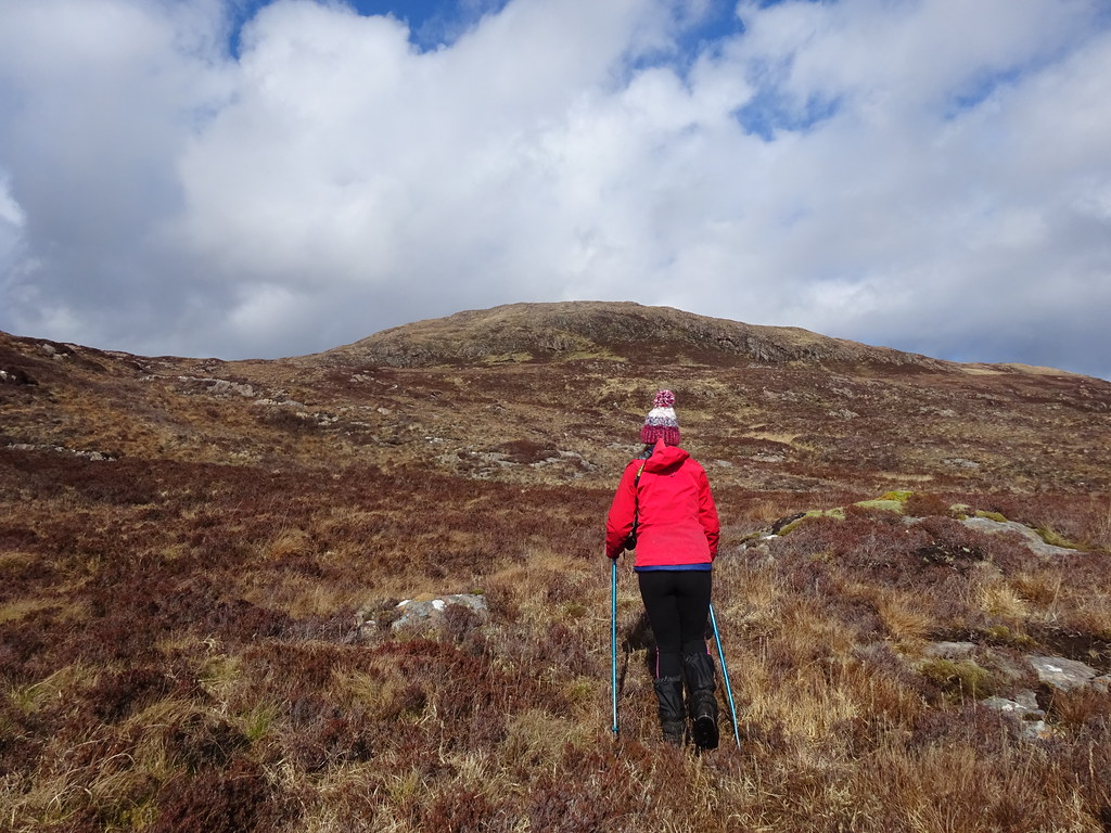
Friday 09/04/21 Sgurr na h-Iolaire: 170m ascent, 3km, 2 hours, 10 minutes.The weather had varied on the drive over from bright sunshine to driving snow, but winter was definitely back on the hills for a short while. As an easy warm-up for the first day (it was getting on for 3pm by the time we crossed onto Skye anyway

), we decided to head down the Sleat peninsula again. Sgurr na h-Iolaire would be a quick summit with great views.
Parking up at the weir on Loch Dhughaill, we set off in sunshine. The water was running over the top of the weir but it wasn't too deep, and on the other side was a path of sorts. We could see the trig point at the summit of the hill so this wasn't going to take too long.
 Loch Dhughaill
 The ground was a little squelchy and heathery but nothing particularly bad. Halfway between the end of the loch and the summit, it began to snow again. Lightly at first and then quite intensely! Since we had picked this hill for the views, we decided to hide behind a rock and wait it out. About 15 minutes later, the sun returned and we moved on.
 Heading for Sgurr na h-Iolaire
 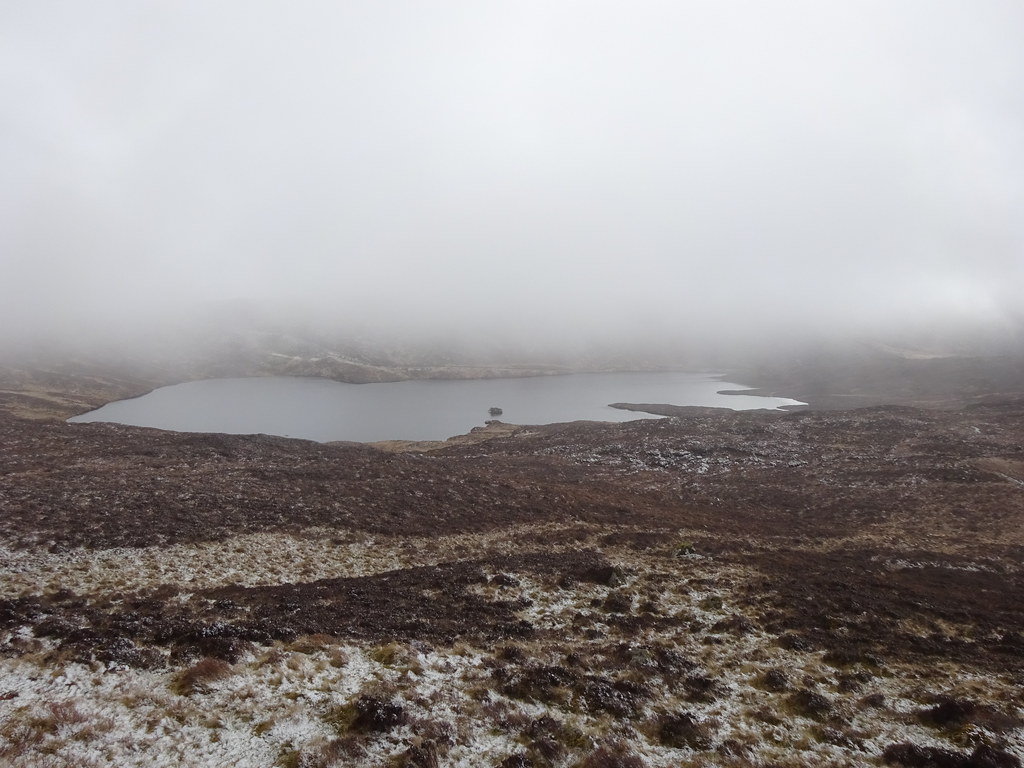 Weather moving in
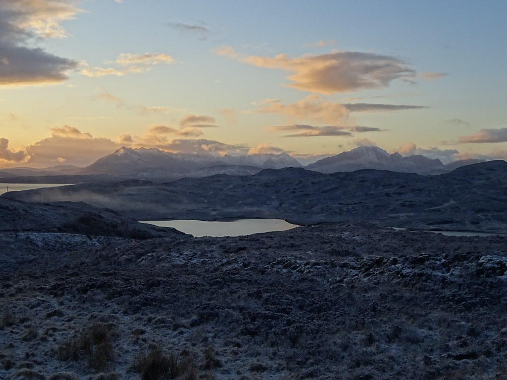
 We took a direct route up the craggy face of the hill, finding a ledge to lead us through, and 5 minutes later we were on the summit. The cloud was gradually clearing, and when it had gone, it was well worth the wait lower down.
 Weather clearing again - Blaven and the Red Cuillin
  Blaven, Garbh-bheinn and Belig
 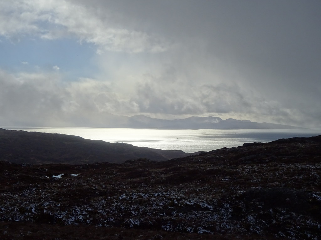 Rum emerging from the cloud
  Loch Nevis
  Blaven
 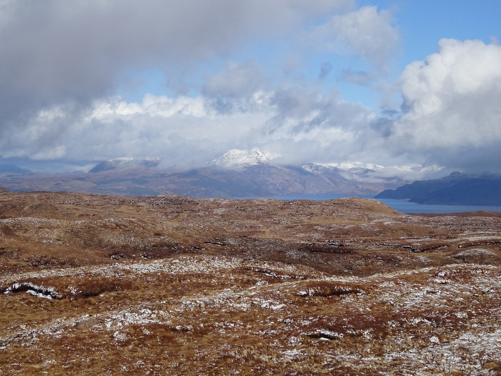 Beinn Sgritheall and Loch Hourn
  Last look up Loch Slapin
 After a good 40 minutes enjoying the views, we retraced our steps back to the car. It was now early evening and time to find somewhere to camp. We had ideas of wandering down towards the Point of Sleat and finding somewhere secluded to put the tent up, but another snow shower and laziness drove us to pick a spot on the Tarskavaig road that we were already on. We just had time to put up the tent before it snowed heavily again for 30 minutes.
 Crossing the weir at Loch Dhughaill
  Knoydart and the Sound of Sleat from our camping spot
  Ladhar Bheinn
  Another snow shower over dinner
 Later on we drove back to the high point of the road for sunset over the Cuillin - it was bloody freezing
. The night in the tent was pretty cold too (dropped to around -3 I think) - I need a new sleeping bag!
 Cuillin from the top of the Tarskavaig road
  Sun going down over the Little Minch
  Black Cuillin
 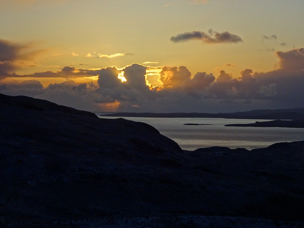 Last of the sun obscured by cloud
 ____________________________________________________
Saturday 10/04/21 Sgurr na Coinnich, Beinn na Caillich: 750m ascent, 8.5km, 5 hours, 50 minutes.The following morning had more snow showers interspersed with strong sunshine. A look at the weather forecast hinted that the expected band of rain on Sunday evening had now disappeared, and Monday looked good too. We had decided against Jackie's better judgement to go up one or both of the hills north of Kylerhea Glen today, but we went into the Co-op at Broadford first to get an extra day's worth of food - we might stick it out longer than planned if the cold didn't get to us first!
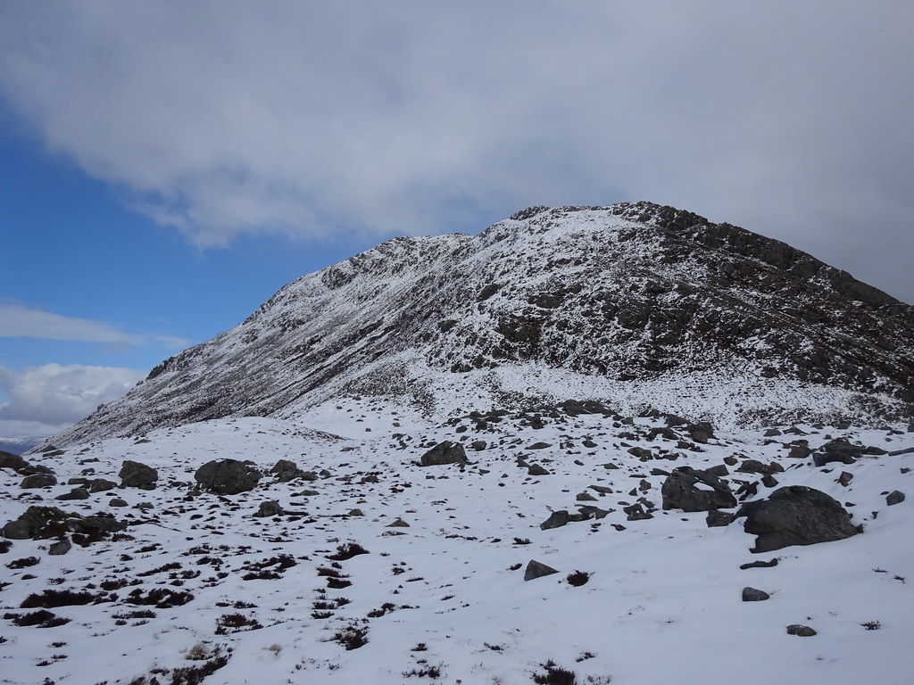
Parking up on Bealach Udal, we set off up the slopes towards Beinne na Greine. Due to the snow showers of the last week, there was actually quite a fair coverage up here which made the going more difficult than expected. Although we picked out a faint quad bike track for parts of the ascent, the vegetation was thicker than I had remembered.
 Ben Aslak above Bealach Udal
 After 40 minutes or so, we had made some progress but not as much as hoped for, and it started to snow heavily again. We sheltered behind a boulder and had some lunch (a late start as ever), and Jackie told me she felt awful. I had undersold the difficulty of the route as usual and she didn't really feel like going on.
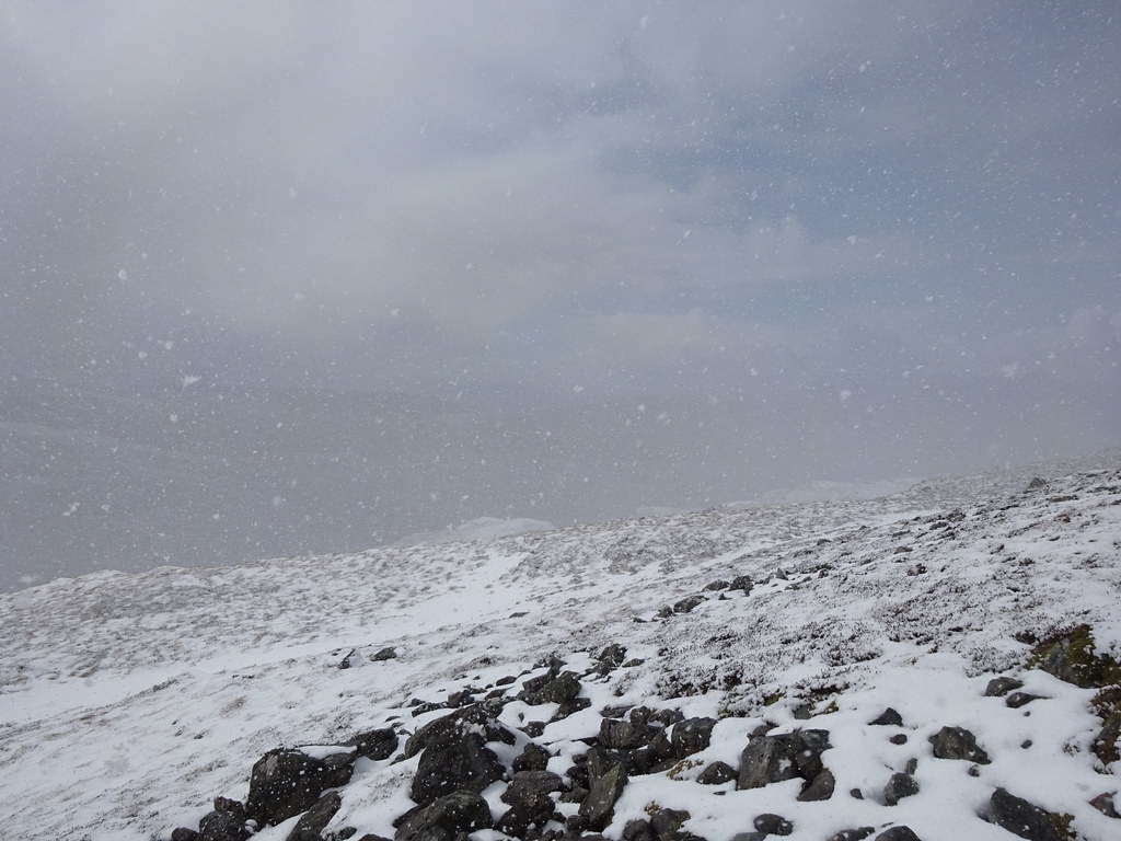 Surprise - it's snowing again!
 As usual though, she was stubborn, and after I suggested turning back, she decided to carry on at least to the ridge above so we could get some views. There was more heather and pockets of deep snow, but eventually we were on the ridge and the summit looked more achievable. She perked up a bit and we pushed on to the top, the views improving all the time.
 Rum and Loch Eishort
  Black Cuillin starting to emerge
  On our way up Sgurr na Coinnich
 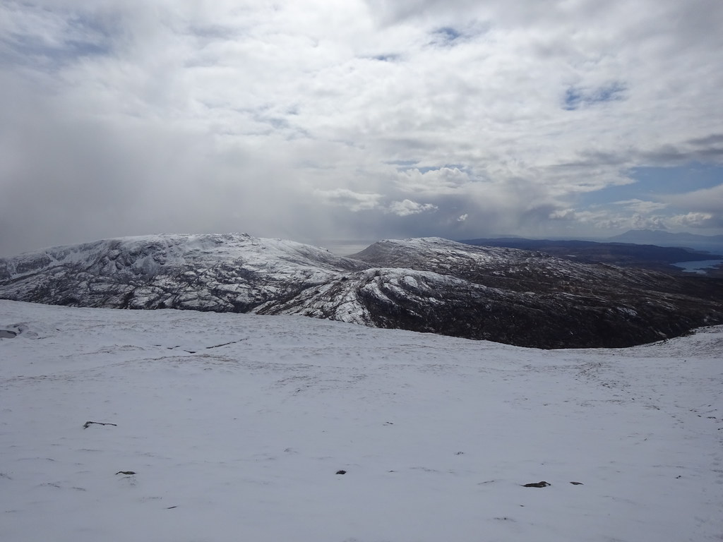 South over Ben Aslak and Beinn na Seamraig
  Broadford, Scalpay and the Cuillin
  Eigg
Eigg 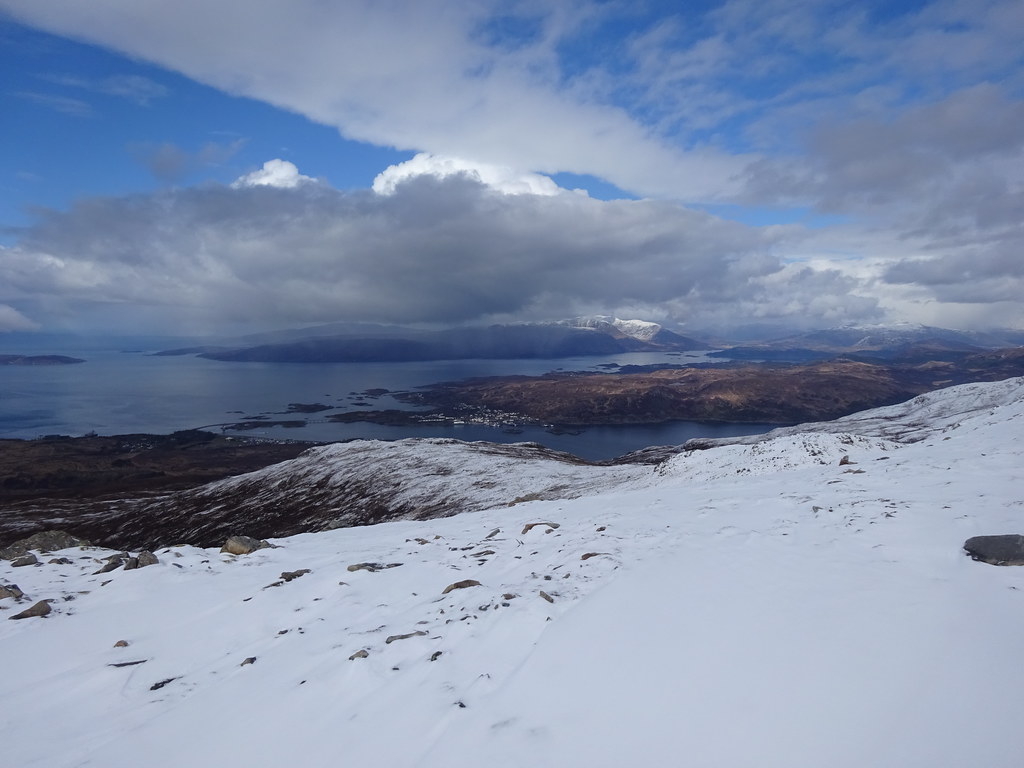 Looking across Kyle of Lochalsh towards Applecross
  Kyle of Lochalsh from Sgurr na Coinnich
  Inner Sound
 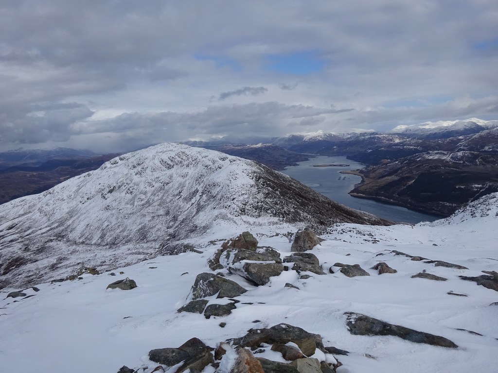 Loch Alsh and Kintail
 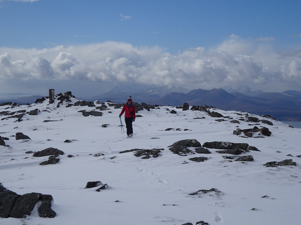 Jackie on Sgurr na Coinnich
 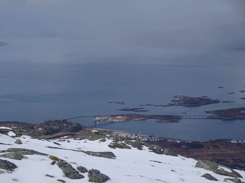 Kyleakin and the Skye Bridge
  Loch Alsh
 This summit is really excellent once you get above the initial heather. It is quite steep and rocky and you are in a pivotal location with Knoydart, Kintail, Applecross and the Cuillin all looking marvellous, as well as the inlets to the various sea lochs and the Inner Sound. Despite the moderate height and time of year, it felt like full-on winter up here - probably our most wintery walk this season. I pointed out Beinn na Caillich for a future visit, but before I knew it we had come up with a plan to drop down to the base of it (with a traverse back across the slopes of Sgurr na Coinnich possible if Jackie changed her mind about going up). We dropped down to the col, feeling more like we were on the high ridges of Kintail, and Jackie decided that she wanted to have a go at Beinn na Caillich.
 Beinn na Caillich
  Looks like we're going up!
 I vaguely remember a path of sorts here, but the preferred route today was to stick to the west side of the ridge and away from any icy rocks. Here, we could climb up steep heathery snow and weave about to avoid the most awkward bits. Again the going felt way more epic than we would have expected from these hills, and before too long we were on the ridge with a short ascent to the summit.
 Looking back to Sgurr na Coinnich
 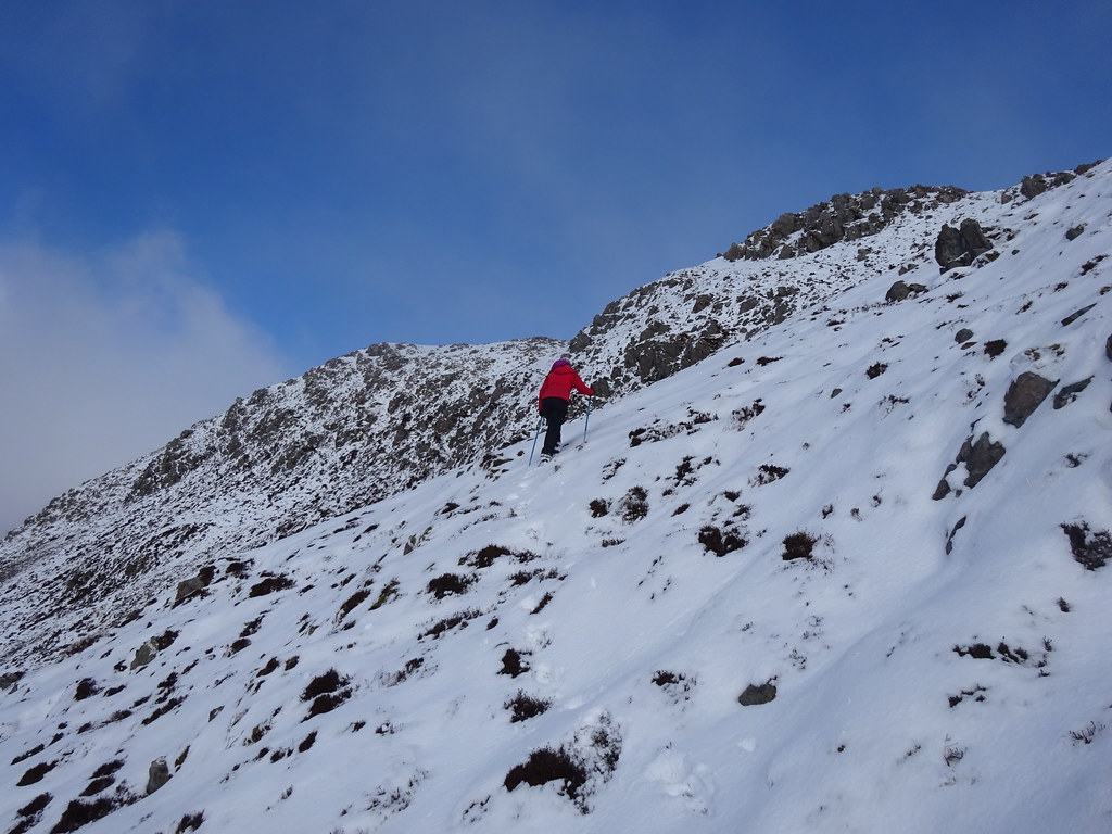 Up the steep bit
 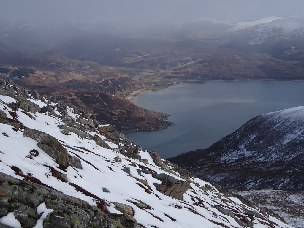 Looking down on Kyle Rhea and Glenelg
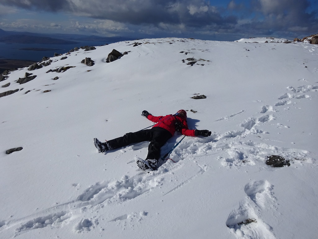
 Spirits had risen and we weren't too bothered about being hit by more snow showers - they were always temporary and followed by sunshine. In the end we only really caught the edge of some flurries, and were glad we had made the effort. I think this hill has even better views than the other one so I was glad (and surprised) we'd made it this far.
 More weather moving in over Glenelg
 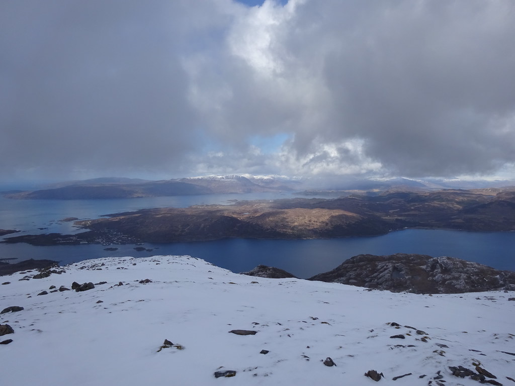 Loch Alsh and Loch Carron
 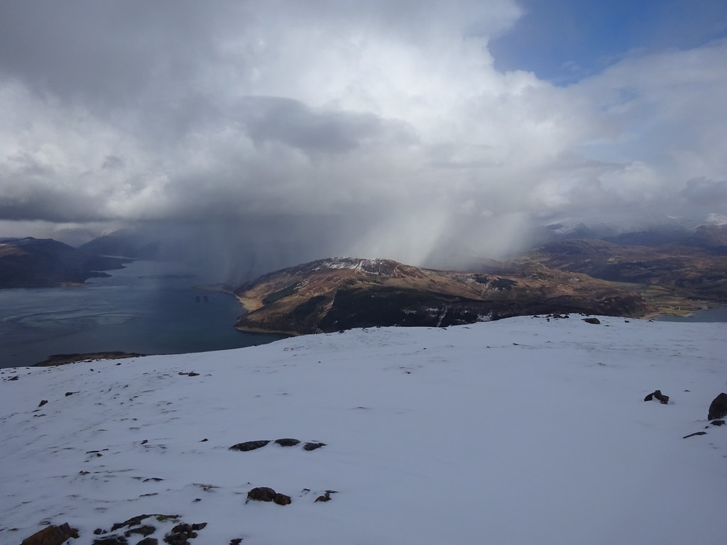 Weather on Glas Bheinn
  Inner Sound and Raasay
  Looking down onto Kyle
  Black Cuillin and Blaven above Broadford
  Kyle Rhea
  Luinne Bheinn and Ladhar Bheinn
 Earlier in the week we had considered camping up here, but I'm glad we hadn't bothered. I don't think my gear is warm enough and I think Jackie would have struggled in the snow with a backpack in her current condition. We dropped back down to the col following our footprints and readied ourselves for a slightly tedious traverse back to the starting point. One day I intend to do a proper horseshoe of these hills and Ben Aslak from Kylerhea, but it hadn't really fitted the bill today as Jackie wouldn't have been able to manage the required ascent.
 Knackered!
 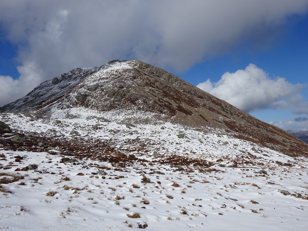 Looking back at Beinn na Caillich
 The traverse started well, then we dropped steeply into Coire na Coinnich. Amusingly this is where it got rough (looking back at a report I had written for doing this in 2013, I had called this section easy and the traverse we had just done rougher
. Seems I have finally found out what it's like to be caught out by one of my reports
). We thought it would be a good idea to just keep dropping down the corrie to meet the road rather than trying to traverse back to the top of the pass. Who knows what was easier, but lower down the corrie, the ground was even worse - steep slopes, deep heather and hidden tussocks and new trees planted!
 Beinn Sgritheall
 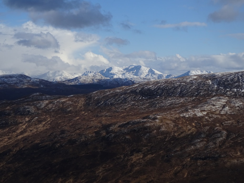 Ladhar Bheinn
 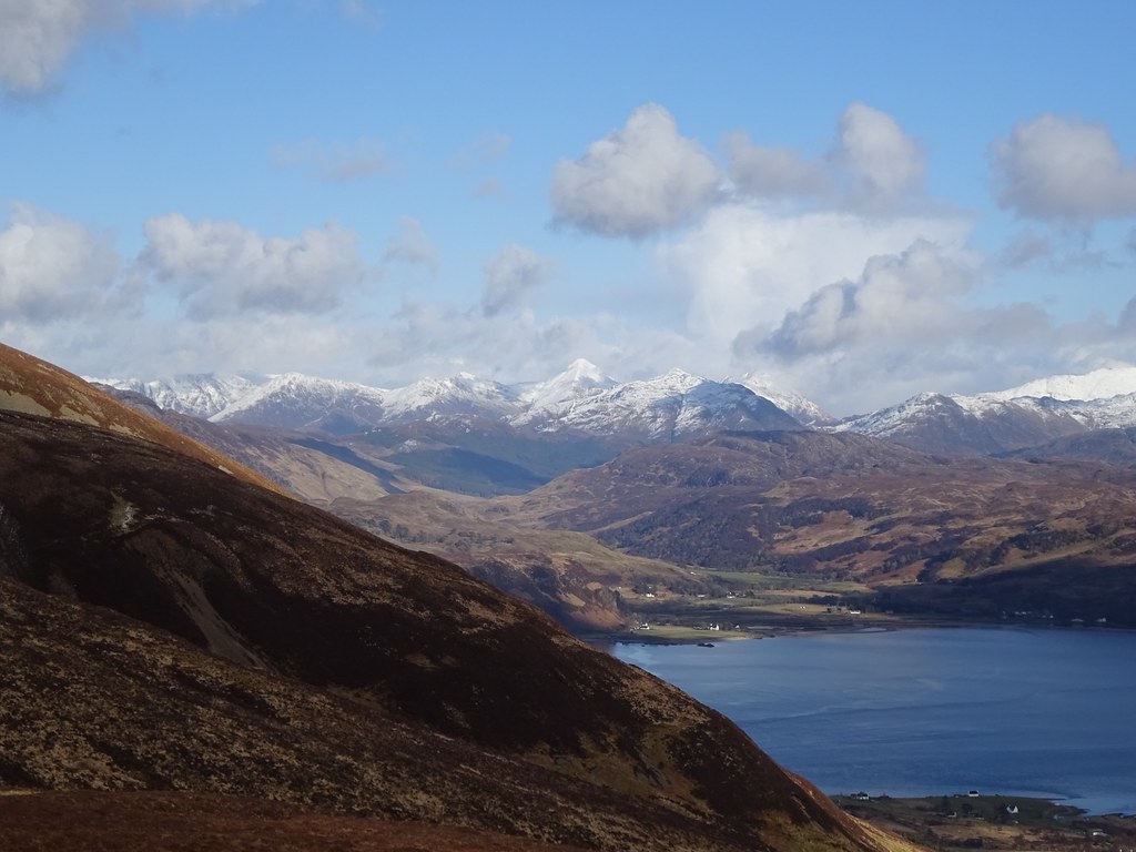 5 Sisters above Glenelg
 By the time we dropped out onto the road, Jackie was just about done for the day, but decided to carry on walking (I had offered to get the car and pick her up). This was straightforward but involved another 100m of ascent.
 In Kylerhea Glen
 We had considered camping spots back down the road towards Broadford on the drive up - we wanted something sheltered from the light but savagely cold north wind. In the end I moved the car slightly to create a barrier and we ended up putting the tent right next to it in our parking spot - super lazy
)
 Lazy (but nice) choice of camping spot
 We had a leisurely dinner and were in a good place to observe the sunset again. Despite the chill, the evening was beautiful. In the 15 hours or so that we were at the tent, we only observed one car passing.
 Bla Bheinn from Bealach Udal
 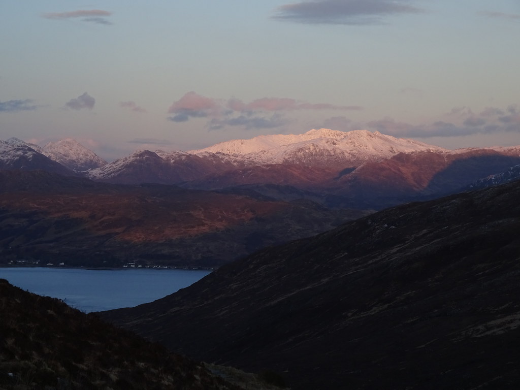 Saddle from Bealach Udal
 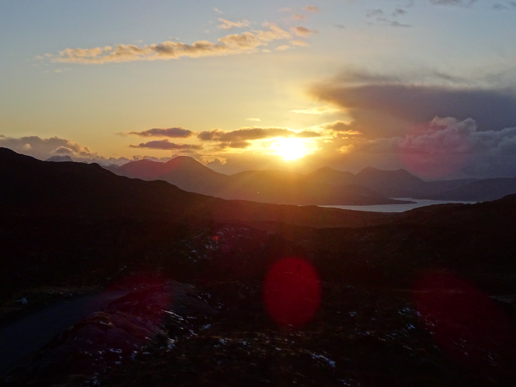 Sunset over the Red Cuillin
 ____________________________________________________________
Sunday11/04/21 Boreraig and Sushinish coast walk: 420m ascent, 17.5km, 5 hours, 25 minutes.Another cold night turned into another bright morning - once the sun hit the tent, lying there without my face buried in the sleeping bag was suddenly comfortable

. Surprisingly after the exertions of yesterday, Jackie felt better than she had the previous morning. The original plan had been to nip up another small hill then home, but the weather looked to be holding so I suggested the coastal loop of Boreraig and Sushinish - quite long but entirely on paths with only gentle ascent.
 Another cold but sunny morning
  Strathcarron from Broadford
 By the time we started, the sun was lovely and warm if the breeze could be avoided, and as we climbed up the tramway past the old marble workings, I regretted the layers I had on. After a break and some more walking, we dropped down to Boreraig. This was a beautiful spot with views out to Rum.
 Beinn Dearg Mor and Beinn na Caillich from Suardail
  Bla Bheinn
  Beinn na Caillich from near the old marble quarries
  Blaven, Clach Glas, Garbh-bheinn and Belig
 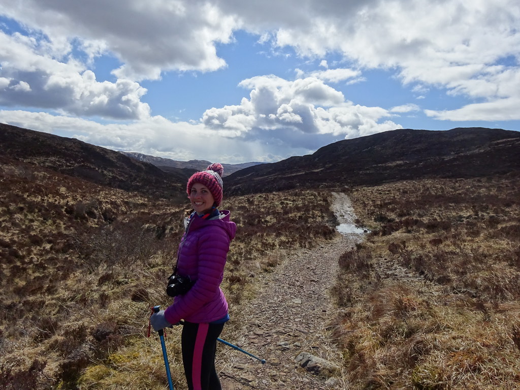 Happy that we're on a path today
  The path to Boreraig
  Sleat and Rum from Boreraig
  Boreraig and Rum
 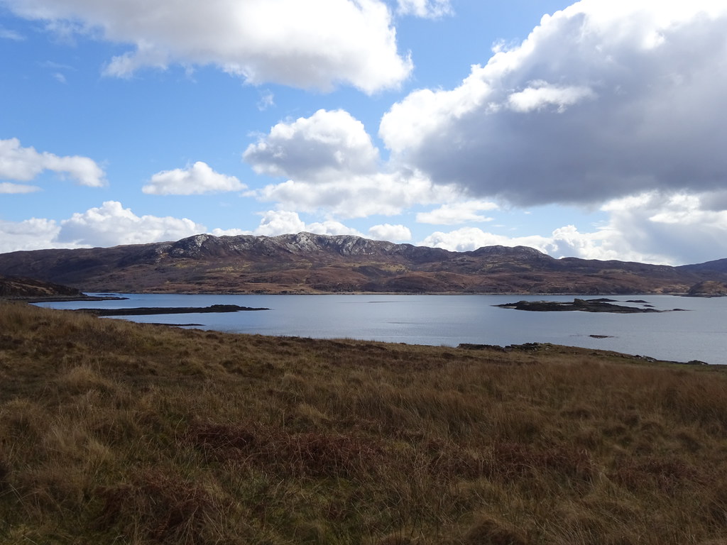 Across to Sgaith Beinn-an-Uird
 We had another break in the shelter of an old ruin, enjoying the view back over a low bit of Skye to Beinn Sgritheall. Then it was onto the shoreline for an entertaining traverse below the cliffs - there was a good path the whole way but the situation was interesting.
 Loch Eishort and Beinn Sgritheall
 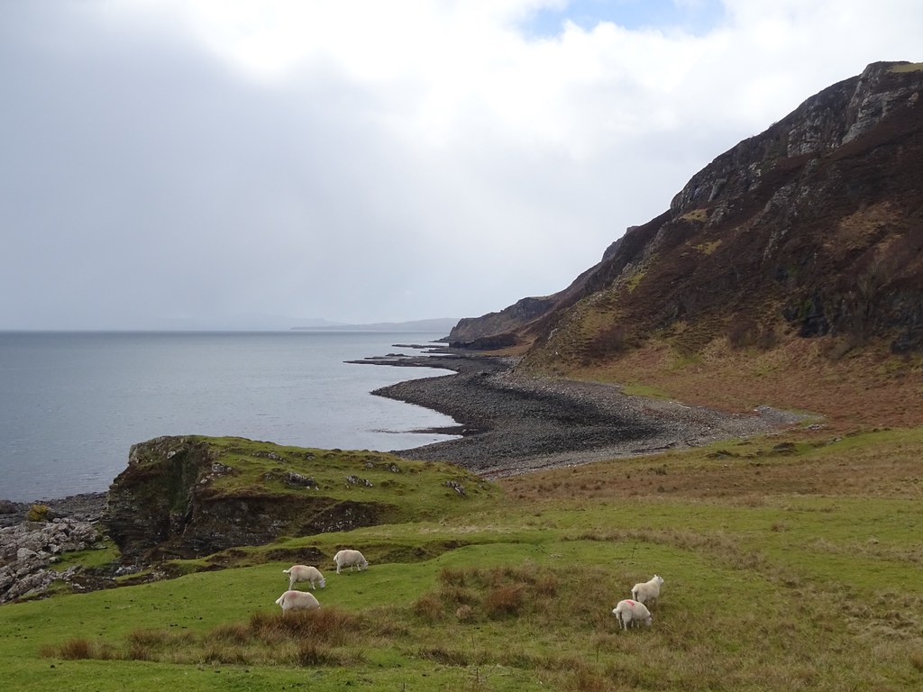 West along the coast from Boreraig
  Mainland peeking out behind Loch Eishort
  Waterfall on the coast
  Coast path
 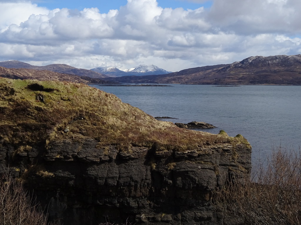 Looking east again
 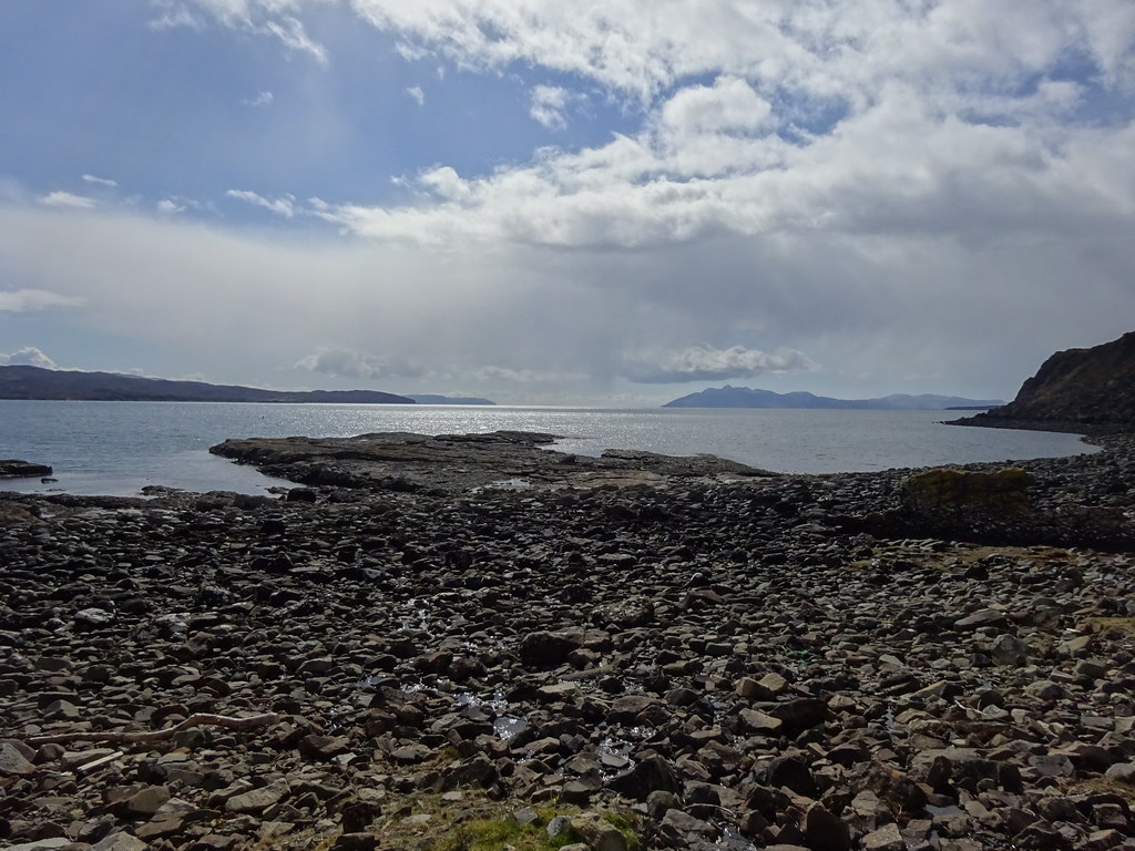 Eigg and Rum
  Loch Eishort
 Climbing back up to higher ground, we traversed round Sushinish to the north, and were then hit by the edge of various snow and sleet showers for the next hour or so. I had been hoping for panoramic views of the Black Cuillin as we turned north, but they were all shrouded for much of the walk. At least the going was good underfoot, although Jackie was now tiring.
 Sushinish and Bla Bheinn
  Rum behind another shower
  Looking up Loch Slapin
 We hit the end of the tarmac at Camas Malag just as the cloud began to draw back from Bla Bheinn. It had soon disappeared completely, leaving us in sunshine and a bit of warmth. On the east-facing slopes of Ben Meabost and Nead an Fhior-eoin, fresh snow was prominent, it now being too late in the day to catch the sun again.
 Bla Bheinn emerging from another snow shower
 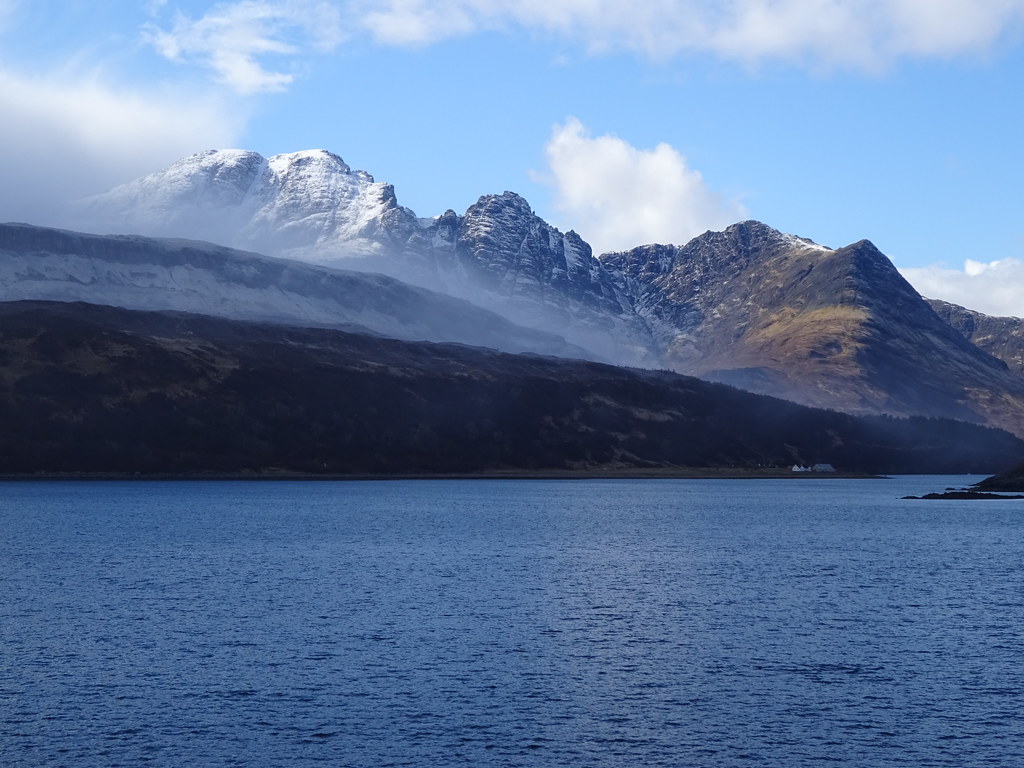 Bla Bheinn, Clach Glas and Garbh-bheinn
  Bla Bheinn to Belig
  Bla Bheinn and Clach Glas
 Jackie eventually flaked out on the walk back along the road and I left her on the shore of Loc Cill Chriosd in the sun to go and get the car from Suardail. We fancied being at Elgol for the sunset, so after picking her up, we continued down the road, looking for a camp spot.
 Bla Bheinn from Loch Cill Chriosd
  Beinn na Caillich
  Church at Suardail
 We found a great one on the grazing just after the Drinan junction - brilliant views back to the mainland in the east.
 Beinn Dearg Mor from Drinan
  Mainland from Drinan
  Camping near Drinan
 After dinner, we drove round to Elgol and wandered out onto the beach for sunset. You can't really get much better than that - even the cold didn't bother us!
 Rum from above Elgol
  Gars-bheinn and the Black Cuillin
  Black Cuillin from Elgol
 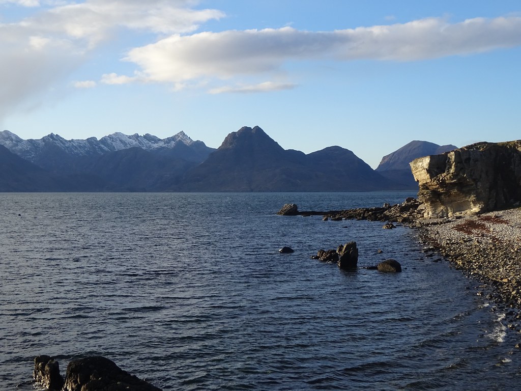 Sgurr nan Gillean and Sgurr na Stri prominent
  Jackie on the beach at Elgol
  Elgol crags
  Rum
Rum  Across Loch Scavaig
  Zoom to Canna
 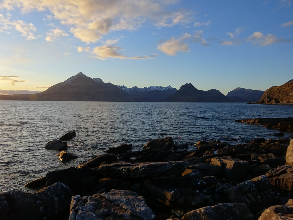 Black Cuillin and Loch Scavaig
  Sgurr na Stri and Marsco
  Sun going down over Soay
  Sun leaving
 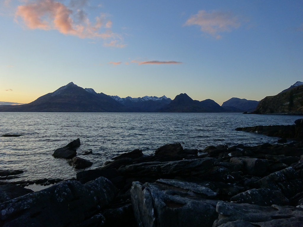 Black Cuillin after sundown
 ________________________________________________________
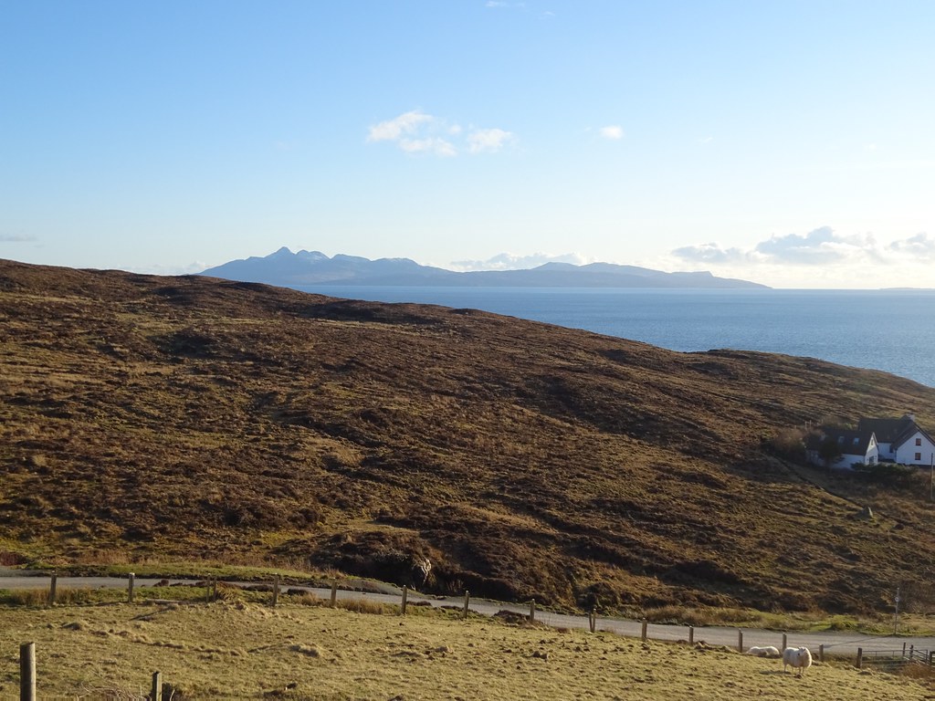
Monday 12/04/21 Beinn Meabost: 220m ascent, 2.5km, 2 hours, 15 minutes; Beinn nan Carn: 205m ascent, 4km 2 hours, 25 minutes.Last night had been the warmest of the 3 nights in the tent, but that wasn't really saying much. Still, another bright and sunny day ahead, and a warm bed awaiting us at home in the evening. We were almost camped at the foot of our next objective (Ben Meabost), so after watching the highland cattle surround the tent over breakfast and moving out of the way of some peat cutters who turned up, we packed the tent away and re-parked in the quarry beneath the hill.
 Sgurr Fhurain and Beinn Sgritheall at sunrise
 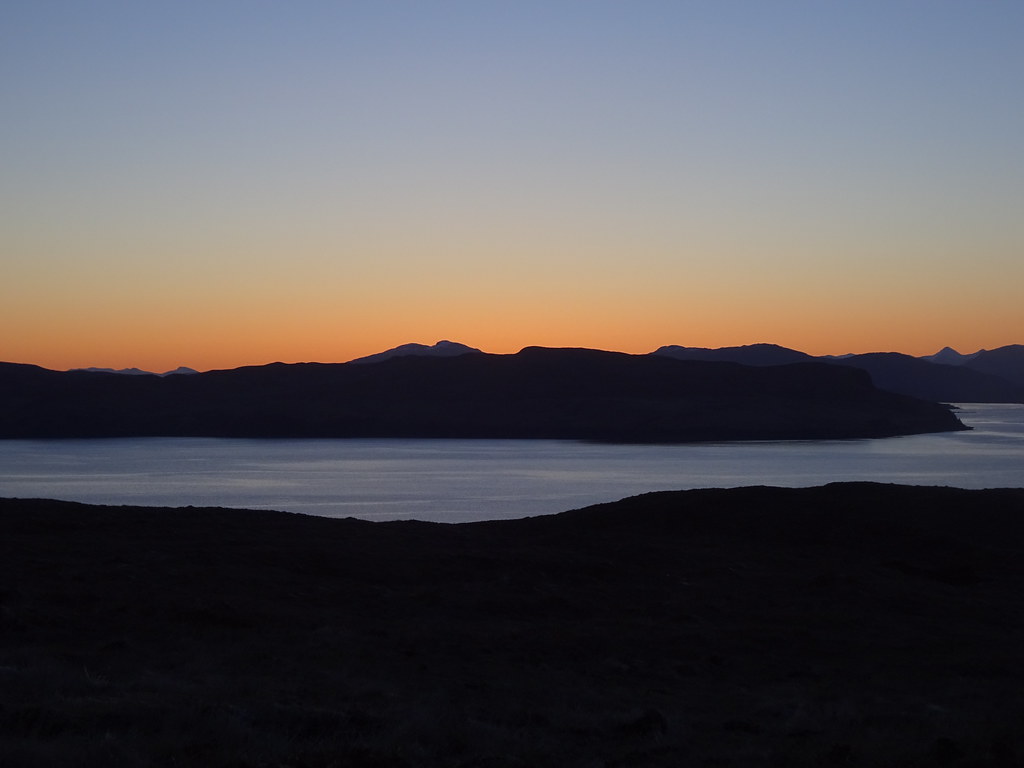 Sunrise over Loch Slapin
  Cows at breakfast
 Ben Meabost is steep but the going was good, mostly on grazed ground, and the plateau was only a short distance away. Jackie had suggested camping up here last night. I had liked the idea, but felt it was already cold enough where we were!
 Beinn Dearg Mor and Beinn Dearg Beag
  Eigg and Rum
 Once on the plateau, we headed for a cairn on a rise at the NW side - excellent views for very little effort

. While this isn't as impressive as Sgurr na Stri, it is a pretty good alternative if you don't have the time or energy. We spent a good hour up here before deciding to head down.
 Bla Bheinn
  Across Loch Slapin
  Gars-bheinn and Sgurr Dubh Mor
  On the summit of Beinn na Cro
  Across Soay to South Uist and Barra
 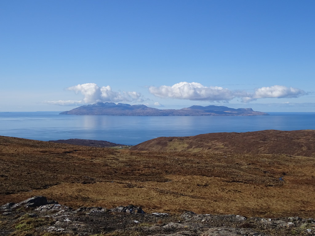 Rum, with Coll just visible behind left
 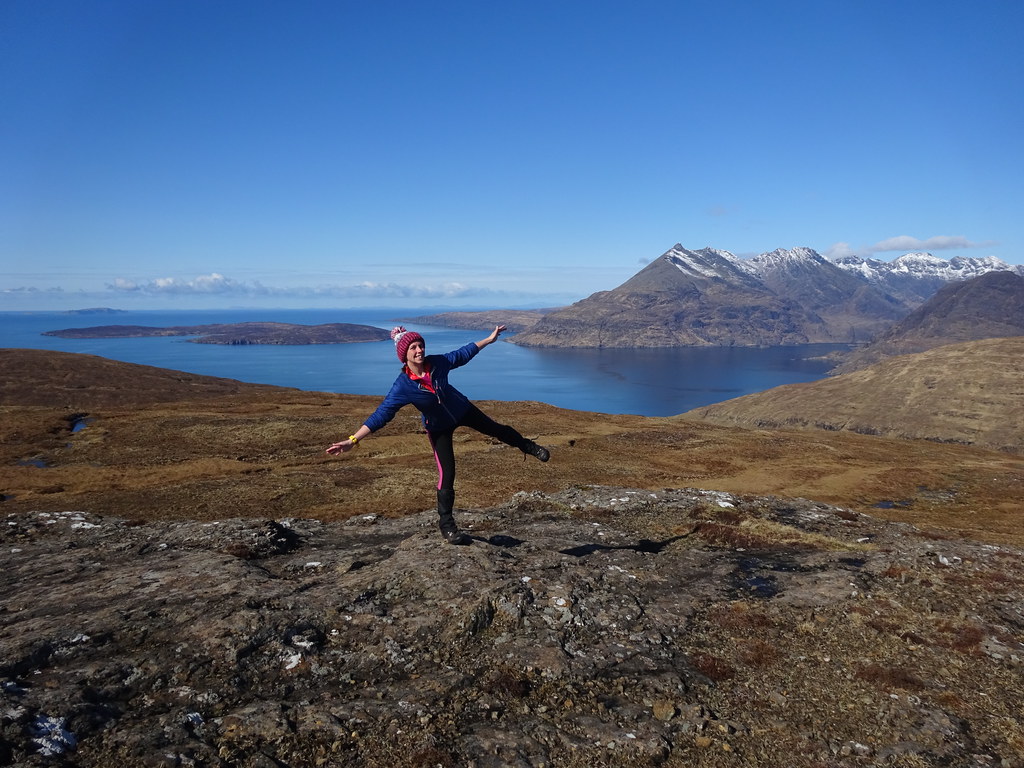 Jaxter
 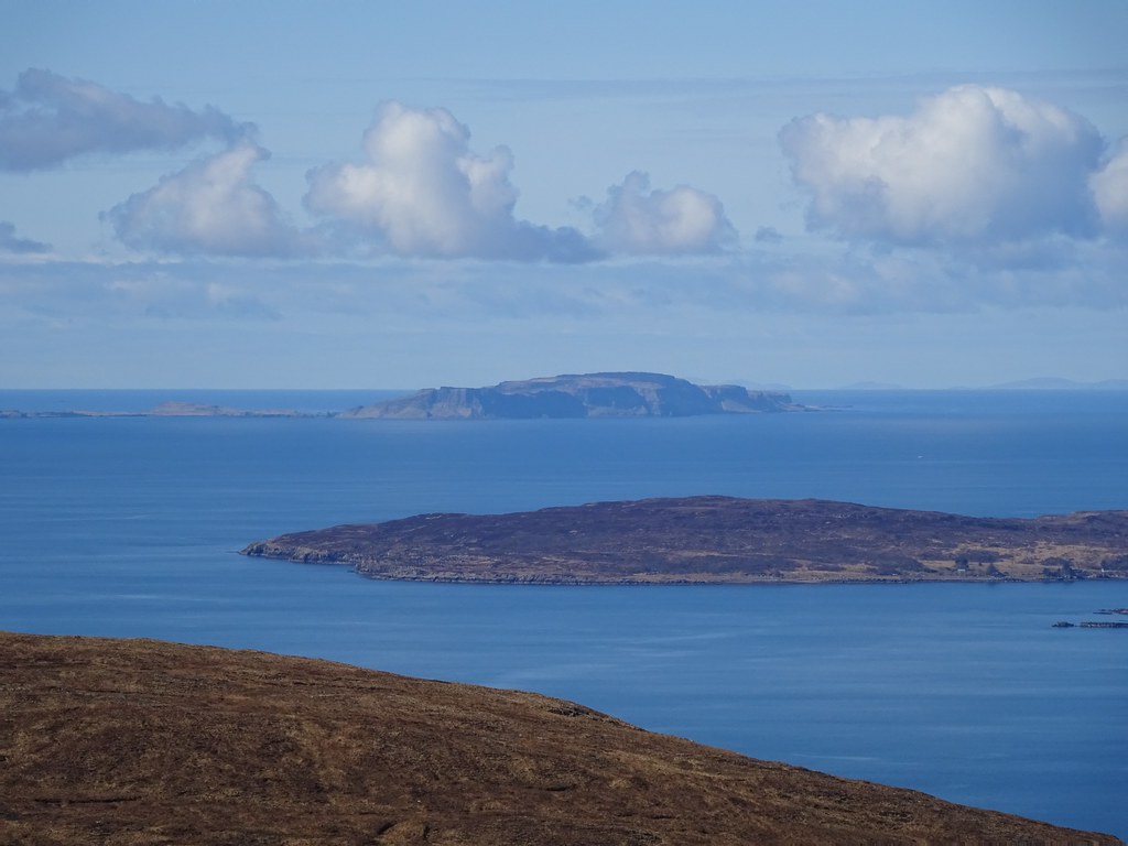 Canna and Soay
  South ridge of Bla Bheinn
  Sgurr Dubh Mor, Sgurr na Banadaich and Sgurr a Gheardaidh
  Gars-bheinn across Loch Scavaig
 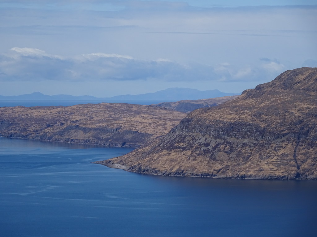 Beinn Mhor on South Uist
 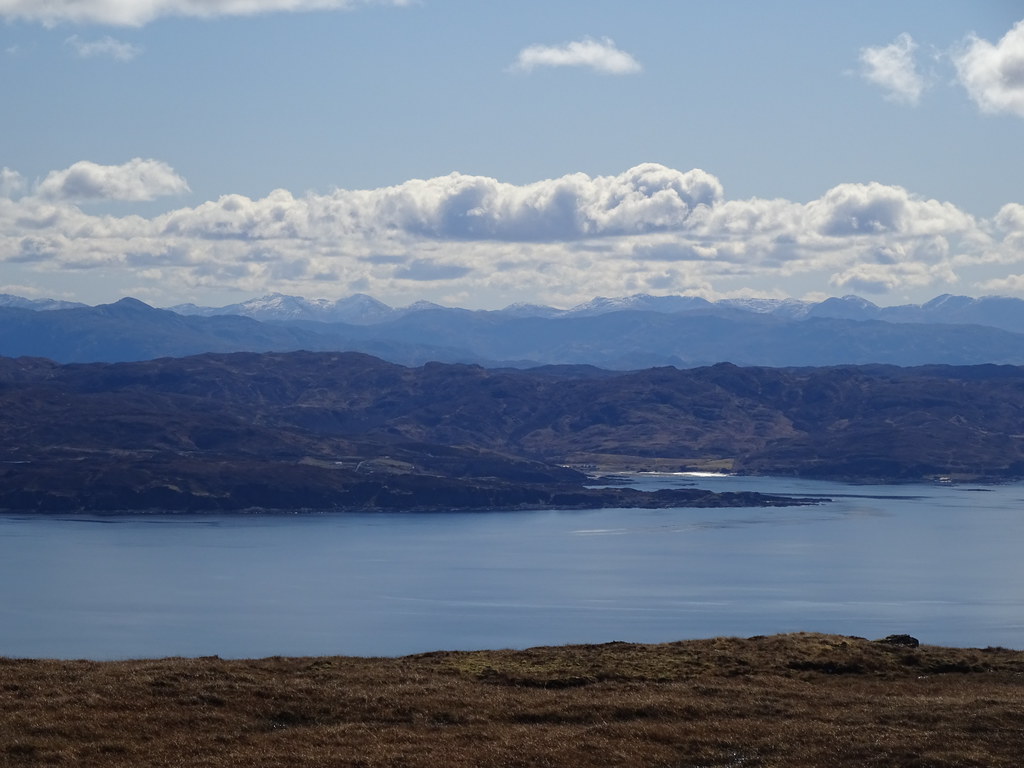 Knoydart biggies across Sleat
  Rum
Rum  Mainland and Sleat
 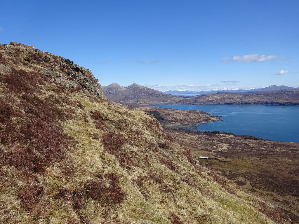 Descending Ben Meabost
 We stopped off at the head of Loch Slapin for lunch, and Jackie decided she could probably manage another hill - why not try to make the most of the great weather?
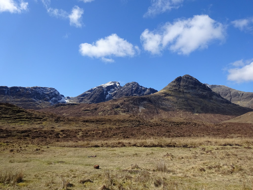 Bla Bheinn and Clach Glas
 We had earmarked Beinn nan Carn as a possible walk for this trip. I didn't think it would seem that interesting after Ben Meabost, but I was wrong. The temperature warmed up slightly as we drove around to Haesta - a new corner for me. Parking just above the village, we crossed a dyke and followed a fence around the edge of enclosures. There were a couple of boggy moments here but the going was OK.
 Rum from Haesta
  Beinn nan Carn
 We started following a burn uphill, concerned that we would soon be marooned in deep heather, but before long we picked up a series of old dykes. We were able to use these and a couple of clear runs of ground to get almost all the way onto the summit plateau, there just being a short steep stretch at the end.
 Loch Eishort from above Haesta
  Mouth of Loch Hourn
  Following a dyke to the summit
 The summit didn't quite the views of the Cuillin that Ben Meabost did, but there were probably a wider variety of things to see - we ended up enjoying this hill just as much, and spent another 45 minutes lounging up there.
 Eigg and Rum
 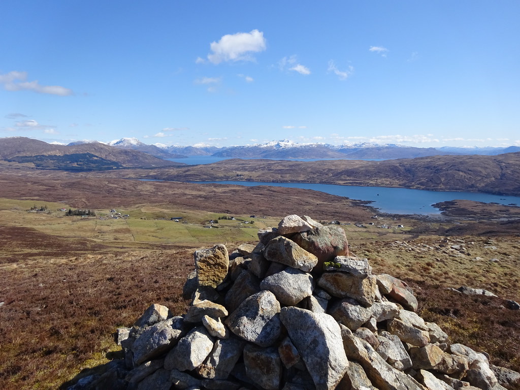 Loch Eishort, Haesta and the mainland
  Cuillin from Beinn nan Carn
 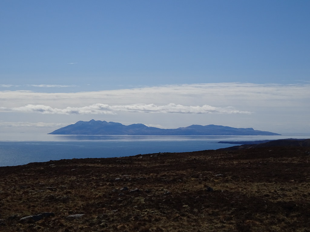 Rum from Beinn nan Carn
  Sleat and Loch Eishort
  Bla Bheinn
  Sgurr Alasdair and Sgurr Dearg
 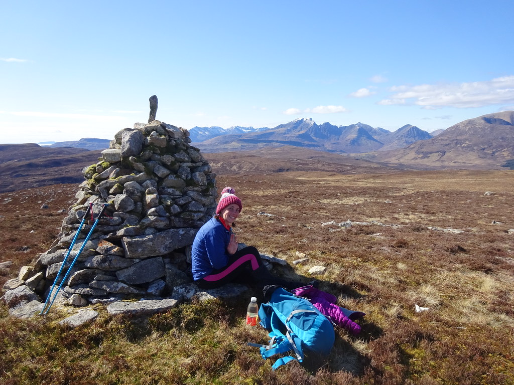 Lunch (for the second time)
  Rum
Rum We followed a slightly different series of dykes down to the car, then took a short detour down to the shore of Loch Eishort before hitting the road home.
 Loch Hourn and Ladhar Bheinn
  Haesta and Knoydart
 Not overly ambitious compared to our more usual trips, but a really enjoyable few days away. Jackie's Long Covid might be a bit of a life ruiner for now, but at least we are able to do this sort of thing

.
