free to be able to rate and comment on reports (as well as access 1:25000 mapping).
While most people have been straining at the leash to get to the Highlands recently, we have had the opposite problem - it has been approaching 6 months since either of us were in Jackie's flat in Glasgow, and when I last left it in November, we had no idea that we would be leaving it empty for so long. So now we were finally able to travel back there (although we weren't intending to move back for the time being - just a flying visit for a couple of nights).
With everything looking fine, we had a 4 day weekend ahead of us with some reasonable looking weather. Stopping in at a friend of Jackie's in Helensburgh for lunch, we were soon continuing up the A82 - why not go home the scenic way?
________________________________
Friday 30/04/21 Fiarach: 510m ascent, 9km, 3 hours, 30 minutes.I had identified a number of suitable length walks for Jackie in the Southern Highlands, with Fiarach being the one closest to our route home. The weather was looking reasonable hereabouts, so it seemed like a good option for Friday afternoon. We parked up at the Dalrigh carpark (lots of cars here but also still plenty of room) at around 3pm and headed up the track to Gleann Auchreoch. Once over the railway, we left the track and began to climb up the northern end of Fiarach. A quad bike track led the way initially.
 River Fillan
  Our route up Fiarach
 Looking back, I could see a new path and bridge heading for Beinn Dubhcraig - not sure when these were put in? The going was steep at first, but the ground underfoot was even better than I remembered. There were a few bumps, but the gradient began to ease before too long. Aiming for a deer fence on the horizon, we were passed by a trio of quad bikes. They disappeared around the eastern flank of the hill and we didn't see them again.
 Ben Challum
  Beinn Chuirn
  Beinn Dorain up Strathfillan
 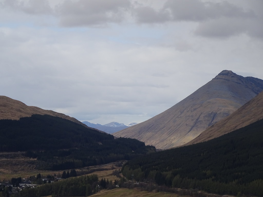 Grey Corries in the distance
  Ben Lui
 We were glad to be able to see Ben Lui poking out from behind the flank of Beinn Dubhcraig, and after following the fence for a short distance, Lochan Fiarach and the summit were before us. Jackie flagged a little after a couple of short descents, but 20 minutes later we were at the summit cairn. I had mentioned a number of times on the way up that this was the best feature of an otherwise shapeless hill, and it is - a rocky rib running across the grain of the hill.
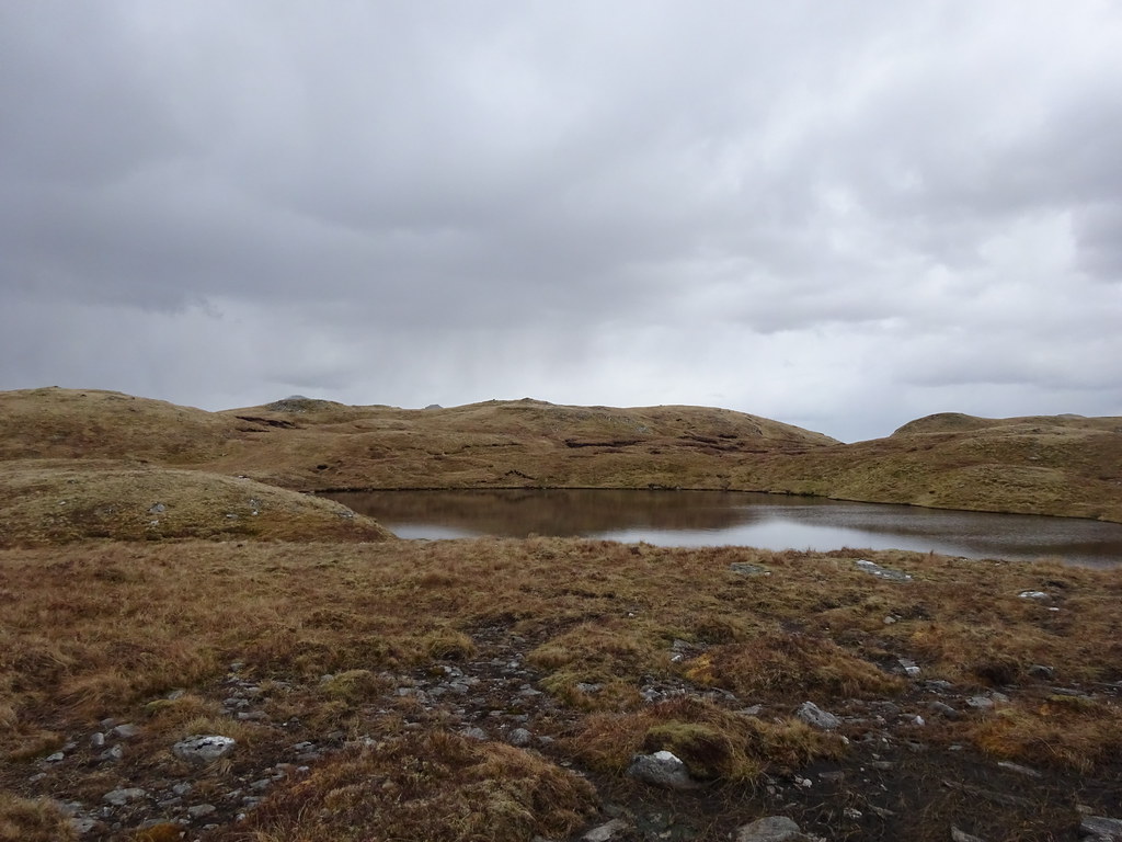 Lochan Fiarach
  Summit photo
 We stopped for a break - the views are not extensive from here, but the surrounding biggies such as Ben More, Ben Challum, Beinn Dorain and Ben Cruachan look good.
 Crianlarach hills from the summit
  Beinn Chuirn from the summit
  Arrochar Alps
 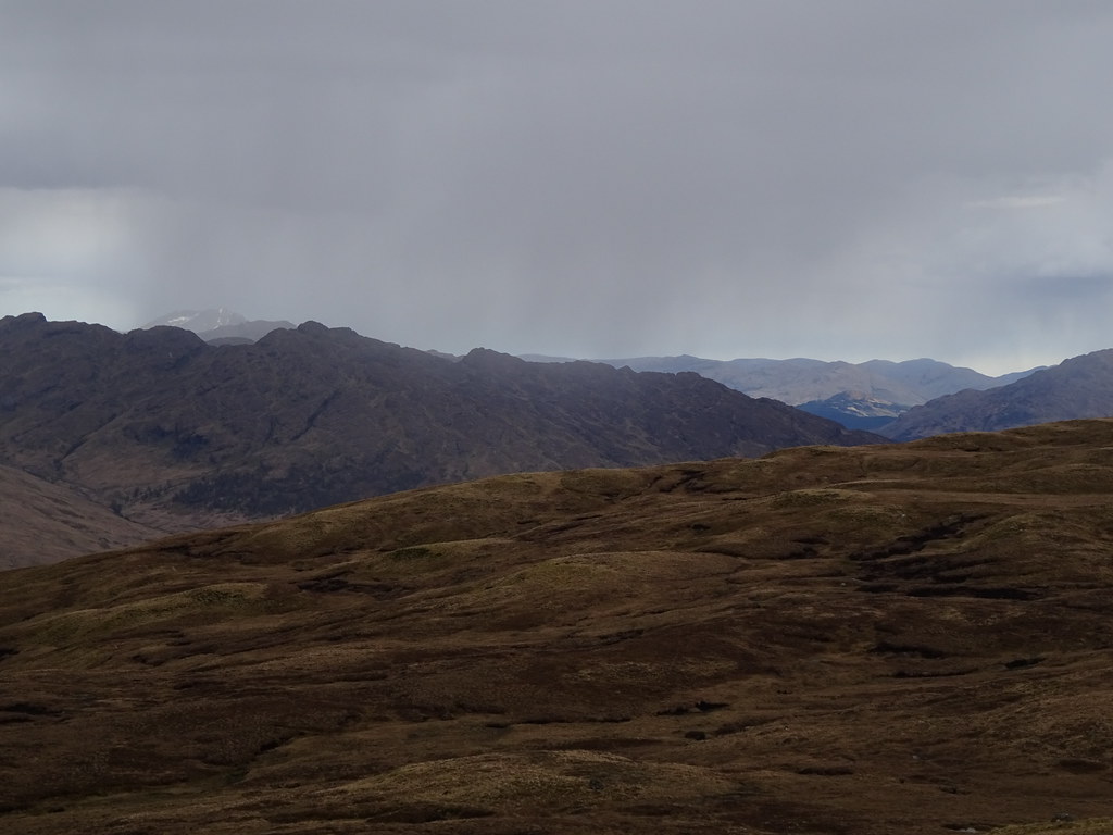 Glen Falloch
 We decided to get going as a light snow flurry appeared. Although it didn't turn into anything significant, there was light snow in the air for much of the return journey. We decided to be boring and straightforward and go back the way we came.
 Beinn Dorain and some light snow
  Glasgow-Oban line
  Ben More
  Ben Cruachan from Loch Nell
 On the way back to the car, we discussed what to do on Saturday. There were a number of possibilities between Rannoch Moor and Spean Bridge, but as a left-field idea, I suggested we go west and spend the day on Kerrera. We always love an island visit, so this quickly became our goal. In order to be on one of the morning ferries, we wanted to spend the night relatively close to Oban so we would only have a short drive the next day.
After looking at a few spots along Loch Etive, we couldn't find anywhere suitable so headed south on backroads towards Kilmore from Connel. Before long, we fetched up at a good spot next to Loch Nell, and before long the tent was up and dinner was on the go. Nice evening colours behing Ben Cruachan were followed by a quiet night.
 Loch Nell camping spot - better than it looked
  Sunset over Loch Nell
 _________________________________
Saturday 01/05/21 Carn Breugach and Kerrera: 430m ascent, 12km, 5 hours, 30 minutes; Na Maoilean: 210m ascent, 4km, 1 hour, 30 minutes.We were up at a reasonable time for the new us (Jackie can't really do early mornings anymore, so now I'm the early riser....at 8:30

), with plenty of time for multiple cups of tea before driving the 20 minutes to Gallanach via Oban.
 Morning at Loch Nell
 The ferry was busy and we were lucky to get one of the last parking spaces. Only 12 passengers are carried and we had to wait for the boat to come back as there were about 20 of us! Hardly surprising, being a sunny bank holiday weekend. Still, I've been to Great Cumbrae on a BH weekend and it was nowhere near as bad as that. Once off the ferry, the various groups scattered and we had the place largely to ourselves.
 Gallanach slipway
  Kerrera ferry is in
  Looking back to Oban from Kerrera
 We were aiming to do a clockwise circuit of the southern part of the island using the good paths shown on the map, but we decided on a slight detour to take in the highest point as well - it
is a Marilyn after all
. At Ardchoic we left the good track (still tarmac at this point, I think) and followed a quad bike route up onto the hill. We crossed over lots of terraces before arriving at the final steep ascent. The bracken could have made this more painful but it wasn't really up yet, and in between the ground was well grazed and easy to walk on.
 Last bit of ascent onto Carn Breugach
 We arrived on the summit just before 12 - lunch time then. The cold breeze was still lurking but it was pleasant enough to sit there for 45 minutes or so watching snow showers move over Mull. This had been a great choice as the weather further inland looked much more showery.
 North end of Kerrera
  Colonsay and the Garvellachs
  North up the Sound of Kerrera to the Ballachulish and Loch Creran hills
 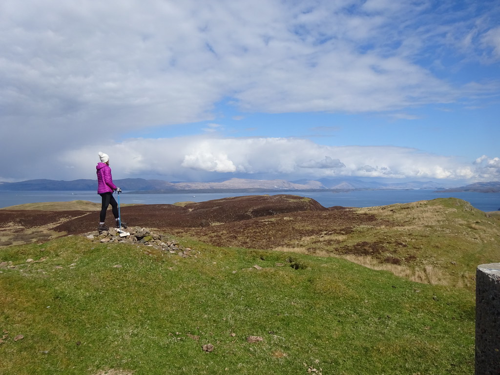 Summit of Carn Breugach
  New snow on Sgurr Dearg and Dun Da Gaoith
 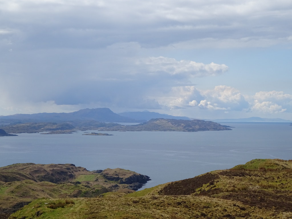 Scarba and Jura - paps just peeking out
  North to Appin
  Across to Gallanach
  Leaving the summit of Carn Breugach
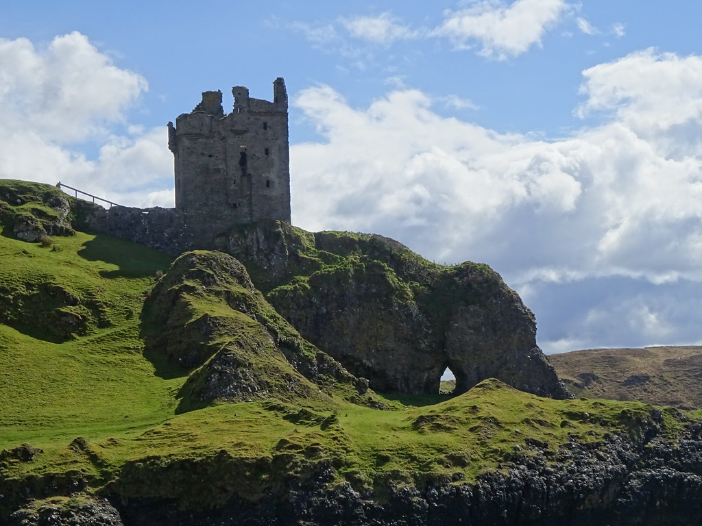
 Eventually we began to get cold, so we got walking again. Good ground led us steeply down towards Upper Gylen, at which point we had to climb a new fence to get back to the main track. After Upper Gylen, we turned off and made a line for Gylen Castle. This sat in an impressive spot between two bays.
 Upper Gylen
  Scarba, Seil and the Garvellachs
  Gylen Castle
  Port a Chroin
  Looking up from the front door
  Gylen Castle
  Port a Chaisteal
  Garvellachs
 Heading back for the track, we continued around to Ardmore, climbing steeply up behind the house past some goats. This side of the island was wilder with some heather moorland and views to Morven. After dropping to Barnabuck, Jackie was unimpressed with the climb back out of this glen. However we had another break at the top of the climb, with views now changing to Lismore and Appin.
 Looking back to the castle
  Earlier snow has almost disappeared on Mull
 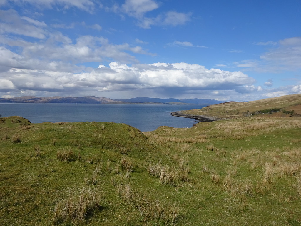 Morven peninsula
  Morven and the southern tip of Lismore from Barnabuck
  Appin and the big hills behind
  Ben Cruachan
 Back down towards the ferry, we found that the farm shop was open and selling homemade ice cream. Excellent

. We dropped back to the slipway just in time to catch the 4:30pm ferry back to the mainland, having taken a rather leisurely 5.5 hours to do the circuit. I had wanted to go to Kerrera for ages, and was glad that we had been able to make a day of it - any time I have considered it previously, it would have ended up being a quick hour or two to get up Carn Breugach.
 Sound of Kerrera
 We drove north from Oban hoping to camp somewhere on the north shore of Loch Etive between Ardchattan and Bonawe. However all likely spots were taken up by caravans and fishermen, so we followed the road over the low pass towards Barcaldine. Halfway up here we found a nice quiet spot by the entrance to the Esragan hydro scheme.
 Camp spot by the River Esragan
 After having some dinner and getting the tent set up, we were in that odd part of the evening where it was too early to go to bed but too cold to sit around. I had been joking about going up Na Maoilean behind the tent (having been to the incorrect summit on here about 8 years ago), but surprisingly Jackie was also keen. If we drove up the road a few hundred meters, we could shorten the ascent and be there in time for sunset.
 Beinn an Lochain across Loch Etive
 Following a path up the hillside with good views back to Ben Cruachan, we made good time. Where the path (only shown on the 1:25,000 map, but pretty good) ran out, we continued up the burn towards the lochan under the summit. We flew up here at a pace I haven't seen Jackie manage for a long time, and were rewarded with a nice sunset over Morven. Perhaps not the ideal sunset spot, but pretty good in the end!
 Ben Cruachan
  Beinn Mheadhonach and Ben Cruachan
  Sunset over Morven
 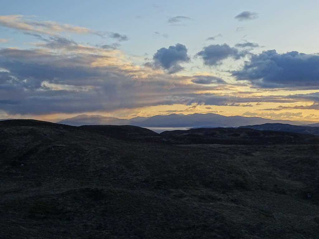 Mull
Mull 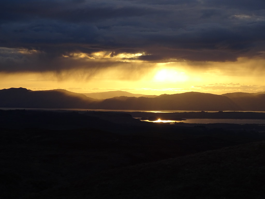 Sithean na Raplaich from Na Maoilean
 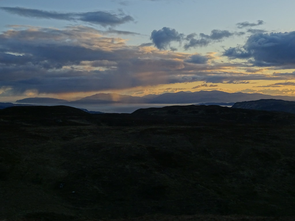 Na Maoilean sunset
 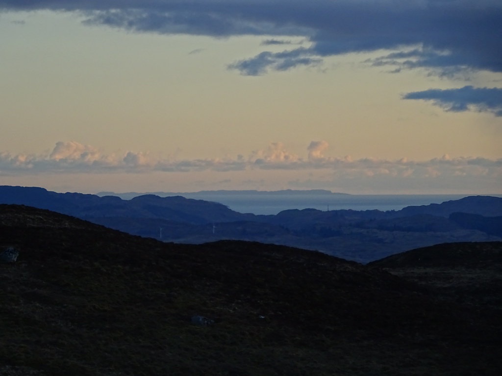 Colonsay
  Beinn na Cille and Glengalmadale
  Almost gone
  Beinn Mheadhonach and Ben Cruachan
  Last light
 Retreating the same way into the gloom, we were back at the tent and ready to go to bed before too long.
_____________________________________
Sunday 02/05/21 Beinn Lora: 350m ascent, 6.5km, 2 hours, 30 minutes; Eriska: 60m ascent, 5km, 1 hour, 30 minutes; Ardsheal Hill: 230m ascent, 3km, 2 hours.Woken by another morning of good weather, we decided to stick to the straightforward walks today, and drove around to the forestry carpark in Benderloch. Beinn Lora has a really good path up it and is also a great viewpoint, so it seemed like a good bet to start off on.
 Morning view
  Mull from above Benderloch
 The path has bedded into the surroundings a bit since I was last up here, but the gradient hasn't changed - it is steep! Jackie was possibly paying for yesterday evening's sunset dash by finding this pretty hard going. There were short sections of descent that had no recollection of, but even the section of path outwith the Forestry Commission area was pretty dry.
 Beinn Lora path
  Benderloch and Morven
  Mull
Mull  Dunbeg and Oban with Kerrera behind
  Oban Airport
 There were great views of Kerrera and Mull, but a shower moved in as we arrived at the summit. We only caught the edge of it but the temperature plummeted!
 Summit of Beinn Lora from the edge of the trees
  Ben Cruachan from Beinn Lora
  Morven and Ardgour from Beinn Lora
  Mull
Mull  Zoom to Kerrera
  More zoom to Scarba and the Paps of Jura
 After finding a sheltered spot and stopping for a short while, we retreated to the car and picked up some tea and cake from the cafe/bookshop.
Next up - after a long break - was a gentle wander round the island of Eriska. We parked at the South Shian nature reserve and wandered over the bridge. The entire island is the grounds of a posh hotel but there is some lovely secluded shoreline to wander along, which we did. We also climbed through the woodlands to the high point of the island (a whopping 50m or so) before strolling back to the car. Lovely
.
 Bridge to Eriska
  Morven from Eriska
  Beinn Sgulaird, Creach Bheinn and Beinn Bhreac
  Across to Appin
  Ben Starav
  Appin from South Shian nature reserve
 It was now mid afternoon and we hit the road north. However there was a final walking possibility that we would have a go at if Jackie felt up to it. Surprisingly she felt better than she had on Beinn Lora, so we parked up at the Duror and Kentallen community centre for the short walk up Ardsheal Hill. There is a comms mast near the summit with a nice access track up to it, making the walk very straightforward.
 Path up Ardsheal Hill
 A couple of steep sections early on had Jackie wondering if this had been a good idea, but we steadily made our way to the summit. I can't remember what was there previously, but there is now a trodden route above the mast the entire way to the trig point.
 Creag Ghorm on the end of Beinn a Bheithir
 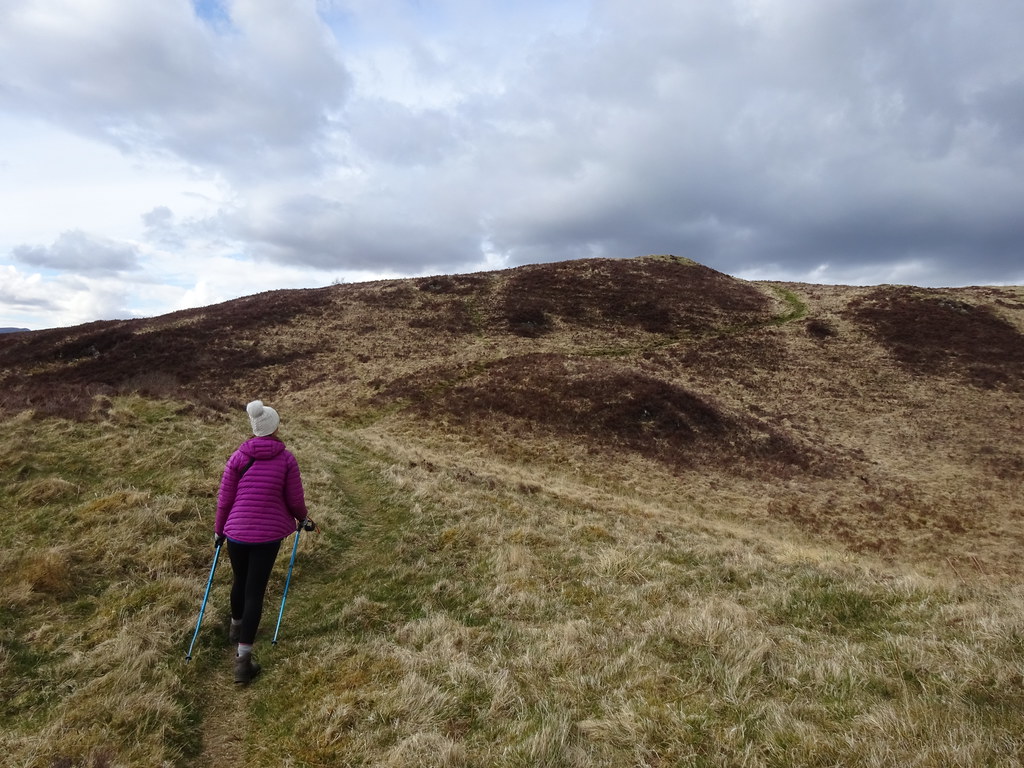 Jackie on the ascent
 If anyone asks for an easy walk in the Glencoe/Ballachulish area, I always recommend this hill as the views are some of the best for the amount of effort required. We had a lengthy stop on the summit, until the cold breeze drove us away.
 Kingairloch hills: Creach Bheinn
  Garbh Bheinn
 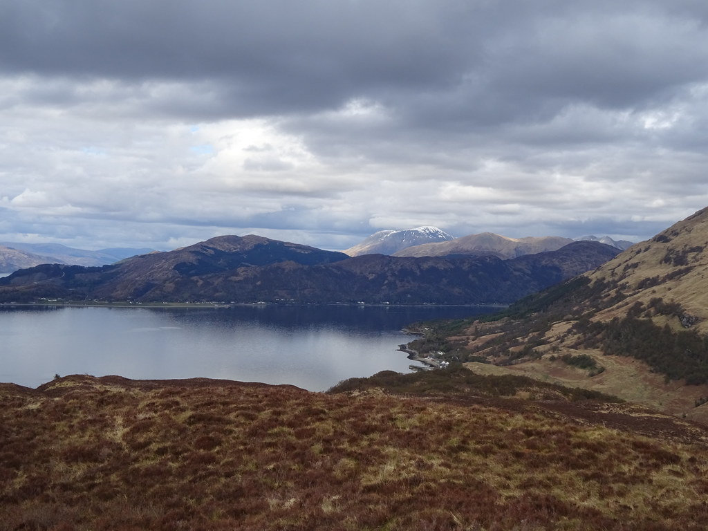 Beinn na Gucaig and Ben Nevis
  Mull, Shuna and Lismore
  Corran narrows
  Ben Nevis from Ardsheal Hill
  Fraochaidh
 Then it was an easy walk back down, which barely took 20 minutes. I previously descended to the west with my dad from here which turned out to be a monumentally bad judgement - Jackie could not be persuaded that way
. A couple of hours of driving up the Great Glen returned us to Inverness again with the idea that we would do this more often.
