free to be able to rate and comment on reports (as well as access 1:25000 mapping).
03–10 May, 2021For weeks, I’d been planning to spend most, or even all of May in Inverness. Travel restrictions had lifted, overnight visits were now allowed, there were long hours of daylight, and the wee beasties remained abed for a few weeks yet. I had a long “to-do” list of hills, mostly Corbetts.
I planned my departure carefully for the end of April...I’d stick around for book group on the Wed night, thinking that we might all actually choose to bundle up and meet outdoors for the first time in more than a year. Frigid temps put paid to that idea, and we had our usual for these days zoom gathering instead. But the zooms never go as late as in-person meetings, so I’d planned an early-ish getaway for the Thurs.
But wait. My postal ballot for the 06 May election hadn’t arrived. I’d been chasing it since Monday, and kept getting told “it should be there in the next day or two.” It didn’t come on Wed…or Thurs…or Fri…or Sat. I was incandescent with rage, which increased exponentially with each day’s mail delivery that didn’t bear fruit. There wasn’t a darn thing that I could do that I hadn’t already, and when the Sat delivery brought no joy, it seemed that not only would I be unable to travel until at least Tues afternoon (Mon holiday), but by this time, there was also a real possibility that I’d not be able to vote at all, through no fault of my own. Finally, at about 5pm on Sunday, a battered blue van from the Renfrewshire Council arrived in front of my house, and my postal ballot was, at last, delivered. I filled it in immediately, and handed it to a trusted friend to deposit directly in the ballot box on Election Day.
So I arrived in Inverness on the first Monday in May, only to find that the weather for the following 7-10 days was, in a word, pish. Typical. Instead of the long tough days under blue skies that I’d been dreaming about, I’d be reverting to my winter diet of short days and lesser hills, at least for the first week or so. At least I’d kept my winter clothing there.
Tues 04 May
Sub2K: Carn na Dubh Choile (Silverbridge)
3¾ hrs / 11.75km / 447m It was hard to summon the enthusiasm to get oot and aboot whilst the rain was chucking down. I had an early breakfast, but didn’t leave the house until around 8:30—just in time to hit all of the work and school traffic. No matter, I had plenty of time.

yet another obligatory photo of the river at Silverbridge

signpost pointing the way
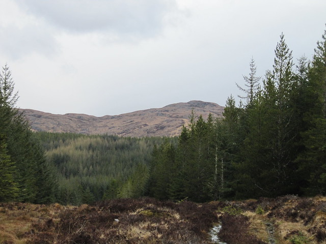
first view of my hill
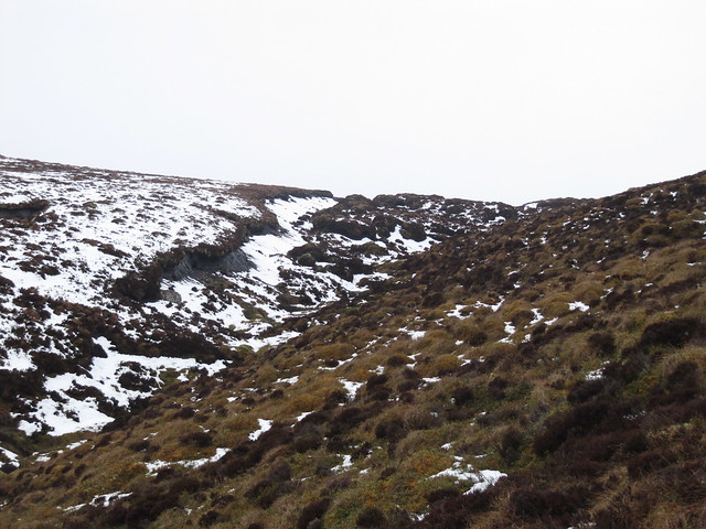
The section through the forest was SO wet. I knew it was going to be; I’d read the reports and seen the photos. By the time I reached the woods, my feet were already sloshing (today’s outing would have been a good time to test my new waterproof socks!), so I wasn’t too concerned. I’ve said it before: once your feet are wet, you can save a LOT of energy by not trying to keep them dry. However, there’s a very wide spectrum between water-filled boots and full body immersion! The latter would have been quite possible in some of the pools of standing water that had to be crossed.

one small sample of the wetness within...
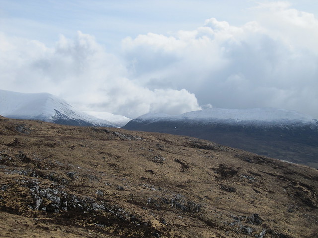
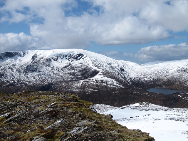
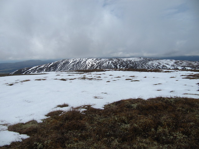
a fair amount of fresh snow on Wyvis and its little sidekick
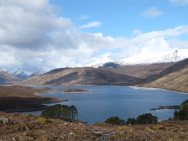
As I approached the summit, I was looking toward (I thought) the Fannichs. Off to my left was a loch with a huge dam, and I struggled to figure out whether it was Loch Fannich. It wasn’t until I got home that I realized I’d been looking straight onto Glascarnoch Dam – doh! Not the Fannichs, then, rather the Beinn Dearg hills.

squally over the Fannichs...errr, I mean, the Beinn Deargs

what IS that big dam? (Surprised I didn't notice the Aultguish...

)
the bedraggled look -- descent route behind me
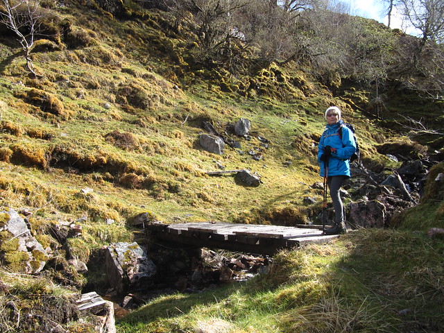
Rather than snorkelling my way back through the forest, I took the SE shoulder off the hill—malky_c’s route, perhaps, I cannae remember—to pick up another forest track that led me back to the A835.
This was no’ a half bad outing, especially considering that I was in full waterproofs from the get-go!
I’d thought about nipping up Carn Faire nan Con from Garve, but by the time I returned to the car at Silverbridge, I was ready to have dry feet.
Wed 05 May
Sron na Muic (near Invermoriston)
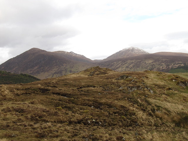
5 hrs / 24.24km / 811mTrack all the way to the top. Nice forest walk, squalls all around. Hadn’t twigged that the first few kms were very near the river and the A887; lots of traffic noise. Good views from the top—to Kintail hills? I think, but not sure which ones, specifically. There were others that had much more snow that might have been Affric; again, not sure.

the river at Invermoriston...

...and the Telford bridge (in danger of being the most interesting thing about the whole excursion!)

much of the route looked like this

but there were some good views once I'd come out of the forest. Toward Kintail, I think, but I couldn't tell ya which hills

another squally day
verra dark skies over Meall Fuar-mhonaidh, which I climbed in Dec with Evie

the afternoon sun made this look like a fairy glen (but for gawdsakes don't call it that or the tour coaches will descend!)
Thurs 06 May (Election Day)
Caledonian Canal, to Dochgarroch and back
2½ hrs / 13.53km / 126m Awakened to at least an inch or two of lying snow! The forecast was, as it has been, for squally snow showers throughout the day. I made a late start, not leaving the house until nearly 10, and not really with a plan in mind, other than a vague notion of doing one of the WH “city of Inverness” routes. If it stopped raining, mind. I pulled into a large layby near the Holm bridge across the River Ness and read the paper for a while. When it cleared, I was out of the car and onto the towpath; I’d just keep walking until I reached the lock at Dochgarroch, or until the weather deteriorated again, whichever came first. I travelled light, carrying only my phone and my camera, and wearing (mistakenly) a heavy winter jacket. It was far too hot (and not fully waterproof), and remained tied around my waist for most of the outing. Luckily, the weather stayed dry for the duration.
Not much to say about this. It’s pleasant enough, a good dry walking surface and flat. It got me some fresh air, and some mileage. The gorse is in bloom, there were a couple of boats making their way up and down the canal, and a few ducks were hanging around the moored boats near to the lock at Dochgarroch. I think I must have just been on autopilot for a lot of it. I walked south on one side of the canal, and north on the other, for a little variety (a very little).

gorse in all its bloomin' glory
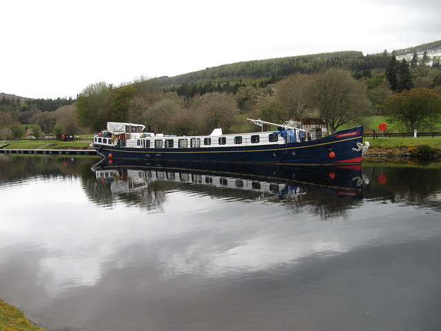
The Scottish Highlander, parked near the Dochgarroch lock
Fri 07 May
Back on the Corbett Campaign!: An Sidhean (Loch Monar)
7 hrs / 17.65km /923mA fab, but wearying day with Evie up at the end of Glen Strathfarrar. Sunshine and snow showers. Did the WH route in reverse (after much discussion during the day whether we were or not).
down Loch Monar -- Sgurr a'Choinnich (or is it a'Chaorachain? I can never remember); Maole Lunndaidh in the cloud on the right

starting to gain some height, one of the Mullardoch (I think) hills coming into view
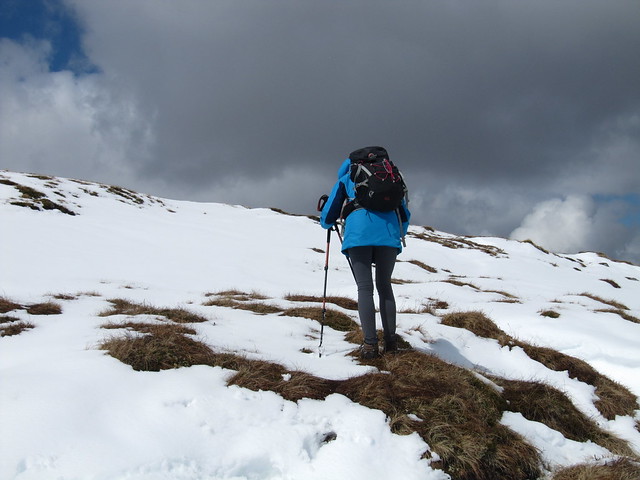
into the snow!

I'm all muddled now...not sure which hills these are

...or these. but some nice atmospheric colours!
Maole Lunndaidh is distinctive, with its corries

summit cairn

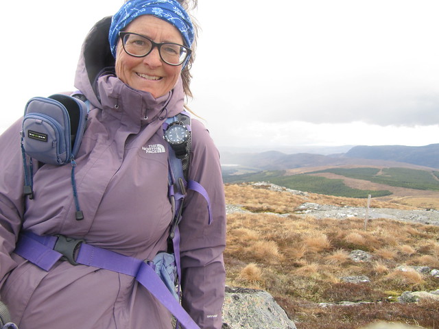
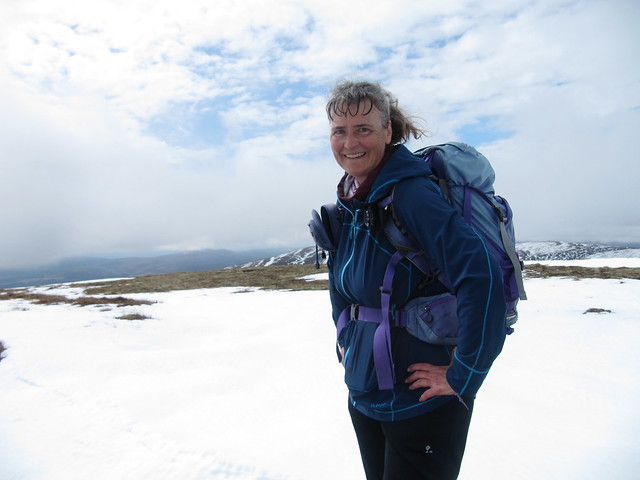
a squint summit selfie

final look back doon the loch
Sat 08 May
City walk along the Ness and northern part of Caledonian Canal
2¼ hrs / 11.53km / 80mI want to say that when I walked the GGW all those years ago, I didn’t—for whatever reason—walk the bit across the islands in the river. Then again, my memory is fairly crap, so it’s possible that I did. None of it looked familiar, but it is very pretty. And was quite busy on a Saturday late morning, everyone having the same plan of getting out before the rain (and wind) moved in from the South.
Sun 09 May
Graham: Beinn Tharsuinn (Ardross) – the free-from peat-hag-faff route
4½ hrs / 13.3km / 555mIt’s been a while since I’ve needed to tidy up a previously recce’d hill. My first attempt at this one was sometime late last autumn, when I wasn’t feeling great to begin with, and was also racing against daylight. Back then, when I’d reached the seemingly impassable (without either a lengthy detour or the strong possibility of being consigned to it for the next millennium) peat hag at the low point between Torr Leathann and Beinn Tharsuinn, I called it a day, and beat a hasty and disappointed retreat.
It was a perfect outing for today, with rain in the early morning, and returning in the afternoon, but largely settled in the interim. I didn’t want to lose whatever momentum I’ve begun to build during this first week in my northern abode.
I set off from the large car park just past the bridge over the River Strathrory on the B9176. The amount of rubbish that’s been dumped there is disgraceful and disgusting. I shan’t dwell on it.
As I marched up the track, I pondered on the route I’d take. I toyed with going up through the wind farm, but just about the time I neared the turnoff for that option, a man on a heavy-duty e-bike, who’d pulled into the car park just about the time I set off, came up behind me, and we had a chat about the various options. Turns out that he’s WH user “m3doc”; a user ID that I recognised. He told me that he’d been up through the wind farm the day before, but had turned back in the face of seemingly endless peat hags once past the turbines. OK, I’ll pass on that, then.
I didn’t feel the need to visit Torr Leathann again, especially since the tops were still in the clag, and there’d be no view. So I traversed around it at about the 500m contour, made an easy crossing of the Allt Fuaranach, and headed up steeply through the heather and occasional hag toward the summit.
the lower end of the humungous hag; this time, I crossed the dip below it
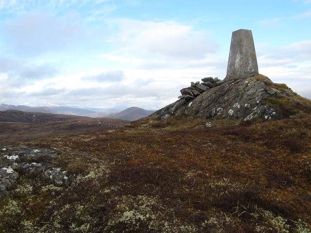
yay, trig point reached
zoom across to Torr Leathann
I overshot the trig point slightly, given that the clag was still down, and because it didn’t appear prominent from the approach from the east. The clag lifted briefly while I was there, giving a good view of my surroundings, and giving the opportunity to orientate myself correctly for the descent; I returned the same way that I’d ascended, stopping once I’d reached the track to have a bite to eat. I was back at the car at 2pm. I sacrificed a fair bit of ascent by giving Torr Leathann a miss, but not having to find a way across all that peat haggery was well worth it.
Mon 10 May
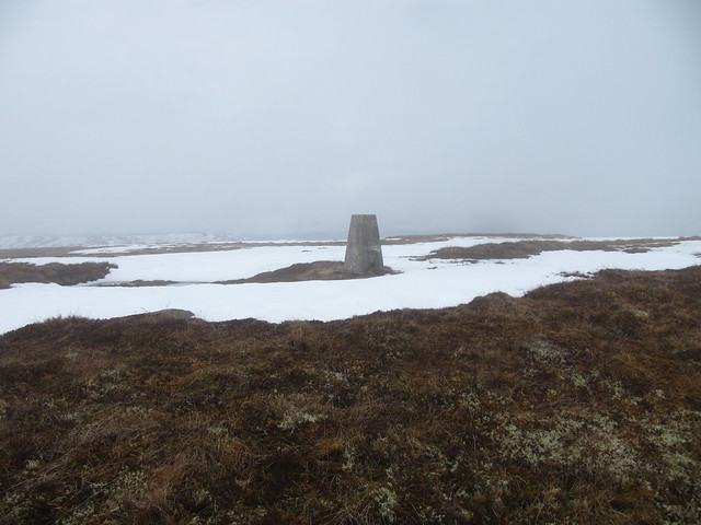
Graham: Carn na Coinnich (Strathconon)
4 hrs / 11.97km / 620mI woke up with a crick in my neck, after dreaming about timber lorries racing toward me at full speed down a single-track road with limited passing places. I must be heading up Strathconon! Once again, the days’ forecast included rain, this time moving in by mid-afternoon. I made an early start, arriving at the start point (just before crossing the river at Bridgend) and setting off just before 7am. Thankfully, there were no lorries…was this because it was so early, or because extraction from the glen is, for the moment finished? I’d wonder about this throughout the walk, and watched for lorries along the glen road as much as I was able to from on high.

nice water feature just past the gate; I'd make use of it on the return!
the view across to Meallan nan Uan / Sgurr a'Mhuilinn kept drawing my attention on the ascent; a fab day, but it had been such a slog up the shoulder of MnU...

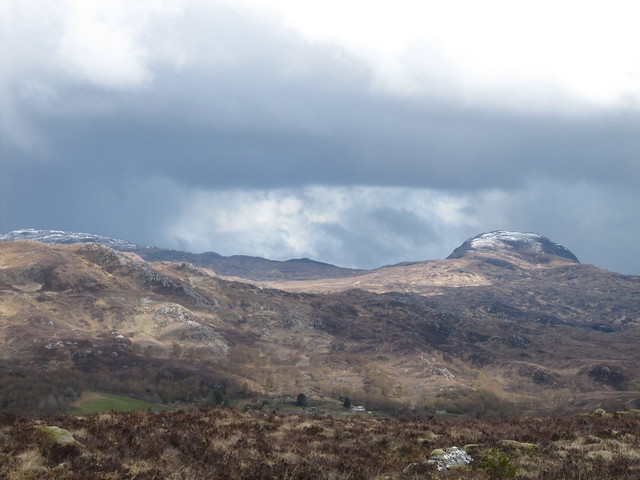
these are the Fannichs, I think. With a bonus view down into Strathconon

first view of my summit
This wasn’t a difficult route; the high point of the track is only about a km from the summit. I was enjoying the warm and at-times sunny moment, although there were midges aplenty about. Thankfully, they seem to not yet be biting…but I’m sure that with the now-milder temps, it’s only a matter of some small amount of time before they realize they’re not only awake, but *hungry*!
elevated trig point
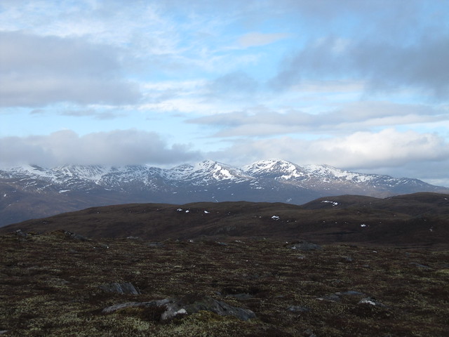
the Strathfarrars
I spent a few minutes sitting at the summit enjoying the views and the solitude, before making my way back to the track, and down. I dumped my things in the car, and walked up along a waterfall just inside the gate. Boots off, trousers rolled up, tootsies into freezing snowmelt. Glorious! But there was a tick inside one of my boots—first this year—and I wondered where I’d picked it up. Thankfully, I met no timber lorries on the way out of the glen. I stopped in Dingwall to pick up a few groceries, and was home by early afternoon.
And so thus endeth my first week in Inverness. It’s perhaps not quite as ignominious as it seemed at first glance. I’ve managed to get out every day, and although I’ve not been able to put in the long days I’d hoped for, here’s hoping that I’m at least building some hill fitness for better (weather) days ahead.
