free to be able to rate and comment on reports (as well as access 1:25000 mapping).
More weeks of feeling horrible, but we needed to get out and do
something 
Malky suggested Torr Achilty - a "small and easy" hill near Contin. We parked up and walked across the bridge - there was plenty of ice around but nothing too slippery. It was a beautiful afternoon

We walked a few metres along the road before taking the track down towards the farm. There was a lot of mud around but the track made for easy walking. The views back towards Ben Wyvis were pretty good


Malky was convinced there was a path and an easy route up. In hindsight I probably ought to have asked more questions rather than blindly trusting him
But we did find something that looked like a bit of a path so we left the track

We followed the path, or bits of it, through the woodland. Mostly we managed to avoid the worst of the bracken and there were animal tracks which helped. It was slow going and more up and down than I would have liked

As we pulled ourselves out of the trees, it was a case of "out of the frying pan and into the fire" as we ended up in deep heather...
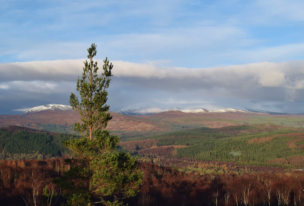
The views were wonderful though, so it was a perfect excuse for a breather, and some lunch.

Looking towards Ben Wyvis
Perhaps we should have stayed in the trees?

Ahead - the deep heather looked like a nightmare. But there were not a lot of options. Fortunately the distance was very short, so we just had to get on and do it

Once across the open field of deep heather, we were back into the trees and the ground underfoot did improve for a while. When we popped out of the trees we could see down Loch Achonachie

Unfortunately, we were back into the horrific deep heather and on an even steeper gradient than before

Out of the worst, we picked up a vague path heading towards the summit - thank goodness the ground was better here
And the views down the loch were incredible

Zoomed towards the Strathfarrar hills

Almost there....

And we were finally there! Summit of Torr Achilty - a smashing spot


The cloud coming in over Ben Wyvis

We had another decent break - this was not turning out to be the quick and easy hill that I was promised

I put my foot down about returning the way we had come, so we debated options and decided to try to head down the shorted steeper ridge to the farm - it would be a longer walk out on the track but would get us off the hill quicker.


Sgurr a' Mhuillin


Initially as headed into the trees the ground wasn't too bad...

We skirted around the top of the steep bit

Looking out towards Contin

Then the ground got steeper


It was pretty tricky to keep our feet as we dropped down...

We made our way around a big cliff and across a huge puddle of water

A conveniently placed gate let us out onto the track

We headed back along the track eventually meeting our outward route. The sky suggested that there was a good sunset somewhere, but we were just glad to get back to the car so I could sleep


Perhaps there is an easier way up Torr Achilty, but this isn't it
