free to be able to rate and comment on reports (as well as access 1:25000 mapping).
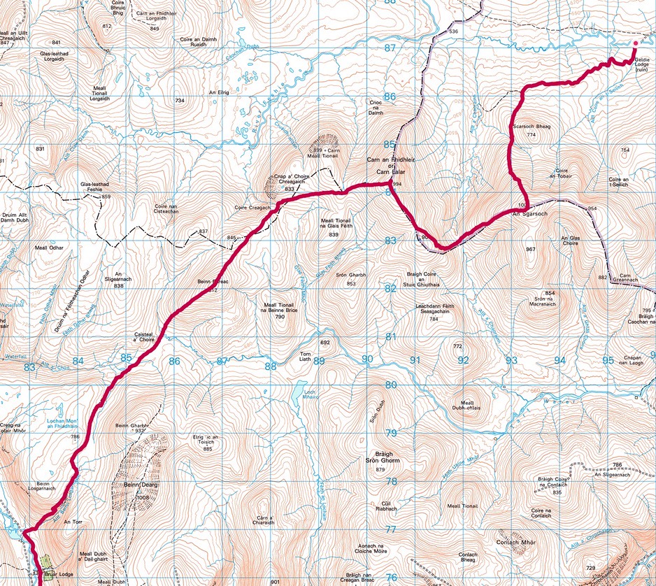
A first post-lockdown visit to Caledonia saw me up from York to Glasgow, spending a couple of days teaching trainee surgeons there how to keep their patients alive after the fun part of hacking them about, so at the end of the course I took the opportunity to nip on a train to Kingussie, to attempt a long planned trek across the remote area of the south west Cairngorms: to Blair Atholl via the summits of some the lonelier hills on the baggers’ list.
I spent the night at the wonderful Greystones B&B in Kingussie, then the next morning my host, Mark, kindly drove me to Drumguish, saving me the 5 km trudge on the road.
Day 1: Drumguish to Tom Dubh (23.5 km, 1165 m ascent).


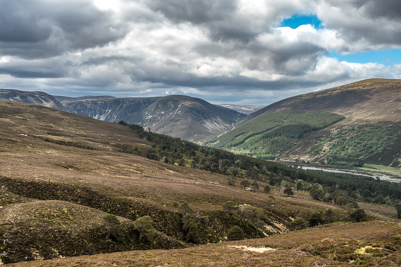
The day was clear, high cloud, occasional sunshine and a beastie-beating breeze, perfect. My route took me through forest across to Glen Feshie, crossing a stretch of open moorland near the abandoned buildings at Baileguish. New bridges get you across the rivers here, but the second one is hidden behind trees though, and a failure to stop and spot it meant I got wet feet instead. Amateur.
In Glen Feshie a short stretch of tarmac took me down to the footbridge south of Stronetoper, and then across the footbridge to join the standard route for Mullach Clach a Bhlair, the first Munro of the trip. Ominous signs in Feshie warned of the erosion of the river bank, and care certainly needed to be taken in parts, like here!

A left turn marked the end of the ambling about, and the start of hill country. However, the ATV track somewhat took away from the feeling of pioneering spirit, and seemed to go on, and on and on … but the views opened up.
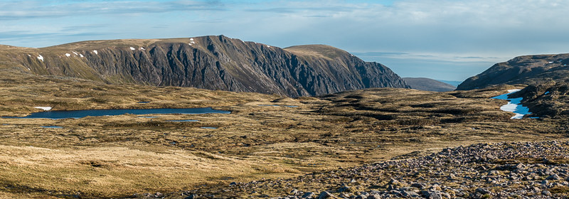
Back to Glen Feshie:
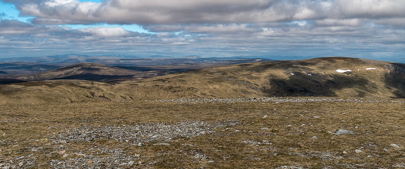
To the summit of Mullach Clach a Bhlair:

At least every step was upwards. Somewhat dispiritingly though was the appearance of several jeep-like vehicles whizzing about the hill summit. At least they were the last motorised vehicles I saw until I got to Blair Atholl.
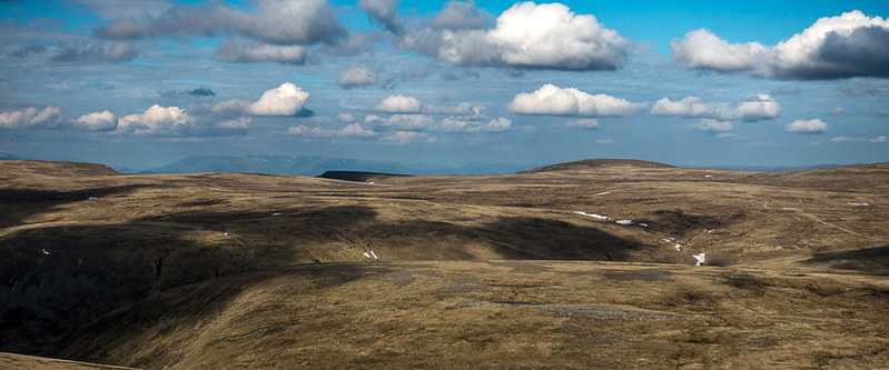
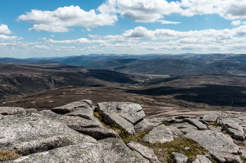
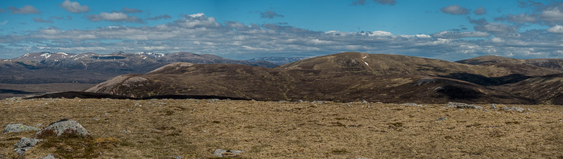
The views are enticing as the plateau of the Moine Mhor is gained, the big glowering lads of the Cairngorms dominating the horizon, the second row heavy lifters of the Munro world.

On the other hand, the summit of Mullach Clach a Bhlair is not one of the more iconic ones, I think it is fair to say, but it was just so good to be back on the hills after 9 months away.

The next objective was the Munro top of Tom Dubh, which I’d earmarked as a spot for my first camp. The bulk of the distance was on easy ATV track:

This then ended abruptly, with an ensuing short climb up to the plateau like summit of Tom Dubh. Flat ground, a wind shelter for cooking, and some water; so all the boxes were ticked for a decent spot to pitch the tent.
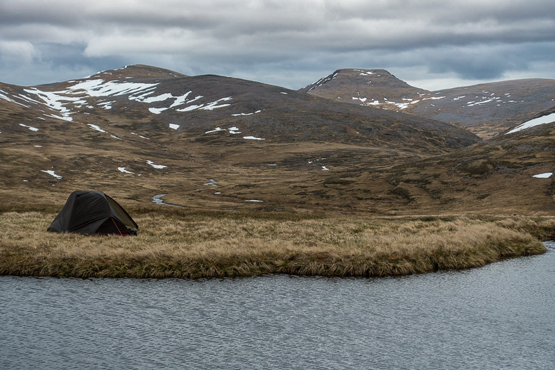
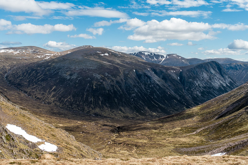
The view was dominated by the cliffs of Sgor Gaoith on one side and the backs of Braeriach, the Angels Peak and Cairn Toul on the other, with the broad flank of Monadh Mor to the side.
The skies cleared and the night was cold but the sunrise and experience were magical. Even better, I’d finally found some dehydrated camping fodder (Summit to Eat) that tastes decent, a far cry from the usual cardboard I’ve had before.

Day 2: Tom Dubh to Geldie Lodge (12.0 km, 546 m ascent).
Beautiful skies greeted me in the morning and the day ahead was full of promise, even if it was to be a much shorter one.
The first obstacle was the crossing of the Allt Luineag between Tom Dubh and the shoulder of Monadh Mor. The WH description does justice to this early sting, stating a paddle across may be necessary, and it certainly was for me, there being quite a deep section across which I don’t think I could safely stride.

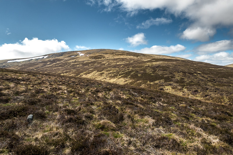
Bracing on the feet but all good otherwise, and soon enough I was heading straight up to the shoulder and then the summit of Monadh Mor, where the views opened up dramatically.
To Mullach Clach a Bhlair:
Cliffs of Braeriach starting to appear:

The Devil’s Point coming into play:

Somewhat bizarrely, given the remote feeling, the Boss (not that one) managed to call me on the summit with a WhatsApp video chat. Not quite what I was expecting, but welcome all the same!
On I went over the long ridge and quite sharply down to the bealach with Beinn Bhrotain, where the views were spectacular.
Less spectacular was the slog up to the next summit over the monotonous boulder field.
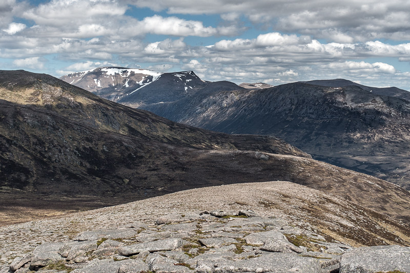
Towards Beinn Bhrotain:

Back to the Cairngorms:
I was beginning to meet other people at this stage, a young couple who had had a very early start from Linn of Dee, looking built for speed, then a couple of chaps more my vintage, built more for comfort but still putting a shift on.
Summit of Beinn bhrotain:

I enjoyed the last lingering views of the Cairngorm heavyweights before dropping south-east, towards the iconic Munro Top of Carn Cloich-mhuilinn:

A Munro from Sir Hugh’s original tables, one of three he never climbed - apparently saving it until last - it was “reclassified” as a Top in 1981, presumably felt to have not enough prominence from Beinn Bhrotain. I find this hard to understand when thinking of existing Munros such as Cairn Bannoch, or Carn a Choire Bhoidheach, which have little prominence from anything! Given the history of Carn Cloich-mhuilinn in the Munro story, and the steep little climb to get to the summit, it’s as deserving of full status in my opinion.
At the summit I had an entertaining chat with a couple of ladies who’d camped near White Bridge, and knew their hills inside out. Aside from the history, as a viewpoint it was pretty stunning as well.
Towards Ben Macdui:
Towards Linn of Dee, with a distant Lochnagar:
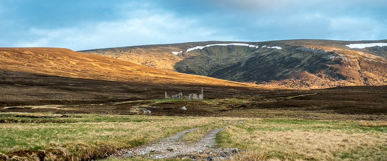
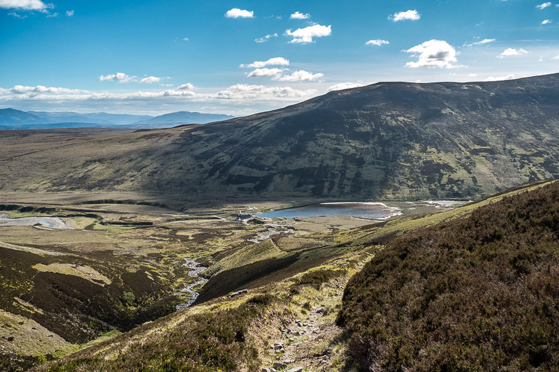
The next bit of the walk was the downhill slog to the Geldie Burn and the Lodge, which I’d picked out as a decent camp spot. Fortunately, visibility continued to remain perfect – as it did for all three days – so there was no problem seeing where I was heading, just a problem actually getting there … nothing much enticing about the way ahead:

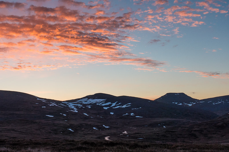
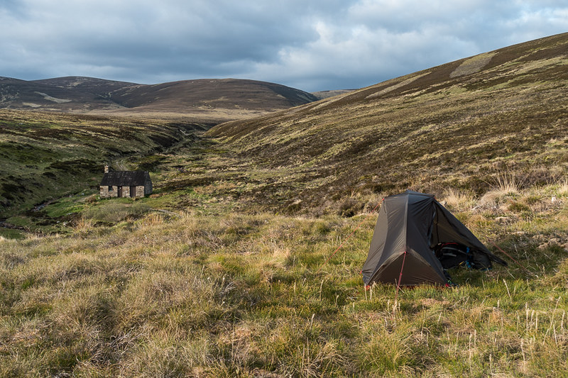
Seemingly endless, and largely pathless, the heather and bog were energy sapping and I was very glad to hit the burn at last, finding an excellent pitch at the confluence of the Geldie and the Allt Coire an t-Seilich burn, which came down from the hillside above the ruin. Idyllic.

I set up the tent and just sat with a cuppa and enjoyed the sunshine and the silence. Apart from one couple picking up their bikes from the ruined lodge and whizzing back to Deeside, I saw no one until the following morning.
There were some heavy showers in the late afternoon, then gentle evening light, perfect for a potter around the ruins, and finishing off with a decent sunset.
The days hills seen through the ruins:

Evening light:


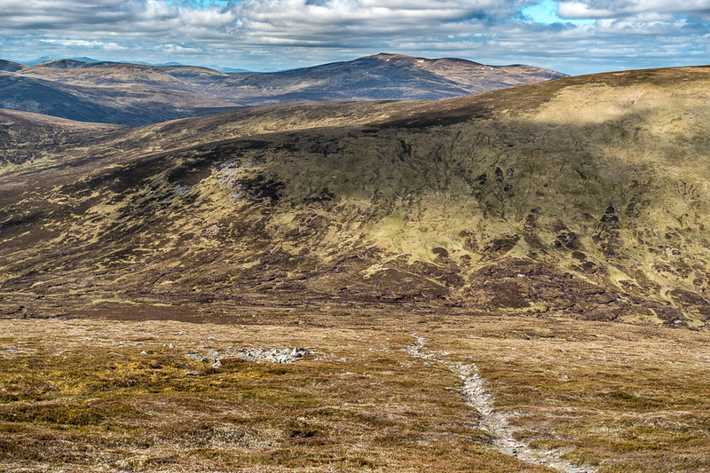
Day 3: Geldie Lodge to Allt Sheicheachann (25.5 km, 1392 m ascent).

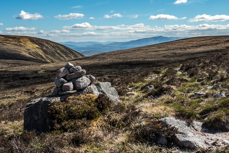
Without doubt, this was going to be the toughest day of the walk, so I didn’t feel too bad about the easier day before. Once again the weather was excellent and I left Geldie at 8am, initially following the excellent path until reaching a cairn which I presumed was the point to break off the path for An Sgarsoch.
An Sgarsoch and Carn a Fhidleir, the day's initial objectives:

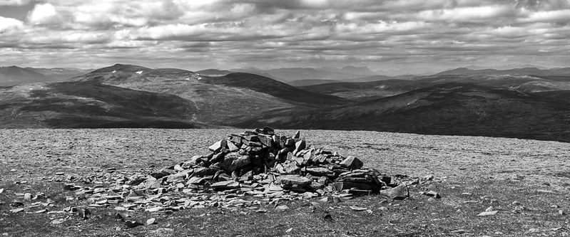
As is so often the case with me, the initial rough track disappeared - or I’d just wandered off it, more likely – so I ended up ploughing on over mainly trackless heather, round the western flanks of Scarsoch Beag, crossing over the Allt a Chaoraine burn, then onwards and upwards over the northern spur of An Sgarsoch, hitting the summit with it’s wonderful “armchair” cairn about 2 hours after leaving Geldie.
The pathless ascent of An Sgarsoch:
The summit:

Back to the first day's camp on Tom Dubh, the small sunlit top in the cleft:

And on to Carn an Fhidleir:
Once again, spectacular views abounded, but I was getting too comfortable in the armchair, out of the wind, so reluctantly had to gird the loins and get on with the boggy bealach between An Sgarsoch and Carn an Fhidleir:
It’s a fair old drop between the two, with a steep pull up on the other side. I met a young trio who looked very athletic, and must have been going round the circuit at a fair old lick. That was the start of the Sunday rush (haha), with another two solitary walkers following on, standing room only.
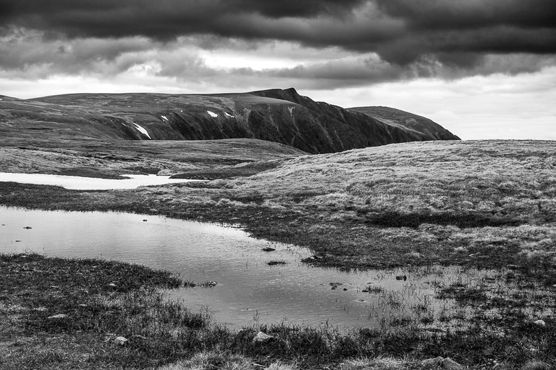
There is no doubt that the summit of Carn an Fhidleir lives up to it’s reputation for remoteness; even the cairn is a bit small and insignificant. The big boys of the Cairngorms were still visible but growing steadily distant.
Mullach a Clach Blair and Sgor Gaoith:

South west to Beinn Dearg on left and Beinn Bhreac to the right:
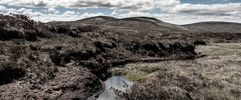
The next section saw me heading west, initially over wonderful springy dry moss, then dry peat hags and pools of green ooze, before swinging south-west to the peaty bealach leading to the ascent of Beinn Bhreac, the seventh tallest Corbett at 912 m.
Typical of the terrain:
A long but steady plod saw me to the summit of this rounded hill. One of the most remote Corbetts, it was certainly easier to go over it then to go round it. And so worth it, what a spot. It reminded me a little bit of Fionn Bheinn in the north-west; not a particularly interesting climb, but a stunning central viewpoint for surrounding hills: Cairngorms, Atholl Munros, and the central Highlands all in sight. And of course, being a Corbett, I had it to myself. To Beinn Dearg:

Carn an Fhidleir and distant Cairngorms:
The next, long section of the route was the descent to Glen Bruar. Initially a straightforward drop off the hill, then a seemingly long and tiresome traverse across the now traditional peaty and boggy bealach, to find a path down, as marked on the map. I found the topography a little confusing as I hadn’t paid enough attention to the map contours, and didn’t initially realise that I was looking for a path that actually went up a glen, not down, and crossed a watershed before dropping to Glen Bruar. The path to be found is up the glen to the upper left.

Back to Bheinn Bhreac from the bog:

Fortunately the nav was working satisfactorily though, and I found the path, which was really no more than a grassy track, until it upped it’s game to become a decent stone construction down to the glen.
This was turning into a long, hard day but immensely satisfying. The solitude was soothing – I hadn’t seen anyone since Carn an Fhidleir – and late afternoon sun kept these old bones warm and happy.
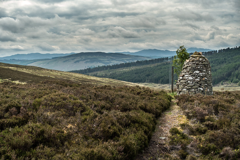
One more sting in the tail remained though. After passing Bruar Lodge, flying a merry Irish tricolour for some reason, the path then took a short turn uphill, throwing in a fair amount of bog and ooze, before finally dropping down to the bothy at the Allt Sheicheachann, on the main route up to Beinn Dearg. It had taken me 10.5 hours to get here, a lot of pathless peat and bog to traverse.


I used the table outside the bothy to cook a meal, but went a few yards up the track to find a decent spot for the tent, I had no intention of using the bothy given the circumstances, and I generally prefer to camp anyway. Once again, it was a peaceful spot, all the Beinn Dearg walkers long gone. Lovely.

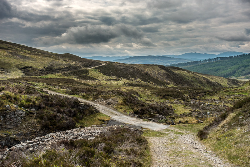
Day 4: Allt Sheicheachann to Blair Atholl station (10.7 km, 234 m ascent, more descent!).
Nothing much more to add, other than a pleasant jaunt down to civilisation, passing a few folk on mountain bikes on the way up to Beinn Dearg.

There are some advantages of taking the train home, not least the ability to enjoy a couple of beers in the Bothy Bar of the Atholl hotel next to the station, as well as good grub. In addition, the train journey is about the same length as the drive, slightly cheaper than the petrol (if you’re canny when buying the tickets), and little concentration from tired eyes is required. Worth thinking about for some hill trips.
Overall, I was blessed with excellent early June weather, no midges in sight, three excellent wild camp spots and some very remote Munros ticked off (and a bonus Corbett). What’s not to like?! Ok, maybe the toilet facilities … but that’s about it!
