free to be able to rate and comment on reports (as well as access 1:25000 mapping).
A weekend on my own - not the dazzling weather I was hoping for, so a 'Plan B' kind of trip - I was quite surprised to see just how many Simms I have still to do in Area 1, so this would be an opportunity to do a few, as well as a nominal couple of Corbetts to keep the numbers ticking over. I'd drawn up several possible routes for these hills, which overlap to some extent, but chose what I considered to be the more efficient approach, walking in from Glen Quaich in a big loop, then driving to Newton Bridge to do a circuit from the Sma' Glen, somewhere I'd never been before.
I headed up to Amulree on Friday morning, dismayed to find there are no petrol stations in Crieff - that'll teach me not to fill up before I leave. I'd intended to start at Auchnacloiche, but found parking there difficult, so parked at the start of the private road to Turrerich farm instead and modified my route a little. It's Perthshire - so plenty of hill tracks, notices and electric fences

Track for the initial section to reach Creag Choille then some heather bashing on my way over to Meall Odhar - I was a little confused where I was going and wondered, looking at the hills over to my right (Meall Dearg) why I wasn't doing them too...already done

Sheihallion was in sight up to the north, that familar outline. I then headed towards part of the giant Calliacher wind farm which made the going easier...Meall Dun Dhomnhuill, electric fences, then a fence line to follow back to the road. Another track up to Meall a'Choire Chreagaich and a change of tracks to reach Creag an Sgliata. I was getting concerned about the strength of the wind high up - knowing the next section would take me up to an 800 metre plus plateau, where camp spots would be questionable. In the end I found a sheltered spot on the side of Creag an Sgliata and pitched camp much earlier than I had intended, at around 5pm. In bed for 6
 A78A89EF-23E5-498C-B7EA-B1791ABF0EAA_1_201_a
 by
Al, on Flickr
 655BF246-F486-4375-B899-6D8845FE135B_1_201_a
 by
Al, on Flickr
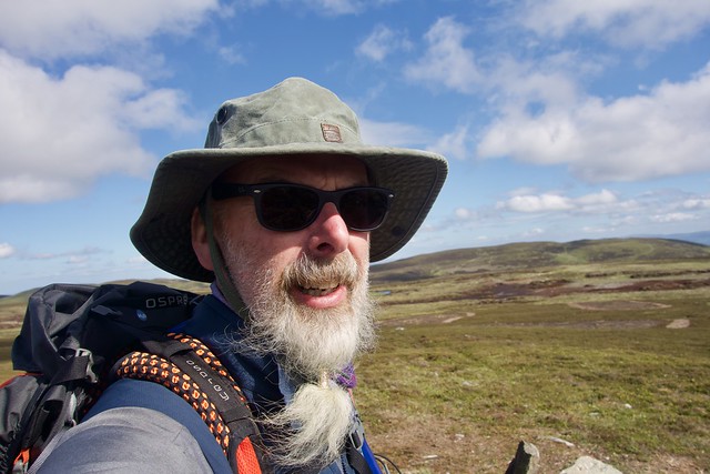
Windy!
 EBABCE0C-1015-4335-B741-52B0EFC392F3_1_201_a
 by
Al, on Flickr
 7947AD48-2E66-414F-9BEE-84D613443AAB_1_201_a
 by
Al, on Flickr
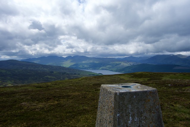
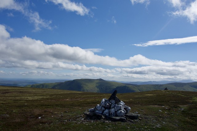
Cool overnight, quiet though. I packed up and set off up the slopes of A'Ghuiseid, helped by a mix of deer and ATV tracks, servicing the ubiquitous gross butts. Up on the plateau it was still windy - I headed across to Creagan na Beinne which we'd last done from the top of Glen Almond. Nobody about. Bak to the ridge and a long walk along track which was pleasant - I headed off to include Garrow Hill and the two Simms on Meall nam Fuaran, before heading down the back of that hill to reunite myself with the car. It was now 1pm, the glen was busy with another half dozen cars squeezed in around where I'd parked. Time to get out of here...
Creagan na Beinne
 9BCF1263-A4FA-4730-9433-92E8EA514C0E_1_201_a
 by
Al, on Flickr
 8AAD4E16-4780-46BC-BC7A-ABE70F15BA71_1_201_a
 by
Al, on Flickr
Yesterday's wind farm
 D68E28AC-29CC-47A7-BD97-47CC1CDC8E64_1_201_a
 by
Al, on Flickr
 00D6BCF5-A4F7-42FD-A33B-9D7A3FB08CF9_1_100_o
 by
Al, on Flickr
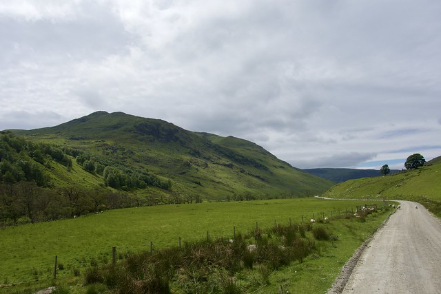
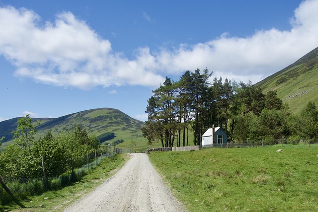
I drove the short distance to Newton Bridge, hoping there would be parking spaces, fortunately there were. Refilled my water bladder, sadly had no more food to slip into the pack, and set off up the Sma' Glen. I wasn't entirely sure what route to take and whether I'd include Ben Chonzie in my hills. The glen is well surfaced, popular with walkers and cyclists (at least at the eastern end) and progress was good. The sun threatened to come out and I had to stop after a few miles and apply suntan lotion to my legs. I was undecided whether to head for Larichlaura or Larichfraskhan - in the end the thought of a proper track right up to the summit os Auchnafree Hill swayed my hand. I passed by the remains of a chambered cairn and standing stones, with the "Millennial Circle" on my left. Time to get my feet wet - I crossed at the ford, taking shoes and socks off and relishing the warm water on my feet (I could have walked a bit further and taken the track over the river Almond, but I enjoyed the plunge) My feet were almost dry by the time I walked a hundred metres to sit on a rock and put my boots back on.
 B871BB39-D5C8-4DB7-9B08-5511F518D8AD_1_201_a
 by
Al, on Flickr
 7305F9F1-D893-4168-BEFB-B0D35E7E9F53_1_201_a
 by
Al, on Flickr
 FF32422B-1CF7-48AC-B99F-1C41AE89AF78_1_201_a
 by
Al, on Flickr
Chambered cairn remnants
 11BEFCA3-353D-4A1B-B609-A0E4D0530245_1_201_a
 by
Al, on Flickr
 4652BF94-4AB3-40A2-9A67-C2C7A21A9057_1_201_a
 by
Al, on Flickr
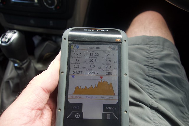
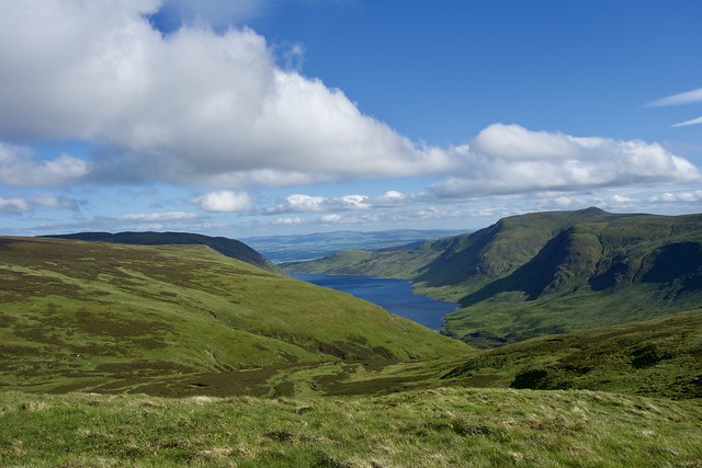
Then a steady uphill of almost 600m. Nice broad zigzags. I was still worrying about where to camp, given the wind was, if anything, stronger than the previous night. I found a dried up peat hag almost at the summit of Auchnafree which allowed me to pitch in relative shelter. Having checked the weather forecast it seemed that there would be lovely late sunshine tonight, but clag tomorrow from early on - so I made the decision to pitch and have my tea now (it was just gone 5pm) then head over and do the two Simms on the way to Chonzie as an out and back, without the encumbrance of my full pack. Having only done Auchnafree Hill in winter conditions and from Loch Turret before it was good to be able to explore more of the surroundings. A'Chairidh was first, with good views to Loch Turret, then a stomp across the Moine Bheag (where I could have camped out of the wind) before steeply ascending Biorach a'Mheannain. Hot work, even in the early evening sun. I decided against continuing on to Chonzie which would have added another 3km and 250m ascent to an already long day. I more or less traced my steps back and was relieved to get into the tent and curl up with a good book. Nearly 40km today and over 2000m ascent- my biggest day for a while. As I sat having a snack, I watched a golden eagle circle around overhead.
 3256547C-E39D-4618-82DA-9777F56987AB_1_201_a
 by
Al, on Flickr
Out of the wind
 54F2BFEB-1C3C-412B-A71E-4C71A3DAB8AF_1_201_a
 by
Al, on Flickr
Auchnafree
 04CB6CE8-406E-4455-86E5-255FF3F58229_1_201_a
 by
Al, on Flickr
 8C2542E9-D1D7-42A2-A196-00D3C9EEBBA0_1_201_a
 by
Al, on Flickr
View to Chonzie
 559EC3AB-B874-455C-B9EF-9C8F053CB5DF_1_201_a
 by
Al, on Flickr
Biorach a'Mheannain
 4A6364BB-FFDE-418B-A131-A5CEF71DE4D7_1_201_a
 by
Al, on Flickr
Loch Turret
 E368C1BC-79BD-49AB-900C-2F1615B24981_1_201_a
 by
Al, on Flickr
Despite the long day, I didn't sleep very well, the wind was blowing over the top of the tent and as predicted the clag came down during the night. Having done a lot yesterday, I knew that today would be a shorter outing, although there wouldn't be any track to follow, and I expected to be doing a fair bit of it in clag. Got my things packed up and sett off eastwards, initially with the luxury of a fence line to follow, but soon it was find your way in a semi straight line over a multitude of peat hags. I'm so glad I chose this route when it had been dry for a while - in wet weather it would be monstrous. Lots of hares coming out of the peat hags, sounds of shotguns not far off - bloodthirsty people killing things.
Right about the morning clag...
 119AD9CB-B88E-4A5A-BE6B-DB342D7A2873_1_201_a
 by
Al, on Flickr
 F2B31B3A-2513-4A14-A649-66CB137C27F8_1_201_a
 by
Al, on Flickr
I eventually found the summit of Stonefield Hill, which isn't even named on the map - one lumpy prominence surrounded by many other ones rising out of the mist. As I picked up the Ridgeline towards Meall Dubh I dropped below the level of the clag and orientating myself was somewhat easier. At the bealach between meal Dubh and Meall Tarsuinn I met a man on a quad machine, who looked surprised to see me. He was going around checking the cameras he had, and was interested whether I'd seen many hares, which I had - said their numbers were really down last year for some reason. We chatted for a bit about what other wildlife I'd seen - he reported that the parking area at Newton Bridge had been busy last night with "pleasure seekers" (not actually the word he used
) and I commiserated with him about the influx of party animals into the countryside - find a nice spot and trash it...
I continued over Meall Tarsuinn then onto The Scorrie, which looked quite intimidating from the initial angle of view. There's a deep cleft running between Tarsuinn and the Scorrie. Up to the summit then steeply down the northern flank to reach a grassy track taking e back to the car. Not even mid-day! The clouds were down and it was starting to drizzle, otherwise I might have looked for something else to climb - instead I made it back home where the sun was shining and caught up with some garden duties instead.
The Scorrie
 90DB58E0-CA9A-41D2-BD34-6CC7B44AACC7_1_201_a
 by
Al, on Flickr
Pretty - I don't know what they are
 C94F3C17-4C38-44EB-BFB4-CA7A2A056026_1_201_a
 by
Al, on Flickr
Sma' Glen
 82AA76A0-B7FE-4366-82F7-0FBCCE27EB3A_1_201_a
 by
Al, on Flickr
..
 0C0ED7CD-D3A1-4AFB-BB38-5A09B6DCEFEE_1_201_a
 by
Al, on Flickr
 879046A6-81FB-4979-BB5A-598FA3063F80_1_100_o
 by
Al, on Flickr
