free to be able to rate and comment on reports (as well as access 1:25000 mapping).
I've been absent from this website for a number of years, having been hopping about first in Australia and then in Norway. To my dismay, I find myself back in Lincolnshire for a time and I've been coping by planning all sorts of walks in Scotland. It was in this process that I realised that four years ago today I was on a train heading into my beloved highlands to embark on what would be my first serious multi day walk. It was a route I'd never written up on here so I thought I'd take the opportunity for a wee throwback. The route I would go on to walk is below, the peculiarities of which will become clear later.
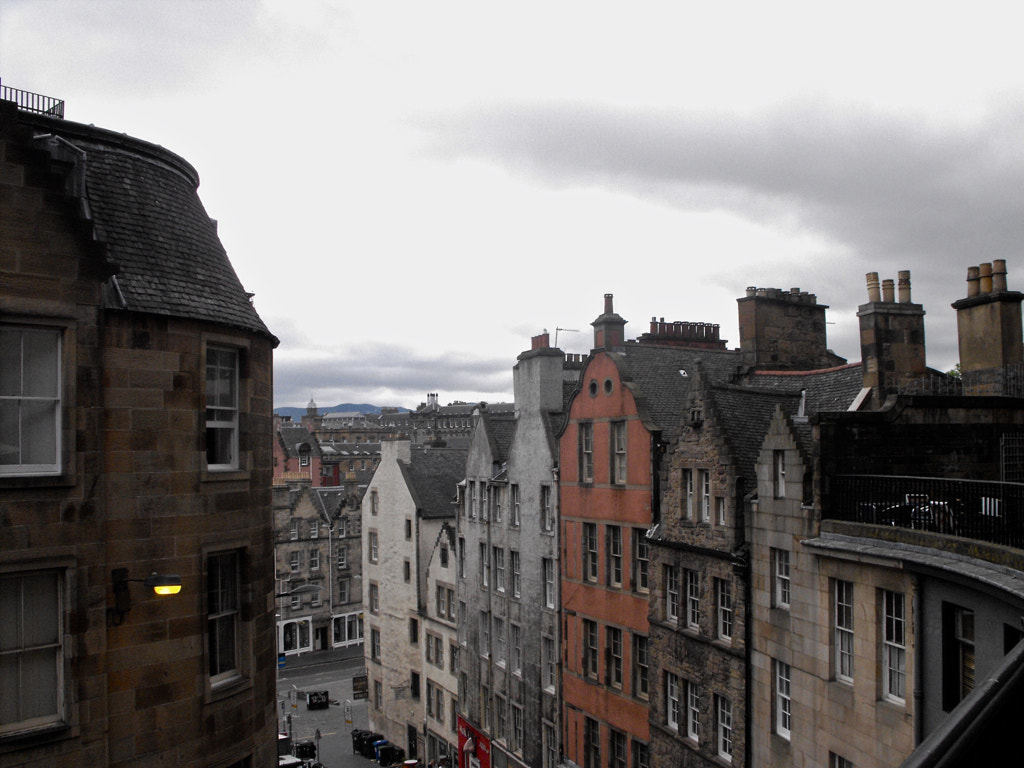
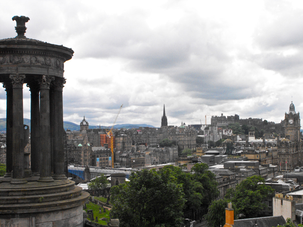
My time in Scotland began with two hours to waste in Edinburgh, this was more due to the timing of the cheapest trains than anything else but I certainly wasn't opposed to the prospect of a short while in one of my favourite cities. Wandering about a city as hilly as Edinburgh with a heavy backpack was perhaps the first ill advised decision I made in my inexperience, no doubt rest would have been more sensible, but I'm a long way from regretting my exploration.
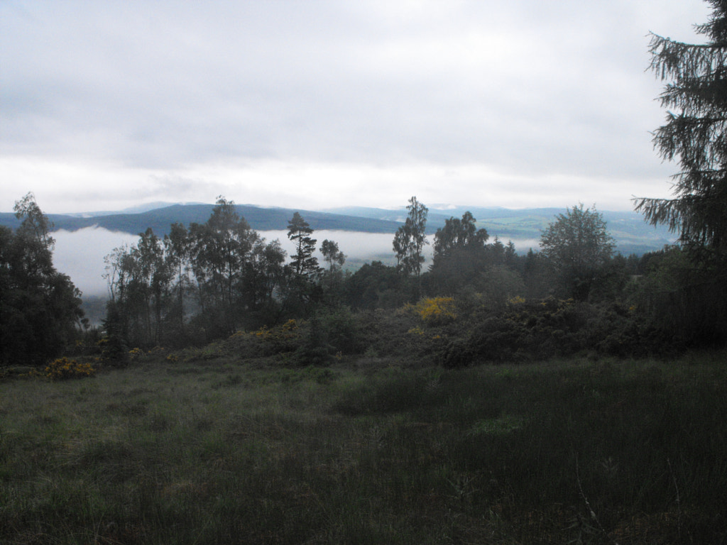
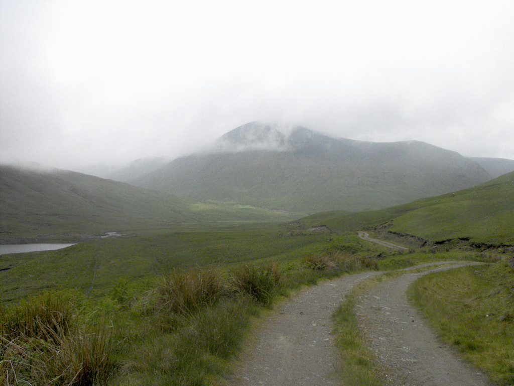
From Edinburgh it was on to Pitlochry. The journey was no West Highland Line—that would be my return—but it has its own beauty, with the views across Stirling to the Ochil Hills followed by the green and increasingly moody way up Strathtay and across the Highland Boundary Fault. The Highlands, more than anywhere else I've yet been, have always felt like home to me, and despite the intense discourse about a local secondary school musical taking place amongst a group of girls seated near me, I was in a contemplative mood when I disembarked the train. This, however, was short-lived. I quickly discovered on the ascent out of Pitlochry that I was not nearly as fit as I'd hoped, or at least not used to walking with a pack, and by the time I reached the plateau between Dunfallandy Hill and An Suidhe I was exhausted. This might not have troubled me too much but that my subsequent search for a campsite was plagued by bog and midge alike. In the end I had to walk on and leave the forestry behind where I found a decent spot overlooking a tendril of cloud snaking its way up Strathtay. Though tired, and a little frustrated, there was still a certain thrill at setting up for my first ever wild camp.
The next morning I woke well rested for what I anticipated would be a long, but easy day. I hoped to get as far as Kenmore and the ascent from Aberfeldy to the Falls of Moness was the only obstacle of any note along the way. The weather had brightened a little since the evening before, though a film of grey still covered the sun from sight. My plan was to follow the Rob Roy Way for the majority of the day, a trail that has always confused me a little. It seems designed as though somebody said 'plan a route from Drymen to Pitlochry, but make sure to do it in the least interesting way possible'. Least interesting in this part of the world is still very interesting though. Scotland shares with Norway and a handful of other countries that trait of almost always being beautiful and very rarely ugly. As such I was pleasantly surprised by this stretch, and Strathtay is perhaps one of the pleasantest routes to walk from the foothills into the Highlands proper.
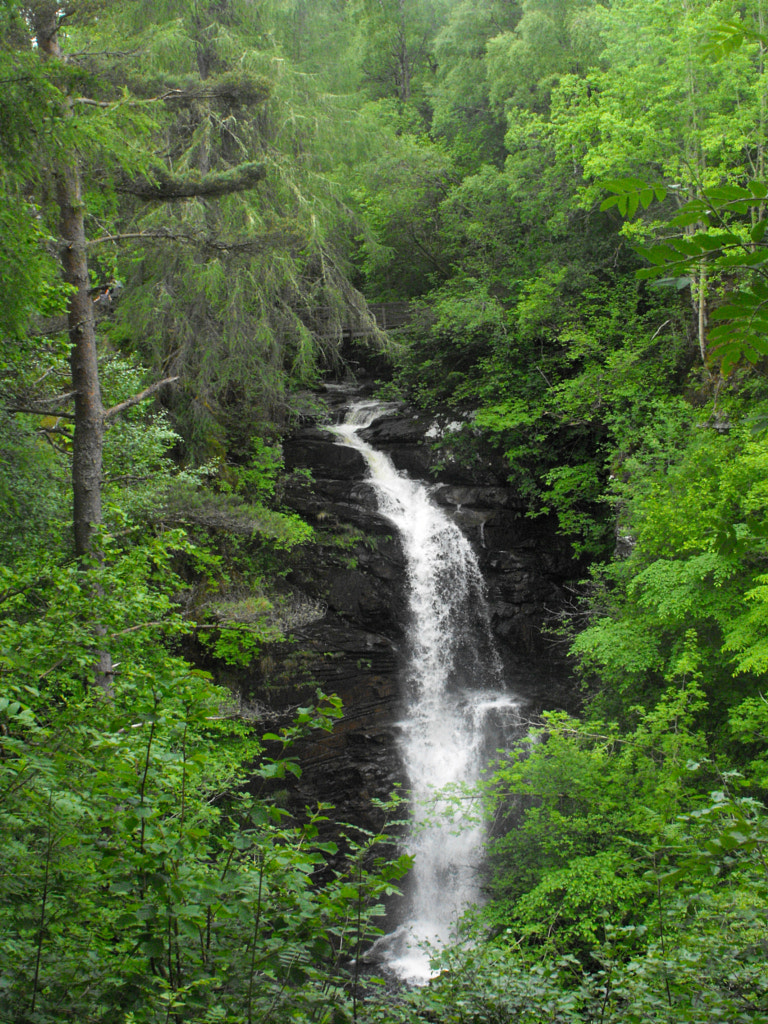
The first half of the day followed the swift Tay waters upstream, and I had half a hope of seeing some of the local beavers making their way here and there. There was no such luck on this occasion though, and I settled for the accompaniment of herons and the usual songbird suspects. I was soon in Aberfeldy for an early lunch at the Breadalbane Bakery and Tea Room, seemingly a more local haunt than some of the other cafés in the town. The land from here onwards was not unfamiliar to me—I'd camped with my family a number of years before at Milton Morenish, when we'd visited Aberfeldy and the falls—and I returned to the gorge and the woods ascending to the Falls of Moness as to an old friend.
It was from here that the Rob Roy Way surprised me most. After climbing out of the Moness woods I began to skirt the edges of the moors that hem Strathtay in from the south. Scattered birch plantations sheltered me as the weather improved and views across Appin of Dull to the knotted moors of Meall Tairneachan, and eventually towards Sìdh Chialleann, were ever present. But for a short stint of ugly conifer forestry at Bolfracks this continued until I descended to the strath at Tullichuil. After a short stint across the Taymouth Castle estate I found myself in Kenmore with many hours of daylight to spare. I probably could have continued on to Glen Lyon, but having already covered a decent distance and with a big day planned tomorrow I decided rest was in order. I stopped first by the Kenmore Hotel for a wee drink, where a group of Germans was already seated outside, the first of many I'd encounter. After that I set off to search out a suitable camping spot.
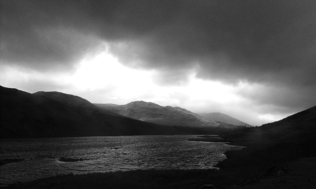
No doubt I'll incur the wrath of some by admitting to where I camped that night, and I fully admit that I was stretching the limits of 'wild camping' somewhat (though not so much as those who park a campervan in a lay-by somewhere and call it 'wild camping'), but I won't pretend to have any shame about it. My chosen spot was a little way into the woods on the shoreline at Kenmore, just out of sight of any buildings. The wind clattered unhindered across Loch Tay whilst the clouds clung stubbornly to the Lawers range in the distance, leaving my campsite dappled in sunlight and mercifully midge-less. Like the Falls of Moness, the loch and I are old friends and we shared a quiet evening together, missing only the swallows that had always accompanied us before with their staccato flights across the water's surface.
In the morning the rain had returned, and all sight of the Lawers range was shrouded from view. I packed up, a little disappointed that the weather had turned this way again. My plan was to ascend Meall Greigh and as many as the other munros as I could before the evening, before camping high and completing the rest of the ridge before descending to continue along Glen Lyon the next day. The prospect of a high camp in these conditions didn't exactly thrill me but I set off anyway, hoping that Scotland's inconsistency would turn to my favour today.
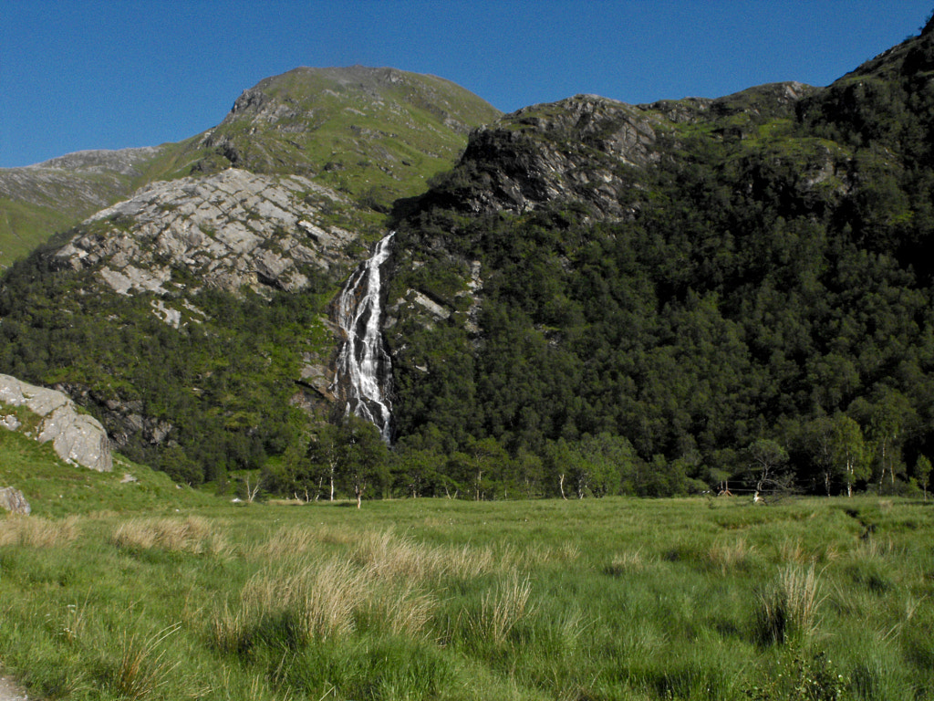
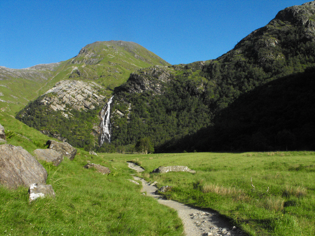
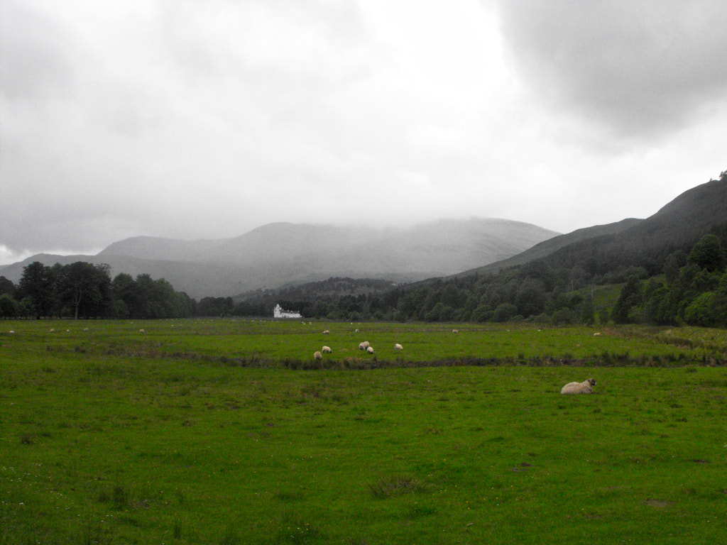
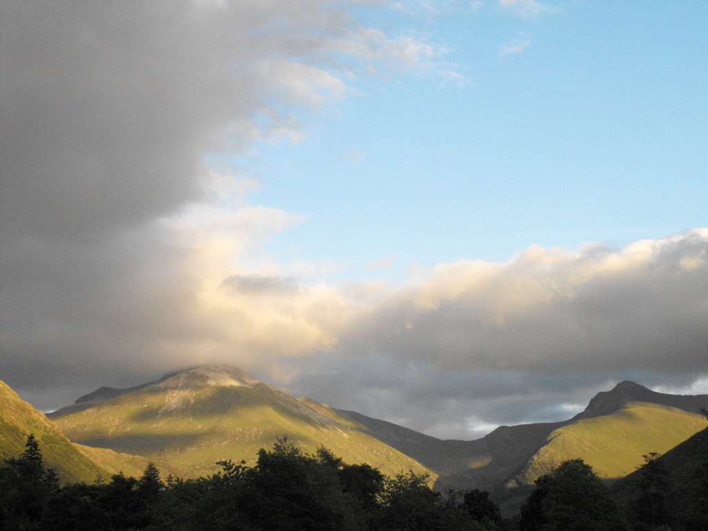
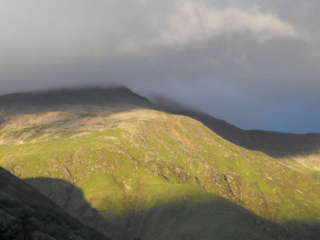
There is no pleasant way to walk between Kenmore and Fearnan. The choice is between ugly forestry tracks and the main road running along the north shore of the Loch. I opted for the former only to find it ill kept and blocked by fallen trees at several points. I still managed to make decent progress though and was quickly on my way up the minor road towards Bridge of Lyon. As I look at the map now it seems there is a root up Meall Greigh from Boreland, I'm not sure why I didn't take this at the time; perhaps the forestry track wasn't open. Certainly there must have been some good explanation because I made the diversion northwards to ascend from Creag Mhadaidh. In terms of scenery, I can't imagine there being a finer route up to Meall Greigh. In terms of terrain, it is an abomination. I began by wading through bracken at an impossibly steep incline—steep to the extent that at times I had to cling onto the bracken in order to prevent my backpack causing me to topple over and roll my merry way down into the river. There is a momentary respite after this, where the hill flattens briefly into something grassy and rocky, but this quickly gives way to a devilish combination of bog and thick heather. This was twice as bad as the steep bracken, and with my fitness not where I'd hoped I already knew this wasn't going well. After Lochan Creag a' Mhadaidh a discernible path finally appeared and my hope would have been renewed a little if the weather hadn't turned for the worst at this point. The wind which I had thanked the evening before was now merciless and it whipped the rain into me. The manufacturers of the waterproof I'd purchased in Australia clearly hadn't heard of Scotland as it quickly began to fail and I began to shiver as the rain made its way to my skin. Exhausted, and with little sign of a change in the weather, I looked up towards Meall Greigh knowing I was barely beyond halfway and decided the Lawers range was not to be on this occasion. I set off down Gleann Dà Ghob disappointed in myself and my fitness as much as the weather. However, I knew I had made a sensible decision, and a golden eagle came to temper my unhappiness, circling a ways above my head before it disappeared beyond Bealach Craig a' Bhannaich.
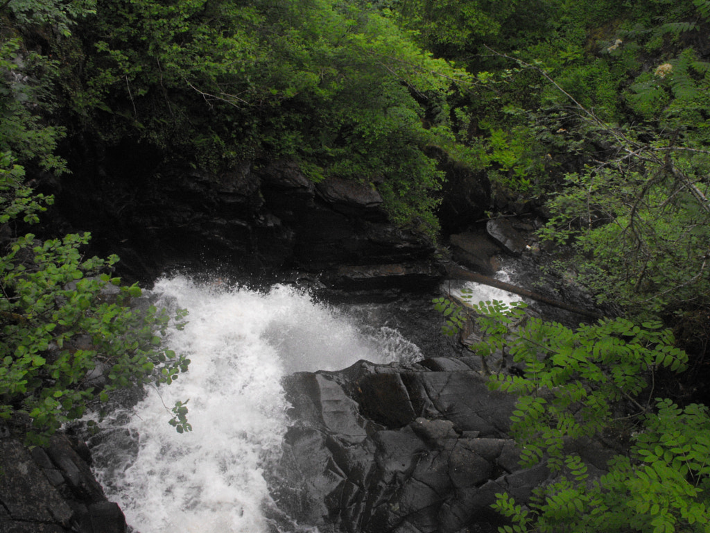
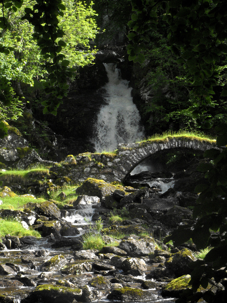
When I reached the glen at Blackcroft I was introduced to a new extent of the term 'microclimate'. It might have been a different day entirely, sunlight pattered the ground there and clouds wove their way across a blue sky. On closer inspection though, they always kept the mountaintops in their midst, reassuring me of my decision. I ended the day with a short walk along the road to Invervar, pausing here and there to admire the waterfalls, before I found a place to camp a little ways from a farm track, close to the river.
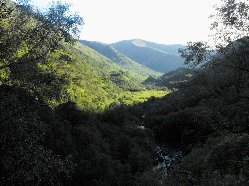
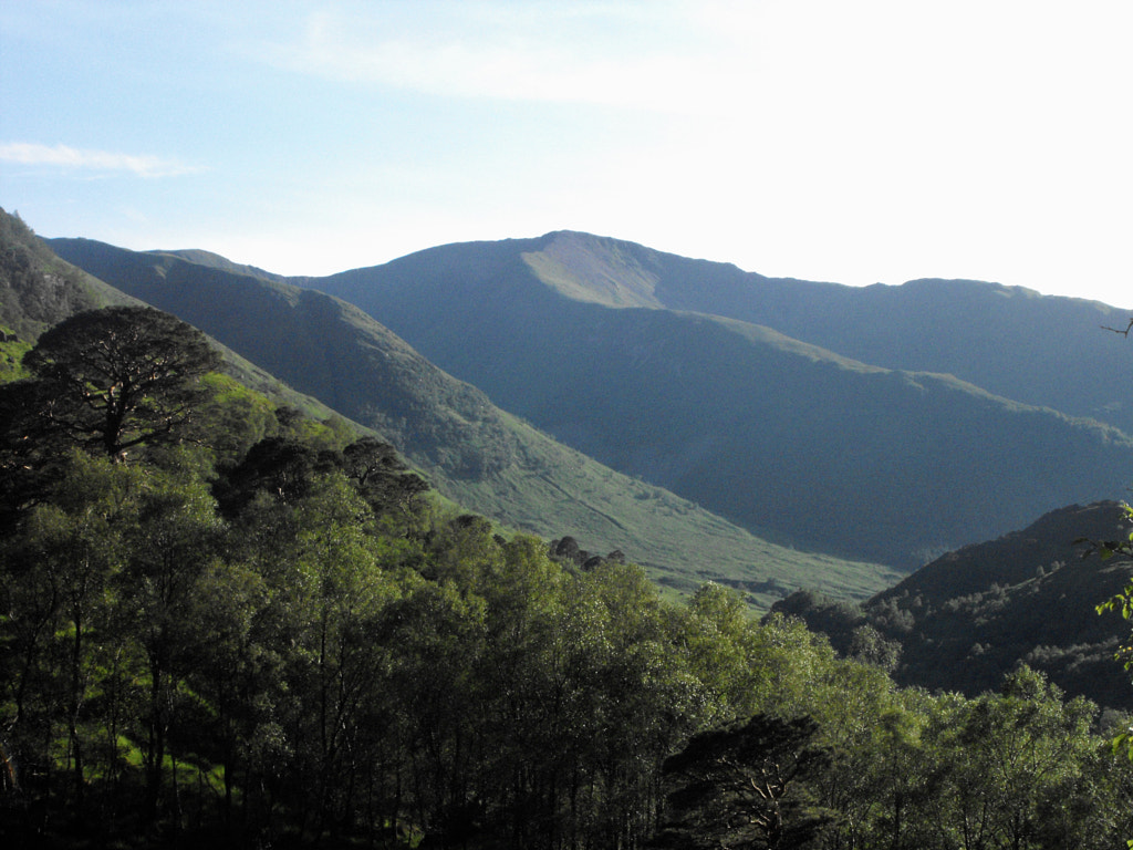
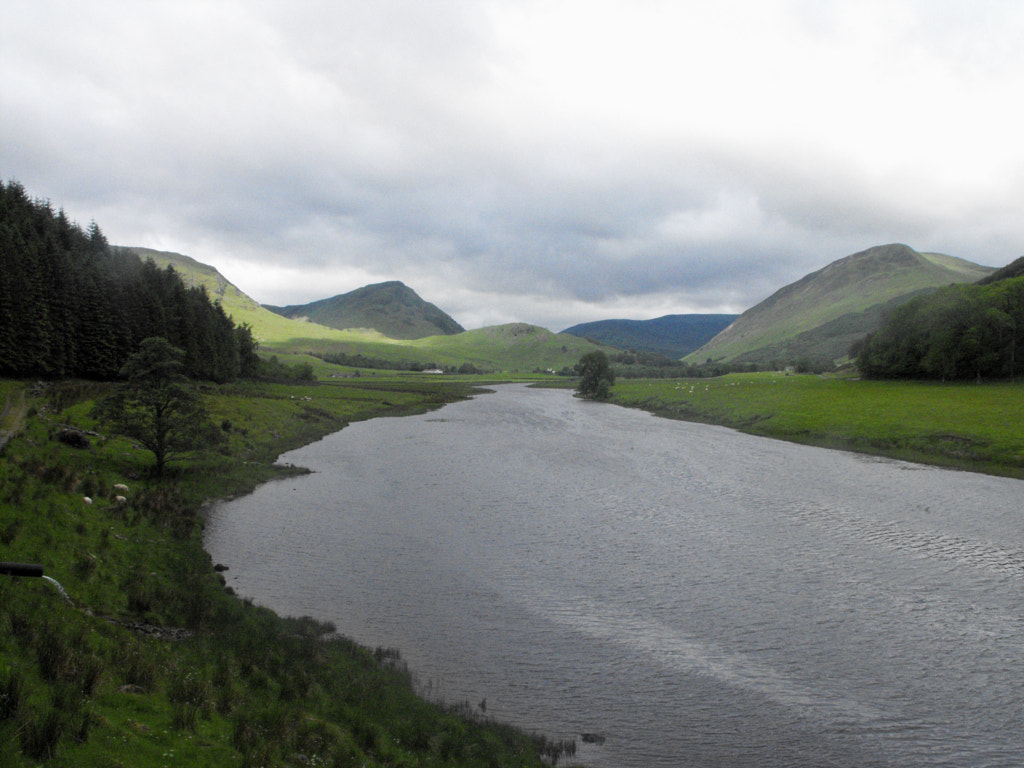
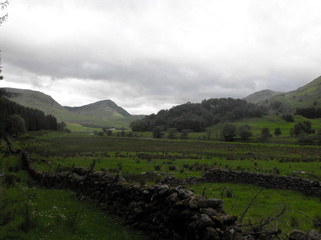
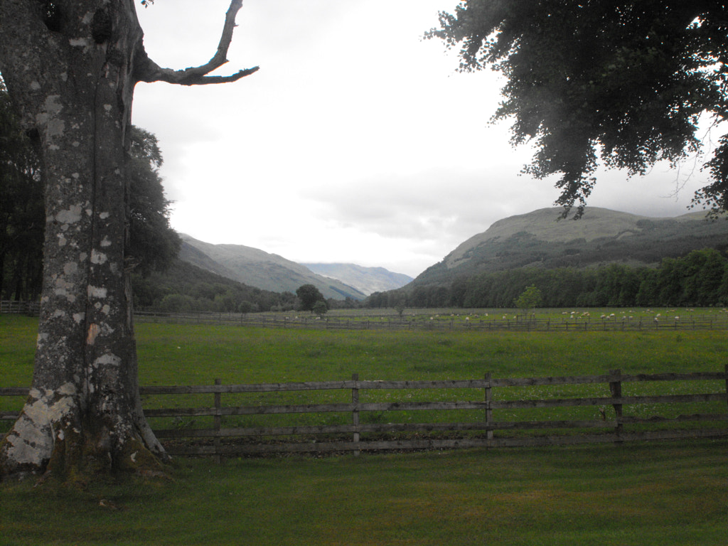
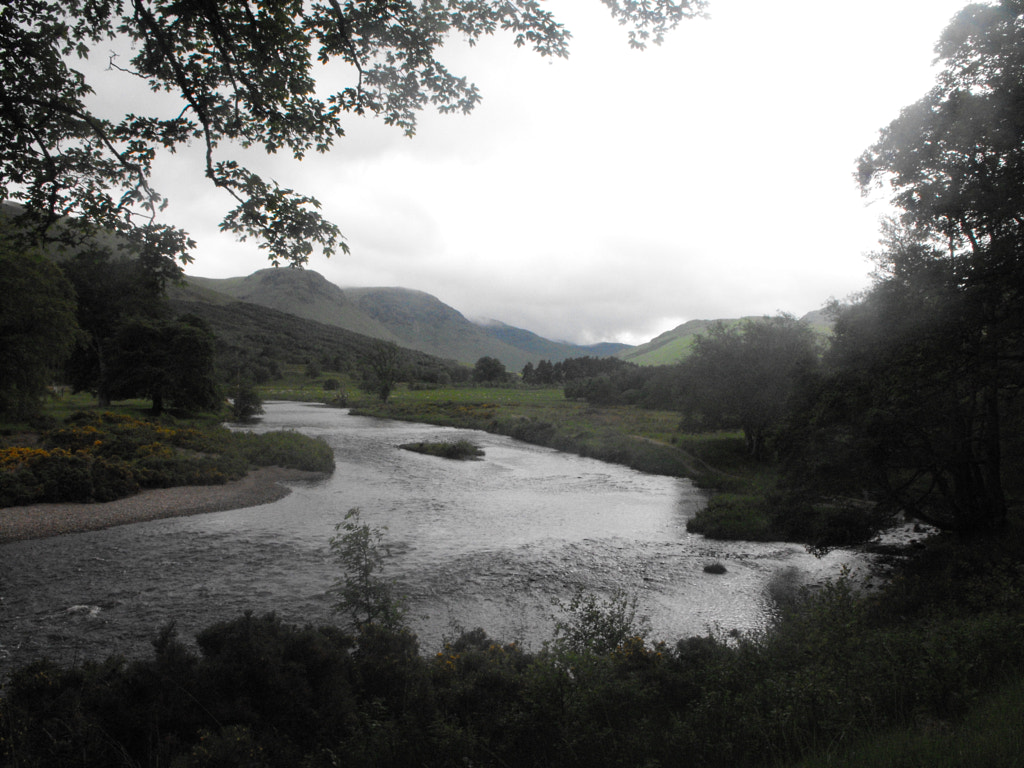
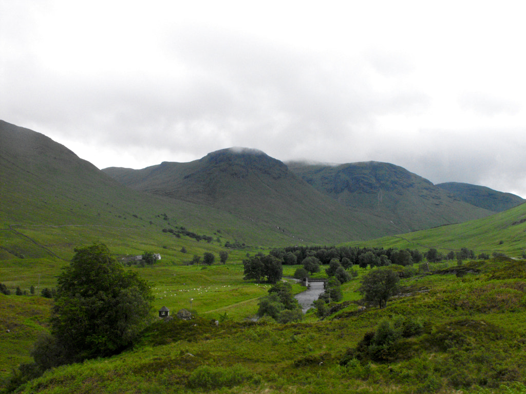
A little disappointment lingered the next day as I set off along the glen. But the sky was grey with clag still on the tops, and despite the absence of mountain walking the day that followed remains one of my favourite in the Highlands. I'm unsure if Glen Lyon is my favourite glen in Scotland, partly because I'm yet to visit the likes of Glen Affric and Glen Sligachan, and partly because another glen that features later is certainly in contention. However, it is undoubtedly Scotland's most under appreciated glen. A fact I'm glad for, I certainly wouldn't want the crowds of Glen Coe to appear there. There is little better to convince me of this than walking almost its entire length (though I don't doubt a cycle would probably do the job too, and do it much quicker). In its lower reaches, it is like the very best of Cumbria. In its middle, it acquires its own drama and Romanticism; comparisons to Norway approach but fail to name the peculiar beauty of this place. Whilst in the upper part of the glen, in spite of the dam and the little road and the dam that do their best to encroach, there is a wildness and a solitude all of their own. Ancient woodland clings on here, always a sign of the liminal space; the wild on the edge of the not-wild; the fae breaking into the modern and unmystical. By the time I was halfway along the track between Inverinian and Roromore I was already enraptured.
My love for this place would only increase upon arrival at Bridge of Balgie. The tea shop, that is also a post office, that is also a village shop is made for the word delightful. The tea itself was one of the best cuppas I've ever had, and I was shocked to discover from the shopkeeper (at the time, an inimitably pleasant woman whose name I didn't learn) that they just used Tetley tea. The reason, I learned, for the taste was that the water in Bridge of Balgie isn't mains water but comes straight from a boring hole in the mountains. Even the water there, it seemed, had an otherness about it. After lunch I set off across the beautiful Meggernie Castle estate satisfied that I hadn't really missed out so terribly by failing on the Lawers range.
After Meggernie came the only real unpleasantness I experienced in all of Glen Lyon. I made my way to the farm at Gallin, passing between the buildings with a friendly hello to some men I saw and went south on a track which led to a footbridge marked on the OS map. I don't know if the footbridge has returned in the four years since then and now but at the time there was nothing of the sort there. I tried, to no avail, to make my own way through the woodlands along to another footbridge marked a little further upstream. But it was dense and difficult and eventually impassable, and I was forced to turn back. This was frustrating enough but then I encountered the men I had said hello to earlier again. They stopped me, and asked if I was lost. Their tone, and the smirks on their faces were already patronising and, a little taken aback, I answered that I wasn't. I held up the map, as though to indicate the extent of my not-lostness. This didn't dissuade them however, and they asked where I was going. I gave them a vague indication and then, speaking as though I were a child, they pointed down the track and told me that would lead me all the way off that land and onto the road which went all the way to the end of the glen. I've read things before about unpleasant landowners in Glen Lyon, who don't much likes Scotland's access laws, and I wonder if this was them. I thanked them anyway and continued up to the road, knowing it was probably my only option for the rest of the day now.
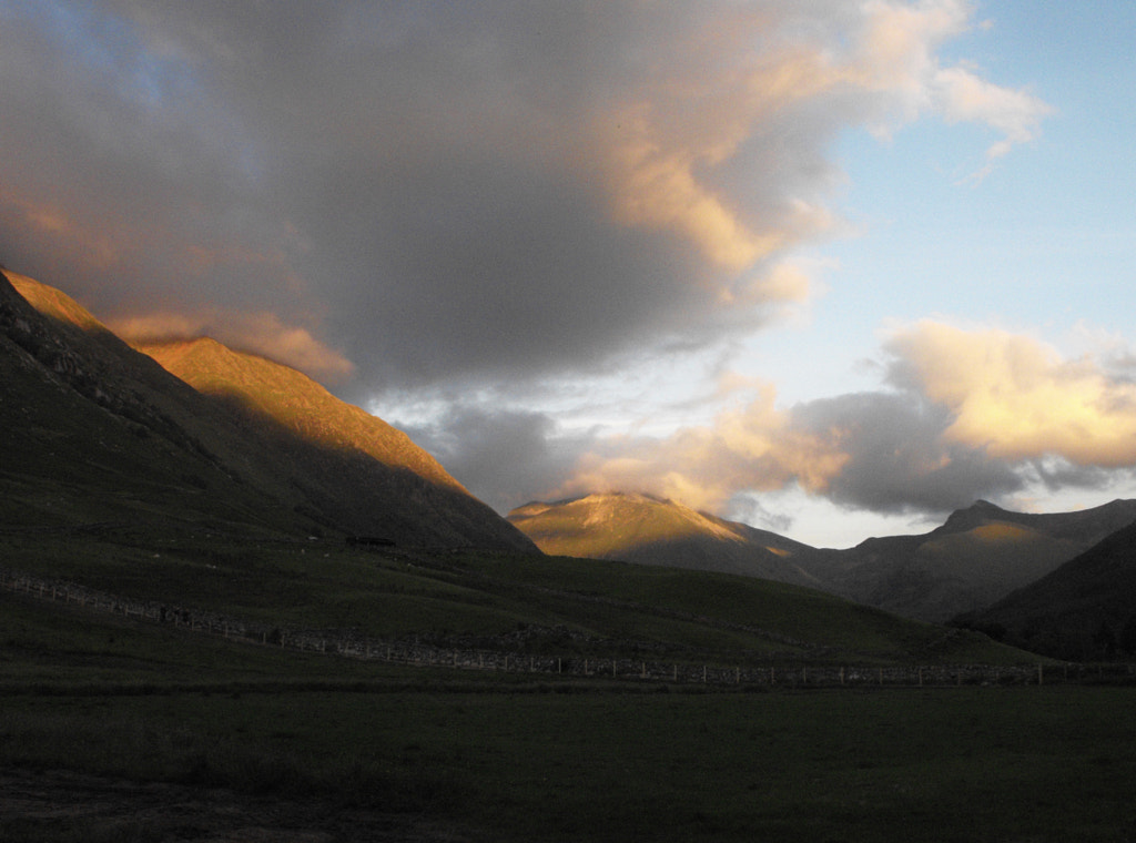
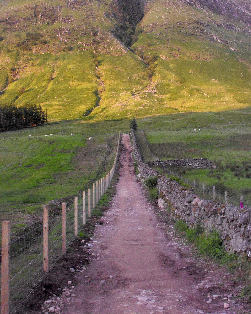
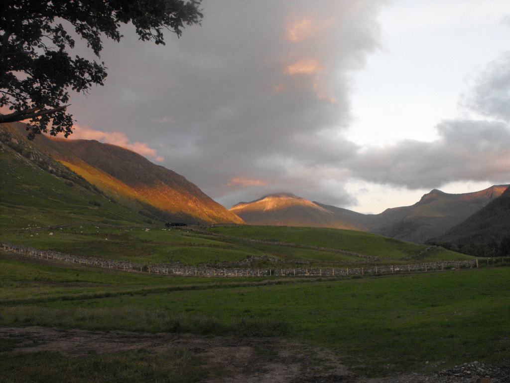
The glen must have heard this encounter because from then on the weather began to improve. The clouds parted over me whilst still insisting on brooding about the mountaintops, and the sun shone with the sort of light you only ever get in Scotland, and it danced across the slopes of the mountains for the rest of the day. As road walking goes this was as good as it gets too, it was small and extremely quiet, and the constant beauty around me distracted me from the tarmac until I made camp by Stronuich reservoir at the end of the day. This was my favourite camp yet. The wind made pitching a little difficult but once I was set up I watched the clag arguing with the evening light on the crags and slopes of Meall Ghaordaidh above me, satisfied that this trip would be worth it if only for a day like this.
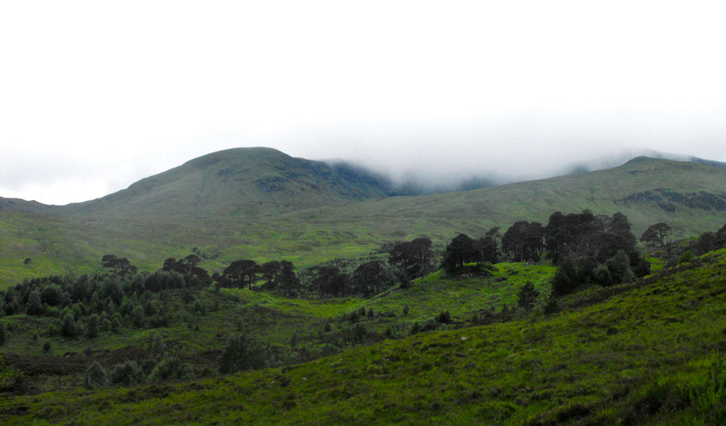
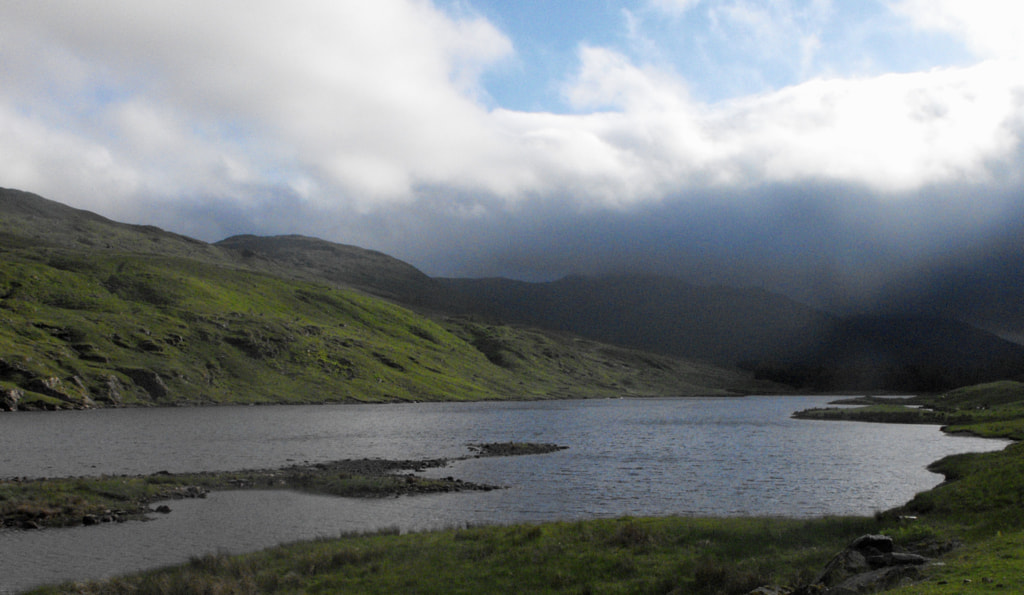
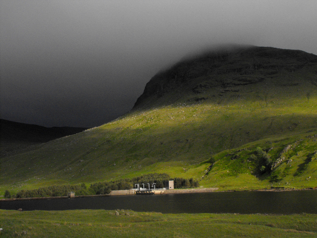
The next day I woke to changeable weather. The wind was still about and occasional brighter spells were flitting through the glen. This gave me a little hope because this was planned to be the second big day. I would ascend Beinn a' Chreachain and then follow the ridge to take in Beinn Achaladair and Beinn an Dothaidh before dropping down and making camp somewhere close to Bridge of Orchy. I continued along the road and soon reached the Loch Lyon dam where I ascended up to the lochside. A large herd of highland cows lined the track here and it was perhaps the most cautious ascent I have made of any slope; they're all cute until you have to make your way through 4 of them on either side, staring you down with those horns. Anyway I survived the cows and made good progress along the loch. Being a reservoir, it's not Glen Lyon at it's prettiest, and but for the mountains around it would have been quite a dull trudge to the end. This was only exacerbated as the weather worsened, complimenting spells of grey cloud with spells of rain. I was feeling fitter by this point though and I resigned myself to a clag covered but manageable mountain walk. Finally I reached Gleann Meurain which made for a surprisingly beautiful end to my time in Glen Lyon after the dullness of the loch. Beinn a' Chreachain loomed above and I steeled myself for what was obviously going to be a difficult ascent.
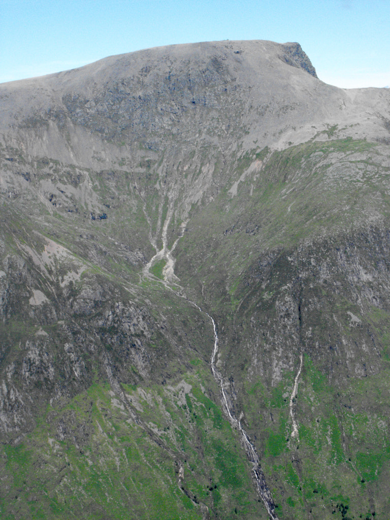
I don't know if there is a path on the Glen Lyon side of Beinn a' Chreachain. It seems unlikely and regardless I didn't find one as I began to trudge my way northwards up its slopes. The ascent was unrelentingly steep and made up of a constant, energy sapping squelch underfoot. I took my time though, knowing my walk down Glen Lyon had set me ahead of schedule and I could afford to be a little slower here. The mountain proved a distraction too. Even in poor weather it is truly beautiful from this side, and the crags and waterfalls and lochans of Coire Mhuiltean and Coire Dubh Beag glared out at me from underneath the clag. My resolve took a hit though when about two thirds of the way up the ascent, the weather hit. 'Hit' is the right word too as the wind battered me with worrying speed, seemingly from all sides. The rain too grew heavier and the Australian waterproof was soon failing once more. I pressed on upwards though, perhaps it was the remoteness, perhaps it was the disappointment of the Lawers range but I was determined to reach the top. By the time I gained the ridge I couldn't see more than 10 feet in front of me through the clag and the wind was whipping up stronger than ever from Rannoch Moor to the north. Though I'd reached a path by this point and physically things were much easier I grew genuinely fearful as I went over some scrambly section above the crags, buffeted by the wind. As though choosing its moment for dramatic effect that was when the wind pulled the rain cover off of my backpack. It lingered within sight for a moment, tempting me, before another gust pulled it down the hill and out of sight. Soon after this I made the summit of Beinn a' Chreachain, resting only for a moment on top before I set off again.
Then came the major mistake of my trip. Thinking I had my sense of direction in place, I set off on the clearest path down from the summit. I knew there was a considerable decent before the path levelled out into a ridge again so it was a while before I realised something was amiss. The path began to peter out and I realised I'd descended in the wrong direction from the summit. I was on the western slopes, halfway down Coire a' Mhath-gamhna. At this point I began to panic, knowing this was one of the remotest points of my planned route, and probably the point with the fewest options in the way of escape routes. The fatigue of the ascent hit me too, at the prospect of the climb back up to the ridge and I made the decision to come down from the mountain. As I reached Gleann Cailliche though I still had almost 200m of pathless climbing ahead of me to reach the bealach, where I could drop down to the track that leads to Gleann Achadh-innis Chailein. I began the ascent. It was the boggiest terrain I had crossed yet and I really began to feel exhausted. With that, I began to panic more and more, becoming almost convinced that I didn't have enough strength and that I'd be stuck and catch my death. I don't know how much trouble I was really in, but in retrospect it's clear that I was having quite a serious panic attack at the time. Somehow, I managed to push through though and I crossed the bealach and reached the track. But by this point I was cold, soaked through, exhausted and shaken up. The prospect of my original escape plan, to walk around Beinn Dorain to Bridge of Orchy, grew ever more distant. In the end as I took shelter in a sheep shed at Ais-an t-Sìthean, dreading the prospect of returning outside to the wind, wet and cold, I made the snap decision to set up my tent in the barn and finish my day there.
If my camping spot at Kenmore riled you up then I dread to think what this will do. This is clearly not wild camping, and it wasn't a decision made with entirely sound mind. But the prospect of resting under a roof, having a chance to dry my things and not having to walk any further was too tempting.
In the morning the rain still fell heavy outside. My boots were still soaked through. And I was still exhausted and shaken from the day before. Without ever making any real decision about it half the day had suddenly passed and I found myself spending another night in the same place. I was a long way from the delight of Glen Lyon a couple of days before.
Another morning and the weather had brightened a little. My boots were still far from dry but I had recovered a little. So I finally packed up, and started to make my way down the glen to meet the West Highland Way. I was feeling better but I was heavy with anger and disappointment now. It was obvious the rest of my intended route wasn't going to happen after the delay. I was angry at my poor navigation on the summit, angry at my lack of fitness, angry at my mental and emotional reaction, angry at my laziness in wasting a whole day in the sheep shed. But I pressed on with the plan to head down to Tyndrum, have a proper meal and reassess my plan for the rest of my time in Scotland. The West Highland Way might as well have been a travelator after the couple of days before and I made quick progress. The views of Beinn Dorain and Beinn a' Chaisteal, and then those down Strath Fillan lightened my heart a little.
Still I must have made for an odd looking and dejected figure as I sat and ate in the Green Welly Stop. Tyndrum was quite the contrast to the solitude of the last few days. I found myself chuckling as a group of American coach tourists spoke in raptures of how Glen Coe was their favourite place in Scotland, as though it wasn't the only place of any note they'd been to.
It's perhaps worth summarising what my original plan was at this point. Had I made it to Bridge of Orchy a couple of days before I would have continued north and ascended the Black Mount. My planned route followed a horseshoe around the River Bà, taking in Stob a' Choire Odhar, Stob Gabhar, Clach Leathad and Meall a' Bhuiridh before descending to the Glen Coe Ski Centre. After that I would have joined the West Highland Way to Kinlochleven, then crossed whichever of the Mamores I fancied doing at the time into Glen Nevis and catching my train home in Fort William. It would have been difficult to manage this even if I'd only spent one night in the Sheep Shed, but with the loss of an extra day there was no way I would make my train booking. I assessed my funds and made a new plan to take a bus to Fort William and camp for my final two nights in Glen Nevis, using my last full day to climb some of the surrounding mountains.
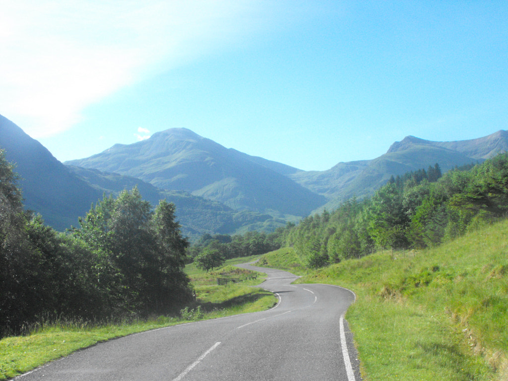
I don't need to tell any of you about the drive from Tyndrum to Fort William. I will only note that the light was as sublime as it can be in the middle of the day. Two teenage girls on the bus responded to this marriage of light and landscape by pointing out that Scotland's scenery "wasn't that bad actually." Perhaps the antithesis to the Americans from before.
The light only improved as I walked from Fort William to the Glen Nevis, and by the time I had set up my tent at the campsite I was met with one of the most incredible evenings I have ever experienced anywhere. I know Glen Nevis can be busy, but as I sat alone on a rock in a meadow at the foot of Ben Nevis, and watched the light arpeggiate across the Mamores, and the birch forests on the mountainside, I could scarcely imagine a place more beautiful. I won't speak too much more about it, this report is already dragging on and I still have one day left to recount. These are only some of the photos I took that evening.
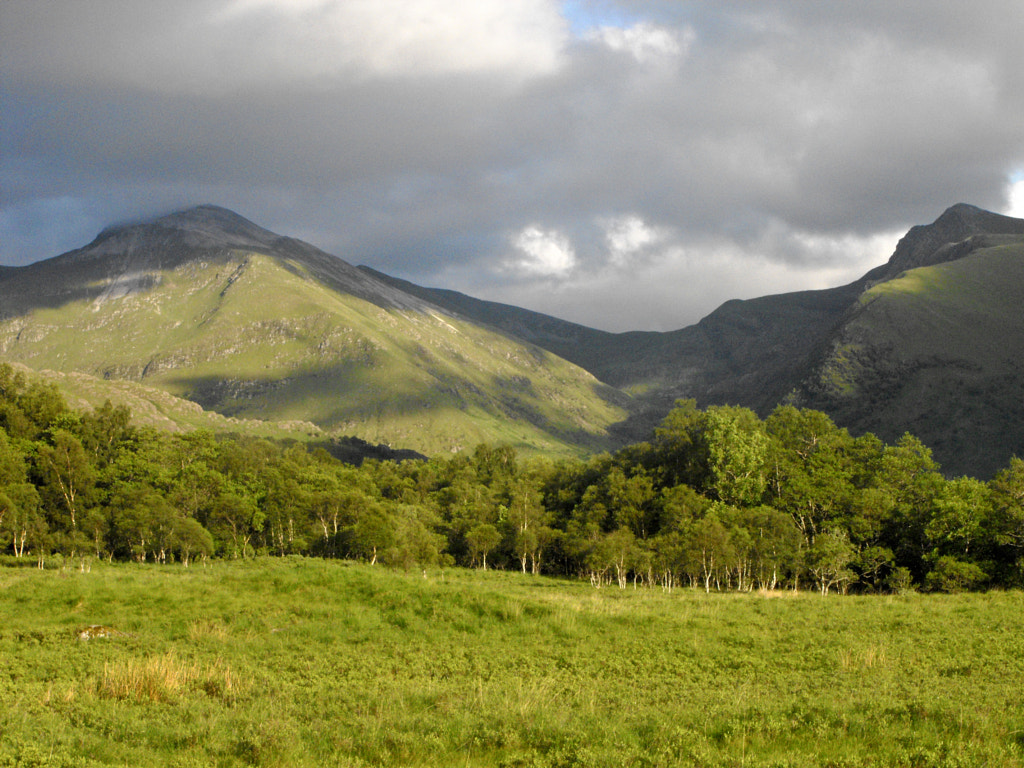
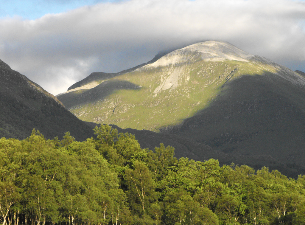
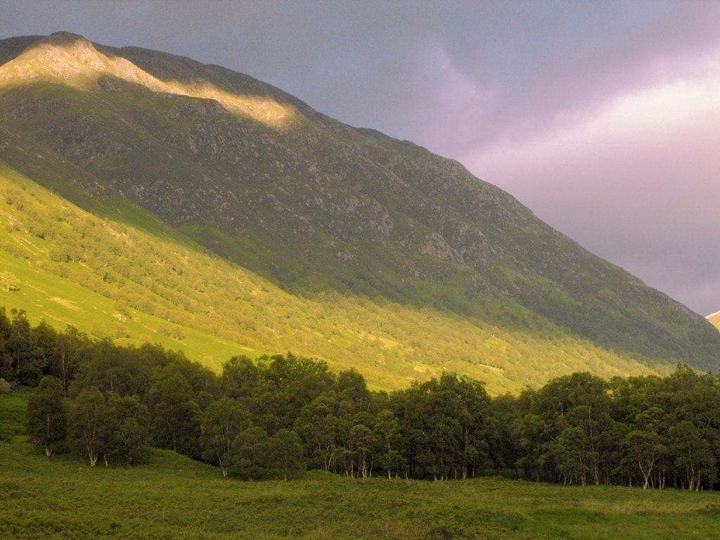
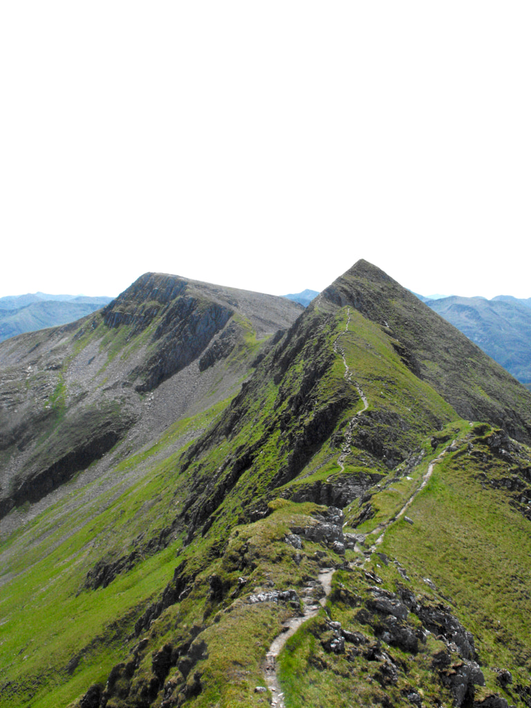
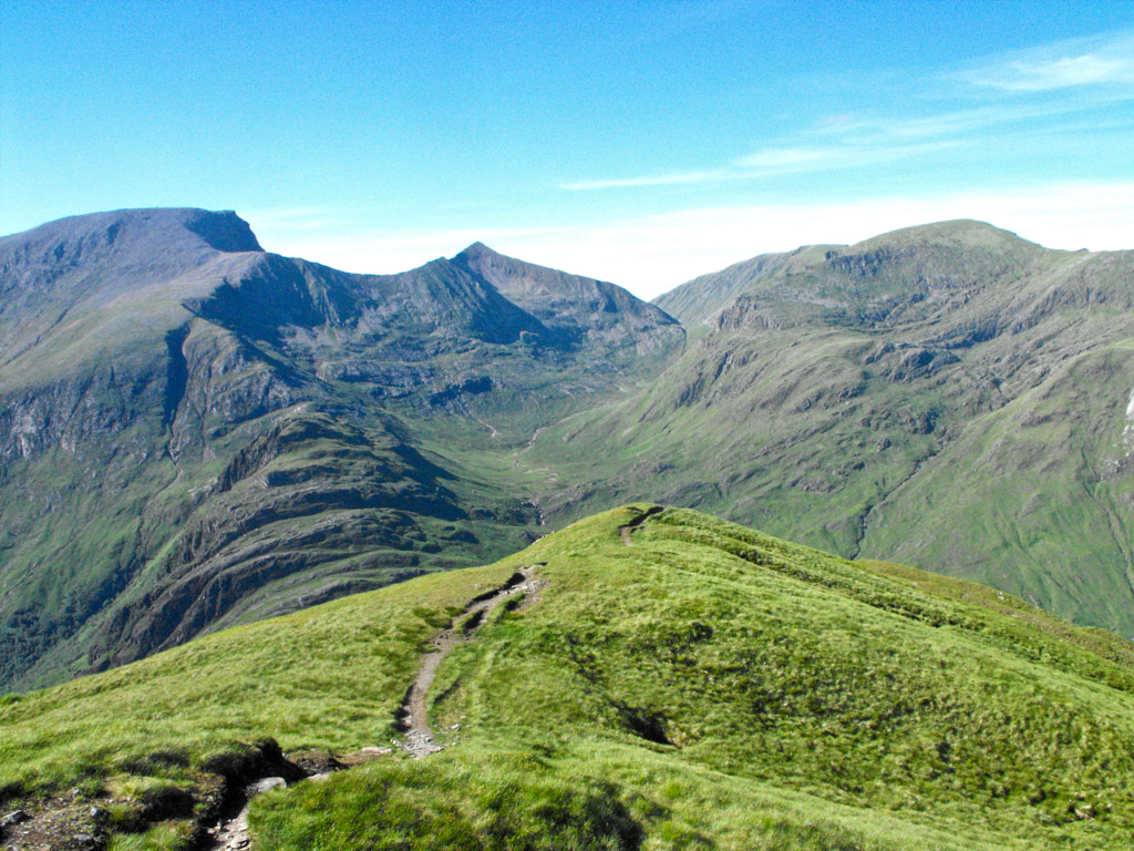
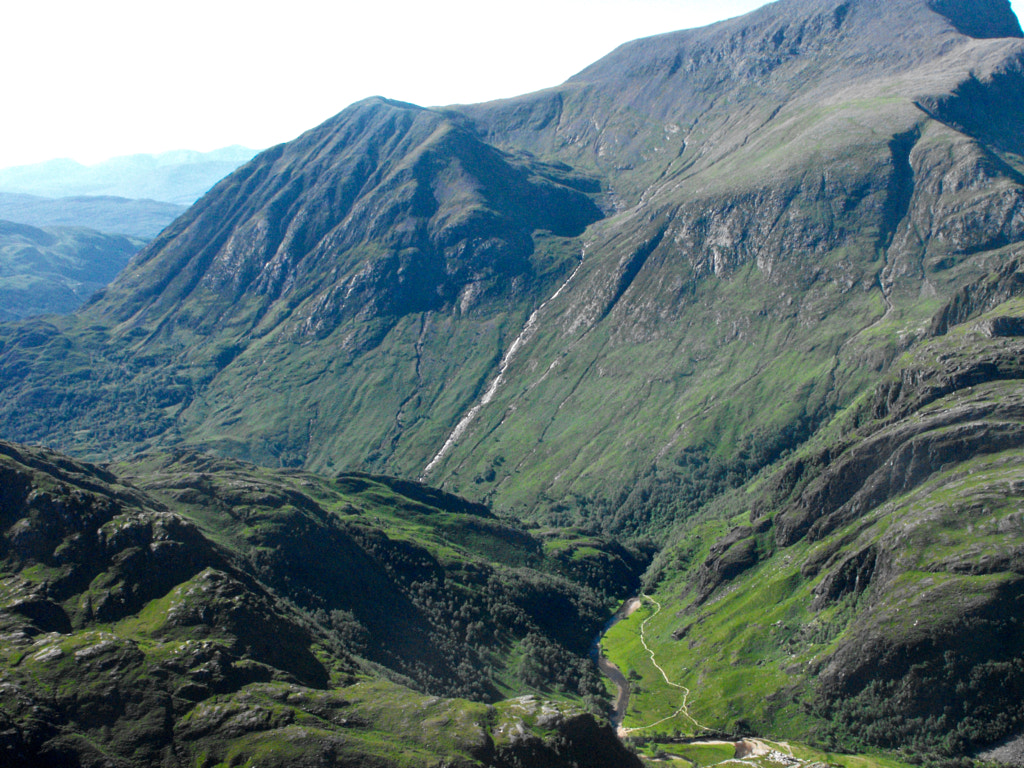
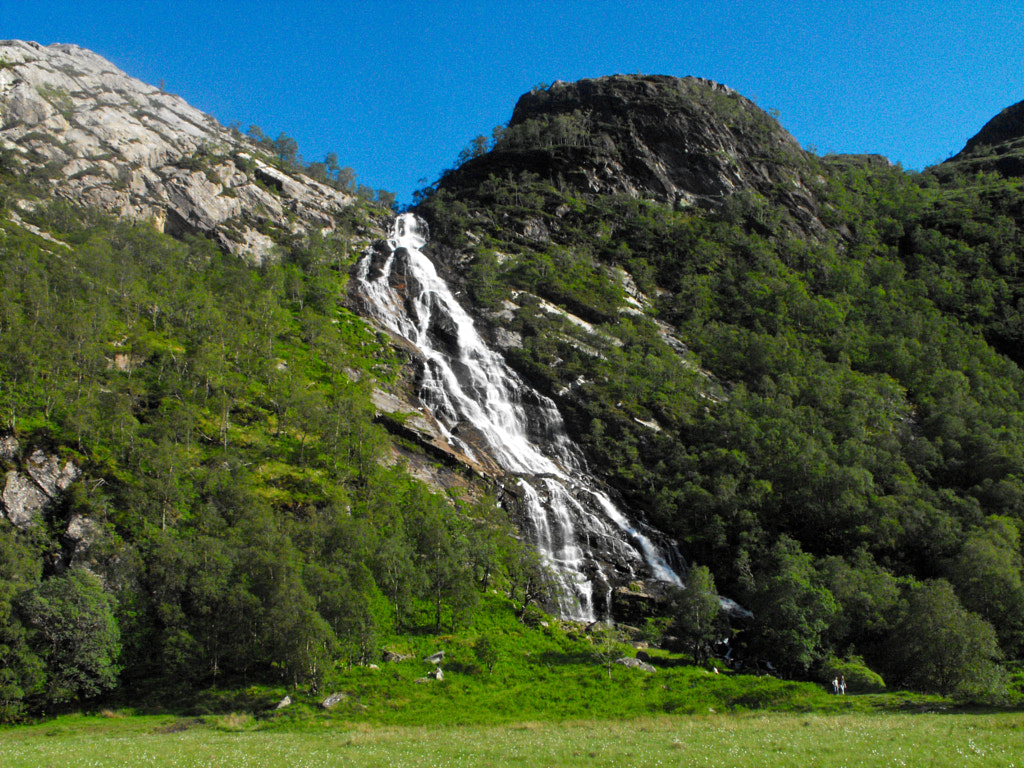
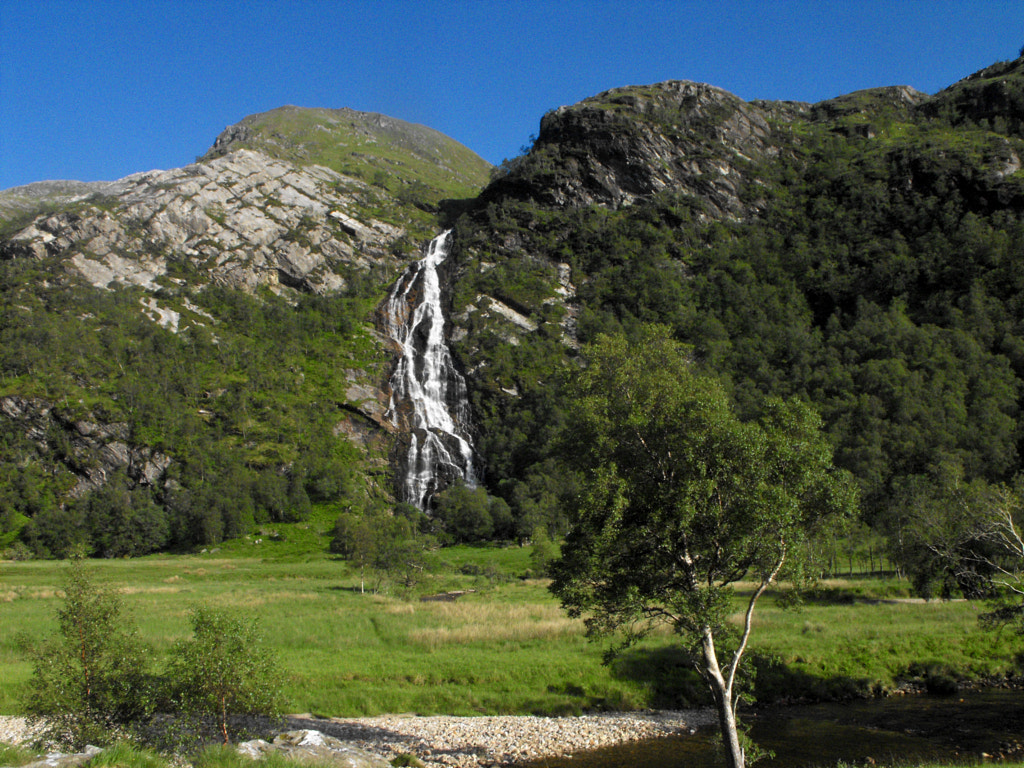
The old adage about red skies proved true and the next day was a blistering one. I'd call it an Alpine summer if it weren't for the fact I've never been to the Alps to know what one of those is like. It was undoubtedly a day for the mountains and I had little doubt about which I would choose. I'd climbed all of the Mamores before in my early teens, but of all the mountains I've been on they remain my favourites and I'd not had any of them in conditions like these. The Ring of Steall would be my target. It has everything that makes Nevis one of my favourite glens: native woodland clinging to the steep valley sides, the Mamores themselves, and of course the upper part of the glen with its wild meadows beyond the Nevis Gorge. At the time I was learning Norwegian, and the almost Nordic cascade of An Steall drew me too.
I had no way of getting down the road to the start of the path so I set of for a long road walk in. Not long after I left the campsite a couple passed me on their bikes. I didn't see them again until less than a kilometre from the start of the path to Sgúrr a' Mháim. They were coming the opposite way up the road with confused looks and they stopped me, asking with thick German accents, 'where is the path to Ben Nevis?'. I had to stifle my laughter, that they had passed me so close to the beginning and cycled all this way, and I directed them back towards the foot of the pony track. I couldn't help but feel sympathy for the resigned look that crossed their faces then and I was half inclined to tell them to join me, that this walk was much better. Still, we went our separate ways and I continued on to the start of the path.
It would be lying to say that the ascent of Sgùrr a' Mhàim was easy, but I had undoubtedly gained fitness, and with a half empty backpack this was the sort of effort I could enjoy. I couldn't even complain about the heat after the days I'd had previous. After slipping my way up the screes I finally reached the summit to what are some of the finest views I've had in the mountains. Despite a little summer haze the visibility was extraordinary, I could see to Sìdh Chialleann and Glenfinnan, even to a pair of mountains that I can only assume are the Paps of Jura. At the summit was the third German encounter of the trip, a pleasant man with his dog, I can only assume that June is the time for Germans visiting Scotland.
I won't go on much about the rest of the route. Again, many of you will know it well and I have written a great deal too much already. Only know that after all the disappointment of failing my first attempt at a backpacking trip it ended with one of my best days in the mountains yet. I hope this year sees a return to my beloved Highlands, though this time with more success, less panic and better weather.