free to be able to rate and comment on reports (as well as access 1:25000 mapping).
With fine weather due everywhere, we decided it would be daft not to get out with the tent somewhere this weekend. After a spell of Jackie not feeling so great, we decided to stick to even shorter walks than usual, resulting in us pulling up just short of Gairloch at the rather late hour of 3:30pm for a wander in Flowerdale.
Saturday 29/05/21 Sithean Mor: 450m ascent, 8km, 4 hours.We were intending to go up Sithean Mor, but a wander round the Gairloch Estate footpaths to the waterfall would be sufficient if the ascent was too much hard work. The estate have made a lot of effort on paths for walkers here so you don't have to walk through people's front yards.
 Bridge at the Old Inn
  Monkey Puzzle tree in Gairloch Estate
 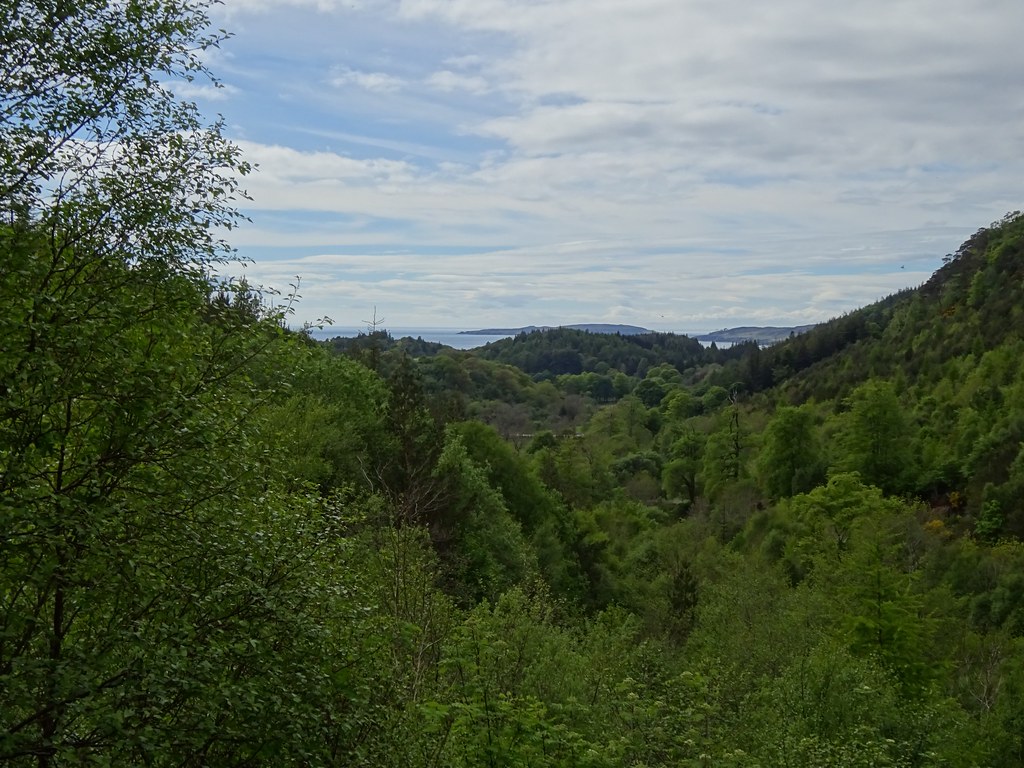 Out to Loch Gairloch
 An Groban was looking impressive, and it looked like we would attempt Sithean Mor. To do this means leaving the path up the south side of Gleann a' Ghrobain at its highest point to crash through some heather. While the heather was easy enough to find a route through, the going was really warm and steep - not ideal. We crossed a deer fence with the aid of some steps of the type you'd find on a telegraph pole, and made the final (even steeper) ascent to the summit ridge.
 Approaching An Groban
  Break for Jackie
  Meall Fuaraidh
  Trotternish on Skye
  Steep ascent on Sithean Mor
 I opted to stick to rock here while Jackie preferred the ground to the side. She was pretty knackered at the top of this and unimpressed to see further bumps to be crossed before we reached the summit. Still we made it eventually, with the views being even better than I remembered - Torridon, Loch Maree and Slioch, Skye and the coastline.
 Nice rock
  Nearly there...Torridon and Baosbheinn
 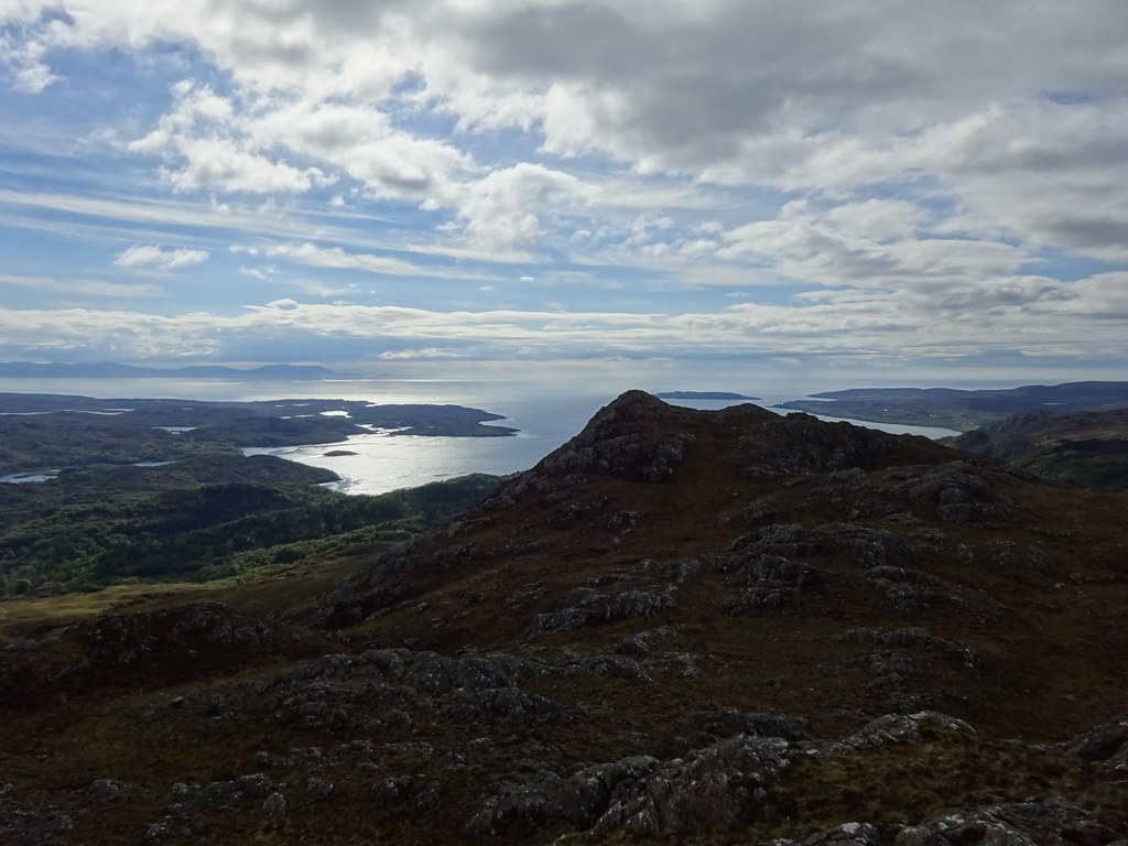 Out to sea
  Slioch from Sithean Mor
  Torridon and Loch Bad na Sgalaig
 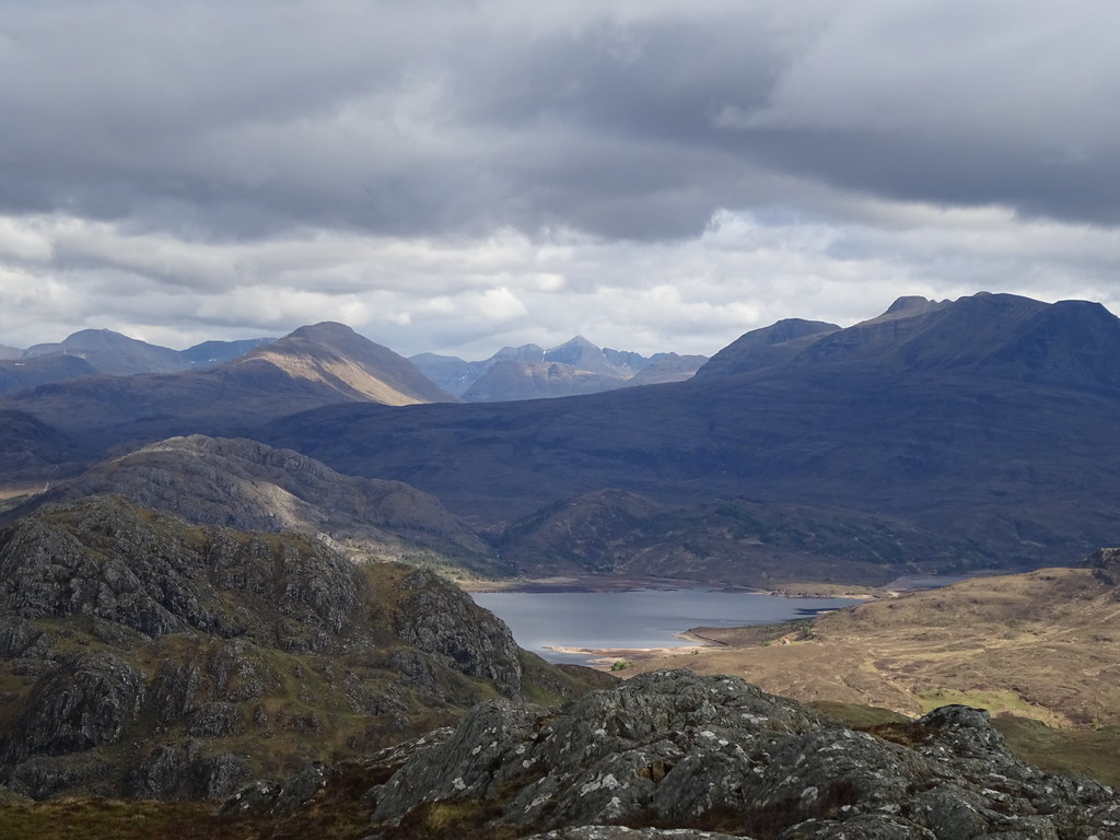 Liathach
  Beinn Eighe and Beinn an Eoin
 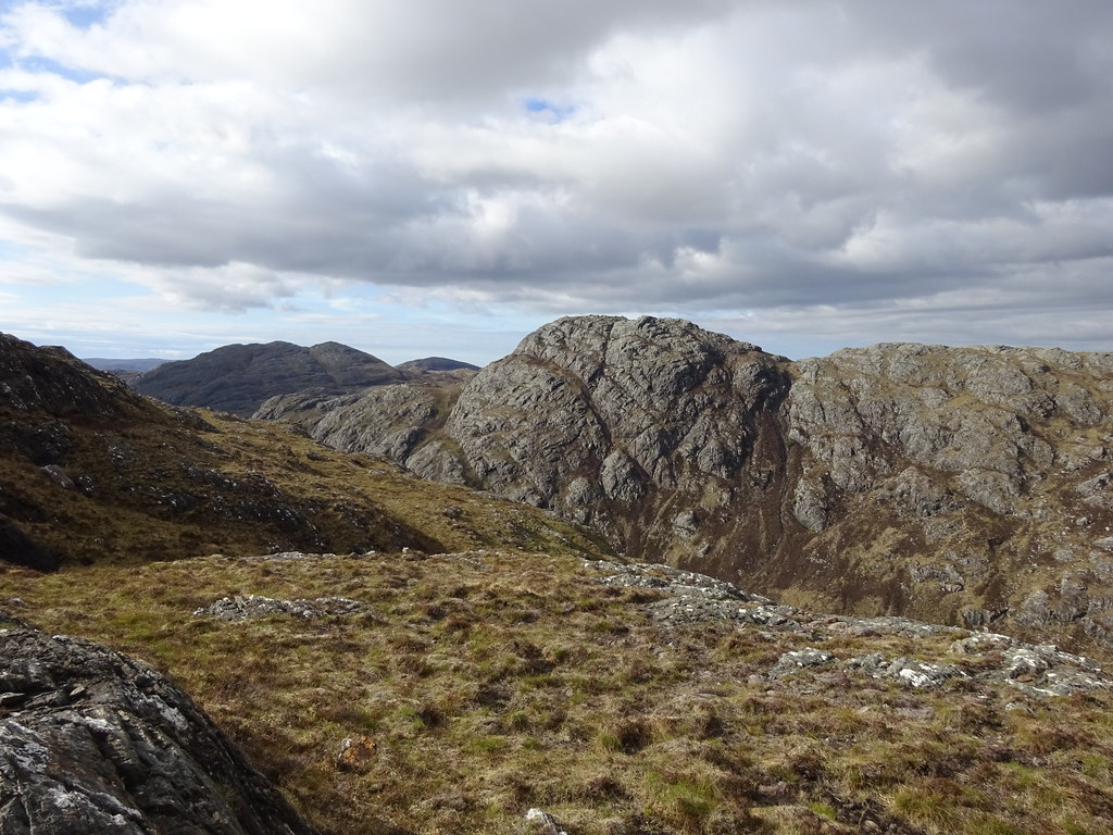 An Groban
 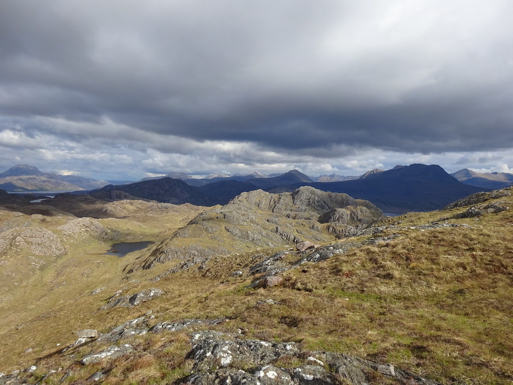 Meallan Aluinn
 Much as I would have liked to include An Groban (which is the best hill in this little corner), there was no way that was going to happen. We decided to keep going east from the summit and get back down into Gleann a' Ghrobain to pick up the path we could see here.
 North end of Skye
 The route down was surprisingly OK underfoot, but it was steep and it took a lot out of Jackie. A low point came in the glen lower down when she couldn't avoid tripping over stuff due to tiredness - this has happened before but the frustration of not being able to do a short walk on a small hill finally got the better of her. Eventually we made it back to the car via the waterfall, thinking that even today's short walk had been too much.
 Flowerdale waterfall
  Bluebells on the Gairloch Estate
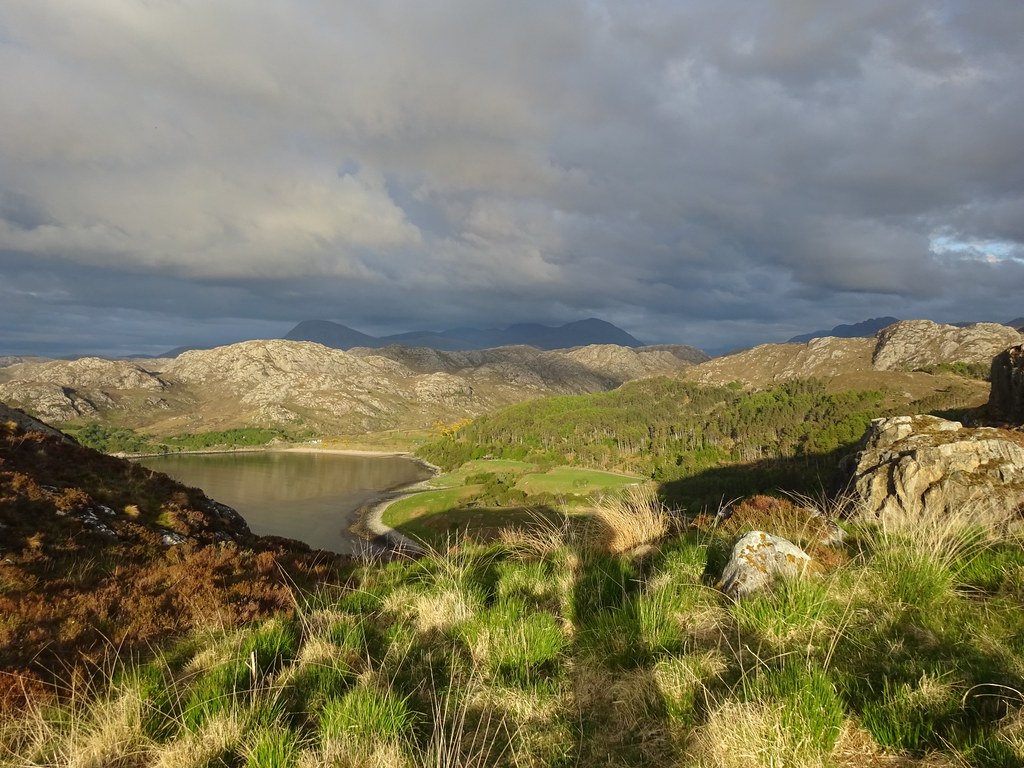
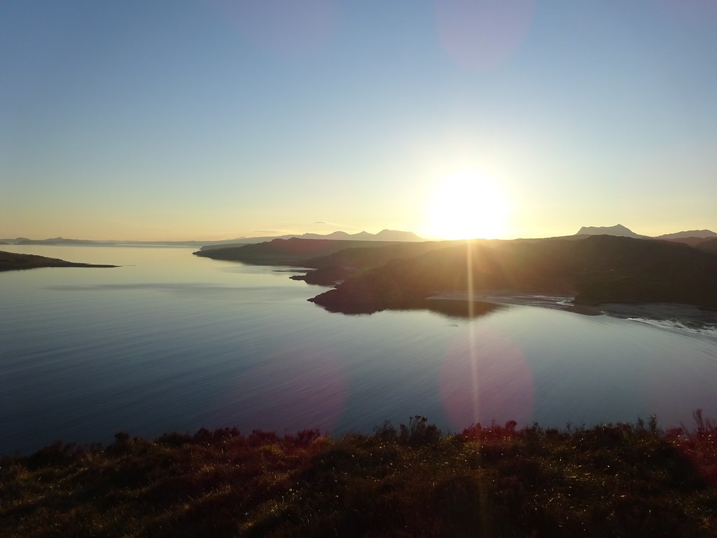
 We drove up to Gruinard Bay to camp at one of Jackie's spots. The laybys were all busy with camper vans but the little knoll above Little Gruinard that she had used a couple of times before was empty...and what a view! It was quite late now, so we had a quick dinner before enjoying the sunset. The midges were out for the first time this year (we'd experienced some a couple of weeks ago when kayaking near Inverness but these were the first ones we had had to tolerate while camping). They weren't awful by any means but they seemed to be going for Jackie.
 Looking down on Little Gruinard
  Gruinard Island
 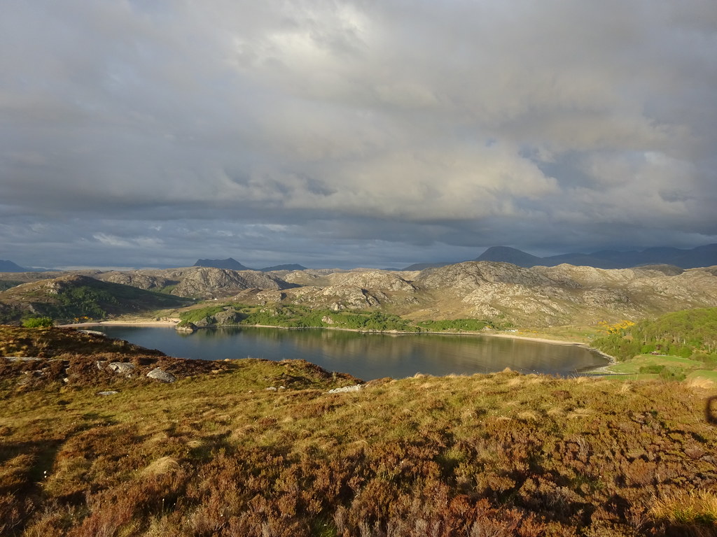 Gruinard Bay
  Atmospheric in Fisherfield
  Torr Mor over Gruinard Bay
 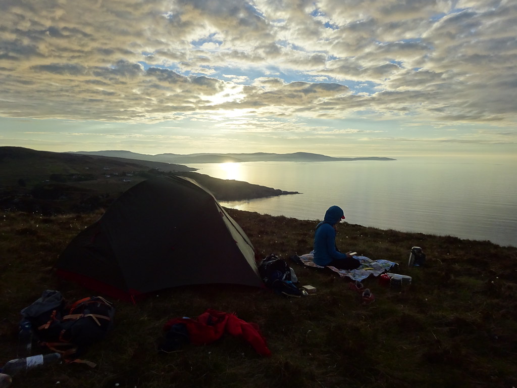 Idyllic camp spot
  Gruinard Island with the Summer Isles beyond
  Not quite so Idyllic (for Jackie anyway)
  Beinn Ghobhlach
  Sail Mhor and An Teallach
  Gruinard Island
  Sunset over Mellon Udrigle
  Cloud blanket
  Evening glow
 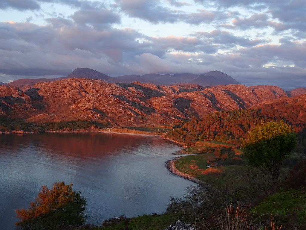 An Teallach and Gruinard Bay
  Later on....
  Even later
  Sun now gone
 ______________________________________
I was woken early by the need to pee and took advantage of a slight breeze before going back to bed. The heat in the tent was tolerable until just before 8am, at which point I had to get out, midges or not! The breeze had gone and there were midges lurking around in the flysheet, but outside in the direct sunlight, they were largely absent.
 First light over Assynt
  Calm morning
 After breakfast we made for Mellon Udrigle, determined to take it easy today. A short walk around the headland was the plan, followed by a dip in the sea.
Sunday 30/05/21 Mellon Udrigle headland & beach: 120m ascent, 4.5km, 3 hours, 20 minutes.Mellon Udrigle was busy and we nabbed one of the last spaces at the beach carpark and set off around the headland circuit clockwise. A good track led us towards Opinan, then we climbed up to a couple of minor summits with great views out across Assynt and Coigach. The weather was warm tending towards hot.
 Opinan
  Camas a’ Charraig
  Assynt hills from Rubha Beag
  Summer Isles
  Coastline
  Rubha Beag
  Mellon Udrigle
 Down at the beach, we stripped off and wandered into the water. So much for the gulf stream up here - it was absolutely freezing! We almost chickened out, but managed to jump in and swim a few strokes before retreating. It didn't really feel any less freezing after staying in for a bit

.
 Beach at Mellon Udrigle
  Beinn Ghobhlach from Mellon Udrigle beach
  An Teallach
 Having eaten lunch, we decided to drive round to Gruinard Bay again for a wander. Although we'd ruled out the Gleann Garbh and Gruinard River circuit in favour of taking it easy at the beach, we thought we'd just wander up to the waterfall. These things have a habit of getting out of hand....
Sunday 30/05/21 Gleann Garbh & Gruinard River: 350m ascent, 10km, 3 hours, 35 minutes.Unsurprisingly the Gruinard Bay carpark was busy but we found a space. We walked back down the road a short distance then through a gate just before the river. After a short, unsuccessful excursion down by the river into gorse, we picked up a path a little further up the bank which led us to the waterfall. We dropped down to the plunge pool for a proper look before exploring the gorge further upstream. My mum and dad often walk up here and I knew there was an interesting ledge to balance along, but we hadn't quite been prepared for the scrappy traverse above the gorge.
 Gleann Garbh
  Gleann Garbh waterfall
  Back down Gleann Garbh
  Gorge on Inverinavie River
  Interesting path up the gorge
  Back down the gorge
 At this point we were just going to drop back down to the car, but Jackie didn't fancy retracing her steps next to the gorge. As it happened, the loop round to the Gruinard River didn't look to add much more distance - why not do that? It is what we had originally planned after all.
 Hair is getting a bit out of hand
Of course it took longer than expected. the path was faint but visible all the way up to the high point, after which it was less obvious at a crucial point, and we ended up following animal tracks down to Loch Dubh Braigh a' Ghlinne. With a little cursing and cross-country floundering, we managed to pick up the path again (faint but cairned) and drop down to the Gruinard River. If we had been doing this walk on its own, we might have wandered up to Loch na Sealga, but by this point, we needed to take the most straightforward route back. Jackie was in nowhere near as bad a state as yesterday, but adding more distance on was not a good idea!
 Sail Mhor and An Teallach from the top of Gleann Garbh
  Beinn a Chlaidheimh and the Beinn Deag pair
 Despite not seeing Loch na Sealga, there were great views to the back of An Teallach and Beinn Dearg Beag. It felt nice and remote here. An easy stroll took us down the glen where we were passed by some cyclists.
 An Teallach above Gruinard River
  Sail Mhor and Gruinard River
 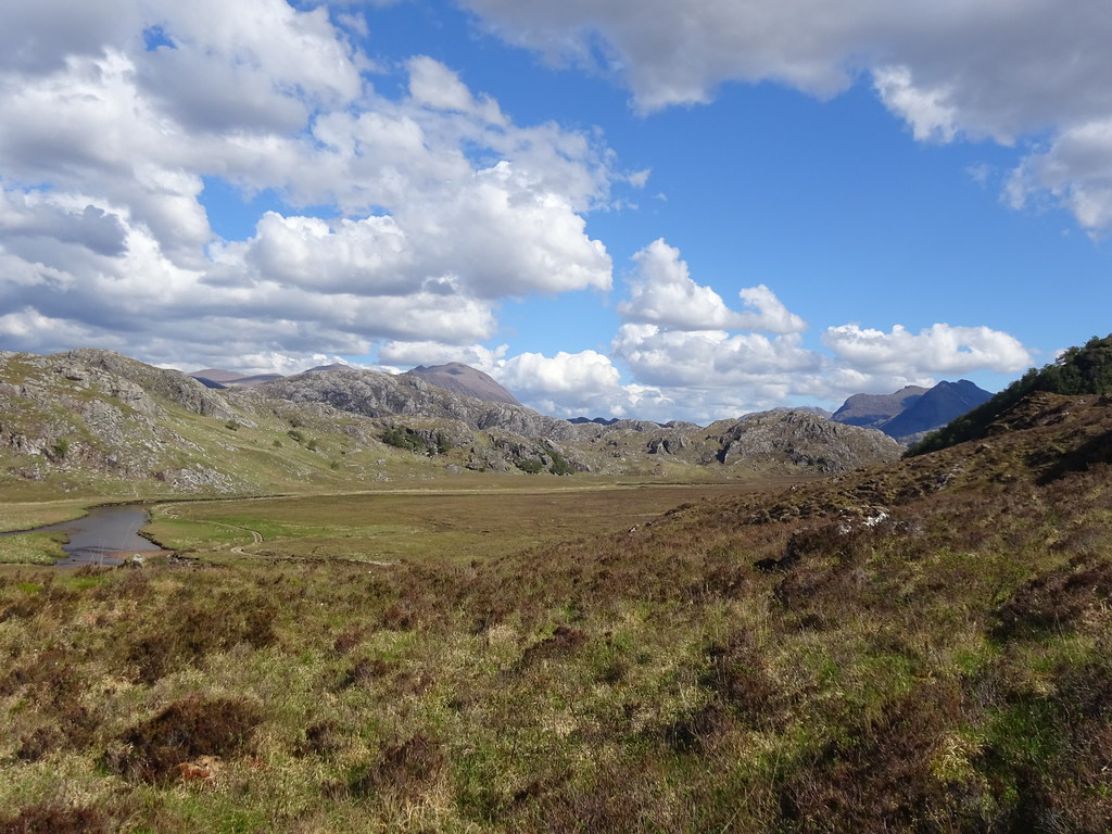 Gruinard River
  Beinn Dearg Mhor and Beinn Deag Beag
  Last look up the Gruinard River
  Carn na h-Aire
 At this point I left the track and took a shortcut back to the road. Jackie would follow the track to the road and I would drive round to meet her, saving a mile or so of road tramping. Initially I floundered in deep heather and thought I had made a bad choice, but I was on the road in no time, and back at the car in another 10 minutes.
 Gruinard Bay
 As is almost always the case these days, I needed to drive home. We hadn't been up any big hills, but the weekend had been great - always good to experience the west coast in this sort of weather

.
