free to be able to rate and comment on reports (as well as access 1:25000 mapping).
I trip up to see my brother in Thurso: with a few days beforehand to do some hills. I’d entertained ideas of going up the northwest and doing a traverse of Foinaven and Cranstackie or other such exotica, but the weather forecast was suggesting east rather than west. Still on a bit of a Simm mission, I thought I should begin to tackle the very numerous Simms that reside in Area 9: there’s around a hundred that I have yet to do nestled around the Monadliath...so a plan emerged to walk up the Corrieyairack Pass - somewhere new to me, and tie in a token Corbett (Gairbeinn) along with a handful of Simms.
I parked at Garva Bridge - I could have taken the car along to Melgarve which is around 6km further in, but since I’m trying to regain some fitness, then a bit of extra walking should be welcomed. Couple of other walkers at the car parking spot, doing Gael Charn, including a woman I was sure I recognised from somewhere. Saddled up the palomino and set off...
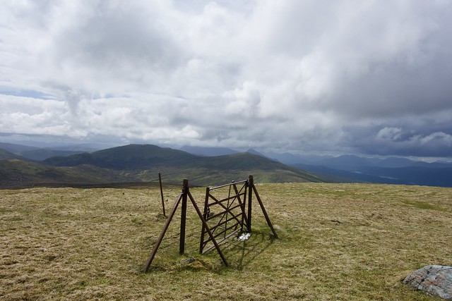
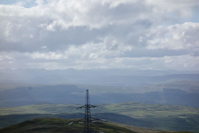
My plan was to walk to the top of the Corrieyairack Pass to tackle the four hills to the south, then head back over the ex-Corbett of Corrieyairack Hill itself and do the hills I hadn’t previously climbed on the north side of the track. I reached the estate bothy at Melgarve (closed for Covid) and sat outside having my lunch. Overcast sky and windy weather had me considering where to stop for the night...anyway onwards along the track, meeting not another soul, slowly gaining altitude. A couple of streams crossing the track to be forded, then the zigzags which looked alluring on the map- I’m a sucker for a zigzag. At the top of the climb I left the track and crossed beneath the huge electrical pylons...as I did so I felt the buzz of static electricity from my poles, and wondered just what such an enormous electric field does to your body...I scoped out a couple of potential camping spots for later in the dip between the track and the southern hills, but was reluctant to commit to them as it would mean camping very near the pylons.
 C4761C40-2A68-42CE-8AD5-610A64A7F42F_1_201_a
 by
Al, on Flickr
 5548E5F7-2BA8-4495-9554-6CC6F8B05A73_1_201_a
 by
Al, on Flickr
 0C4583A6-8A62-4154-AB6C-90CC0192862D_1_201_a
 by
Al, on Flickr
 472001A5-69F5-420B-B828-07EA61DD2A9A_1_201_a
 by
Al, on Flickr
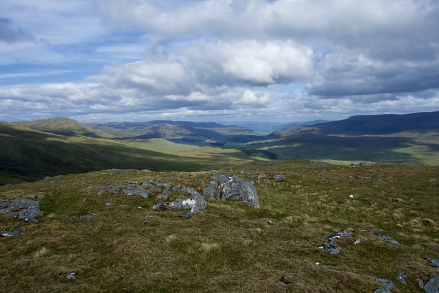
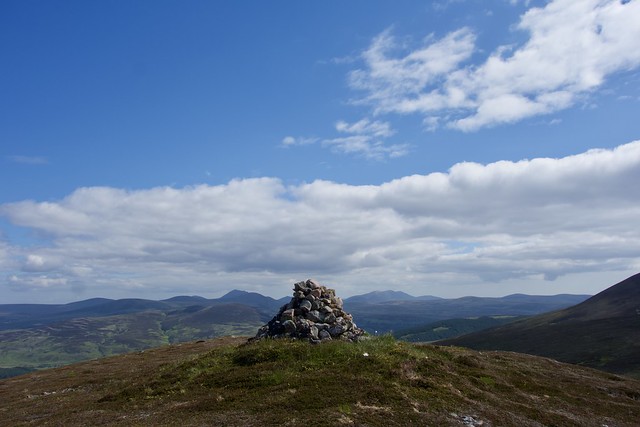
Onwards I went, with Carn Leac the first of my Simms...a nice grassy surface to walk on with an ATV track. Then down and up to Pol-Gormack Hill and a tramp over heather and bog to the more distant Leac nam Uan. From here I could see other hills over to the west- were they additional Simms I should tag on? A consult of my phone showed me these were the Carn Deargs of Glen Roy and related Simms...thankfully all done. I hadn’t realised I was that close to Glen Roy. The next hill was a long way off- Creag a’Chail - and involved once again a loss of height then a climb over heather. I like the idea of Simms only needing 30m drop between each, not this several hundred metres each time😉. When I eventually reached the summit I had a mere 300m height to regain heading back up Carn Leac to my starting point.
 840F4AC5-2919-4276-8029-FD1D9D2FC249_1_201_a
 by
Al, on Flickr
 32A50B86-52C7-4883-B19D-A14A40347A0C_1_201_a
 by
Al, on Flickr
 40279C79-1711-4F20-B85E-CF10E6CB87B5_1_201_a
 by
Al, on Flickr
 E2679B40-D900-46EA-AB12-7AFA3F248FEF_1_201_a
 by
Al, on Flickr
It was getting on in the day, but the weather was improving, apart from the wind, and instead of choosing one of my previously scoped camp spots near the Pass I decided to continue on over Corrieyairack Hill, with the hope that I could camp somewhere to the north east of it, which should be relatively wind sheltered. A nice track up this hill made matters easier but once I’d come off from the summit I found the terrain on the soggy side for camping. I kept on to Bac nam Fuaran, an easy travel with little re-ascent and made do with a semi sheltered spot to the north of this top. Dinner was welcome and I curled up for a good night’s sleep after a 30km day.
 2C49BFE1-1149-4101-84D0-3F7ACD2C3D96_1_201_a
 by
Al, on Flickr
 0890EFC8-E43D-4862-9A87-6DDA7BD7A719_1_201_a
 by
Al, on Flickr
A cold wind and the threat of rain was order of the day on Thursday, I had a few bumps to go over before climbing up Gairbeinn from the bealach with Geal Charn. From there I had another long dip and climb to get onto Creag Mhor...I could either come off the east side of Gairbeinn and lose lots of height, or head north along the ridge and do an extra 2 km. I opted shorter and steeper...again thinking about getting fitter. On the way off Gairbeinn I stumbled across a very wet iPad, which was an unusual find; looked like it had been there for a while. Crossing over to Creag Mhor was fine, the ascent was less enjoyable and I had to resort to counting steps to get to the top. From here I had the option of cutting back to the track, or I could add on Meall an h-aisre. I’d done the intervening Simms previously, but decided another Corbett was worth the walk. On the way over I noted a new (ie not on my map) track heading up it, which would be useful if you wanted to cycle up, I suppose. I lunched about a hundred metres from the summit then had the rather tedious descent back to the track.
 9258AFCB-69D0-4314-92B3-472BE4AB7490_1_201_a
 by
Al, on Flickr
 714E338B-FFDB-4DE7-BD70-9D08FDFDA5BC_1_201_a
 by
Al, on Flickr
 6B69DDCD-F813-424E-A256-AAF91517A0F5_1_201_a
 by
Al, on Flickr
 E3AA7060-E20E-462D-BF0D-B5CEFE27A476_1_100_o
 by
Al, on Flickr
Just after 2pm by the time I got back to the car: time for a bit more driving. I headed back along to Lagan then rejoined the A9 to continue my trip North. The road was busy in both directions but I took it easy and headed up through Brora to the sharp turn off for Glen Loth. It’s a narrow wee road this, but generally quiet, at least when I’ve been up it. I found an open field to park in, at the start of the track I intended to take. Time was about 5- I was happy to walk for two or three hours, but once again wondered if the wind would be too strong to high camp. I’d planned this route a couple years ago, so my memory of what was involved was vague, and I decided to reverse the direction I’d initially intended to walk it. I do like bringing planned routes into reality and did remember the rather severe looking clefts between the hills.
The track was good initially then deteriorated into soggier and boggier going before becoming indistinguishable from deer tracks. I followed the river, knowing that I was aiming for the cleft between Meall a’Phiobaire and Carn Garbh. The wind was really quite strong, even at this level, and I decided to just camp by the river. I’d only walked 2.5km, which was paltry, and in retrospect I could have gone on and high camped between Meallan Liath Beag and The Craggan...it was a shame as it turned out to be a lovely sunny evening and the views from up there would have been good...I could see little from the valley. I did have some South Indian potatoes/cashews I’d cooked before leaving: this proved a most welcome change from Huel...
 62254BE6-6345-4F22-A658-F9F94097BAB4_1_201_a
 by
Al, on Flickr
 476D3798-9136-401E-83E5-EFF6CD3C145E_1_201_a
 by
Al, on Flickr
 DD346540-7B02-4B76-8D63-DAB0288A4945_1_201_a
 by
Al, on Flickr
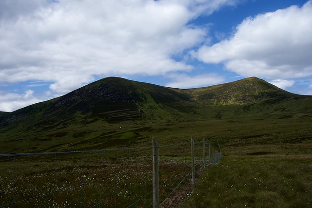
I’d intended to get up early next morning, but the wind kept me awake half the night, dropping off around 5 at which time I also dropped off and I didn’t get up til 7.30. The sun was beaming through the tent, slowly cooking me. As I prepared to set off the weather held. I crossed the river and set off up the folds of the cleft and reaching the first summit, the Marilyn of Carn Garbh. Great views north to Morven and north west to The Griams, Loyal and Klibreck, with Hope and co just visible in the far haze. Sadly the large wind farm just beside me detracted from the beautiful isolation. From Carn Garbh, I continued on a very pleasant high level walk, over the Meallan Liaths and the Craggan, with its ancient cairn, before turning east and walking up the gentle slopes of Beinn Dhorain: a much easier ascent than climbing it from the other side. At the summit, the sea view stretched out as far as I could see, and the golden sands of Brora looked inviting.
 8AD282EF-6D88-4EDC-B932-E4A69ED87171_1_201_a
 by
Al, on Flickr
 16CBF800-B127-43E6-89DD-AECFC85F532A_1_201_a
 by
Al, on Flickr
 A9077786-EE83-4C6D-80BF-7CBCB840CA98_1_201_a
 by
Al, on Flickr
 F7699923-3323-449B-89DC-AD6866822981_1_201_a
 by
Al, on Flickr
 42C31A52-2C55-44BE-B302-7228FA3662EF_1_201_a
 by
Al, on Flickr
 F48D6DCC-4BFD-4ECD-BC62-B46F945ECC30_1_201_a
 by
Al, on Flickr
 A5F9947A-3CAC-4042-87EC-262E0B1A5426_1_201_a
 by
Al, on Flickr
Beinn Mhealaich
 FF023B09-C383-4520-A231-98543D7582B3_1_201_a
 by
Al, on Flickr
I headed off on the NE flanks of Dhorain, steep but short heather and grass, making for the road and finding a stile across the deer fence. My final target, Beinn Mhealaich, sat across the road. Another 400m of ascent required: I yomped over heather til I came to a deer fence, which I followed round until I reached the mountain slopes. I paused for lunch, noting to my surprise, a woman had parked in the lay-by and was coming towards me with 2 dogs...a dog Walker or Marilyn bagger? Although she came up the side of the hill a bit, she turned off to the north, so the former. I didn’t expect to meet anyone else here. Steady, slow climb through heather to reach the top at last. From here I could make out the standing stone of Clach Mhic Mhios, way down near the road. I had intended to stay high and come down off Creag Riasgain to return to the car, but I decided I had to see this standing stone. So I descended directly towards it. There’s new woodland plantation before you reach it, this had the pits dug for the new trees covered in heather, making it a nightmare to avoid turning an ankle. The stone itself was well worth the visit, especially when experienced against the mountain backdrop. I do like Glen Loth. On the walk back to the car, along the road, I noticed a derelict croft and idly speculated about what it would be like to live there.
 065A661C-BC1B-44E8-9902-EA5A9005B9A6_1_201_a
 by
Al, on Flickr
 D6BB1094-2D10-49A5-B145-6261CFCDD19E_1_201_a
 by
Al, on Flickr
 CC4605A4-E5B2-4828-A76B-EF985FE630BB_1_201_a
 by
Al, on Flickr
 CA882F3E-B00A-41E6-951A-0A0DB0FEDE8C_1_201_a
 by
Al, on Flickr
 4FE99701-9F6B-4D24-A38B-70675ED861FB_1_201_a
 by
Al, on Flickr
 5851DA6F-5072-4507-A42D-4FD277C0F6D2_1_201_a
 by
Al, on Flickr
 B5C54DBD-5265-4407-9EEB-E89143C3F22A_1_201_a
 by
Al, on Flickr
 9E9BB6E4-1DB8-42B3-B838-CBABFB04F116_1_100_o
 by
Al, on Flickr
Back at the car I’d gained an audience of sheep. It was very warm, around 2.15, and in good spirits I set off towards my brother’s near Thurso- I’d not been up for 18 months, thanks to Covid.
