free to be able to rate and comment on reports (as well as access 1:25000 mapping).
After my suucessful outing earlier in May I was really pleased to get back to the Watershed so soon, That report can be read here
https://www.walkhighlands.co.uk/Forum/viewtopic.php?f=9&t=10512131st MaySuccess! It being a Monday, I managed to arrive at Braemore Junction at 14.50, without the need for taxis or long hours waiting in Inverness. Slapping on the factor 50 kid’s sunscreen – it was the only one available in Semichem in a small enough size to squeeze into my very full rucksack. In fact, the shop assistant happily told me that it could easily fit into my handbag. “A haaandbaag”, I retorted in my best Lady Bracknell. “Does this look like a Haandbaag?” pointing at my massive rucksack. She looked baffled and I beat a hasty retreat. Anyway, duly slapped on it did stow neatly away and adjusting my poles I started back up the track that I had come down 13 days earlier but now with the heaviest rucksack I had had for a while (Headline “Pensioner collapses under weight of rucksack packed with a surfeit of “just in case” items”).
It was hot but the stiff breeze helped to cool me down
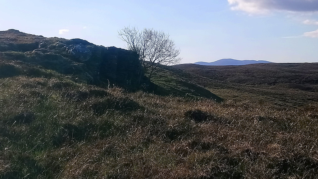
“I’m on the road again”I passed the lollipop trees outside the (lollipop) mansion, the dogs that had barked as I had walked down the road, barked again as I walked up.
 Caged lollipop trees and Big House.
 by
Seal54, on Flickr
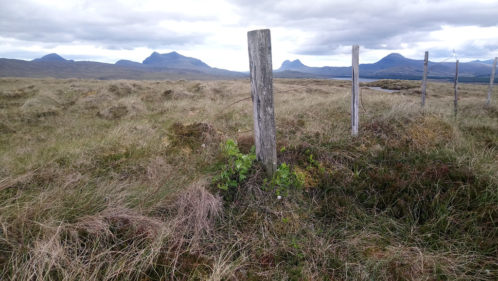
Then, at the end of a 4-day trip with a much reduced rucksack. It had been cooler and I had been going downhill but I seemed to be quicker today. I counted off the significant points, my campsite,Home Loch, the dipping pool (a lot lower, more like a teacup full) I looked nostalgically across to the Fannaichs (what a good trip that had been), I stopped and chatted with a couple (Bridie and Donald) from Inverness coming down from Beinn Enaiglair and kept expecting the weight of my bag to floor me. I stopped again to take a photo of the big rock here with a red mark marking the height of walking pole (0.65m) for scale.
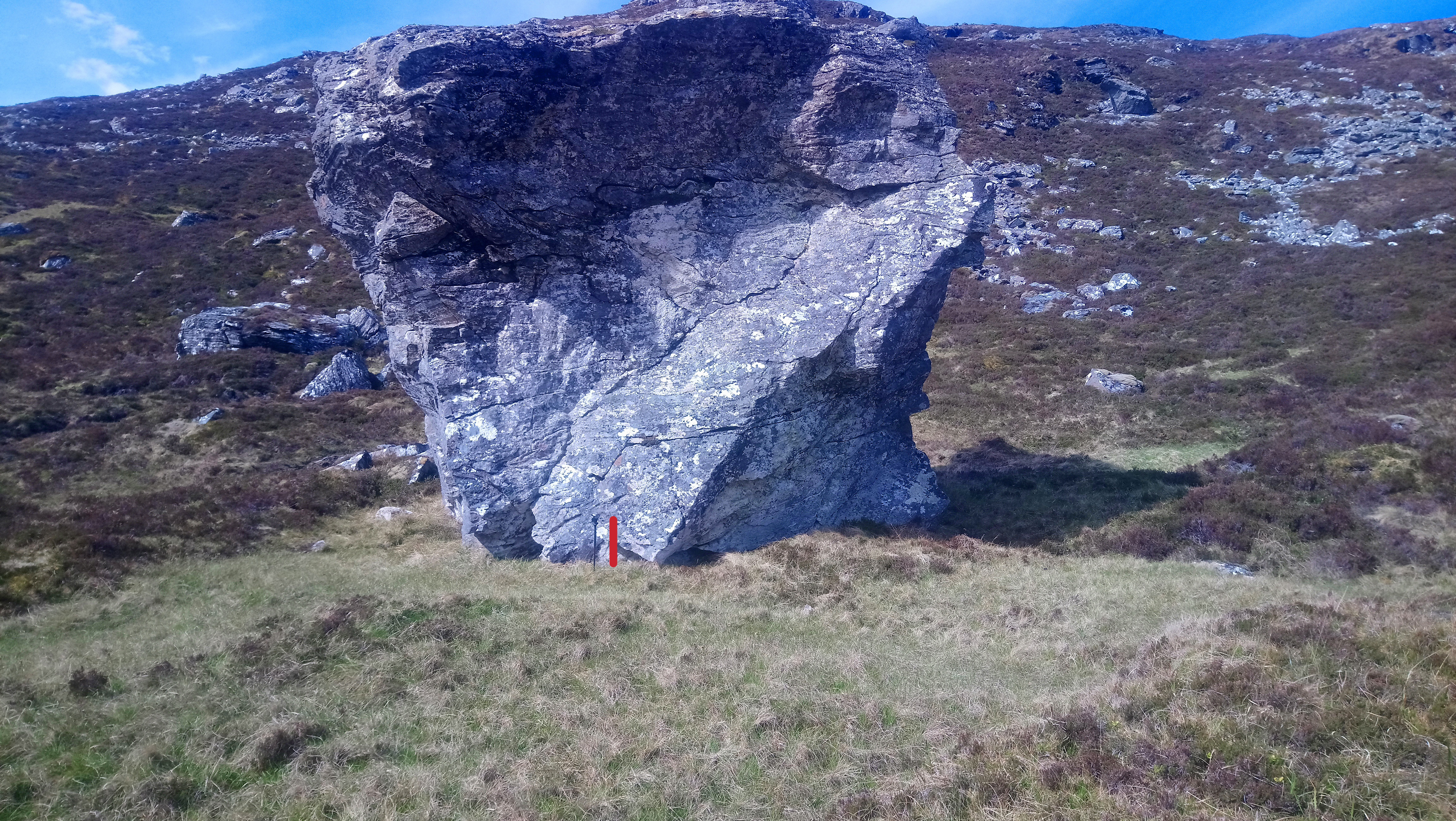 Rock with mark (0.65m) for scale
 by
Seal54, on Flickr
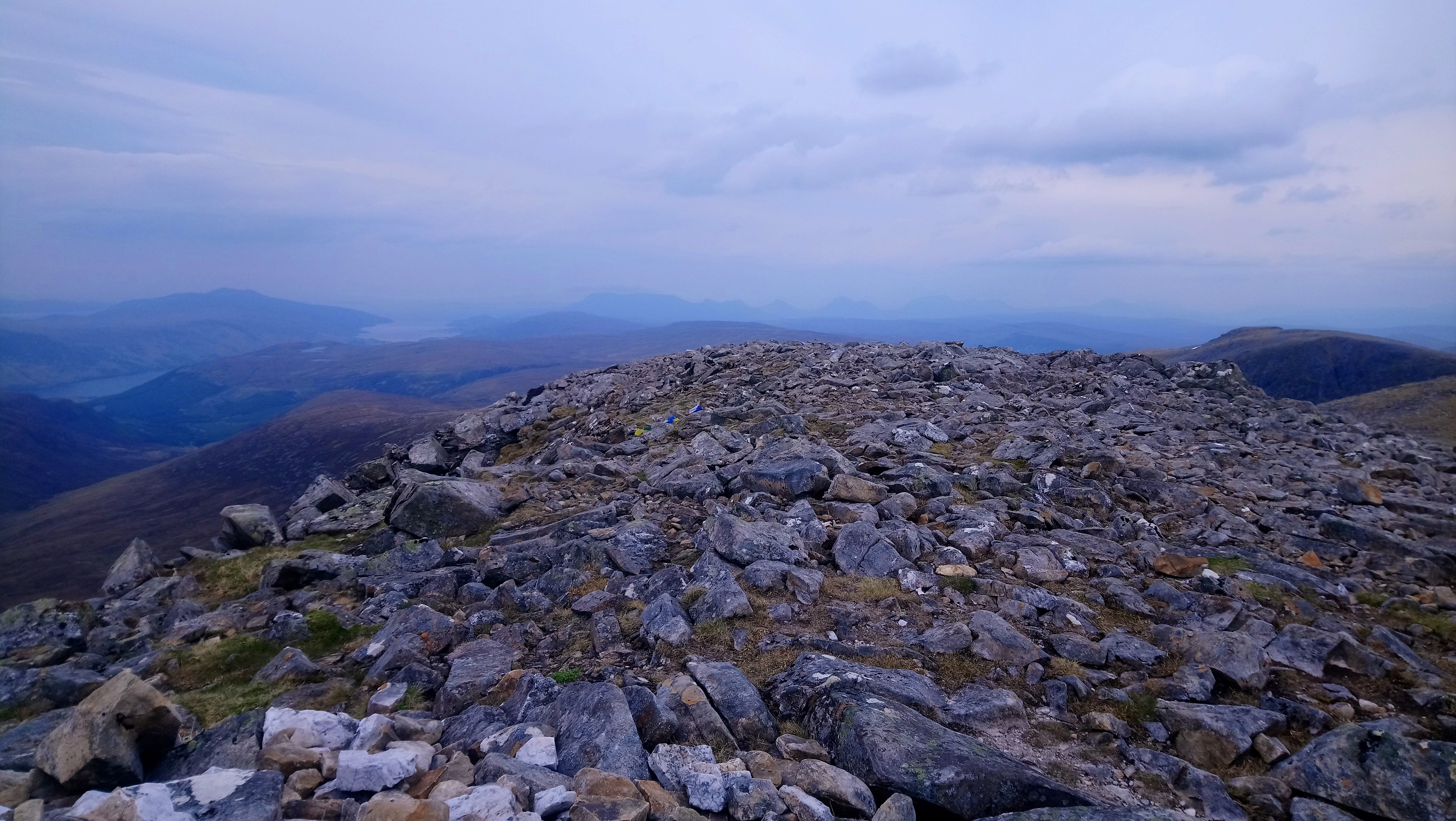
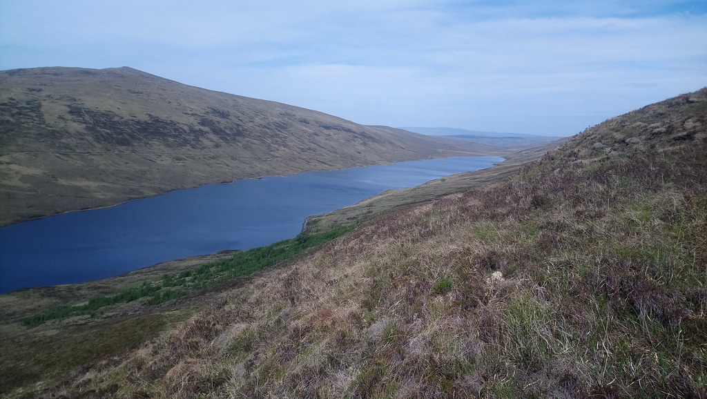
My aim was to reach Ledmore Junction by Saturday morning and the 08.15 bus. Any later and I would have to wait until Monday. There is a later bus on Saturday but I wouldn’t get to Aberdeen in time for my last bus home. With no buses on Sunday I had to pack 2 day’s extra food “just in case”. The weather forecast was for the sunny weather to continue to Wednesday albeit with some strong winds. From Wednesday there was to be increasing risk of rain but hopefully by then I would be onto lower ground beyond Seana Bhraigh. Today I hoped to re-join the Watershed where I left it at the junction of the circular path of Beinn Enaiglair (NH238796) and the stalkers path from the east. My route would take me up the east shoulder of Beinn Enaiglair then steeply down over Creag Bac na Faire, hopefully to find a bivvy site in the bealach before Lorguill. Stopping there would give me a chance to fill up with water before tackling Beinn Dearg.
 Rejoining Watershed, Beinn Enaiglair
 by
Seal54, on Flickr
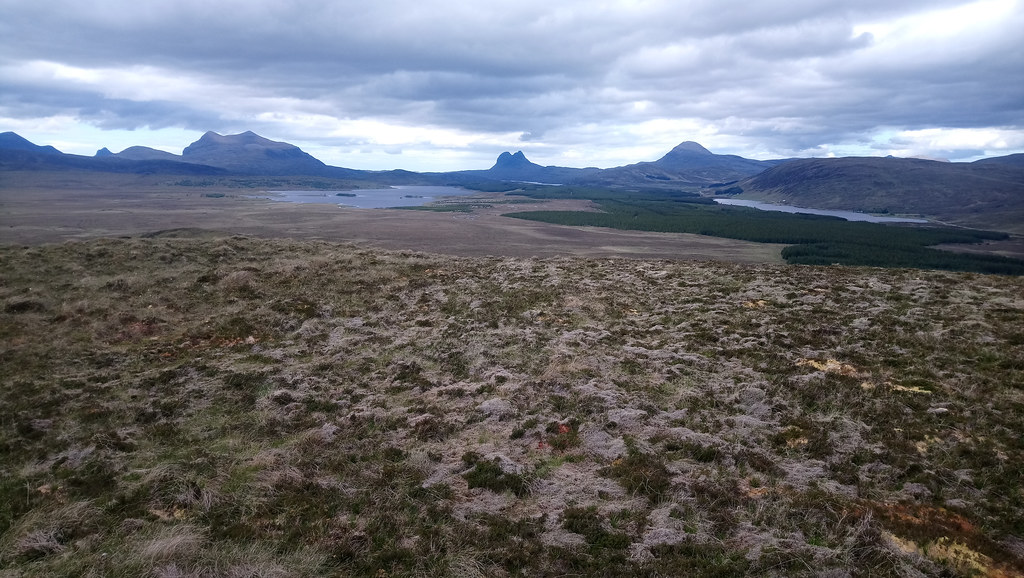
Leaving the circular path, the shoulder of Beinn Enaiglair was an easy walk on short crowberry and lichen vegetation. The Fannaichs reappeared to my right and Lorguill and Beinn Dearg loomed large and intimidating to my left. The famous dry stane dyke curved up over the shoulder of Beinn Dearg zipping it into a steep join.
 Watershed from Beinn Enaiglair shoulder
 by
Seal54, on Flickr
Plovers called and a male ptarmigan scurried away as I approached the summit. Enaiglair is a fabulous viewpont. This is my 2nd ascent (first was an early morning trip in April 2011 on an equally fine day). With views of the Fannaichs to the south, then round to Fisherfield and An Teallach, followed by The North West Highlands and then Beinn Dearg to North East and finally Loch Glascarnoch I was tempted to camp at the summit. Unfortunately I felt pressurised to go on. No beautiful sunset over Ullapool for me. However, given that I had been up since 04.45 I doubted I would be still awake to appreciate it.
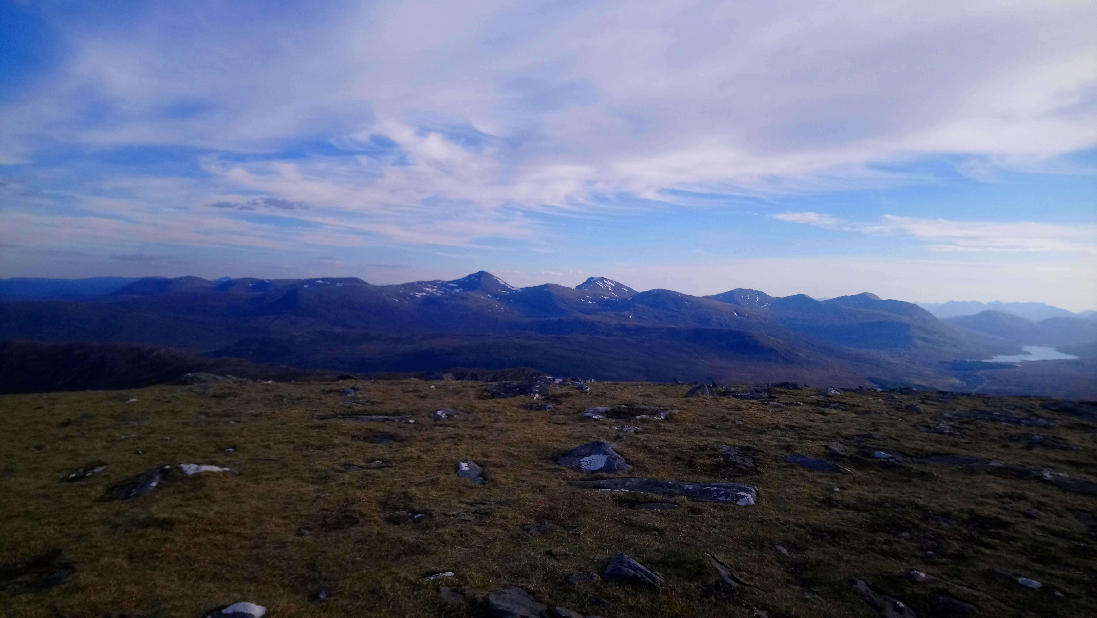 Fannaichs from Beinn Enaiglair summit
 by
Seal54, on Flickr
 DSC_0014 Looking to Fishefield, An Teallach , Loch Broom from Summit Beinn Enaiglair
 by
Seal54, on Flickr
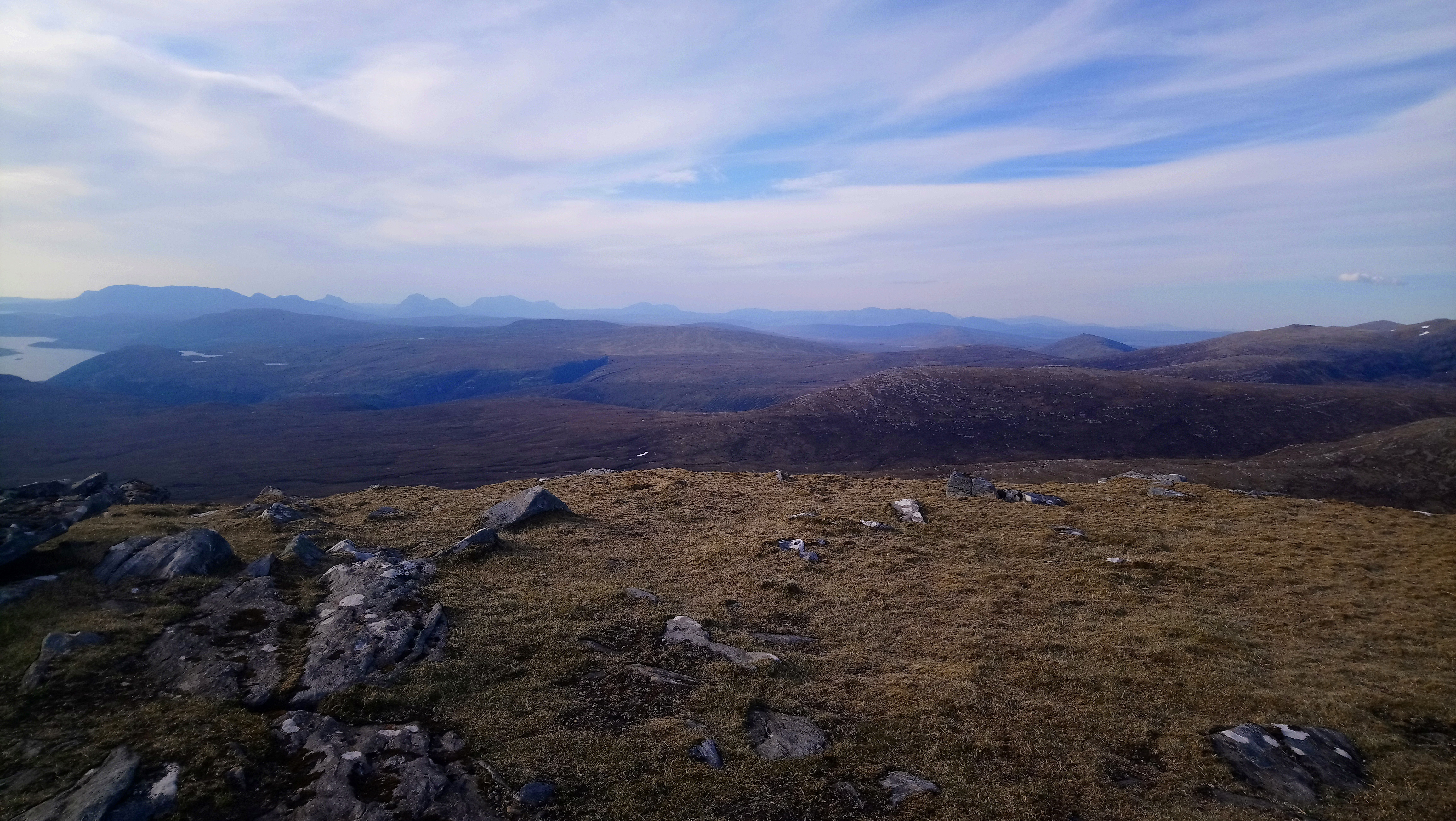 North West Highlands from Beinn Enaiglair
 by
Seal54, on Flickr
 DSC_0019 View to Beinn Dearg from Beinn Enaiglair
 by
Seal54, on Flickr
 View East over Loch Glascarnoch from summit of Beinn Enaiglair
 by
Seal54, on Flickr
I traversed the slope to the east and picked my way down the steep, slabby ground, then up and over Creag Bac na Faire and into the bealach where I found a flat, spot clear of stones with a view down the Alt Mhucarnaich to Loch Glascarnoch.
 Looking back to descent of Beinn Enaiglair from Creag Bac na Faire
 by
Seal54, on Flickr
 Looking back up to Beinn Enaiglair and Creag Bac na Faiire
 by
Seal54, on Flickr
 Camp at bealach looking to East
 by
Seal54, on Flickr
Later, I could see the headlights of traffic on the A835 always a surreal experience, do they know they are being watched? Water was harder to find with so little rain or snow melt available to fill the burns, I had to descend further than anticipated on the Atlantic side. Back at my camp site the cool breeze, caused the temperatures to drop considerably but before getting into my sleeping bag,I sprayed myself all over with smidge, not for the midges (there were none) but to deter ticks.The chilly evening made me glad that I had put in my warm sleeping bag liner despite the extra weight and bulk.
I was brushing my teeth when a stag in velvet appeared over the lip of the bealach. I was down wind and despite making a noise, the stag did not hear or smell me and continued picking his way amongst the boulders unperturbed. I could watch him and brush my teeth at the same time. It was a special kind of privilege to be once again close up to an animal that was behaving as though I wasn’t there. Eventually, though he spotted me and made a hasty exit.
 Spot the evening visitor
 by
Seal54, on Flickr
1st JuneThe deer or a pal came back during the night and barked and grunted as he circled my bivvy bag site, then a plover had its say, the deer came back again and, as it was getting light a small tweeting, which I think was a pipit added his/her voice to the conversation. Each time I woke up the sky was light so it was hard to know whether darkness ever actually came. I woke to a beautiful morning before the alarm, set early so that I could put the steep 500m climb to the summit of Beinn Dearg behind me before the heat got properly into the day.
“”Birds flying high
You know how I feel
Sun in the sky
You know how I feel” Early morning view to An Teallach
 by
Seal54, on Flickr
Due to lack of oats at home, discovered too late I had picked up sachets of M&S instant porridge in Inverness. Lack of microwave in my rucksack didn't worry me as I prefer my porridge raw but I found that the portions were rather miserly and ate 2. Not good if I didn't make the bus.. I repeated my trip to fetch water (why hadn’t I got enough the night before, I’m not sure) The dribble took a while to fill my 2 bottles (2.5 litres) and I finally set off at 06.50. I ignored the stalkers path that wound round Lorguill and looked like it went up the corrie. I thought I might regret it but the ascent of Lorguill (a new route to me) was easy enough and enlivened by the wild flowers, with milkwort and mountain everlasting joining the tally.
 A waterfall of moss campion
 by
Seal54, on Flickr
The sun glowed off the surrounding hills and although seen through a blue, grey haze, An Teallach and Fisherfield were impressive behind me. I mentally wished a friend and her wife good luck with their foray into Fisherfield today. The stalkers path re-joined me and then wandered off again as I went onto the summit of Lorguill and then joined the impressive and famous wall. Built by starving crofters in the 1840s in return for food, it is a testament to the craft of those crofters that despite its exposed situation it remains very much intact 180 years later. Trump, eat your heart out this is a wall to be proud of. Those crofters would have no idea that come the 20th Century the pursuit of Munro bagging would lead thousands of walkers to their wall although more usually from the other side. of Beinn Dearg. However I failed to take a photo of the wall close up.
“Another brick in the Wall” View from Lorguill looking back over Beinn Enaiglair to the Fannaichs
 by
Seal54, on Flickr
 View from Lorguill ahead to Beinn Dearg and Meall nan Ceapraichean
 by
Seal54, on Flickr
 View from Lorguill looking west with the wall zipping up the shoulder
 by
Seal54, on Flickr
 Meall na Ceapraichean and Edidh nan Clach Geala from ascent of Beinn Dearg
 by
Seal54, on Flickr
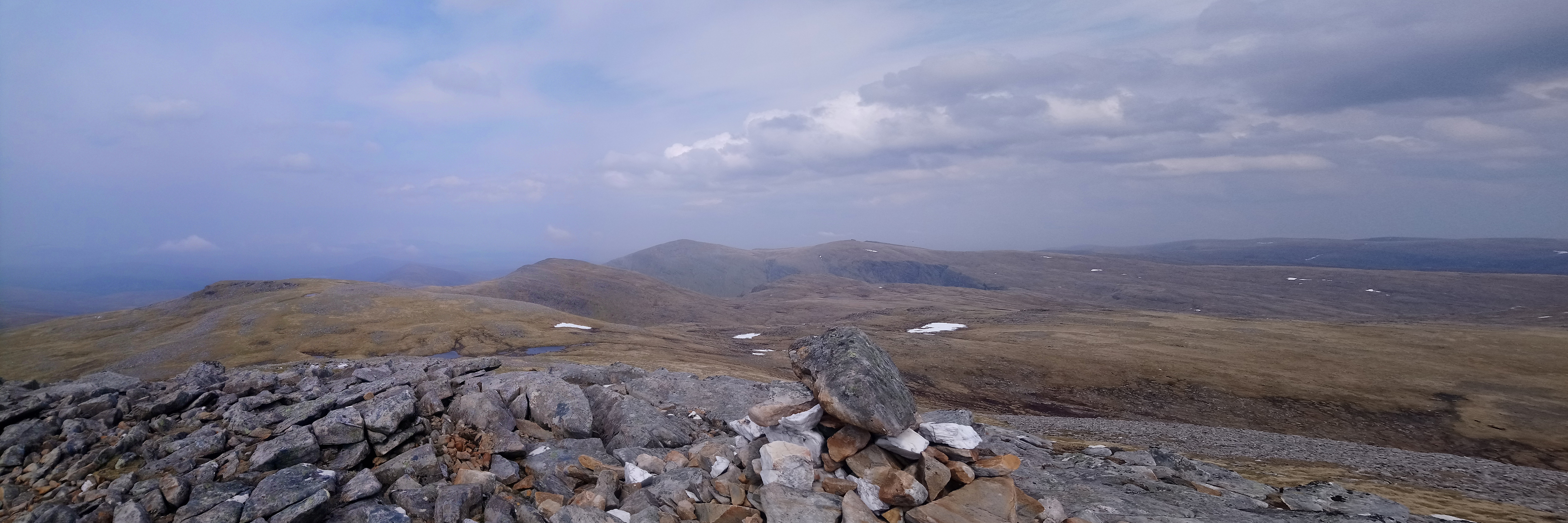
Almost unnoticed the early morning sun gave way to increasing cloud and this helped to keep the temperature comfortable, perfect really and without obscuring the viewswith the sun breaking through at times. I parted company with the wall as it headed east and I went on to the summit and another set of fine views. I could come to expect this, it seems a long time ago that I was moaning about lack of views on Groban. Beinn Dearg is the last hill over 1000 m on the Watershed, indeed by the end of tomorrow, all being well I should only have one more Munro to climb albeit one with a bit of a challenge.
 View from summit of Beinn Dearg to North West Highlands
 by
Seal54, on Flickr
 View from summit of Beinn Dearg with the Fannaichs to the left of Loch a' Bhraoin (centre) and Fisherfield to the right
 by
Seal54, on Flickr
I checked in with my daughter at the summit, sent a message to my granddaughter wishing her luck in her college assessment today, her driving test tomorrow after which she is off to Manchester to train with Ryan Air as a member of their cabin crew. I waved to friends Viv and Linda over in Fisherfield and took loads of photos before re-joining the wall for the descent into the criss-crossing bealach between Cona Mheall, Beinn Dearg and Meall nan Ceapraichean. My first overnight camp was a midsummer bivvy here back in 2003.Then, after a fine ascent of Cona Mheall from Loch Droma, the weather deteriorated as we climbed Meall nan Ceapraichean and Eididh nan Clach Geala. It rained most of the night and we had no views from Beinn Dearg the next day. This was repeated the next time I did the group with friends in 2005 so today was a treat.
My heavy sack and a skittery path meant a slow descent and I took a break to chat to 2 lads (as I thought they were) on the way up. They said they had come in from the car park and I didn’t check which one and assumed the one at Loch Droma and that they had already climbed Cona Meall. I was confident that they would soon catch me up but they had come up from Inverlael and had still to go onto Cona Mheal after Beinn Dearg..
In clear conditions, all appeared new and bore little resemblance to my memory of a mist shrouded col. There were plenty of lochans making my extra 2.5 kg of water a bit excessive but a drink in the hand is worth 2 in the bog. The triple way bealach is a little complicated nevertheless it was clear which way the Watershed went but I confess that I didn’t and cut the corner to the shoulder of Meall nan Ceapraichean. I could see groups of walkers far below me on the path up from Inverlael. Although it can be boggy I personally think the approach from Loch Droma is finer for the appreciation of Cona Mheall.
 View West from summit of Meall nan Ceapraichean
 by
Seal54, on Flickr
 Beinn Dearg from Meall nan Ceapraichean
 by
Seal54, on Flickr
 View from summit of Meall nan Ceapraichean towards Beinn Dearg west ridge Beinn Enaiglair , Fannaichs and Fisherfield beyond
 by
Seal54, on Flickr
More slabby boulders on the descent of Meall nan Ceapraichean and then a steep snow bank to cross. It was soft and I literally took it in my stride and halfway across had a light bulb moment. All my fannying around on the snow on the Fannaichs and worry about exposure on sharp ridges have an explanation. It is precisely because I haven’t been exposed to much of them in the past few years that I have become much more nervous. With snow, I do have to get my snow “legs” in each year and build up my confidence. It doesn’t take much. With scrambling, I have done less and less each year. I just need to get some practise in before Conival’s SE east ridge (not far away now) and I should be fine.
 Snow descent Meall nan Ceapraichean
 by
Seal54, on Flickr
The sun was now shining again and I almost skipped down to the col and a delicious looking (but unnamed) lochan which would do nicely for a swim and a lunch spot. Following a question on FB in response to a photo I posted of a swim spot, I now call all lochs I swm in "Yes I did". I just had to hope that as it was only metres below the path, I was far enough ahead of the other walkers to have my swim and get dressed again.
(Headline, "Pensioner charged with exposure")
 DSC_0066 Yes I did, unnamed loch at bealach
 by
Seal54, on Flickr
 Lunchtime swim spot
 by
Seal54, on Flickr
I had rounded the head of another water basin and now the waters draining east were destined for the Dornoch Firth (Westward they were still heading for Loch Broom).
No –one appeared and I had my lunch and was ready to set off again when the 2 guys reappeared. We had a brief exchange in which they expressed surprise as to how much progress I had made. I later realised that as they were new to the Watershed as an entity, they probably thought I had also taken in Cona Mheall, still I basked in their praise as they disappeared up Edidh Clach Geala and I plodded on happily behind. All 3 summits had been close together with little in the way of ascent for the 2 latter ones and I was making good progress for me.
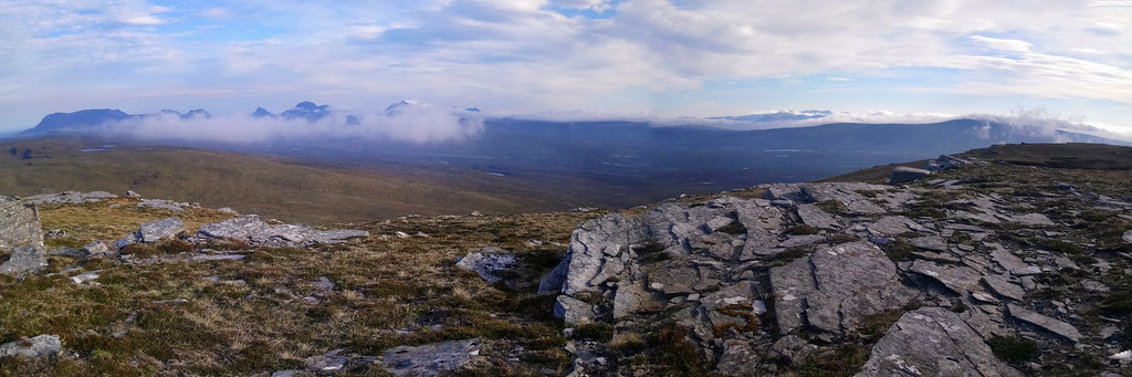
Edidh nan Clach Geala’s summit appeared heaving, the most people (5!) I had seen on a summit all the way back to Ben Lui. Each of the cairns were occupied, with one person waiting to have the summit cairn to themselves. The 2 guys were just getting ready to depart or rather one had already left, the other wasn’t so keen and admitted to me that he was flagging a bit. They had left Dundee at 02.30 and still had Seana Bhraigh to do before descending. A shout from his mate reminding him who was driving had him scurrying off. I was pretty happy with my progress, I had my eye on the wonderfully named Gate of Ca’derg for a bivvy but ever conscious of counting my Watershed miles ahead of doing them. The terrain had been easy going so far. My views were beginning to changed. An Teallach and Fisherfield were still present but the bulk of Beinn Dearg partially hid the Fannaichs from view. Further north views were obscured by haze but I could make out the low ridge of the Watershed above the lush green of East Rhidorroch rising to Meall Liath Choire, at 548m the highest peak after Seana Bhraigh on this trip. Presence of people meant less wildlife but the ever present plovers still agitated and I worried about the wind chill on their eggs or young. Seana Bhraigh looks very different from this angle. I had previously approached it from the north.
 Panorama from Edidh nan Clach Geala with Beinn Dearg left, Beinn Enaiglair centre and Fannaichs behind. Fisherfield on far right in haze.
 by
Seal54, on Flickr
 Panorama Edidh nan Clach Geala with Seana Bhraigh centre
 by
Seal54, on Flickr
The descent of Edidh nan Clach Geala (any one of the hills could have taken the name, covered as they were with white stones and boulders) was easy enough but with good visibility I failed to check the map and should have remembered that the Watershed almost doubles back on itself and I misread the land ahead, overshooting the turn. It probably didn’t take me much out of my way but it was the first of a couple of unforced errors on this trip that punctured my over confidence.
(Headline “Pensioner ends up in Inverness after non-reading map error”)
Back on track and I headed SE to almost opposite my lunch spot before turning NW and then North to Meall a Choire Ghlas and the knobbly ridge out to the Gate of Ca’derg.
 Crossing the beallach looking towards Seana Bhraigh
 by
Seal54, on Flickr
 An Teallach still visible
 by
Seal54, on Flickr
The group of lochans below Meall a'Choire Ghlas were just too tempting to pass and at the east end of the largest one was a nice bivvy spot. I had come to appreciate not carrying on until the light faded, the extra rest making the walk more enjoyable and not really impacting on my progress.
 DSC_0085 Looking down from Meall a Choire Ghlas. Seana Bhraigh ahead
 by
Seal54, on Flickr
 Tea spot.
 by
Seal54, on Flickr
I ate my tea with my feet cooling in the lochan. I had a fine view of Seana Bhraigh although seen from this side there is none of the drama of the Creag an Duine ridge, the way I had approached the summit twice before. I saw 2 figures (yes , it was the 2 guys) approach the summit and then followed their progress down. They were going at some speed but I was conscious of how much they still had to do before they reached their car. For the 4th time they stopped and had a wee blether. I said that I would offer them a cup of tea but I didn’t have any. They said coffee would do fine and then I had to refuse as my coffee was counted out. I then felt bad. In return, they again complimented me on what I had achieved. I discovered that they were older than they appeared (but also that they were ex TA and very fit) just a few years younger than me. I was impressed but also concerned that they would be driving home tonight, having had a long day already. Finally, we exchanged names. (“no, I am not the clothing brand and yes, it is my real name”) They introduced themselves as Murray and Andy. Not names I will forget in a hurry! So Andy and Murray if you read this, I hope you got home safely and now you know that I didn’t do Cona Meall!
Maybe some of their undoubted energy rubbed off on me but I suddenly got a 2nd wind and decided to go onto the Gate after all. The cliffs to my left and up ahead were impressive. Gleann a’ Chadha Dearg presented a classic ice-sculpted u shaped valley with the River Douchray snaking down to Rhiddoroch and a new name, flowing into Loch Achall as the River Rhidorroch, leaving it as the River Ullapool which flows into Loch Broom at Ullapool.
 Looking down to u-shaped valley of River Douchray
 by
Seal54, on Flickr
 The crags
 by
Seal54, on Flickr
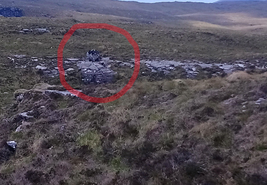
Always hopeful of wildlife I saw a big ,shaggy black goat and a group of 5 smaller pale goats. When the 5 smaller ones didn’t move (but the black one did, or I convinced myself it did) I realised that they were rocks and eventually, that the movements of the black goat were about perspective. Sure enough close up it revealed itself as a lichen covered rock with 5 grey and white rocks behind.
 "Goat"
 by
Seal54, on Flickr
 The "sheep" ahead, the "goat " on the left
 by
Seal54, on Flickr
 Looking to crags above Cadha Dearg
 by
Seal54, on Flickr
Another black and white vision flew up in front of me, a ring ouzel. Another first on the Watershed although not on these hills. For some reason on a previous visit in 2003 I had recorded that I had seen a dipper, followed by a question and exclamations marks. As soon as I read that before this trip, I said to myself “Ring ouzel, you idiot”!
Cloud was building above me and the summit of Seana Bhraigh disappeared under a grey, damp duvet as did the other visible peaks. I had expected the weather to deteriorate as the week progressed and wasn’t too down hearted. Twice previously I had excellent views from Seana Bhraigh and tomorrow, most of the day’s walking would be lower than 500m.
It is not unknown for me to sleep walk so I positioned my bivvy bag some way from the cliffs with a view down to the reed filled, Loch a’ Chadha Dheirg.
(headline “Pensioners body found at bottom of a cliff oin mystery accident”)
2nd June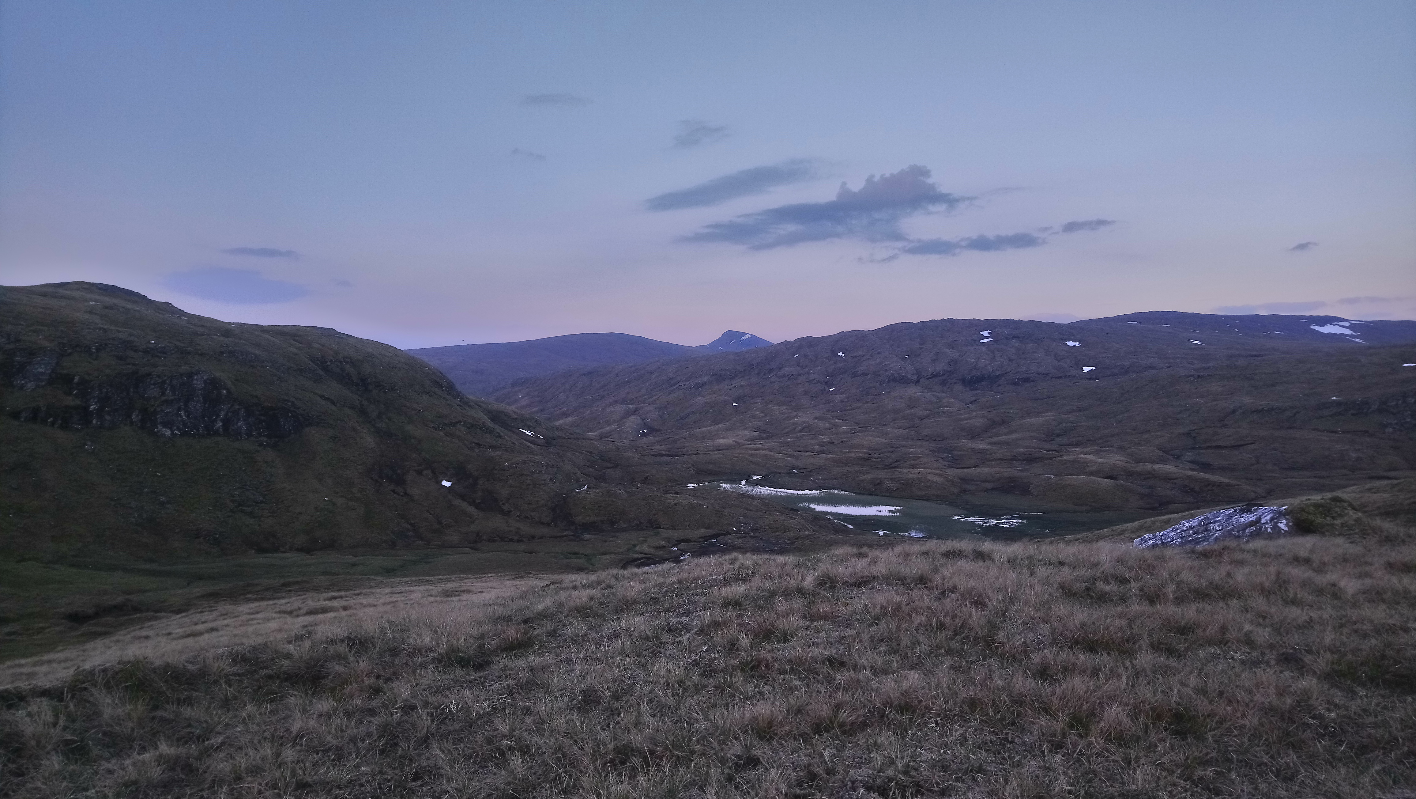 Tip of Cona'Mheall seen from camp spot
 by
Seal54, on Flickr
"
When I wake up in the morning, love
And the sunlight hurts my eyes..."The plovers’ mournful cries could not dampen my mood. I woke during the night to some spots of rain, then mist, all around and condensation in my bivvy bag. Ah well, it had been good so far. I woke again around dawn to clear skies and promise of sun, so opening up the bivvy by the time I woke properly the breeze had dried off all dampness. So far I had been denied the luxury of breakfast in bed as I don’t carry a wind shield for the stove. I packed up and found enough shelter for the stove in the Gate itself much to the annoyance of the ring ouzel who had been perched on a high spot above it. Higher than the stove, I lost half my oats in the breeze at my first mouthful! The sun was shining but traces of cloud in the glen suggested that there may have been a temperature inversion overnight.
 " I feel good" looking across to the crags below Meall a' Choire Ghlais
 by
Seal54, on Flickr
Again the dominant song in my head was .
“
”Birds flying high
You know how I feel
Sun in the sky
You know how I feel”but definitely with Nina Simone's voice not my tuneless warbling.
Whilst not the most interesting side of Seana Bhraigh, this was more than compensated by the views. The jaggy, distinctive peaks of the NW highlands, small in stature compared to Munros but overflowing with character, stretched out to my left. Beinn Dearg and its 3 satellites behind, An Teallach and Fisherfield just visible in the haze I was internally jumping for joy (I couldn’t quite manage it physically). Temperature inversions dominated to the east .Walking round the rim of Seana Bhraigh, happy memories of my companions of 2 previous outings were very much with me (2003 and 2005 (?)). I also remembered guiding the less confident of the 2nd party over the Creag Duine ridge, without any worries, another indicator that I could regain confidence with practise.
 View to Craig an Duine ridge from 905 spot
 by
Seal54, on Flickr
 Inversions to the East
 by
Seal54, on Flickr
 Looking towards Beinn Dearg Group (R) and Am Faochagach (L)
 by
Seal54, on Flickr
 View from Seana Bhraigh, A hazy An Teallach still visible in centre
 by
Seal54, on Flickr
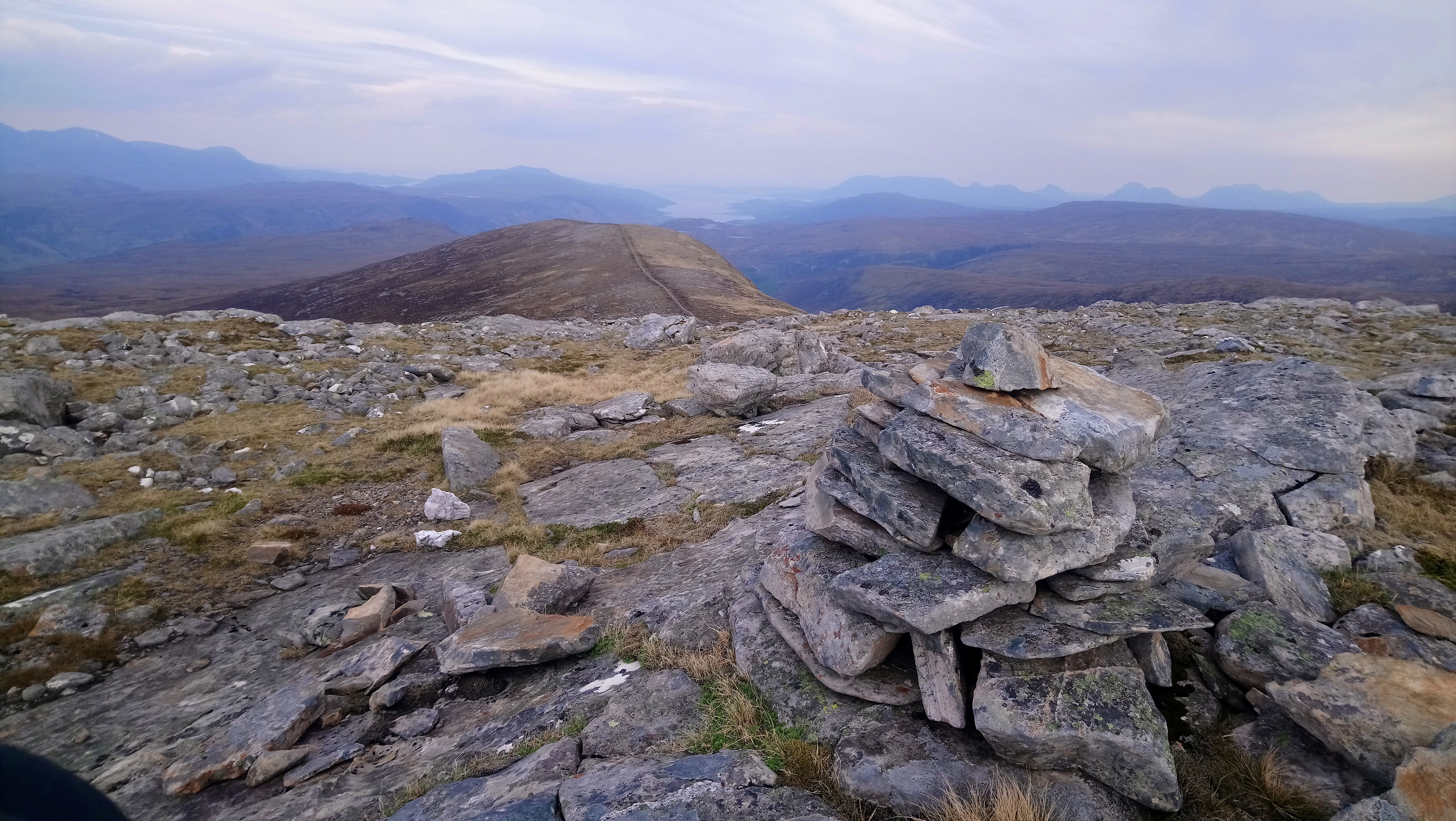
The summit of Seana Bhraigh was another outstanding view point but haze did limit the extent of the view. The day held the promise of better to come. The summit was possibly the last point I would have a signal for the next couple of days. I was in time to text a message of good luck to my granddaughter for her driving test and wave to my friends over in Fisherfield, hopefully having completed their round. I later heard that they had but were probably still sleeping when I waved.
 Summit shelter cairn, Seana Bhraigh
 by
Seal54, on Flickr
The descent down the west shoulder was across the usual slabby rocks. The invertebrate life on this walk had been dominated by a grey/brown day flying moth and I finally managed to photo one as it rested. At home I identified it as a common heath moth but am happy to be corrected if I am wrong.. I have not been able to identify a small white flower, similar in size to a moss campion flower, but with fleshy leaves.I only came across one patch of it on the way to the summit. On the descent I came across cloudberry flowers for the first tiime this year and another lichen inkblot test..
 Common heath moth (I think)
 by
Seal54, on Flickr
 White flower
 by
Seal54, on Flickr
 DSC_0117 Lichen ink blot test
 by
Seal54, on Flickr
I was very conscious as I left the summit of Seana Bhraigh that the high ground of the Watershed was all but over with just one more hill over 3,000 ft. Coming through the mountains all the way back to Ben Lomond in August 2017 had been slow to say the least with highs and lows of weather, mood and terrain. I had reached both the lowest point of the Watershed at the Great Glen and the highest at Sgurr nan Ceathremhnan, I had doubts about my ability to complete contrasting with many episodes of great joy and wonderment. I had swum in lochs, had days without people but experienced amazing encounters with the natural inhabitants of the hills. This all sounds like I was getting near the end but if I have learnt anything on this journey it is not to underestimate the difficult terrain and after the well-trodden paths of the Fannaichs and the Deargs, I was about to go off piste again with peat hags below me and on the way up Meall nan Bradhan. It was unknown terrority for me, the closest I had come to it before was a visit to Knockan Crag. There would be a lack of tracks or paths and probably little walked by most hillwalkers. The character ahead also changed from high angular peaks to more rounded, lumpy lower terrain and I was also to discover a surfeit of lochs and lochans.
The familiar remained for the descent over slabby, mainly flat boulders. I even thought I had discovered a new hill sport, riding slabs as one particularly large flat one started to slide with me down the hill. I don’t think it will catch on in these environmentally aware times.
(Headlines “Pensioner slated for introducing rock surfing as an Olympic sport”)
The peat hags were easily progressed - the dry weather meant that they were firm underfoot. Half way across I saw an enormous boot print. I nicknamed the owner" Big Foot "and occasionally saw other prints from the same pair of boots but no trace of the owner up ahead. As I write up this report I checked the Hill-Bagging website and discovered that this hill is a Hump, SiM and Graham Top and it had been visited on12/05 this year. Could this be Big Foot ? but he had come Duag Bridge and doesn’t mention Seana Bhraigh.
u
 View north from Meall na Bradhan with the watershed trending right, then left then right
 by
Seal54, on Flickr
 Seana Bhraigh from Meall nam Bradhan
 by
Seal54, on Flickr
 View from Meall nam Bradhan looking back to Beinn Dearg group
 by
Seal54, on Flickr
The mystery continued as did I over the summit and failing to make a proper check of my route taking the more defined ridge rather than the less obvious route down to the track.
(Headlines “Pensioner discovers new mystery beast in Highlands”)
The day was heating up as was I and I started eyeing up lochans for a swim but there ,far below was a fine looking loch, with a white strip of beach at the eastern end.
 Lochan Badan Ghals Liath looking inviting
 by
Seal54, on Flickr
There also was the track I hoped to join but slowly it dawned on me that I had made another error and was heading off the hill in the wrong direction. I contoured back round above some crags and some 20 minutes later made my way down to the track, I was angry with myself, this was the 2nd unforced error I had made, this time costing me more in time and effort. There was only one thing to do and that was to head off to the fine looking loch and have a swim and lunch. There was a significant landrover track coming up from Corriemluzie and a small boat at the lochside but I felt sure that any fishermen would have already taken possession of the loch so I figured I was safe for my swim.
 Yes I did! Lochan Badan Glasliath
 by
Seal54, on Flickr
The beach was composed of very even pea-sized white gravel. It would have fetched £6.00 per Kg on Amazon but whilst it was beautiful it was murder to walk on. The loch shelved very gradually so I just lay on my back then front before drip drying in the now very warm sun. There was still a breeze which helped the drying but I wasn’t in any hurry, there was no-one to disturb me in this “off the usual routes” place and as I have already mentioned, any fishermen would have already been in residence. All anger had been washed away and I finally put some clothes on to prevent sun burn. It was then that the first 4x4 appeared down the track behind me, then another and then a third, A fourth appeared some 10 minutes later, having gone the wrong way ”he’s only been coming here for 6 years and he always gets it wrong”
"Let's waste time
Chasing cars
Around our heads" 7 miles as the crow flies, far more by tracks but they found their way here!
 by
Seal54, on Flickr
7 fishermen on holiday at Corriemulzie Lodge had a near escape from the sight of me skinny dipping. We had a laugh and a joke about unexpected surprises and how they never got going until later in the day. They would normally fish the rivers but lack of rain meant that those were too low. They didn’t hold up much hope of catching anything in the loch but that wasn’t the point, the point was the company, the banter, the scenery and yes some alcohol would be partaken. They were a pleasant bunch of guys and I ate my lunch listening to their (unobtrusive) music and chat, watching them fit the electric outboard to the boat (very quiet and pollution free) and the trouble they had pushing the boat out far enough but without getting too wet before 2 of them could get aboard without it grounding and musing on how far you can truly get away from the rest of the world. An innocent discussion with one of the fishermen about the name of the loch led to a misunderstanding of where I was. He looked at my map and pointed at Lochan na Beinn Brice, telling me that was where we were. This was 5km to the west of where I thought I was and I seriously began to doubt myself. Fortunately one of the others intervened and confirmed I was at Lochan Badan Glas Liath but they knew as a different name.
It was very warm by now and I had to drag myself away from the loch (no chance of anymore dipping now) Just before I left ,a 4 spot chaser flew by, my first dragonfly since the Central Belt.
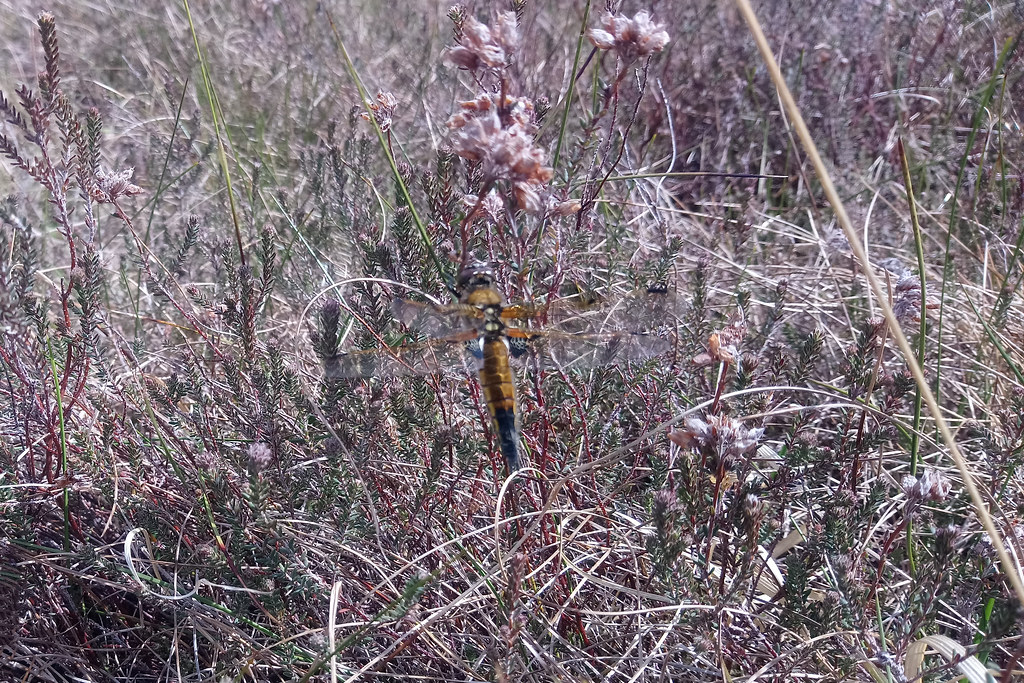 DSC_0132 4 spot chaser
 by
Seal54, on Flickr
10 minutes later when I was back on the Watershed the conversation about which loch I had stopped at plus my previous errors had a cumulative effect on my belief in myself. My 1:50k map did not tally with what I could see (tracks in wrong places) on the ground or my notes (from the 1:25k WH mapping).
"Lose your way
And I will follow"Finally, I took a compass bearing from where I thought I was, disregarding the tracks but subsequently picking up a path that was marked on the map and was relieved on reaching a small knoll to see the mismatched lochs I needed to pass between on the way to Mullach a’ Bhreun Leitir. Phew! I could navigate after all. It had taken a good hour to go ¾ mile because I kept on checking and rechecking.doubting my abiliities. The views of Seana Bhraigh, looking more impressive from this side, had a restorative effect too.
 Fine views of Seana Bhraigh and the path I needed
 by
Seal54, on Flickr
The heat of the sun was ameliorated by the breeze but it wasn’t quite cooling enough and when it dropped the temperature soared so I had become a bit hot and bothered although I was hardly ,moving. The ground under foot should have been soggy but was dry with only the merest squish. For now the slabby quartzite rocks had gone and I started to wonder about water up ahead. I was drinking a lot in the heat. My unreliable fisherman had also told me that they called Loch an Diamh the Dead Loch because it dried up in times of drought. I found this hard to believe as it was almost 2 miles in length and over 10 m deep but if it was true, would all the other lochans on my route, similarly dry up and I be out of water?
 Looking ahead to Meall Liath Choire from Mullach a'Bhruin Leitir with Clar Lochan central and Cul Beag and Mor in the distance.
 by
Seal54, on Flickr
Mullach a’ Bhreun-Letir was a good vantage point to look down on Loch an Diamh and I hoped that the feeder burns I could see would provide some water. A short way to the west the Rhidorroch Lodge is surrounded by a SSSI that holds the largest stand of Scots Pine in the Northern Region, one of the seven genetically distinct regions of Scots pine that have been identified in Scotland. This is but a splinter of the original spread of the ancient Caledonian forest in these parts. This would be a possible escape route down to Ullapool but with renewed confidence (albeit a bit concerned about water) I now didn’t want to escape anywhere except along the Watershed, besides it would mean another long walk back
.
 Loch an Diamh
 by
Seal54, on Flickr
There were plenty of excllent camping spots on the shores of Loch an Daimh but it was far too early, I found that the feeder burns were but a smudge of dampness. It was another shallow shelving loch and I lazily did not remove my boots so danced about trying not to get them wet whilst I slowly filled my big platypus using my small one to scoop up 250mls at a time. Westward what water there was, was still draining into Loch Broom. I was concerned that the numerous lochans marked on the map ahead were maybe muddy, reedy wastes without accessible water. Better carry the 2 kg extra weight than collapse due to dehydration.
 A dribble of a burn feeding Loch an Diamh.
 by
Seal54, on Flickr
I still lived in hopes of finding running water so after Loch an Diamh followed the track to another outflow from a smaller lochan (why I thought it would have anymore water in it ,I don't know but I would try anything) In between blasts of breeze it was very warm and my musical accompaniment in my head alternated between
“ The Heat is on” and “
Blow the wind southerly, southerly southerly” Predictably there was no luck at the next burn either.
 Not even a dribble
 by
Seal54, on Flickr
I finally stopped a lochan that the watershed close to. It was time for some sustenance and cooling again. I had another prolonged break, sticking my feet in the crystal clear water (after I had refilled my water as this was ”newer” than the Loch an Diamh water) and waiting for the heat of the afternoon to subside a little.
 Seana Bhraigh from my from tea spot
 by
Seal54, on Flickr
I was making good enough progress and it was a beautiful spot with views of Seana Bhraigh and the sunlight making sparkling diamonds on the water as I soaked my feet.
"Diamonds on the soles of my shoes"  The water sparkled
 by
Seal54, on Flickr
If it all went haywire underfoot I still had enough supplies to get me through to Monday. I only had another couple of miles to go before my planned stop for the night. A bee-mimicking hover fly of a variety I had not seen before and later idfentified as
Sericomyia lappona, joined me for my tea
 Dinner guest Sericomyia lappona
 by
Seal54, on Flickrr
Suitably refreshed and replenished, I continued west along the watershed rising up over a series of knobs and knolls on the escarpment that runs above Glen Achall and the Rhidorroch River. The going was easy, the day had cooled and there were good views to the west over to Beinn Gobhlach and Sail Mhor. With plenty of substantial lochans ( and one or 2 less so) I stopped worrying about water. I even managed to get a phone signal and found that my GD had passed her driving test. Yeah! Sometimes it is good to be in touch with the outside world, all in all in was a very good evening.
 https://flic.kr/p/2m65eW7
 by
Seal54, on Flickr
 An insubstantial lochan
 by
Seal54, on Flickr
 View from Creag Ghrianach to Loch Achall with Ben Goblach on left above it in distance.
 by
Seal54, on Flickr
 Meall nan Uan with Meall Liath Coire behind from Creag Grianach
 by
Seal54, on Flickr
 Lochan under Meall nan Uan
 by
Seal54, on Flickr
 Looking back to Seana Bhraigh and Beinn Dearg beyond from Meall nan Uan
 by
Seal54, on Flickr
Reaching the lochan below Creag Ghriannach I found that the easterly wind was whistling through with a distinct chill so I rejected this as a campsite for the night and continued over Meall nan Uan thinking that dropping down into the gully between it and the slopes of Meall Liath Choire may offer some shelter. The gully of course, was a collecting channel for water running off the slopes above and whilst considerably drier than normal it was still too damp for a bivvy. I eventually elected for a narrow, heathery (dry) ledge rather than try my luck further up Meall Liath Choire, feeling that it would be even more exposed. This was possibly the worst camp of the Watershed since my windy night above the A7 but (spoiler alert) not the worst of this trip. I constantly rolled off the ledge during the night but on the upside I did see the plough directly above me at one point when the sky was just dark enough to show it.
3rd JuneWith another beautiful morning in the offing, I gave up attempts at sleep around 05.30.
 Early morning sunshine
 by
Seal54, on Flickr
The sky is clearing and the night has cried enough
The sun he comes the world so often up
Rejoice, rejoice, we have no choice but to carry on
A group of deer passed across the coll above me again not noticing my presence. For the first time I had problems with condensation in my bivvy bag but the wind was still blowing and moving from my “shelf” into the sunshine both my sleeping bag and the bivvy bag dried off rapidly. My first breakfast of the day was eaten and I realised that I had been getting through my food at a rate that was above my normal consumption on these trips. I hadn’t really noticed much of a lightening of my load but my supplies of porridge oats, oat cakes, coffee and apricots were rapidly diminishing. For once I had hardly touched my snicker supply. If I missed the Saturday morning bus, I would be living off couscous and snickers for 2 days.
My route for the day started with the Marilyn, Meall Liath Choire and looped in a large letter C round the headwaters of what would become Rappach Water, River Einig and finally the River Oykell that dicharges into the Dornoch Firth. The Marilyn, Meall an Fhuarain was just above the top of the return sweep of the "C", almost corresponding with Meall Liath Choire. I hoped to reach the region of Strathan Lon which is just under 4 miles (6 km) away as the hoodie flies but the Watershed miles were almost triple that with lots of small ups and downs and twists and turns. However, the crow route would be a boggy challenge. Meanwhile, I was to discover that my route was along ribs of quartzite ribs of rock interspersed with short grassy, lichen and mossy vegetation, a delightful terrain for walking.
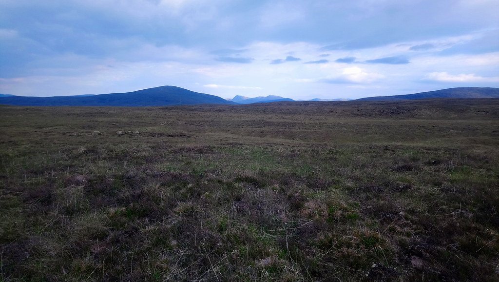
Plovers continued to dominate the bird life with the occasional pipit and grouse. Deer were everywhere and I had them to thank for the low level of vegetation. An Teallach still remained in view as did the familiar outlines of the other “lesser” hills poking above wreaths of fluffly clouds. Cul Mor had a judge's wig of cloud wrapped around its eastern slopesI passed a number of campsites that would have suited me better but didn't dwell on what might have been.
 Another lochan
 by
Seal54, on Flickr
From the summit of Meall Liath Choire I could just make out the hazy outlines of the Western Isles through the binoculars. I couldn’t quite make out the hills of Harris but waved to my Harris friends. It was a beautiful morning and i relaxed in the sun enjoying a 2nd breakfast.
 An Teallach (R) and Beinn a Chlaidheimh (L) still visible to the SW
 by
Seal54, on Flickr
 An Teallach zoomed
 by
Seal54, on Flickrr
 View north west from Meall Liath Choire
 by
Seal54, on Flickrkr
 Pano east from Meall Liath Choire
 by
Seal54, on Flickr
 Panorama looking south to Beinn Dearg group, Fisherfield, An Teallach and Sail Mhor
 by
Seal54, on Flickr
 Panorama looking SE from Meall Liath Choire. The watershed route is mainly on the right.
 by
Seal54, on Flickr
 Wreaths of cloud and judge's wig on Cul Mor.
 by
Seal54, on Flickr
On the descent, the outcrops of weathered rock looked like leaves of a huge book and offered easy scrambling but with not enough difficulty to increase my confidence. The day had become overcast and I was aware that rain was possible for today (as it had been yesterday).
"Don't know much about history
Don't know much biology
Don't know much about a science book
Don't know much about the French I took"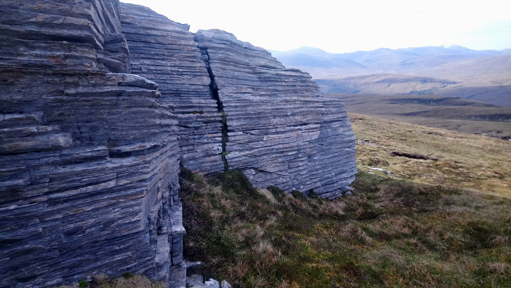 Book-like outcrop
 by
Seal54, on Flickr
 Looking back up Meall Liath Choire
 by
Seal54, on Flickr
The westwards trend of the walk gave unparalleled views of the hazy western isles and the jagged outlines of the NW highlands but I stopped taking photos from each small rise after Meall an Eich Ghlas-463m. I could see the "return leg" of the "C" across the low dip of the Allt Bheinn Dònuill basin. Breabag, Conival and Ben More Assynt had emerged from the haze, their greyness having obscured them from clear view. I came to realise that my “Hope” on the Fannaichs had been misplaced and these were the hills I had seen.
 Names of peaks
 by
Seal54, on Flickr
The cool breeze was behind me and I felt that I was making reasonable progress, wending my way through the numerous unnamed but sizable lochans that appeared at every turn and over every slight rise and by the time I had reached the unnamed lochan below Cnoc a’Choilich, I felt I deserved a good break.The morning had clouded up and I expected rain but the sun came out as I stopped.
 Meall an Eich Ghlais with typical terrain of short grasses and moss
 by
Seal54, on Flickr
 Looking ahead at Watershed route.
 by
Seal54, on Flickr
 Route of Watershed as seen from Meall an Eich Ghlas
 by
Seal54, on Flickr
 An Teallach ever visible over the ever present lochans
 by
Seal54, on Flickr
 The Torridean Sandstone peaks of the NW highlands L-R Ben Mor Coigach, Bein an Eoin, Stac Pollaidh, Cul Beag and Mor (with Suilven just behind) and Canisp
 by
Seal54, on Flickr
 More Lochans
 by
Seal54, on Flickr
 More Lochans with An Teallach, Sail Mhor and Beinn Ghoblach behind.
 by
Seal54, on Flickr
The lochan looked ideal for a dip and the clouds cleared and the sun belted down. The spot was sheltered and a cuckoo became the musical accompaniment to my dip and lunch. I felt wonderfully at peace with the world. There were no nearby tracks so I didn’t expect any fishermen (never say never). I wondered if any walkers on the Cape Wrath Trail chose this pleasant route but I had seen no sign of any human presence.
 Lunch spot below Cnoc a Choillich
 by
Seal54, on Flickr
Unfortunately, this was dented when I slid out on the algae covered rocks at the bottom of the shallow water of the lochan and narrowly missed stepping on a beer bottle. Fortunately, it was intact so no risk of stepping on hidden shards but the thought of sustaining a bad cut due to the thoughtlessness of some lazy “B” who had clearly tossed it from the bank made me swear. If I had cut my foot, I would have 3 miles to walk out with the injury and a heavy rucksack. I couldn’t carry the bottle so removed it and placed in the sediment under the overhanging bank out of reach of unwary feet stepping on it feeling that this was the best I could do. It put me off going any further out so I made do again with just a back and front lie down dip. A large red damselfly appeared as I was finishing my lunch. The weather changed again and the cloud and cooling breeze came back. This was a relief as it made for pleasant walking conditions. I was now heading up the curved back of the "C"
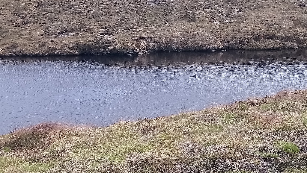
I could also make out Quinag to add to the distinguishable hills up ahead. The number of lochans, made me wonder if anyone had completed swimming in all the inland bodies of water in Scotland- a truly massive undertaking. I was hoping that I may see divers (not the human sort) at some point and as I approached Lochan Sgreadach I could see a bird swimming on the far side. Viewing through my binoculars it appeared to be a female mallard with a large brood of ducklings which she was keeping close. I wondered how many she would lose to overhead predators and I half expected an eagle to swoop down as I watched - they seemed very vulnerable.
After crossing a track that could offfer me another escape route out west to Strathcanaird, I started to turn into the top of the “C” and heading east and a completely different view. Klibreck was looking a good deal closer and at some point in the future, I would follow the Watershed in a handbreak turn over its western then southern flanks without going to the summit. I disturbed a lizard that nose-dived into the undergrowth. A huge counterpart sat firmly between the twin lochs of Lochanan nan Sàilean Mòra and I also saw a group of black-faced Valais sheep on a ridge above me. These “out of place” sightings were of course tricks of the landscape but like the lichen rocks, made me smile but not as much as the 2 divers I spotted on another lochan. I didn’t want to disturb them so took a quick photo but not very clear at the distance I was. I identified them as black-throated.
 Lizard with 3 humps and unbalanced 2 white eyes
 by
Seal54, on Flickr
 Swiss black-faced valais sheep
 by
Seal54, on Flickr
 divers
 by
Seal54, on Flickr
Ahead I could see the lochs of Strath nan Lòn and I was able to identify the 2 that the Watershed passed through. That would do me as a camp site for the night. Stopping for a break and checking for a signal without much I hope. I was surprised to get one and updated my daughter with my progress. I didn’t hang around as for the first time, came under attack from midges.
The boggy slope down to Strath nan Lòn was dissected with numerous drainage ditches. I do hope that these have been blocked as to drain the bog would destroy the peat, another environmental catastrophe.
 Looking ahead to Meall an Fhuarain
 by
Seal54, on Flickr
 Meall Liath Choire with Seana Bhraigh behind
 by
Seal54, on Flickr
I camped at Clar Lochan (the collective name, it appears, for the Strath nan Lòn lochans). Not to be confused with the Clàr Lochan group just to the north of Loch an Diamh and only 3.5 miles south from my camp near the start of "C". I watched the breeze ruffle the loch then die and the midges arrive only to disperse again as the intermittent breeze sprung up again. I timed my eating with the ruffles as it is difficult to eat with a midge hat.
 Camp site, no wind.
 by
Seal54, on Flickr
A minor disaster occurred as I managed to tip my full mug of cuppa soup into the lochan but it meant I had to resort to my 2nd choice of soup, Heinz tomato. A foodie snob, it is years since I’ve tasted Heinz tomato soup and how good it was out here looking west to the sun dropping sparkles onto the lochan with Cul Beag poking its head above the Cromalt hills. I felt fit, I wasn’t dropping exhausted into my bed. I was eating well (too well, I now had to make that bus!) and tomorrow should see me at the A837 and maybe a meal at The Alt. Early starts, mini breaks every couple of hours and longer breaks for lunch and tea seemed to have worked but I should not forget that apart from the first couple of days there had been no significant ascents and the terrain underfoot had been easy.
 A little ruffle
 by
Seal54, on Flickr
4th June, Apart from trying to swallow my midge hat during the night, I slept really well and for the first time didn’t wake before the alarm. I did have a fair way ahead of me and a worrying section of forestry at the last bit of the Watershed before the road “A mixture of forest rides and a track give a
strenuous route through the forest” (my emphasis) states Peter Wright. This forestry was just forest diggings in Dave Hewitt’s day but he describes them delaying his arrival at the A837 so I was prepared for the worst.
From my camp site a ridge of easy terrain takes the Watershed onto the less defined broad, south ridge of Meall a’Bùirich (467m) not to be confused with another hill of the same name a whose summit is less than 4km to the NW.
I took a number of photos of the last group of lochans, some of which looked almost artificial and wondered if i would find anywhere to have a dip and a clean up. before arriving back in civilisation. There was also a lone tree that had managed to avoid being browsed.
 Reflections
 by
Seal54, on Flickr
 More reflections
 by
Seal54, on Flickr
 DSC_0275
 by
Seal54, on Flickr
 A collection of swimming pools
 by
Seal54, on Flickr
Both Meall a’Bùirich and the marked point, Meall a’Bhùirich Rapaig (474m) are minor bumps off the main summit of Meall an Fhuarain, a Marilyn with a trig point but 2 kms off to the east of the the Watershed. Meall a'Bùirich was so insignificant I didn’t notice that I had passed it until I reached the summit of Meall a’Bhùirich Rapaig , the highest point of the day.
 Summit Meall a'Bhuirich Rapaig
 by
Seal54, on Flickr
I could now see to the A837. Loch Borralan and The Alt were obscured by the forestry on the east side of Loch Urigill. Above the road Breabag, Conival and Ben More Assynt looked massive from my lowly stance. Ben Klibreck and possibly Ben Loyal also in view. The familiar sentinnels to my left continued to march northwards with Quinag now very clear at the northern end. Nearer was Strathcannaird with Ben Mor Coigach above it.To the south west An Teallach was still clearly visible as was Beinn Dearg and Seana Bhraigh.to the South.
 Loch Urigill
 by
Seal54, on Flickr
 Conival and Ben More Assynt (L) , Ben Loyal, a faint smudge andKlibreck right.
 by
Seal54, on Flickr
 The sentinels to the West
 by
Seal54, on Flickr
 Strathcanaird with the bulk of Bienn Mhor Coigach above.
 by
Seal54, on Flickr
 An Teallach still visible
 by
Seal54, on Flickr
 Seana Bhraigh and Beinn Dearg
 by
Seal54, on Flickr
I had intended taking in Meall an Fhuarain, I thought I would regret it if I didn’t and I would have time. My issue was the road miles I had at the end of the day which I knew would take their toll on my feet. I decided that as I had overshot the turning point off to it, I woiuld leave it. Any regrets were soon vanquished when I came across a shallow lochan just before the 2nd summit of the double topped Meall a’Chaorainn. (454m). This proved to be a gem.
 Last swim spot
 by
Seal54, on Flickr
Again very shallow but with a fine grained schist mud on the bottom. I used this to scrub my skin clean. Last time I had done this was on a fine spa day with my daughter and granddaughter back in 2019, a life time and a pandemic away. This was a good deal cheaper and I was able to drip dry in the sunshine and light breeze confident that I could see for miles around that there were no approaching fishermen in the vicinity.
The views were far superior to the Sheraton but a photo from the lochan included my rucksack dominating the frame, something I couldn’t see due to the bright sunshine on the screen. Klibreck and Ben Loyal beyond were visible to the NE but Ben Hope still eluded me.
Dressed and feeling clean, now that I could see white building of The Alt , I checked to see if there were any vacancies (come on Rohan, this is NC 500 territory and it is a Friday night, even before covid this would have been unlikely). Since new owners took over 4 years ago there is no longer a bunkhouse so it would be a spot of luxury. No vacancies but I was able to book a table for an evening meal. I also booked a seat on the bus from Ullapool, just in case it filled up.
 Meall a' Chaorainn summit. Loch Urigill in distance
 by
Seal54, on Flickr
 I couldn't get enough of this view
 by
Seal54, on Flickr
Ahead a faint atv track followed a fence line onto Meall nan Imrichean. To the west of me the Crom Alt marked a change of drainage from Loch Broom. It drained into Loch Urigill and the water would ultimately run into Loch Veyatie and then Fionn Loch under Suilven down the River Kirkaig, tumbling over the Kirkaig Falls and out into the Minch at Inverkirkaig, familiar sights from previous visits to the area.
 Looking back along fence to Meall a'Chaorain with Meall an Fhuarain on left.
 by
Seal54, on Flickr
I didn’t see any stones marking the summit of Meall nan Imrichean (298m) but a strainer post of the fence seemed to coincide with the summit. A dwarf, multi-stemmed rowan clung to the strainer post probably well browsed by deer.
 Summit rowan at Meall nan Imrichean
 by
Seal54, on Flickr
The Watershed takes a turn to the east to Cnoc na Ghlas Coille (307m), the last named height before the road. A couple of sink holes on the downward slope from Meall nan Imrichean indicated that the underlying geology had changed to limestone. This change of geology marks where the Moine Thrust turns east. for a while before curving westwards again beyond Ben More Assynt to run parallel to the Sole Thrust, the oldest of the group ot thrusts making up the MoineThrust Zone to Loch Eribiol. I was going forward and back in geological time.
 Sinkholes
 by
Seal54, on Flickr
 The dip of Crom Allt, with Loch Urigill in the distance
 by
Seal54, on Flickr
The limestone gives way to quartzite again on Cnoc na Ghlas Coille. The terrain was getting progressivley worse with longer, tussocky grass and the plantation forestry looked closely packed. Breabag dominated the Watershed route on the otherside of the A837
 Summit of Cnoc na Glas Choille with Loch Urigill (l) and Loch Borralan (r)
 by
Seal54, on Flickr
 Breabag plus forestry in foreground
 by
Seal54, on Flickr
The Watershed takes another turn to the SE roughly parallel to the deer fence protecting the forestry plantation until an elbow in the fence on the other side of which was a slight rise, the end of a weak ridge from CnGC. I couldn’t remember when I had last encountered a deer fence. There was no stile in sight so I found a strainer post and unloaded the heaviest items from my rucksack before climbing over. The contrast on the other, deer-excluded side was obvious. Gone altogether was the short vegetation, here was leggy heather and long tussocky grasses. Hope for some kind of path through the firebreak was misplaced. As plantation vegetation went it wasn’t that bad but I had been spoilt. I took no photos as the contrast with the all round quality views that I had been blessed with for so long was such that nothing seemed photogenic enough. The plantation was dense and when I reached the track I stuck to it even though it took me out onto the A837 just over ½ mile (1 km) from where the Watershed. crosses it. Ahead as I turned north-westward along the road, Suilven dominated the view but long before Suilven was the Alt and a drink and a meal as long as I didn't get taken out by a car before I got there.
"Hit the road Jack"(Headline, Pensioner takes no risks on hills but gets totalled by car)
 Watershed, back into the forest and up to Cnoc na Glas Choille
 by
Seal54, on Flickr
 Name the hill !
 by
Seal54, on Flickr
 Where the Watershed continues.
 by
Seal54, on Flickr
The breeze had kept up most of the day. I was early for my meal but this wasn’t a problem. I meant to change my clothes but I was accepted in my rather dirty boots and clothes (but my table was by an open door. Covid ensures well ventilated, socially distanced spaces which suited me and no doubt the other diners.
 DSC_0334
 by
Seal54, on Flickr
Whilst I ate the wind dropped and the midges came out and Sue confirmed that they had appeared yesterday for the first time this season The bar wasn’t busy and I felt no pressure to hurry, I kept my eye on the trees to see if the wind picked up again. It didn’t and eventually I could not put off heading up the road and certain attack by midges in wherever I found to bivvy.
The spot I found out of sight of the road and away from any houses was particularly sheltered. It was also the warmest night of the whole trip. In burrowing down in my sleeping bag with midgey hat pulled right down, the sweat was soon running off me. I braved midge attack to get out of my sleeping bag and into my fleecy liner instead which I hadn’t used for a couple of nights. This was better but it was almost impossible to sleep I so tried to work out how many midges it would take to drain me of my blood supply. Unfortunately, I was short of a few facts (like how much blood does a midge suck). I have since discovered that they take 2µl. So it would take 500 midges to take 1 ml of blood and as the average human had 5,000mls of blood it would need 25,000,000 midges. I swear there was at least that number that night and of course it would take less to actually kill me AAARGH.BUT, I’m still here so with either my maths was wrong or I was well protected. It was a long and itchy night, probably my worst on the Watershed fro sheer discomfort but it did not diminish the feeling of absolute joy I had experienced over the previous few days. I may take another 4 years to complete the Watershed but nothing will take from these great hill days.
Next morning there was a slight breeze but I waited until I reached Ledmore Junction before making my breakfast, fortunately with enough breeze not to need my midge hat. It was a relief when the bus turned up and to know that I didn’t have to spend 2 days under further attack from this tiny insect. As I got on the bus I realised that the rain had never materialised apart from a few drops on Tuesday night. There was just one last thing to make the walk complete or rather 2,. 2 egg and tattie scone rolls and a mug of coffee at Ashers in Inverness bus station. As I now have to come through the bus station on every trip to the Watershed, I am starting to get to know the 2 women that serve me.
