
We love a challenge
The time has come to think about travelling further in order to keep chipping away at Parminder's remaining hills.
So I suggested we head to Kintail to see if we could manage Beinn Fhada & it's closish neighbour A'Ghlas Beinn, that way it would save us having to make 2 journey's. As usual the forecast changed constantly as Sunday got nearer and George reported on Saturday that thunderstorms were now forecast. I checked the Met Office forecast & although there was plenty of rain on the menu there were no thunderstorms. To think we even considered going elsewhere makes a mockery of the weather forecasts, especially when you see the photo's and the lack of rain. Rant over.
Now Kintail is about 3 hours drive for us so I suggested we meet at our usual spot at 5.15. No surprise that the roads were very quiet on our journey north and they were almost as quiet on our way home - due to a much discussed small football match that was taking place south of the Border.

We managed to get one of the last spots in the small National Trust car park

The River Croe which runs along side the road
George showing off his talents, walking & taking a photo at the same time

The bridge over the River Croe

Very picturesque and not fast flowing

We are now off and marching along
We didn't see any livestock at all

Heading into the overgrown stuff now

Looking back
A vehicle parked on the track that heads to the Falls of Glomach

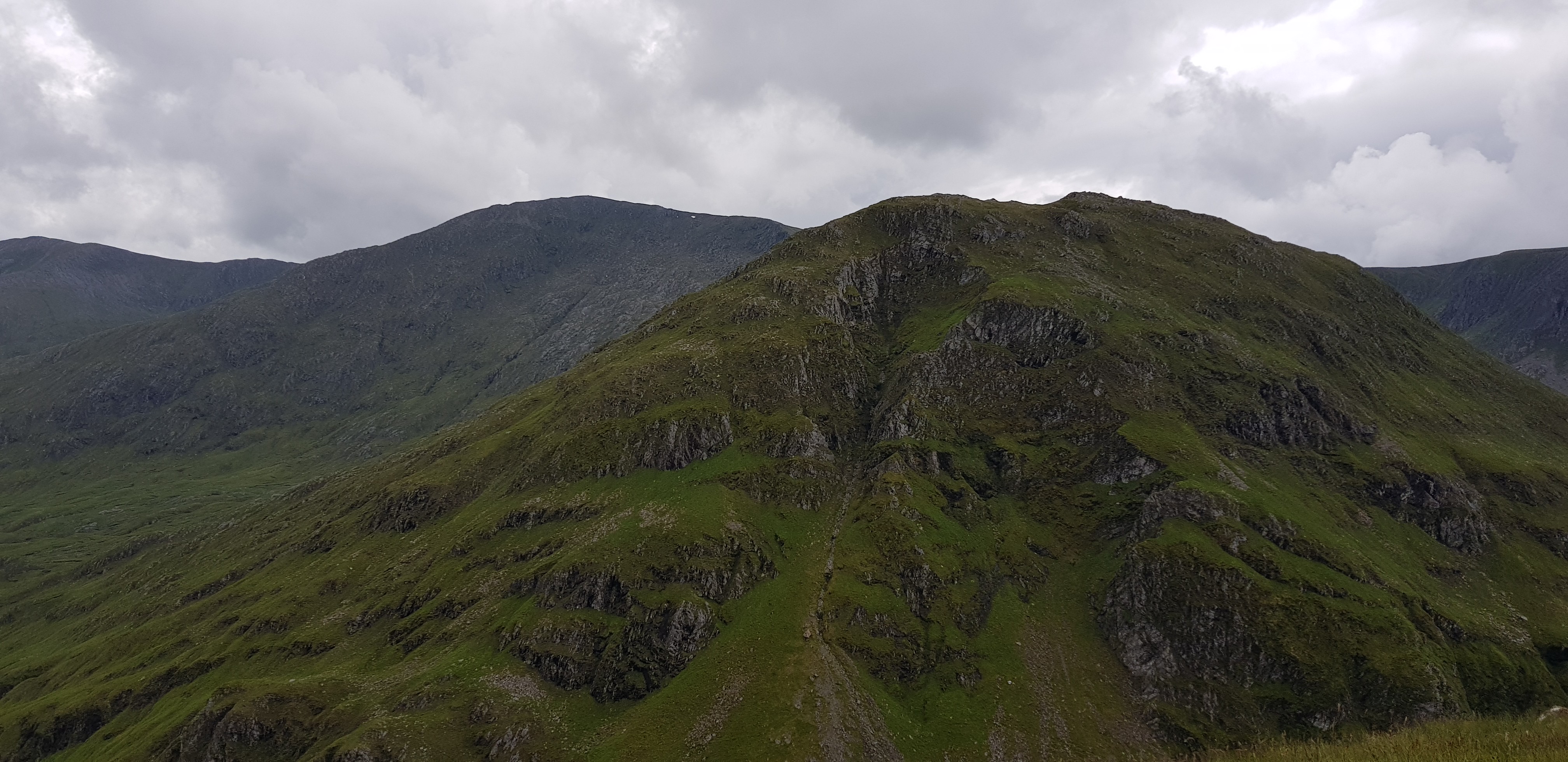
Both our hills are either side of the lump in the distance

By now we perspiring profusely
Nice water feature

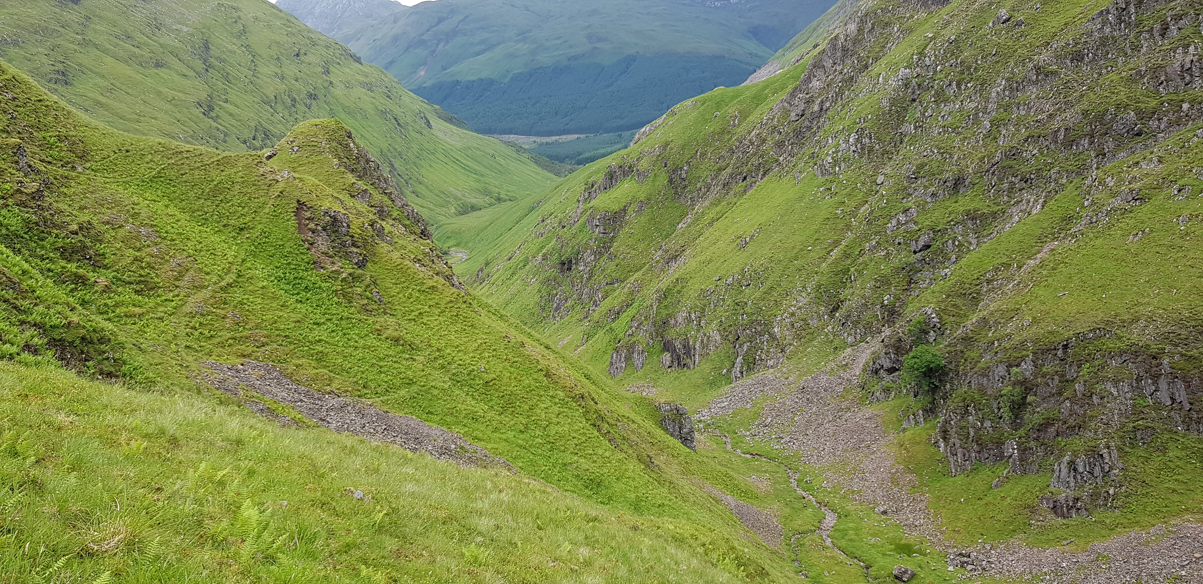
Looking back down the glen
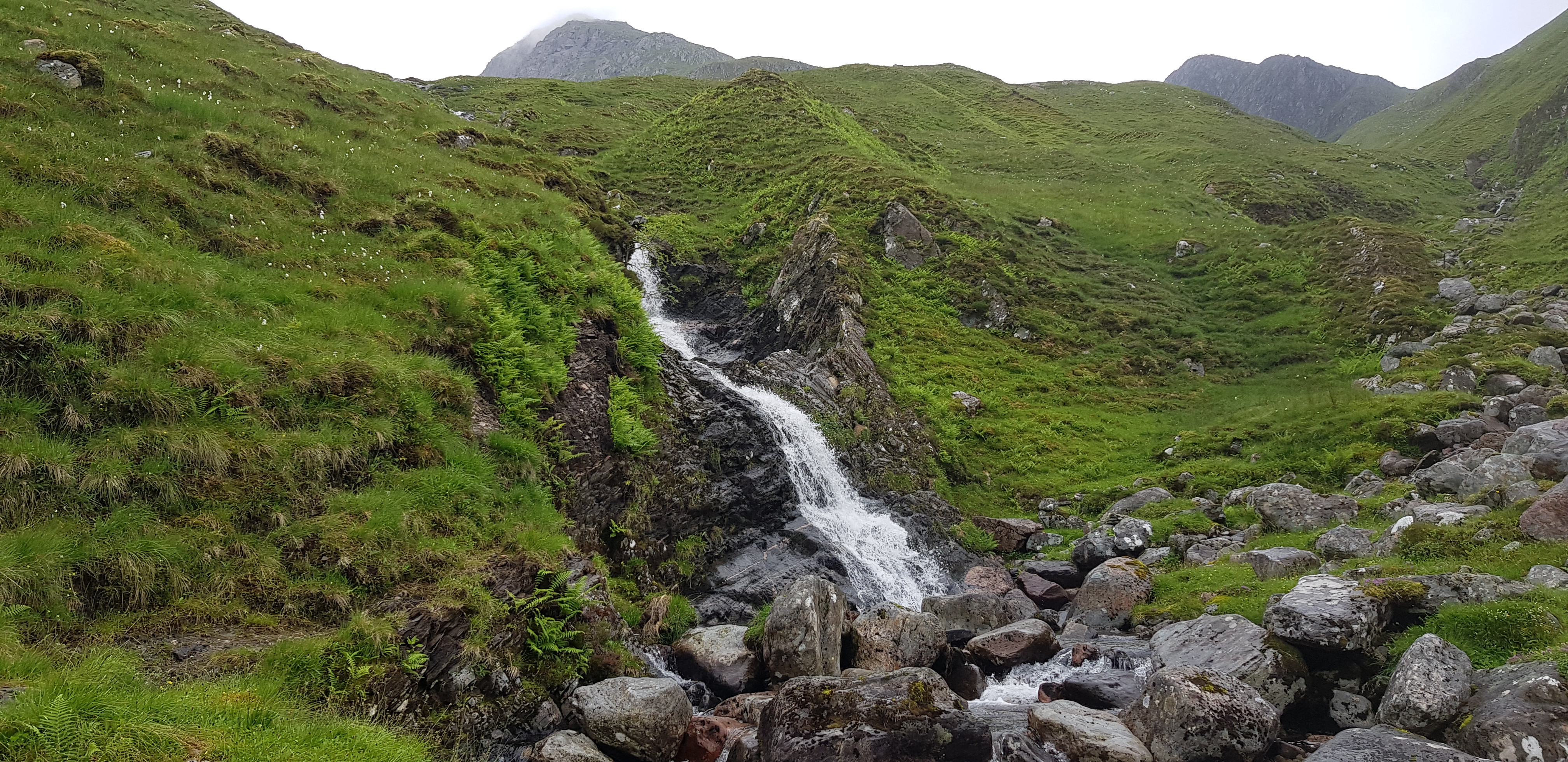
The next water feature on our travels
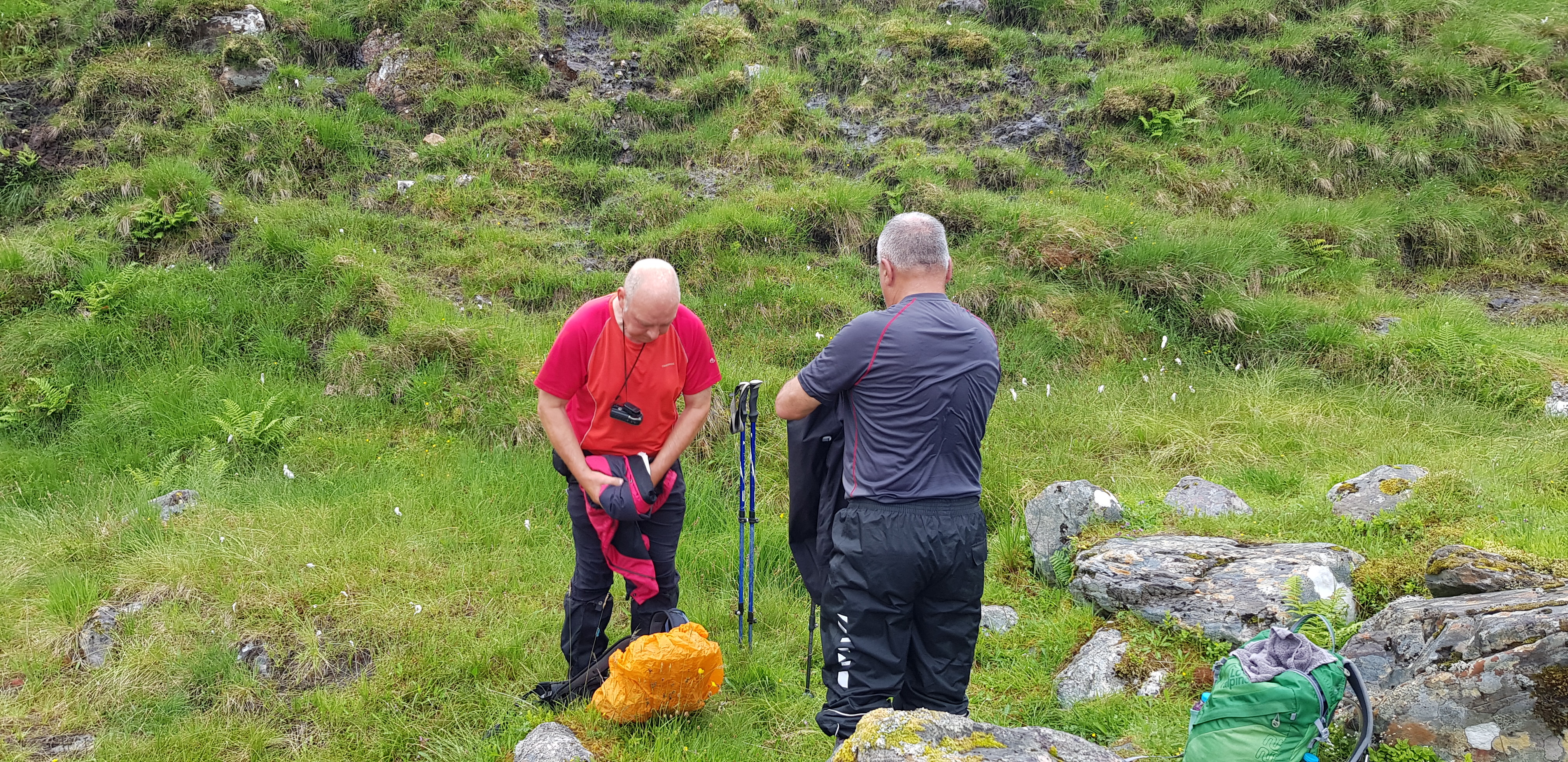
It was time to remove the waterproof stuff
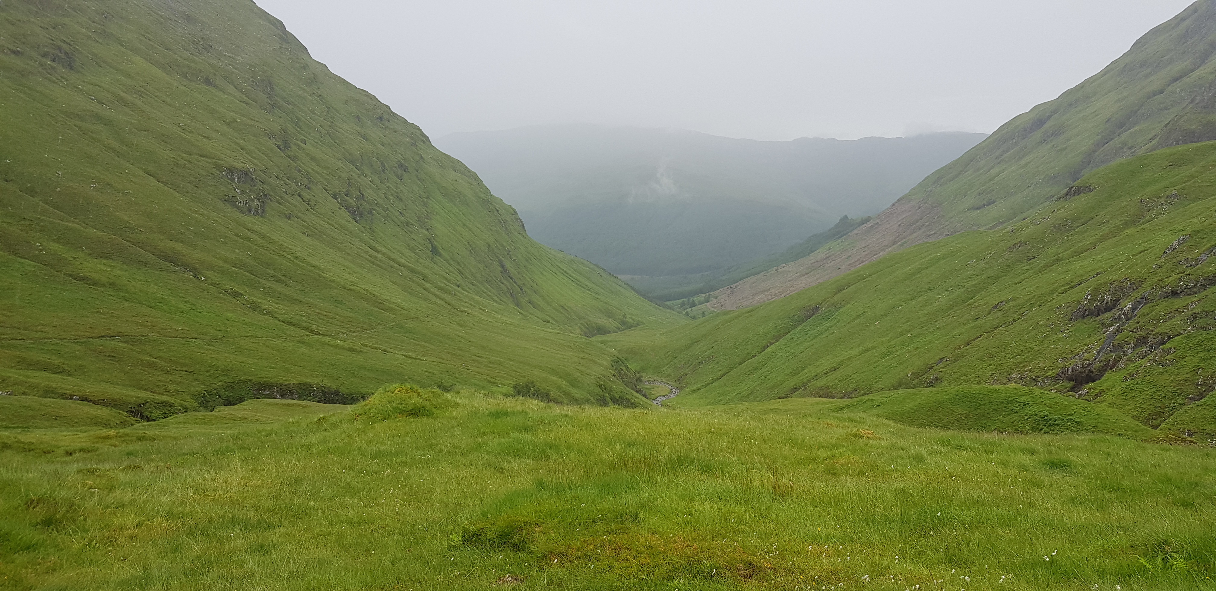
Looking back down the glen

We are heading along the path towards Fhada first, our theory was it is the higher of the so let's tackle it first
The plan sounded as if we had really thought about it in depth, we hadn't as there were a couple of serious flaws. Firstly after tackling Fhada we retraced our steps back down to where the path splits in two. The major drawback was we had to descend down to 420m, meaning we had a minimum of 500m to ascend, which doesn't include the undulating terrain to reach AGB. Once we reached A'Ghlas-bheinn our plan was to make the day more interesting by loosely following Gill c's descent route down to the forest. On the map it looked a doddle but as you will find out later it was familiar territory for us 'adventurers'.

The path would take us to the left of the burn
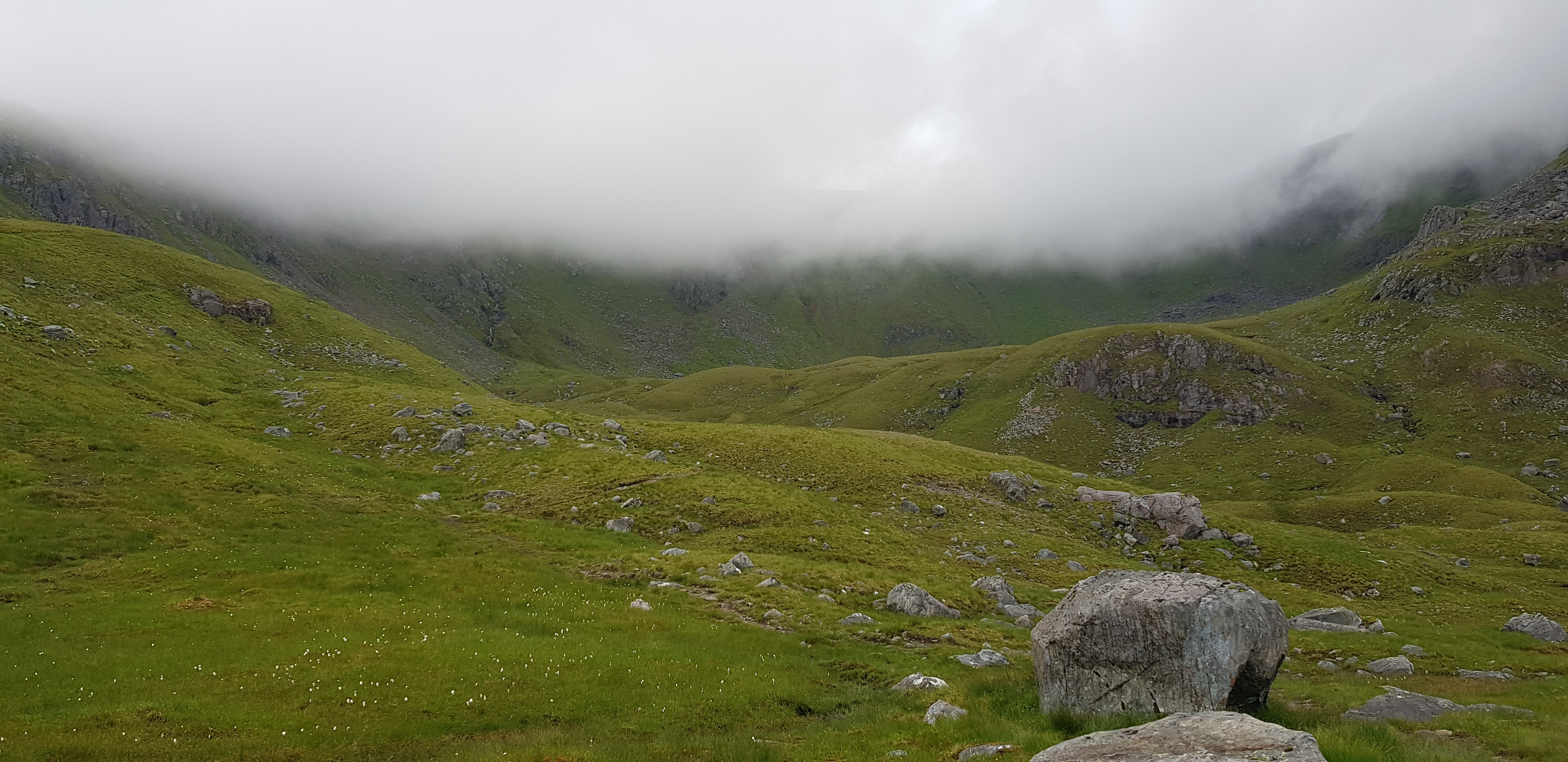
The Coire an Sgairne with low cloud hiding higher area

Cloud starting to lift

The path that will take us onto the shoulder that eventually leads to the summit

On the shoulder now looking east

Parminder rushing uphill to join us

Cairn at the start of the shoulder

George checking the weather forecast again

And suddenly the low cloud rushed in behind Parminder

Looking back down the shoulder - A'Ghlas Beinn in the distance
Looking back again

Plaide Mhor behind Parminder

A white quartz seam

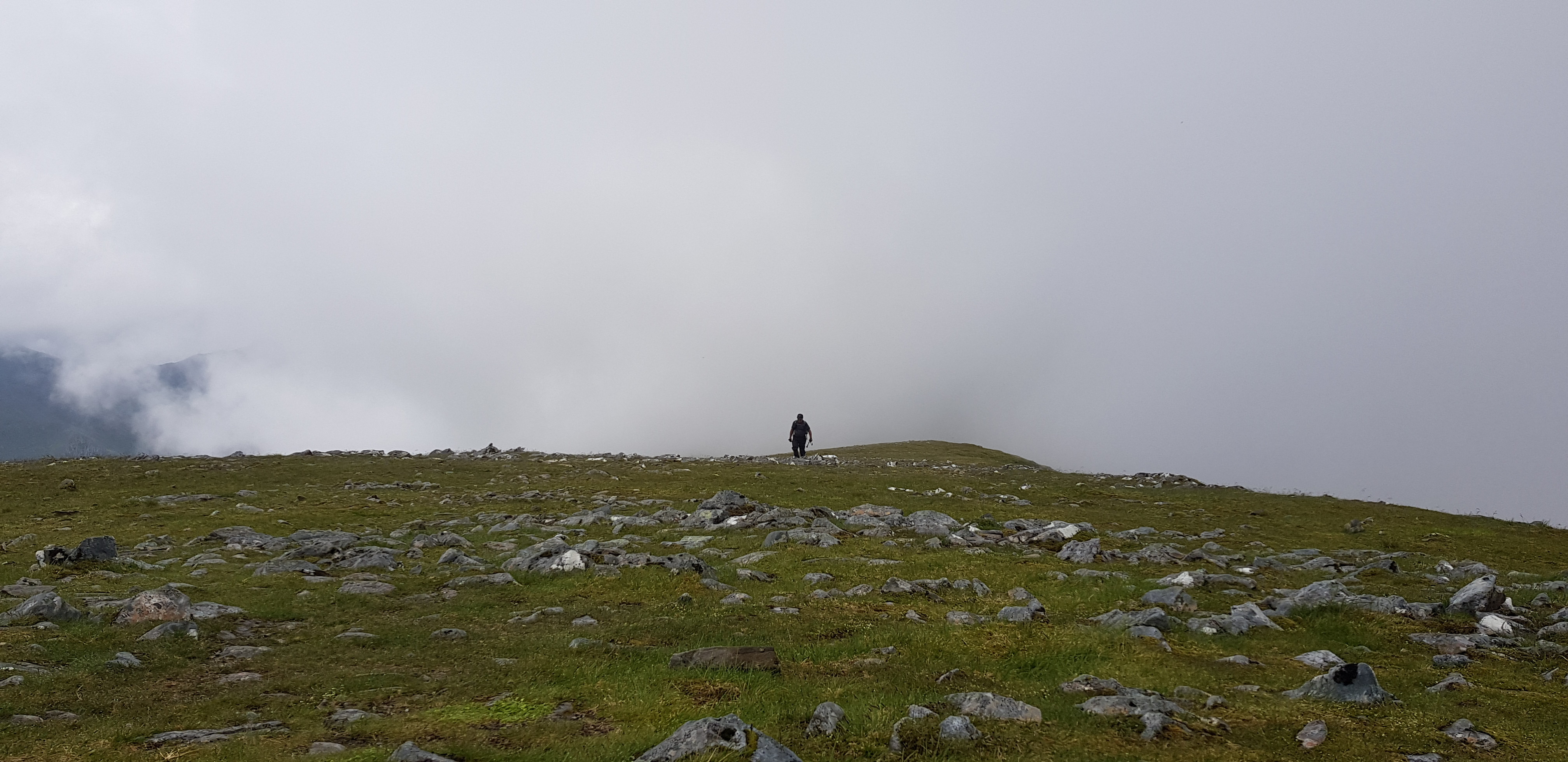
Not far to the summit of Beinn Fhada
George getting his camera ready for Parminder arriving
A straggler appearing out of the cloud
A wee bit of cloud obscuring the views for a minute
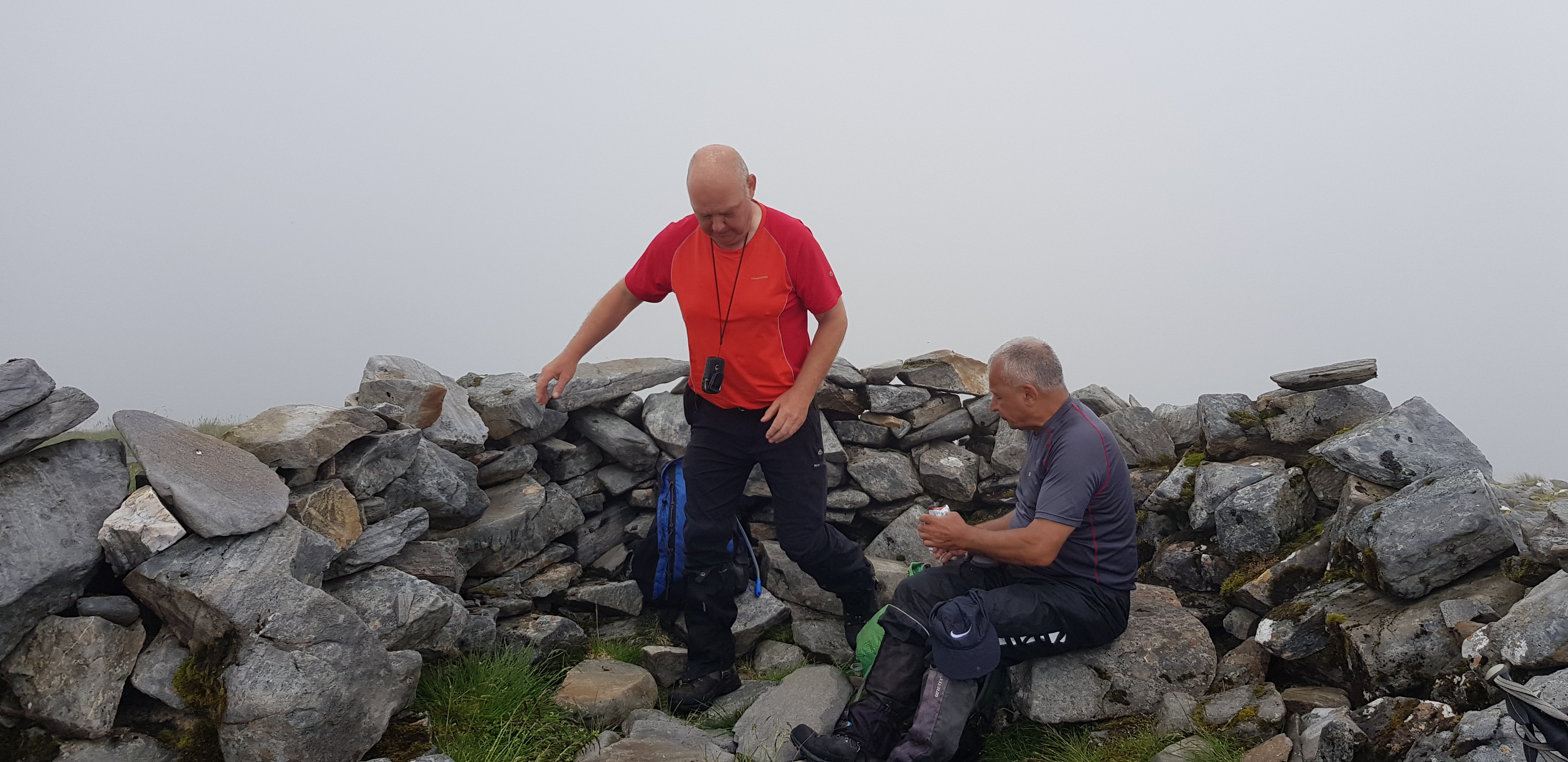
Our lunch spot - well earned
I have to mention a very nice young lady who overtook us on the long ascent, she was running and walking. We met her again as she was descending and she was originally from Greece but has lived in Scotland for over 20 years, if you read this, thanks for the chat and it was good to meet you.
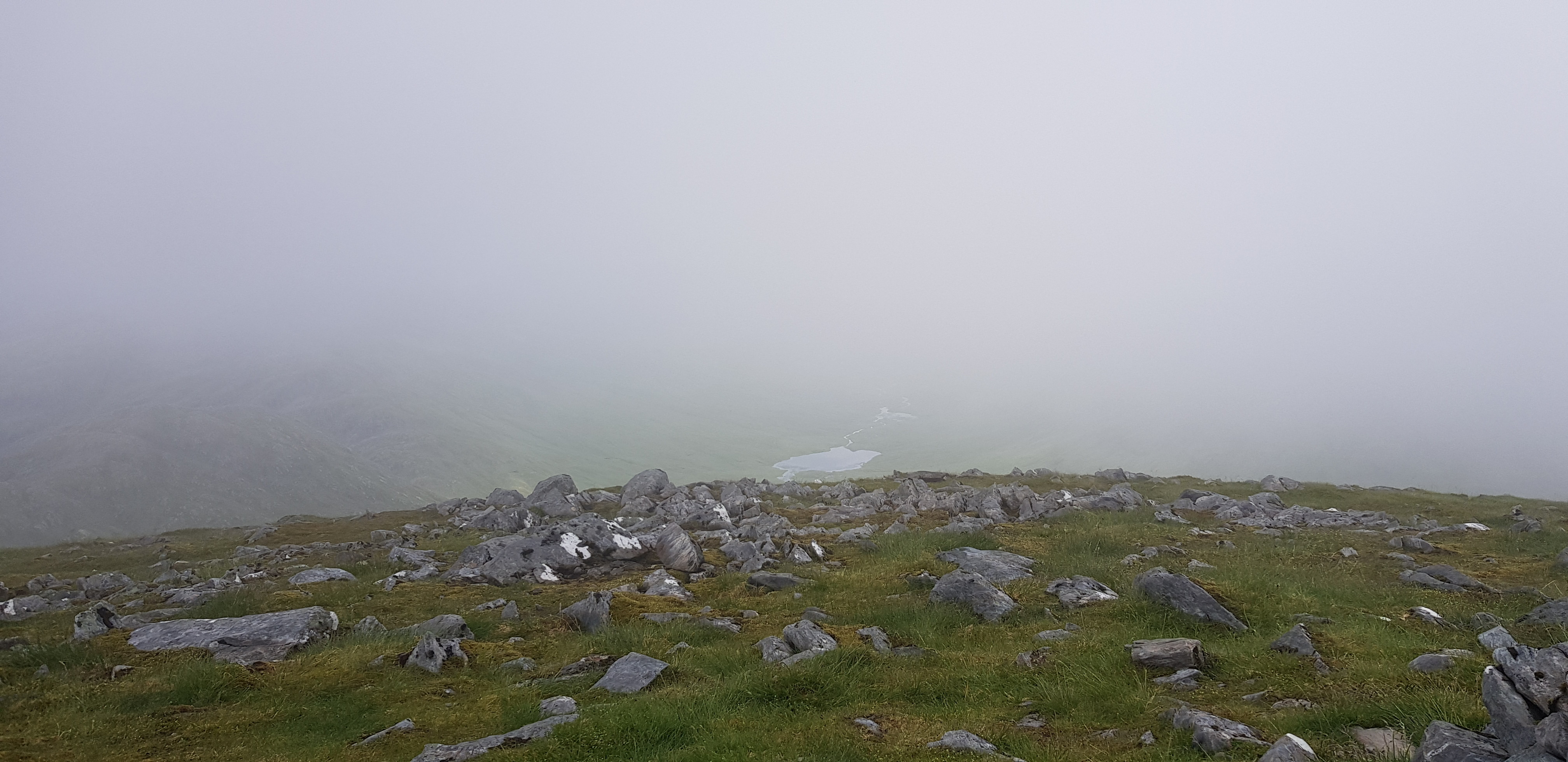
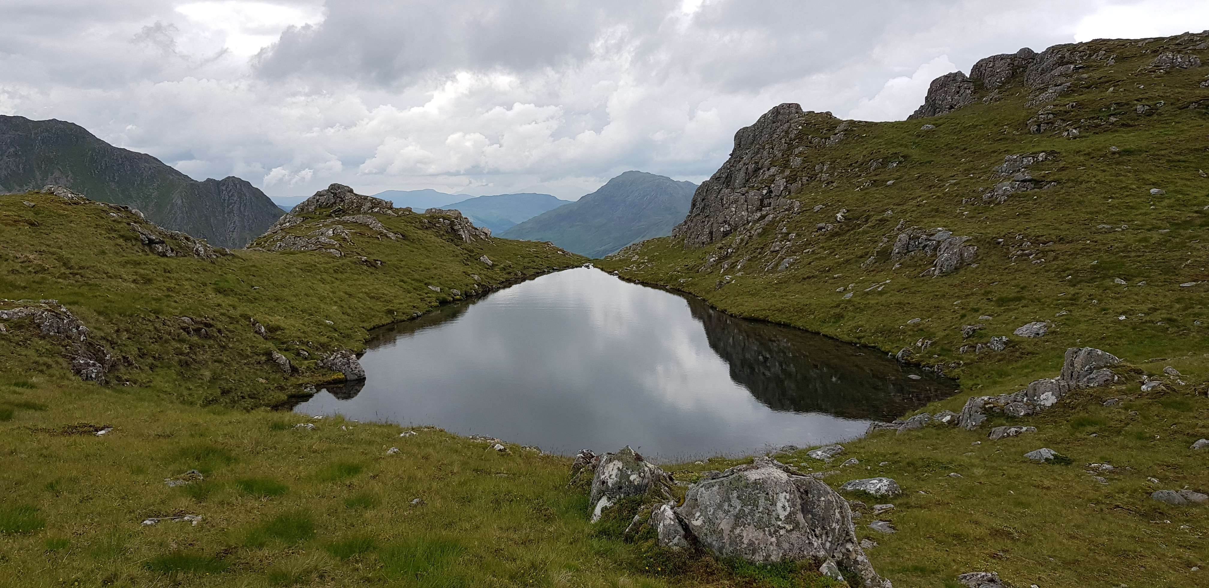
There you are I knew it would clear up, Loch a'Bhealaich which lies to the east

Heading down now and shoulder can be seen clearly, A'Ghlas-bheinn in the distance

Everywhere is so green
Looking back down from the bealach before you turn left and head uphill

Plenty of steep sided lumps

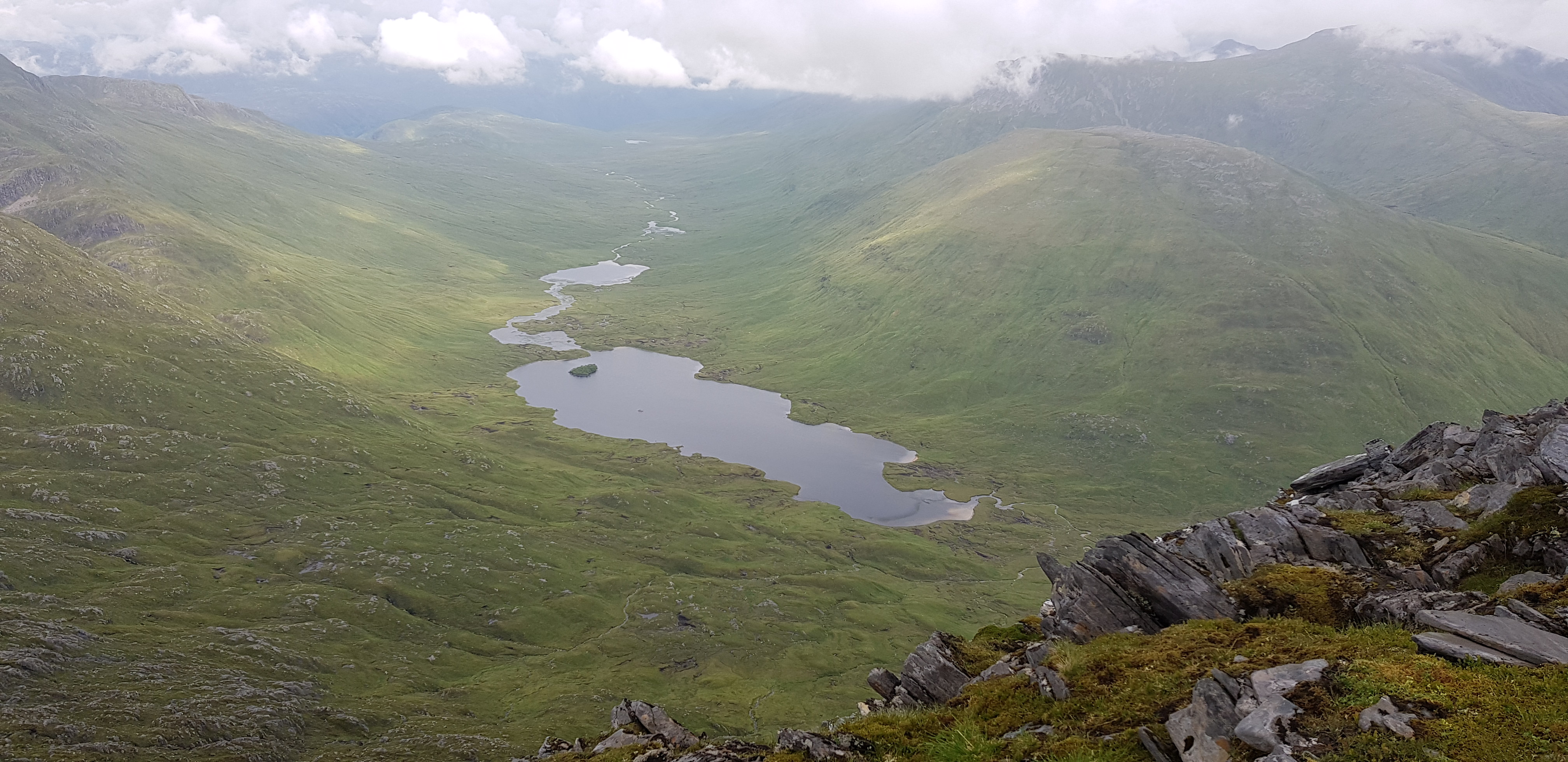
Loch a'Bhealaich again from a different angle

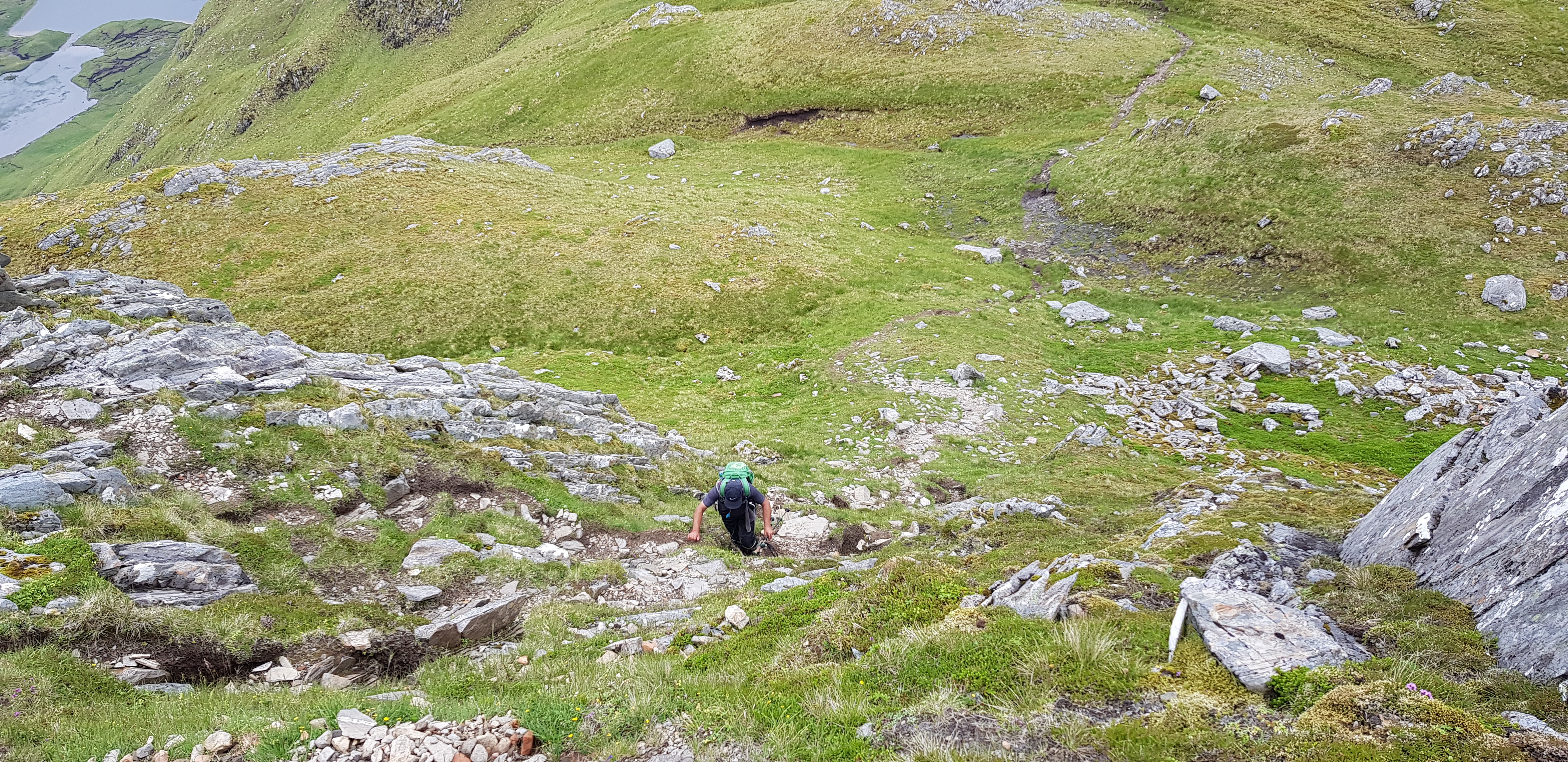
You know it is a bit steeper than usual when you have a zig zag path

Looking up to our leader

Loch a'Bhealaich again from slightly higher up
Looking back towards Fhada and the lump in between the 2 hills

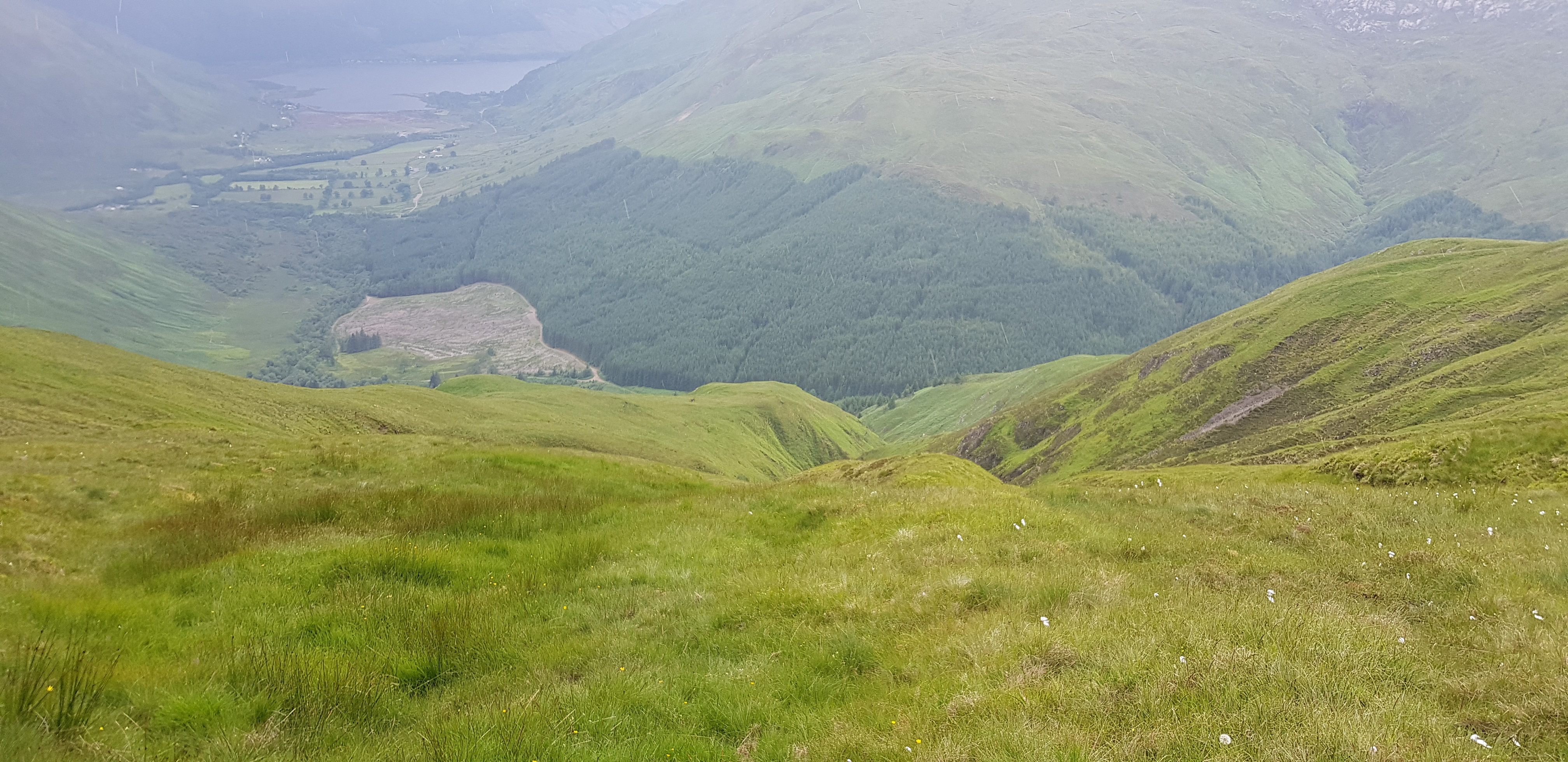
Looking further down the glen from Loch a'Bhealaich

A moments reflection whilst we get our breath back

This highlights how many false summits you haver to endure before you reach your goal
Arty shot for the day
Parminder head down and loving the final push

Looking back to our start point and Morvich and Loch Duich

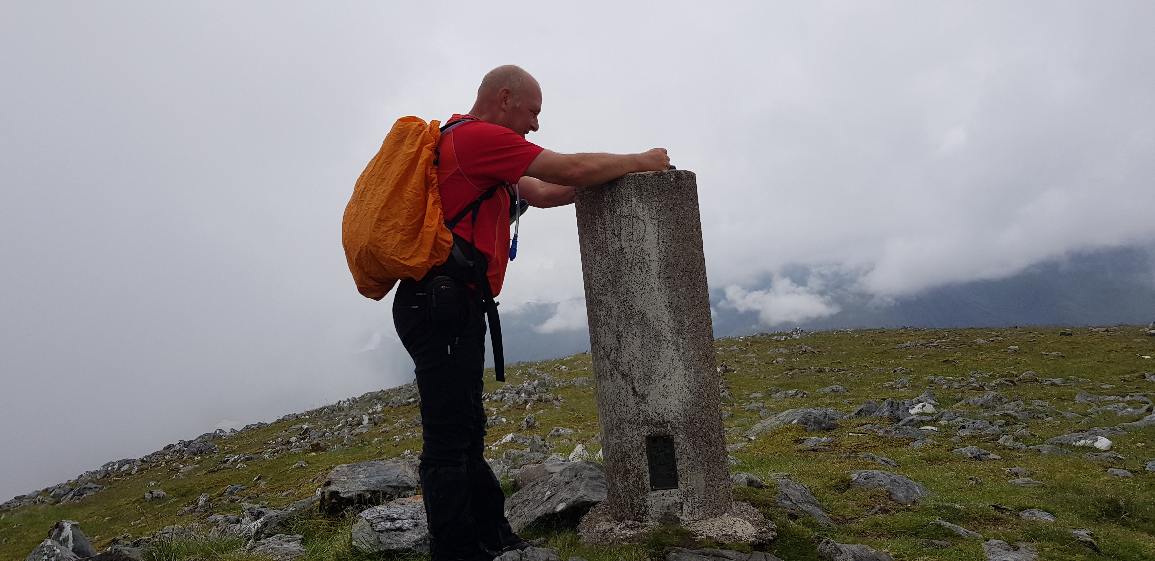
At last the summit of A'Ghlas-bheinn

"Come on Parminder, not far now"

We are now descending down the steepish grassy shoulder / slope, loosely following Gill's route

I wasn't expecting this
I think the route we should have taken is on the right shoulder, we went straight down, you can see the track on the edge of the forest
We weren't going to cross the chasm to get onto the shoulder on the left - for obvious reasons
Whilst descending down the shoulder it started to rain, so it was on with the gear and off we went again.

Our first obstacle
Before we reached the fence we assessed our options when we were higher up, do we head left & possibly try and pick up the path that we headed in on - NO, that idea was binned as it involved a bit of ascending. Do we climb over the fence now and head for the track which was about 200m away - NO, the forest was far too dense, we could have tried but it would have involved being on hands and knees. So we followed the fence to the right and downhill, which in theory was going to wards the track.

How inviting does this look, bearing in mind it was raining as well. Bracken is bad enough when it is dry, when it is wet it isn't even remotely any fun. You notice s light brown patch, there is a tiny burn, that is where we headed

If we followed the fence we would have to do more ascending so that possible idea was binned
The track is very close now, so we took a chance - luckily we didn't have to climb the deer fence, someone else must have been here before us as there was a gap underneath - easy peasy

We were now in familiar territory, jungle - it has been a while but we still have our jungle skills

The photo's make it look quite light, it wasn't. I was using viewranger on my phone to navigate through the trees to the track along with assessing if we could battle our way through

Bit blurry, sorry but it shows we had to take care with all the sticky out branches wanting to assault you

The next obstacle a small burn, once again we had to find a safe crossing point - there were plenty of big stones/boulders but all were nice and shiny and even worse slippy

Parminder leading the way, shock

Looking back uphill from the safety of the track

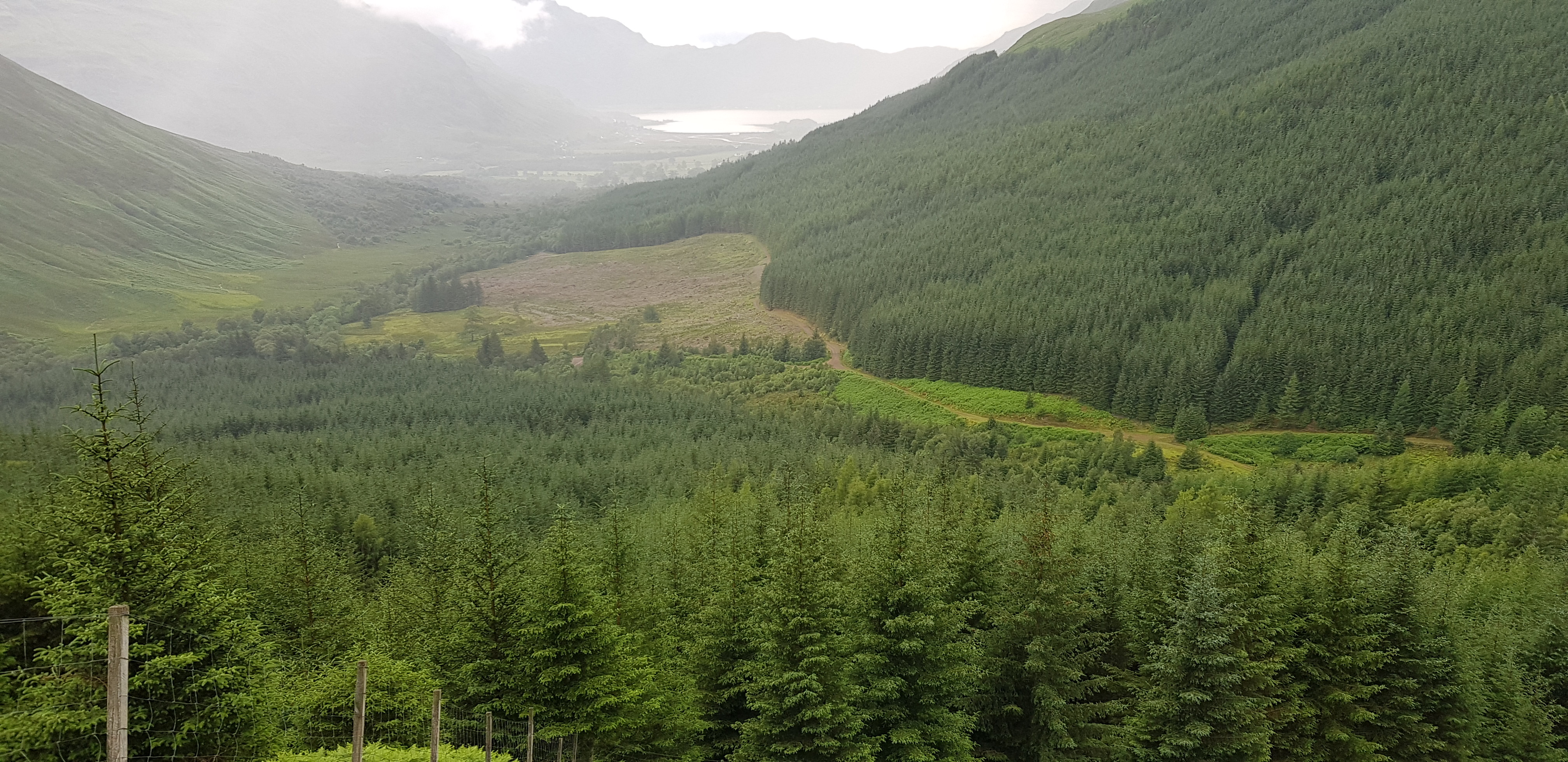
We are now on the track that takes you to the Glomach Falls, I went there last time and wasn't overly impressed

This shot looking back highlights the choice of shoulders you can descend on
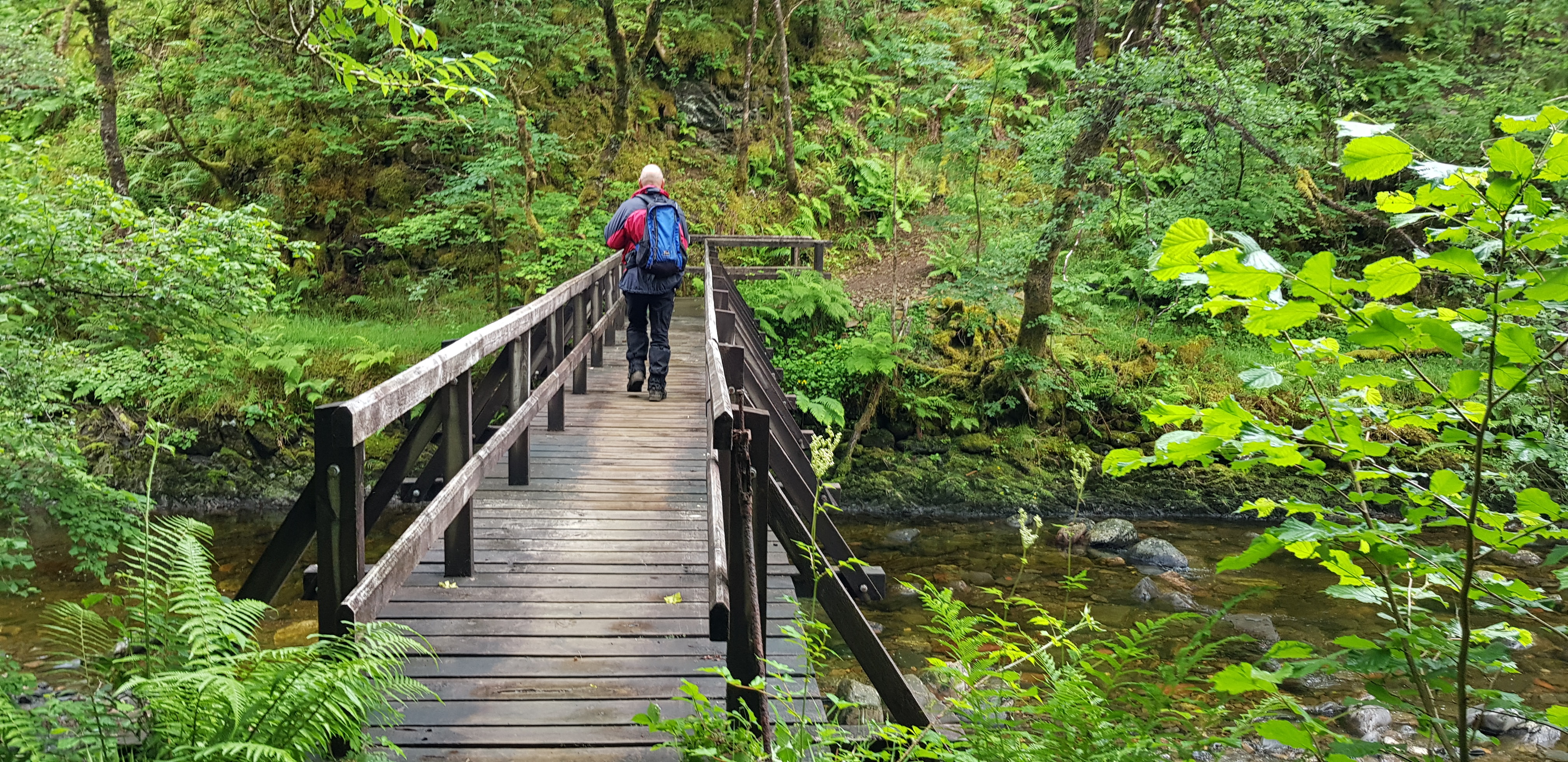
The bridge that takes us back onto the outward path
This turned out to be another tough day, we seem to be making a habit of that every week. I personally loved the wee adventure at the end of the descent, it makes what could be a routine walk a bit more memorable.
If anyone has lost a RAB top that was in a bag? We found it in the forest - so we weren't the first ones to venture that way. If you PM dibs he will arrange to return it to the unlucky owner.
Next for us is Kintail, the return - different hills though.
So I suggested we head to Kintail to see if we could manage Beinn Fhada & it's closish neighbour A'Ghlas Beinn, that way it would save us having to make 2 journey's. As usual the forecast changed constantly as Sunday got nearer and George reported on Saturday that thunderstorms were now forecast. I checked the Met Office forecast & although there was plenty of rain on the menu there were no thunderstorms. To think we even considered going elsewhere makes a mockery of the weather forecasts, especially when you see the photo's and the lack of rain. Rant over.
Now Kintail is about 3 hours drive for us so I suggested we meet at our usual spot at 5.15. No surprise that the roads were very quiet on our journey north and they were almost as quiet on our way home - due to a much discussed small football match that was taking place south of the Border.
We managed to get one of the last spots in the small National Trust car park
The River Croe which runs along side the road
George showing off his talents, walking & taking a photo at the same time
The bridge over the River Croe
Very picturesque and not fast flowing
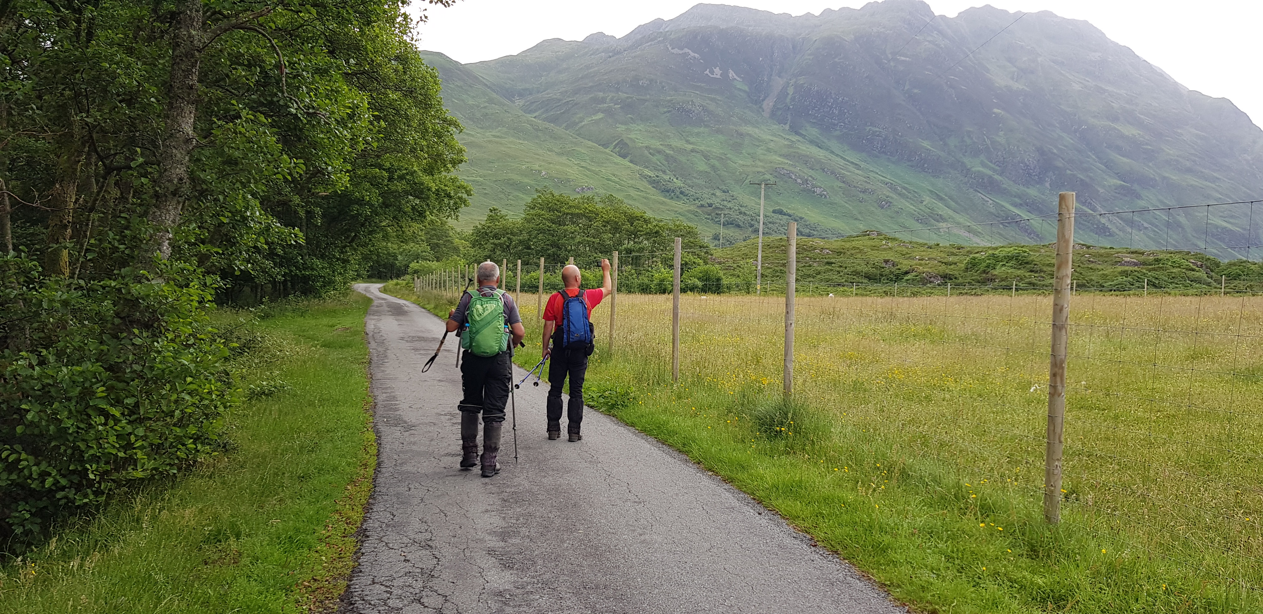
We are now off and marching along
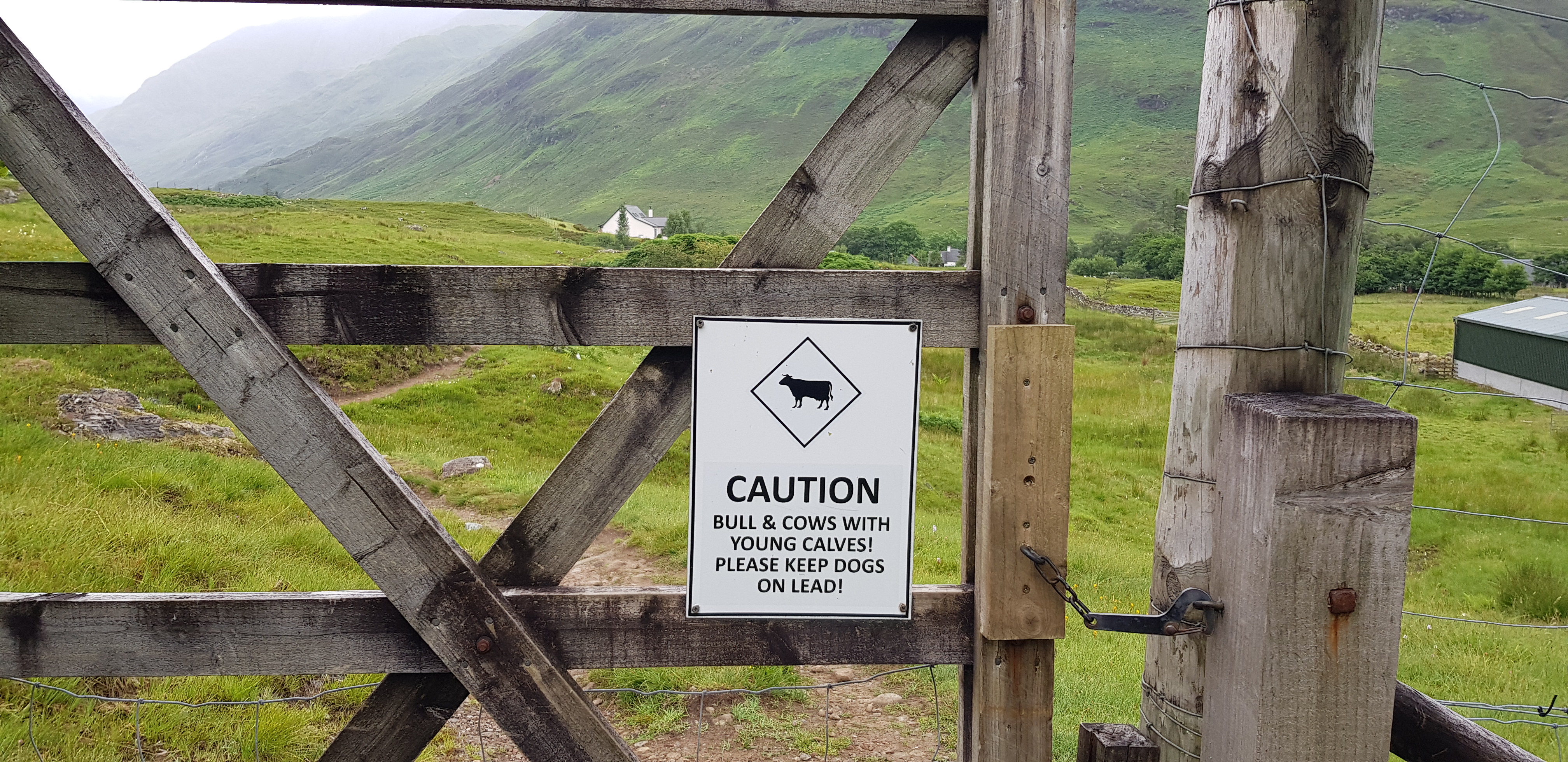
We didn't see any livestock at all
Heading into the overgrown stuff now
Looking back
A vehicle parked on the track that heads to the Falls of Glomach
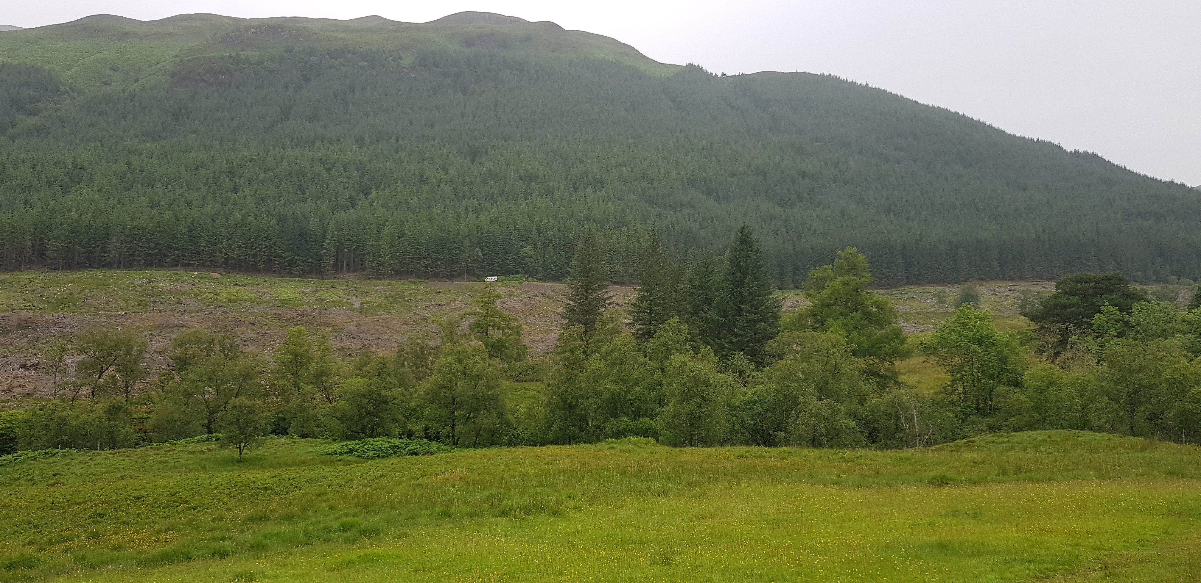
Both our hills are either side of the lump in the distance
By now we perspiring profusely
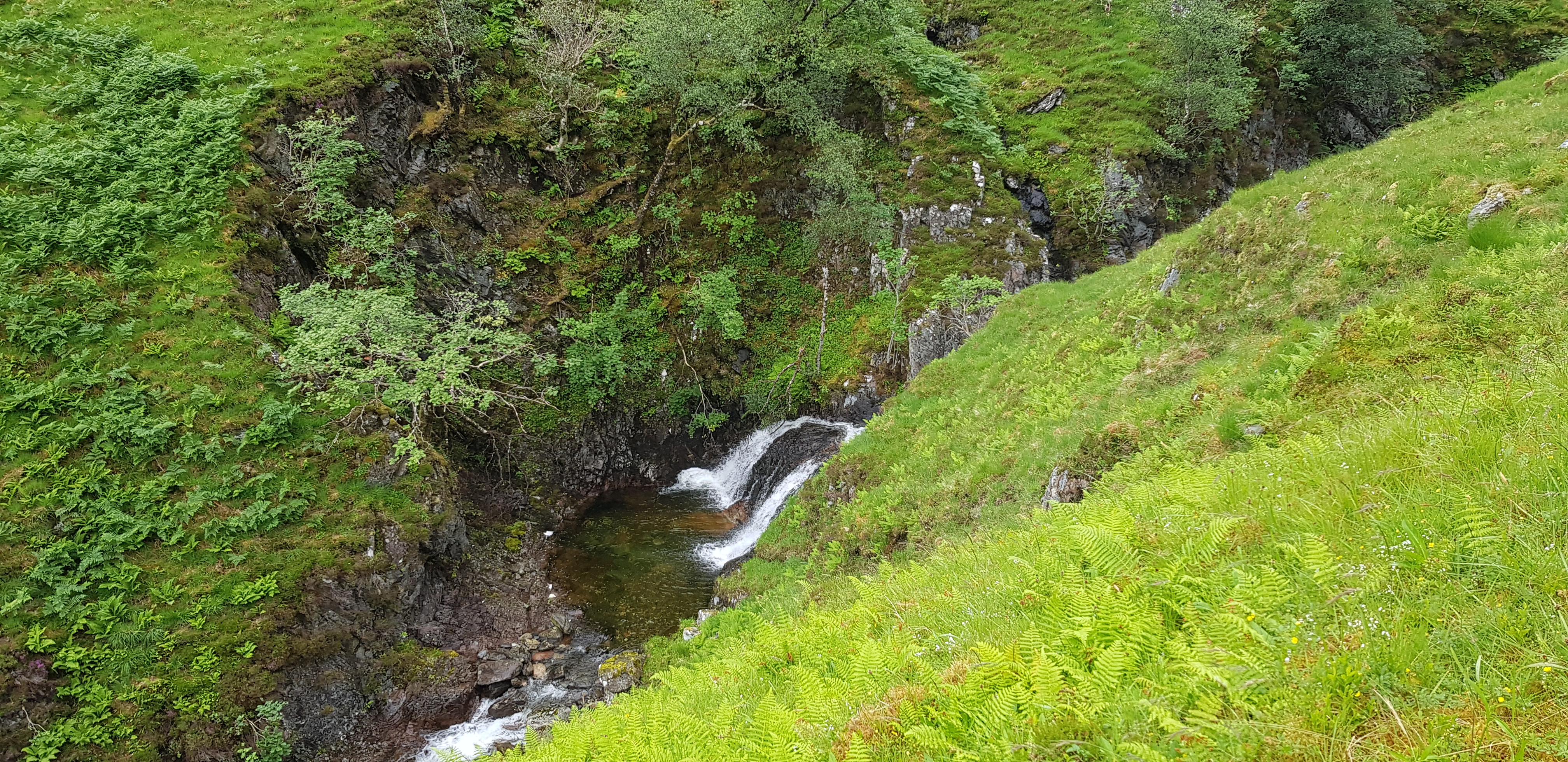
Nice water feature
Looking back down the glen
The next water feature on our travels
It was time to remove the waterproof stuff
Looking back down the glen
We are heading along the path towards Fhada first, our theory was it is the higher of the so let's tackle it first
The plan sounded as if we had really thought about it in depth, we hadn't as there were a couple of serious flaws. Firstly after tackling Fhada we retraced our steps back down to where the path splits in two. The major drawback was we had to descend down to 420m, meaning we had a minimum of 500m to ascend, which doesn't include the undulating terrain to reach AGB. Once we reached A'Ghlas-bheinn our plan was to make the day more interesting by loosely following Gill c's descent route down to the forest. On the map it looked a doddle but as you will find out later it was familiar territory for us 'adventurers'.
The path would take us to the left of the burn
The Coire an Sgairne with low cloud hiding higher area
Cloud starting to lift
The path that will take us onto the shoulder that eventually leads to the summit
On the shoulder now looking east
Parminder rushing uphill to join us
Cairn at the start of the shoulder
George checking the weather forecast again
And suddenly the low cloud rushed in behind Parminder
Looking back down the shoulder - A'Ghlas Beinn in the distance
Looking back again
Plaide Mhor behind Parminder
A white quartz seam
Not far to the summit of Beinn Fhada
George getting his camera ready for Parminder arriving
A straggler appearing out of the cloud
A wee bit of cloud obscuring the views for a minute
Our lunch spot - well earned
I have to mention a very nice young lady who overtook us on the long ascent, she was running and walking. We met her again as she was descending and she was originally from Greece but has lived in Scotland for over 20 years, if you read this, thanks for the chat and it was good to meet you.
There you are I knew it would clear up, Loch a'Bhealaich which lies to the east
Heading down now and shoulder can be seen clearly, A'Ghlas-bheinn in the distance
Everywhere is so green
Looking back down from the bealach before you turn left and head uphill
Plenty of steep sided lumps
Loch a'Bhealaich again from a different angle
You know it is a bit steeper than usual when you have a zig zag path
Looking up to our leader
Loch a'Bhealaich again from slightly higher up
Looking back towards Fhada and the lump in between the 2 hills
Looking further down the glen from Loch a'Bhealaich
A moments reflection whilst we get our breath back
This highlights how many false summits you haver to endure before you reach your goal
Arty shot for the day
Parminder head down and loving the final push
Looking back to our start point and Morvich and Loch Duich
At last the summit of A'Ghlas-bheinn
"Come on Parminder, not far now"
We are now descending down the steepish grassy shoulder / slope, loosely following Gill's route
I wasn't expecting this
I think the route we should have taken is on the right shoulder, we went straight down, you can see the track on the edge of the forest
We weren't going to cross the chasm to get onto the shoulder on the left - for obvious reasons
Whilst descending down the shoulder it started to rain, so it was on with the gear and off we went again.
Our first obstacle
Before we reached the fence we assessed our options when we were higher up, do we head left & possibly try and pick up the path that we headed in on - NO, that idea was binned as it involved a bit of ascending. Do we climb over the fence now and head for the track which was about 200m away - NO, the forest was far too dense, we could have tried but it would have involved being on hands and knees. So we followed the fence to the right and downhill, which in theory was going to wards the track.
How inviting does this look, bearing in mind it was raining as well. Bracken is bad enough when it is dry, when it is wet it isn't even remotely any fun. You notice s light brown patch, there is a tiny burn, that is where we headed
If we followed the fence we would have to do more ascending so that possible idea was binned
The track is very close now, so we took a chance - luckily we didn't have to climb the deer fence, someone else must have been here before us as there was a gap underneath - easy peasy
We were now in familiar territory, jungle - it has been a while but we still have our jungle skills
The photo's make it look quite light, it wasn't. I was using viewranger on my phone to navigate through the trees to the track along with assessing if we could battle our way through
Bit blurry, sorry but it shows we had to take care with all the sticky out branches wanting to assault you
The next obstacle a small burn, once again we had to find a safe crossing point - there were plenty of big stones/boulders but all were nice and shiny and even worse slippy
Parminder leading the way, shock
Looking back uphill from the safety of the track
We are now on the track that takes you to the Glomach Falls, I went there last time and wasn't overly impressed
This shot looking back highlights the choice of shoulders you can descend on
The bridge that takes us back onto the outward path
This turned out to be another tough day, we seem to be making a habit of that every week. I personally loved the wee adventure at the end of the descent, it makes what could be a routine walk a bit more memorable.
If anyone has lost a RAB top that was in a bag? We found it in the forest - so we weren't the first ones to venture that way. If you PM dibs he will arrange to return it to the unlucky owner.
Next for us is Kintail, the return - different hills though.