free to be able to rate and comment on reports (as well as access 1:25000 mapping).
Wednesday 18th August 2021 (photos display better if you click on them)
MWIS claimed the entire country would be beneath a blanket of low cloud, with it lifting and breaking in the east, if we were lucky...
Based on the above forecast, I decided to head up the Gaick Pass on a bike/hike to visit the two corbetts up there. At least if the cloud was low I would still enjoy the cycle up the Glen. I left home late, and arrived at the start of the Gaick Pass (opposite the junction for Trinafour, near the start of the long section of dual carriageway) about 12.10pm. It was bloody roasting and there wasn't a cloud in the sky!! Ha, typical. To think I almost never bothered going out... Anyway, I saddled up and started up the gravel track climb out of the trees. I had packed my "river crossing sandals" for the fords, just in case, but it was so dry it turned out they were just ballast.
 The track ahead, once up over the shortish climb out the trees
I've cycled the full pass once before, and it's a brilliant track. Suitable for mountain, hybrid or gravel bike, there's nothing technical or exceptionally rough (to the start of the walk here anyway). I was only cycling to near the east end of Loch an Duin, which is 9.1km from the A9. This took me 48 minutes into a stiff headwind, with a few photo stops, it was absolutely stunning.
 Boiling under a hot sun
 One for the Dunfermline Cycling Club page
 River very low!
I dumped my bike amongst some peat hags on the large moraine at the east end of Loch an Duin (just past the old lodge ruins), and started on foot. I hadn't seen a soul, however still locked the bike anyway. Safety first! Turned out later that I hid it so well in a hag that I struggled to find it! An Dun, the first corbett, looks like a pretty steep pull, and it was. There is a faint path almost all the way, which does help if you find it. I started off heather bashing though.
 A fine vista ahead, with both targets in sight either side of the loch. The wide angle here doesn't make An Dun on the left look very steep, but it's a proper grind!
 It looks a bit steeper here to be fair on a heather bashing section.
The view back down the glen is stunning as you climb, so I stopped for lunch about two-thirds of the way up and took it all in. It's a cracking view, miles and miles of open space as far as Schiehallion in the distance.
 Lunch views back down the Glen, with Schiehallion visible in the distance.
From my lunch spot, it didn't take much more than 10 minutes to reach the summit plateau area and find the cairn. I had two cairns marked at 827m on my map, so obviously had to visit them both, not sure which is marginally higher than the other! Away from the summits, the views down to the loch below were seriously impressive, and north up the Gaick Pass towards the Glen Feshie munros and the Cairn Toul munros. It made me laugh that there wasn't a single cloud over Cairn Toul etc when the cloud was supposed to be everywhere in a thick blanket.
 The reasonably pathetic summit cairn of An Dun
 The view north up the Gaick Pass
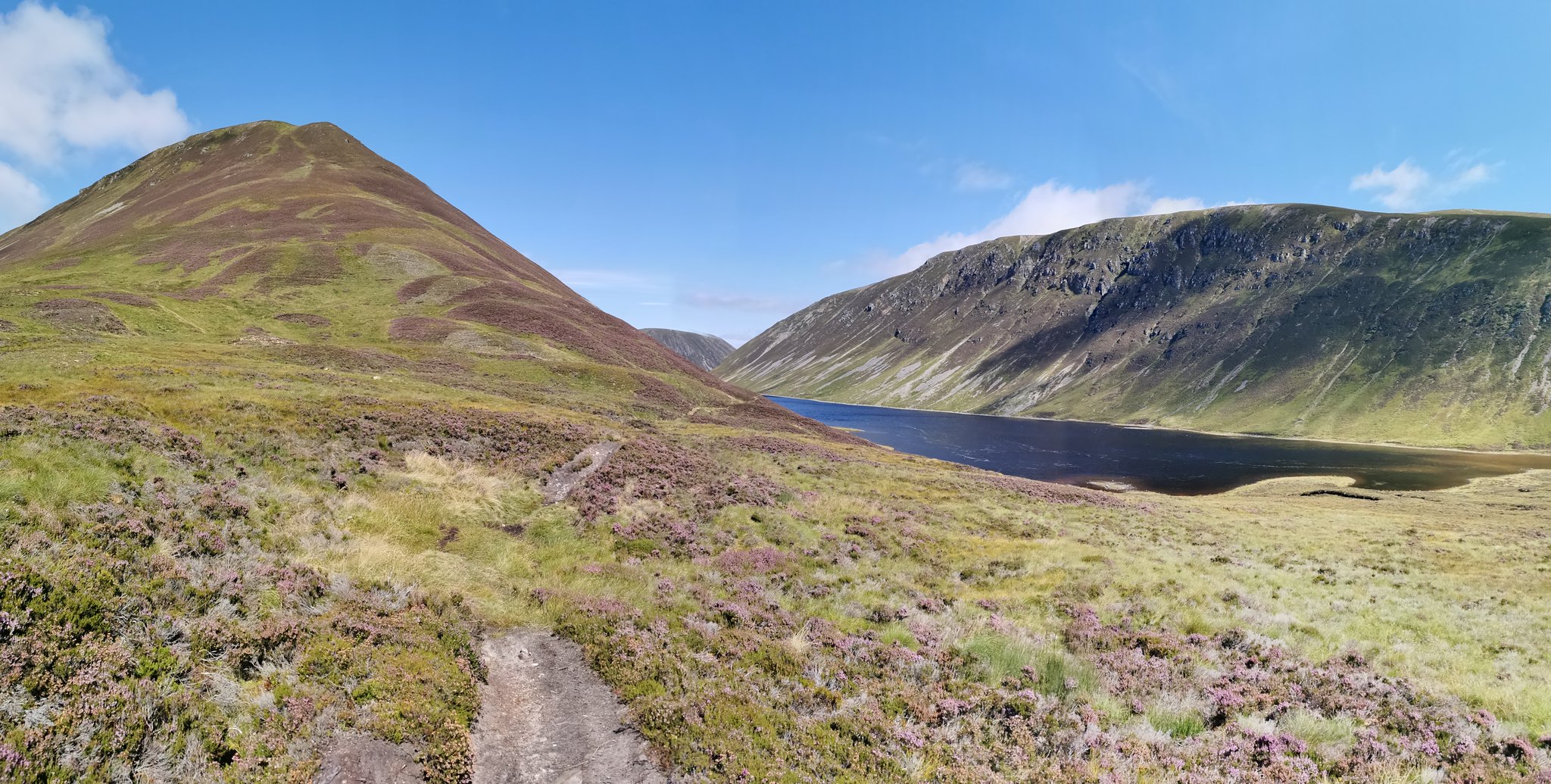
 Wide panorama of Maol Creag an Loch (my ascent route was left of the scree gully, roughly above the islands)
The descent from An Dun at the north side is just as steep as the ascent. There was a very faint path which I promptly lost/ignored, and ended up picking my own way down, taking care on the steep heathery ground. I aimed for where I thought would be the best place to ford the river, which I managed easily due to the low water levels. I forded around 100m left of the main track ford. I stopped for some water before having a quick look at the map to plot my ascent path. The Walkhighlands route appeared to extend the route by a couple of km, so I decided to batter up the wall in front of me in a near straight line to the summit. I can't think of a steeper ascent I have ever attempted, but it was a good workout. Poles were almost essential for this! With plenty hard graft over half an hour or so, I popped out bang on the summit cairn, where I found two ladies standing chatting. They were the only folk I saw all day and was nice to have a quick chat by the cairn.
 The summit cairn of Maol Creag an Loch - arguably the most pathetic cairn of any corbett?
After half a sandwich, I set off south along the summit plateau towards the ridge that would take me down to my bike. It was very easy walking (no path) until the final very steep section that took me down to the peat hags, which were thankfully dry. I'm assuming this is why the Walkhighlands loop descends further on past the trees and ruin of the old lodge. Safely negotiating the peat hags, I found my bike after walking in circles for a minute or two, a cracking hiding spot!
 This was taken on the descent, just before dropping very steeply down to cross the peat hags you can see left of the loch.
 The hike section took me 2hrs 58mins. My route cuts off some distance compared to the WH route, however my ascents and descents were very steep and probably not everyone's cup of tea.
As always, it felt great to get back on the bike after a hike. Even better with a roaring tailwind! The girls I saw earlier were jogging back along the track and it felt cruel to whizz past with so little effort. Walking/running this whole route would be a pretty long day out for sure, with 10 miles of track each way. It is gorgeous though so would be very enjoyable still.
The cycle back took me bang on 20 minutes which was great fun on the track, mostly downhill with a couple of small ups. Big smiles to finish!
Total time for the trip was 4hrs 15 mins. Considering I picked this route expecting cloud on the hills and to enjoy cycling in the Glen, it couldn't have worked out better. I was in my short sleeves all day and actually got battered by the sun, it was that clear and hot. Top day in a very underrated area! If you like open spaces and avoiding the crowds, get fired in

(GPX track of my route below - hike section only)
