free to be able to rate and comment on reports (as well as access 1:25000 mapping).
Well, it has taken over 37 years (even longer than the 28 years for the Munros) but I finally got there – all worth it in the end. Little did I think when walking up my first Corbett on a hot Monday holiday in early May 1984 that I was starting such a journey as I was only vaguely aware of the different hill classifications. Up until that point I’d done a fair bit of walking mostly on holidays in the North West but hadn’t really tackled any hills of significance. The photo below is of a friend and me on The Cobbler that day in 1984 and I’m somewhat embarrassed to admit that I’m on the right in the “sawn off” denims.
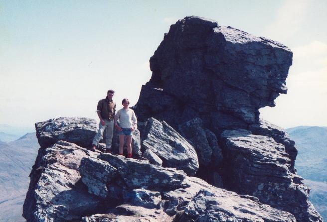
Goatfell then followed on a work outing in July 1985. Having walked up from the ferry at Brodick we somehow managed to get diverted in thick mist on the descent and ended up in Corrie. Relying on the navigation skills of colleagues was perhaps not such a good idea after all but all soon fixed by a pint in the pub followed by a taxi journey back to Brodick. By this time I’d got a bit of the Munro bug and the third Corbett didn’t follow until in the snow on Ben Ledi in early February 1987. A few more Munros followed but no further Corbetts until I got started back into the hills in 2010.
As for comparing the Munros’ and Corbetts’ journeys, I actually found the Corbetts more difficult than the Munros. Although counter intuitive as there are more Munros and the Corbetts aren’t as high, I found it easier to link up Munros in multi hill days. Moreover, the Corbetts seem to be more widely geographically spread (including more islands) as well as frequently being more spread out with greater distances from hill to hill.


I had decided on my final Munro, if I ever got there, fairly early on. However, it probably wasn’t until after I finished the Munros and started seriously considering the Corbetts that I decided on Quinag as the final Corbett trip. Views to Quinag featured heavily on many a family holiday in the early to late 1970s in Stoer, Drumbeg and Nedd – the photo below shows me in the middle with Quinag in the background.

That probably influenced us when on a holiday on Skye in the early 2000s and we visited John Bathgate’s studio at Borve on Skye – one of his watercolours over Loch Drumbeg towards Quinag still hangs over our fireplace.

So, Quinag it was to be. It was planned for 2020 but COVID-19 struck and I also had to get to Clisham before Quinag which meant a longer wait until ferry travel was again permitted – we live in one of the areas which was one of the last to be freed up from lockdown. I think it was Dave Hewitt who flagged up the list of final Corbetts in a post – at that point Spidean Coinich had not been a final Corbett on a reported round hence the reason I opted to do the round anti-clockwise and finish on it.
A relatively early start from Glasgow got me to the John Muir car park a little before 1300hrs. The car park was jammed but I managed to squeeze in on the right just after the entrance. Got ready then crossed the road to get to the start of the path. Quite early on I met several people on their way down.
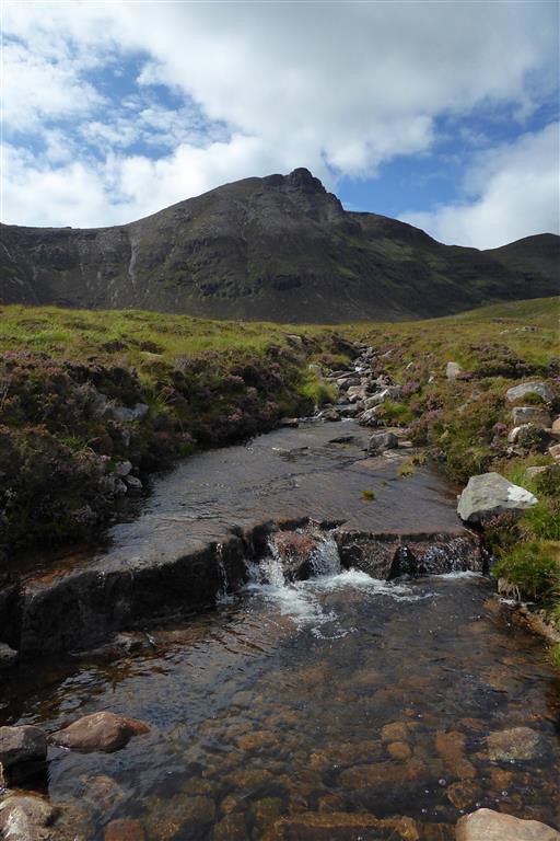
It’s a good path and doesn’t take long to get up past the lochan. As far as camping was concerned, I knew the only water higher up was the small lochan below the summit of Spidean Coinich. I had debated whether I could risk relying on it as looking at photos on geograph and other reports suggested that the level could vary. Didn’t want to drop down and camp at the lochan. Accordingly I decided instead to carry an extra 2 litres of water from the start – filling up at the lochan wouldn’t have helped much. It did mean my pack was heavier than I’d have liked with nearly 4kg of water but I was in no great rush and could take it fairly easy.
The path took me nearly up to Bealach a’Chornaidh with views over to Spidean Coinich.

I then turned more northwards to head up towards Sàil Gharbh with a view back towards the lochan.
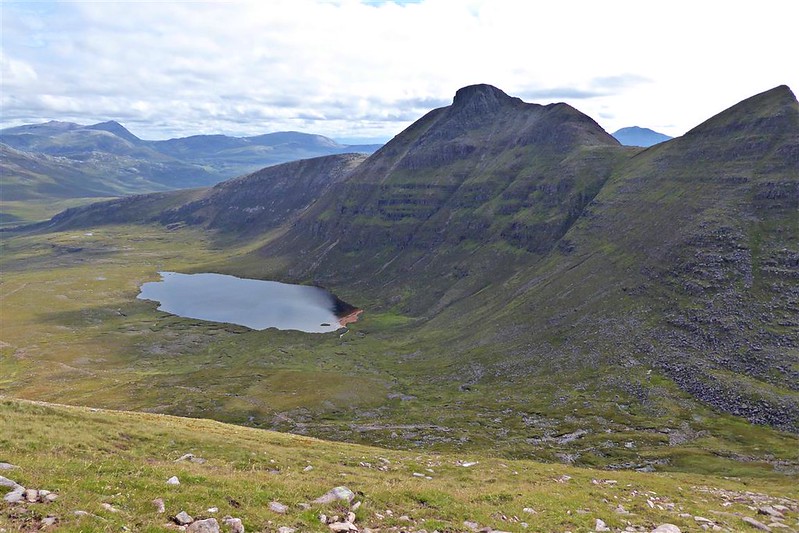
It was certainly getting quite a bit steeper at this point – looking towards the western end of Loch Assynt.

I met a larger family group and stopped for a long chat with them. A mix of people with few and many hills under their belts but all happy to be out on such a nice day. Oddly despite the weight of the pack I wasn’t finding the going as hard as I’d expected – having a good path was a definite help – kept going until Sàil Gharbh came into sight.

I was reflecting on how little time it had taken to get here – compared to many Corbetts, the walk in is very short meaning that you get into the hill properly so much quicker. Up at the top it was pretty windy but no complaints from me as it kept the midges well away. Got a reasonable view over towards Glas Bheinn and the two Assynt Munros.

Looking towards Canisp and Suilven beyond Spidean Coinich.

When I first started hill walking, mobile phones didn’t exist and even up to just a few years ago I was still finding that I often couldn’t get a signal even just to make a phone call or text. However, that seems to have changed over the last few years and it still amazes me that we can now get a 4G signal on the top of many of the relatively remote hills. The downside I guess is that I now find myself taking photos on my phone to send via whatsapp to the family, taking photos to post on facebook and taking photos on the camera. Oh the pressure of modern life – it used to be easy – just take a couple of photos so as not to use up too much 35mm film then move on.
Another chat with some walkers at the summit and eventually set off back down to the 703m flat area from where I had a good view of the next stage out to Sàil Gorm.

At first sight it does look a little intimidating with a “bypass path” past the 687m point but as is often the case it’s straightforward when actually there. It does get a little steeper further along in places.

To the west of Kylesku; Loch Glencoul, Loch Glendhu and the distant Loch an Leathiad Bhuain.
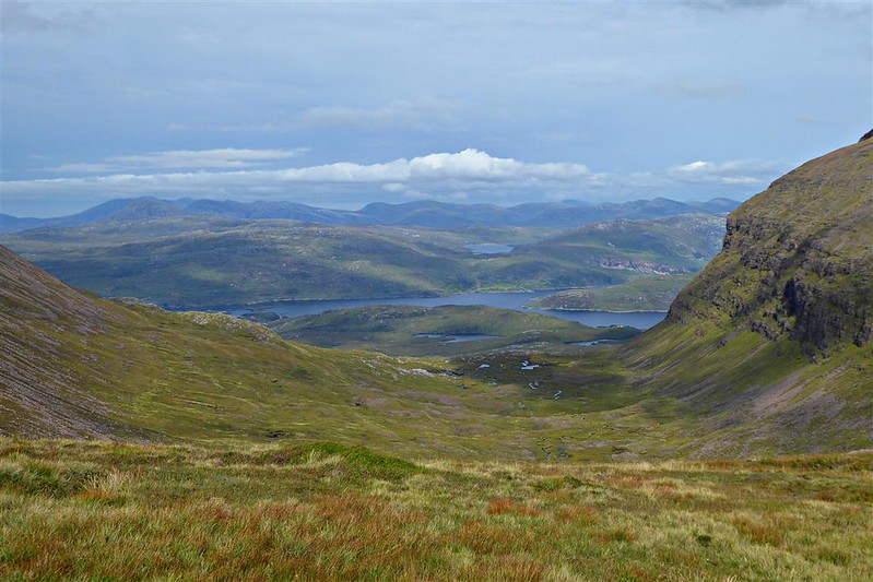
Looking back.

Kylesku Bridge
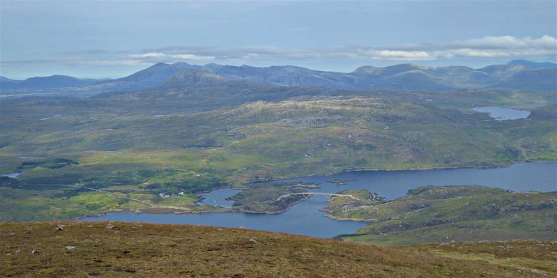
I have many memories of taking the ferry over to Kylestrome in the 1970s before the bridge was built. Kind of “romantic” in a way, a bit like memories of the Skye ferry at Kyle of Lochalsh. Things just seemed to be slower and more relaxed in those days. That said, the Kylesku Bridge is one of my favourites; a fairly simple looking structure, it always strikes me as being elegant and just sort of blends into the background. I first drove over it on a motoring holiday in my first car in early September 1984 not long after it was completed.
Some blue sky at the summit of Sàil Gorm and I was able to see over much of the rest of Assynt.

The usual faffing around again with whatsapp and facebook, some more photos and then I was off for the walk back to Bealach a’Chornaidh passing a gully and a couple of “natural viewpoints” on the way.

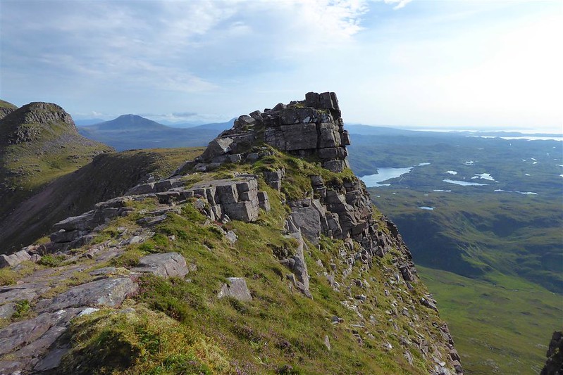

I had originally thought about dropping the rucksack for the out/back walks to both Sàil Gharbh and Sàil Gorm but in the end didn’t bother – there were too many walkers around for me to be comfortable doing that and there was an absence of decent hiding places.
The Kylesku Bridge again.

Instead of dropping down to the 703m point, I went a little higher for a direct route over the bealach. I could make out the location of my intended stop for the night – just had to get up and over the 714m top first.

Assynt hills again.
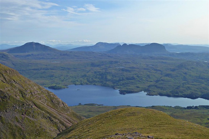
By this time most of the other walkers were long gone but, on the way up, I caught up with two other walkers – perhaps a little older than me. They explained that they like to take their time and were quite happy descending as sunset was approaching. We were discussing the relative merits of going clockwise, like most walkers, or anticlockwise which they told me that they’d been advised to do as it was better to descend from Spidean Coinich. They went on to explain that Spidean Coinich was their final Corbett. Must admit that I was somewhat astonished when they said that as it seemed a massive coincidence - I told them it was the same for me and asked them about some of their earlier trips. Transpired that they actually meant that Spidean Coinich was their final Corbett of the three on Quinag although they had walked quite a few other Corbetts.
We talked for a little longer before they set off for the summit as they had to get back down to their car that night. I wandered around looking for a flat-ish, dry-ish are for the tent and finally settled on a spot just before the lochan. I would have liked to camp at the summit but the pictures I’d seen suggested it would be too rocky.

After setting up the tent, I made dinner. Still quite windy and warm so no problems with midges. Ate my dinner at a “table” with a view.

Finished up, tidied away then set off for the short walk up to the summit which was only about 0.5km and just over 100m of ascent. Got to the top in plenty of time for sunset.

Sat for a while just watching the sunset.

Then had a wee whisky and a toast to my Dad. It was probably mostly down to him that I developed a liking for walking – not so much in the hills as he wasn’t a hillwalker but just paths and tracks in the north west when on holiday. I can still remember to this day sitting with my brothers and him overlooking one of the wee lochans at the end of a track south of Drumbeg – it was one of those quiet, still, relatively warm early evenings with the water flat calm and him telling us to remember it when trudging to school through the snow and slush on a cold, wet winter’s day – strange the things we remember for such a long time. I had hoped that he would still be here when I got to Quinag as it meant a lot to him as well but it wasn’t to be.


It was getting dark when I eventually tore myself away and set off back down to the tent. Made it before it got dark enough to need the headtorch. Deer on the skyline were perhaps a little unhappy that I’d camped beside their water source – was just hoping that they weren’t too thirsty…….

No disturbance through the night from the deer fortunately. Got up just before dawn to catch the sun as it started to rise.


Quite a lot of cloud but it wasn’t cold and there was no condensation at all on the tent. Boiled up some water for porridge and coffee then packed up as the sun got higher.
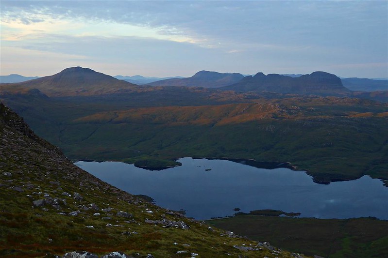
Set off up towards the summit again, this time with the full pack – looking back down to the lochan and my camping spot.

The rest of the way to the summit of Spidean Coinich.

Back at the summit again I stopped for a few photos.


Contemplating Assynt

Selfie
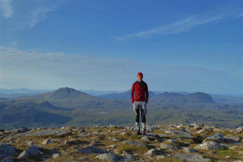
I didn’t spend too much time there as I had plans for the rest of the day. Set off over rocky ground looking towards loch Assynt.

Looking back, a little mist was rising up from the west.

That view again – currently my desktop wallpaper.

It was just a case then of following the ridge down over more rocky and slabby ground before joining up with the outward path to get back to the car.