free to be able to rate and comment on reports (as well as access 1:25000 mapping).
This hill seems to attract little enthusiasm, but I found it very enjoyable. Especially, its north-west summit Meall Luaidhe is a brilliant viewpoint for all the hills around Glen Lyon.
I was not feeling 100% - a bit of a bug. Bu having been tested as Covid-negative, I thought I would venture outside and try something not too strenuous. A pleasant morning stroll round the Birks of Aberfeldy gave me an appetite for an afternoon walk.
As it was the stalking season, I looked at the advice provided by the Boreland Estate. Walkers might want to note that the estate helpfully states that the main routes up Meall nam Maigheach, Meall Ghaordaidh and Beinn nan Oighreag (the latter two being the WH routes from Glen Lochay) are all OK on
all days during the season. The estate describes the Meall nam Maigheach route as being along the ridge from Meall nan Eun, rather than the ascent route recommended on WH.
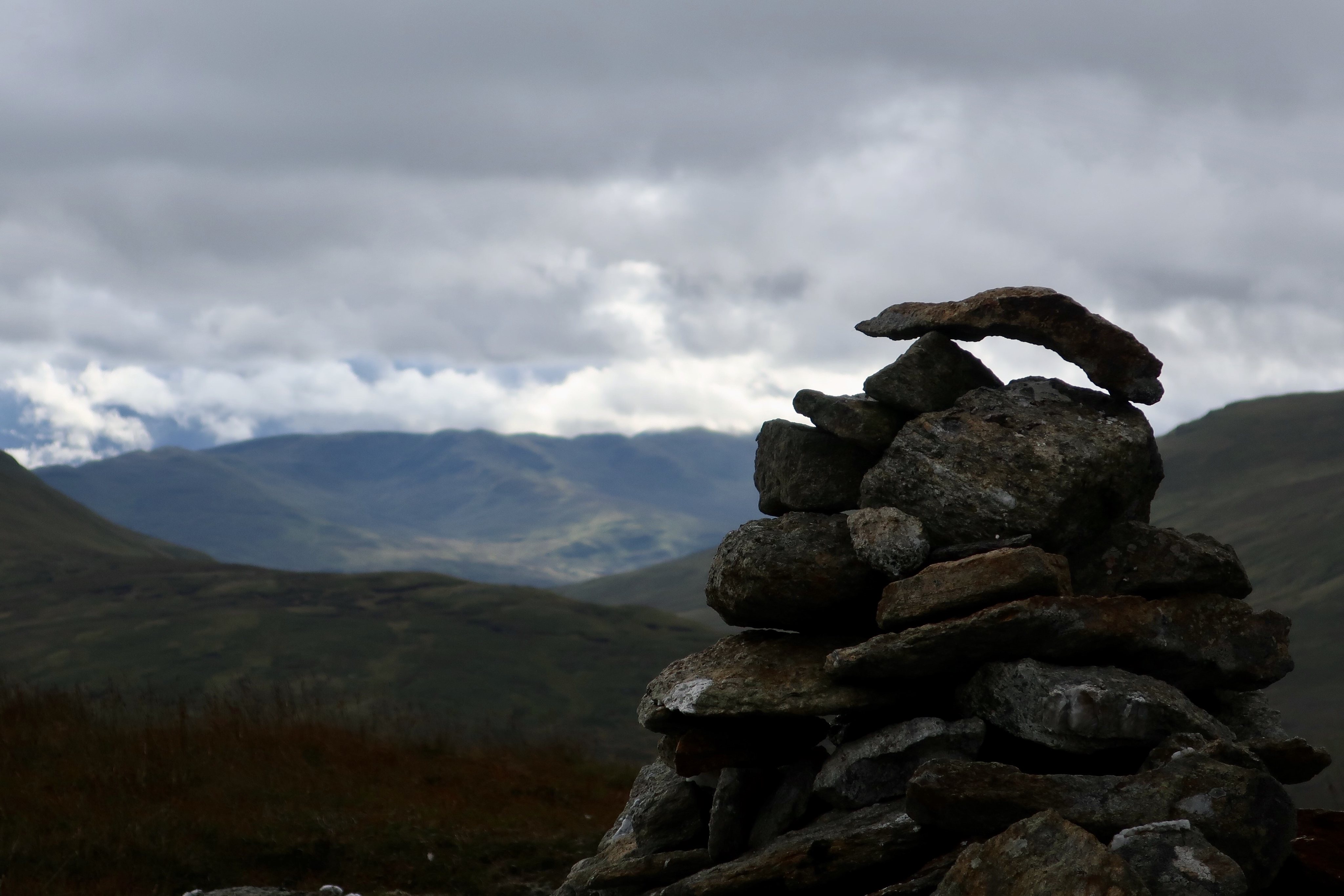
Meall nan Eun, above the highest part of the Loch Tay to Gen Lyon road, has a reputation as a soggy lump. But on a previous visit to Meall a'Coire Leith I had traversed the side of it and found it not too bad. So I set off via the cairn about the high point of the road. From the start, there were good views of Ben Vorlich and its surrounding hills.
 IMG_2793
 by
Half Man Half Titanium, on Flickr
There was one wet patch on Meall nan Eun, but it was easily avoided, and a mini-pond provided a nice foreground for a view of the Tarmachan ridge.
 IMG_2797
 by
Half Man Half Titanium, on Flickr
Zoomed
 IMG_3269
 by
Half Man Half Titanium, on Flickr
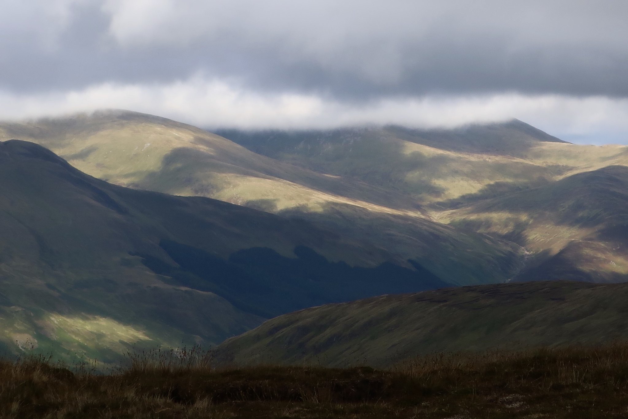
Views opened up south-west too - Sgaith Chuil (on the right with top in the cloud) and its long eastern ridge, which I think would make an interesting walk sometime.
 IMG_3268
 by
Half Man Half Titanium, on Flickr
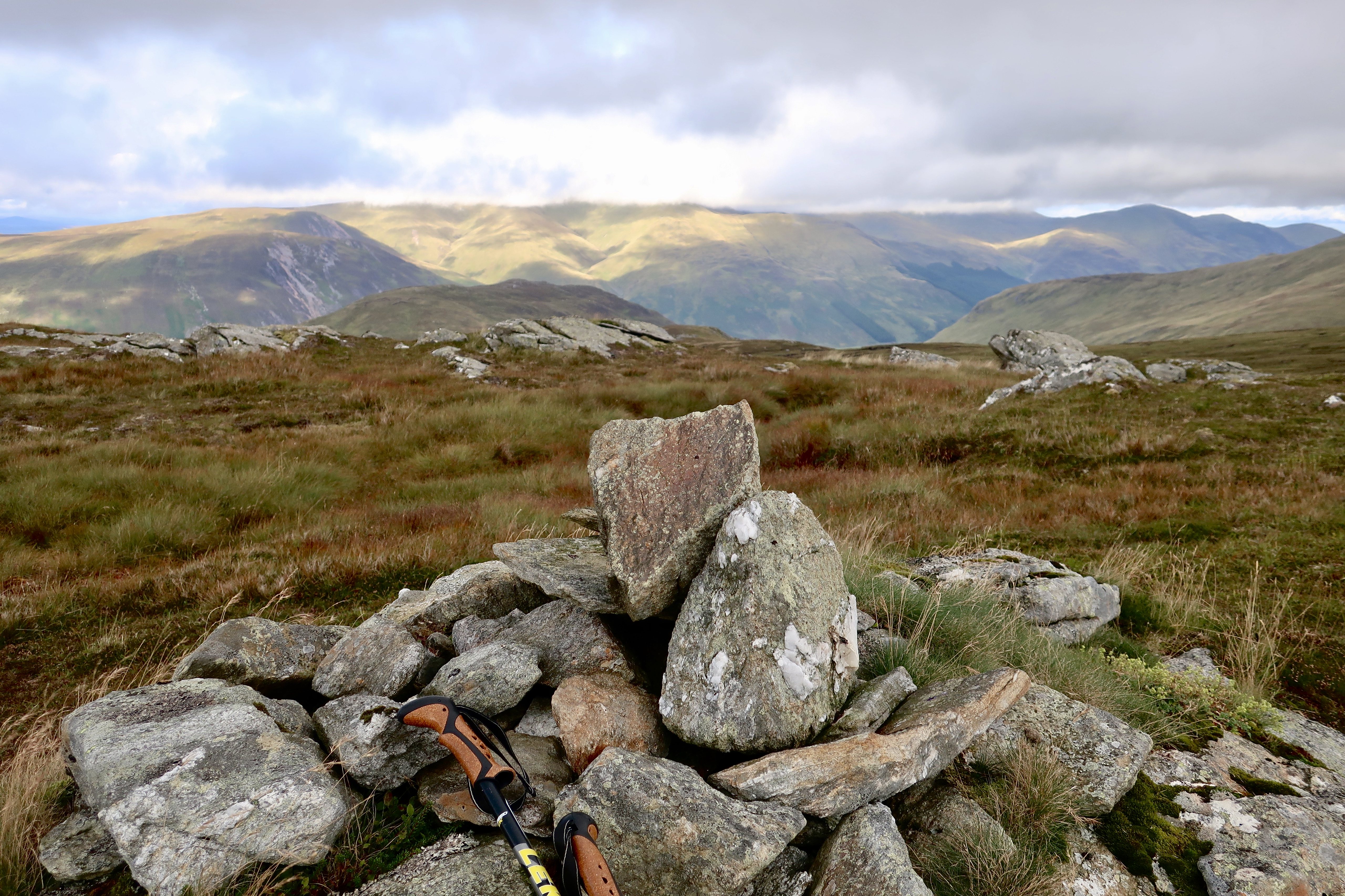
It was a very easy stroll up to the cairn on Meall nam Maigheach.
 IMG_3265
 by
Half Man Half Titanium, on Flickr
Beinn Mhanach and An Grianan
 IMG_3263
 by
Half Man Half Titanium, on Flickr
I walked over to the north-western summit, Meall Luaidhe. The name presumably reflects the lead-mining in this area, although there seems to be little information about the actual mines.
 IMG_3267
 by
Half Man Half Titanium, on Flickr
As I had suspected from the map, this summit is a much finer viewpoint, with better views of Glen Lyon and westwards, including Loch an Daimh nested between Stuchd an Lochain and Meall Bhuidhe.
 IMG_3266
 by
Half Man Half Titanium, on Flickr
Sunshine on Lyon
 IMG_3259
 by
Half Man Half Titanium, on Flickr
A Howgill-ish zigzag valley on Carn Gorm.
 IMG_3264
 by
Half Man Half Titanium, on Flickr
The cloud-topped Cairn Mairg group.
 IMG_3262
 by
Half Man Half Titanium, on Flickr
A look at the map told me that this puddingy hill is called Meall a'Mhuic. The track is a bit of a scar, but it looks like it would make this hill into an easy half-day walk.
 IMG_3260
 by
Half Man Half Titanium, on Flickr
I peered at this ravine for a while, looking in vain for signs of "hushing" (a common mining method in the past - building a dam and then breaking it, in the hope that the resulting flood might expose veins of lead ore).
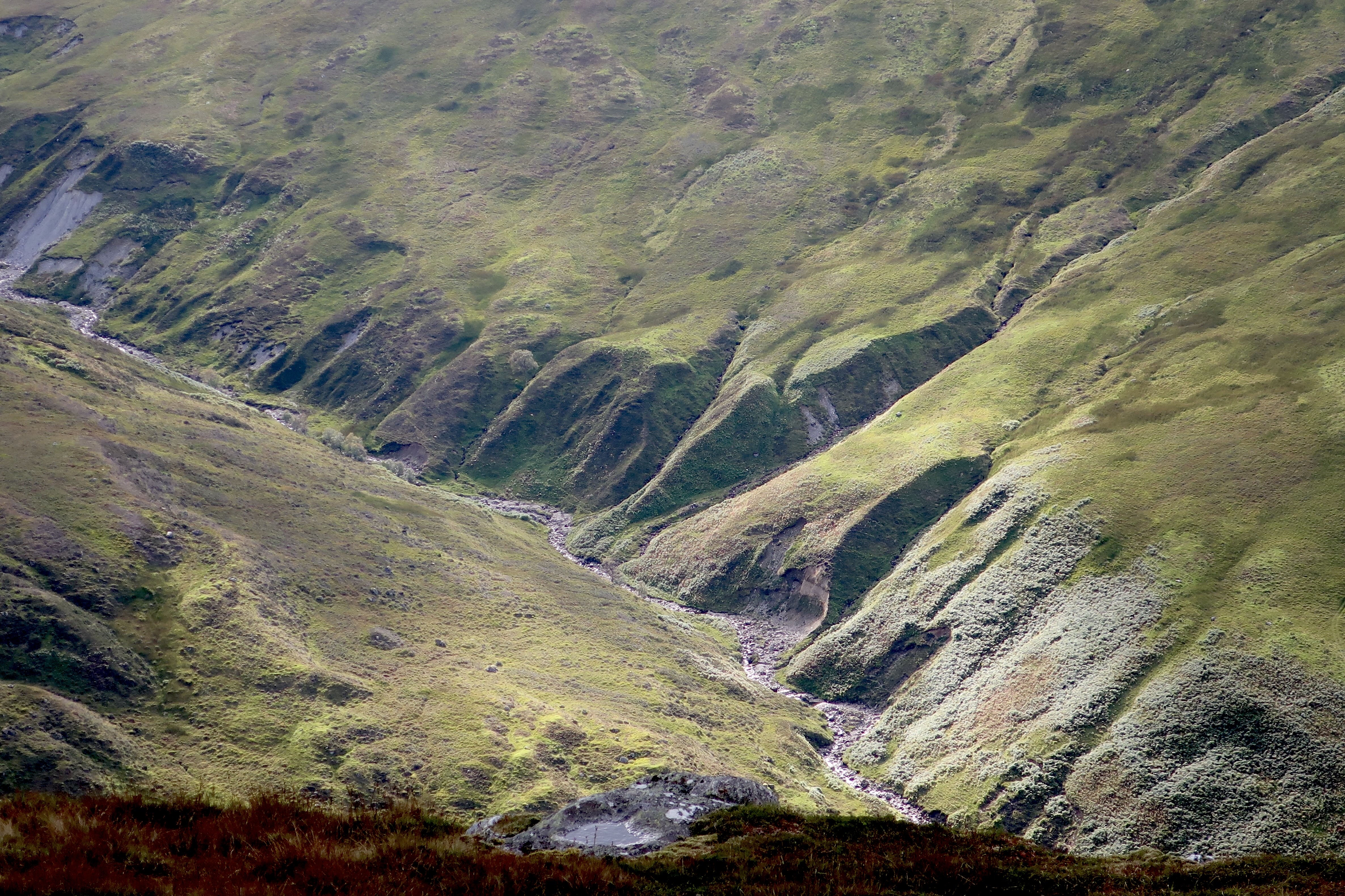 IMG_3258
 by
Half Man Half Titanium, on Flickr
Skies over Beinn nan Oighreag and upper Glen Lyon.
 IMG_3261
 by
Half Man Half Titanium, on Flickr
I had seen no signs of stalking on the slopes below me, so to make a circuit, I decided to follow the WH route back to the car. This is looking back to the prominent wall, which I think separates the Boreland and Meggernie estates.
 IMG_3255
 by
Half Man Half Titanium, on Flickr
The road and the car were quickly within easy reach.
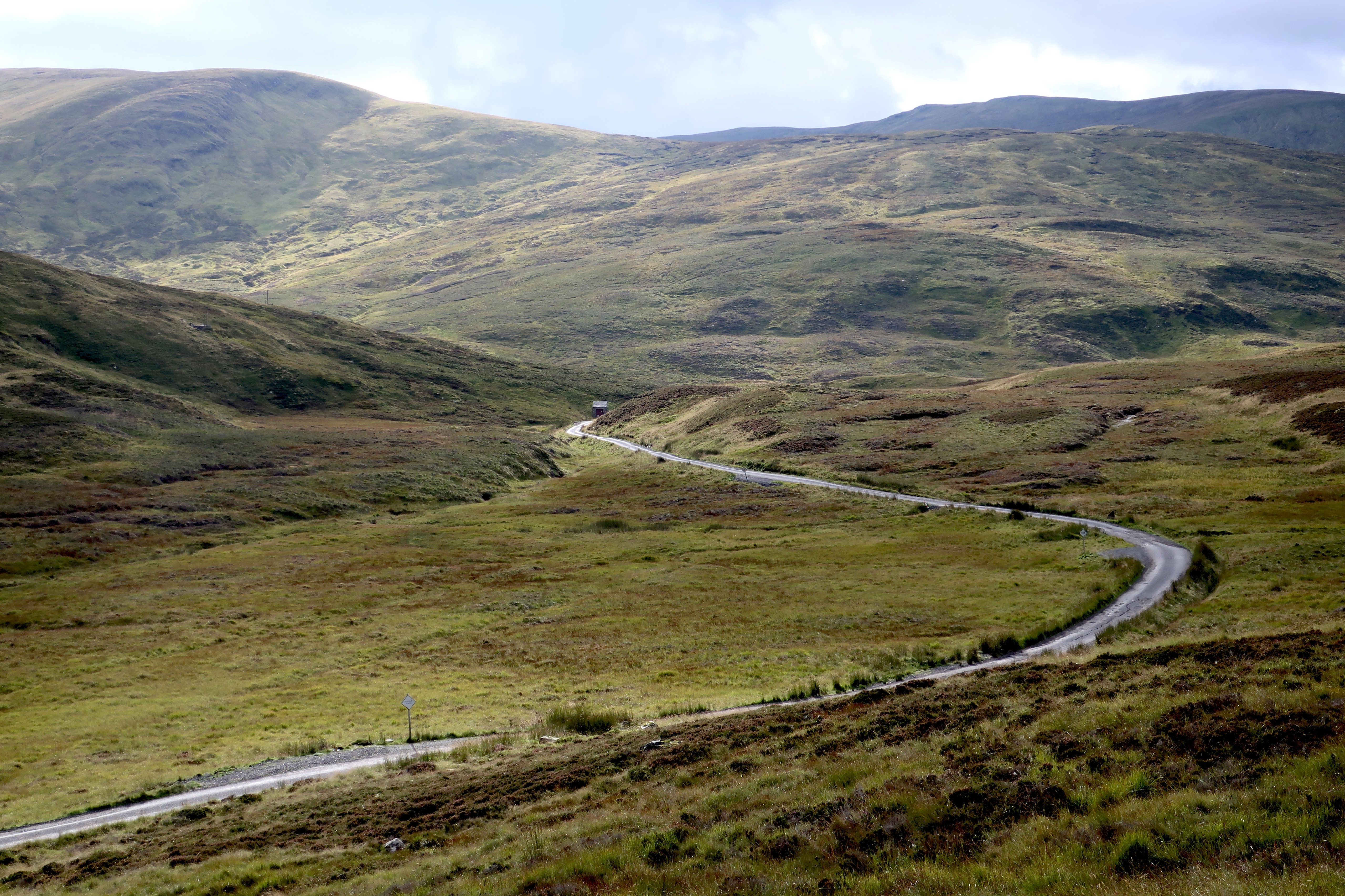 IMG_3256
 by
Half Man Half Titanium, on Flickr
The sun then came out fully, so I had a mooch around Killin, which was looking lovely.
 IMG_2800
 by
Half Man Half Titanium, on Flickr
 IMG_2802
 by
Half Man Half Titanium, on Flickr
 IMG_3253
 by
Half Man Half Titanium, on Flickr
 IMG_2804
 by
Half Man Half Titanium, on Flickr
