free to be able to rate and comment on reports (as well as access 1:25000 mapping).
It was a glorious October morning in Glen Lyon. (Little did I know that the glen would look even finer that afternoon!)
 IMG_3275
 by
Half Man Half Titanium, on Flickr
 IMG_2839 (2)
 by
Half Man Half Titanium, on Flickr
Early that morning, it had been a pleasant drive over the hills to the glen - making good use of a passing place at one point, for this behemoth.
 IMG_2837
 by
Half Man Half Titanium, on Flickr
Now, I took the side road up to the Giorra Dam, but had to keep stopping to take photos in the beautiful changing light. The rugged northern spurs of Meall Ghaordaidh add so much to the fine scenes in this section of the glen - I have to disagree with Butterfield's opinion of Meall Ghaordaidh as "quite the dullest hill in the Southern Highlands".
 IMG_2842
 by
Half Man Half Titanium, on Flickr
 IMG_2846
 by
Half Man Half Titanium, on Flickr
 IMG_2844
 by
Half Man Half Titanium, on Flickr
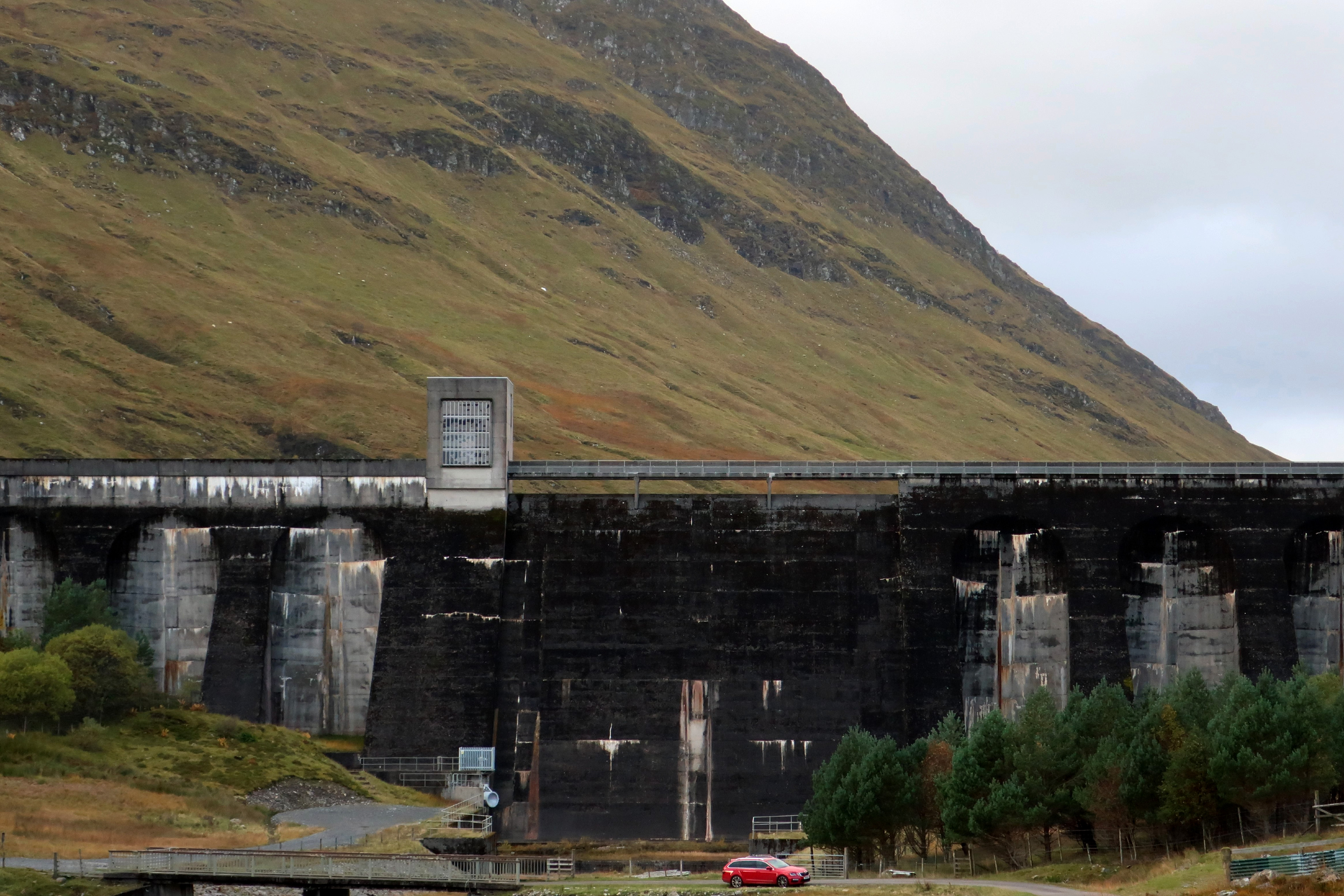
I arrived at the parking spot near the dam. At this point the weather was quite brooding and ominous.
 IMG_2855
 by
Half Man Half Titanium, on Flickr
Next to the parking area, the Meggernie and Lochs Estate have put up a very useful notice board. It may have been there a couple of years ago when I walked to Meall Buidhe, but on that occasion it was horizontal rain and I didn't stop to look.
I will put the details at the end of this report for anyone who is interested. They include maps of routes that are open on
all days during the stalking season, to Stucd an Lochain, Meall Buidhe, Cam Chreag, Meall Ghaordaidh, Beinn nan Oighreag and Meall nam Maigheach.
While looking at the board, I became aware of light breaking through behind me, and turned around to see shafts of light on Beinn nan Oighreag.
 IMG_2860
 by
Half Man Half Titanium, on Flickr
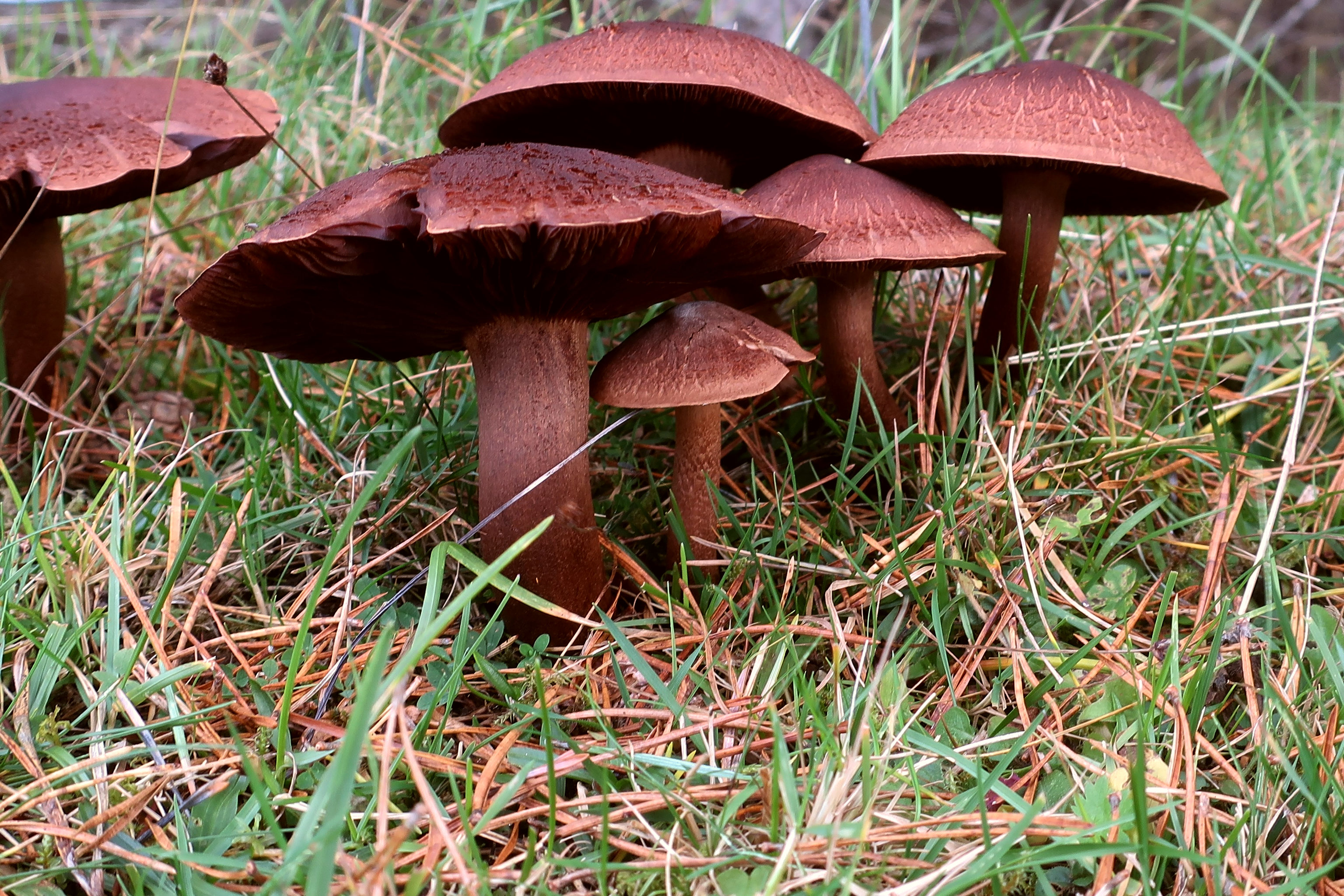
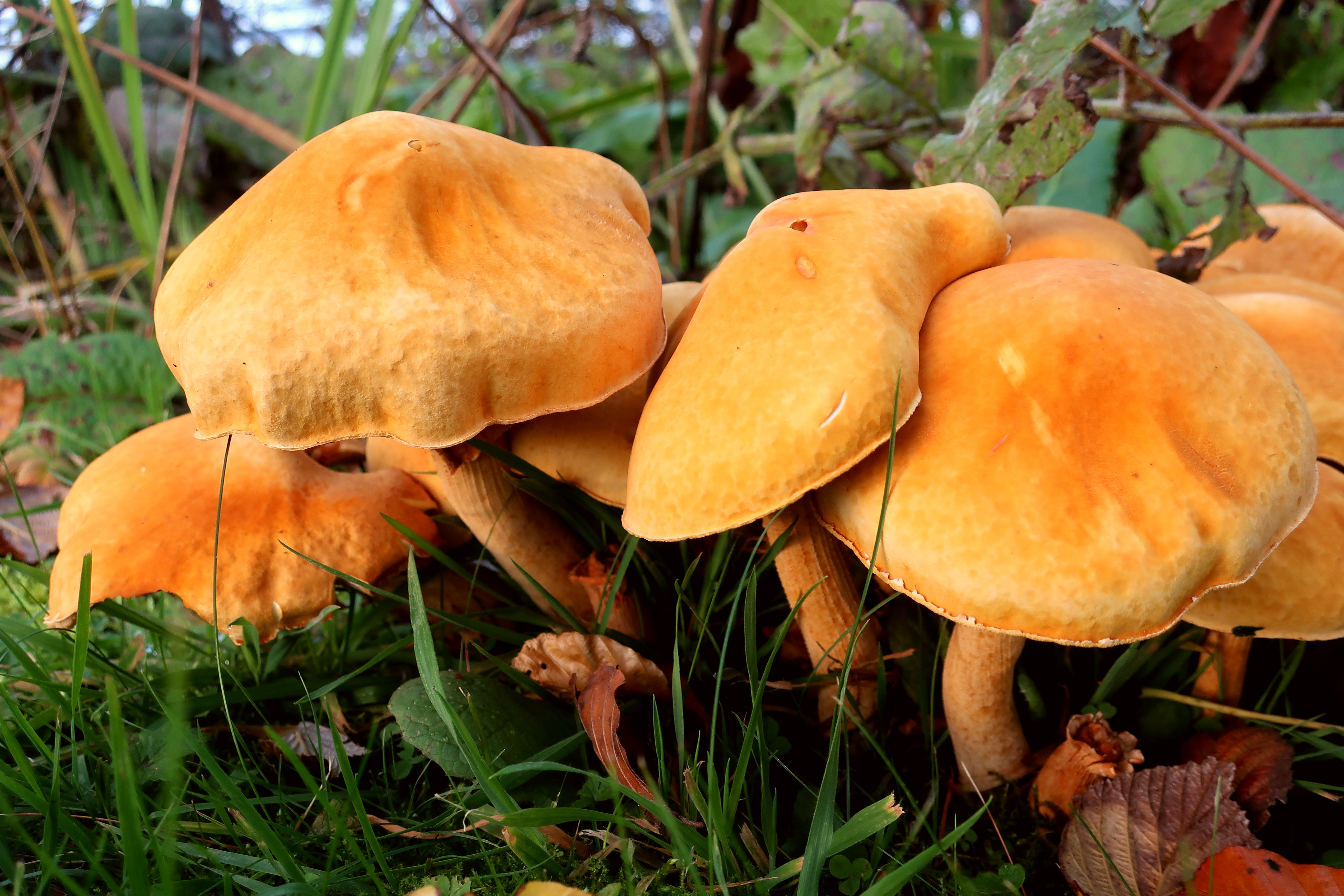
Then I set off, stopping to admire the autumn foliage and plentiful fungus below the dam.
 IMG_3223
 by
Half Man Half Titanium, on Flickr
 IMG_3227
 by
Half Man Half Titanium, on Flickr
I soon came to the cairn signalling the start of the path, and followed it uphill. Over the loch, the sun was coming out again.
 IMG_2870
 by
Half Man Half Titanium, on Flickr
Looking back to the dam, with Cam Chreag in the background.
 IMG_2901
 by
Half Man Half Titanium, on Flickr
The middle section of Loch an Daimh from the same spot.
 IMG_2884
 by
Half Man Half Titanium, on Flickr
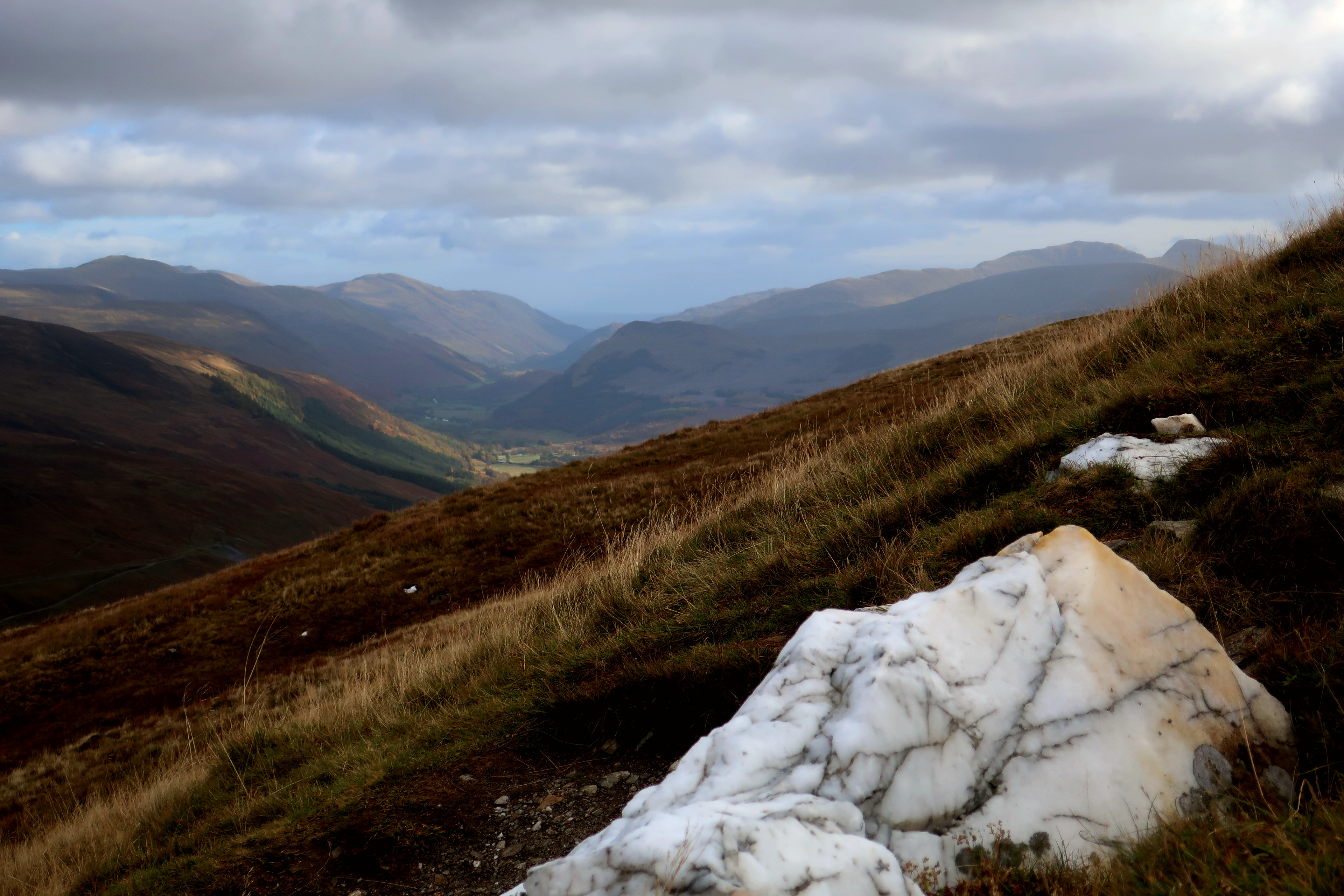
I soon reached a place where I could start to glimpse the view back east to Glen Lyon.
 IMG_2918
 by
Half Man Half Titanium, on Flickr
There was more fungus alongside the path.
 IMG_3186
 by
Half Man Half Titanium, on Flickr
Before I expected it, I reached the crest of the ridge and the views widened out.
 IMG_2932
 by
Half Man Half Titanium, on Flickr
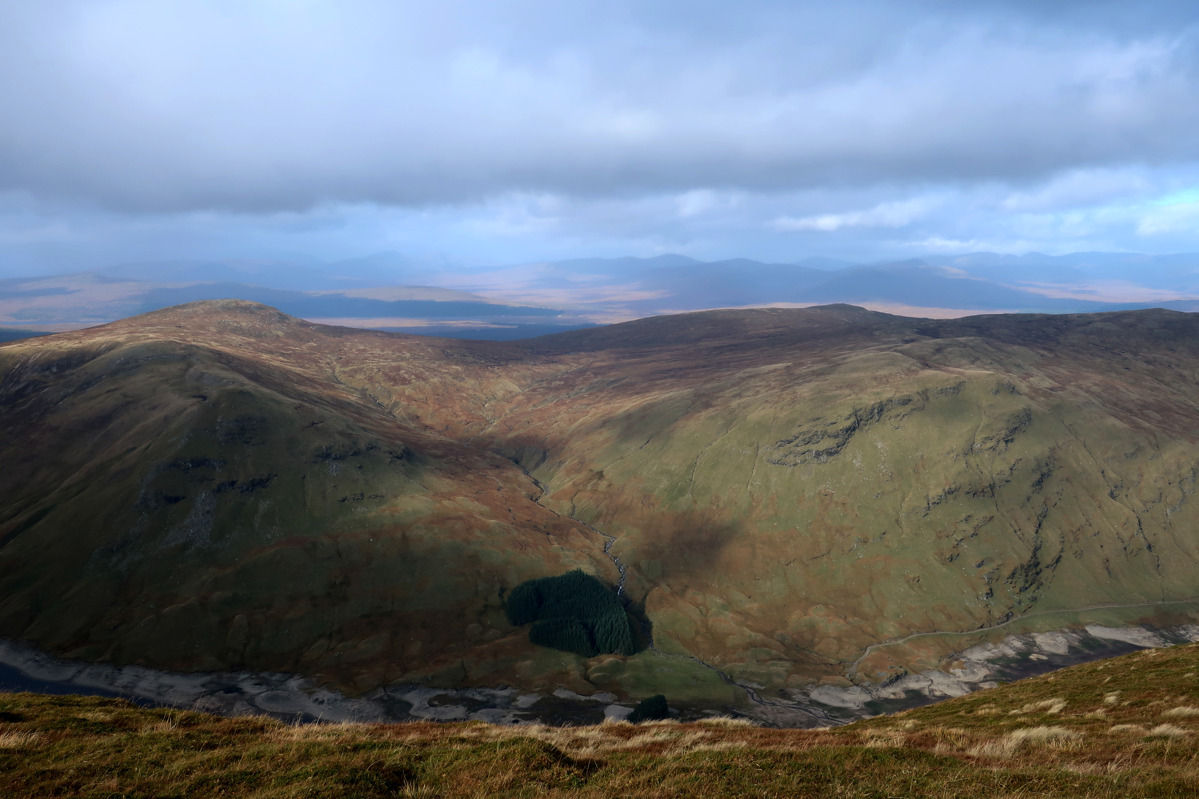
Looking down into the Lairig Luaidhe between Beinn nan Oighreag and Creag an Tulabhain. As with Meall Luaidhe on Meall nam Maigheach, the name may well be connected with lead mining in this area, but I can find very little about the mines.
 IMG_2924
 by
Half Man Half Titanium, on Flickr
From here, a short rise, following a line of fence posts, took me to the top of Creag an Fheadain, and a great view back down into Glen Lyon.
 IMG_2959
 by
Half Man Half Titanium, on Flickr
The top of Creag an Fheadain also opened up views to the west, including the outline of Buachaille Etive Mor across Rannoch Moor.
 IMG_3162
 by
Half Man Half Titanium, on Flickr
Pool on Creag an Fheadain
 IMG_3179
 by
Half Man Half Titanium, on Flickr
There was also a good view to the south - Meall Ghaordaidh and its northern ridges looking very fine over the ridge of Sron Chona Coirein.
 IMG_2966
 by
Half Man Half Titanium, on Flickr
At this point I was hit by rain and strong westerly winds. But I plodded on and soon the sun came out again, revealing the Tarmachan ridge beyond this reedy pond.
 IMG_3011
 by
Half Man Half Titanium, on Flickr
As I walked along the ridge, Lochan nan Cat came into sight bit by bit.
 IMG_2987
 by
Half Man Half Titanium, on Flickr
The sunshine now felt actually warm! I decided it was time for a sit down and lunch. Above me were fast moving clouds, and sunlight on moss.
 IMG_3020
 by
Half Man Half Titanium, on Flickr
My picnic spot. On the left is faraway Beinn a'Chreachain.
 IMG_2996
 by
Half Man Half Titanium, on Flickr
Eventually I shouldered the rucksack and headed along the last easy bit of ridge towards the top. This section of the walk was like a stroll in some kind of hilly heaven. To the south I had a grand view of Ben More above the deep gap between Sgiath Chuil and Beinn Cheathaich. An Grianan is in the foreground.
 IMG_3041
 by
Half Man Half Titanium, on Flickr
And to the west, Beinn a'Chreachain looked like the culminating wave of a rippled sea. The top of Stob Ghabhar can be seen peeking out to its right.
 IMG_3028
 by
Half Man Half Titanium, on Flickr
Further right was Clach Leathad and the dim shapes of the Glencoe hills.
 IMG_3029
 by
Half Man Half Titanium, on Flickr
On my right hand side there were glimpses of Loch an Daimh, or rather the muddy bottom of it.
 IMG_3002
 by
Half Man Half Titanium, on Flickr
The last few steps to the summit.
 IMG_3046
 by
Half Man Half Titanium, on Flickr
There were now wide views all around me. In this photo, the left-hand skyline is Cruach Ardrain and Beinn a'Chroin above the Beinn Cheathaich - Meall Glas ridge. In the centre are Beinn Challuim, Beinn Heasgarnich and a bit of Ben Lui, and on the right are Beinn Dorain, Beinn Mhanach and Beinn an Dothaidh.
 IMG_3117
 by
Half Man Half Titanium, on Flickr
Looking back down on my route
 IMG_3143
 by
Half Man Half Titanium, on Flickr
Meall Buidhe from the final slopes below the summit
 IMG_3063
 by
Half Man Half Titanium, on Flickr
Lochan nan Cat from the same spot
 IMG_3062 (1)
 by
Half Man Half Titanium, on Flickr
Summit cairn and Ben Lawers
 IMG_3091
 by
Half Man Half Titanium, on Flickr
Very different weather over the Crianlarich hills
 IMG_3113 (1)
 by
Half Man Half Titanium, on Flickr
Looking south-west
 IMG_3106
 by
Half Man Half Titanium, on Flickr
Beinn Heasgarnich and the Loch Lyon dam
 IMG_3119
 by
Half Man Half Titanium, on Flickr
Bridge of Orchy hills
 IMG_3112
 by
Half Man Half Titanium, on Flickr
The head of Loch an Daimh
 IMG_3093
 by
Half Man Half Titanium, on Flickr
Looking 'over the top' to Rannoch Moor. On the moor, directly above the loch-side patch of pine trees, is a white dot which I think is the Moor of Rannoch Hotel (might only be visible if you enlarge the Flickr image)
 IMG_3103
 by
Half Man Half Titanium, on Flickr
It was a very pleasant walk back to the car. As I set off for my guest house, a rainbow appeared.
 IMG_3254
 by
Half Man Half Titanium, on Flickr
 IMG_3245
 by
Half Man Half Titanium, on Flickr
The afternoon light was also very fine on Beinn nan Oighreag
 IMG_3255
 by
Half Man Half Titanium, on Flickr
And there were wonderful scenes along the glen.
 IMG_3261
 by
Half Man Half Titanium, on Flickr
 IMG_3257
 by
Half Man Half Titanium, on Flickr
 IMG_3262
 by
Half Man Half Titanium, on Flickr
 IMG_3274
 by
Half Man Half Titanium, on Flickr
The colours of these trees and grass reminded me of my trip to Utah, also in October
 IMG_3271
 by
Half Man Half Titanium, on Flickr
 IMG_3266
 by
Half Man Half Titanium, on Flickr
A last view of the Tarmachan ridge
 IMG_3277
 by
Half Man Half Titanium, on Flickr
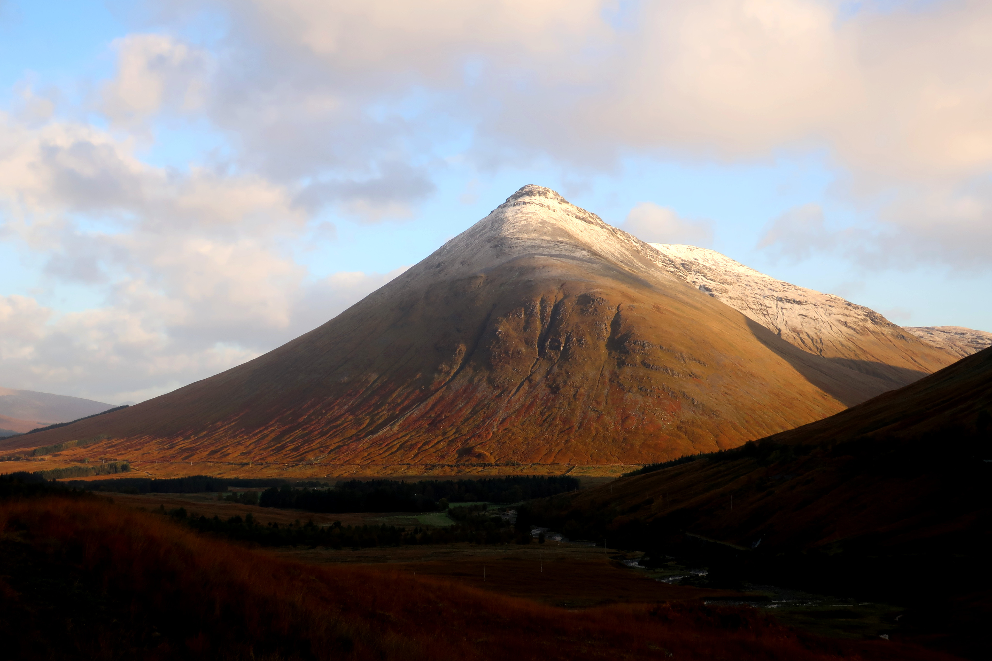
The next morning, it was time for the long drive south. But I took the chance to photograph some scenes along the way. I was surprised at the slight dusting of frost on Ben Lui compared to more significant snow on Beinn Dorain, the Tarmachan and Ben Lawers. The rock in the foreground of photo 4 is the standing stone by the A827 just west of the old Killin Curling Pond.
 IMG_3285
 by
Half Man Half Titanium, on Flickr
 IMG_3284
 by
Half Man Half Titanium, on Flickr
 IMG_3290
 by
Half Man Half Titanium, on Flickr
 IMG_3293
 by
Half Man Half Titanium, on Flickr
 IMG_3303
 by
Half Man Half Titanium, on Flickr
 IMG_3308
 by
Half Man Half Titanium, on Flickr
 IMG_3296
 by
Half Man Half Titanium, on Flickr
 IMG_3299
 by
Half Man Half Titanium, on Flickr
 IMG_3309
 by
Half Man Half Titanium, on Flickr
 IMG_3318
 by
Half Man Half Titanium, on Flickr
 IMG_3320
 by
Half Man Half Titanium, on Flickr
Finally, here are those details of routes on the Meggernie and Lochs Estate which are open all year round, to Stucd an Lochain, Meall Buidhe (the Munro), Cam Chreag (Glen Lyon), Meall Ghaordaidh, Beinn nan Oighreag and Meall nam Maigheach.
I have not seen this information on the Heading for the Scottish Hills website (
https://www.outdooraccess-scotland.scot/doc/heading-scottish-hills-stalking-tables-central-highlands-area-6) which simply states in regard to these hills "No stalking information provided, be prepared to follow reasonable local guidance."
The notice board states "Our stalking teams are under great pressure to achieve annually the essential deer cull and this becomes very difficult or impossible if deer are unduly disturbed. For this reason, during the crucial part of our stalking season (20th July to 21st October) it would be greatly appreciated if you would keep to the routes marked on the map." These routes are marked in dotted pink lines on these maps.
