free to be able to rate and comment on reports (as well as access 1:25000 mapping).
With Allison otherwise occupied I would have time myself this week to get some Corbetts done. I longed for dry crisp weather that would allow me to go off for three or four days with a backpack, into Glen Dessarry or somewhere. But it was not to be - big winds, big rain, generally not pleasant weather to be out in. So it became a case of finding a cluster of Corbetts needing done not too far away. I had three of the Auch five left to do, and another bunch in Glen Lyon, so I decided that would be my choice for the weekend. Not much point in going away til Friday morning, when I left the house in the dark and the rain at just after 7 and drove up to Auchtertyre farm. When Allison had done these three last time round I had been struck down with some plague or other and languished in the tent all day while she was out on the hills - I managed to restore myself sufficiently the following day to do the western two. Both times before I'd done the circuit of 5, I think from the road above Tyndrum.
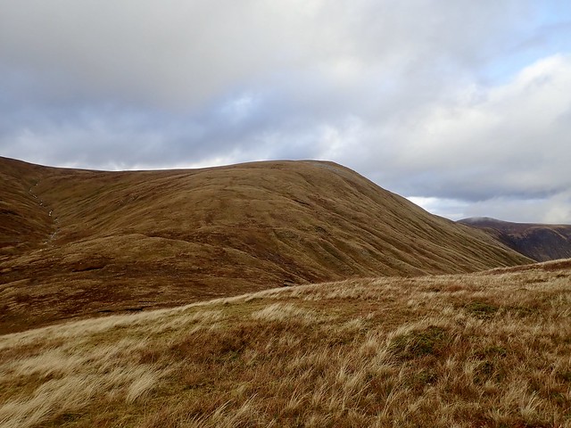
The weather was still miserable when I got to the Farm. I noticed the Wigwams campsite had a shut sign on it - I thought they opened all year? Anyway I got into my waterproofs and set off up the farm track, under the railway viaduct, where a herd of black cows were sheltering from the rain - they reluctantly moved off as I passed by, wishing them a good, if damp morning. The track heads round the southern flank of Beinn Caorach before entering a small native woods plantation - the track by this time has become soggy with many streams to cross. After a bit the track seemed to disappear altogether and I headed up the hillside aiming for the bealach between Caorach and Cam Chreag. Once there I could pick up a sheep track that led more or less to the summit of Cam Chreag. I took a single picture, not much point in taking views of clag and rain.
 F7E21508-8833-41AE-A18D-A50426E4D01A_1_201_a
 by
Al, on Flickr
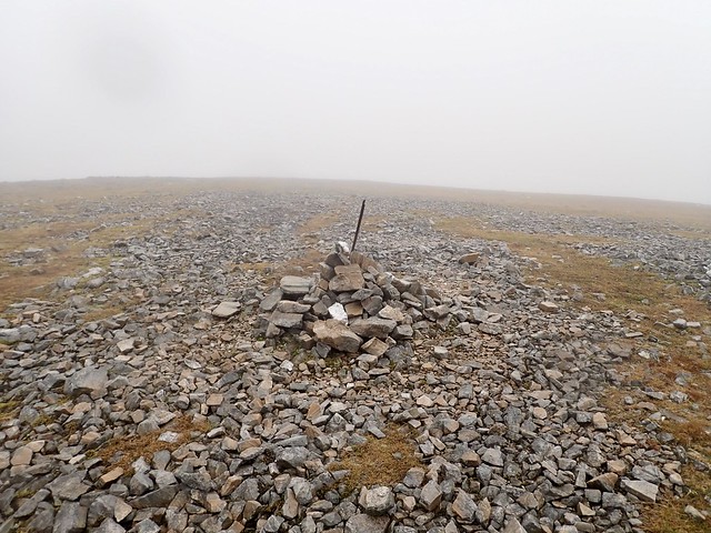
It was that kind of day...
 5D4E3C64-7AA8-4972-869C-CDF60B23AB03_1_201_a
 by
Al, on Flickr
Back the way I'd come to the bealach and up to the summit of Caorach. Now the "fun" starts - steeply down - sliding on my bum a couple of times - to the depressingly low bealach (444m) between Caorach and Beinn Odhar, then the long climb back up to the 901m summit of Odhar. I had been shielded from the wind on my way up, but as I clambered over the boulders near the top the blast of wind and rain was quite fierce. Lovely. I'd elected to continue south, following a fence line, over the Simm of Meall Buidhe, which was fine apart from a swamp at the lowest point between the two hills - one of those peat hags where there are running streams and bits of it look as if they'd swallow you whole. I bumbled my way back down to the track and so to the car, where I dripped a day's rain onto the seats.
 7B005244-3863-4725-B4D9-C5565235D2D5
 by
Al, on Flickr
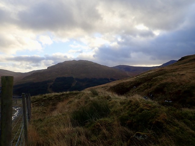
Off to Glen Lyon now - if there had been more daylight I'd have stopped to do Meall nam Maigheach en route, but as it was I got to Cashlie dam around 3.45 and found a spot we've used often before, evicting some sheep who were nibbling the grass. I had an early tea before the light completely faded, read for a bit and listened to some Mahler (4th Symphony) before getting some sleep. I had a headache and had to return to the car not long before midnight - the full moon illuminated the landscape brilliantly, including the sheep who were resting all around and appeared bemused by my sudden appearance.
Saturday I planned to do the three Corbetts at the far end of the glen, from Pubil dam - Meall nan Subh, Sron a'Choire Chnapanaich and Meall Buidhe. I parked just before the metal bridge and set off along the wrong road - I'd intended to climb the two on the north side first of all, but didn't take the right track, even though it was just where I'd parked. I thought I'd just be as well doing Meall na Subh first anyway, so I retraced my steps a little, crossed the bridge and set off up the "road" that ends up in Glen Lochay, one I've never been brave enough to drive on. The Bridge of Balgie road is bad enough as far as I'm concerned. Anyway, I found an opening in the fence just after the line of forestry and an ATV track heading off along the north of the hill - I followed this for a bit then cut straight up onto the hillside. A fairly brutal slog, with clag sitting on the tops and the rain continuing to soak me. I aimed for an old trig marker from when the dam was being constructed- the summit prominence isn't too far behind this. I took more or less the same route back down to the road and, passing by the car, took the proper track along the north shore of Loch Lyon.
Meall na Subh
 1E794908-9FA8-425F-A780-B8ABDAB3AEBF_1_201_a
 by
Al, on Flickr
 A42C6C94-FDB8-4518-A022-5921A71BC56D_1_201_a
 by
Al, on Flickr
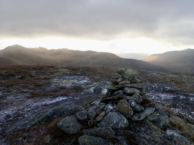
Sheep dotted around the hillside, scraps of wool on the grass. I turned steeply up the hillside, raked with ravines as if some fierce creature had clawed the mountainside. Into the clag. Then some clearing, even the possibility of blue sky: the wind had switched from a westerly to a northernly and conditions dried up although became chillier. I could see Meall Buidhe ahead of me, but I'd forgotten just how long a shoulder it is to the top - another of those 900m plus Corbetts. But there's a fence line and a path to follow. To the summit then back down. I continued to follow the fence line from the bealach heading up Creag a'Chaorainn as I remembered going that way before - when we were doing Simms...I thought it was all too easy and was mildly horrified when I saw I'd gained 50 or 60 metres for nothing and would have to lose it all going down to the 616m bealach with Sron a'Choire Chnapanaich. There was a big herd of hinds on that hill, who scurried round into Gleann Daimh. From what I could see of that end of the glen, it looked a nice spot for a camp. I pulled myself up to the summit then turned and followed the fence line SE to take me back towards Pubil, picking up a good track after the dam to complete the day. I felt really tired by this time, and although it was only 3pm or thereabouts, returned to the tent for a bit of reading. It was Mahler's 2nd tonight, which I lay listening to in the dark whilst the rain and wind battered the sides of the tent, the wind now coming icily from the north. Sheep had taken shelter.
Meall Buidhe
 BF539B81-A98A-4171-8655-B8917F97E149_1_201_a
 by
Al, on Flickr
 C8910F87-41F7-455E-BD28-757A6AA1A34D_1_201_a
 by
Al, on Flickr
Sron a'choirs Chnapnaich
 CBC99C29-F6A7-46BA-9109-B8764A066235_1_201_a
 by
Al, on Flickr
Meall na Subh
 7926A50B-2D21-47D7-8A85-0871633DE33C_1_201_a
 by
Al, on Flickr
 034925B0-83AA-412A-9350-B90601D803EF
 by
Al, on Flickr
There was a big moon in the morning over Meall Gheordaidh. Some white on the mountaintops, my fingers felt frozen whilst I was packing the tent away. I had Beinn nan Oighreag for starters today. We had previously climbed it and Meall Gheordaidh from this side - I remembered a steep climb up Gheordaidh and a rough descent from Oighreag. I swithered whether to add the Munro or not, but I was feeling surprisingly tired and decided to just do Oighreag. I could have started from the bridge at Kenknock, which I'd noticed on the map - would have given a shorter and less steep ascent, but I just went from the bridge east of Cashlie and contoured round Creag an Tulabhain then went straight up the flank of Oighreag. I was really feeling the Ain on ascent - my heart beating in my chest like a frantic animal thudding around. I had to pause every 100 double strides at times - why I'm not sure - maybe I'd been a bit quicker than usual the past two days and it had caught up with me. Anyhow, I made it to the summit, looking west up Glen Lyon and to the surrounding hills. More snow further north. This was my 100th Corbett - pleased I managed to get to that number before the end of the year.
 D062D4EB-D40F-4BFF-B80B-A1AF16834FBC_1_201_a
 by
Al, on Flickr
Oighreag
 38D8B805-F079-4388-8579-DC37BE3650AE_1_201_a
 by
Al, on Flickr
Gheordaidh
 BD3ED719-A3E3-4D81-B7A4-AC79246B9144_1_201_a
 by
Al, on Flickr
 A36E3683-F37A-4D86-806E-AF4F6CBEA804_1_201_a
 by
Al, on Flickr
 68E9B504-2CF2-4ACD-A212-A54AD6EE0417_1_201_a
 by
Al, on Flickr
 F58173F2-32C0-4112-942B-DBC48873C184
 by
Al, on Flickr
Back to the car and a short drive to the Bridge of Balgie road to go up Meall nam Maigheach - one of the shortest Corbett routes if you go up from the road. There were numerous cars parked all around - though I saw no-one else on Maigheach - possibly everyone was up Meall nan Tarmachan or the Lawers Mealls. In fact I had to exercise some restraint not to head up Meall Corrananch and Meall a'Coire Leith as I still have these two Munros on my list to do and have been waiting for an occasion to head that way with Allison. I doubt if I had the energy today anyway

Up the road a bit, having parked across the road from a wee hut, then onto a "track" that's more imaginary than real, a turn up the hillside and Bob's your uncle, the summit is attained. Nice views to Tarmachan and Lawers hills with just a thin layer of snow upon them. Cold wind. Back to the car and off down the road to my mother's, having to endure a lengthy hold up due to roadworks in Callander.
 01D8A775-DC33-4934-8B33-3E578438F854_1_201_a
 by
Al, on Flickr
Moody Tarmachan
 4EE74ED4-294B-4BCB-8574-401254620F08_1_201_a
 by
Al, on Flickr
 2D806E38-71DB-4621-B7DD-1A500FE50F0F_1_201_a
 by
Al, on Flickr
 EEDEC9A3-54EC-464B-A1BB-15A2A4C9326D
 by
Al, on Flickr
.
