free to be able to rate and comment on reports (as well as access 1:25000 mapping).
Donalds / New Donalds: Glenrath Heights, Stob Law, Clockmore.
Date: 29/05/2022.
Distance: 11 + 1.5km.
Ascent: 620 + 290m.
Time: 2 hours, 30 minutes + 40 minutes.
Weather: Grey with some sunny spells.
Included within a 57 mile cycle from Broughton.
I had camped the previous night a few miles from Broughton so I got up nice and early and was parked by the public toilets by 7:45am. Miraculously they were open even before 8am on a Sunday which was much appreciated. Today's main feature would be a cycle following the Tweed with a return via St Mary's Loch and the Megget/Talla Reservoir road, but I was also hoping to pick off a couple of Donalds along the way. I had originally considered driving round to Peebles and doing the walk first followed by the cycle but it made sense to save on diesel and roll everything into one.
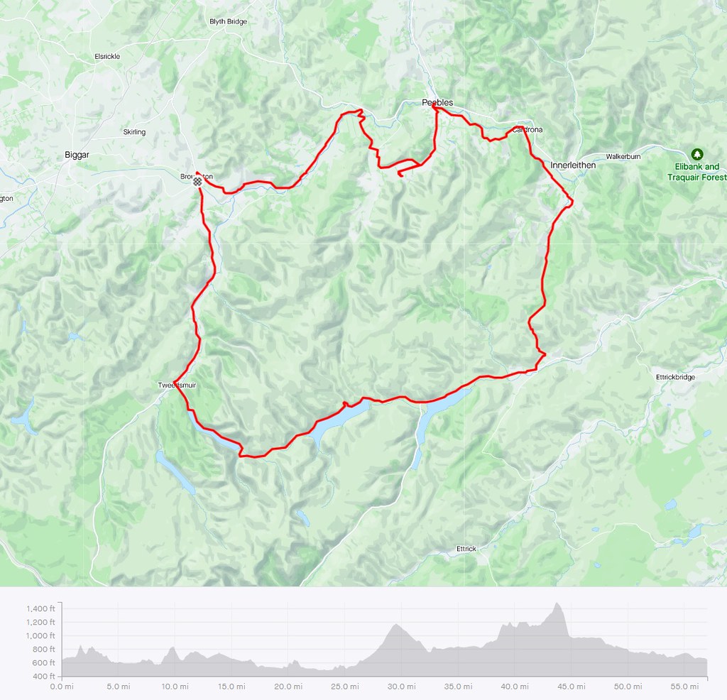 Cycling map
 A slightly chilly start was soon forgotten with a puff up the hill out of Broughton on the north side of the Tweed. Then it was back down again and past Stobo Castle. The roads were nice and quiet this early on.
 Chapelgill Hill and Blakehope Head from above Broughton
  Cycling past Trahenna Hill
 A well-placed footbridge allowed me to avoid the busier A72 into Peebles entirely, instead taking me into the mouth of the Manor Valley and round the foot of the rocky part of Cademuir Hill - pleasant cycling

. I then cycled down to Hundleshope farm and a short way up the burn behind it to access my main walk of the day.
 Footbridge over the Tweed near Lyne Station
  Hundleshope Heights from Cademuir
 Glenrath Heights and Stob Law were the summits that I was after on this walk, but looking at the map I couldn't remember which bumps were Donalds and which weren't. I knew though that if I followed the skyline of the Hundleshope Burn I would end up going over all of the hills I required. A couple of routes were possible - I decided to go up to the old fort (little evidence of this left but nice easy walking on short grass) followed by Juniper Craigs. I had to climb a wall and there was a very short bit of off-piste to pick up an obvious path which came from somewhere else. The Craigs provided some interest on a pretty heathery hillside.
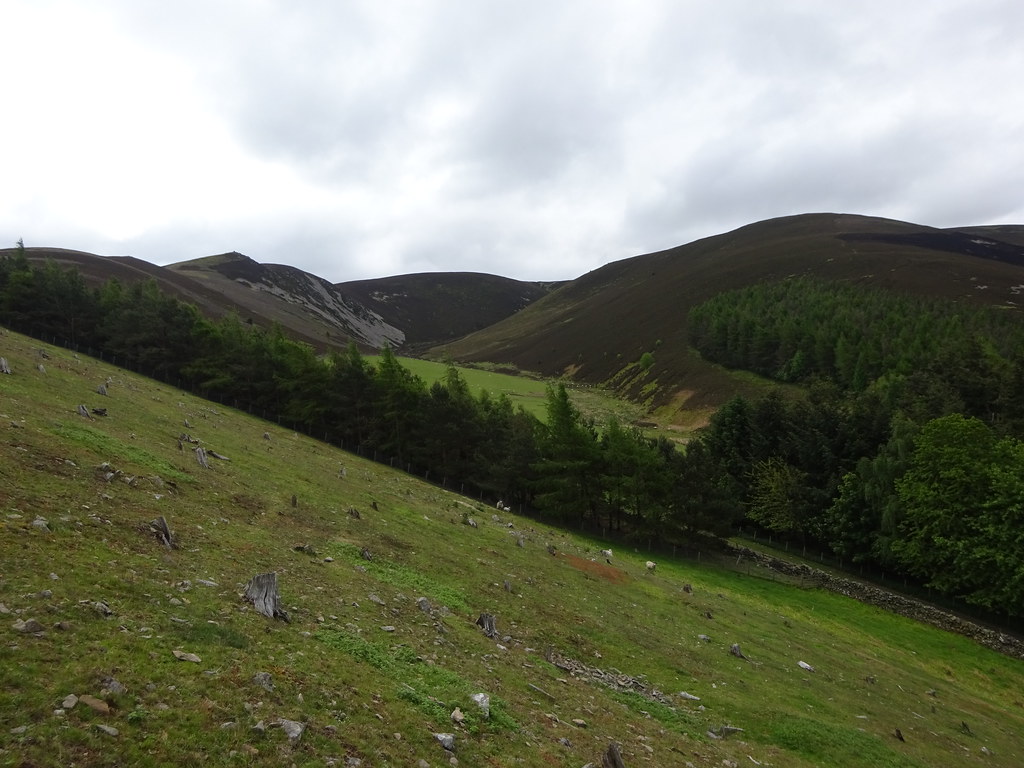 Juniper Craigs and Rae Burn
  Wether Law from Juniper Craigs
  On Juniper Craigs
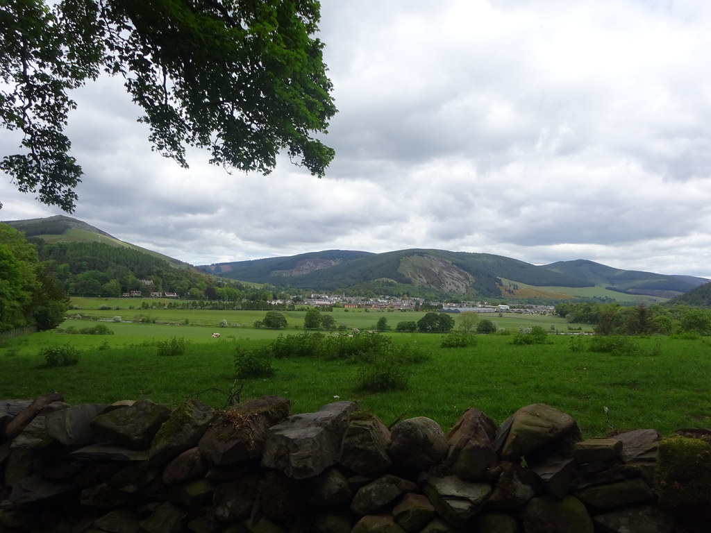
 Above the Craigs a good track led the rest of the way to the trig point on Hundleshope Heights with good views of Peebles and Arthur's Seat opening up.
 Peebles and Newby Kipps
  Pentlands, Moorfoots and Peebles
 The plateau was much drier and grassier than I expected for the most part and I was able to keep my feet dry despite wearing trail shoes. This was quite different to my previous experience on the other side of the Glensax Horseshoe on Birkscairn Hill!
 Heading for Glenrath Heights
  High sheep
 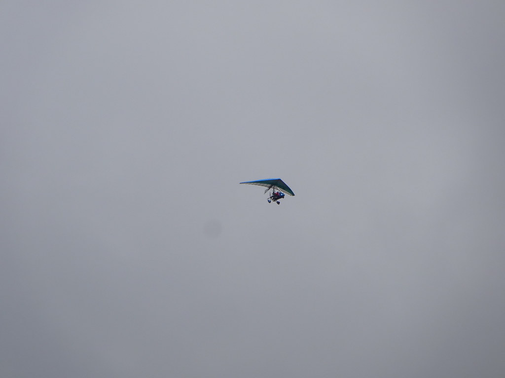 Paramotor
 Once at the high point of Hundleshope Heights a very short retrace of steps led me steeply down towards Stob Law. The going was dry again and there were good views into the Manor Valley. Stob Law summit was quickly attained.
 Glenrath and Stob Law
  Glenrath and Pykestone Hill
  Descending towards Stob Law
 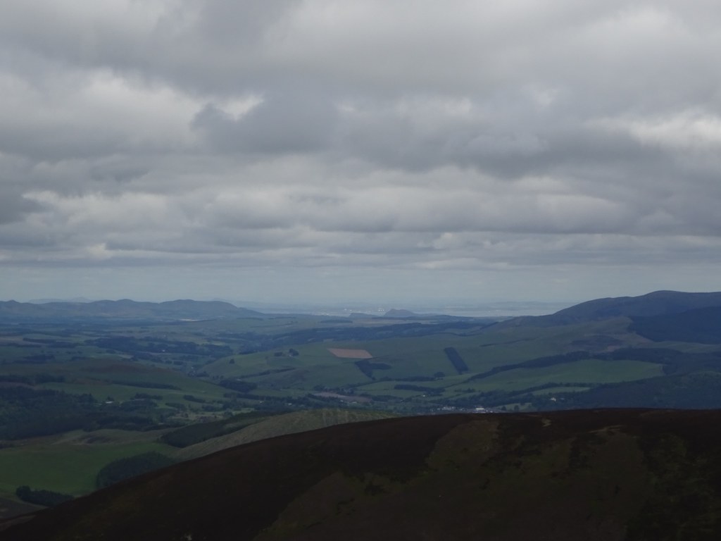 Fife and Arthurs Seat
  Along the ridges of Hundleshope Heights from Stob Law
 The descent back to the bike took me over some smaller summits (Glenrath Hill and Canada Hill) before dropping me into the trees above Hundleshope. A steep descent through these led me through a gate and back onto the track I had started up. An enjoyable short alternative to the entire Glensax horseshoe.
It was getting on for lunchtime so I diverted into the centre of Peebles for a coffee and something sugary to eat with my lunch. It was quite busy so after the coffee I decided to carry on and find a quieter spot to eat.
 Peebles
 Back out of Peebles, I hit the back road towards Traquair stopping at Traquair Forestry Commission carpark for lunch. I had been worried that this would be a busy road but it wasn't too bad at all.
 Across the Tweed to Innerleithen
 Then it was time for the long climb and descent over to St Mary's Loch. This was never steep but it went on a bit! Having whizzed over here a few times in the car before without paying much attention to the scenery, it was much more enjoyable at a slower pace. As I turned right for St Mary's Loch I discovered some more uphill that I hadn't anticipated, plus I
still seemed to be cycling into the wind somehow

.
 On the Traquair to Yarrow road
  St Marys Loch
 The main road hadn't been too busy but I was soon onto the quieter road heading for Megget Reservoir. Not that it was that much quieter, but the traffic was a bit slower. So was I as I began to climb towards the top of the dam! Although inconspicuous due to being covered in grass, the dam is impressively large and so is the reservoir. There is a bit of a high water mark around the edge, but as it stores drinking water, the levels don't go up and down anywhere near as frequently as the big hydro reservoirs in the Highlands, so it is nowhere near as prominent..
 Megget Dam and Reservoir
 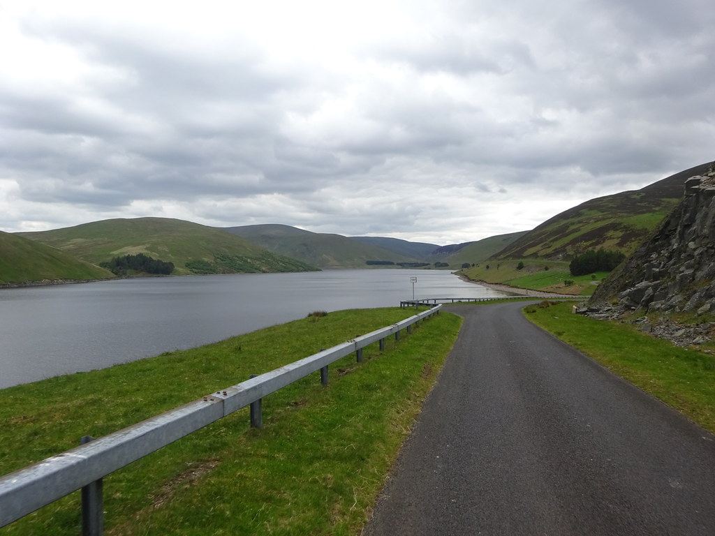 Megget Reservoir
 About three quarters of the way along, I decided to add in a second hillwalk - more of a dash than a proper walk really. Clockmore is only a New Donald and fitting it into a round that I'm likely to do any time soon seems nigh on impossible. 4 years ago I had driven along this road twice in the same weekend both times intending to stop and nip up it, but I hadn't bothered in the end. It looked steep from the side but a fair height of it was well grazed by sheep, so I thought the ground would be good.
 Meggethead and Dead for Cauld from Clockmore
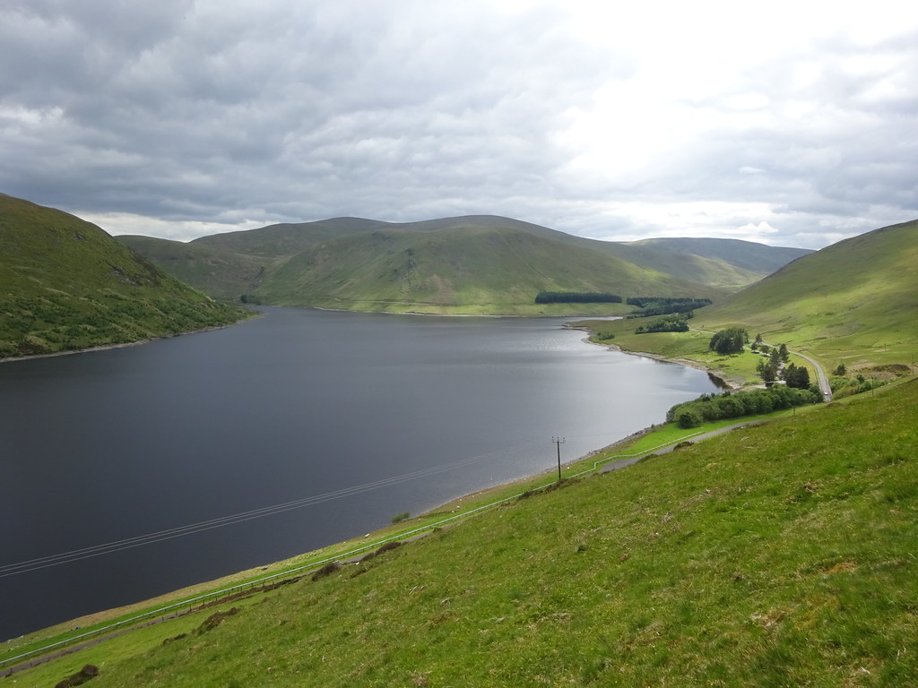
 The ground was mostly good - a bit of heather bashing higher up but overall the ascent only took 25 minutes. It was definitely steep though! There were some good views down the reservoir and St Mary's Loch, and beyond to the Cheviot, as well as into the wild0- looking glen of Winterhopeburn. I came down much the same way in about half the time.
 Craig Dilly and Winterhope from Clockmore
  Broad Law and Cramalt Craig
  Megget Reservoir and St Marys Loch with the Cheviot beyond
 Back on the bike, I was tiring fast. In theory after my short climb up to the Megget Stone, the rest of my ride was downhill. However I had a feeling that following the Tweed would involve some ups and downs and the wind would probably be against me. Once I had dragged my way up the scenic final hill I enjoyed a short descent before stopping for a break by the waterfalls on the Talla Water. Then it was a boneshaking descent to the reservoir - the main reason I had gone round the circuit in this direction!
 Back at the road
  Is this the Megget Stone? No wonder I missed it previously!
  Waterfalls on the Talla Water
 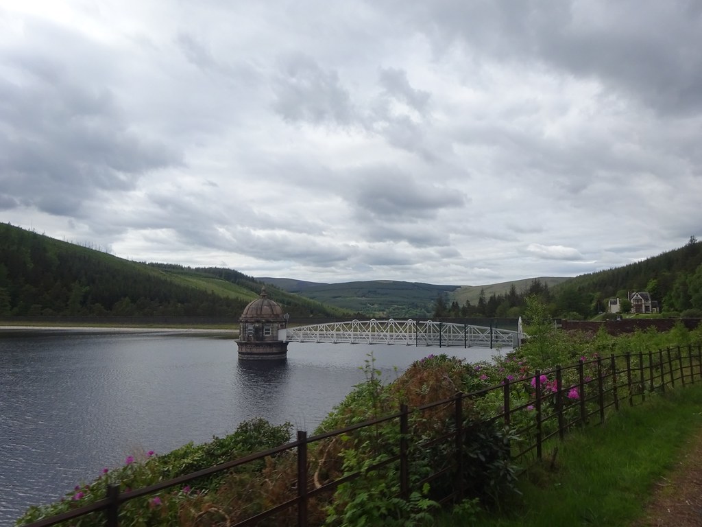 Talla Reservoir
 As it turned out the final miles back down the Tweed to Broughton were delightful. The wind must have flipped during the day as it was no longer against me and the scenery and light were lovely. I finally rolled back to the car shortly before 5pm and had a nice long sit down before heading back to Glasgow. As expected the Borders had provided a great weekend - I just needed to persuade myself to go there in the first place!
 Craig Head above Stanhope