free to be able to rate and comment on reports (as well as access 1:25000 mapping).
After last week’s epic adventure up and around Ben Lui, I thought I'd go for something a bit easier and shorter this time round. So I set my sights on either An Caisteal & Beinn a'Chroin or Cruach Ardrain & Beinn Tulaichean from the layby where the River Falloch meets the A82. But after having a wee read of the Ralph Storer 100 Best Routes book I changed it slightly. He described An Caisteal, Beinn a'Chroin and Beinn Chabhair from Derrydaroch Farm. It would be a shame to leave one solitary Munro on it's own so Chabhair was now included in the route but the biggest reason for changing was to include a visit to the "delightful secret hollow that cradles Lochan a' Chaisteil" on the way back which was supposedly awesome.
Having checked the weather constantly for the previous few days, I had almost planned on attempting An Caisteal then when the expected heavy rain and lighting came later I would give up and head back to the car. This almost put my mind at ease as I really wasn't expecting to tackle this whole route if the bad weather came. But when I arrived at the layby, the sun was out and there wasn't much sign of thick grey cloud anywhere! *gulp* Maybe I will have to do the whole thing after all!
So I started off with my trusty DSLR slung over my shoulder for a change (expect lots of pictures below!), crossing over the WHW path then carefully jumping over a rotten old fence. After clambering up the boggy hill for a few minutes I had a wee look back at where I started, and then set my sights on Sron Gharbh where I was headed, aiming for my first summit of the day.
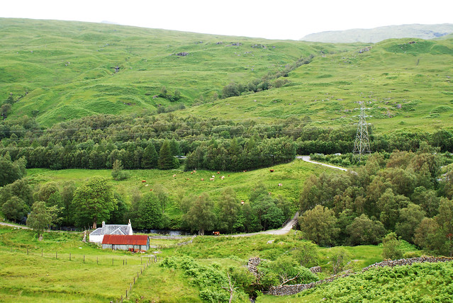 Looking back to Derrydaroch Farm
 by
Rossco 7, on Flickr
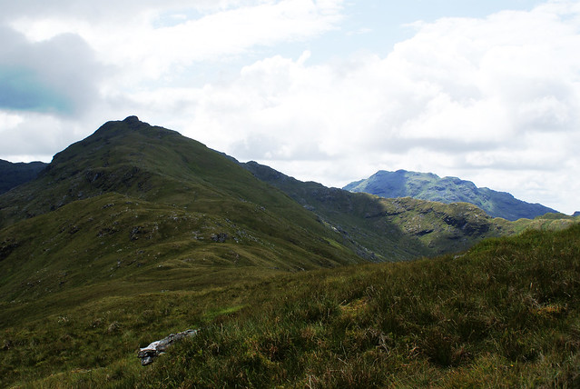
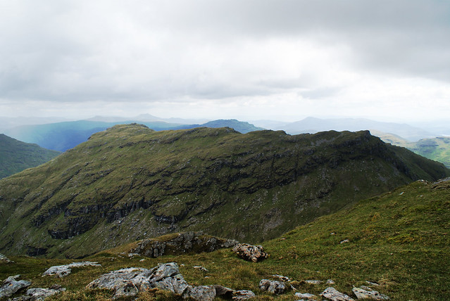
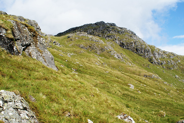
The going was pretty tough along the side of the hill to Sron Gharbh. At the start it looked as if there was a path following the fence along at the base of the hill but with so many miles ahead of me I wasn't up for taking a long route around so just headed straight up the middle. It was very boggy, lots of wee burns to cross that would sometimes just sneak up on you out of nowhere forcing you to quickly take an extra big lunge to avoid it! Not long after though, the view opened up to see the whole of Sron Gharbh, Twisting Hill and An Caisteal in all it's glory even if there was some cloud forming on top!
 Sron Gharbh, Twisting Hill and An Caisteal
 by
Rossco 7, on Flickr
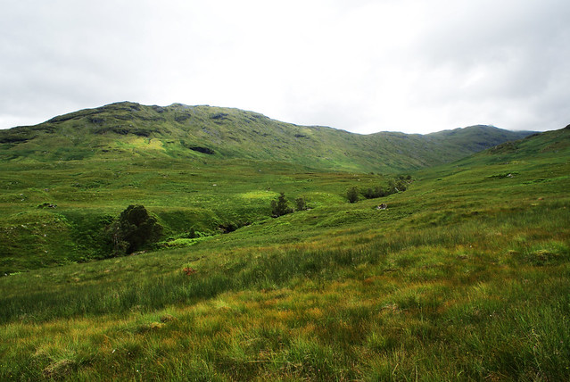
Half way there, a sizeable river had to be jumped but I easily found a narrow section further upstream to cross without getting my boots wet. Then a gate had to be manoeuvred which strangely had a wire suspended about a foot or two above the gate meaning I had to remove my bag to squeeze in-between it. Never seen anything like that before!? Anyway, onwards and upwards. Great views at this point of some of the hills I'd be tackling later on.
 Looking up Coire Andoran with Beinn Chabhair in the distance
 by
Rossco 7, on Flickr
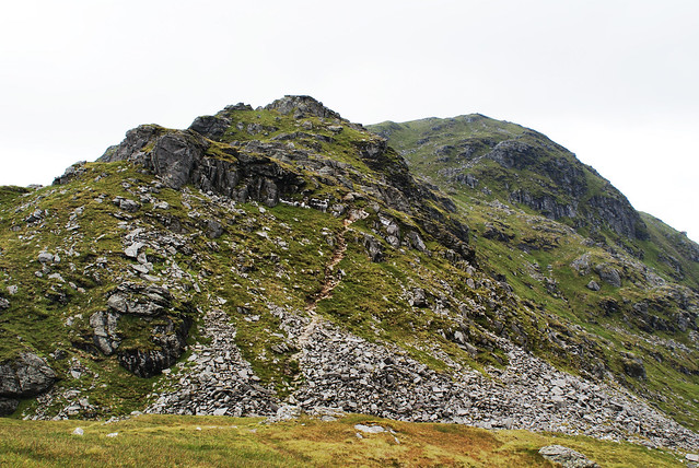
Climbing Sron Gharbh from this angle was a gruelling process. There was no path and it was steep, grassy, boggy, and rocky all at the same time. With only an hour gone of the day so far, I was wrecked already after the long trudge up the field so this ascent was probably the least enjoyable of the day. Eventually a path emerged out of nowhere and it was plain sailing to the top.
 The path to Sron Gharbh
 by
Rossco 7, on Flickr
Time for a wee piece and some photo opportunities and also a quick agreement with myself to slow the pace down drastically so I could actually appreciate the day. The ascent up Twisting Hill to An Caisteal looked just that, a big twisting hill with a few walkers already on the path popping in and out of view as they twisted their way up.
 Sron Gharbh summit view up Twisting Hill to An Caisteal
 by
Rossco 7, on Flickr
 Sron Gharbh summit view up Twisting Hill to An Caisteal
 by
Rossco 7, on Flickr
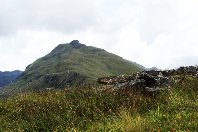
The walk up to An Caisteal was fairly pleasant on a well trodden path with good views of Cruach Ardrain and Beinn Tulaichean and of course Ben More and Stob Binnein towering above behind them. There was one huge gash out the path at one point where you descent into a wee small rocky gully and climb up the other side but nothing too challenging. Then it's pretty simple after that to get to the summit which is quite a large flat area. Spoke with a man here for a while about the surrounding hills and mainly discussed the 3 summits of Beinn a' Chroin and which was actually the highest. He questioned whether I'd make the effort to go to the furthest away one which I wasn't too keen on it at the time seeing as it wasn't the highest point.
 An Caisteal summit (995m) with Beinn a' Chroin in background
 by
Rossco 7, on Flickr
Stopped again here to refuel and for some more photo opportunities whilst also deciding I had to go on. Partly because I was feeling quite good, the weather was holding on too but I think mainly because I really didn't want to have to go all the way back down that bloody boggy field I came up to start with!

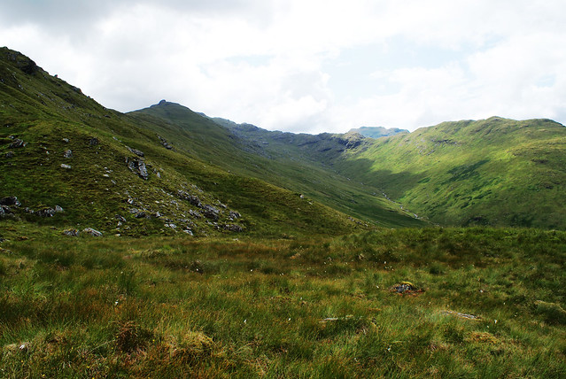
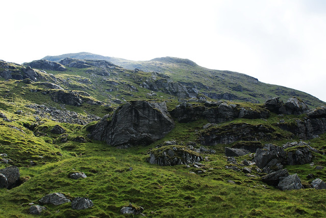
 Beinn Chabhair's pathless east face
 by
Rossco 7, on Flickr
Had a wee look at Beinn Chabhair from up at this height to see if it was possible to spot anything that resembled a path but there was nothing to be seen. It looked a difficult beast to ascent but I had other things on my mind first of all for the next few hours... Beinn a' Chroin!
 Beinn a' Chroin from An Caisteal summit
 by
Rossco 7, on Flickr
The descent from An Caisteal to Bealach Buidhe was actually quite fun, some steep rocky sections which might be an enjoyable climb up if you were starting the walk from another location. From the Bealach, again I had a wee look at Beinn Chabhair to see if I could spot the best route down to the start and then up to the summit but again, I drew a blank. Looked a long, hard slog from here!!
 Bealach Buidhe looking up to An Caisteal
 by
Rossco 7, on Flickr
The path up Beinn a' Chroin however, was pretty straightforward apart from one tricky scramble. The walking stick had to get lobbed up ahead of me as I needed both hands free to grab on tightly and make sure the weight of my bag didn't send me tumbling backwards down the hill!
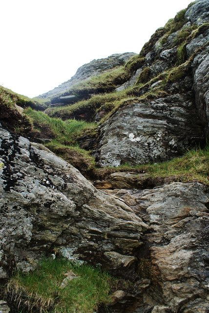 Tricky scrambling section up Beinn a' Chroin
 by
Rossco 7, on Flickr
After that, again it was plain sailing. Path the whole way, taking in all three summits. I got to the second and main summit and thought, it's only another mile or so to grab the final summit so I may as well do it. What's an extra mile when you're already planning on doing 10 or 11 anyway? Only this last summit required any effort, almost 100m of descent then ascent again to reach it but it was worth it for the views. The weather was starting to get pretty windy at this point though so the old jacket was thrown on just as some rain started but it didn't last long thankfully.
 First summit of Beinn a' Chroin (938m)
 by
Rossco 7, on Flickr
 Looking south east from Beinn 'a Chroin
 by
Rossco 7, on Flickr
 Beinn a' Chroin's second and highest summit (942m)
 by
Rossco 7, on Flickr
 Beinn a' Chroin's third and final summit (940m) with Cruach Ardrain behind
 by
Rossco 7, on Flickr
Back down the same route to Bealach Buidhe, I actually made a wrong turn after going down the scrambling section. It looked as if there was a path leading around in a similar direction but higher up. It quickly disappeared into nothing though so I smartly headed back rather than attempt to descent down some crazy steep rocks.
At the Bealach, I kinda stood about not sure where to go. In the end I just aimed for the small lochans at the base of Beinn Chabhair and tumbled my way down. The sun was out again now in full force so the jacket and fleeces were off and the shades were back on.

 Descending from Bealach Buidhe towards Beinn Chabhair
 by
Rossco 7, on Flickr
 Looking back up at Beinn a' Chroin
 by
Rossco 7, on Flickr
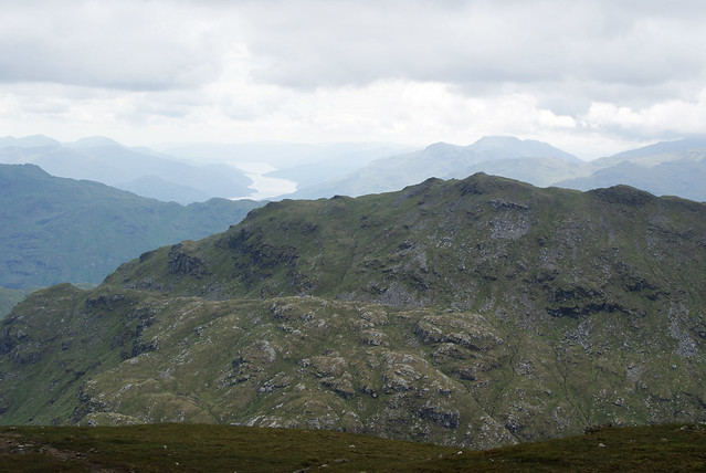
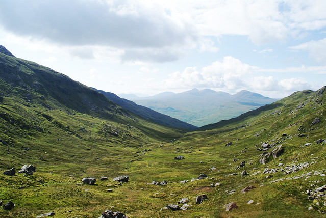 Looking down Coire a' Chuilinn towards Ben Lui
 by
Rossco 7, on Flickr
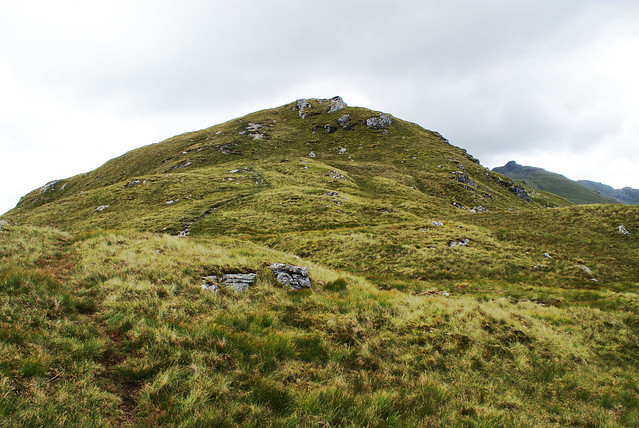
Eventually, a small path was reached and I thought I was in luck and just couldn't spot the path up Chabhair from where I was looking before but as usual, the path amounted to nothing after 10 minutes or so of climbing so I was on my own again! It was a beautiful side of the hill though, lots of small burns and waterfalls around and the odd frog jumping about. It was extremely steep though and there didn't seem an easy way at all to do it. I made several stops for a breather and to appreciate the awesome view of An Caisteal towering above me now. Near the top, there was a plateau which almost looked like it had a path leading round to the left to attack the summit from the South but I wasn't sure how much longer it would take so headed straight up a large rocky route instead.
 Beinn Chabhair, the only way is up
 by
Rossco 7, on Flickr
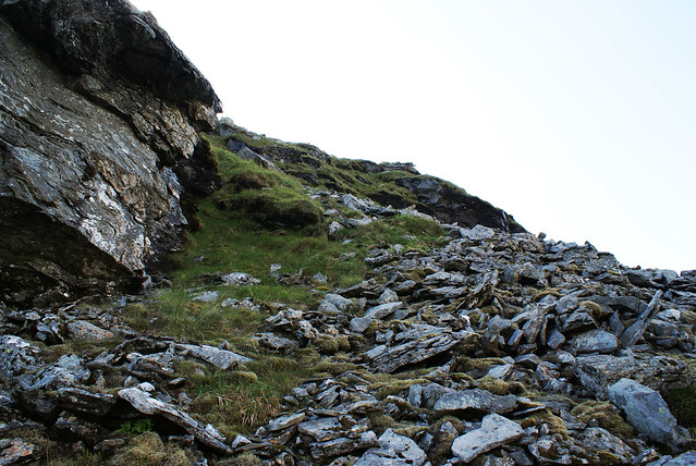 Beinn Chabhair, rocky route
 by
Rossco 7, on Flickr
The further up you got from this direction, the steeper the hill got. Both hands were needed at times to hold on and pull yourself up and at one point I thought I was a goner. I was balancing precariously on some rocks when I put my hand down for stability and all of a sudden a frog jumps right onto it. I honestly got the fright of my life. Possibly because I was so focussed on what I was doing and this thing just came out of nowhere. My heart rate must have doubled so another wee breather was in order here before finally making the last clamber to the final Munro summit of the day and my 9th to date.
 Beinn Chabhair summit (933m)
 by
Rossco 7, on Flickr
The wind was crazy at this point, it was actually difficult to stay on your feet but I couldn't help to stand in the face of it and just admire the views. Absolutely astounding, the sun’s rays piercing through the white clouds and reflecting off the lochans below.

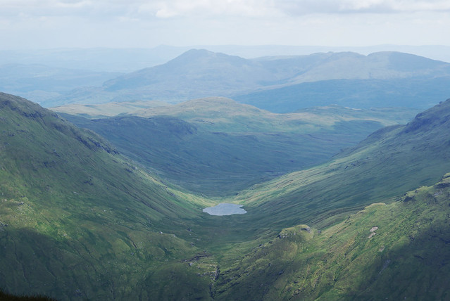
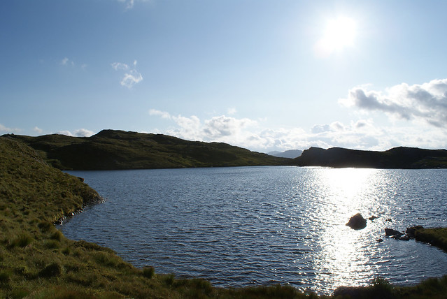
And then I saw it, Lochan a' Chaisteil. What I was here for. It sure as hell looked a distance away from here, but how magnificent does it look perched high up on that plateau.
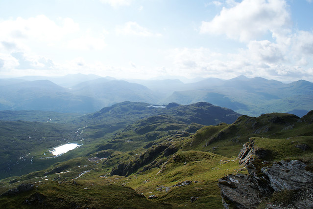 Lochan a' Chaisteil in the distance from Beinn Chabhair summit
 by
Rossco 7, on Flickr
So off I headed, knowing the path was once again going to disappear leaving me on my own with only my compass to help navigate over the endless labyrinth of grassy knolls. Making my way down the north west ridge of Beinn Chabhair towards Meall nan Tarmachan, the lochan would appear in and out of site every so often. It was playing a cruel game with me though. The closer I got to it, the further away I actually seemed. I didn't appear to be making any progress. Every hill I got over, another huge ditch was waiting for me on the other side.
 Lochan a' Chaisteil getting closer
 by
Rossco 7, on Flickr
 Still so far away...
 by
Rossco 7, on Flickr
Eventually, after almost an hour and a half of hard walking and scrambling up and down these gullys, I made it! And man was it worth the 8 hour walk so far to get there!

 Made it. Awesome!
 by
Rossco 7, on Flickr
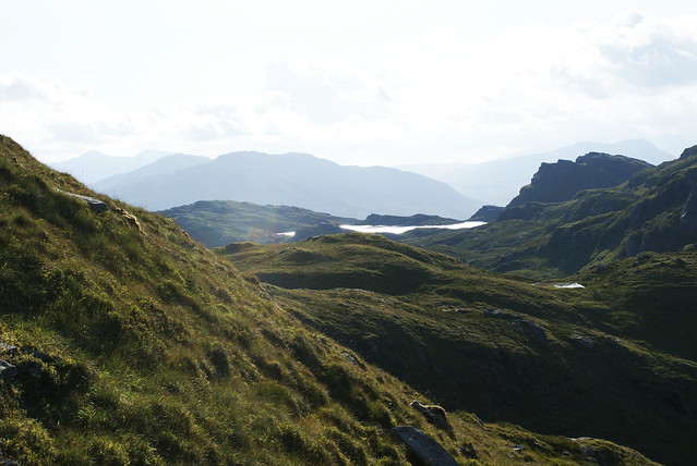
It was quite surreal, this small lochan perched high up and surrounded on all sides like a castle. Completely secluded. I can't imagine a lot of people visit it which made it feel even more special. The huge cliff face that drops straight down into the water from Ben Glas is a strange sight as it forms an almost dead straight line across the north east side of the lochan. I wondered round it clockwise until I found the perfect flat slab of rocks right on the shore of the lochan to put my bag down and lie in the sun for 15 minutes or so appreciating the sheer awesomeness of where I was.
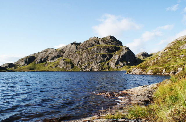 Lochan a' Chaisteil and Ben Glas
 by
Rossco 7, on Flickr
[youtube]http://www.youtube.com/watch?v=WrfnKRbiUNc[/youtube]
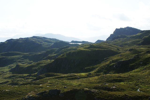
I had completely fallen in love with it at this point and was already planning on when I could start wild camping and spending the night up in this idyllic spot but time was pressing on and I knew I had a 2 hours walk ahead of me to get back to the car so I had to leave. Added in the summit of Meall Mor nan Eag then stopped by the other side for a final panoramic photo of the area before heading for the descent leading down to Glen Falloch.
 Meall Mor nan Eag summit (624m) with Lochan a' Chaisteil behind
 by
Rossco 7, on Flickr
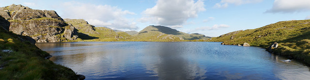 Beautiful Lochain a' Chaisteil looking back towards Beinn Chabhair
 by
Rossco 7, on Flickr
It was here that I got my second fright of the day! I turned around behind Ben Glas when I stumbled upon a flock of about 30 sheep
right next to me! They clearly weren't expecting company and all ran like the wind but this startled me a fair amount to say the least.
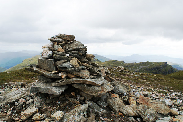
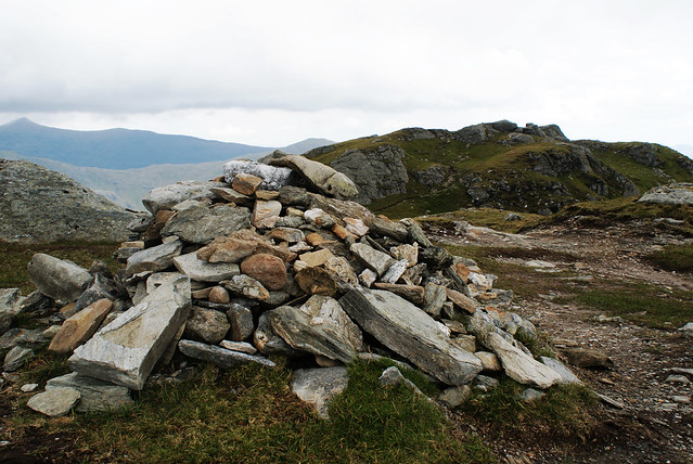
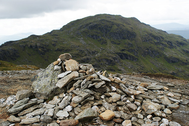
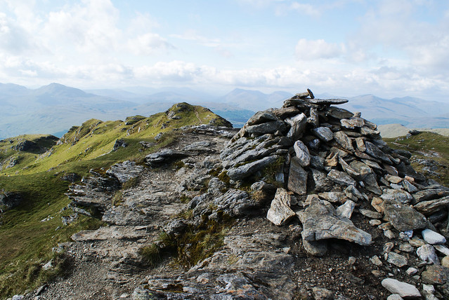
The rest of the descent was fairly normal. The sun was setting at this point so the whole area was just stunningly lit up with an orange hue which added to the majesty of the final descent of the day. Also spotted a cairn balanced on top of a high set of rocks which was quite funny to see out in the middle of nowhere so duly added to it and kept on going. I stopped around this area to put a plaster on my blistering foot and I think this is where I sadly lost my sunglasses. So anyone doing this mammoth route soon keep an eye out for them!
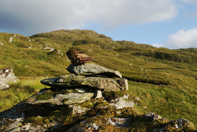 Small cairn half way down to Glen Falloch
 by
Rossco 7, on Flickr
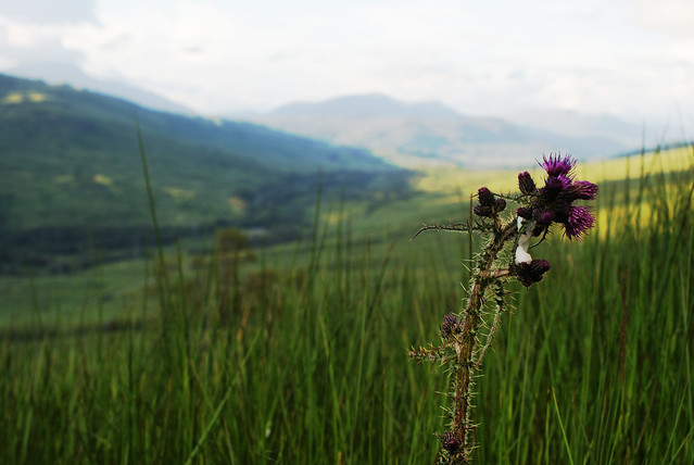 Thistle with Glen Falloch behind
 by
Rossco 7, on Flickr
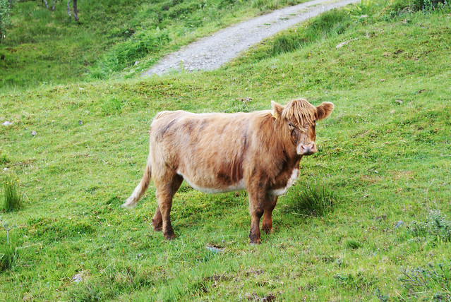 A coo
A coo by
Rossco 7, on Flickr
After climbing a few fences, and jumping some rivers, I made it back to ground level and joined the WHW path for the last mile or so back to Derrydaroch Farm, stopping every so often at one of the many rivers to splash my face with water. So refreshing after a 10 hour walk!
As I arrived back at the car, the clouds were looking the greyest they had all day, I somehow missed the heavy rain and lightning that was supposedly forecast and had an absolute belter of a day up there. I hadn't seen a single person from the final summit at Beinn a' Chroin onwards. About 5 hours on my own, climbing pathless hills, crossing wild terrain and stopping at secret lochans. Its day like this hillwalking was made for. Never be forgotten.
http://www.everytrail.com/view_trip.php?trip_id=1179950