free to be able to rate and comment on reports (as well as access 1:25000 mapping).
Corbetts: Meall na h-Aisre, Gairbeinn
Date walked: 06/08/2011
Distance: 22 km (cycling), 21 km (walking)
Ascent: 650 m (cycling), 615 m (walking)
Time: 6 hours 45 minutes
Weather: Clear and calm, mainly overcast. Showers later
I was supposed to be doing family stuff this weekend, but with the plug pulled at the last minute I started looking at maps. My original plan to visit Glenlivet for a longish day out was thwarted when I realised I didn't own a paper map of the area and the printer was out of ink. Good thing too, as the weather looked a bit grimmer over that way. My alternative was this route, taking in the last of the Monadhliath Corbetts. I must thank RCFC/Ed for the inspiration for this route, as I'd never considered approaching from this direction prior to reading his great
report from last July. His mention of new tracks had me looking at the latest 1:25,000 map, which showed the network in full. I realised it would be possible to cycle to within easy walking distance of these two hills, making this approach just as straightforward as the more usual one from Garva Bridge to the south.
Cycling part of route (new track not marked):
Walking part of route (new track not marked):
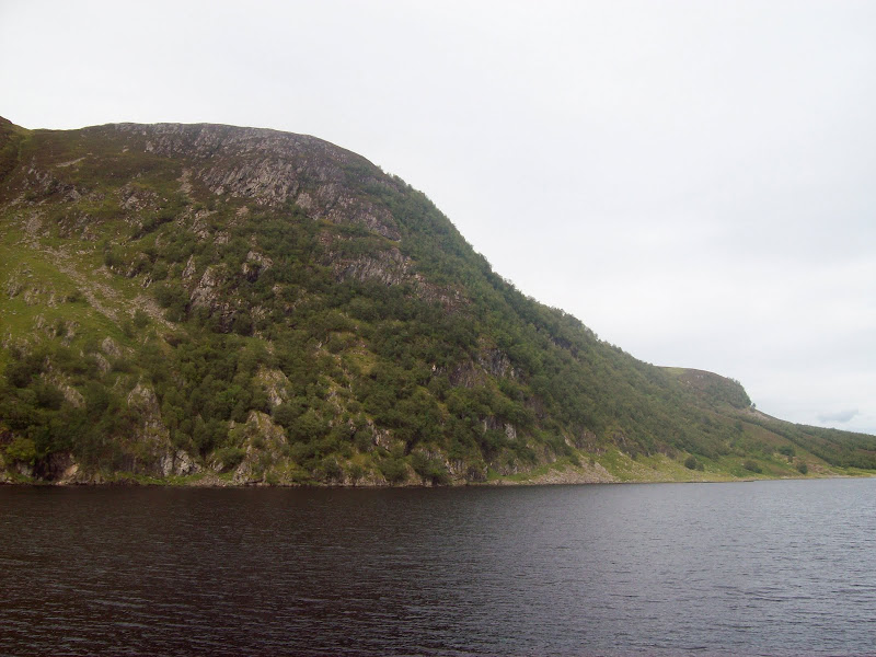
I'd been up the Fechlin to Loch Killin once before on a work trip, as there are quite a few run-of-river hydro schemes in the area, and it was just as impressive as I'd remembered it. Garrogie Lodge appeared to have undergone a bit of renovation though, as I'm sure I remember it as a crumbling ruin. A sign on the road at the start of the loch advised that further up was unsuitable for motor vehicles, but I drove on anyway. It was pretty rough, but to be honest parts of the A9 were almost as bad at the end of last winter! A sign advised no parking at the end, so I turned back and found a space to squeeze into about halfway back down the loch. It was an impressive spot, quite similar to the Gaick pass or even the head of Glen Clova. However lack of popular hills seems to make it much more popular with fishermen than walkers.
Loch Killin:

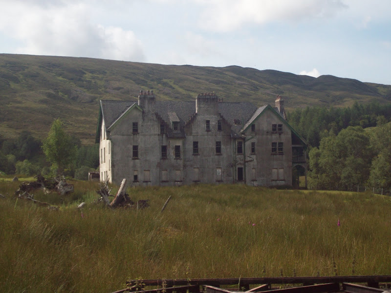
Easy cycling took me to Stronelairg Lodge, which was in a rather ruinous state, rather like I remembered Garrogie Lodge on my previous visit in 2006.
Stronelairg Lodge:
The track upwards was quite clear, following the line of the old stalker's path marked on my 1:50,000 map. It was extremely well made, and also one of the steepest tracks I'd ever cycled up. My gears weren't playing ball, and I had to get off and kick the derailleur into the granny gear. Even after this, the going was so steep that I had to get off and push for about 1/3 of the initial section. This track makes the Attadale to Bendronaig Lodge track seem like a doddle!
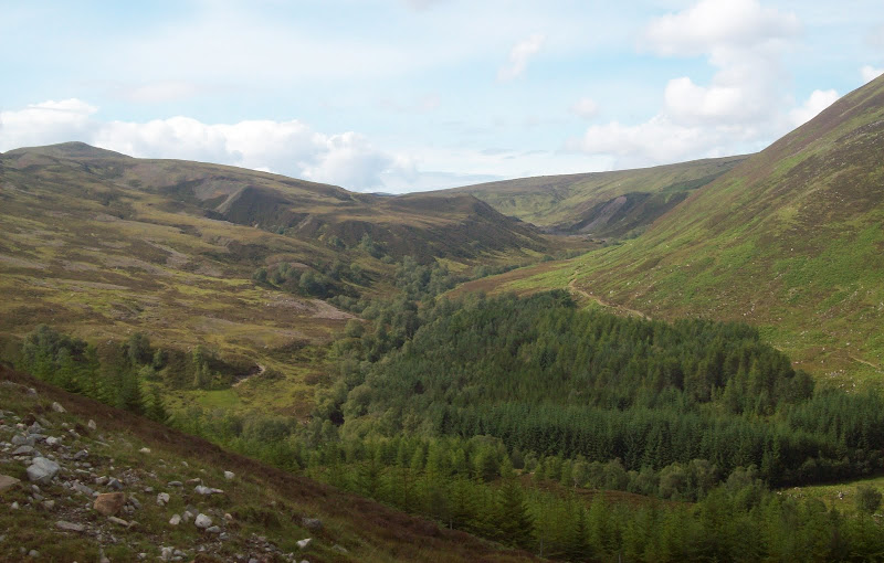
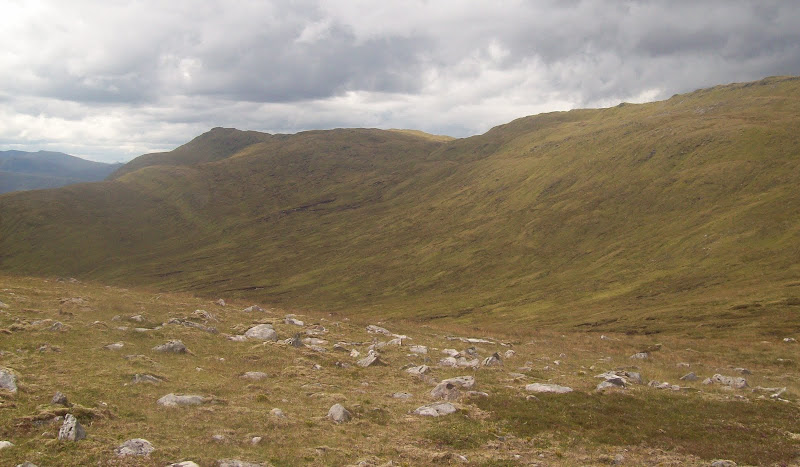
Gleann Odhar:
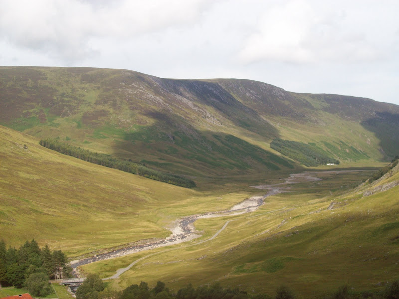
Back down Glen Killin:
New track up Sron na Lairige. The next section follows the skyline in the right of the photo. Steep!
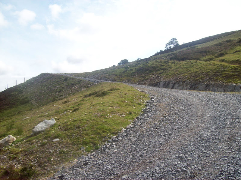
After 3 or 4 zigzags, the gradient eased considerably, and I was able to return to a more normal gear. Again, the bike failed to co-operate and the gear cable snapped. I only carry a very limited set of tools when mountain biking, so I was glad to find that the one allen key I had with me fitted, and allowed me to re-attach things (albeit without the really high gears working).
Pleasant cycling now took me gradually up to the 13km long aqueduct which diverts water from a number of streams into the upper reservoir in the Glendoe hydroelectric scheme. At each major stream crossing, there was a weir designed to divert a percentage of the flow into the aqueduct.
New intake on the Glendoe aqueduct:

It was really hard to spot individual hills up here, as they were not much higher than I was. What I thought was Meall na h-Aisre was actually the Munro Geal Charn, which could also be approached from this direction. I had a couple more miles to pedal, crossing the high point of the track and a radio mast.
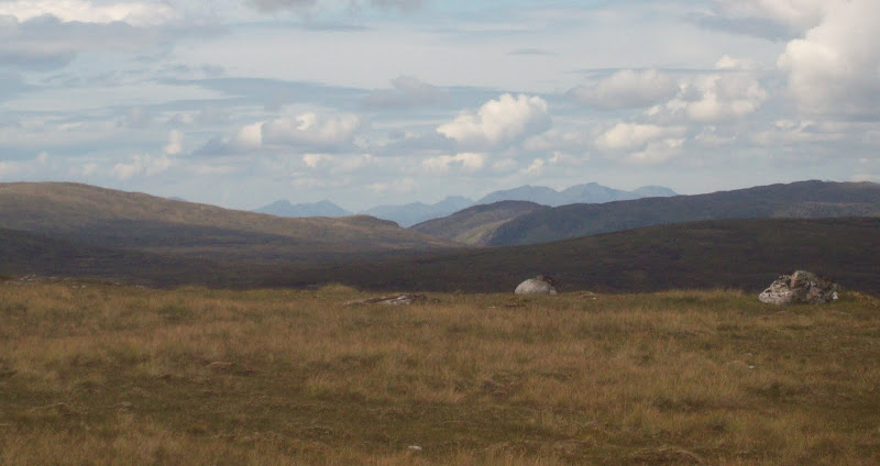
West to the hills around Loch Quoich:
A short way down the hill on the far side of the high point, I ditched the bike and started walking towards Meall na h-Aisre (I think most people who have considered climbing this hill have an arse-related pun for it. Mine was borrowed from a friend). The initial 100m of ascent onto Carn na Gourach was a little wet in places, but after that, walking was very pleasant over short turf. I scared off lots of deer, and was on the summit in little more than 40 minutes from the bike. Easy hill if you forget about the cycling!
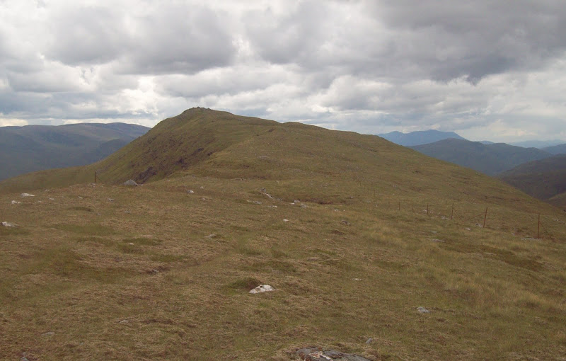
Towards the summit of Meall na h-Aisre:
Southwest towards the Ben from Meall na h-Aisre:
Southeast towards Drumochter:

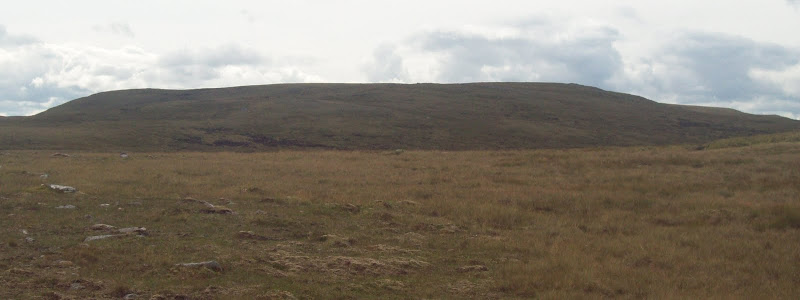
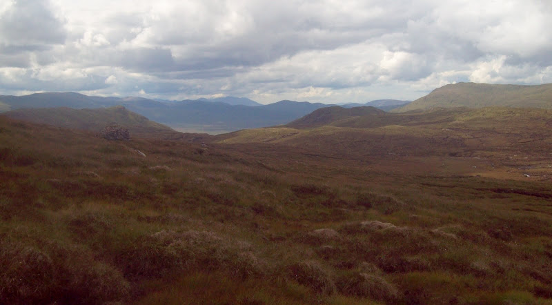
Sitting on the summit for lunch, I was struck by how quiet it was. There wasn't a breath of wind, and I couldn't hear any running water, bellowing stags, or anything at all. Hairy Arse appeared to have a little more shape from the south, but was fairly uniform rolling bog from most directions. I could see what my route to Gairbeinn entailed from here. The Corbett guidebook doesn't make any suggestion for combining these hills, which seems typical of the SMC's aversion to interesting routes. I tend to find that these kind of boggy traverses are all part of the Corbett (and Graham) experience.
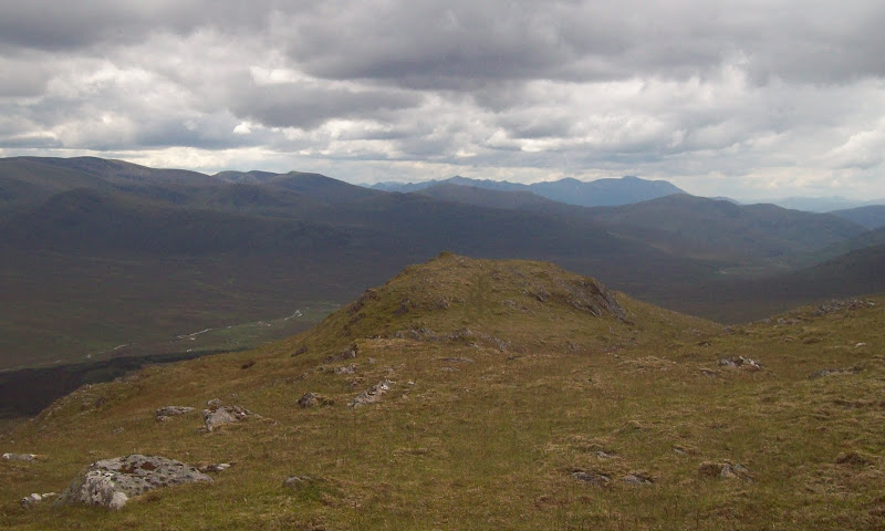
Landscape between Meall na h-Aisre and Gairbeinn:
Typical bog/stream crossing on the col:
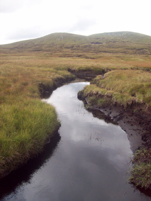
I started off following fence posts down easy terrain, before abandoning them to pick my own way across the first bog (in mist, you could stick to the fenceline to ease navigation). The walking was actually pretty good, with the most difficult bits being a couple of benign-looking stream crossings. However the streams were just to wide to jump and appeared to consist of bottomless gloop. A bit of weaving about led to a crossing point.
Ascending and descending slightly to the south of the 758m spot height, I reached the second section of the traverse. This was less wet but more haggy, passing by the pleasant Lochan Iain, then up onto the long, almost level NE ridge of Gairbeinn. Oddly, there were not one but two rows of old fence posts along the ridge. Maybe due to a right of passage being required between different estates?
Gairbeinn from Lochan Iain:

Lochan Iain and Meall na h-Aisre:

Gairbeinn used to be one half of a double-summited Corbett which also included Corrieyairack Hill. In the latest edition of the Corbett list, Gairbeinn had been fixed as the higher of the two. I had only realised this very recently, previously thinking Corrieyairack Hill to be the highest. Certainly made my walk a bit shorter. A friend had already recommended Gairbeinn as the more interesting hill, with its long, narrowish summit ridge. He was right, and although it wasn't that narrow, it made nice walking again. This seems to be a theme in the Monadhliath. For all of the rolling peat hags, the summits tend to make for nice easy walking.
Summit ridge of Gairbeinn:
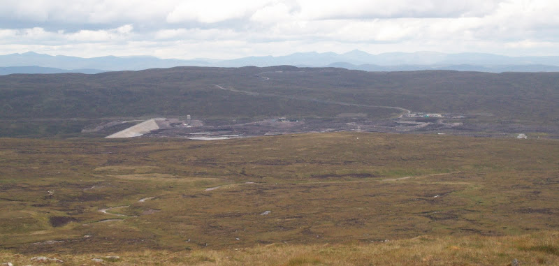
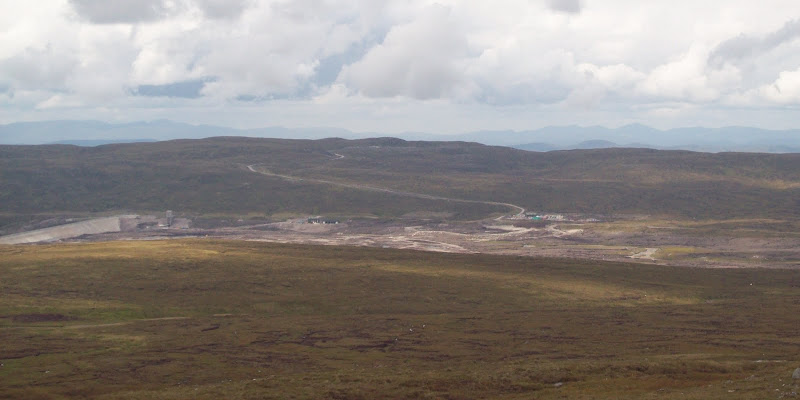
I could see over to what was supposed to be top reservoir of the Glendoe scheme, only it appeared to be empty. I was aware of a fracture in the main tunnel down to the generators, so it is likely that the reservoir has been temporarily drained as a safety measure while this is repaired. It will certainly improve the appearance of the area once it is refilled. As an aside, I was aware of the workers camp down at Fort Augustus, but until seeing a presentation last year by one of the engineers on the scheme, I hadn't been aware that during construction, over 100 workers had been living on another camp at the upper reservoir. This site is at about 620m, and people were living and working up there right through the harsh winter of 2009/10.
Upper reservoir of Glendoe hydro scheme - drained down:
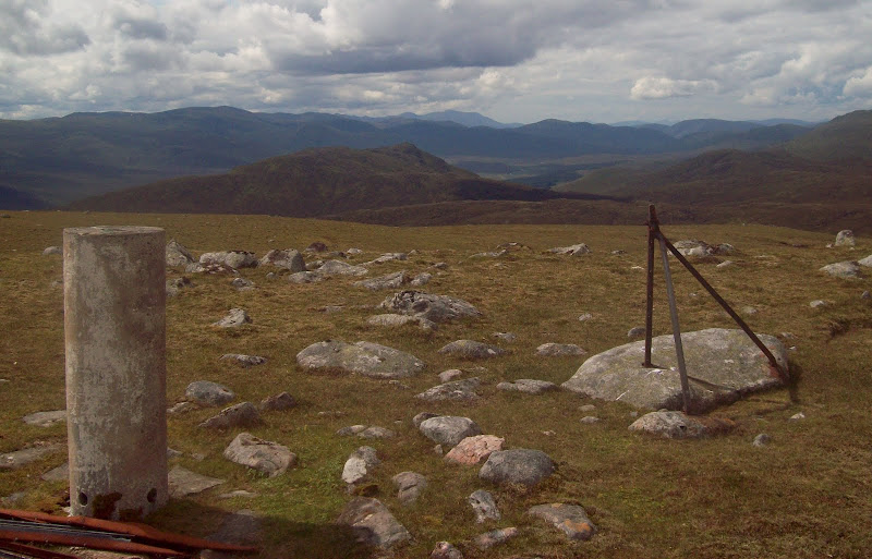
Gairbeinn summit from the NE:
At the summit, the breeze had got up very slightly - just enough to remove the total silence. It was just about possible to see through to Knoydart from here, with Sgurr na Ciche prominent, and Sgurr Dhomhuill of Ardgour was also visible through another gap. Despite the weather not being that bright, the Ben was just about clear. Looking east, the cloud looked to be down on the Cairngorms.
Ben Tee and Knoydart:
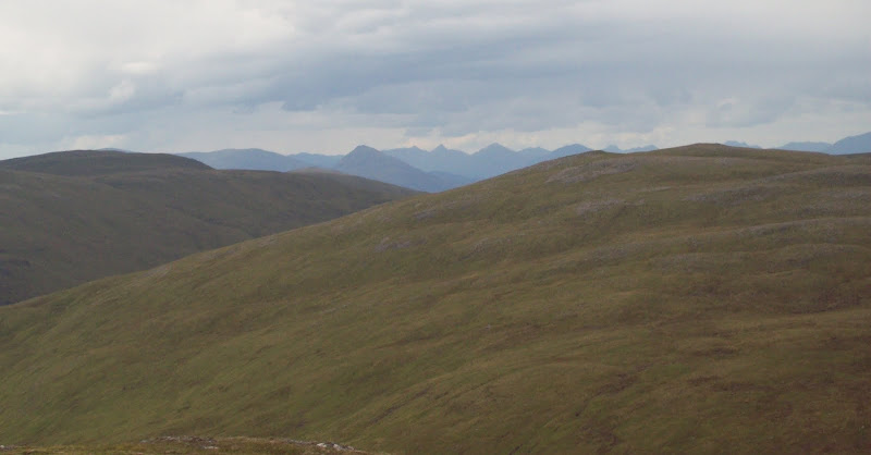
Back of Creag Meagaidh, Grey Corries and the Ben:
SE to upper Strathspey. Meall Cuaich in distance on left:

Close-up of dam and upper reservoir:
I had thought to continue to Corrieyairack Hill, partly because of its former status and partly because I would be able to get good views down Glen Tarff on my return, but it looked a long way, and the weather appeared to be deteriorating. Instead, I took it as an excuse to return along the nice summit ridge of Gairbeinn and head down over more boggy ground to the hydro track. There was an odd and impressive view of Ben Tee backed by Sgurr na Ciche just over the reservoir site from here. I decided to jog the 4 km back to the bike, mindful that I'd pretty much stopped running in the last couple of months (mainly due to laziness). A light shower started as I was running.
Ben Tee (and Sgurr na Ciche, but doesn't really show up in the photo) from the aqueduct track:

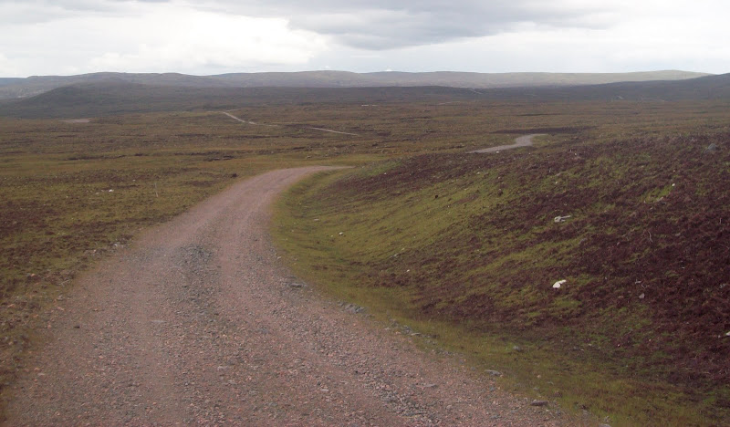
The track goes on and on...
The rain got a little heavier as I got back on the bike, but didn't amount to too much in the end. Most of the cycle back was a lovely speedy descent with the occasional minor bit of uphill, until I got to the steep initial section. Here I discovered my brakes were also a bit knackered, so ended up walking the bike down the steepest section.
Back down the steep zigzags into Glen Killin:

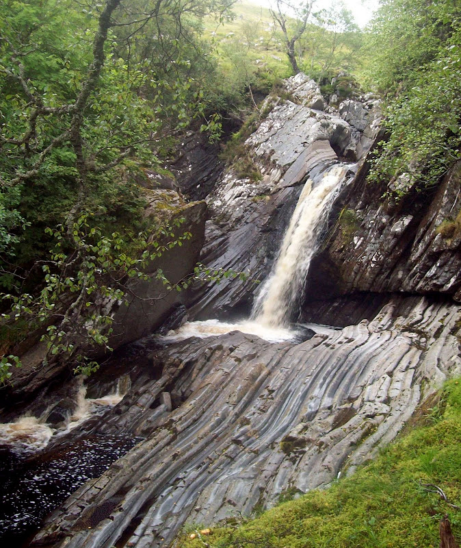
There were some nice waterfalls on the Glenmarkie Burn that I'd missed on the ascent. A nice pedal back to the car, where the midges were suddenly really ferocious.
Waterfall on the Glenmarkie Burn:
Loch Killin again:

A good excuse to visit Loch Killin again, and a nice day out. If not using the bike from this side, I'd be tempted to use RCFC's approach as the stalker's path up Gleann Odhar would make more pleasant and varied walking than the hydro track.
