
Beinn Mheadhonach and two close neighbours from Glen Tilt
Well for once the weather forecast was absolutely correct…….other than being about 6 hours adrift:
- the 4am rain arrived at about 10am
- the wind didn’t get up until the afternoon so the midges were out en masse
- no wind meant the clag stayed down
On the plus side though, it was a lovely drive back to Glasgow in the sun……..until coming to a standstill on the M90 because a section had been closed for roadworks.
Only three other vehicles in the Old Bridge of Tilt car park when I set off early on the bike. Many of the early photos are rather grainy as I was having to use 800 and 1600 ASA settings due to the low light levels.
Cycled up the main track to the bridge at Marble Lodge where I locked the bike to a tree close to the river. This bit always seems to take longer than expected and reduces the time saved versus walking but I think it was worth it.
The plan was to go clockwise first to Beinn Dearg, then Beinn Mheadonach and finally on to Carn a’ Chlamain. I then set off on the track which runs north of the river heading west for the old bridge at NN888712.

I had then intended to go NW via Elrig then over Beinn a’ Chait and on to Beinn Dearg. However, with low cloud and clag I couldn’t see the tops and decided to take the easier but slightly longer option and head for the track up to Beinn Dearg beside the Allt Slanaidh.

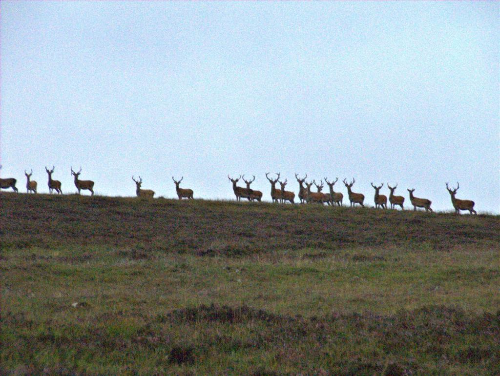
Had to pass through some tall ferns and deep heather – deer on the skyline
but it wasn’t that bad and I was soon on the main track. Picked up one tick but managed to remove it before it got its teeth in me.
Easy walk up the track but then had to stop for waterproofs as the cloud came down and the rain started – this wasn’t in the forecast.

Straightforward walk from here up the main track until it meets the other track beside the Allt Sheicheachan. It then narrows and winds its way up the steeper hillside before levelling off.

Not much to see at all in the clag but followed the track to the summit having to go through some rocky parts on the way.

Couldn’t see anything in the clag at the summit – waited a bit but it wasn’t going to clear.

I was hoping to lose as little height as possible so headed off northwards along Beinn Dearg’s top, dropped down steeply through some rocky sections before turning more abruptly SE. I was aiming for the bealach between Carn a’ Chiaraidh and Beinn Mheadhonach but couldn’t take a straight line due to having to negotiate the many peat hags and bogs on the way.

View from further up the hill side

Walked up the summit of Beinn Mheadhonach and found a wee cairn but could see another one further south. The odd thing was that the more southerly point looked higher so I walked down to it as well.

Took some photos


then headed back up to the summit as per the OS map. Walked over to yet another wee cairn on the way. Headed back north for a short way. The clag was lifting occasionally at this point and the wind had now got up. It meant that I could see Carn a’ Chlamain and my planned route up between Aonach na Cloiche Moire and Braigh nan Creagan Breac. It also meant that I could see the peat hags lower down and could plan a way through them.

Dropped down fairly steeply on grassy slopes and found some stones to help me cross the Allt Mhairc.

Then steeply eastwards up the hillside. Weather improving looking back from where I’d come and further round.


When the ground levelled off at the top I could see Carn a’ Chlamain with not much ascent remaining.

I tried to stay fairly high at this point to avoid the worst of the peat hags and headed round to pick the track to the summit. Starting to get views of the Cairngorms to the north.

Stayed on the track up to the stony summit.

Still hadn’t seen anyone else at all and was a bit surprised at this. Very windy at this point but at least the sun was appearing more frequently.
With the improving weather to views were opening up round to Carn Liath, Beinn a’ Ghlo, Glen Ey and the Cairngorms.


From there I just followed the main track back down to Glen Tilt

Looking back to Carn a’ Chlamain

only coming off it to take the steep narrower track for the last wee bit to Glen Tilt.

Met one walker on this section and some mountain bikers in the Glen itself.


Walked back to the bike and then had a great cycle back to the car park – had to get the tick tweezers out to remove two from my right leg. OK, the weather wasn’t as good as forecast in the morning but it was nice loop round the hills, enjoyable cycle in the Glen which is lovely and I got home in time for dinner (despite the hold up and diversion on the M90).
Note:
Approx distance: Bike 14km, Walk 30km
Approx ascent: 1,750m is an estimate – downloading the gpx to WH/TheHug suggests over 2,000m which doesn’t seem correct
- the 4am rain arrived at about 10am
- the wind didn’t get up until the afternoon so the midges were out en masse
- no wind meant the clag stayed down
On the plus side though, it was a lovely drive back to Glasgow in the sun……..until coming to a standstill on the M90 because a section had been closed for roadworks.
Only three other vehicles in the Old Bridge of Tilt car park when I set off early on the bike. Many of the early photos are rather grainy as I was having to use 800 and 1600 ASA settings due to the low light levels.
Cycled up the main track to the bridge at Marble Lodge where I locked the bike to a tree close to the river. This bit always seems to take longer than expected and reduces the time saved versus walking but I think it was worth it.
The plan was to go clockwise first to Beinn Dearg, then Beinn Mheadonach and finally on to Carn a’ Chlamain. I then set off on the track which runs north of the river heading west for the old bridge at NN888712.
I had then intended to go NW via Elrig then over Beinn a’ Chait and on to Beinn Dearg. However, with low cloud and clag I couldn’t see the tops and decided to take the easier but slightly longer option and head for the track up to Beinn Dearg beside the Allt Slanaidh.
Had to pass through some tall ferns and deep heather – deer on the skyline
but it wasn’t that bad and I was soon on the main track. Picked up one tick but managed to remove it before it got its teeth in me.
Easy walk up the track but then had to stop for waterproofs as the cloud came down and the rain started – this wasn’t in the forecast.
Straightforward walk from here up the main track until it meets the other track beside the Allt Sheicheachan. It then narrows and winds its way up the steeper hillside before levelling off.
Not much to see at all in the clag but followed the track to the summit having to go through some rocky parts on the way.
Couldn’t see anything in the clag at the summit – waited a bit but it wasn’t going to clear.
I was hoping to lose as little height as possible so headed off northwards along Beinn Dearg’s top, dropped down steeply through some rocky sections before turning more abruptly SE. I was aiming for the bealach between Carn a’ Chiaraidh and Beinn Mheadhonach but couldn’t take a straight line due to having to negotiate the many peat hags and bogs on the way.
View from further up the hill side
Walked up the summit of Beinn Mheadhonach and found a wee cairn but could see another one further south. The odd thing was that the more southerly point looked higher so I walked down to it as well.
Took some photos
then headed back up to the summit as per the OS map. Walked over to yet another wee cairn on the way. Headed back north for a short way. The clag was lifting occasionally at this point and the wind had now got up. It meant that I could see Carn a’ Chlamain and my planned route up between Aonach na Cloiche Moire and Braigh nan Creagan Breac. It also meant that I could see the peat hags lower down and could plan a way through them.
Dropped down fairly steeply on grassy slopes and found some stones to help me cross the Allt Mhairc.
Then steeply eastwards up the hillside. Weather improving looking back from where I’d come and further round.
When the ground levelled off at the top I could see Carn a’ Chlamain with not much ascent remaining.
I tried to stay fairly high at this point to avoid the worst of the peat hags and headed round to pick the track to the summit. Starting to get views of the Cairngorms to the north.
Stayed on the track up to the stony summit.
Still hadn’t seen anyone else at all and was a bit surprised at this.
With the improving weather to views were opening up round to Carn Liath, Beinn a’ Ghlo, Glen Ey and the Cairngorms.
From there I just followed the main track back down to Glen Tilt
Looking back to Carn a’ Chlamain
only coming off it to take the steep narrower track for the last wee bit to Glen Tilt.
Met one walker on this section and some mountain bikers in the Glen itself.
Walked back to the bike and then had a great cycle back to the car park – had to get the tick tweezers out to remove two from my right leg. OK, the weather wasn’t as good as forecast in the morning but it was nice loop round the hills, enjoyable cycle in the Glen which is lovely and I got home in time for dinner (despite the hold up and diversion on the M90).
Note:
Approx distance: Bike 14km, Walk 30km
Approx ascent: 1,750m is an estimate – downloading the gpx to WH/TheHug suggests over 2,000m which doesn’t seem correct