free to be able to rate and comment on reports (as well as access 1:25000 mapping).
Personal Note
In 1992 and 1993 I walked in England and Wales. I visited Scotland two times already. In 1994 I went for my first long walk in the Highlands. June 1, the first mountain, Garbh Bheinn in Ardgour, proved too much. I got lost trying to find the way off northward, and got so wet and tired that later a police car picked me up from the roadside and brought me to a doctor, slurred speech, mega-shiverings. I slept for a day and continued my walk in Glenfinnan. My first munro was Sgurr nan Coireachan. I skipped the tangle of hills in the heart of Ardgour. This is why Carn na Nathrach is high on my list, and why I'm proud to have climbed it 18 years later.
Walk in
I discovered this hill doesn't have a route description or map on WH. Apparently it is not often visited. It seems and feels remote, but what are the facts?
From Callop is it too far away, hidden behind Druim Tarsuinn and its neighbours.
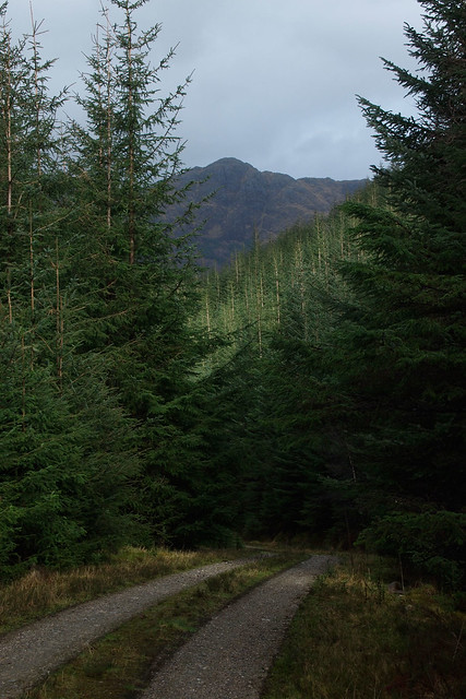
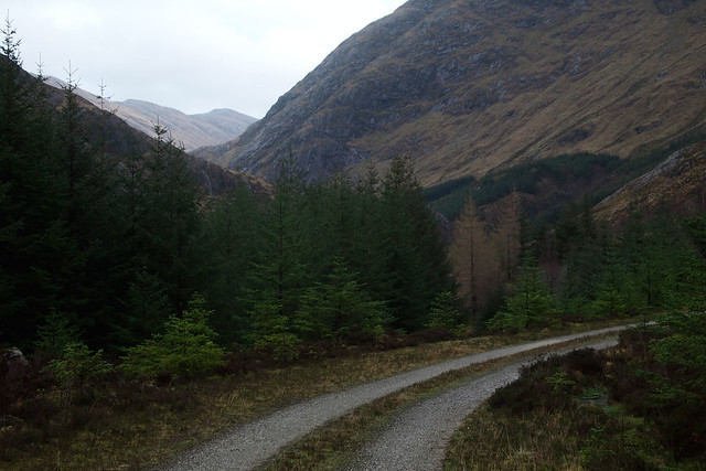
From the A861 of from Corran Ferry it is a 12 to 16km walk in to its eastern foot.
From Strontian it is a 4-5 hr walk in (18km), but those in posession of a mountain bike can ride all the way to its foot at the south side of Glen Hurich. You could hitchhike to Loch Doilet I suppose.
Options for ascent
A look at the map shows enought possibilities for ascent. Of course, the east-west ridge is easy, the western end hemmed in by forest.
An approach from the south looks improbable. From Sgurr Dhomhnuill for instance, one would have to cross Druim Garbh and climb Nathrach's steep south face.
Since I walked in from Strontian, I opted for the north side of the hill. I camped next to the river at the Mam Beathaig, not far from the track's end. A track from Resourie, signposted by the Scottish Rights of Way Society, follows the north bank of the river.
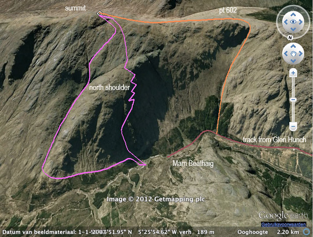
Carn na Nathrach routes on north side (looking south!)
Pink = my route; orange = easier route
FirebreaksThe track along the south side of Glen Hurich corners into the Mam Beathaig at 876706. Immediately above, there's a wide fire break, and a logical ascent to point 602, from where the summit is easily gained.
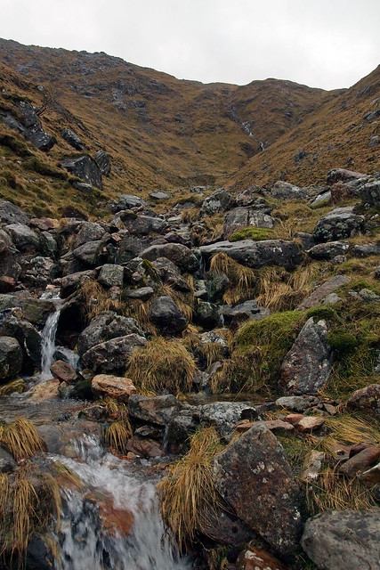
Further on, at 881710 is another firebreak. It gives access to a stream filled cleft. A very steep climb out to the right (west) gives you green gullies and grassy ledges to pick. I saw no big difficulties, there are many possibilities for reaching the top of the north shoulder, Creag an Fhireoin (bird-man?) at 884704. Of course, this is 'making things more difficult as they need be' and I'd say the whole flank between mentioned firebreaks provides a good way up the hill.
The steepest ascents are not fit for descending, the flank between pt 602 and Creag Fhireoin looks safe.
Way down off the summit
I came down in mist and rain. If you do not want to go out east, or out west to pt 602, the fool proof way of going down from the summit is to go west for some 200 m and then let the cuttings of two streams (Y-shaped on the map) funnel you into Coire a'Bhalbain. Where the first two streams meet, it is extremely steep grass, barely doable. In dry weather, this would be no problem, in summer on could follow the stream bed itself. It is almost a gorge. Where the second stream comes in from the left (west), cross the streams at their confluence. Follow the stream on its east bank along a pleasant flat shelf. Nice walking! Follow the deer fence at the forest edge to a fire break and find your way back to the starting point.
Meall Mhor from Glen Hurich
Summit of Mam Beathaig looking at Craig Fhireoin of Carn na Nathrach

Pair of golden eagles over Carn na Nathrach

Carn na Nathrach north side, point 602 top right out of frame

Carn na Nathrach north shoulder (Creag an Fhireoin)

Tent at forest edge from face of Carn na Nathrach

Carn na Nathrach, cleft below and NNE of summit with waterfalls
Looking back up my descent route from 888709, previous photo taken top right

Ardgour Tangle: Sgurr Dhomnuill and Carn na Nathrach (darkest) from Sgurr Craob a'Chaorain
Map of day 7 of my recent 9-day walk
