free to be able to rate and comment on reports (as well as access 1:25000 mapping).
(
Link to previous day's report.)
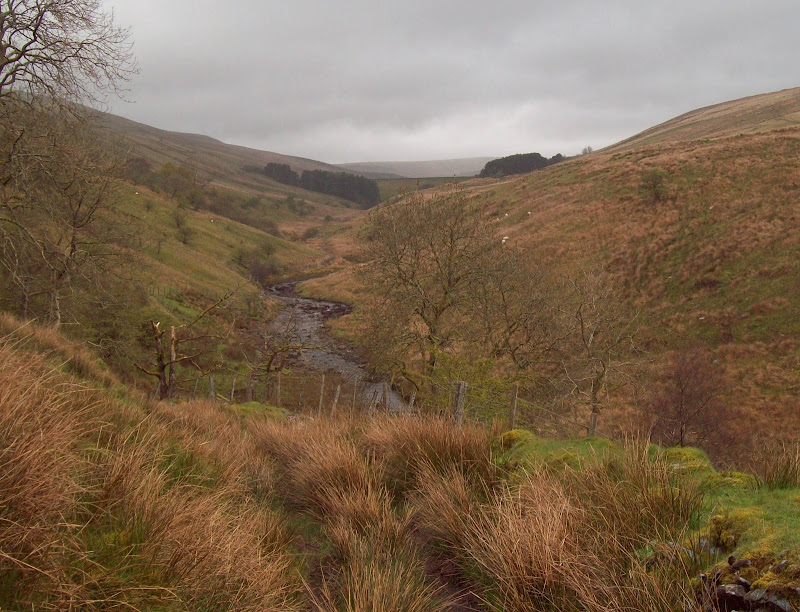
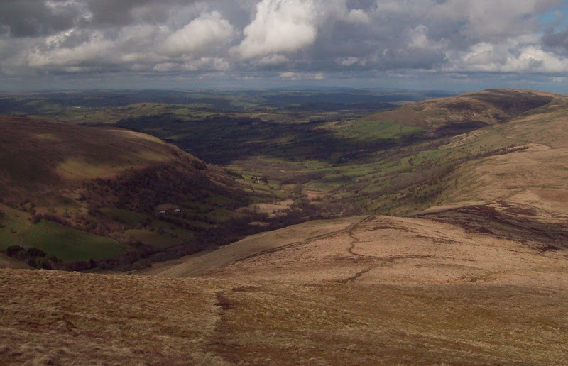
I had a reasonable night’s sleep in the tent, and got up at 6:30 am to thick mist. There was the odd bit of blue floating past above, but no views. My stove had run out of gas, so I ate some pancakes and cereal bars before packing up, striking camp and carting everything back to the car. I then dropped out of the mist and drove down through Brynamman, cutting across the heads of some of the valleys. The South Wales Valleys are an interesting area – a mixture of urbanisation, industrialisation, deprivation, and hilly landscape. There are few places like it in the UK – maybe parts of Yorkshire could be considered similar. My main aim of the day was to do a long circuit of all of the major Fforest Fawr summits, but first I wanted to visit the Marilyn of Craig y Llyn. This could be considered a sort of microcosm of the Valleys area – equal parts impressive and devastated.
~~~~~~~~~~~~~~~~~~~~~~~~~~~~~~~~~~~~~~~~~~~~~~~~~~~~~~~~
Sub 2000 Marilyns: Craig y Llyn
Date walked: 22/04/2012
Time taken: 45 minutes
Distance: 4km
Ascent: 130m
Weather: Misty and calm
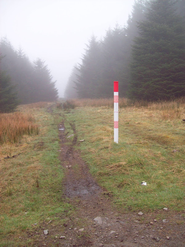
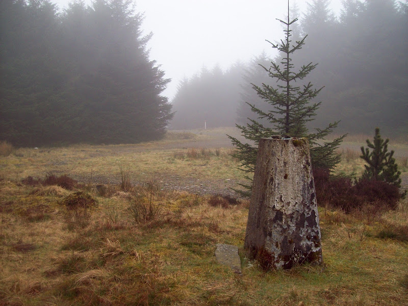
A couple of wrong turnings later and I was passing Tower Colliery on the Treherbert road. I remember this road from passing over in my youth – there aren’t many like it in the UK. It snakes up through crags next to Llyn Fawr before dropping into the impressively steep-sided Rhondda Valley. Further continuation to Afan Argoed takes you over another high, winding pass – like going over the Bealach na Ba, but with terraces of houses stretching halfway up. I wasn’t going that far today, so stopped above Llyn Fawr on a forestry track junction. At almost 500m, I was just about back in the cloud, and the area had an uninspiring look about it. It was a short and uninspiring walk up the edge of the forest, then on a track through large felled areas, to the trig point. There were conifers all around, so no prospect of a view even if it wasn’t claggy. There’s even a gas main running over the summit (which could be the highest gas main in the UK for all I know). Not a spot for a picnic!
That gas main in detail:
Summit trig:
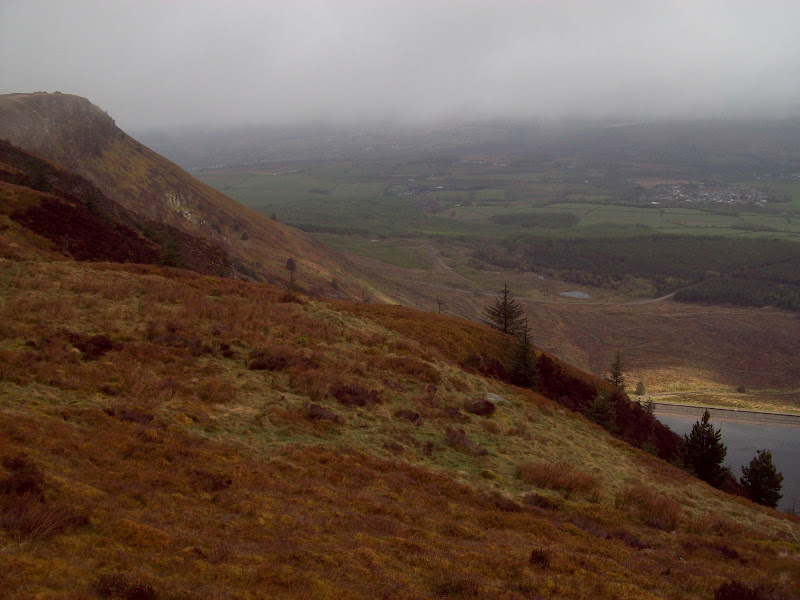
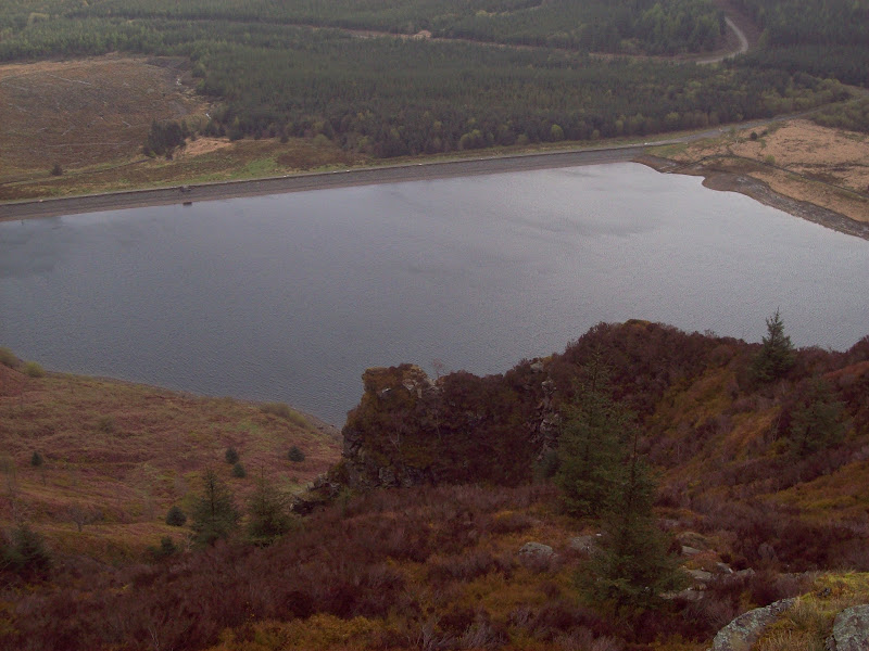
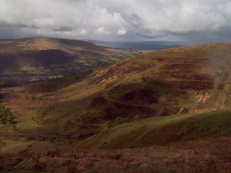
On the way back however, I strayed from the forestry track after a short while, and picked up the edge of the crags overlooking Llyn Fawr. This made the visit completely worth it, as these crags are reasonably steep and impressive. The clag was lifting too. I can only imagine that the overlook of the nearby Llyn Bach is just as impressive. So there is quite clearly a worthwhile hill under all of that stuff. Still while not exactly geared up for walking, there were many mountain biking trails around the area. Probably the best way to enjoy it. On the other hand, I got equally good views of the crags and lake from a layby on the road, so maybe you don’t even need to get out of the car to see the best of this hill.
The crags, the main road and Llyn Fawr:
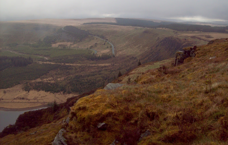
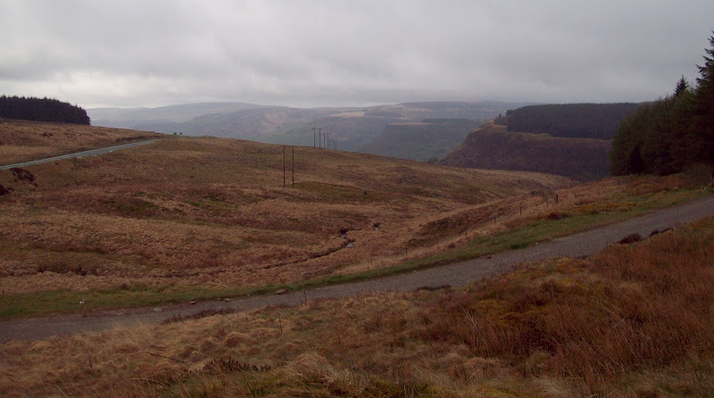
The top end of the Rhondda Valley:
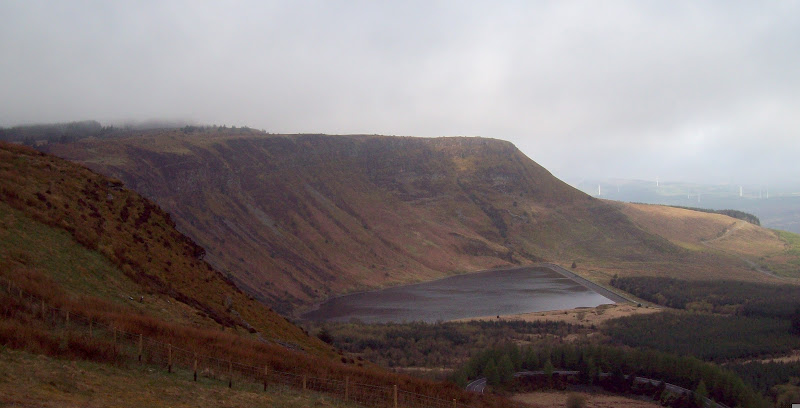
Craig y Llyn from the A4061 viewpoint:
~~~~~~~~~~~~~~~~~~~~~~~~~~~~~~~~~~~~~~~~~~~~~~~~~~~~~~~~
Hewitts: Fan Fawr, Craig Cerrig-gleisiad, Fan Frynych, Fan Llia, Fan Nedd, Fan Gyhirych
Date walked: 22/04/2012
Time taken: 9 hours
Distance: 34km
Ascent: 1440m
Weather: Heavy hail showers, with a windy sunny spell in the middle.
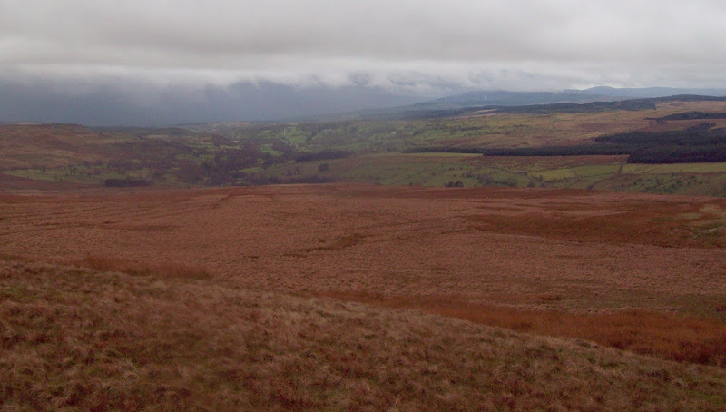
Another wrong turning in Hirwaun, and I was approaching Ystradfellte, from where I planned to start my circuit if Fforest Fawr. Any hopes of parking at the start of the Ystradfellte reservoir access road were dashed, as there was nowhere that wouldn’t be getting in the way, so I carried on into the village.
There was a large carpark here which was free, and I was walking again by 9:40 am. I re-crossed the river and followed a footpath back to the reservoir access road. The weather took a turn for the worse, going from overcast to showery. After a mile or so, I passed a farmer on a quad bike, who told me that there was no public access to the reservoir this way, and I would need to use the other side of the valley. True enough there were signs advising that it was a private road, but surely that shouldn’t prevent walkers using it? “The sign means what it says” was his response, which didn’t really invite further argument. He pointed out the rights of way on this side of the valley, and told me that there was no public access to the surrounding land.
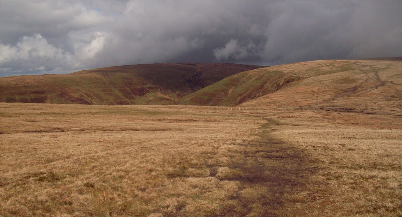
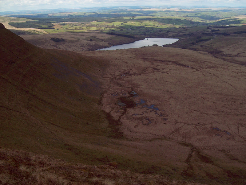
Fan Nedd from the reservoir access road:
This put a bit of a damper on the day. I reversed my route to the public road, then picked up the bridleway on the west side of the valley. This was muddy, and climbed up the hillside before dropping back down to the river. There was a gated bridge here, and I half expected it to be plastered with more ‘gerrofmyland’ notices, but it wasn’t. A short climb up the bank brought me back onto the reservoir road, which was evidently OK to walk on at this point. Quite why the landowner wanted to stop walkers using a mile or two of tarmac road was beyond me, and seemed rather petty. I can only imagine there must have been some massive historical dispute between the owner and the water board.
Afon Dringarth just below the Ystradfellte reservoir:
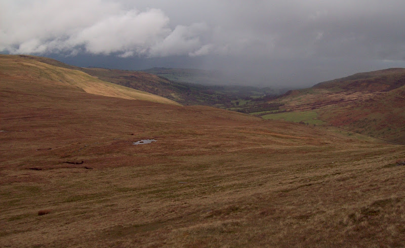
I crossed the road and started ascending the grassy hillside, mainly following sheep tracks. This wasn’t steep or difficult, but it went on for ages. There was still no great promise of sunshine between the showers, and I eventually reached the summit of Fan Fawr in a slightly gloomy mood. At least it was clear of the cloud.
Looking back to Ystradfellte from the long ascent of Fan Fawr:
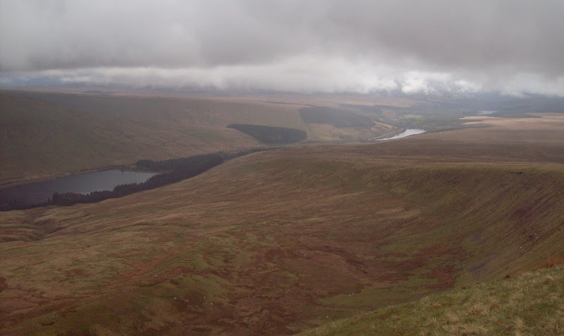
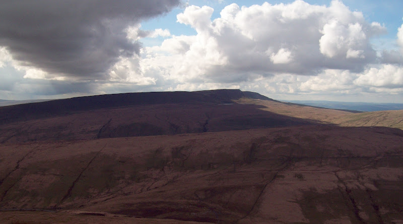
Beacons, Cantref and Llwyn-On Reservoirs from Fan Fawr:
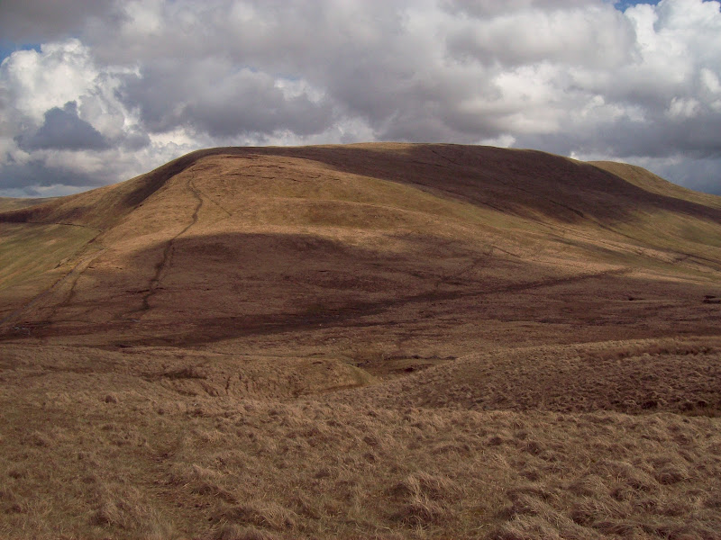
The descent northward was much steeper, and I passed a large DofE expedition, with their distinctive massive packs with bright orange rain covers. They were making quite a meal of the ascent. The traverse over to Craig Cerrig-gleisiad was uneventful, but by the time I arrived at the summit, there was a heavy hail shower on.
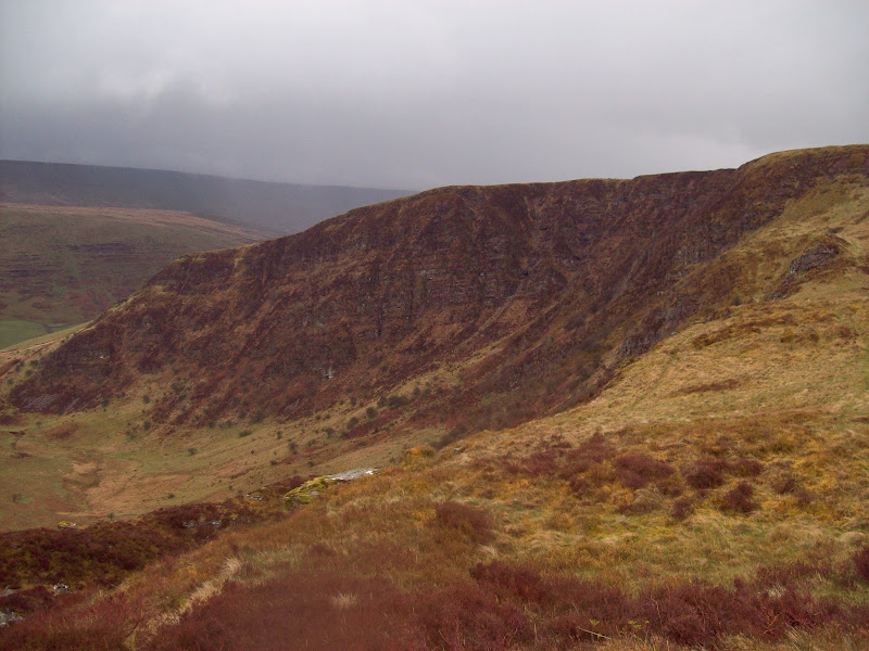
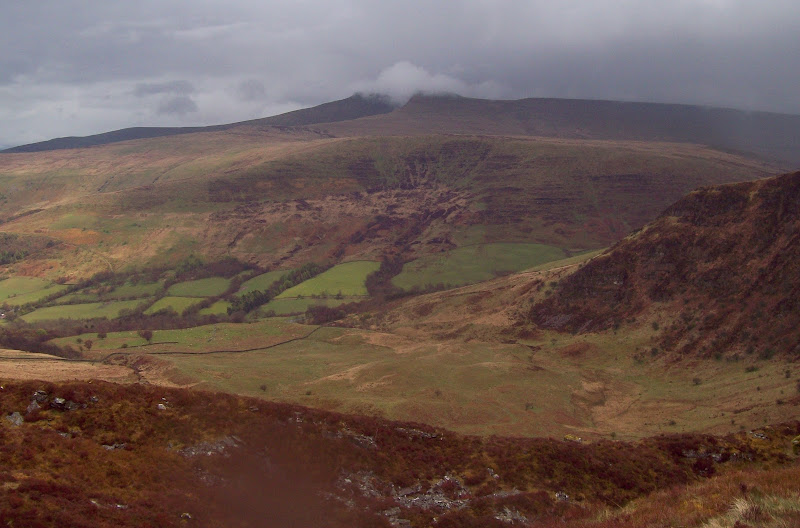
I pretty much hit my nadir on the next stretch to Fan Frynych. The false start, showers and long plod up to Fan Fawr had already put me in a poor frame of mind. Now I was starving (but unwilling to stop in the hail) and my hands were numb. I decided to put my gloves on and grab a pork pie to eat while moving, but I struggled to get my numb fingers into my rather tight-fitting gloves. To compound things, I managed to hook my rucksack onto a strand of barbed wire! The rain and hail barely let up, and I started to wonder what I was doing. I had been looking forward to Fforest Fawr as it appeared to have lots of interesting corners, even if it didn’t have the most exciting summits. So far I had been mildly unimpressed. To be fair, the vegetated crag of Craig Cerrig-gleisiad was one of the highlights I had expected, and it did look impressive. It is a wonder that I actually took a photo of it in my foul mood though!
Craig Cerrig-gleisiad:
Finally there were some gaps in the showers, and a little sunshine. Glyn Tarell looked briefly enchanting, and Pen y Fan and Corn Du even made a brief appearance. I retraced my steps towards Craig Cerrig-gleisiad, before contouring across a boggy col and heading towards Cefn Perfedd. Here I discovered a highlight I hadn’t been expecting – Cwm Du. The sun popped out for an extended visit here, and the air between the showers was crystal clear. I hadn’t paid much attention to this valley on the map, but with its steep crags and winding river, it was one of the prettiest parts of the Beacons I have seen.
Glyn Tarell:
Pen y Fan and Corn Du (almost) from above Craig Cerrig-gleision:
Fan Gyhirych, Fan Bwlch Chwyth and the Senni valley:
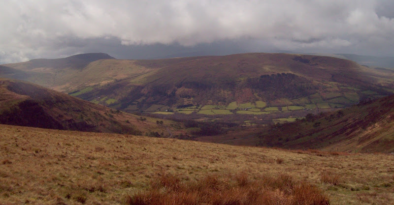
Cwm Du:
Back to the shoulder of Fan Frynych:
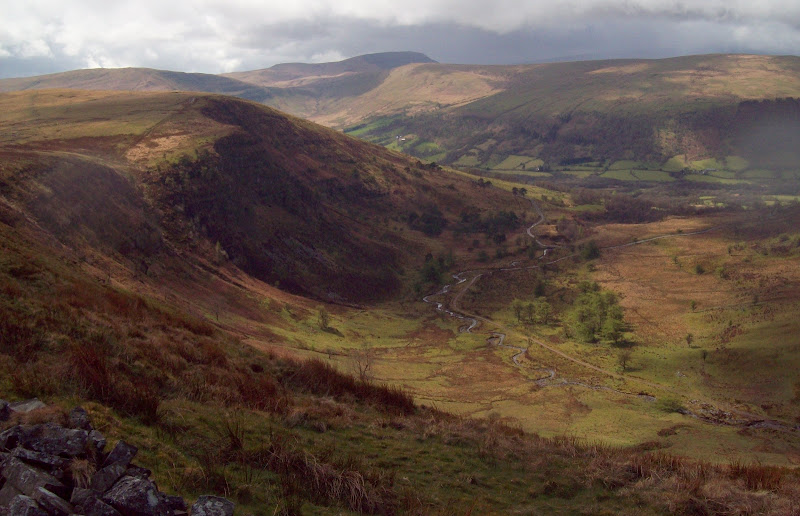
My mood now lightened, and the longish but flat walk over to Fan Llia breezed by. There now seemed to be a prolonged sunny period, although like yesterday it was quite breezy. Looking back over to Fan Fawr, I could see the DofE group descending towards Ystradfellte reservoir, no doubt well on their way to upsetting the local farmer for a second time that day (unless they already knew to cross the valley and avoid the road).
The slopes off Fan Llia were surprisingly dry and easy, and although there was a bit of bog on the valley floor, I was on the road soon enough. I had my first proper break of the day, as the wind was a bit less harsh down here. On my way down, Fan Gyhirych finally began to look close enough to walk to.
Fan Frynych from the ascent of Fan Llia:
Fan Gyhirych with Black Mountain behind:
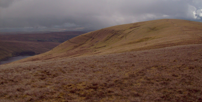
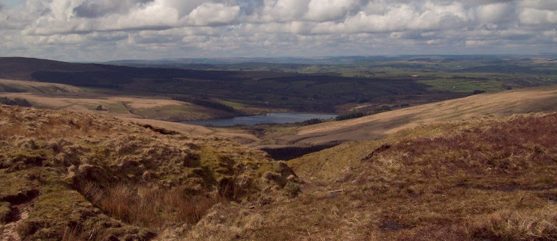
Fan Llia summit ridge and the Ystradfellte reservoir:
I missed the lower part of the path up Fan Nedd, and stumbled briefly through wet tussocky grass. Before long I was on the summit. This was the first steep ascent of the day. I could see a couple of folk some way behind me, but the theme for the day seemed to be as for yesterday – always seeing people on adjacent summits, but rarely passing them. I didn’t pass anyone else after the DofE group on Fan Fawr. Solitude can definitely be had in the Brecon Beacons if you want it.
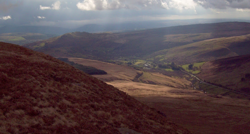
The Senni Valley from the ascent of Fan Nedd:
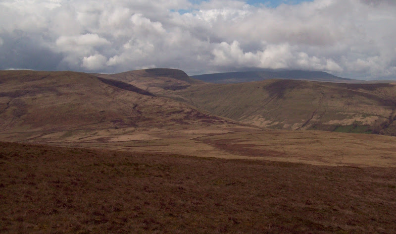
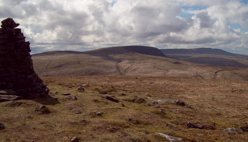
Fan Gyhirych and Fan Brycheiniog from Fan Nedd:
A contouring descent on an old, rarely used path took me to a boggy col. On the way down I enjoyed views of the distinctive northern corrie of Fan Gyhirych, before slopping across some bottomless looking cesspits of mud. The other side of the col was drier, and before long I wss on the east ridge. There is a new, well constructed vehicle track just behind this ridge, but I stuck to the crest as it had better views. The summit was flat and featureless, not to mention particularly boggy round the trig point, but the views were fantastic to the south and west. Looking down the Swansea Valley was impressive, and also across the valleys to the south.
Back to Fan Nedd:
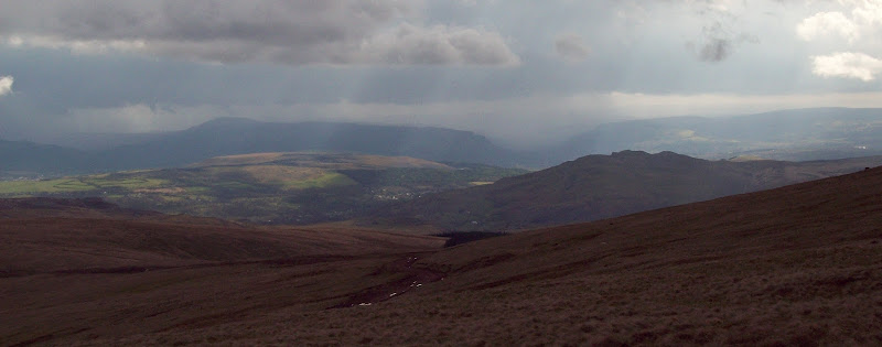
Cray Reservoir and Mid Wales:
Corrie on Fan Gyhirych:
Black Mountain: Fan Hir and Fan Brycheiniog:
Down the Swansea Valley to Craig-y-nos:
Carreg Lwyd and Hirfynydd:
I was enjoying the day now, and decided to throw in the summit of Fan Fraith. When I started working towards doing all of the Welsh 2000ers, I picked the Hewitt list as a guide. I was vaguely aware of the Nuttalls too, but hadn’t realised that the criteria for a Nuttall is different (only 15m of ascent required rather than 30m). This means that when I’m done with the Welsh Hewitts, I will still have 11 or so unclimbed Welsh Nuttalls. Some of these are impressive (Corn Du on Pen y Fan for example – hard to believe that it has less than 30m of re-ascent). Most of the ones I missed are fairly unexciting however, and I think Fan Fraith falls into that category. I don’t think I’ll be too bothered that I failed to complete all of the Welsh Nuttalls.
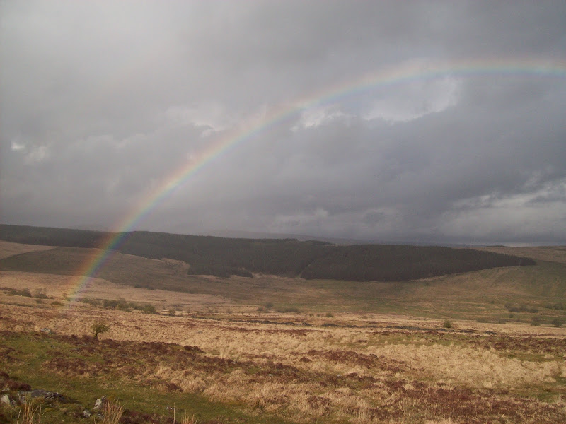
The terrain coming off Fan Fraith was some of the hardest of the day – the sort of ankle trapping tussocky grass with the occasional rock that the Galloway hills specialise in. At the forest edge, I had to climb a fence into an area (far too rough to call a field) of cows before being able to join the forestry track. An armchair plan had been to bushwhack my way a little further south and join the Beacons Way, but the forestry track offered the shortest, easiest route back so I took it. The views were limited this way, but a few more showers came on, so I wasn’t too fussed.
Rainbow over the Nedd Valley:
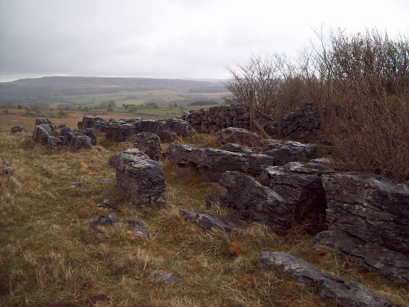
At Blaen-nedd Isaf, I briefly joined the road before picking up a bridleway up the final ascent – crossing the low ridge between the Nedd and the Llia. There were a couple of wet bits, but this was mainly easy walking, and there were some interesting limestone outcrops on the way. No full-on limestone pavements like Malham Cove, but there were a couple of places that looked like they had been at one time. Then it was a quick descent through throngs of sheep and newish lambs into Ystradfellte.
Limestone pavement remains:
I actually felt more sore and knackered than my longer Fisherfield walk of a week earlier. I decided it was down to the boots – I can’t be bothered carting walking boots up and down between Scotland and the Midlands, so I use an old pair of my dad’s Scarpas down here. They are fine normally, but a bit thin and flexible for long walks.
Fforest Fawr was good in the end, even if it took me a few hours to begin appreciating it. Black Mountain was definitely the highlight of South Wales though. Things finally seem to be coming to a head now – this marked the end of the Brecon Beacons for me, and I now only have 14 Welsh Hewitts left unclimbed. While I subscribe to Kinley’s ‘last first ascent’ theory normally, after completing this list, it could be the last I see of many of the more southern hills.
