free to be able to rate and comment on reports (as well as access 1:25000 mapping).
Sub 2000 Marilyns: Meallan Odhar Doire nan Gillean, Beinn Dubh an Iaruinn, Meall Inis an Loichel.
Date: 14/10/2012
Distance: 10 km
Ascent: 800m
Time taken: 3 hours
Weather: Mainly overcast, occasional shower.
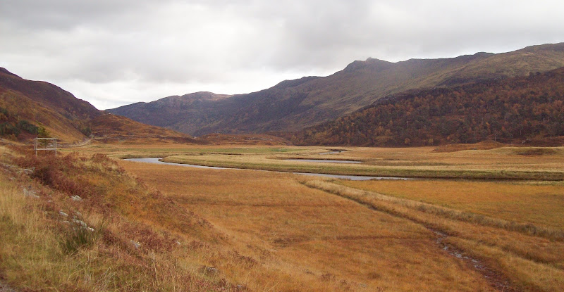
Looking for another short outing this Sunday, I finally turned my attention to Glen Strathfarrar again. These hills had caught my eye when I was on An Sidhean, and I thought they must give a decent short day out with great views into the Mullardoch/Monar wilderness. The original plan was to get up early and park at Struy, cycling up Glen Strathfarrar. This was both to save petrol and get a fuller appreciation of the woodlands in autumn, but laziness kicked in and I drove all the way. With the gate not opening until 9am, there was no need to get up at the crack of dawn. Indeed it was 10:30 by the time I started walking.
Like it or hate it, the need to knock on the door and get permission to drive up the glen always makes routes in this area feel quite adventurous, despite it only being 25 miles from home. There has been the odd comment alluding to the unfriendliness of the couple who man the gate in the past, but they were on good form today, and I can never remember them being rude to me.
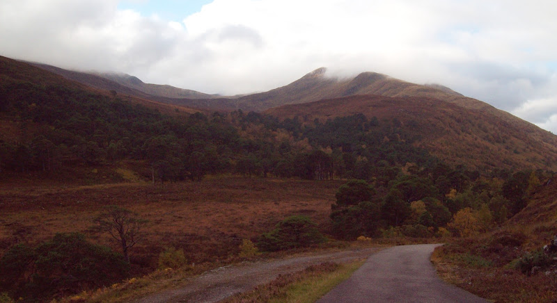
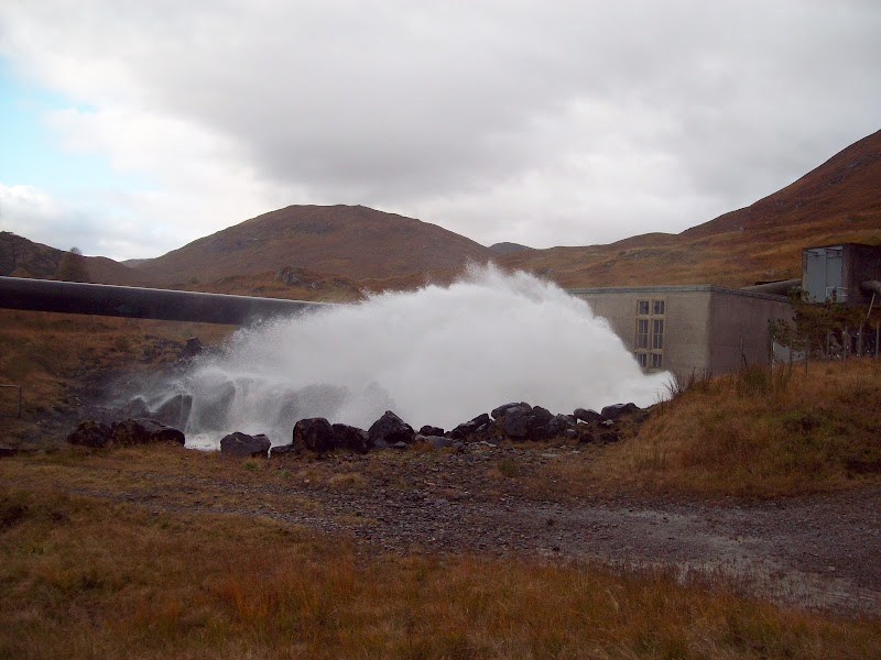
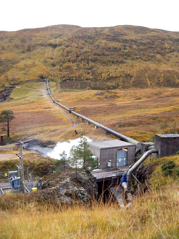
It was a lovely drive on the far side of the gate, and I stopped for a photo of the spectacular Meall Innis an Loichel before the sun went away. There is plenty of parking next to the power station in Gleann Innis an Loichel, and for a moment I was tempted to whizz up Sgurr na Lapaich instead. However it never removed itself from the cloud, so I stuck to the plan, knowing I’d be much more likely to avoid the clag that way.
Meall Innis an Loichel from the road to Monar Dam:
Sgurr na Lapaich from Glean Innis an Loichel:
Power station in Gleann Innis an Loichel:
The track up the glen was good but I soon left it for a less obvious stalkers path which climbed the nose of Meallan Odhar Doire nan Gillean. It was almost untraceable in parts, but once out of the valley the more obvious bits made for easy going. In 45 minutes, I was at the small boulder marking the summit of Meallan Odhar Doire nan Gillean, with sudden great views out west. An Cruachan and its NE summit were very prominent, and to the right of it were some unexpected views of Skye – from the Black Cuillin to the eastern red hills. While it isn’t that much of a surprise to see the coast and islands from this area, at this height (just below 2000ft), you never know where a gap through is going to pop up. True to the weather forecast, it looked better over there.
An Cruachan and NE top:
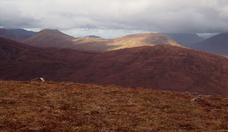
An Riabachain, An Soacach and Aonach Buidhe:

Cloud sitting defiantly on An Riabachain:

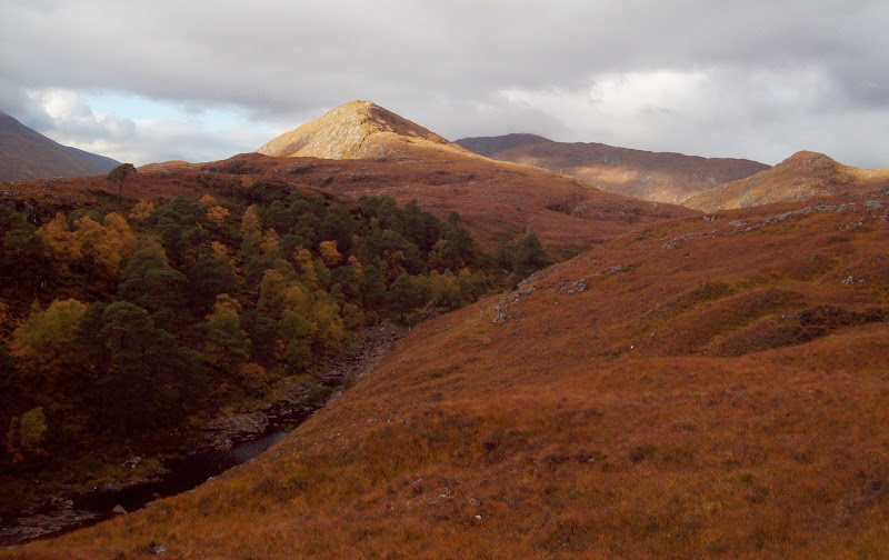
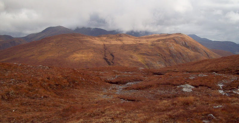
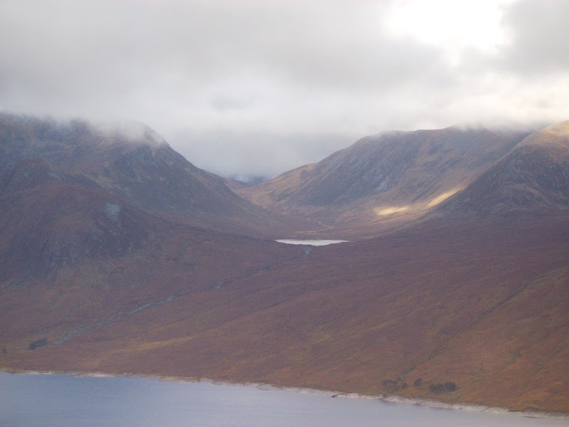
The Strathfarrar Munros and those circling the head of Loch Monar looked steep and impressive, but the cloud never lifted of them save for Sgurr Choinnich. I threw in the northern top of Meallan Odhar to increase the views over Loch Monar. The ground was saturated and pretty slippy, but other than that the going was easy.
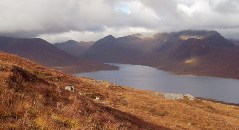
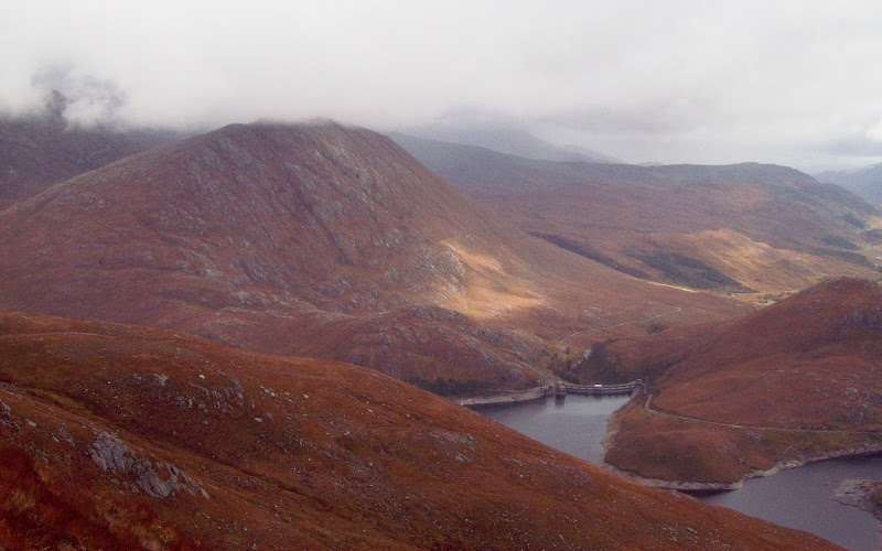
Beinn Dubh an Iaruinn with thewestern Strathfarrar Munros behind:
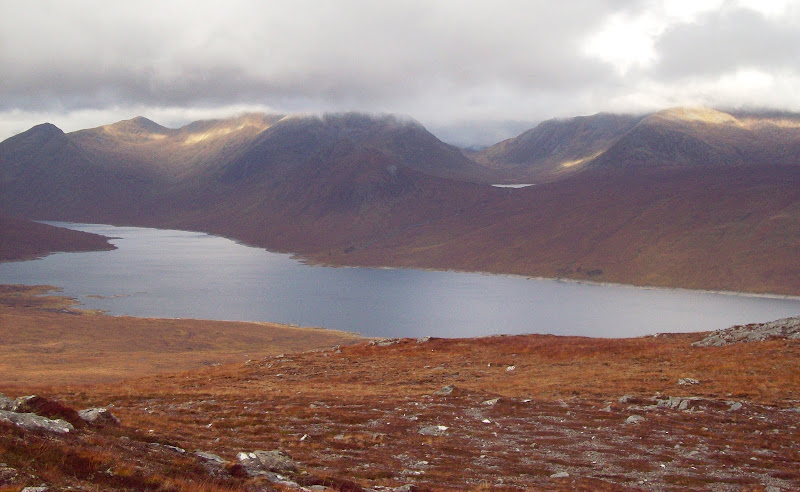
Loch Monar and Sgurr Choinnich:
Across to Loch Mhuilich:
Beinn Tharsuinn, Sgurr Choinnich and Sgurr na Caorachainn:
Beinn Dronaig (right), with the Black Cuillin behind:
It was a reasonable drop down to the col, followed by an easy-angled ascent of Beinn Dubh on the other side. From here, I couldn’t help thinking that Lurg Mhor was only a short squelch away above Pait Lodge. Approaching from my start point would be a relatively quick way to get to it. Before long, I had a plan in my head for a future round of the loch, taking in all of the Munros around its western end. The more I thought about it, the more I realised that this is what my mate Dave R had done 5 or 6 years back – I hadn’t appreciated the quality of the circuit at the time, but it suddenly clicked with me. One for the tent and bike up from Struy I think, as you would have to be moving at a fair rate to beat the gate times, even in the height of summer (being a bit of a fell runner, this didn’t present any issues to Dave).
Rainbow over Loch Monar:
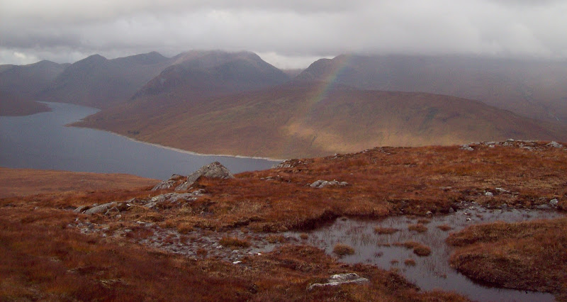
My map was lacking in some of the spot heights that are on the most recent edition, but I quickly concluded that the west-most summit of this hill was the highest. A fortunate situation, as it has great views of Beinn na Muice and down onto the dams. Firstly I had a break facing west over the loch, as a shower appeared to be moving in from the east. Then I made a beeline for the high point, missing out the middle (588m) summit.
Carn Eiteige, Sgurr Fhuar-thuill, Sgurr na Muice and Beinn na Muice from Beinn Dubh an Iaruinn:

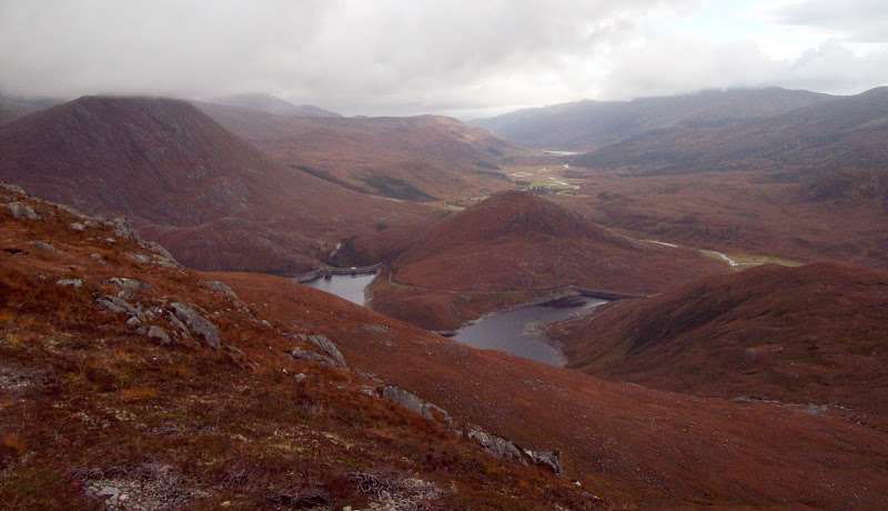
The dams, Beinn na Muice, Meall Innis an Loichel and Glen Strathfarrar:
I was going to drop straight down the south face from the summit, but it was steep and craggy so I worked my way westwards a little first. Then it was a quick descent to the car, just as the first significant shower of the day hit. Good timing!
An Riabachainn:

Before heading home, I made a quick ascent of Meall Innis an Loichel. I wasn’t sure of the parking situation so I stopped at the NE end of the Loichel Dam and weaved around rocky outcrops to the summit. The final section was quite steep. If I’d been paying more attention on the way in, I would have spotted a small parking area at the high point of the road, which would have made things slightly easier. As it was, the ascent and descent still only took 25 minutes. The views weren’t very far ranging, but it was a great little spot for such a small effort. I reckon most Sunday drivers could manage this one. Of course the alternative would be the epic Norman Grieve approach by bus and bike from Aberdeen, which would make it a little more challenging

.
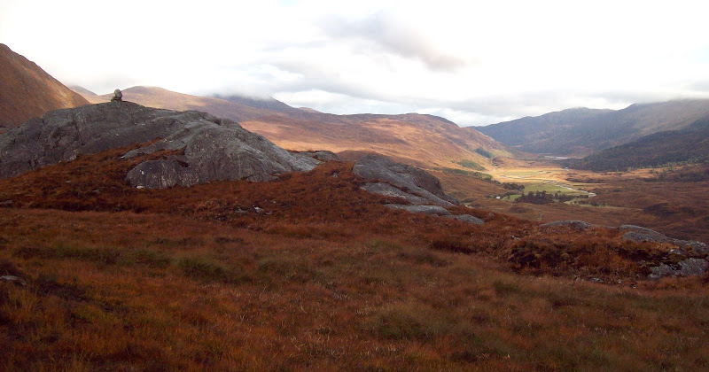
Glen Strathfarrar from Meall Innis an Loichel:
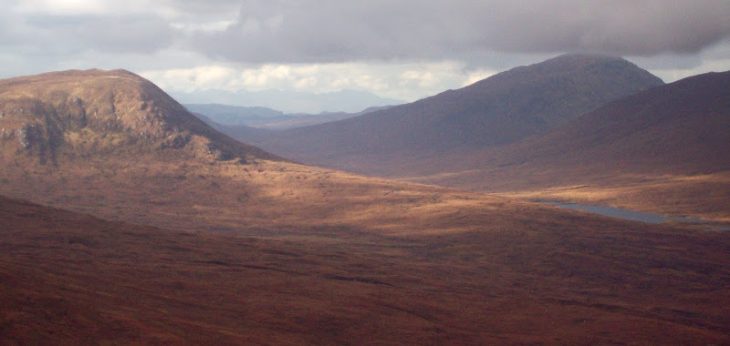
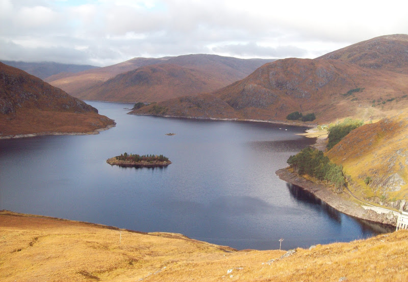
Maoile Lunndaidh, Carn Eiteige and Loch Monar:

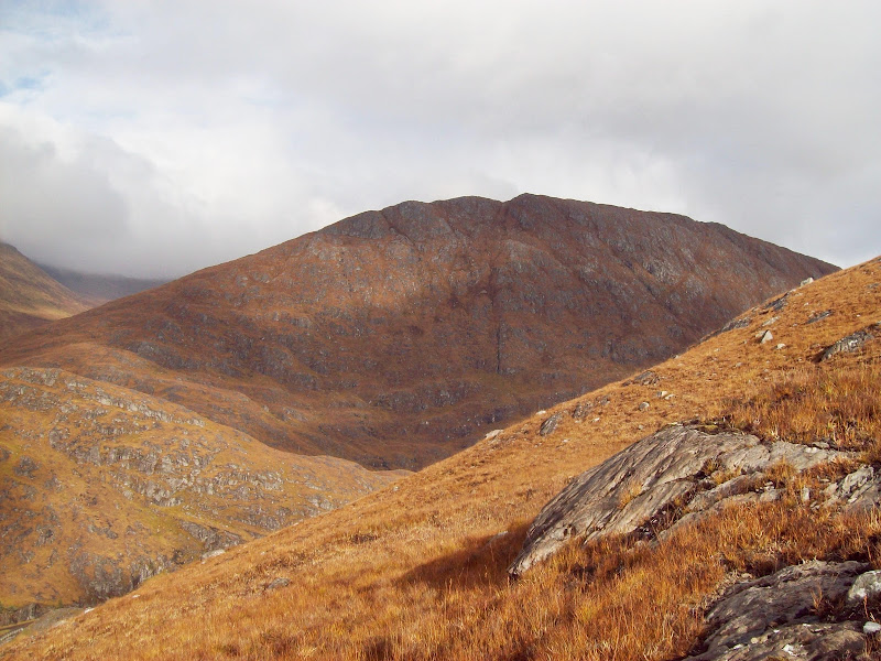
Beinn na Muice:
Loch Monar:
All that remained was a saunter down the glen in the car and a late lunch at home. Another great visit to Strathfarrar, some great little hills and a plan for a more epic walk hatched at the same time.
Sgurr na Diollad from Glen Strathfarrar: