
Glennachulish to Duror via Beinn a'Bheithir
After a successful outing to Torridon I was itching to climb some more hills before the days got any shorter. Jumped on a ciylink bus to Fort William and got off at the Ballachulish bridge to be faced with that afternoon's goal(s): Sgorr Dhearg and Sgorr Dhonuill.

Was able to set off from the Glennachulish forestry car park by the back of 1pm on only my second solo hike. The day was glorious with clear skies and heat in the sun. I made good progress on the ascent through the Glennachulish forest meeting a couple coming the other way. Turned out these were the only people I would meet all afternoon.
Leaving the forest line the ground was quite boggy but made the col (757m) following an old fence 90 minutes in.

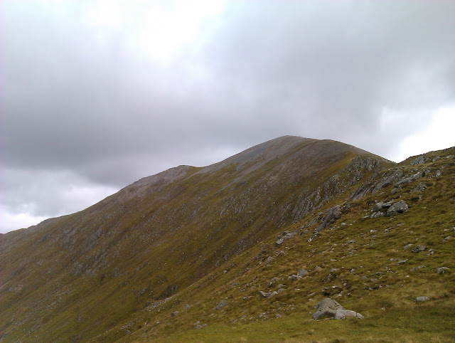
A view of Sgorr Dhonuill from the col (and looking quite benign!)

But first: Sgorr Dhearg
A good path on granite saw me make the top of Sgorr Dhearg 2hrs after leaving the car park. The views were amazing and reminded me for the upteenth time why I really need to invest in a decent camera!
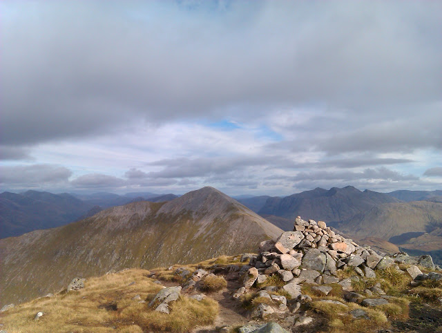
Sgorr Dhonuill from Sgorr Dhearg:
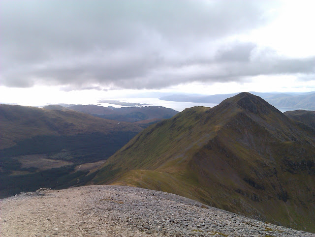
You can see Sgorr Dhonuill's narrow crest quite clearly showing the sharp drops north into the coire.
The camera was put away as I headed west to tackle the steep climb up Sgorr Dhonuill. Some easy scrambling was required at the top but it was quite clear where you had to head.
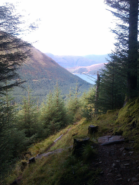
Arriving at the top I was aware that my shadow was getting longer so did not hang around and soon headed west making my way towards Duror forest. Headed for the lochan that can be seen here in the middle distance (NN026554).

The descent was simple enough and provided fantastic views down Loch Linnhe as the sun was beginning to set in the west. The only real danger was from the numerous hidden burns that dotted the hill side.

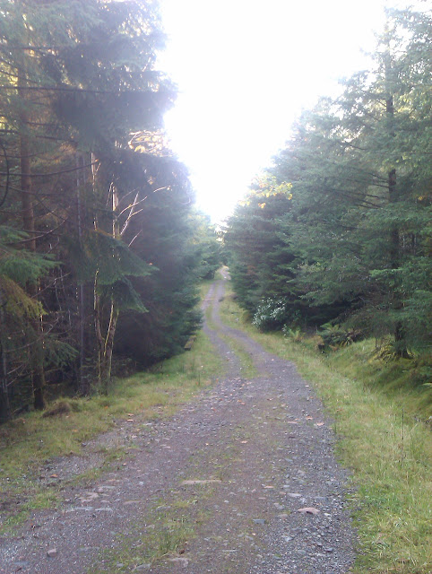
The clearing in the forest shown on the map (NN015552) that I was making for had trees growing in it. However, it was possible to cross the burn 100m left of the clearing and make my way through the trees - where a clearing had recently been made and is not marked on the map - to a forestry track. From there it was a pleasant walk through the forest to the car park.
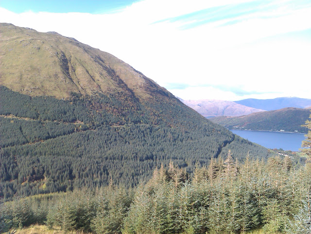
Duror forest:
Was able to set off from the Glennachulish forestry car park by the back of 1pm on only my second solo hike. The day was glorious with clear skies and heat in the sun. I made good progress on the ascent through the Glennachulish forest meeting a couple coming the other way. Turned out these were the only people I would meet all afternoon.
Leaving the forest line the ground was quite boggy but made the col (757m) following an old fence 90 minutes in.
A view of Sgorr Dhonuill from the col (and looking quite benign!)
But first: Sgorr Dhearg
A good path on granite saw me make the top of Sgorr Dhearg 2hrs after leaving the car park. The views were amazing and reminded me for the upteenth time why I really need to invest in a decent camera!
Sgorr Dhonuill from Sgorr Dhearg:
You can see Sgorr Dhonuill's narrow crest quite clearly showing the sharp drops north into the coire.
The camera was put away as I headed west to tackle the steep climb up Sgorr Dhonuill. Some easy scrambling was required at the top but it was quite clear where you had to head.
Arriving at the top I was aware that my shadow was getting longer so did not hang around and soon headed west making my way towards Duror forest. Headed for the lochan that can be seen here in the middle distance (NN026554).
The descent was simple enough and provided fantastic views down Loch Linnhe as the sun was beginning to set in the west. The only real danger was from the numerous hidden burns that dotted the hill side.
The clearing in the forest shown on the map (NN015552) that I was making for had trees growing in it. However, it was possible to cross the burn 100m left of the clearing and make my way through the trees - where a clearing had recently been made and is not marked on the map - to a forestry track. From there it was a pleasant walk through the forest to the car park.
Duror forest: