free to be able to rate and comment on reports (as well as access 1:25000 mapping).
SaturdayGrahams: Marsco
Sub 2000 Marilyns: Ruadh Stac, Sgurr na Stri.
Date: 30/03/2013.
Distance: 16km
Ascent: 1500m
Time taken: 6 hour, 20 minutes.
Weather: Cold, sunny and calm.
Easter is usually family time for us, but not this year. In fact Gill seemed pretty keen to get rid of me for the weekend, so I didn't think twice about dusting off the tent and making plans. Where to go though? I ended up booking a bus to Skye. I hadn't been since 2009, and ever since seeing
Kinley's report from a couple of years back, I'd wanted to spend the night on Sgurr na Stri. Coupled with a few other hills on my wishlist, it didn't take long to come up with a route.
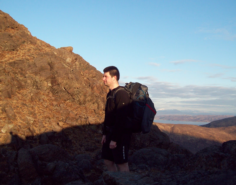
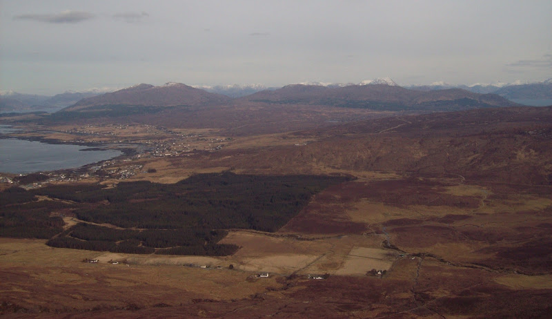
I was on the 9:15 bus from Inverness, and passed a fire on a croft just before Broadford. It looked like muirburn, but since there was a fire engine in attendance it was probably unintentional. Off the bus just after midday into sunshine and great views.
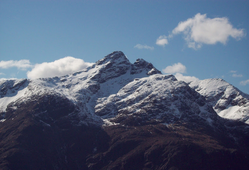
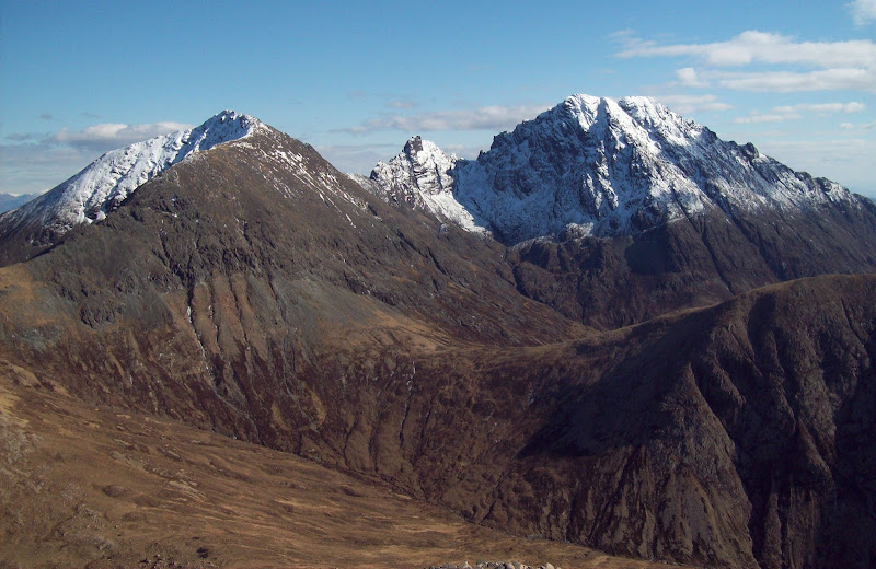
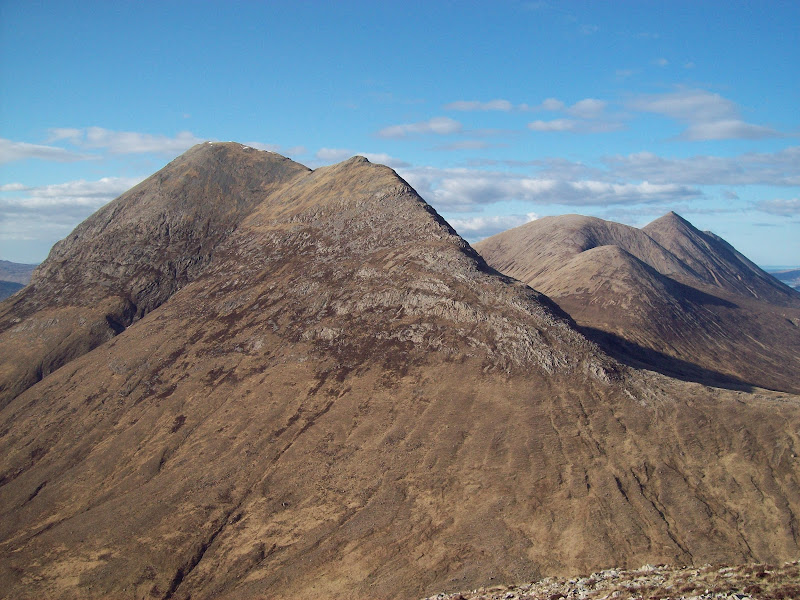
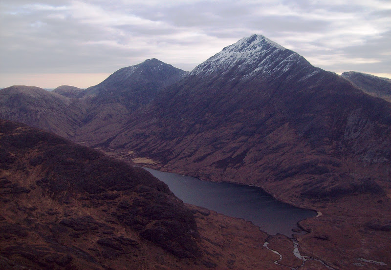
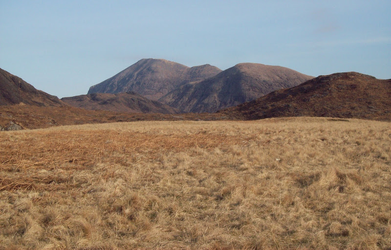
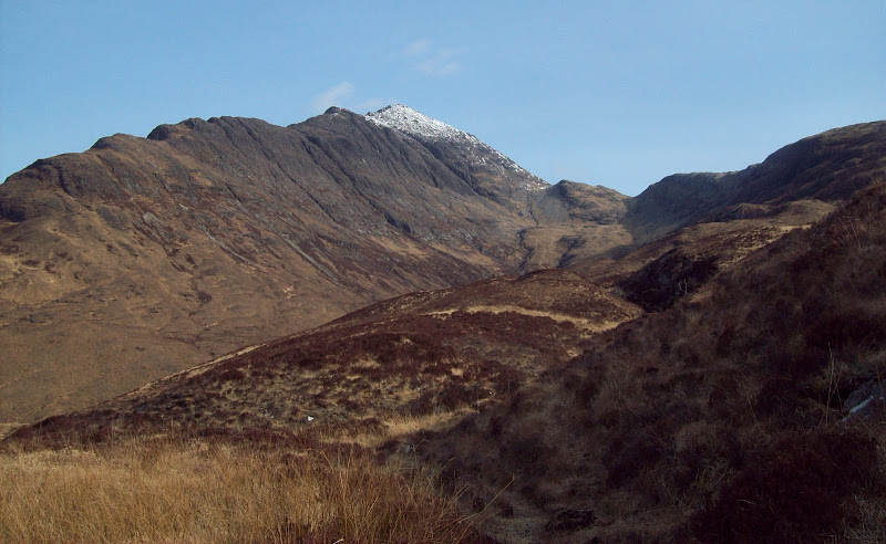
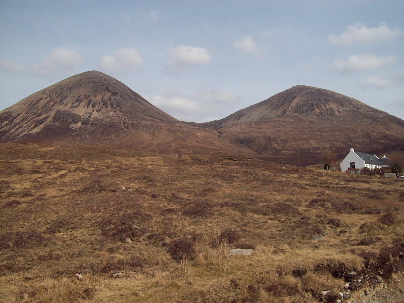
Beinn Dearg Mhor and Marsco:
Sgurr nan Gillean and Bruach na Frithe:
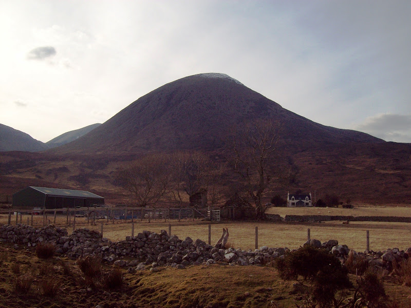
Glamaig:
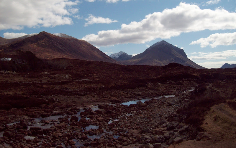
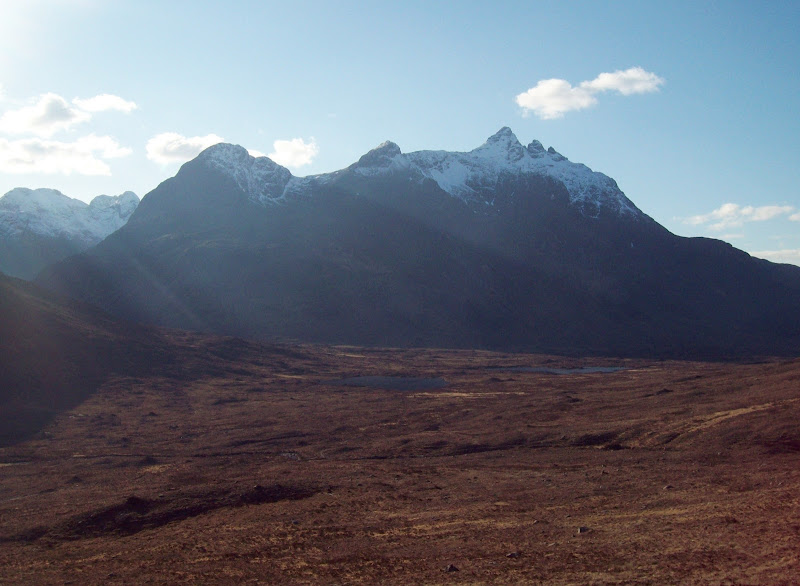
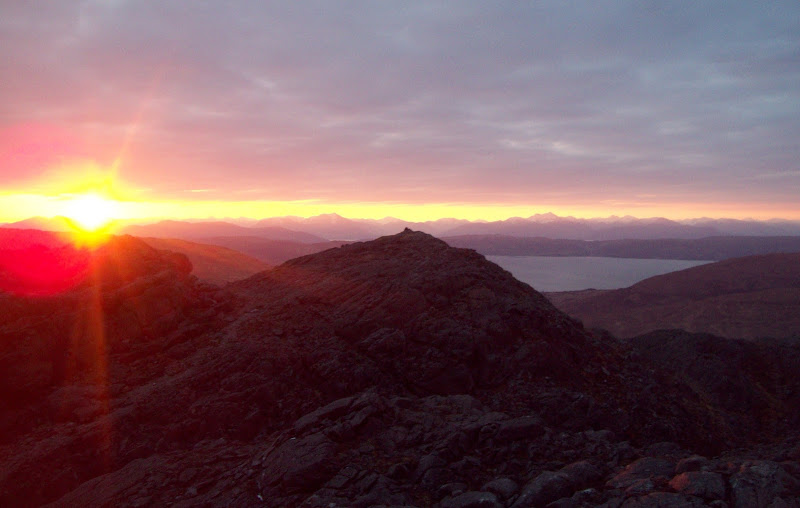
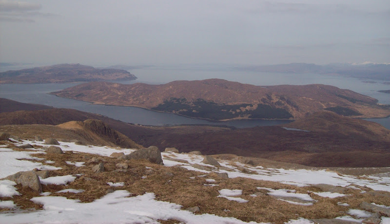
Easy walking along the Glen Sligachan path. This was reasonably popular and I passed half a dozen or so other folk. The views of the Cuillin barely need to be described. I had originally planned to head up to Mam a Phobuill and get onto Marsco from the NE. However the N ridge looked doable (if steep) so I got onto that.
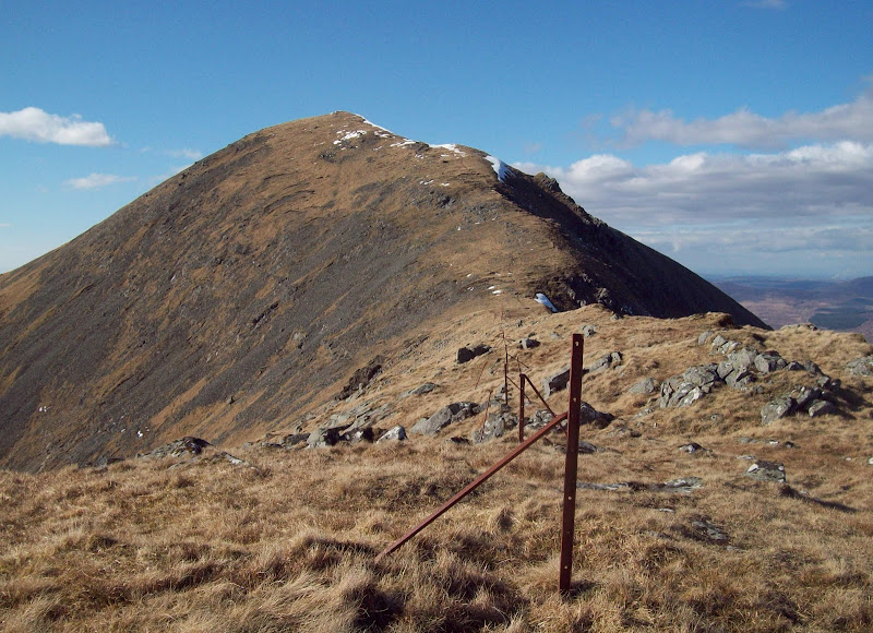
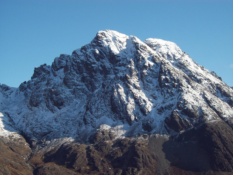
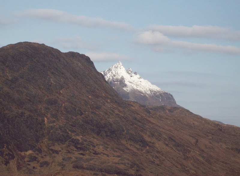
Marsco:
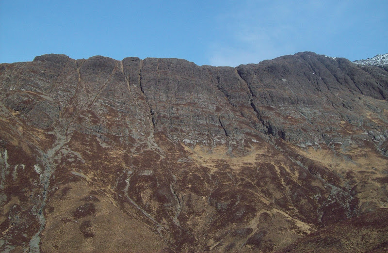
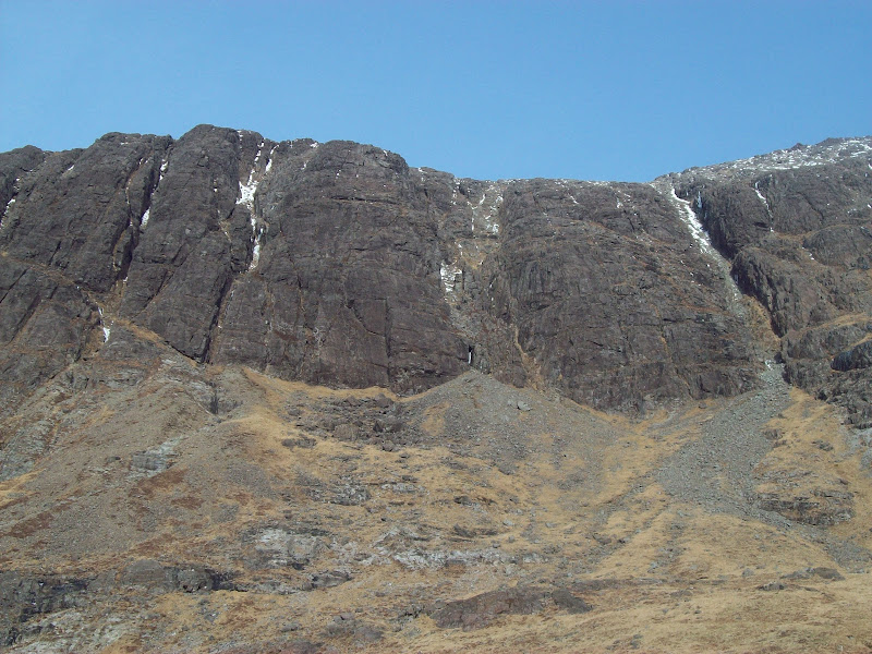
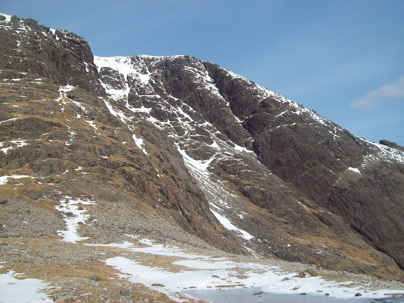
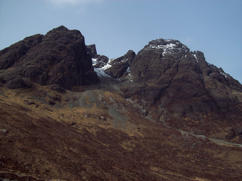
Pinnacle Ridge:
It certainly was steep, but the going was fine on short grass and I made good progress. A bit of a diversion to the left was required high up to avoid icy rocks, but before long I was on the summit ridge.
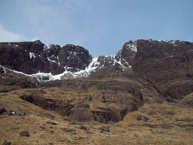
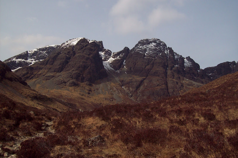
Gars-bheinn:
Sgurr Alasdair, Sgurr Mhic Choinnich and Sgurr Dearg:
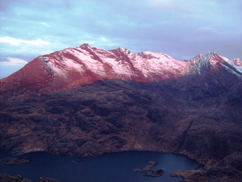
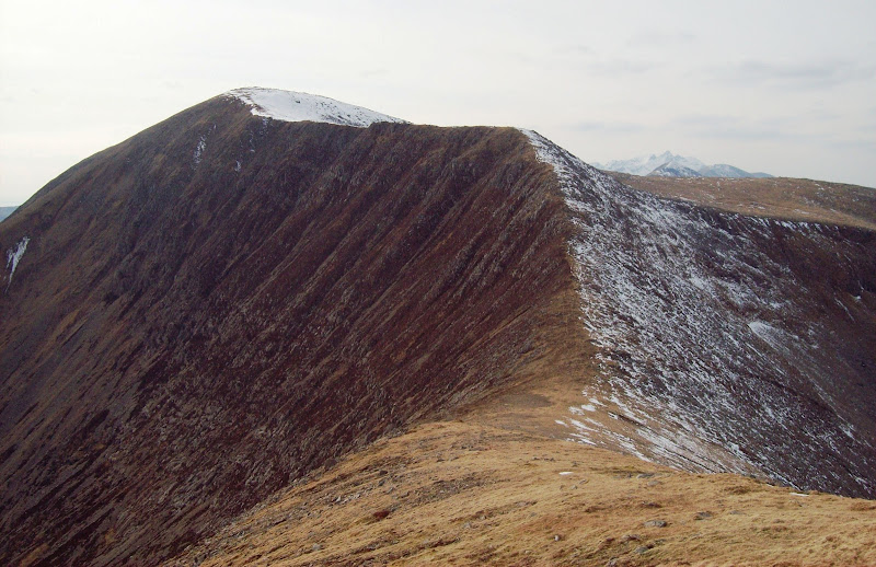
Summit of Marsco:
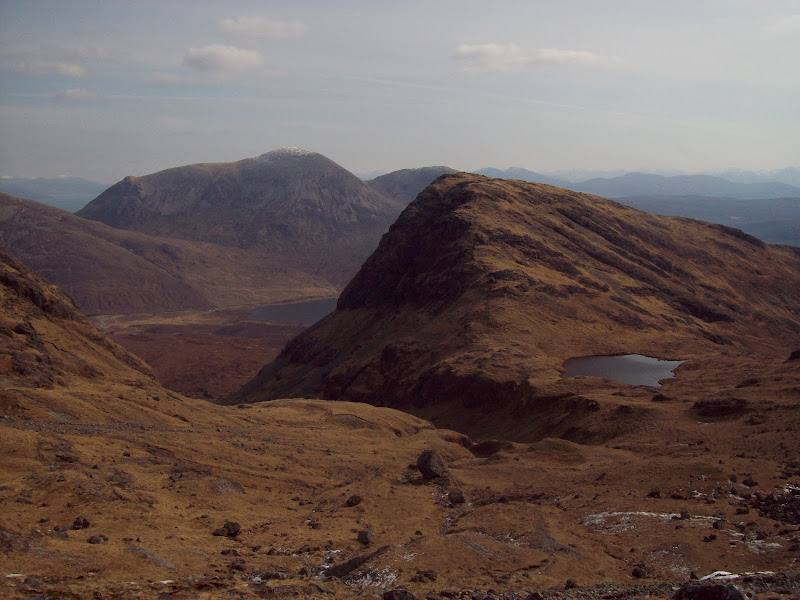
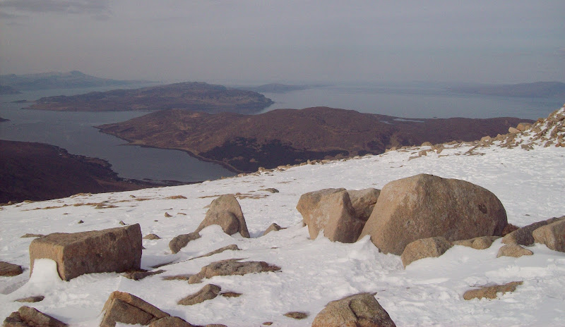
Garbh-bheinn and Bla Bheinn from Marsco:
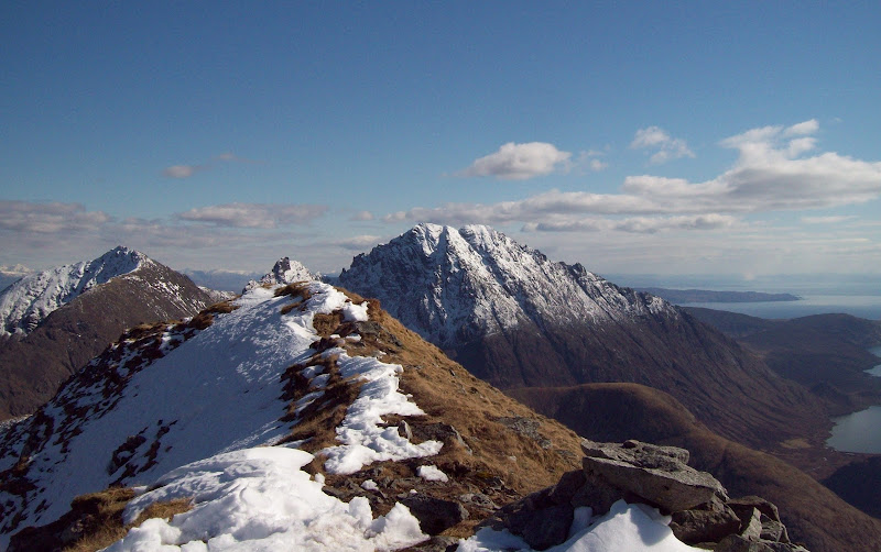
What a great summit! The Red Cuillin may not have the rocky complexity of the black, but they still have some great narrow ridges, and above all, stunning views.
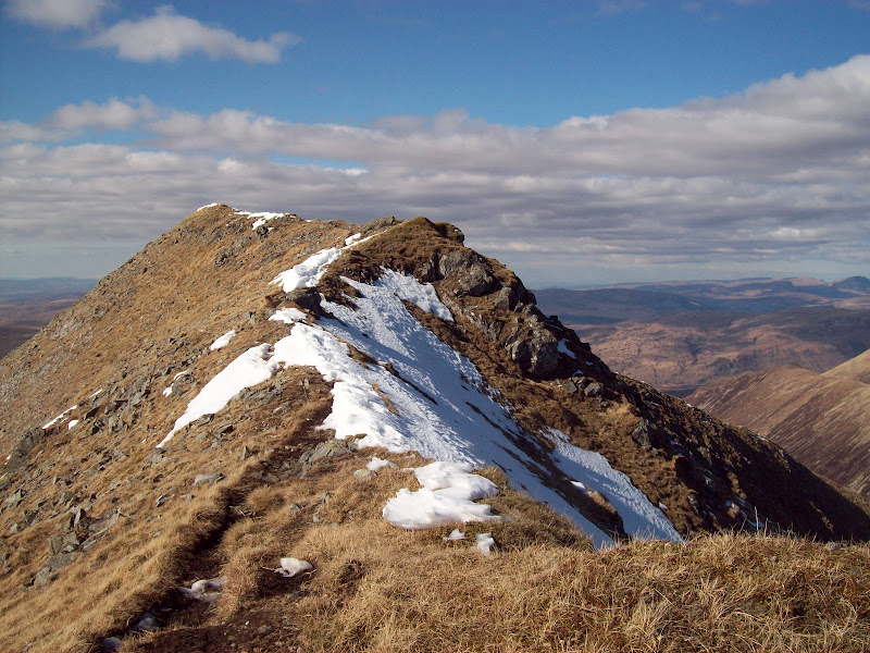
Marsco summit ridge:
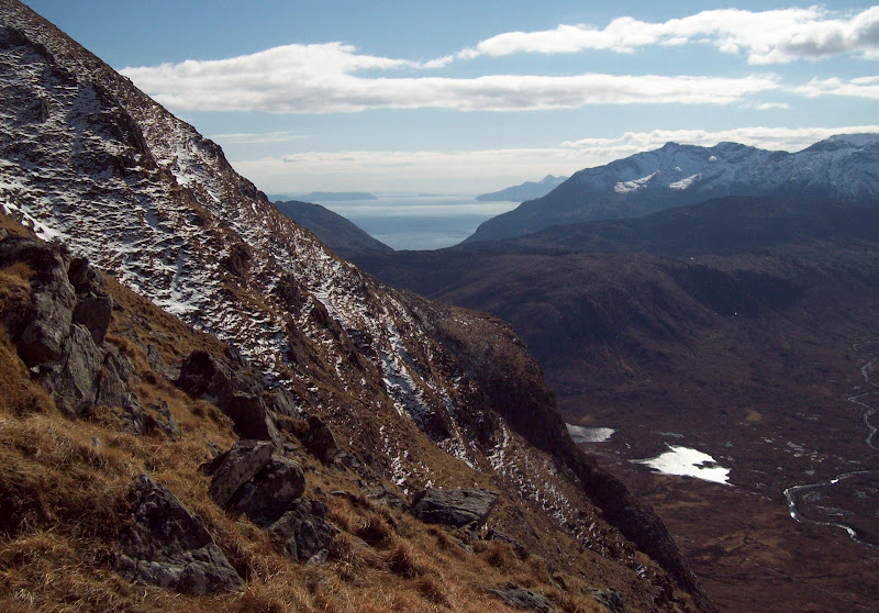
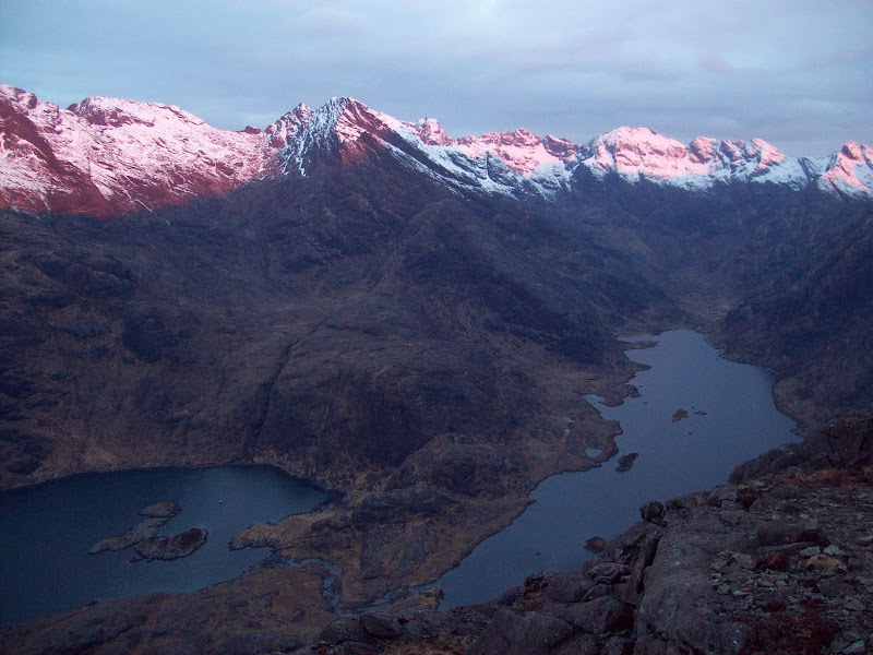
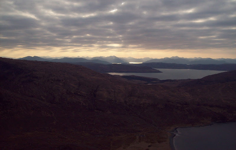
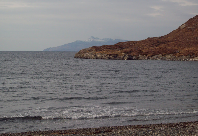
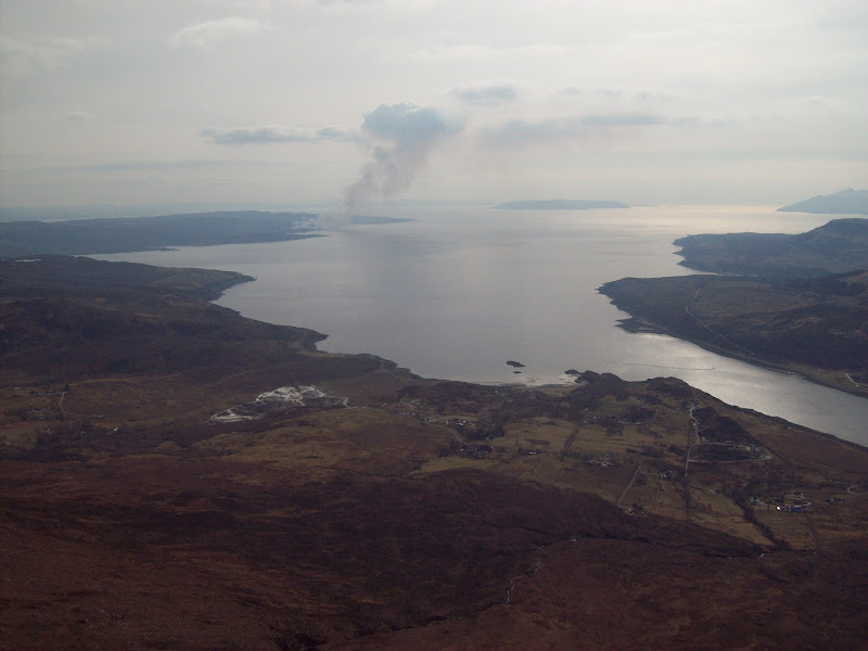
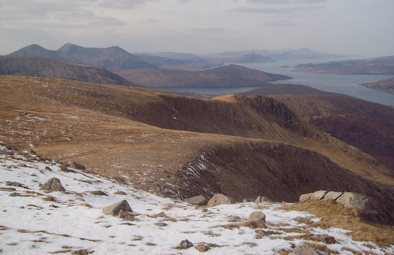
Loch Ainort and the mainland:
There was a bit of a haze in the air, making both North Harris and the mainland rather faint, but the immediate surroundings were really clear. A great viewpoint for the back side of Bla Bheinn.
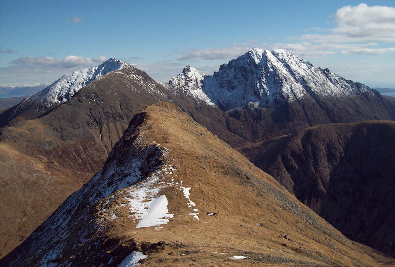
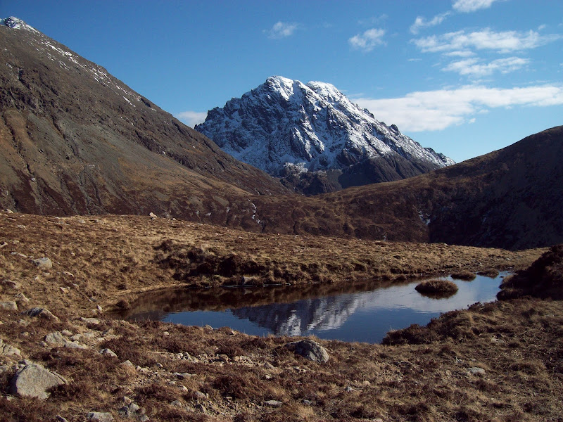
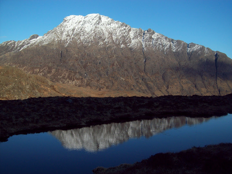
Garbh-bheinn, Clach Glas and Bla Bheinn:
Back to the summit:
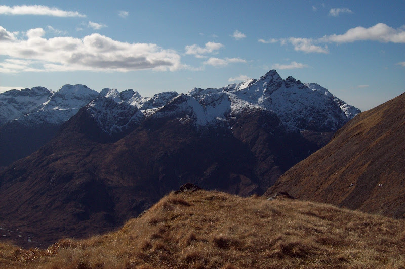
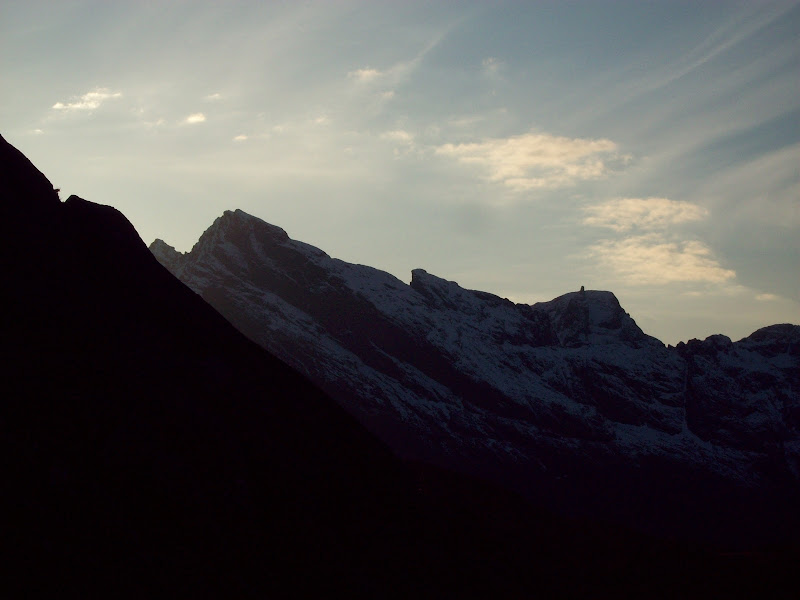
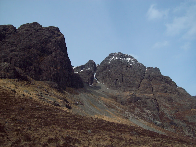
Sgurr an Mhadaidh to Sgurr nan Gillean:
There were a couple of easy rocky steps on the descent southeast, but nothing difficult. Having a full rucksack of camping gear certainly made them more noticeable though!
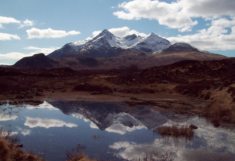
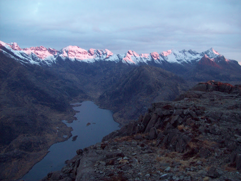
Bla Bheinn:
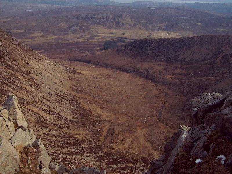
It was then a contour around the head of Am Fraoch-choire (much less unpleasant than it looks, with even faint sketches of path in places) and onto Ruadh Stac. A fairly insignificant hill in the scheme of things, but one with a killer detailed view of Clach Glas and Bla Bheinn.
Bla Bheinn from Ruadh Stac:
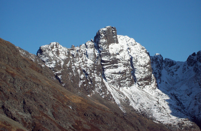
Clach Glas:
Marsco and Bheinn Dearg Mhor:
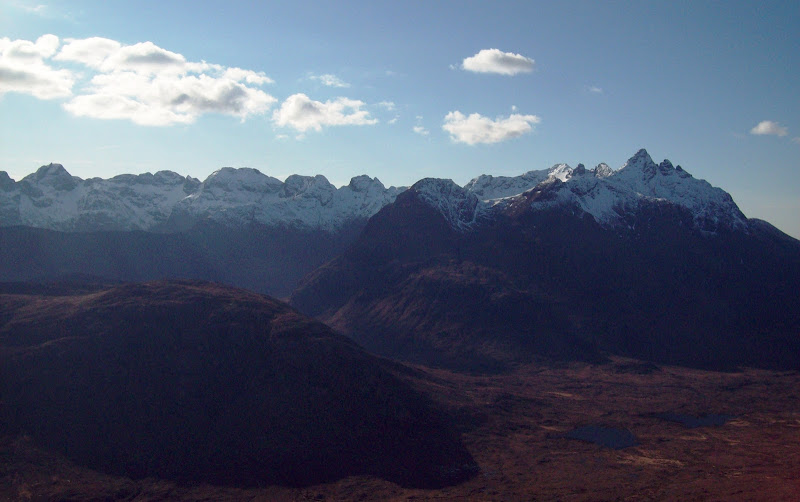
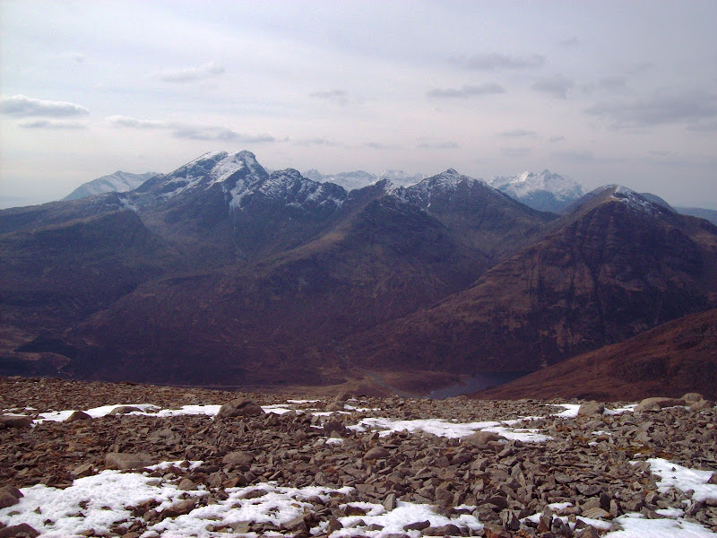
Black Cuillin from In Pinn to Gillean:
There was a good scree run down into Strath na Chreitheach (they do exist - usually where not destroyed by repeated use!). As I dropped down into the glen, the full height of Sgurr nan Gillean bore down on me.
Sgurr nan Gillean:
Bla Bheinn from Strath na Chreitheach:
I wasn't sure what water I would pass between here and the summit of Sgurr na Stri, so I filled up for the summit camp before joining the path to Coruisk. Crossing the floor of the glen to join the path was very soft - in more normal conditions I'd imagine it to be tediously swampy.
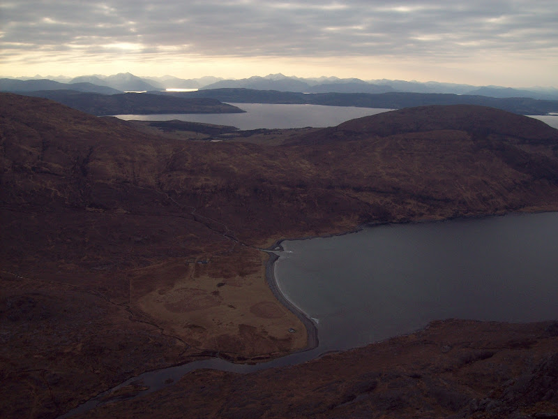
Marsco and Ruadh Stac:
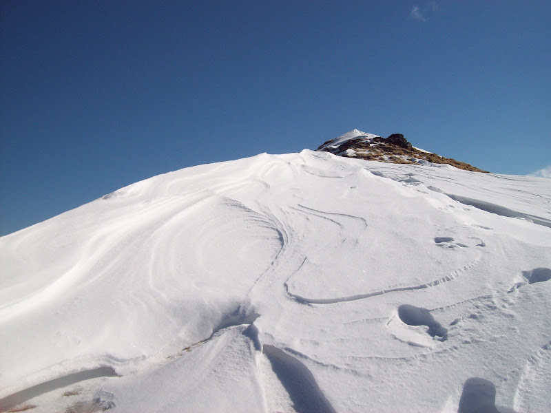
It is a well worn path which leads to Coruisk, with the Cuillin and Loch Coruisk gradually opening up below as Druim Hain was approached. A less-defined path branched off to the left here, leading though increasingly bouldert territory. I lost it eventually and made my own way across boilerplate gabbro to the west summit of Sgurr na Stri.
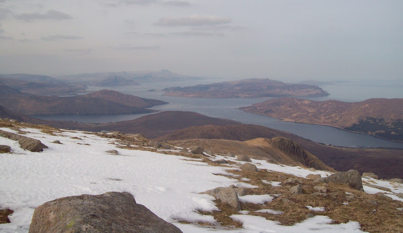
Loch Scavaig and Ben Meabost:
Approaching the summit of Sgurr na Stri:
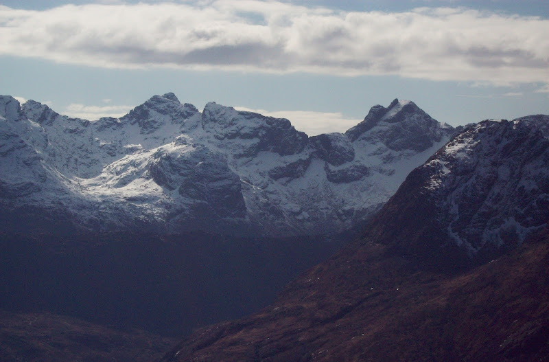
Sgurr Thearlaich, Sgurr Mhic Choinnich and Sgurr Dearg:
Sgurr nan Eag and Sgurr Alasdair:
This was pretty much everything I'd hoped it would be, and more

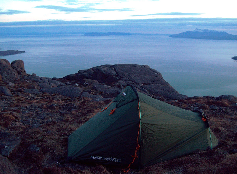
. I don't know how you'd even begin to work out what the best viewpoint in the country is, but it would have to be pretty damn good to beat this! Even better, it was possibly to look right down the western slopes to the Bad Step and Loch Scavaig - steep! I managed to find a vaguely grassy spot just under the western summit cairn, only a couple of meters from the edge. Perfect pitch

. A few steps further round and the classic view up Loch Coruisk was right there in front of me.
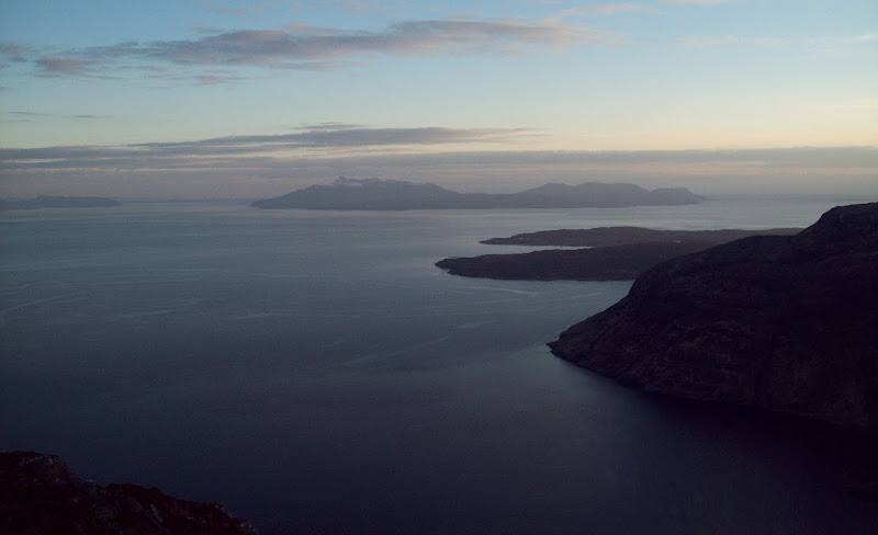
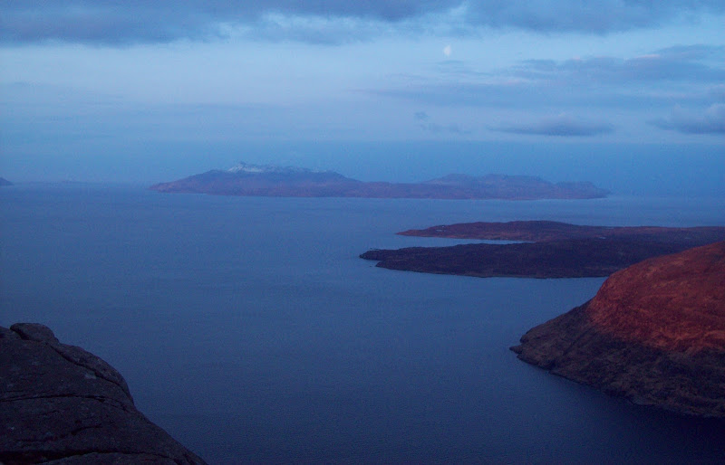
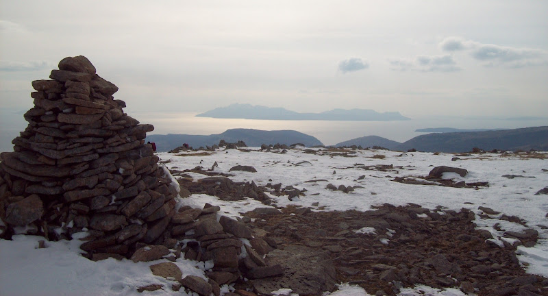
Rum:
Campsite with a view:
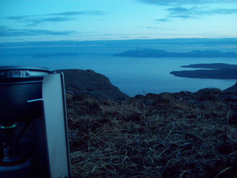
Dinner:
After dinner I had a quick wander over to the eastern summit - it appeared to be the higher of the two. More fiddly than I thought it would be in the half-light, as a fault splits the hill in two. Great atmosphere but my camera wasn't really up to capturing it.
Sgurr nan Gillean and Marsco in last light:
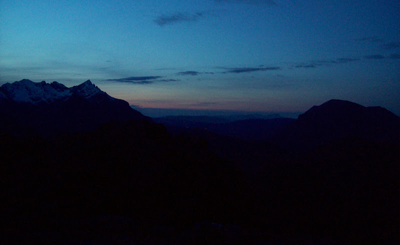
I stuck my head out at various points in the night - pretty chilly! Worth it to see the stars and watch the various lighthouses and ships.
~~~~~~~~~~~~~~~~~~~~~~~~~~~~~~~~~~~~~~~~~~~~~~~
SundayGrahams: Beinn Dearg Mhor, Beinn na Caillich
Date: 31/03/2013.
Distance: 25km
Ascent: 1750m
Time taken: 9 hour, 40 minutes.
Weather: Cold, sunny and calm. Slightly hazier than Saturday.
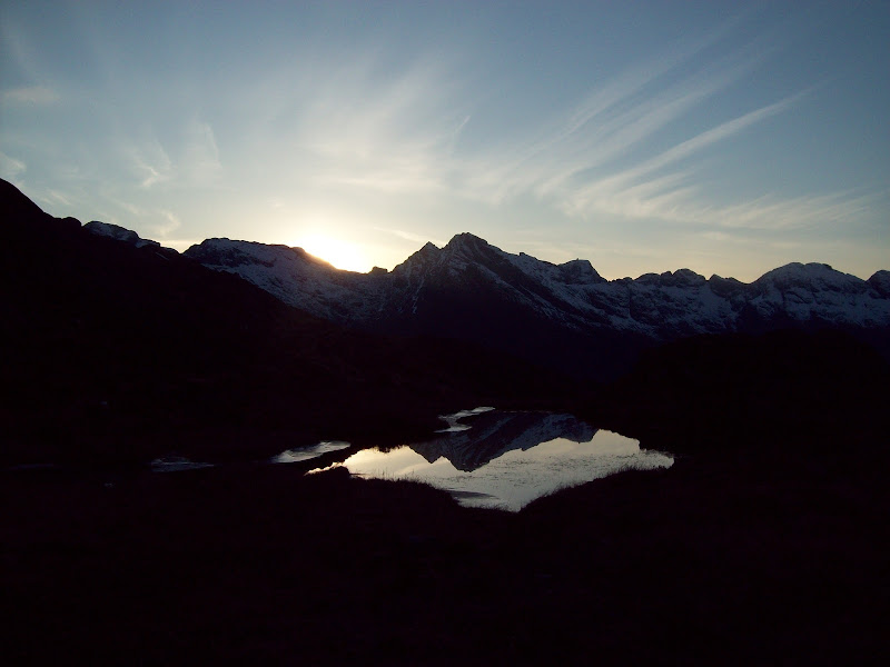
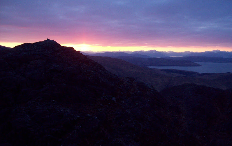
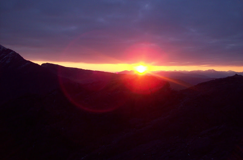
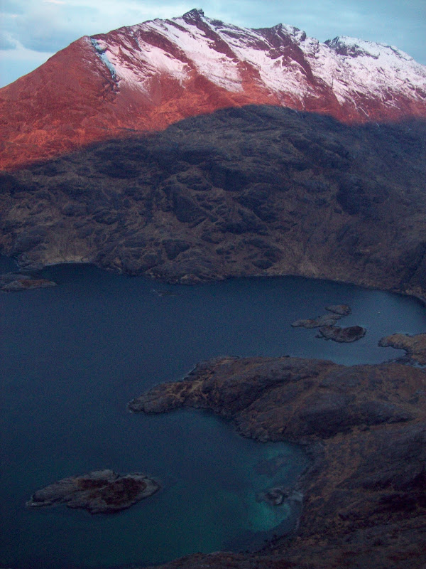
Up just before 7am for the sunrise - I timed it about right. The sun was just about to pop over the eastern horizon and there was alpenglow on the Black Cuillin. I finally managed to get some half-decent shots of Loch Coruisk.
Sunrise over the mainland:
Gars-bheinn and Sgurr nan Eag with alpenglow:
Loch Coruisk:
Sun is finally above the horizon:
Loch na Cuilce:
Rum:
I was finally packed away by 8:15, and headed back towards Sgurr Hain via the eastern summit for some photos. I wondered idly whether it would be possible to drop straight down to Camasunary, but decided against trying.
Garbh-bheinn and Bla Bheinn:
Towards the mainland, mouth of Loch Hourn catching the sunshine:
Looking down onto Camasunary:
I managed to find the path I'd lost the evening before and followed it back towards Sgurr Hain, dropping down the corrie towards Camasunary. The path went the whole way down. Having had an interesting experience crossing the river in the dark on the walk-in to Coruisk some years back, I decided to cross further upstream this time.
Sgurr Hain:
Now it was decision time. I had wanted to include an ascent of the south ridge of Bla Bheinn in today's walk, but I hard started too late to do both it and the Eastern Red Hills. It was an either/or decision. I had packed my axe and crampons with this in mind, but I still had concerns about the shoogly bit between the two summits. With the snow likely to be rock solid and my overweight rucksack, I decided to give it a miss and head for the red hills instead (probably a good move - when I got home I found out that a couple had been airlifted off Bla Bheinn later in the day).
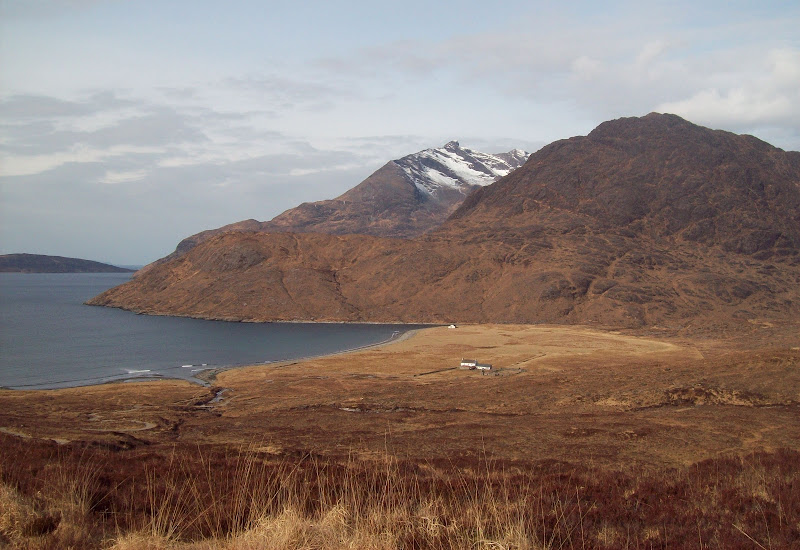
That decision made, I decided to take a stroll along the beach at Camasunary before climbing into Coire nan Leac. I started off up the path to Kilmarie before following a branch into the corrie. This petered out and going got rougher for a while.
Camasunary and Bla Bheinn:
Rum from Camasunary Bay:
Marsco and Ruadh Stac:
Gars-bheinn and Camasunary bothy:
Sligachan that way:

Camasunary Bay and Gars-bheinn:
Sgurr nan Gillean:
Higher up I was free of the heather and the walking was easier. Soon enough I had joined the popular descent from Bla Bheinn. Someone was descending the ridge above me. Looks like they would have got a great morning up there.
South ridge of Bla Bheinn:
Rum:

Summit of Bla Bheinn from the rim of Fionna Choire:
Dropping down the other side was quite tedious and slow on the partially frozen scree, the heavy bag not helping at all. If this was the easy part of the descent, I was quite glad I hadn't gone up there.
An Stac:
I passed a few people on my way down to the road. Bla Bheinn on a sunny easter Sunday was bound to be busy.
Bla Bheinn:
Clach Glas:
Bla Bheinn and Clach Glas:
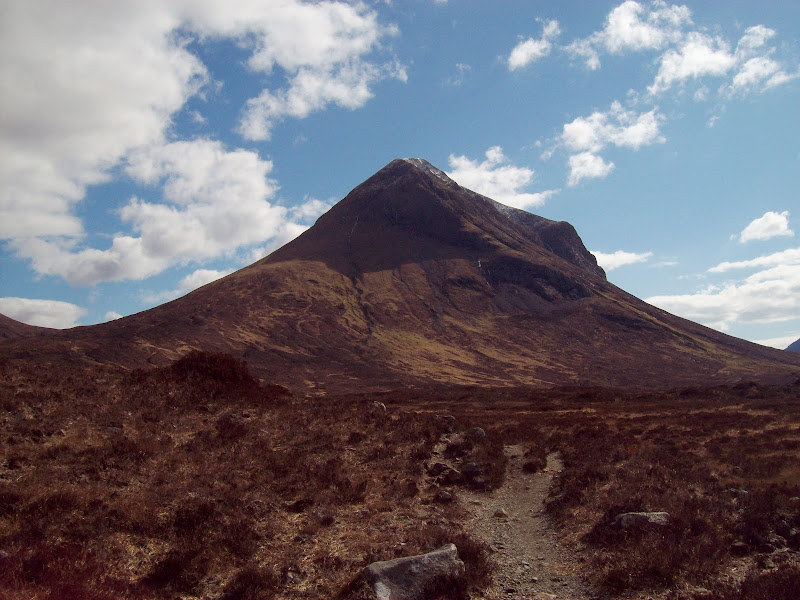
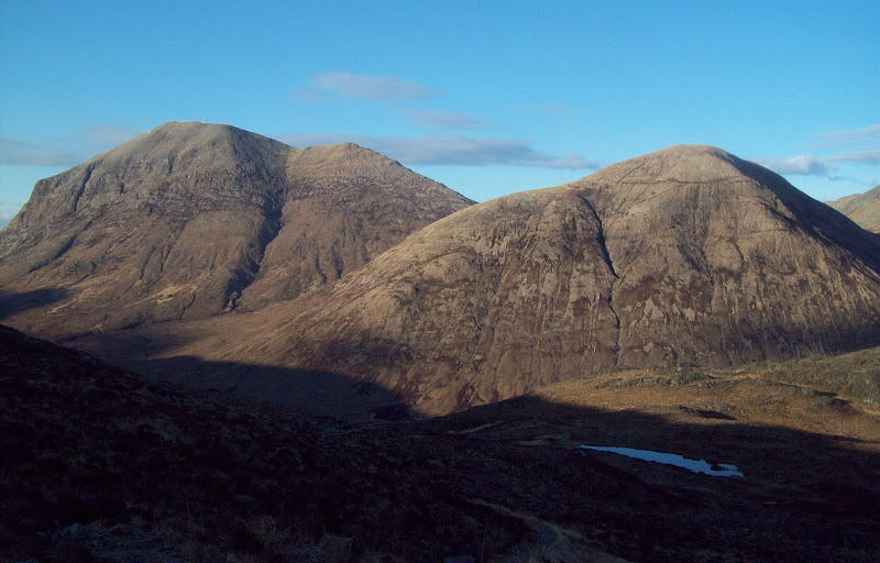
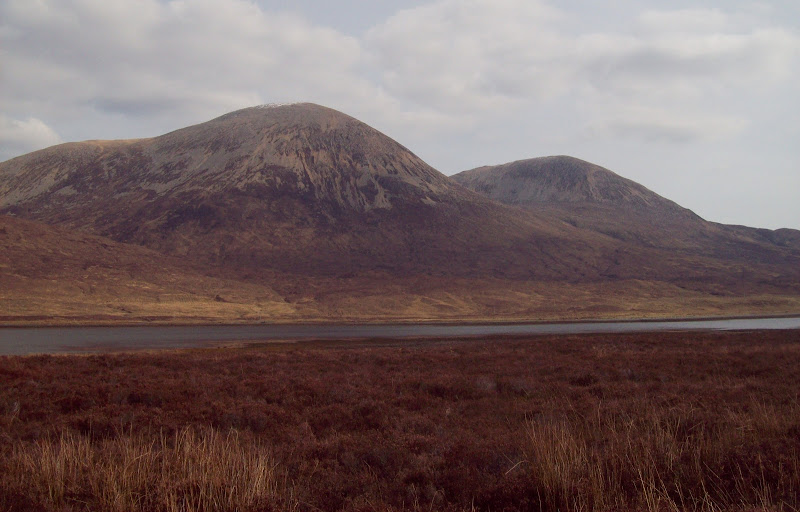
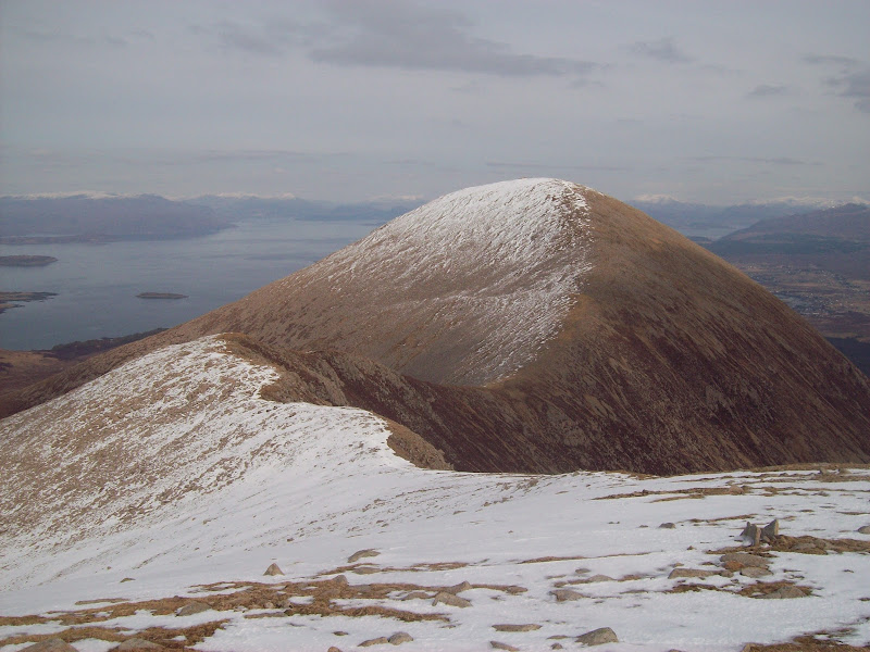
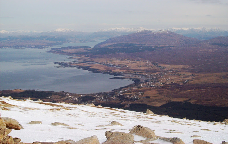
Finally on the road, and it was a relaxing stroll round the head of Loch Slapin. I was eyeing up a circuit of Garbh-bheinn and Belig from this side for a future outing. The thought of dragging my bag up the back side of Beinn Dearg Mhor was less than appealing right now.
Beinn Dearg Mhor and Beinn Dearg Bheag across Loch Slapin:
I often lose my shoes:
Beinn Dearg Mhor and Beinn Dearg Bheag from Torrin:
Nice cafe on the outskirts of Torrin - wish I'd had the time to stop in (turns out I would've missed the bus home if I had). The route up followed a faint path on the north bank of the Slapin burn into the corrie. My original thought was to go right up to the col, but the route up from there looked like nasty scree. Instead I went straight up the hillside from the mouth of the corrie - typically steep but on firm blocks at least. There were more fires raging down on the Sleat peninsula.
Fire on the Sleat peninsula:
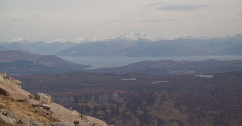
While the haze had developed more than yesterday, the views were great back onto the Black Cuillin. However the views east were just as good, so I had a break facing east, out of the cutting breeze (gentle but really cold).
Bla Bheinn and the Black Cuillin:
Trotternish, Raasay and Scalpay:
Scalpay and the Inner Sound:
Rum from Beinn Dearg Mhor:
The route ahead looked good and provided lovely walking - in fact it seduced me into thinking that the way down to Broadford would be easy.
Beinn na Callaich from Beinn Dearg Mhor:
Back to Beinn Dearg Mhor:
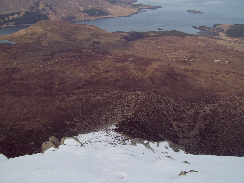
Coire Gorm:
Northern corries of Beinn Dearg Mhor and Glamaig:
Mainland, Ladhar Bheinn in centre:
Raasay and Scalpay:
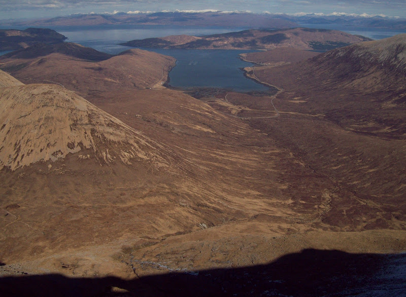
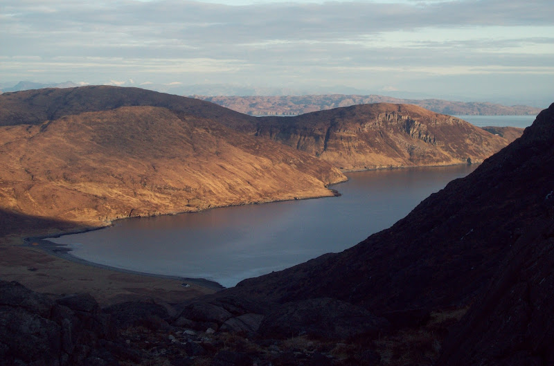
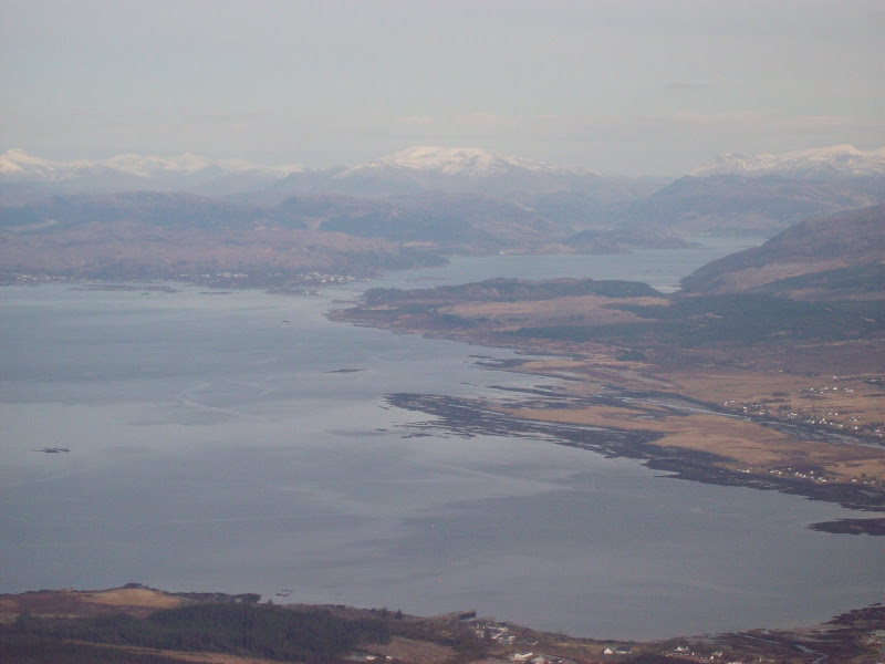
Broadford and Lochalsh:
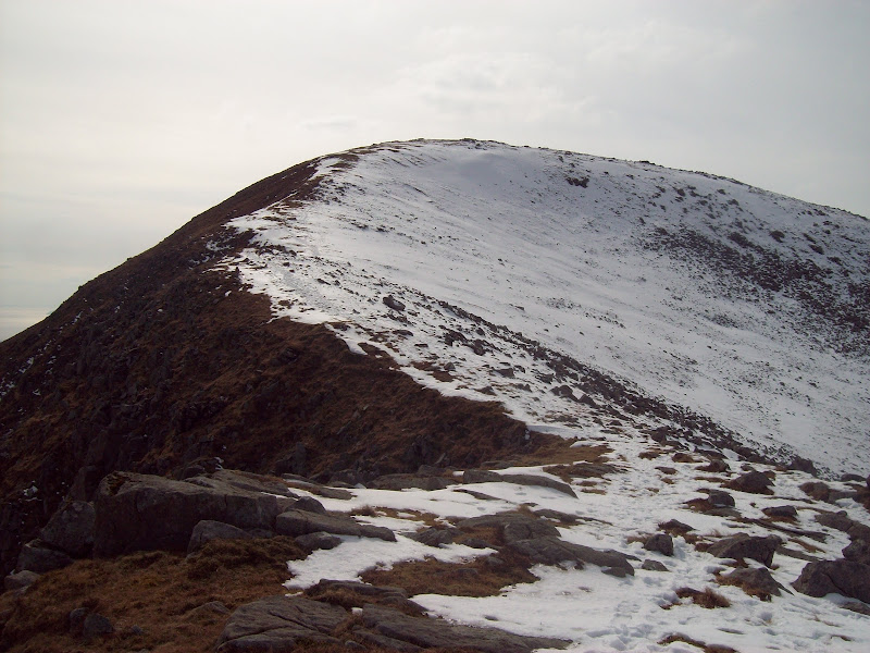
I followed footprints towards the NE ridge, as this looked fun and narrow lower down. However the top section was steep and coverd in a rather nasty snow mixture of solid and slushy snow. Even with the axe out I didn't feel comfortable on it (heavy bag putting me off balance again), so after dropping 15m or so, I decided to climb back up and try the E ridge. It probably would have gone fine in crampons but I couldn't be bothered putting them on so late in the walk.
NE ridge of Beinn na Caillich - a speedy retreat:
Broadford and Kylerhea hills:
The E ridge was fine for snow, but it was seriously bouldery! In retrospect it might have been quicker to get the crampons out than teeter my way down. I was running out of time now, so the planned pint in Broadford was replaced by a quick march down the road. I followed part of the Marble route out to the coast, then got onto the Torrin road as it looked faster and gave me the chance to thumb a lift if things got really tight.
Beinn na Caillich:
I made it with 15 minutes to spare in the end, so no problems. Once home, all my muscles were killing - need to do this more often! Well worth the pain though.
